Hubbry Logo
OphelOphelMain
Open search
Ophel
Community hub
Ophel
logo
8 pages, 0 posts
0 subscribers
Be the first to start a discussion here.
Ophel
Ophel
from Wikipedia

The ophel of Jerusalem, Israel. The Kidron Valley and Mount of Olives are in the background.

Ophel (Hebrew: עֹפֶל, romanizedʿōp̄el)[1][2] is the biblical term given to a certain part of a settlement or city that is elevated from its surroundings, and probably means fortified hill or risen area. In the Hebrew Bible, the term is in reference to two cities: Jerusalem (as in 2 Chronicles 27, 2 Chronicles 33, Nehemiah 3, and Nehemiah 11) and Samaria (mentioned in 2 Kings 5). The Mesha Stele, written in Moabite, a Canaanite language closely related to Biblical Hebrew, is the only extra-biblical source using the word, also in connection to a fortified place.[3]

Meaning of the term

[edit]

Ophel, with the definite article ha-ophel, is a common noun known from two Canaanitic languages, Biblical Hebrew and Moabitic.[3] As a place name or description it appears several times in the Hebrew Bible and once on the Mesha Stele from Moab.[3] There is no agreement as to its exact meaning, and scholars have long been trying to deduce it from the different contexts it appears in.[3] When used as a common noun, it has been translated as "tumors" (1 Samuel 5:9, 12; 6:5), and in a verb form it was taken to mean "puffed up" (Habakkuk 2:4), this indicating that the root might be associated with "swelling".[3] When referring to a place, it seems from the context to mean either hill, or fortified place, or a mixture of the two, i.e., a fortified hill, and by considering the presumed meaning of the root, it might signify a "bulging or rounded" fortification.[3]

Biblical verses in which it has been translated either as "fortified place " (tower, citadel, stronghold etc.) or "hill" are 2 Kings 5:24, 2 Chronicles 27:3; 33:14, Isaiah 32:14, Nehemiah 3:26; 11:21, and Micah 4:8.[3] On the Mesha Stele, named for the king of Moab who erected it, Mesha says: "I built Q-R-CH-H (Karhah?), the wall of ye'arim [forests], and the wall of ophel and I built its gates and I built its towers."[3] Here ophel is commonly translated as "citadel".[4]
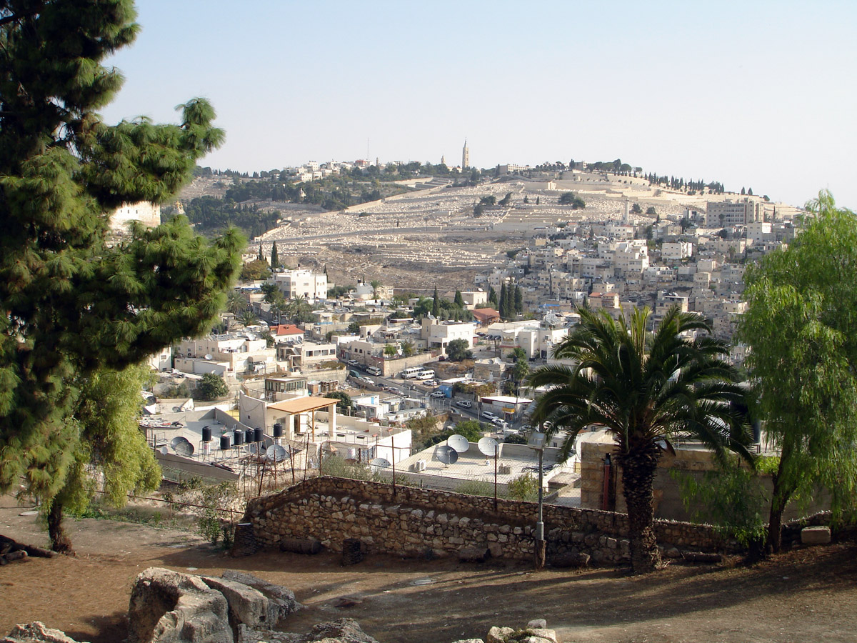
Jerusalem ophel

[edit]

Hebrew Bible

[edit]

The location of the ophel of the Hebrew Bible can be deduced from references in 2 Chronicles and Nehemiah: It was on the eastern ridge, which descended south of Solomon's Temple, and probably near the middle of it.[3] In current terms, the still extant Herodian cased-in Temple Mount is bordered to the south by a saddle, followed by the ridge in case, also known as the southeastern hill, which stretches down to the King's Garden and the lower Pool of Siloam.[3] If the ophel was, as it seems, close to its centre, the use of the term "ophel ridge" for the entire southeastern hill including the saddle, seems to be wrong.[3]

Two kings of Judah, Jotham and Manasseh, are described to have massively strengthened the ophel fortifications in 2 Chronicles 27:3 and 33:14, leading to the conclusion that this must have been an area of great strategic importance, and either very close to or identical with the "stronghold of Zion" conquered and reused by David in 2 Samuel 5:7).[3]

Josephus' ophlas

[edit]

Josephus, writing about the First Jewish–Roman War (66–70 CE), uses the Graecised form ophlas, and places it slightly higher up the eastern ridge from the First Temple-period ophel, touching the "eastern cloister of the temple" (Jewish Wars, V, iv, 2[5]) and in the context of "the temple and the parts thereto adjoining ... and the ... 'Valley of the Cedron'" (Jewish Wars, V, iv, 1[6]).[3] This takes us to the area of the saddle right next to the southeast corner of Herod's Temple Mount.

Wadi Hilweh excavation

[edit]
A Second Temple-era pool excavated in the ophel

Benjamin Mazar and Eilat Mazar began excavating an area identified as Jerusalem's ophel, lying on the rise to the north of the Wadi Hilweh neighbourhood, in 1968.[7] The term is commonly used by archaeologists with this meaning.[7][8] The excavation was a joint project of Hebrew University, in cooperation with the Israel Antiquities Authority, the Israel Nature and Parks Authority, and the East Jerusalem Development Company, with funding provided by Jewish American couple, Daniel Mintz and Meredith Berkman.[9][10][11]

Notable structures found during these excavations include architectural remains and a variety of movable objects, some dated to the First Temple period, many to the Second Temple period, as well as the Byzantine and Early Muslim periods, the latter including major findings from the Umayyad and Fatimid periods.

The findings included remains interpreted by Eilat Mazar to be a 70- or 79-metre-long segment of city wall including a gatehouse leading to a royal structure, and a watchtower overlooking the Kidron Valley.[9][12] Mazar believes these are the remains of the fortifications that, according to the biblical First Book of Kings, once encompassed the city.[9] Eilat Mazar, who re-excavated the remains in 2010, dated them to the late 10th century BCE,[13] and linked them to King Solomon, a conclusion challenged by other archaeologists.[9][13]

Also present were several Hellenistic-period buildings,[12] a large mikvah,[14] the southern steps to the Herodian Temple compound,[15] leading up to the Double and Triple Gates of the Temple compound, the Monastery of the Virgins, and several large residential and administrative structures (qasr-type "palaces"), probably Umayyad, to the south of the ophel.

A discovered artefact of particular importance is the ophel inscription, a 3,000-year-old pottery shard that bears the earliest alphabetical inscription found in Jerusalem.[12]

Archaeological assessment

[edit]

Although consensus on the dating of the wall has not been reached by the archaeological community, Mazar maintains that, "It's the most significant construction we have from First Temple days in Israel," and "It means that at that time, the 10th century (BCE), in Jerusalem there was a regime capable of carrying out such construction." The 10th century is the period the Bible describes as the reign of King Solomon.[9] Claiming that broken pottery in the "royal structure" enabled the team to date the building. One storage jar bears an inscription in Hebrew. Mazar told the Jerusalem Post that "The jars that were found are the largest ever found in Jerusalem," and "the inscription found on one of them shows that it belonged to a government official, apparently the person responsible for overseeing the provision of baked goods to the royal court."[9]

Aren Maeir, an archeology professor at Bar Ilan University said he has yet to see evidence that the fortifications are as old as Mazar claims. Whilst acknowledging that 10th century remains have been found in Jerusalem, he describes proof of a strong, centralized kingdom at that time as "tenuous".[9]

A section of wall 79 metres (259 ft) long and 6 metres (20 ft) high has been uncovered. The discoveries include an inner gatehouse, a "royal structure" and a corner tower with a base measuring 23 metres (75 ft) by 18 metres (59 ft) from which watchmen could keep watch on the Kidron Valley. According to Mazar, the built structures are similar to the First Temple era fortifications of Megiddo, Beersheba and Ashdod. Mazar told reporters that "A comparison of this latest finding with city walls and gates from the period of the First Temple, as well as pottery found at the site," enable her to "postulate, with a great degree of assurance" that the wall dates form the late 10th-century BCE.[9]

Mazar told reporters that "A comparison of this latest finding with city walls and gates from the period of the First Temple, as well as pottery found at the site, enable us to postulate, with a great degree of assurance, that the wall that has been revealed is that which was built by King Solomon in Jerusalem in the latter part of the tenth century BCE."[9]

The wall has been excavated twice before, once in the 1860s and again in the 1980s. In 1867 Charles Warren conducted an underground survey in the area, describing the outline of a large tower but without attributing it to the era of Solomon.[13]

Israel Finkelstein and other archaeologists from Tel Aviv University have flagged concern that, with reference to her 2006 dating of the "Solomonic city wall" in the area to the south of the Temple Mount known as the ophel, "the biblical text dominates this field operation, not archaeology. Had it not been for Mazar's literal reading of the biblical text, she never would have dated the remains to the 10th century BCE with such confidence".[7]

Samaria ophel

[edit]

2 Kings 5:24 speaks of the ophel of Samaria, where Gehazi took the presents he received from Naaman of Aram. Traditionally translated as "hill", it can as well have meant "tower" and can quite likely be understood as a spot in the city wall or its citadel.[3]

King Mesha's ophel

[edit]

Here, too, the context indicates part of a fortification—either a fortified hill, or something like a tower or enceinte and, judging by the root of the word, probably a bulging or rounded one.[3]

See also

[edit]
  • Acropolis – similar concept in ancient Greek architecture
For the Jerusalem Ophel

Further reading

[edit]

References

[edit]
[edit]
Revisions and contributorsEdit on WikipediaRead on Wikipedia
from Grokipedia
The Ophel (Hebrew: הָעֹפֶל, ha-Ofel) designates a fortified ridge in ancient , positioned between the City of David to the south and the to the north, functioning as a strategic during the and subsequent periods. Referenced in the as an elevated area fortified by monarchs including , Manasseh, and , the Ophel encompassed royal structures, defensive walls, and gateways integral to the city's defenses. Archaeological excavations, notably those directed by from 2009 onward, have unearthed monumental IIA buildings—potentially part of a royal complex—along with Hezekiah-era fortifications and the Ophel inscription, a 10th-century BCE artifact bearing proto-alphabetic script. A significant discovery, the Ophel Treasure, comprises a 7th-century BCE hoard of 36 Tyrian gold coins, jewelry, and temple vessels, suggesting ritual deposition amid Assyrian threats. Ongoing digs into the Byzantine era reveal layered urban development, underscoring the site's continuous occupation and its role in Jerusalem's historical topography, though interpretations of early structures' attribution to Solomonic kingship remain debated among scholars favoring empirical over maximalist biblical chronologies.

Etymology and Linguistic Origins

Hebrew Term and Semantic Range

The Hebrew term ʿōp̄el (עֹפֶל) denotes a topographical , fundamentally connoting a hill, mound, or swelling rise in , with a core emphasis on its suitability for defensive rather than mere altitude. Lexical analyses trace its root to concepts of swelling or bulging, as in a protuberance that naturally lends itself to strategic heightening for purposes, distinguishing it from undifferentiated "high places" (bāmôt) which carry ritual connotations. This practical denotation prioritizes utility in urban defense, where the term evokes an acclivity or fortified spur integrated with surrounding structures for protection. Semantically, ʿōp̄el encompasses both natural hillocks and artificially enhanced bastions, reflecting a range from organic terrain features to engineered strongholds, without inherent or overtones in its ancient usage. While a secondary medical sense appears as "tumor" or "" in certain contexts, deriving from the same swelling imagery, the dominant biblical application remains geo-strategic, underscoring elevation for over allegorical elevation. Linguistic evidence indicates no shift toward ethical or theological metaphorization within the Hebrew corpus itself, with such interpretations emerging only in later rabbinic and medieval .

Comparative Semitic Usage

In Ugaritic texts from the Late , the term ʿp(l) denotes elevated enclosures or acropolis-like structures fortified for defense, reflecting a shared Northwest Semitic conceptualization of raised urban strongholds that parallels the Hebrew ʿopel as a swollen or fortified . This linguistic and architectural motif underscores common Iron Age Levantine practices where settlements exploited topographic elevations for strategic advantage, as seen in Ugarit's upper city with its enclosing walls and temples. Akkadian sources similarly describe fortified tilu (mounds or tells) as raised, defensible settlements in Mesopotamian contexts, often with thick ramparts and gated accesses, evidencing broader Semitic adaptation of elevated terrain for urban protection across the from the second millennium BCE onward. These parallels indicate that the Israelite application of ophel involved regional borrowing of defensive topography rather than invention ex nihilo, yet diverged through rigorous cultic demarcation that prioritized monotheistic exclusivity over syncretic religious layering typical in Canaanite or sites. Such distinctions challenge exaggerated claims of seamless Canaanite cultural persistence, as empirical site plans reveal Israelite modifications emphasizing isolated sacred precincts amid shared fortification techniques.

Biblical References

Occurrences in the Hebrew Bible

The term Ophel (Hebrew: ha-ʿŌp̄el, meaning "hill" or "mound") appears six times in the , with all instances referring to a specific elevated, fortified ridge in associated with the City of David. These references underscore its recurrent role in Judahite defensive architecture and urban organization from the 8th century BCE through the post-exilic period. In 2 Chronicles 27:3, King Jotham (reigned c. 750–735 BCE) is credited with extensive building on the wall of Ophel alongside repairs to the Upper Gate of the temple, indicating early monarchic fortification efforts. Similarly, 2 Chronicles 33:14 describes King Manasseh (reigned c. 687–642 BCE) constructing an outer wall encircling Ophel as part of a larger defensive perimeter extending from the Gihon spring to the Fish Gate, linking it directly to royal enhancements of the City of David. Post-exilic texts in Nehemiah highlight Ophel's proximity to priestly functions. Nehemiah 3:26–27 details repairs to the city wall by the Nethinim (temple servants) living on Ophel, from the Water Gate eastward to the projecting tower, positioning it as a key segment in the 5th-century BCE reconstruction under Nehemiah (c. 445 BCE). Nehemiah 11:21 explicitly states that the Nethinim and descendants of Solomon's servants resided on Ophel, associating the area with subordinate temple personnel and suggesting its integration into sacred precincts adjacent to royal zones. Prophetic books evoke Ophel in visions of desolation and renewal: 32:14 (c. BCE) prophesies its abandonment as "dens forever, a delight of wild donkeys" amid broader judgment on 's hill and watchtower, while 4:8 (contemporary with ) portrays the "Ophel of the daughter of " as a restored stronghold and former royal residence. Collectively, these verses tally six explicit links to , portraying Ophel as a central, elite defensive elevation safeguarding priestly and monarchic districts in the Davidic capital.

Theological and Symbolic Implications

The fortifications on the Ophel, as described in accounts of kings such as , Manasseh, and particularly , illustrate a biblical motif of human agency in defense as complementary to divine sovereignty, enacted amid verifiable geopolitical pressures like the Assyrian campaigns under in 701 BCE. 's strengthening of the Ophel wall (2 Chronicles 32:5) coincided with broader preparations, including the , directly responding to the Assyrian threat documented in both biblical narratives and extrabiblical Assyrian annals, emphasizing material causality—strategic engineering to secure water and elevations—over purely intervention. This reflects a of covenantal responsibility, where aligns with prophetic calls to trust while addressing empirical vulnerabilities, as seen in Isaiah's assurances amid 's reforms (2 Kings 19:14–34). Scholarly analyses prioritize the Ophel's literal designation as a bulging, fortified south of the , a topographic feature exploited for military and administrative dominance, rather than expansive symbolic overlays. Archaeological evidence, including walls and seals from the Ophel excavations, corroborates these as pragmatic responses to imperial aggression, not allegorical constructs for spiritual elevation or moral fortitude. Interpretations positing the Ophel as a for divine protection through human boundaries, as occasionally advanced in devotional commentaries, overreach by projecting post-biblical typology onto texts focused on historical kingship and survival; empirical data from stratified digs favors causal realism in defensive architecture prompted by regional powers, with the Bible's precise locational details enabling modern verification over anachronistic spiritualizations. The Ophel's role in preserving Judahite identity through fortified cultic proximity—temple servants residing there (Nehemiah 3:26)—highlights biblical texts' fidelity to site-specific knowledge, aiding archaeological correlations while underscoring critiques of allegorical excess that dilute the accounts' grounding in lived exigencies of ancient Near Eastern statecraft.

Historical and Extrabiblical Attestations

Josephus and Greco-Roman Sources

Flavius Josephus, the first-century Romano-Jewish historian, provides key attestations to the Ophel in his (c. 75 CE), rendering the Hebrew term as "Ophlas" or "Ophla" in Greek. In Book 5, chapter 4, section 2, he describes Jerusalem's first wall as extending from the Hippicus Tower southward along the western ridge, then eastward to "a certain place which they called Ophlas, where it was joined to the eastern cloister of the temple," positioning it as an elevated rise directly adjoining the Temple Mount's southeastern perimeter. This topographic detail corroborates biblical references to the Ophel's proximity to the temple, emphasizing its role as a strategic overlooking the . Josephus further highlights the Ophel's defensive significance during the Roman siege of 70 CE. In 5.6.1, he notes that rebel leader controlled "the temple, and the parts thereto adjoining, for a great way; as also Ophla, and the valley called the valley of Cedron," underscoring its fortified character amid factional conflicts and Roman assaults. As a native of with military experience in the , Josephus' accounts derive from direct observation, confirming the Ophel's longstanding function as a bulwark integrating origins with Hellenistic and Roman-era enhancements. Herod the Great's expansions, detailed in Josephus' Antiquities of the Jews (c. 94 CE), extended this defensive framework. In 15.11, Herod's reconstruction of the included massive retaining walls and gates along the southern flank, enveloping the Ophel ridge and linking it seamlessly to prior Hasmonean projections that had pushed Jerusalem's boundaries southward for enhanced elevation-based protection. These fortifications, incorporating ashlar masonry and porticoes, causally amplified the Ophel's role against eastern threats, as Josephus implies through descriptions of the integrated enclosure system. No other Greco-Roman authors, such as or , provide comparable specifics on the Ophel, rendering Josephus the primary extrabiblical witness bridging biblical and Roman-period understandings.

Mesha Stele and Moabite Context

The , a inscription erected by Moab's King circa 840 BCE, attests to the term ʿpʾl (rendered as "" or "Ophel") in a Transjordanian context, denoting a fortified elevated structure within the Moabite capital of Dibon. In lines 21–26 of the surviving text, Mesha recounts rebuilding Karchoh—a district of Dibon—including "the wall of the citadel [ʿpʾl]," alongside gates, towers, and a dug using Israelite prisoners, underscoring its role as a core defensive element in Moabite . This usage parallels Hebrew ʿopel but originates from an independent Moabite source, evidencing the term's diffusion across for hilltop strongholds optimized for defense via natural topography and added ramparts, a causal adaptation to warfare in rugged terrains. The stele's narrative frames ʿpʾl amid Mesha's campaigns against Israel's Omride dynasty (ca. 885–841 BCE), which had conquered Moabite territories including Medeba and Ataroth, sites reclaimed through sieges and dedications to . For Ataroth—fortified by and held by Gadite settlers—Mesha describes capturing the city and slaughtering its inhabitants (lines 10–12), implying seizure of its central , though the explicit ʿpʾl applies to Dibon's restorations; this suggests ʿpʾl denoted comparable fortified cores in seized Israelite outposts, enabling Moab's reconquest by targeting elevated command points. The inscription's mid-9th-century BCE dating, corroborated by paleography and historical synchronisms with 's oppression (lines 4–8), aligns with 2 Kings 3's account of Moabite revolt post-Ahab (ca. 853–852 BCE), providing epigraphic validation for the conflict's scale without endorsing either side's theological claims. As a primary royal monument discovered intact (save fragments) at Dhiban in 1868 and preserved mainly in the , the yields direct, non-decomposed evidence of Moabite agency, contrasting biblical Judahite framing by prioritizing Chemosh's causation over Yahweh's; its stems from durability and linguistic consistency, though self-aggrandizing tone warrants cross-verification with archaeological like Ataroth's unwalled settlements indicating opportunistic Israelite garrisons vulnerable to Moabite assaults. This Moabite attestation expands ʿpʾl's semantic range to generic fortified heights in eastern polities, rooted in empirical defensive needs rather than symbolic exclusivity, and highlights Transjordan's role in power dynamics beyond Israelite narratives.

Primary Archaeological Sites

Jerusalem Ophel

The Jerusalem Ophel constitutes the elevated ridge immediately south of the , linking the City of David to the Temple esplanade at roughly 600 meters above sea level. This strategic elevation, fortified from the early around the 10th century BCE, functioned as a fortified extension, protecting approaches to the royal and cultic core of ancient . Excavations reveal monumental walls, gatehouses, and towers dating to the Solomonic era, expanding the city's defenses northward from the City of David. Key infrastructural features include proximity to Hezekiah's Tunnel, engineered in the late 8th century BCE to secure water supplies during Assyrian threats, highlighting the Ophel's role in Judahite . Later phases encompass enhancements, such as monumental approaches and retaining structures supporting the Temple platform, evidenced by ashlar masonry and architectural elements consistent with construction techniques. Modern digs, directed by figures like and ongoing collaborations between the , Hebrew University, and the Armstrong Institute of Biblical Archaeology, have yielded pivotal artifacts. These include a 2,700-year-old Assyrian inscription from the First Temple period demanding , underscoring foreign incursions. In 2025 excavations, discoveries featured a Hebrew mason's mark on a stone likely originating from the Temple Mount's , indicating quarry-to-site transport logistics, alongside evidence of ancient glass blowing workshops dating to the Roman era. These finds affirm the Ophel's continuous occupation and multilayered historical significance across biblical epochs.

Iron Age Fortifications and Biblical Correlations

Excavations in the area of have uncovered substantial fortifications dating to the IIA period (10th-9th centuries BCE), including a section of city wall constructed with large blocks, measuring up to 6 meters in height and attributed to the time of King Solomon. This wall's architectural style, featuring dressed stones, corresponds to the biblical description of Solomonic building projects in 1 Kings 6:7 and 1 Kings 9:15, which detail the use of hewn stones for Jerusalem's fortifications and the . The structure's placement on the eastern slope aligns with scriptural references to fortified extensions southward from the , supporting the historicity of an early urban expansion under the United Monarchy. Later strata reveal 8th-century BCE enhancements, such as casemate walls approximately 5 meters thick, indicative of defensive preparations during the Kingdom of Judah. These fortifications correlate with 2 Chronicles 32:5, where King Hezekiah is recorded as building an outer wall and reinforcing the Ophel amid threats from Assyria. Radiocarbon dating of associated organic materials, including olive pits from destruction layers, places these modifications in the late 8th century BCE, contemporaneous with Sennacherib's campaign of 701 BCE. Administrative artifacts, including royal bullae from the Ophel, such as those bearing the name of and possibly , dated to the 8th-7th centuries BCE, confirm the site's role as a Judahite governmental hub. Inscriptions like "Belonging to Netanyahu ben Oznayahu" further tie the area to high-level Judean bureaucracy during this era, aligning with biblical accounts of centralized authority in under kings like (2 Kings 18:13-16). These finds provide empirical corroboration for scriptural narratives of fortification and siege readiness, countering minimalist interpretations that downplay Jerusalem's scale.

Second Temple Period Structures

Following the Babylonian exile, the Ophel area in underwent reconstruction during the Persian and Hellenistic periods, maintaining its role as a fortified ridge linking the City of David to the , with continuity in defensive structures evidenced by stratified remains overlying earlier layers. By the Hasmonean era (circa 140–37 BCE), enhancements included fortified extensions and public infrastructure to support growing urban and religious activity, as indicated by architectural features such as retaining walls and access points integrated into the expanding Temple precinct. Under (37–4 BCE), significant expansions transformed the Ophel, incorporating massive ashlar masonry into the southern enclosure, including the Hulda Gates complex with its double and triple gateways that facilitated pilgrim access via monumental staircases. These structures featured advanced engineering, such as vaulted ceilings and cisterns for water management, reflecting investment in monumental architecture for religious and defensive purposes. Excavations have uncovered ornate -period elements, including carved ceiling fragments with geometric motifs, underscoring the area's elite construction quality. Numerous ritual immersion pools (mikvaot) dating to the Second Temple period have been excavated in the Ophel, with one exceptionally large example measuring approximately 10 by 10 meters, likely used by priests for purification rituals before Temple service, accommodating the influx of pilgrims during festivals. These baths, hewn into bedrock and lined with plaster, align with Josephus's accounts of ritual purity practices and the Ophel's proximity to the Temple's southern entrance. Artifactual evidence includes Hasmonean coins minted under (103–76 BCE), found in stratified contexts, corroborating continuous occupation and economic activity from the late Hellenistic through early Roman periods. The Ophel's fortifications demonstrated resilience during the First Jewish-Roman War, forming part of the second wall circuit that Josephus described as a key defensive line; despite Roman engineering breaches elsewhere, the area's elevated terrain and integrated bastions contributed to prolonged resistance until the Temple's fall in 70 CE. Post-destruction layers in recent excavations reveal burn marks and collapsed structures consistent with this event, affirming the Ophel's strategic role in late Second Temple Jerusalem's urban layout.

Modern Excavations and Key Discoveries

Modern excavations of the Ophel, the ridge south of the , commenced in the late under the direction of Benjamin Mazar, whose work from 1968 to 1974 exposed monumental structures, including city walls reaching heights of approximately 6 meters and associated fortifications dating to the 10th-9th centuries BCE. These findings, documented through stratigraphic analysis and typology, indicated a fortified urban center consistent with Judean monarchic expansion, challenging narratives that minimize the site's significance. Subsequent digs by Yigal Shiloh in the adjacent City of David area during the 1970s and 1980s extended Ophel investigations, revealing domestic terraces, water systems, and inscribed ostraca from the Iron Age II period, which provided epigraphic evidence of administrative continuity into the Persian era. Eilat Mazar's targeted Ophel campaigns from 2009 to 2013 yielded pivotal artifacts, including a large stone structure interpreted as part of a 10th-century BCE royal complex—potentially linked to King David's palace—overlain by a Babylonian destruction layer from 586 BCE, confirmed via charred remains and siege debris. Her team also recovered over 150 bullae (seal impressions) bearing Hebrew names like "Gedaliah" and "Yeho'ezer," alongside a rare gold-leaf medallion and paleo-Hebrew inscriptions, underscoring literate bureaucratic activity that aligns with biblical descriptions of Judean governance. These multidisciplinary approaches, integrating ceramic seriation, radiocarbon dating, and contextual architecture, have bolstered arguments for historical continuity in the Ophel's role as a fortified administrative hub, countering revisionist views that downplay pre-exilic monumental construction. Post-2020 efforts, coordinated by the (IAA) and academic partners, have incorporated advanced geophysical surveys and volunteer-led stratigraphic peels to probe and later layers. In 2023, excavations at the Givati Parking Lot on the southeastern ridge uncovered an Early moat-like ditch, 30 meters wide and up to 7 meters deep, suggesting early defensive engineering predating the United Monarchy. The 2025 Ophel season revealed evidence of a 4th-century CE glass-blowing installation, including furnace remnants and vessel fragments, indicating localized industrial activity during the late Roman period. Additionally, a mason's mark incised on a massive Herodian-style stone—likely originating from the Temple Mount's —highlights construction techniques from the 1st century BCE to CE, with quarry marks matching those at known sites. IAA stratigraphic reports from these digs affirm multilayered occupation from the onward, providing empirical refutation to dehistoricizing interpretations that attribute biblical-era features to later anachronisms.

Samaria Ophel

The Samaria Ophel denotes the fortified atop the hill of ancient , the capital established by King Omri of the northern Kingdom of Israel circa 880 BCE, as recorded in 1 Kings 16:24. This elevated summit area, spanning approximately 89 by 178 meters and covering 4 acres, served as the core of the royal quarter, paralleling topographical usages in Judahite contexts by emphasizing a defensible, raised platform for palaces and administrative structures. Biblical attestation links the term "ophel" explicitly to in 2 Kings 5:24, where Elisha's servant receives illicit gifts "at the ophel" (Hebrew: baʿōp̄el), interpreted by scholars as a reference to a prominent, fortified elevation or adjacent to or within the city, underscoring its role in elite transactions during the BCE. Excavations conducted by the Harvard Expedition (1908–1910) and later by J.W. (1931–1935) revealed casemate walls enclosing the , providing elevated defenses against incursions, alongside over 30 rock-cut cisterns for essential to the site's isolation on a steep hill. Omri's foundational palace was expanded by , incorporating monumental architecture documented through and inlays, with more than 500 burnt ivory fragments recovered from 8th-century BCE destruction debris, corroborating the "house of ivory" in 1 Kings 22:39. This Ophel's development occurred amid the Omride dynasty's 9th–8th century BCE expansion, coinciding with Ahab's campaigns against (1 Kings 20; 22), where the acropolis's strategic height—rising sharply from surrounding valleys—facilitated oversight of approaches and housed administrative ostraca evidencing royal bureaucracy. The site's fortifications and elite artifacts reflect adaptations to northern Israel's geopolitical pressures, distinct from southern Judean precedents yet sharing the ophel's connotation of a royal stronghold.

Identification and Regional Context

The Ophel of denotes the elevated and fortified upper district of , referenced biblically as the site where concealed gifts from in 2 Kings 5:24. This term, denoting a risen or fortified hill, aligns with the city's as an isolated mound in the central hill country of ancient , strategically positioned amid the tribal territory of . Archaeological surveys identify the site as a prominent tell rising approximately 120–150 meters above adjacent valleys, such as the northern , offering inherent defensibility through steep slopes on multiple sides. In the Iron Age II period (c. 1000–586 BCE), particularly during the 9th–8th centuries BCE, the Samaria Ophel functioned as the acropolis-like core of the Northern Kingdom's capital, established by King Omri around 880 BCE and serving as the royal and administrative center until its fall. The site's selection reflected causal necessities of regional , where persistent threats from Aramean kingdoms to the north and east, followed by Assyrian military pressures under and , demanded elevated strongholds for surveillance, resource control, and resistance. This emphasis, evident in the biblical portrayal of Samaria as a "stronghold," underscored adaptations to an era of expanding empires, culminating in the city's conquest in 722 BCE.

Excavation Evidence

Excavations at conducted by J.W. Crowfoot between 1931 and 1935 revealed strata in the area, identified as the Ophel, spanning approximately 880 BCE to 722 BCE, corresponding to the Omride dynasty's founding of the through its destruction under King by Assyrian forces. These layers yielded administrative artifacts, including over 100 Samaria Ostraca—Hebrew-inscribed sherds listing personal names, places, and commodities such as wine shipments—primarily from fills in the palace courtyard, evidencing bureaucratic practices in the northern kingdom's capital during the late BCE. The ostraca's paleography and associated align with Pottery Periods IV-V, predating the 722 BCE conquest. Architectural elements from these strata include proto-Aeolic capitals, with three nearly identical volute capitals discovered near the southeastern in secondary use but associated with Stratum II construction phases linked to 9th-century BCE royal building. These stylized stone capitals, featuring motifs, reflect Phoenician-influenced monumental masonry typical of Israelite monarchic elite structures, supporting textual descriptions of fortified palaces. Seal impressions and bullae further attest to administrative functions, including two inscribed clay bullae from the season bearing alphabetic scripts consistent with Northern Kingdom Hebrew, found in contexts tied to the pre-Assyrian operations. Collectively, these finds—ostraca for and , capitals for , and seals for official transactions—corroborate the of a centralized polity in Samaria's Ophel, with destruction layers marking the end around 720 BCE.

Other Attestations

The , dated to approximately 840 BCE, records Moabite King constructing an ophel—a fortified citadel or upper enclosure—at the site of Qarho using spoils captured from Ataroth after defeating Israelite forces there. This usage parallels the Hebrew term for elevated defensive structures, indicating shared architectural terminology across Levantine kingdoms, though Moabite contexts emphasize constructed fortifications rather than purely topographical features. Qarho's precise location remains debated but is linked to settlements in central , with Ataroth conventionally identified as Khirbet Ataruz, a 10-hectare mound in modern exhibiting Iron Age pottery, structures, and defensive walls from surface surveys and limited excavations conducted in the 2010s. Beyond Moabite territory, potential ophels appear in Judahite peripheral sites, where elevated tells with fortifications suggest analogous features, albeit without direct epigraphic confirmation. At Lachish, Level III fortifications from the late BCE include an upper and complex on the mound's , interpreted by some as fulfilling an ophel-like role in urban defense, consistent with biblical descriptions of regional strongholds. Similarly, Gezer's II upper city, featuring a wall and administrative buildings dated to the 10th-9th centuries BCE via stratigraphic analysis, has prompted scholarly proposals for ophel designations in unwritten local traditions, though evidence relies on typological comparisons rather than inscriptions. These attestations remain sparse, with no additional monumental texts, reflecting the decentralized nature of fortifications in Judah and , where ophels served as localized high-ground bastions amid broader kingdom-wide defenses.

Mesha's Ophel in Moabite Territory

The , inscribed circa 840 BCE by King of , records the construction of a fortified at Qarho as part of Mesha's territorial reclamation and building campaigns following his revolt against the kingdom of Israel. Specifically, the inscription states that Mesha built the wall of the Ophel, along with its gates and towers, attributing the endeavor to divine favor from after victories over Israelite forces. This Ophel represents a or upper fortified enclosure, reflecting Moabite efforts to secure control over reclaimed lands in the mid-9th century BCE. Qarho is interpreted by scholars as a or site linked to Dibon, Moab's capital where the was discovered, rather than a distant location, based on the inscription's context of local dedications and the stele's erection there for . The term "Ophel" in this Moabite context parallels its usage as a topographic or architectural feature denoting a prominent, defensible hilltop or enclosure, distinct from mere place names but emphasizing . No direct biblical parallel exists for this specific Ophel, underscoring the stele's unique attestation to Moabite infrastructure independent of Israelite narratives. Archaeological work at Dhiban (ancient Dibon) has revealed Iron Age II occupation layers with pottery assemblages matching Moabite ceramic traditions, including collared-rim jars and burnished wares akin to those from Israelite sites, indicative of a substantial settlement with defensive capabilities during Mesha's era. Limited excavations on the acropolis suggest possible fortification remnants, though erosion and later occupations obscure precise Iron II structures; no unambiguous identification of Mesha's Ophel walls or towers has emerged, leaving the inscription as the primary evidence for this Moabite citadel. These findings align chronologically with Mesha's activities around 850–830 BCE but require further stratigraphic analysis to confirm causal links to the stele's claims.

Potential Sites in Judah and Israel

The term ophel, denoting an elevated or fortified hill within a settlement, has prompted archaeologists to examine analogous topographical features at other sites in Judah and , where high ground was strategically defended, though no inscriptions or texts explicitly apply the name beyond principal locations. At Tel Gezer in the , a mound rising approximately 40 meters above the surrounding plain served as the core settlement area, featuring extensive fortifications including walls, towers, and six-chambered dated to the BCE via radiocarbon analysis of destruction layers. This upper tell's prominence and defensive architecture align with the functional characteristics of an ophel as a risen, protected zone, potentially reflecting Solomonic rebuilding efforts documented in biblical accounts of Judahite territorial consolidation. However, the absence of epigraphic evidence—such as dedicatory inscriptions naming the feature—limits identification to topographic inference, distinguishing it from attested ophlim in major capitals. Such hypotheses underscore the term's likely descriptive rather than proper-noun usage in peripheral contexts, constrained by the empirical scarcity of on-site textual artifacts.

Interpretations and Scholarly Debates

Fortification vs. Topographical Definitions

The Hebrew term 'ophel (עֹפֶל) derives from a root connoting swelling, mound, or elevation, yet biblical usage consistently pairs it with defensive constructions such as walls, towers, and gates, suggesting a semantic emphasis on fortified prominence rather than mere topography. In texts like 2 Chronicles 27:3 and 33:14, the Ophel is explicitly the locus of royal fortification projects, including wall extensions and reinforcements, integrating the term with engineered barriers against assault. Similarly, Nehemiah 3:26-27 describes repairs to the Ophel's walls and its association with the Water Gate and projecting tower, framing it as a bastioned sector vulnerable to siege but enhanced for resilience. Archaeological evidence from ancient Near Eastern urban contexts reinforces this defensive connotation, with elevated 'ophel-like features routinely incorporating scarped walls, moats, and bastions to exploit height for defense and , as seen in integrated stratigraphic layers of and earthworks. Such integrations—evident in wall abutments and phased reinforcements—align 'ophel with anthropogenic atop natural rises, prioritizing strategic hardening over passive elevation. Scholarly analyses argue this reflects a specialized designation for human-modified strongpoints, distinct from generic terms like har (hill), underscoring causal primacy of defense in . Interpretations reducing 'ophel to neutral topographical swell—absent fortificatory intent—overlook the exigencies of siege logic, where undefended heights invited rapid conquest via scaling or enfilade, rendering pure elevation maladaptive without barriers. These views, often rooted in anachronistic minimization of endemic warfare, impose modern assumptions of static nomenclature, disregarding textual and material records of iterative wall-building to secure rises against battering , sappers, and assaults. Empirical patterns across Levantine sites affirm that 'ophel-equivalents denote defensible eminences, with non-fortified readings failing to account for the adaptive pressures of survival in contested terrains.

Chronological and Cultural Significance

The Ophel in traces its origins to the early BCE, coinciding with the establishment of the United Monarchy under Kings and , where it served as a fortified royal precinct adjacent to the . Archaeological evidence, including monumental structures like gatehouses and walls attributed to Solomonic construction, indicates initial development during this period, marking the site's transition from a modest hill to a central hub of political and religious authority. This timeline aligns with biblical accounts of expansion under Solomon, supported by remains such as masonry and large-scale fortifications that underscore a peak in urban sophistication by the mid- BCE. The site's prominence endured through the Divided Monarchy, functioning as Judah's administrative and cultic core for approximately 400 years until the Babylonian conquest in 586 BCE, when destruction layers confirm widespread burning and abandonment. from multiple excavations, including Ophel contexts, corroborates continuous occupation and building activity from the 10th to 6th centuries BCE, with enhancements like Hezekiah's mid-8th-century BCE tunnel and walls enhancing defensive resilience against Assyrian threats. This chronological arc highlights the Ophel's role in sustaining Judahite sovereignty amid regional upheavals, yet its ultimate fall—evidenced by ash, collapsed structures, and artifact scatters—aligns with historical records of Nebuchadnezzar's , reflecting the limits of material fortifications. Culturally, the Israelite Ophel exemplified a theocratic model distinct from pagan acropolises in surrounding cultures, such as those in Greece or Mesopotamia, which typically housed polytheistic temples and royal cults without exclusive devotion to a singular deity. In Judah, the Ophel's integration with the YHWH sanctuary emphasized covenantal fidelity and centralized worship, as prescribed in Deuteronomic reforms, prioritizing divine sovereignty over syncretistic practices prevalent elsewhere. This YHWH-centric framework fostered cultural resilience, enabling ritual continuity and national identity amid imperial pressures, though biblical texts attribute the 586 BCE collapse to prophetic warnings of judgment for idolatry and social injustice, a narrative substantiated by the site's post-destruction desolation. Thus, the Ophel symbolizes both architectural ingenuity in defense and the precarious balance of faithfulness in ancient Near Eastern geopolitics.

Controversies in Identification and Dating

The identification of the Ophel as a distinct topographical and fortified feature in ancient Jerusalem has sparked debate, particularly regarding its boundaries relative to the City of David on the Southeastern Hill. Excavations in the Givʽati Parking Lot revealed a massive rock-cut moat, approximately 30 meters wide and 6-9 meters deep, separating the Ophel from the adjacent ridge, with a vertical southern scarp and stepped northern scarp; this structure was in use by the Late Iron IIA period (late 9th to early 8th centuries BCE) and remained open until backfilled in the Late Hellenistic era (2nd century BCE). This finding bolsters the view of the Ophel as an independent acropolis, potentially encompassing the Temple Mount area, rather than a mere extension of the lower city, challenging earlier assumptions of seamless urban continuity. Dating of Iron Age structures within Jerusalem's Ophel remains contentious, with stratigraphic, ceramic, and architectural evidence dividing scholars. Eilat Mazar's excavations (2009-2013) attributed the Large Stone Structure, gatehouse, and associated walls to the 10th century BCE, aligning with biblical accounts of Solomonic fortifications based on pottery forms and comparative typology with sites like Samaria. Critics, however, redate the western complex to no earlier than Iron IIB (8th century BCE) and eastern buildings to Late Iron IIA (9th century BCE), citing juglets and other ceramics inconsistent with 10th-century profiles, alongside the lack of destruction layers indicative of early conquests. This reflects broader Iron Age chronology disputes, where "high" chronologies favor biblical timelines and "low" chronologies emphasize regional pottery sequences over textual correlations. Beyond Jerusalem, identifying extra-biblical Ophls introduces further ambiguity, as the term denotes elevated, fortified hills without uniform archaeological markers. The (circa 840 BCE) records Moabite king Mesha's construction of an Ophel at Dibon, likely a citadel wall, but its precise location remains unconfirmed amid sparse Moabite site excavations, with proposals linking it to elevated terrain near modern Dhiban rather than 's biblical Ophel. In , the acropolis walls' attribution to the Omride dynasty (9th century BCE) is debated, with some layers potentially post-dating due to ceramic overlaps and rebuilding phases, complicating parallels drawn to 's Ophel for cross-site dating. These variances underscore that "Ophel" may signify functional —fortified heights—rather than a singular site, rendering unified identification across regions provisional pending refined radiocarbon and stratigraphic data.

References

Add your contribution
Related Hubs
User Avatar
No comments yet.