

Community hub
Recent from talks
Contribute something
Nothing was collected or created yet.
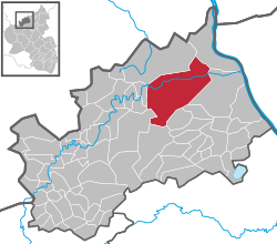
Bad Neuenahr-Ahrweiler
View on WikipediaYou can help expand this article with text translated from the corresponding article in German. Click [show] for important translation instructions.
|
Bad Neuenahr-Ahrweiler (German pronunciation: [baːt ˌnɔʏənʔaːɐ̯ˈʔaːɐ̯vaɪlɐ] ⓘ) is a spa town in the German Bundesland of Rhineland-Palatinate that serves as the capital of the Ahrweiler district. The A61 motorway connects the town with cities like Cologne and Mainz. Formed by the merging of the towns (now districts) of Bad Neuenahr and Ahrweiler in 1969, Bad Neuenahr-Ahrweiler consists of 11 such districts.
Key Information


Geography
[edit]Bad Neuenahr-Ahrweiler rests in the Ahr valley (German: Ahrtal) on the left bank of the Rhine river in the north of Rhineland-Palatinate. Bad Neuenahr-Ahrweiler nestles in the Ahr Hills (German: Ahrgebirge).
The highest hill in the area is the Häuschen at 506 metres (1,660 ft) above sea level. Nearby are the hills of Steckenberg, Neuenahrer, and Talerweiterung. There used to be castles on the last two of these hills.
Neighbouring communities
[edit]Bad Neuenahr-Ahrweiler is surrounded by the following villages and towns (clockwise from the north): Grafschaft, Remagen, Sinzig, Königsfeld, Schalkenbach, Heckenbach, Kesseling, Rech and Dernau. The nearest cities are Bonn and Koblenz.
Districts
[edit]Bad Neuenahr is divided into Ortsbezirke which consist of one or more districts. The Ortsbezirke are represented by local councils. The largest district, Bad Neuenahr, was originally made up of three communities, which are still seen as districts.
Population statistics as of 31 March 2013 (main and secondary residence):[3]
| Local District | Subdivision | Population (30 June 2015) |
|---|---|---|
| Ahrweiler | District: Ahrweiler | 7,411 |
| Bachem | District: Bachem | 1,214 |
| Bad Neuenahr | Districts: Beul, Hemmessen and Wadenheim | 12,132 |
| Gimmigen | District: Gimmigen | 735 |
| Heimersheim | District: Heimersheim and Ehlingen | 3,194 |
| Heppingen | District: Heppingen | 873 |
| Kirchdaun | District: Kirchdaun | 368 |
| Lohrsdorf | District: Lohrsdorf and Green | 672 |
| Ramersbach | District: Ramersbach | 567 |
| Walporzheim | District: Walporzheim and Marienthal | 698 |
Climate
[edit]| Climate data for Bad Neuenahr-Ahrweiler (1991-2020) | |||||||||||||
|---|---|---|---|---|---|---|---|---|---|---|---|---|---|
| Month | Jan | Feb | Mar | Apr | May | Jun | Jul | Aug | Sep | Oct | Nov | Dec | Year |
| Record high °C (°F) | 16.9 (62.4) |
20.7 (69.3) |
25.4 (77.7) |
30.5 (86.9) |
33.4 (92.1) |
36.4 (97.5) |
40.4 (104.7) |
38.9 (102.0) |
34.5 (94.1) |
28.5 (83.3) |
22.4 (72.3) |
19.0 (66.2) |
40.4 (104.7) |
| Mean daily maximum °C (°F) | 5.9 (42.6) |
7.3 (45.1) |
11.4 (52.5) |
15.9 (60.6) |
19.8 (67.6) |
22.9 (73.2) |
25.2 (77.4) |
25.1 (77.2) |
20.7 (69.3) |
15.5 (59.9) |
10.0 (50.0) |
6.5 (43.7) |
15.5 (59.9) |
| Daily mean °C (°F) | 2.9 (37.2) |
3.5 (38.3) |
6.5 (43.7) |
10.2 (50.4) |
14.1 (57.4) |
17.2 (63.0) |
19.2 (66.6) |
18.7 (65.7) |
14.7 (58.5) |
10.5 (50.9) |
6.5 (43.7) |
3.6 (38.5) |
10.6 (51.1) |
| Mean daily minimum °C (°F) | −0.3 (31.5) |
−0.2 (31.6) |
2.1 (35.8) |
4.6 (40.3) |
8.4 (47.1) |
11.6 (52.9) |
13.5 (56.3) |
13.1 (55.6) |
9.6 (49.3) |
6.0 (42.8) |
2.9 (37.2) |
0.5 (32.9) |
6.0 (42.8) |
| Record low °C (°F) | −20.3 (−4.5) |
−21.8 (−7.2) |
−14.1 (6.6) |
−6.4 (20.5) |
−2.7 (27.1) |
1.6 (34.9) |
4.0 (39.2) |
4.5 (40.1) |
0.1 (32.2) |
−7.0 (19.4) |
−12.5 (9.5) |
−20.1 (−4.2) |
−21.8 (−7.2) |
| Average precipitation mm (inches) | 46.0 (1.81) |
42.0 (1.65) |
48.0 (1.89) |
39.0 (1.54) |
58.0 (2.28) |
60.0 (2.36) |
62.0 (2.44) |
64.0 (2.52) |
53.0 (2.09) |
49.0 (1.93) |
46.0 (1.81) |
53.0 (2.09) |
620.0 (24.41) |
| Source: wetterlabs.de: Bad Neuenahr-Ahrweiler | |||||||||||||
History
[edit]


Antiquity
[edit]Discoveries dating to the Hallstatt period (1000–500 BC) show farming activity by Celts that dwelled in the area.
The Gallic Wars (58–50 BC) resulted in the forced relocation of the indigenous Eburones to the Middle Rhine.
Several Roman antiquities were discovered in the region and date from the 1st to 3rd centuries.
Most notable is the Villa Rustica of Bad Neuenahr, which, today is open to the public and serves as a museum (Museum Römervilla).[4]
Middle Ages
[edit]In 893 AD, Ahrweiler was mentioned as Arwilre, Arewilre, Arewilere, and later Areweiller in the Prüm Urbar (register of estates owned by Prüm Abbey). The abbey of Ahrweiler owned a manor with 24 farmsteads; 50 acres of farmland and 76 acres of vineyards. The first mention of a parish church occurred in Neuenahr Castle and surrounding county (Newenare) from 1204 to 1225. In 1246 was founded one of the oldest German inns Gasthaus Sanct Peter. During this period, the area was ruled by German Counts von Neuenahr until 1587, until they went extinct in the male line.[5]
Modern times
[edit]Close to Bad Neuenahr-Ahrweiler, the national Government bunker was built between 1960 and 1972 inside two abandoned railway tunnels that were built as part of the Strategic Railway. The bunker was maintained and kept in a working condition for about 30 years and decommissioned in 1997. The location is a museum since February 2008.
During the 2021 European floods much of the town was submerged and many died.[6]
Economy
[edit]- The German Army's (German: Deutsches Heer) Logistics Centre (main depot) is located in an underground facility.
- Bad Neuenahr-Ahrweiler has been home to the traditional mineral water "Heppinger" since 1584.
- The "Apollinaris" mineral water company was founded in Bad Neuenahr in 1852.
Transport
[edit]The town has five stations on the Ahr Valley Railway and provides hourly connections to Bonn.
Sport
[edit]- Bad Neuenahr-Ahrweiler is the home of the successful women's football team, SC 07 Bad Neuenahr.
Twin towns – sister cities
[edit]Bad Neuenahr-Ahrweiler is twinned with:[7]
 Brasschaat, Belgium
Notable people
[edit]
- Cyrillus Jarre (1878–1952), Franciscan Archbishop in Jinan
- Markus Stenz (born 1965), conductor
- Björn Glasner (born 1973), cyclist
- Jan van Eijden (born 1976), cyclist
- Pierre Kaffer (born 1976), racing driver
- Bianca Rech (born 1981), footballer
- Ricarda Funk (born 1992), canoeist
Associated with the town
[edit]- Karl Marx (1818–1883), philosopher and economist, stayed in a spa resort in Bad Neuenahr in 1877
- Ludwig van Beethoven (baptised 17 December 1770 – 26 March 1827), is said to have visited the town in his youth. The Beethovenhaus is named in his honor.[8]
- Peter Friedhofen (1819–1860), founder of the Charitable Brethren of Maria Hilf, who practiced his trade first in Ahrweiler
- Wolfgang Müller von Königswinter (1816–1873), novelist and poet, died in Bad Neuenahr
- Blandine Merten (1883–1918), Ursuline nun near Ahrweiler
- Ebba Tesdorpf (1851–1920), illustrator and watercolorist, died in Ahrweiler
- Paul Metternich (1853–1934), diplomat, died in the district of Heppingen
- Max von Schillings (1868–1933), composer and conductor
- Christian Hülsmeyer (1891–1957), inventor, physicist and entrepreneur, died in Ahrweiler
References
[edit]- ^ Wahlen der Bürgermeister der verbandsfreien Gemeinden, Landeswahlleiter Rheinland-Pfalz, accessed 30 July 2021.
- ^ "Alle politisch selbständigen Gemeinden mit ausgewählten Merkmalen am 31.12.2023" (in German). Federal Statistical Office of Germany. 28 October 2024. Retrieved 16 November 2024.
- ^ "Zahlen & Daten Bad Neuenahr-Ahrweiler". Stadt Bad Neuenahr-Ahrweiler – offizielle Website. Archived from the original on 2021-08-08. Retrieved 2015-12-22.
- ^ "Museum Roemervilla".
- ^ "Neuenahr - Deutsche Biographie".
- ^ "More than 100 dead as flood 'catastrophe' hits Germany and Belgium". the Guardian. July 16, 2021.
- ^ "Städtepartnerschaft mit Brasschaat". bad-neuenahr-ahrweiler.de (in German). Bad Neuenahr-Ahrweiler. Archived from the original on 2016-03-19. Retrieved 2021-03-10.
- ^ Frick, Hans. "Beethoven in Ahrweiler". Kreisverwaltung Ahrweiler. Retrieved 7 February 2024.
External links
[edit]- . Encyclopædia Britannica. Vol. 19 (11th ed.). 1911. p. 425.
- Official website
 (in German)

| International | |
|---|---|
| National | |
| Geographic | |
| Other | |
Bad Neuenahr-Ahrweiler
View on GrokipediaGeography
Location and terrain
Bad Neuenahr-Ahrweiler is located in northern Rhineland-Palatinate, Germany, within the Ahr Valley at coordinates 50°32′41″N 7°06′48″E.[18] The town sits on the left bank of the Ahr River, a 85-kilometer-long tributary of the Rhine that originates in the Eifel and joins the Rhine near Sinzig approximately 10 kilometers to the east.[19][20] The surrounding terrain encompasses the narrow, meandering Ahr Valley, flanked by the undulating hills of the Eifel region to the west and north.[21] These hills, part of the Low Mountain Range, rise gradually from the valley floor, with the nearby Häuschen hill reaching an elevation of 506 meters above sea level about 2.7 kilometers southeast of the town.[22] The landscape features steep, terraced slopes along the river, transitioning to gentler, broader expanses in the eastern part of the valley near the town.[21] Geologically, the area is shaped by Devonian slate and greywacke formations, overlaid in places with volcanic rocks from the Quaternary Eifel volcanic activity that began around 700,000 years ago.[23][24] Basalt and tuff deposits contribute to the stony, well-drained soils that influence local agriculture, particularly viticulture on the south-facing slopes.[25] These soils, combined with the valley's sheltered microclimate—mild temperatures moderated by the Gulf Stream, low precipitation, and a greenhouse effect in the steep sites—create favorable conditions for red wine production, especially Pinot Noir.[21][26]Administrative divisions
Bad Neuenahr-Ahrweiler was established as a single administrative entity on June 7, 1969, through the merger of the independent towns of Ahrweiler and Bad Neuenahr with the surrounding municipalities of Gimmigen, Heimersheim, and Lohrsdorf, pursuant to the Fourth Law on Administrative Simplification in Rhineland-Palatinate.[27][28] Additional incorporations in 1969 included the villages of Bachem and Kirchdaun, along with the integration of Green into Lohrsdorf.[29] Ramersbach was added in 1974. This evolution created a cohesive administrative unit from previously autonomous locales, with districts retaining local identities while sharing central services. The 13 districts (Ortsbezirke or Stadtteile) include some historical sub-areas, such as Ehlingen within Heimersheim since 1371 and Green within Lohrsdorf since 1969, varying in size and character, often reflecting their wine-growing heritage or historical roles, and were fully integrated post-merger to form the town's internal administrative framework. The town currently holds the status of a verbandsfreie Stadt, an independent municipality exempt from membership in a Verbandsgemeinde (collective municipality), and functions as the administrative seat of the Ahrweiler district in northern Rhineland-Palatinate.[30][31] Key examples include:| District | Key Characteristics |
|---|---|
| Ahrweiler | Historic old town core, enclosed by medieval walls with four gate towers; serves as a cultural and administrative hub.[29] |
| Bad Neuenahr | Largest district, centered on the spa facilities and thermal springs; had approximately 12,247 residents as of December 2015.[32][29] |
| Bachem | Elevated wine village renowned for Pinot Noir production; features a 1650 bakehouse now housing a wine museum and annual wine festival.[29] |
| Ehlingen | Eastern district integrated into Heimersheim since 1371; known for its renovated historic bakehouse and annual plum cake festival in September.[29] |
| Gimmigen | Small district near the Landskrone hill; includes a 14th-century chapel and hosts an annual fair with May pilgrimage traditions.[29] |
| Green | Former independent area merged into Lohrsdorf in 1969, separated by the B266 road since 1981; linked historically by a 17th-century chapel.[29] |
| Heimersheim | Eastern district with 12th-century origins; preserves remnants of town walls, half-timbered houses, and hosts a medieval wine festival.[29] |
| Heppingen | Located at the foot of Landskrone hill with 10th-century roots; features St. Martinus Church (built 1905) and the Maria Hilf chapel.[29] |
| Kirchdaun | Northeastern district incorporated in 1969; centered around the 12th-century St. Lamberti Church and part of the Aachen-Frankfurt trail.[29] |
| Lohrsdorf | 10th-century village including the Köhlerhof golf course and proximity to Landskron Castle; contains an 11th-century chapel.[29] |
| Marienthal | Western wine village with ruins of an Augustinian convent (now a winery) and the Government Bunker museum.[29] |
| Ramersbach | Youngest and highest-elevation district, added in 1974, offering panoramic views; site of ancient Roman iron smelting and the Eisenweg trail.[29][27] |
| Walporzheim | Situated between Ahrweiler and Marienthal; home to the region's oldest wine terraces and St. Peter's Inn (circa 1100).[29] |
Climate
Bad Neuenahr-Ahrweiler experiences a temperate oceanic climate (Köppen Cfb), characterized by mild temperatures and moderate precipitation throughout the year, influenced by its position in the Rhine-Ahr region near the Rhine River. According to long-term records from the German Weather Service (Deutscher Wetterdienst, DWD), the average annual temperature for the period 1991–2020 at the local station is 10.9°C, with annual precipitation averaging 687 mm.[33][34] This moderated oceanic influence results from westerly winds carrying moist air from the Atlantic, tempered by the surrounding Eifel hills and the river valley, leading to relatively stable conditions compared to more continental inland areas.[35] Seasonal variations are pronounced but mild, with winters featuring average temperatures of 3.1°C in January and summers reaching 19.4°C in July, allowing for a growing season supportive of regional agriculture.[33] Precipitation is fairly evenly distributed, with July as the wettest month at 71.7 mm and April the driest at 42.7 mm, contributing to the area's overall humidity levels that average around 80% annually.[34] These patterns reflect the oceanic moderation, where proximity to the Rhine helps buffer extreme cold or heat. The Ahr Valley's topography creates distinct microclimates, including frequent autumn fog that aids vineyard ripening by maintaining higher nighttime humidity and protecting against early frosts. This elevated humidity, combined with the valley's sheltered position, also supports the natural thermal springs, which emerge at temperatures around 34°C and benefit from the consistently moist environment. Volcanic soils in the region further aid in climate moderation by retaining heat and moisture.[36] Recent observations indicate increased precipitation variability since 2020, with more frequent deviations from long-term averages, including wetter periods in western Germany such as Rhineland-Palatinate.[37] For instance, the 12-month period from July 2023 to June 2024 marked Germany's wettest on record, with regional totals exceeding 1,000 mm in parts of the area, highlighting a trend toward greater irregularity in rainfall patterns.[38]Demographics
Population trends
Bad Neuenahr-Ahrweiler was formed in 1969 through the merger of the towns of Bad Neuenahr and Ahrweiler, with an initial population of approximately 25,000 residents. Since then, the population has exhibited steady growth, reaching 27,647 as of December 31, 2023, an increase of 2.7% over the decade from 2013 (from 26,934). As of January 2025, the population stands at 29,444 residents, with a population density of 464 inhabitants per square kilometer across its 63.25 km² area.[39][1][3][40][41] The age structure reflects an aging population, with 29.6% of residents aged 65 and older as of December 31, 2023—higher than the national average of about 22%—including 17.8% aged 65–80 and 11.8% aged 80 and above. Younger cohorts are smaller, comprising 5.4% under age 6 and 11.2% aged 6–20, indicative of a low birth rate consistent with regional trends in Rhineland-Palatinate. The working-age group (20–65) accounts for 53.8% of the population.[39] The July 2021 Ahr Valley flood caused temporary displacement, leading to a population dip of 5–10% due to evacuations and relocations in affected areas. By 2025, the population had recovered to near pre-flood levels through return migrations and migration balances, including a net migration of -204 persons in 2023. Projections indicate modest growth to around 28,000 residents by 2030, driven by continued migration balances despite low natural increase.[42][17][39]Composition and migration
As of 2023, foreign nationals comprise 10.8% of the population of Bad Neuenahr-Ahrweiler, contributing to the town's multicultural fabric as a regional administrative and health hub.[39] As of the 2022 census, approximately 49% identified as Catholic, 12% as Protestant, and 39% as unaffiliated, other faiths, or unknown, a composition shaped by centuries of regional ecclesiastical influence and post-war secularization trends.[1] Migration patterns have been influenced by the town's role as a spa and wellness center, attracting an influx of retirees and health-seeking visitors since the post-World War II era, alongside more recent arrivals of EU citizens working in tourism and services; this has resulted in a net positive migration rate of 0.5% annually in the years leading up to 2021. The 2021 Ahr Valley flood caused temporary displacement, an event that has since strengthened local community resilience programs focused on emergency preparedness and social support networks.[43]History
Pre-Roman and Roman periods
The region surrounding Bad Neuenahr-Ahrweiler, encompassing the Ahr Valley and the adjacent Eifel hills, shows evidence of pre-Roman Celtic activity dating back to the Iron Age, roughly 1000–500 BC, when tribes such as the Treveri inhabited the area and established fortified settlements known as hillforts for defense and community organization. These hillforts, often positioned on elevated terrain in the Eifel, reflect the Celtic exploitation of the landscape's natural defenses and resources, including early agricultural practices that laid the groundwork for later viticulture.[44] Following the Roman conquest of the region under Julius Caesar around 50 BC, the area became an outpost within the province of Germania Inferior, linked to the major sanctuary and settlement at Ara Ubiorum (modern Cologne).[45] By the 1st century AD, Roman influence solidified in the region.[45] A key archaeological site is the Römervilla am Silberberg, a mid-1st-century AD villa rustica uncovered in 1980, which featured luxurious elements including colorful wall paintings, a private bathing complex with underfloor heating (hypocaust), and remnants of mosaics, indicating the wealth of its owners and continuous occupation through the 3rd century AD.[46] Another significant find is the Roman bath (Römerbad) in Ahrweiler, dating to the 2nd–3rd centuries AD, which utilized local thermal springs for therapeutic purposes and was part of a larger estate complex.[47] The Romans economically transformed the area by introducing viticulture, cultivating vines along the south-facing slopes of the Ahr Valley to produce wine, a practice evidenced by ancient pressings and vineyard terraces that persist today.[48] Thermal springs, such as those in Bad Neuenahr, were harnessed for bathing and health, with infrastructure like the nearby Eifel Aqueduct—constructed around 80 AD to supply water over 95 kilometers from the Eifel hills to Cologne—demonstrating Roman engineering that supported local spas and agriculture through remnant channels and reservoirs in the vicinity.[49] Artifacts from sites like Adenbach, including pottery and tools from the 1st–3rd centuries AD, further illustrate daily Roman life and trade in the outpost. Roman presence in the Ahr Valley waned during the late 4th century AD amid increasing barbarian incursions, culminating in a military withdrawal around 400 AD that left behind abandoned villas and baths whose structures were later repurposed in medieval constructions.[45][50]Medieval development
The medieval development of Bad Neuenahr-Ahrweiler centered on the district of Ahrweiler, which served as the historical core of the emerging town. Ahrweiler was first mentioned in 893 AD in the Prüm Urbar, a register of estates belonging to Prüm Abbey, where it appears as "Arwilre" (with variants such as Arewilre and Arewilere), denoting a Carolingian manor with approximately 50 morgens of arable land, 76 morgens of vineyards, and 24 tenant farms. This early documentation highlights Ahrweiler's role as an agricultural estate under ecclesiastical overlordship during the late Carolingian period.[51][52] Building briefly on Roman-era settlements in the vicinity, such as villas along the Ahr River, the area transitioned into a Germanic medieval framework by the 10th century, with Prüm Abbey exerting influence through its proprietary church (Eigenkirche) likely established before 900 AD. By the 12th century, feudal control shifted as the region passed from the Ahrgau county to the Counts of Are around 1100, fostering gradual consolidation of local lordship and ecclesiastical ties.[52] Significant growth occurred in the 12th and 13th centuries under the Archbishopric of Cologne, which assumed authority over Ahrweiler by 1246. In 1248, Archbishop Konrad von Are-Hochstaden confirmed the town's civic rights and commissioned the construction of extensive fortifications, including a circuit wall with a moat, four gates (such as the Obertor and Untertor), and multiple towers, begun around 1250 and expanded through the 15th century; these remain among Germany's best-preserved medieval town defenses. This fortification effort reflected strategic imperatives along the southern border of the Electorate of Cologne, enhancing Ahrweiler's defensive and economic prominence as a wine-trade hub.[51][53][54] Ecclesiastically, the parish of St. Laurentius emerged as a pivotal institution, with records indicating a church structure by 1106 in the Annales Rodenses and a rebuild commissioned by Abbot Goffred of Prüm in 1162; a new hall church was erected between 1258 and 1269 amid the town's expansion. The parish, initially tied to Prüm Abbey, was incorporated into the Archdiocese of Cologne in 1298, serving as the spiritual center for local worship, processions, and community cohesion under canon law. Mineral springs near Neuenahr, part of the broader territory, were recognized for their properties by the 13th century, with initial therapeutic applications in bathing and drinking cures tied to ecclesiastical and feudal estates, though systematic exploitation awaited later eras.[52][55] Feudal governance solidified under the Electorate of Cologne from the mid-13th century, positioning Ahrweiler as a co-capital alongside Bonn, Neuss, and Andernach until 1794, when French revolutionary forces annexed the territory. This period of stable archiepiscopal rule supported modest demographic growth, with Ahrweiler's population reaching about 1,000 inhabitants by 1500, sustained by viticulture, trade, and fortified security.[51][56]Early modern era
In the 16th century, the region of what is now Bad Neuenahr-Ahrweiler remained firmly under the influence of the Catholic Electorate of Cologne, limiting the spread of the Protestant Reformation. The area's strong Catholic dominance, reinforced by the local nobility and ecclesiastical structures, meant that Reformation ideas had minimal impact, with no significant Protestant communities emerging. Concurrently, the mineral springs in Heppingen gained recognition for their health benefits, known since at least 1565 and later associated with the Heppinger Heilwasser tradition established around 1584.[57][58][59] The French Revolutionary Wars brought dramatic changes in 1794, when French troops occupied the left bank of the Rhine, including the Ahrweiler area, leading to its annexation by France. This period saw the secularization of church lands, dissolving monastic properties and redistributing them under revolutionary principles of "liberty, equality, and fraternity." Ahrweiler served as the seat of a mairie and later as the administrative center of the arrondissement within the Roer Department, integrating the region into French administrative and legal systems until 1814.[60][61][62] Following the Congress of Vienna in 1815, the territory came under Prussian control as part of the Rhine Province, fostering stability and infrastructure development. The spa tradition in Bad Neuenahr emerged in the mid-19th century, catalyzed by the 1852 discovery of the Apollinaris mineral spring by local vintner Georg Kreuzberg, which was analyzed and approved for therapeutic use by 1856. The first official spa season commenced in 1859, attracting visitors for treatments related to diabetes, liver ailments, and metabolic disorders, with guest numbers reaching 3,505 by 1880. The arrival of the railway station in 1880, connecting to the Remagen-Ahrweiler line, significantly boosted tourism by improving accessibility for international visitors.[63][64][65] By 1900, the combined population of the emerging spa town and surrounding areas had grown to approximately 5,000, driven by the influx of spa-related commerce and residents, though exact figures vary by district. This era marked the transition of Bad Neuenahr into a prominent health resort, supported by Prussian royal patronage, including visits from figures like Princess Augusta in 1858, which enhanced its prestige.[63][66]19th to 21st centuries
In the late 19th century, Bad Neuenahr emerged as a prominent spa destination following the discovery of mineral springs in 1852, which led to the establishment of bathhouses, hotels, and the Kurhaus by the early 20th century, attracting international visitors for treatments related to metabolic and digestive ailments.[8] The town's spa infrastructure expanded rapidly, with the Großer Sprudel spring drilled in 1861 and additional facilities like the cast-iron drinking hall, laying the foundation for its role as a health resort built upon earlier modern-era spa traditions.[8] During World War I, the spa's operations declined sharply as facilities were repurposed as a military hospital, with guest numbers dropping to just 54 foreign visitors by 1916 amid wartime restrictions.[8] In World War II, the area again served as a military hospital, suffering damage including the destruction of local structures like the St. Martinus Church in Heppingen, until Allied forces occupied the region in March 1945.[8][67] Post-war recovery began in 1946 when the town became part of the newly formed state of Rhineland-Palatinate, and the spa reopened to the public, marking a revival in tourism.[8][68] The opening of a casino in 1948 further stimulated economic growth through increased visitor numbers, contributing to a broader post-war boom in the region's health and leisure sectors.[8] During the Cold War, between 1960 and 1972, an extensive underground bunker complex was constructed beneath Ahrweiler to serve as an emergency seat for the West German federal government in the event of nuclear conflict; the site is now preserved as a museum.[9] In 1969, the municipalities of Bad Neuenahr and Ahrweiler merged, forming the modern town of Bad Neuenahr-Ahrweiler and incorporating surrounding neighborhoods like Lohrsdorf and Green to create a unified administrative and health-focused entity.[67] This consolidation enhanced the area's appeal as a pluralistic health resort, with tourism and medical services driving expansion.[8] By the late 20th century, Bad Neuenahr-Ahrweiler had solidified its status as a leading health destination, hosting 13 specialized clinics and over 100 resident consultants offering treatments for conditions like rheumatism and cardiovascular issues, supported by the mineral-rich thermal springs.[11] European Union integration provided additional benefits, including funding opportunities that bolstered infrastructure and recovery efforts in the region.[69] The devastating Ahr Valley flood of July 2021 caused profound impacts in Bad Neuenahr-Ahrweiler, part of the Ahrweiler district where many of the 134 fatalities in the Ahr Valley occurred, exacerbated by dike failures and inadequate warnings that led to widespread inundation.[70][71] Thousands of homes were destroyed or severely damaged in the locality, contributing to overall regional losses estimated at €40 billion, including insured damages of €7 billion from the broader German flooding event.[72][73][74] By 2025, recovery efforts in Bad Neuenahr-Ahrweiler emphasized resilience and sustainability, with the Kurhaus convention center refurbished as part of the Spa Park redevelopment to include a historic concert hall and enhanced thermal facilities.[75] Infrastructure rebuilding incorporated elevated designs, such as higher-span bridges and a raised Ahr-Radweg bike path with flood sensors and permeable surfaces, to mitigate future risks.[75] Green initiatives transformed the valley, featuring solar panels, green roofs, expanded tree plantings in the Spa Park, and vineyard practices like sheep grazing for soil health, restoring ecological vitality and promoting carbon-neutral development.[75]Politics and administration
Local governance
Bad Neuenahr-Ahrweiler functions as a verbandsfreie Stadt in Rhineland-Palatinate, operating independently without affiliation to a municipal association and maintaining a self-contained administrative structure. The local government is headed by the Bürgermeister, who holds executive authority and is directly elected for an eight-year term, supported by the Stadtrat, a unicameral city council comprising 36 members elected every five years through proportional representation. The council deliberates and decides on municipal policies, budgets, and ordinances, while the mayor implements these decisions and represents the city externally.[76] Guido Orthen of the Christian Democratic Union (CDU) has served as mayor since August 2010, re-elected in 2017. Orthen's current term ends in early 2026, with the next election scheduled for 22 March 2026 alongside the state parliament election. In the most recent local elections held on June 9, 2024, the CDU secured the largest share with 42.9% of the vote, translating to approximately 15 seats in the council; the Social Democratic Party (SPD) followed with 15.7% (about 6 seats), the Greens with 13.7% (about 5 seats), the Alternative for Germany (AfD) with 5.4% (2 seats), and the Free Democratic Party (FDP) with 4.4% (2 seats), alongside smaller parties and independents filling the remainder. This composition reflects a CDU-led majority, enabling continued focus on post-disaster recovery and economic revitalization.[77][78][79] Key municipal policies under the current administration emphasize flood recovery from the 2021 disaster, tourism enhancement, and sustainability initiatives. For flood recovery, the city has coordinated with regional and federal programs, including allocations from a special fund that provided approximately €4.09 billion in regional budgets for the Ahrweiler district between 2022 and 2025 to support infrastructure rebuilding, housing repairs, and community resilience measures. Tourism promotion efforts include the "Nachhaltiges Tourismuskonzept Ahrtal 2025," a strategic plan led by local authorities to reposition the Ahrtal region as an eco-friendly destination through sustainable practices like green infrastructure and cultural event programming. Sustainability plans further integrate climate adaptation, such as water-sensitive urban design projects aimed at mitigating future flood risks while preserving the area's natural and thermal spa heritage.[80][81][82] As the administrative seat of the Ahrweiler district (Landkreis Ahrweiler), Bad Neuenahr-Ahrweiler hosts the Kreisverwaltung, which oversees governance for approximately 129,000 residents across 74 municipalities, including coordination of district-wide services like education, social welfare, and emergency management. This role amplifies the city's influence in regional decision-making, particularly in allocating resources for cross-municipal projects such as disaster preparedness and economic development.[83]District role and symbols
Bad Neuenahr-Ahrweiler serves as the administrative seat of the Ahrweiler district (Landkreis Ahrweiler), a position it has held since the district's formation in 1969 following the merger of the former town of Ahrweiler into Bad Neuenahr to create the unified municipality.[84] The district encompasses 787 square kilometers and had a population of 129,353 as of 31 December 2024. As the district capital, Bad Neuenahr-Ahrweiler hosts the central administration, which oversees key regional functions including secondary education through the management of vocational and high schools, public health services via district hospitals and preventive care programs, and emergency services such as fire protection coordination and disaster response planning.[85] The town's coat of arms, officially granted on October 15, 1971, reflects its composite history as a merger of Bad Neuenahr and Ahrweiler. It features a shield divided per pale: on the dexter side, a silver eagle displayed on a red field, derived from the arms of the Counts of Are and the medieval city of Ahrweiler; on the sinister side, a black lion rampant armed and langued red on a gold field, symbolizing the Duchy of Jülich-Berg and the former city of Bad Neuenahr, with a crown in exchanged colors in the base.[86][87] This design evolved from medieval seals; the earliest known seal of Ahrweiler dates to 1365, incorporating elements like the Cologne cross, while Bad Neuenahr's 1546 seal combined the Are eagle with the Jülich lion, establishing heraldic continuity through the centuries.[84][88] Complementing the coat of arms, the municipal banner is yellow-red vertically bicolored with the arms placed above the center; it was approved on 15 October 1971.[89] The official seal incorporates the coat of arms and is used for administrative documents, maintaining the heraldic tradition from the medieval period when seals served as both authentication and symbolic representation of authority.[89] In its district role, Bad Neuenahr-Ahrweiler coordinates regional planning initiatives, particularly in flood defense following the devastating 2021 inundation of the Ahr Valley, where the district administration led resilient reconstruction efforts, including enhanced riverbank fortifications and climate-adaptive infrastructure across the 787-square-kilometer area. Additionally, as the administrative hub, it supports designations for the Ahr Wine Route (Rotweinwanderweg), a 35-kilometer trail promoting the region's renowned red wine production through coordinated tourism and viticultural development.[90]Economy
Primary sectors
The primary sectors of Bad Neuenahr-Ahrweiler's economy center on agriculture, particularly viticulture in the Ahr Valley, alongside beverage production from local mineral springs and a legacy of mining activity. Viticulture forms a cornerstone of the region's traditional economy, with the Ahr Valley wine region encompassing approximately 560 hectares of vineyards. Around 85% of production focuses on red wines, of which three-quarters are Spätburgunder (Pinot Noir), benefiting from the area's slate soils and mild climate suitable for these varieties. The sector typically yields an average of 6.1 million bottles annually, though the 2024 harvest experienced a 64% reduction in output due to frost and weather challenges, emphasizing its vulnerability to climatic factors. Seasonal employment in viticulture supports around 1,000 workers during peak harvest periods, underscoring the labor-intensive nature of the industry. Beverage production, rooted in the exploitation of natural mineral springs, includes Heppinger mineral water, a traditional brand sourced from the area since 1584 with an annual output of 100,000 hectoliters. Similarly, Apollinaris sparkling mineral water, discovered in 1852 near Bad Neuenahr and now owned by the Coca-Cola Company, contributes significantly, highlighting the enduring role of natural resources in local manufacturing. Mining, historically prominent in the basalt-rich Eifel landscape surrounding Ahrweiler, involved quarrying operations that supplied construction materials until closures in the 1980s; these sites have since transitioned to tourism attractions, offering geological trails and educational visits that preserve industrial heritage without active extraction. Overall, these sectors reflect a resilient economy, with an unemployment rate of 4.2% in 2024—below the national average of 5.5%—driven by sustainable resource use and seasonal dynamics. As of mid-2025, the local unemployment rate stood at 4.0%, supported by ongoing post-flood recovery efforts bolstered by federal aid.[91]Major employers
The public sector serves as a cornerstone of employment in Bad Neuenahr-Ahrweiler, particularly through the district administration, which employs approximately 720 staff members across various administrative and service roles.[92] This entity manages essential local governance functions, including social services, infrastructure planning, and community projects, contributing to stable job opportunities in the region.[93] The health and services sector is another key employer, encompassing 13 clinics and rehabilitation facilities that provide specialized care in areas such as orthopedics, vascular medicine, and internal diseases.[94] For instance, the DRK Fachklinik Bad Neuenahr employs approximately 130 staff members focused on pediatric and adolescent rehabilitation.[95] Complementing this, the Spielbank Bad Neuenahr, a prominent entertainment venue, supports around 110 jobs in hospitality, gaming operations, and customer service.[96] In manufacturing, smaller firms dominate, particularly in food processing and ancillary tourism services, such as logistics and equipment supply, fostering localized employment without large-scale industrial operations.[97] Post-2021 flood reconstruction efforts from 2022 to 2025 have generated temporary positions, with initiatives like those from the Aufbau- und Entwicklungsgesellschaft Bad Neuenahr-Ahrweiler mbH offering ongoing roles in project management and development to aid recovery.[98] Economic recovery in 2025 has been bolstered by federal aid, promoting green jobs in resilient infrastructure and reflecting optimism among local businesses following the floods.[99] Viticulture, as outlined in primary sectors, also sustains seasonal employment tied to the Ahr Valley's wine production.[100]Health, tourism, and culture
Spa and wellness facilities
Bad Neuenahr-Ahrweiler's spa infrastructure revolves around its mineral-rich healing waters, which originated in the early modern period with the bottling of Heppinger mineral water starting in 1584.[101] The town's central thermal feature is the Großer Sprudel, a state-recognized healing spring that bubbles up from a depth of 95 meters at a temperature of 34°C, containing high levels of sodium, hydrogen carbonate, magnesium, natural carbonic acid, silicic acid, and various trace elements known for their therapeutic effects on the skin, immune system, and overall vitality.[36] Approved by the Federal Institute for Drugs and Medical Devices (BfArM), this natural warm water has been harnessed for over 150 years to support health treatments, drawing visitors seeking natural remedies.[36] The spa facilities include 13 specialized clinics and rehabilitation centers staffed by more than 100 resident physicians, focusing on treatments for rheumatism, circulatory disorders, and metabolic conditions through balneotherapy and hydrotherapy using the mineral waters.[11] Key venues such as the Ahr-Thermen thermal baths provide indoor and outdoor pools filled with the 31–34°C healing water, along with jacuzzis, hydromassage features, saunas, steam baths, and relaxation areas designed to promote muscle recovery and stress relief.[102] Adjacent to these is the Kurpark, a landscaped spa garden featuring accessible paths, fountains fed by the springs, and green spaces that enhance the therapeutic environment for gentle walks and outdoor wellness activities.[103] The 2021 Ahr Valley flood severely damaged much of the spa infrastructure, including the Ahr-Thermen and surrounding clinics, leading to temporary closures and extensive reconstruction efforts.[104] By 2024, key facilities including the Ahr-Thermen had been restored and reopened with enhanced flood-resilient measures, such as elevated structural elements and improved water management systems, to ensure long-term sustainability while maintaining the focus on modern rehabilitation programs and holistic wellness therapies.[105]Cultural heritage and attractions
Bad Neuenahr-Ahrweiler boasts a rich tapestry of cultural heritage spanning Roman antiquity to medieval fortifications, preserved through key archaeological sites and architectural landmarks. The Römervilla at Silberberg, a 1st-century AD Roman villa complex uncovered in 1980 during road construction, exemplifies the region's ancient provincial Roman life, featuring well-preserved ruins including a bathhouse with underfloor heating, mosaic floors, and wall paintings depicting mythological scenes.[46] The site's continuous use from the Roman era through the Middle Ages underscores its historical significance, with artifacts like tableware, hairpins, and theater masks offering insights into daily existence in the Ahr Valley.[106] Complementing this is the medieval old town of Ahrweiler, encircled by fortifications dating to the 1240s, forming an approximately 3-kilometer circuit of walls that ranks among Germany's best-preserved examples, complete with four main gates—such as the Obertor and Ahrtor—and defensive towers like the Weißer Turm. These structures, built in the 13th century to protect against invasions, feature Gothic elements and integrate seamlessly with the surrounding half-timbered houses, providing a vivid portal to the town's feudal past.[107] Museums in Bad Neuenahr-Ahrweiler further illuminate this heritage, with the Museum Römervilla serving as the primary repository for local Roman history through its on-site displays of excavated finds and reconstructed rooms.[108] For broader local narratives, the city's museale Sammlung der Stadt Bad Neuenahr-Ahrweiler curates artifacts on urban development and cultural evolution from medieval times onward, housed in various historic buildings including the Weißer Turm, a 13th-century residential tower now adapted for exhibitions on regional traditions.[109] The Casino Bad Neuenahr, constructed in 1903 in the Art Nouveau style, stands as a testament to early 20th-century spa culture, originally part of the Kurhaus complex and one of the first casinos to reopen in post-World War II Germany, blending ornate architectural details with its role in the town's social history.[110] These institutions not only preserve artifacts but also host guided tours that contextualize the area's evolution from Roman settlement to modern resort town. Annual events animate this heritage, drawing visitors to celebrate the town's layered past. The Ahrweiler Christmas Market, held over four Advent weekends on the historic Marktplatz and adjacent streets, transforms the medieval core into a festive scene with traditional stalls, lights, and crafts amid the encircling walls, fostering a romantic atmosphere that highlights the old town's charm.[111] Roman-themed festivals, including guided reenactments and wine events invoking ancient viticulture traditions, occur throughout the year at sites like the Römervilla, connecting the area's prehistoric Roman roots—evident in early settlements along the Ahr River—to contemporary cultural expressions.[112] Culinary highlights include Michelin-starred dining, such as at Restaurant Brogsitter in Historisches Gasthaus Sanct Peter, where modern cuisine interprets local ingredients in a one-star setting that earned acclaim in the 2025 Michelin Guide.[113] The devastating 2021 Ahr Valley flood, which severely impacted Bad Neuenahr and damaged infrastructure around cultural sites, prompted resilient restorations emphasizing heritage preservation. By 2025, efforts had restored key landmarks, including the Museum Römervilla which reopened in April 2022 after flood repairs to protect its ruins from water ingress, with the site continuing to operate seasonally and incorporating ongoing protective measures against future flooding, and ongoing reconstruction of the old town's flood-vulnerable areas to enhance structural integrity while maintaining historical authenticity.[114] These initiatives, supported by federal funding exceeding €30 billion for the region, underscore a commitment to cultural resilience, ensuring sites like the medieval walls and Roman villa continue to educate and attract visitors post-disaster.[115]Wine and culinary traditions
The Ahr Valley represents Germany's northernmost wine-growing region, a compact area of approximately 560 hectares dedicated predominantly to red wine production on steep, terraced slopes along the river. This northerly location, combined with a mild microclimate influenced by the Rhine, fosters the cultivation of elegant Spätburgunder (Pinot Noir), which accounts for about 60 percent of the vineyard plantings, making the Ahr a standout for high-quality red wines in the country. The remaining vines include other reds like Portugieser and whites such as Riesling and Pinot Blanc, contributing to a total red wine share exceeding 80 percent.[116][26] Central to the region's wine culture is the Rotweinwanderweg, a 35-kilometer hiking trail—known as the Red Wine Trail—that meanders through the iconic vineyards from Altenahr to Bad Bodendorf, passing picturesque villages, slate soils, and vantage points like the Altenahrer Eck for immersive exploration of the terroir. Approximately 250 wine producers, including family estates, cooperatives, and boutique operations, maintain these vineyards, with manual harvesting essential due to the challenging terrain. Traditions revolve around communal celebrations, particularly the annual Weinfeste or wine festivals during the harvest season from late September to October, where locals and visitors enjoy tastings, live music, processions, and pairings of fresh vintages with regional fare in settings like Ahrweiler's market square or Altenahr's wine taverns.[117][118][119] The 2024 vintage exemplified the region's resilience, yielding smaller quantities due to late-spring frost—a 64 percent drop in some areas—but producing wines of exceptional quality with vibrant fruit and balanced acidity, signaling robust recovery from the devastating 2021 flood that destroyed up to 40 percent of vineyards. Culinary traditions in Bad Neuenahr-Ahrweiler draw from Rheinische influences, emphasizing hearty, seasonal ingredients like white asparagus from nearby Mosel fields, wild game such as venison or boar from the Eifel forests, and river fish, often paired with the valley's velvety Pinot Noirs for reds or lighter Rieslings for whites to enhance earthy flavors. As of the 2025 Michelin Guide, the area features notable fine-dining venues, including the two-star Steinheuers Restaurant, which innovates on these local elements with precise, terroir-driven menus.[120][75][121][122] Sustainability has gained momentum post-2021, with many producers adopting organic practices to rebuild resiliently amid climate challenges, resulting in a growing share of certified organic vineyards—estimated at around 20 percent by 2025—focusing on biodiversity, reduced chemical use, and soil regeneration on the flood-affected slate terrains.[75]Infrastructure and transport
Transportation networks
Bad Neuenahr-Ahrweiler benefits from its position along the Ahr Valley Railway, a regional line operated by Deutsche Bahn that provides essential connectivity for residents and tourists. As of November 2025, the line is under reconstruction following the 2021 flood, with trains operating from Remagen to Walporzheim. Rail replacement bus services cover the route from Walporzheim to Ahrbrück, with full rail service expected by December 2025. The town features four stations on this route—Bad Neuenahr, Bad Bodendorf, Ahrweiler, and Walporzheim—facilitating access to the surrounding region. Hourly regional trains (RB 30 and RB 39) run from these stations to Bonn Hauptbahnhof, with journey times averaging around 30 to 45 minutes depending on the starting point.[123] These services integrate seamlessly with Deutsche Bahn's Regional-Express (RE) lines at Bonn, enabling efficient onward travel to Cologne in approximately 20 additional minutes. Road infrastructure supports both local mobility and broader accessibility, with the B 573 federal highway serving as a key link from the town center to the A 61 motorway interchange just north of Bad Neuenahr. This connection allows quick access to major cities like Cologne (about 50 km north) and Koblenz (around 40 km south), making the area attractive for day trips and regional commuting. The local public bus network, managed by the Verkehrsverbund Rhein-Mosel (VRM), operates numerous routes across the district, including lines like 836 (connecting Sinzig to Bad Neuenahr and Ahrweiler) and 860 (extending to Ahrbrück and beyond), with services running hourly or more frequently during peak times. The guest card provided by local tourism authorities grants free access to this network for visitors.[124][125] Cycling enthusiasts enjoy an extensive network of well-maintained paths, totaling over 200 km in the vicinity, primarily along the Ahr River (approximately 80 km from Blankenheim to the Rhine confluence) and the Rhine Cycle Route (EuroVelo 15). These trails, such as the Ahr Cycle Path, wind through vineyards and scenic valleys, with bike-friendly infrastructure including cycle buses for assisted transport. A notable feature is the passenger ferry service across the Rhine near the neighboring town of Sinzig, which supports cross-river cycling loops and connects to routes toward Bad Hönningen and Linz am Rhein.[126][127][128] Access to air travel is provided via Cologne/Bonn Airport (CGN), located roughly 45 km northwest of the town center, reachable in about 40 minutes by car or via combined train-bus connections from Bonn (totaling around 1.5 hours). The valley terrain influences route planning, with rail and road alignments following the Ahr's contours to navigate the hilly landscape efficiently.[129]Utilities and flood resilience
Bad Neuenahr-Ahrweiler's public utilities emphasize sustainability, drawing on local natural resources for water supply. The municipal system primarily utilizes the Apollinaris springs in the Heppingen district, a source of naturally sparkling mineral water discovered in the mid-19th century, which supports both residential needs and the town's spa tradition while relying on renewable groundwater extraction.[130] Energy provision is handled by local utilities like the Ahrtal-Werke GmbH, part of broader regional efforts to transition toward greener sources amid Germany's national push for renewables.[131] Waste management aligns with high national standards, incorporating efficient collection and processing systems that promote material recovery and reduce landfill use.[132] In response to the catastrophic July 2021 flood, which caused 69 fatalities in the town and widespread infrastructure damage, authorities have prioritized flood resilience through targeted adaptations. Reconstruction efforts include the development of new dikes, retention basins, and enhanced waterways to mitigate future risks along the Ahr River, integrated into a broader €15 billion federal funding package for the Ahr Valley region.[133][72] These measures build on lessons from the event's rapid onset and inadequate prior warnings, with improved early warning systems now incorporating real-time monitoring and community alerts to better protect vulnerable areas. As of 2025, additional resilience initiatives include ongoing enhancements to infrastructure like the railway, with flood-proof designs implemented during rebuilding.[134] Broadband infrastructure supports modern utilities and resilience, with ongoing expansions in fiber-optic networks enabling reliable connectivity for emergency services and remote health monitoring, particularly vital in a spa town with an aging population.[135] District-wide sustainability initiatives further bolster resilience, including solar panel installations on public buildings as part of post-flood rebuilding; for instance, REC Group donated panels for a climate-friendly daycare center reconstruction, exemplifying efforts to integrate renewable energy into community facilities.[136]Sports and leisure
Local sports clubs
Bad Neuenahr-Ahrweiler boasts a diverse array of local sports clubs that foster community engagement and physical activity across various disciplines. The Sport-Club 13 Bad Neuenahr e.V., founded in 2013 as the successor to the defunct SC 07 Bad Neuenahr (established 1907), continues the tradition of its women's football section, which achieved national prominence by competing in the Frauen-Bundesliga from 1997 until its relegation in 2013.[137] The club fields competitive teams in lower divisions, such as the Regionalliga Südwest, emphasizing youth development and regional tournaments.[137] The Turn- und Sportverein (TuS) Ahrweiler 1898 e.V. serves as a cornerstone multi-sport organization, offering programs in handball, athletics, table tennis, gymnastics, triathlon, and volleyball, with dedicated youth and adult sections to promote inclusive participation.[138] Its handball department fields multiple teams in regional leagues under the Handballverband Rheinland, including junior squads that compete in youth championships.[139] Complementing this, the Hockey- und Tennisclub (HTC) Bad Neuenahr 1920 e.V. focuses on tennis and field hockey, maintaining 13 outdoor courts equipped with modern floodlighting and hosting events like the German Senior Championships to nurture talent from beginners to competitive players.[140] Golf enthusiasts are served by the Golf- und Landclub Bad Neuenahr-Ahrweiler e.V., established in 1979 with its 18-hole championship course opening in 1980 on undulating parkland terrain designed by Rainer Preißmann.[141] The club also features a 7-hole par-3 short course added in 1990, attracting members and visitors for leisurely and challenging rounds amid the Ahr Valley's scenic vineyards.[141] Running remains a popular pursuit through the annual Ahrathon, an experiential half-marathon and shorter races held in June along the picturesque Ahr Valley trails and vineyards, drawing participants for its blend of athletic challenge and regional beauty.[142] Following the 2021 flood, local clubs like TuS Ahrweiler and HTC Bad Neuenahr have expanded youth initiatives linked to schools, integrating sports into recovery efforts to support mental and physical health among young residents.[138]Recreational facilities
Bad Neuenahr-Ahrweiler offers a variety of parks that serve as key recreational spaces, particularly those integrated with the town's thermal and natural surroundings. The Kurpark, located in the historic spa district, features landscaped gardens, walking paths, and proximity to thermal facilities, providing a serene environment for relaxation and light exercise.[103] Adjacent to it, the Kaiserin-Auguste-Viktoria Park spans approximately 3 hectares and includes green lawns, benches, and shaded areas ideal for picnics and leisurely strolls.[143] Together with other green spaces in the region, these parks contribute to a network of thermal gardens emphasizing wellness amid the Ahr Valley's landscape. Playgrounds are distributed across multiple districts, such as the multi-generational facility in Kaiserin-Auguste-Viktoria Park equipped with swings, climbing structures, and inclusive play elements for all ages, and others like Spielplatz Im Bülland and Spielplatz Schillerstraße in central areas, ensuring accessible family recreation in at least 10 of the town's 13 districts.[144][145][146] The town's trail system enhances outdoor leisure, with over 100 km of hiking paths weaving through the Eifel region's hills and valleys, starting from Bad Neuenahr-Ahrweiler along the Ahrsteig long-distance trail. This route offers varied terrain, from gentle riverside walks to elevated viewpoints, and incorporates themed elements highlighting the area's natural and historical features, including paths near ancient Roman settlements in the broader Eifel.[147][148] Local residents and visitors use these trails for casual exploration, with shorter loops like the Waldentdeckerpfad providing interactive forest stations for educational family outings.[149] The Waldabenteuerpark provides adventure activities in the forest, including treetop paths, climbing elements, and zip lines suitable for families, promoting active engagement with the Ahr Valley's woodlands.[15] Recreational venues include the historic Kurhaus convention center, a landmark completed in 1905 and refurbished following the 2021 floods, now featuring a ballroom with capacity for up to 1,000 people in theater-style seating for events and gatherings.[150][75] Outdoor pools such as the Freibad Ahrweiler provide heated lanes, a 45-meter slide, children's pools, and features like water mushrooms and massage jets, open seasonally for swimming and play.[151] Gyms like Fit & Fun and AhrFit24 offer modern equipment and group classes in central locations, supporting personal fitness routines.[152][153] In response to the 2021 floods, post-disaster enhancements have bolstered recreational resilience, with elevated park designs and floodplain transformations into green spaces completed by 2025 as part of a master reconstruction plan. These include raised pathways in areas like the Kurpark vicinity and resilient landscaping to mitigate future water risks while preserving leisure access.[154][155] Local sports clubs occasionally utilize these facilities for community events, fostering integrated leisure opportunities.[156]International relations
Twin towns
Bad Neuenahr-Ahrweiler maintains a formal twin town partnership with Brasschaat in Belgium.[157] The partnership was initiated in 1982 through the Council of European Municipalities and Regions and officially established by signing ceremonies on February 27, 1988, in Brasschaat and May 28, 1988, in Bad Neuenahr-Ahrweiler.[157] It focuses on fostering cultural, educational, and social exchanges to strengthen European ties at the local level.[157] A dedicated partnership committee, formed on February 29, 1988, with six members representing all city council parties, oversees these efforts.[157] Activities include school partnerships, youth council collaborations, and joint training for fire brigades, promoting mutual understanding among residents.[157] Annual citizen exchange trips, such as the two planned for 2024 to Brasschaat, encourage direct interactions and shared experiences between communities.[158] Over 40 years, the partnership has sustained numerous actions, including cultural events and citizen exchanges, building a warm rapport across borders.[159] Recent initiatives, like dedicating the redesigned Bad Neuenahr train station forecourt to Brasschaat, symbolize ongoing solidarity and cultural homage.[160] These exchanges benefit both towns by enhancing tourism through joint promotions and supporting youth programs that build international networks.[157]Other partnerships
Bad Neuenahr-Ahrweiler engages in various EU-supported projects aimed at enhancing sustainability and flood resilience. The town participated in the KAHR (Climate Adaptation, Flood, Resilience) research project, funded by the German Federal Ministry of Education and Research (BMBF), which ran from 2022 until December 31, 2024, and involved 13 partners from academia, local government, and industry to develop strategies for sustainable reconstruction after extreme weather events like the 2021 floods.[161][162] This initiative focused on risk management, urban planning adaptations, and community involvement to build long-term environmental protection along the Ahr River. Additionally, the region benefits from broader EU frameworks such as Horizon Europe programs addressing flood prediction and climate impacts, with local applications in the Ahr Valley for improved early warning systems and infrastructure hardening.[163] The town advanced climate adaptation with the opening of the IQIB (International Center for Flood Risk Management) in September 2025, a hub for international knowledge exchange on disaster preparedness, supported by partnerships with organizations like the German Committee for Disaster Risk Reduction (DKKV).[164] This facility builds on post-flood learnings to share best practices with European and international counterparts, emphasizing resilient urban design through networked EU-aligned programs, including delegations from institutions such as the National Institute for Disaster Management.Notable people
Born in the town
Cyrillus Jarre (1878–1952) was a German Franciscan friar and missionary who became the Archbishop of Jinan in China, serving from 1946 until his death amid persecution by the Chinese Communist regime. Born in Ahrweiler as Rudolf Jarre, he joined the Franciscan order in 1898, was ordained a priest in 1904, and spent over four decades in China establishing missions and educational institutions.[165] Markus Stenz (born 1965) is a prominent German conductor known for his work with major orchestras including the Gürzenich Orchestra Cologne, where he served as General Music Director from 2003 to 2014, and the Netherlands Radio Philharmonic Orchestra as principal conductor from 2012 to 2019. Born in Bad Neuenahr-Ahrweiler, he studied at the Hochschule für Musik in Cologne and later at Tanglewood with Leonard Bernstein and Seiji Ozawa, gaining international acclaim for interpretations of Beethoven, Mahler, and contemporary composers.[166] Bianca Rech (born 1981) is a former German professional footballer and current director of women's football at FC Bayern Munich, having previously been sporting director for 1. FC Köln's women's team. Born in Bad Neuenahr-Ahrweiler, she began her career with local club SC 07 Bad Neuenahr, making over 100 Bundesliga appearances as a defender and contributing to the team's 2007–08 DFB-Pokal win before moving to clubs like FFC Frankfurt and Bayer Leverkusen. Ricarda Funk (born 1992) is an Olympic gold medalist in canoe slalom, winning the K1 event at the 2020 Tokyo Games and securing multiple World Championship titles, including in 2021 and 2022. Born in Bad Neuenahr-Ahrweiler, she started paddling locally before joining the German national team, where she has earned European titles and competed in three Olympics, establishing herself as one of Germany's top slalom canoeists. She won a silver medal in the K1 team event at the 2024 Paris Olympics.Associated figures
Bad Neuenahr-Ahrweiler has attracted numerous prominent individuals throughout history due to its renowned spa facilities and mineral springs, fostering connections beyond mere birthplace. One such figure is Georg Kreuzberg (1795–1873), a local entrepreneur whose discovery of the Apollinaris spring in 1852 revolutionized the town's health and economic landscape. While drilling for better vineyard conditions on his property in what is now the Heppingen district, Kreuzberg uncovered a carbonated mineral spring with exceptional effervescence, which he named after Saint Apollinaris, the town's patron saint.[130] This find led to the establishment of the Apollinaris company, which bottled and exported the sparkling water internationally, earning it the nickname "the queen of table waters" among European royalty and boosting Bad Neuenahr's status as a premier spa destination in the 19th century. Kreuzberg's initiative not only transformed unproductive land into a valuable asset but also laid the foundation for the town's enduring wellness industry, with the spring's output reaching millions of bottles annually by the late 1800s.[167] In the realm of modern culture, the town maintains a notable association with the influential artist Joseph Beuys (1921–1986), whose works are prominently featured in the former Regierungsbunker, a Cold War-era site now serving as a documentation center. The bunker houses original lithographs by Beuys, including pieces that reflect his themes of social sculpture and political activism, acquired from the Berliner Galerie to underscore the site's historical and artistic significance.[168] These installations highlight Beuys's enduring impact on contemporary art, connecting the town's post-war heritage to his provocative legacy as a key figure in the Fluxus movement and environmental advocacy. The presence of his art in this underground complex symbolizes a bridge between Bad Neuenahr-Ahrweiler's strategic past and broader cultural dialogues on democracy and creativity. Beuys visited the bunker site in 1981.[169] Philosophers and intellectuals have also found respite in the town's therapeutic waters, exemplified by Karl Marx (1818–1883), who resided there briefly in 1877 to alleviate chronic health issues. Accompanied by his wife Jenny and daughter Eleanor, Marx stayed at a spa hotel on what is now Hauptstraße 116, the current site of the town hall, where he underwent treatments using the local mineral springs amid his exile from political turmoil in London.[170] This visit, facilitated by Friedrich Engels, provided Marx a temporary haven for recovery, during which he continued correspondence on economic theory, underscoring the spa's role as a retreat for 19th-century thinkers. His stay, documented in family letters, illustrates how Bad Neuenahr-Ahrweiler served as a neutral ground for intellectual renewal in an era of ideological ferment.[171] Early modern ecclesiastical leaders further tied the region to broader historical narratives, such as Abbot Johann von Ahrweiler (d. 1538), who served as head of Steinfeld Abbey near the town from 1517 to 1538 and commissioned significant artistic projects amid the Reformation's onset. Under his leadership, the abbey acquired renowned stained-glass windows depicting biblical scenes, including a panel portraying himself with Saint Norbert, which exemplify the Premonstratensian order's cultural patronage in the Eifel area.[172] These works, now preserved in collections like the Victoria and Albert Museum, reflect Johann's efforts to fortify the abbey's spiritual and aesthetic legacy during a turbulent period, linking Ahrweiler's medieval roots to Renaissance artistic traditions.References
- https://commons.wikimedia.org/wiki/File:DEU_Bad_Neuenahr-Ahrweiler_COA.svg