

Community hub
Recent from talks
Contribute something
Nothing was collected or created yet.
Carlyle Lake
View on Wikipedia
Carlyle Lake is a 25,000-acre (101.2 km2) reservoir largely located in Clinton County, Illinois, United States, with smaller portions of the lake within Bond and Fayette counties. It is the largest man-made lake in Illinois, and the largest lake wholly contained within the state.
Key Information


History
[edit]With the frequent flooding of the Kaskaskia River, citizens of Clinton County formed an organization in 1933 to discuss the Kaskaskia River Valley Project. This group made efforts to study all of the physical, economic, and social aspects of the Kaskaskia River throughout the state of Illinois. After completing this report the possibilities of Carlyle Lake were discussed. In 1938, Congress approved the Flood Control Act of June 28, 1938, which authorized a major reservoir at Carlyle, levees downstream, and a plan for the development of the Kaskaskia Basin, but World War II put a temporary halt to the construction of the Carlyle reservoir.
Shortly after settling in Carlyle, Eldon E. Hazlet became interested in the Kaskaskia River and points along the banks. Full of enthusiasm, Hazlet formed the Kaskaskia Valley Association (KVA) to sell the Kaskaskia River Project to the general public. In 1957, the U.S. Army Corps of Engineers completed a comprehensive plan for the Kaskaskia River Project and the Carlyle and Shelbyville Reservoir Projects were authorized in Congress by the Flood Control Act of July 3, 1958.
Construction of Carlyle Lake began October 18, 1958. The government purchased 25,000 acres for the lake, in addition to land surrounding the lake for flowage easement. Homesteads were moved, along with country roads and the Chicago, Burlington and Quincy Railroad. Tracks containing five bridges span the water between Keyesport and Boulder, dividing the upper and lower parts of the lake. The rights to 69 oil wells were purchased, and the wells were plugged to prevent pollution in the lake. Over 600 burial sites had to be moved from seven cemeteries. Other shoreline cemeteries had to be moved to higher ground.
The Carlyle Lake project was completed in April 1967 and the Carlyle Lake Dam was dedicated on June 3, 1967. The damming of the Kaskaskia River at Carlyle is 107 miles from the mouth of the river and creates the largest man-made lake in Illinois.
Today
[edit]Located around the lake are the Dam West, Dam East, McNair, Coles Creek, Boulder and Keyesport Recreation Areas operated by the U.S. Army Corps of Engineers. The Illinois Department of Natural Resources operates the Eldon Hazlet State Park and the Carlyle Lake Wildlife Management Area. Carlyle Lake has five developed campgrounds with more than 300 campsites. The lake also has beaches, boat ramps, and access areas for outdoor recreational enthusiasts to enjoy.
Carlyle Lake is a multi purpose lake that was built for the primary purpose of flood risk management. The lake also supports commercial navigation, water supply, water quality, fish and wildlife conservation, and recreational swimming.
Carlyle Lake is used by many for boating, particularly sailing. Many use the lake to catch channel catfish, flatheads, largemouth bass, white bass, crappie, and bluegill.
The lake is separated into two unequal parts by a 3.5-mile-long (5.6 km) railroad embankment, and five bridges, carrying the tracks of the Burlington Northern Santa Fe.
The lake is the subject of Sufjan Stevens' song, "Carlyle Lake" on The Avalanche: Outtakes and Extras from the Illinois Album.
Beaches of Carlyle Lake
[edit]- Keyesport Beach: Located on the northwestern edge of Carlyle Lake, Keyesport Beach (GPS coordinates: 38.733183, -89.275172) is approximately 15 miles from Exit 45 of Interstate 70. With Dam West Beach located farther south, it is one of the largest beaches on Carlyle Lake. It is adjacent to Keyesport Boat Ramp, a public restroom, a small playground, and shaded picnic tables. The beach is surrounded by the town of Keyesport and within a short drive of several restaurants.[1]
- Dam West Beach: Situated at the Dam West Recreation Area (GPS coordinates: 38.625083, -89.359979), Dam West Beach is the largest public beach on Carlyle Lake. It offers a sandy beach area for swimming and relaxing by the water. It is adjacent to a picnic area with public restrooms, picnic tables, and large, mature trees that provide shade. It is also a short walk from the Carlyle Dam, which attracts walkers, bikers, and wildlife viewers. The beach is approximately two miles outside of the City of Carlyle, which has a population of over 3,000, and is the largest town adjacent to Carlyle Lake.[2]
- McNair Beach: McNair Beach (GPS coordinates: 38.613239, -89.333340) is another public beach near Caryle Dam. It is approximately one third the size of Dam West Beach and is adjacent to the McNair Campground, to the east side of Carlyle Dam. Picnic tables are available in the area.[3]
- Coles Creek Beach: Located on the less-frequented east side of Carlyle Lake, Coles Creek Beach (GPS coordinates: 38.656458, -89.266160) is adjacent to Coles Creek Campground, which includes picnic tables and restrooms, and Coles Creek Boat Ramp. It is smaller than McNair Beach.[4]
See also
[edit]- Carlyle Lake Resort, Saskatchewan
References
[edit]- ^ "Keyesport Beach". The City of Carlyle.
- ^ "Dam West Beach". The City of Carlyle.
- ^ "McNair Beach". The City of Carlyle.
- ^ "Coles Creek Beach". The City of Carlyle.
External links
[edit] Media related to Carlyle Lake at Wikimedia Commons
- Carlyle Lake - U.S. Army Corps of Engineers
- History
- "Fishing Guide" (PDF). Archived from the original (PDF) on May 8, 2007. (6.20 MB) (Source of depths and shoreline)
Municipalities and communities of Clinton County, Illinois, United States | ||
|---|---|---|
| Cities | 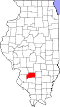 | |
| Villages | ||
| Townships | ||
| Unincorporated communities | ||
| Ghost town | ||
| Footnotes | ‡This populated place also has portions in an adjacent county or counties | |
Carlyle Lake
View on GrokipediaGeography
Location and Physical Features
Carlyle Lake is a reservoir spanning Clinton, Bond, and Fayette counties in south-central Illinois, United States, primarily situated within Clinton County.[4] The lake lies approximately 50 miles east of St. Louis, Missouri, along the Kaskaskia River at river mile 94.2.[7][8] The dam is located at coordinates 38°37′05″N 89°21′04″W.[9] At normal pool elevation, the lake covers a surface area of approximately 26,000 acres (105 km²), making it the largest man-made lake in Illinois.[4][10] It extends about 15 miles in length and up to 3.5 miles in width, with 85 miles of shoreline.[10][8] The maximum depth reaches 35 feet, while the average depth is 11 feet.[11] The lake is bordered by the city of Carlyle, the largest adjacent settlement with a population exceeding 3,000 as of 2024 estimates, and the smaller village of Keyesport to the north.[12][8] It occupies the Kaskaskia River basin within the broader Illinois prairie region, characterized by flat to gently rolling terrain and partially timbered shorelines.[7][11]Hydrology and Watershed
Carlyle Lake serves as an impoundment of the Kaskaskia River, the second-largest river entirely within Illinois and a tributary of the Mississippi River, with the dam situated at river mile 94.2 upstream from the Kaskaskia River's confluence with the Mississippi. The lake's hydrology is regulated by the U.S. Army Corps of Engineers to manage flood risks, navigation, and water supply in the regional system.[13] The broader watershed context encompasses the Kaskaskia River Basin, spanning approximately 5,746 square miles across 22 counties in central and southern Illinois.[13] Carlyle Lake's direct contributing watershed covers 1,663 square miles in seven counties, delivering inflows primarily from upstream tributaries including the North Fork, West Fork, and East Fork of the Kaskaskia River, supplemented by local surface runoff from agricultural and urbanized areas.[13] These inflows have increased by over 30% since 1996 due to a rise in regional precipitation and expanded impervious surfaces, altering natural flow dynamics.[13] Flow dynamics feature controlled outflows through the dam's spillway, with a minimum release of 50 cubic feet per second (cfs) at a tailwater elevation of 412 feet NGVD to support downstream navigation and ecology.[13] Higher releases can reach 10,000 cfs at tailwater elevations up to 427 feet NGVD during flood events, though seasonal restrictions limit maximum outflows to 4,000 cfs in the growing season (May 1 to November 1) to protect downstream habitats.[13] The normal recreation pool maintains an elevation of 445 feet NGVD, covering 24,710 acres, while the tailwater typically fluctuates between 410 and 444 feet depending on operational releases.[13] Water levels exhibit significant seasonal variations driven by rainfall patterns and upstream contributions, with the pool often exceeding 445 feet NGVD for 62% of the time from March to September and reaching 450 feet NGVD or higher 12% of the period, based on 1995–2014 records.[13] During high-water events, the lake provides flood storage capacity of up to 250,000 acre-feet above the normal pool, extending to elevations of 460 feet NGVD to attenuate peak flows in the basin.[13] Sedimentation from inflows has reduced storage by about 3.5% since impoundment, at a rate of 682 acre-feet per year from 1967 to 1999, with cumulative loss reaching approximately 5.7% in the joint-use pool by 2019.[13] The lake's structure is divided into upper (northern) and lower (southern) sections by a railroad embankment formerly of the Burlington Northern Railroad (now BNSF Railway), which spans the narrow connecting channel between Keyesport and Boulder and includes five bridges that restrict full water circulation and create distinct hydrological zones.[13] The upper section, encompassing about 8,000 acres north of the embankment, is shallower and more prone to siltation and erosion, influencing local flow patterns and habitat distribution.[13]History
Evidence of human habitation at the Carlyle Lake site dates back approximately 10,000 years, with Native Americans utilizing the area's prairies, forests, and a natural ford across the Kaskaskia River. European-American settlement began around 1812, when John Hall constructed a log fort and lock house near the ford, facilitating travel between the Ohio River and St. Louis.[1]Planning and Authorization
In 1933, amid frequent and severe flooding along the Kaskaskia River, citizens of Clinton County, Illinois, formed the Kaskaskia River Valley Project to study potential solutions for flood mitigation in the region.[1] This local initiative involved detailed assessments of the river's physical characteristics, economic impacts, and social consequences, laying the groundwork for broader regional development efforts.[1] The planning for Carlyle Lake emerged within the national context of intensified flood control initiatives during the Great Depression and the post-World War II period, driven by devastating floods across the Mississippi River basin in the 1930s that highlighted the need for comprehensive water management.[14] These events, including major inundations that affected agricultural lands and communities, prompted federal responses to shift from localized levees to integrated reservoir systems for long-term protection.[15] Federal authorization for the project came through the Flood Control Act of June 28, 1938, which included provisions for a major reservoir at the Carlyle site as part of Kaskaskia Basin improvements, alongside downstream levees.[1] The U.S. Army Corps of Engineers conducted extensive surveys and planning throughout the 1940s and 1950s, culminating in a comprehensive report for the Kaskaskia River Project in 1957; this work was further modified by the Flood Control Act of July 3, 1958. In 1940, the Corps had recommended initial surveys specifically for flood control on the Kaskaskia River, though progress was delayed by wartime priorities.[16] The primary motivation for the project was to reduce flood risks for downstream communities and farmlands in the Kaskaskia basin, with secondary benefits including enhanced navigation on the lower river, municipal and industrial water supply, and opportunities for recreation.[1] Preliminary studies during this phase encompassed environmental evaluations of local ecosystems and economic analyses of potential benefits, alongside planning for land acquisition totaling approximately 26,000 acres to support the reservoir and associated flowage easements.[1]Construction and Relocations
The U.S. Army Corps of Engineers initiated construction of Carlyle Lake on October 18, 1958, by beginning work to dam the Kaskaskia River in Clinton County, Illinois.[1] The project, aimed at flood control and multi-purpose water management, spanned nearly nine years and was completed in April 1967, with the dam's formal dedication occurring on June 3, 1967.[1] To create the reservoir, the Corps acquired approximately 26,000 acres of land, encompassing the lake basin and surrounding areas for flowage easements, which necessitated extensive site preparation including the clearing of forests and farmland.[1] This scale of land acquisition displaced numerous families and required the relocation of homesteads to areas outside the flood pool.[1] Infrastructure adjustments were equally significant: country roads were rerouted, and segments of the Chicago, Burlington and Quincy Railroad tracks, along with five associated bridges, were realigned to accommodate the new reservoir boundaries.[1] Further relocations addressed environmental and cultural concerns during construction. The Corps purchased rights to 69 active oil wells within the project area and plugged them to mitigate potential pollution of the lake.[1] Seven shoreline cemeteries were identified, leading to the careful exhumation and reinterment of over 600 burial sites on higher ground to preserve community heritage.[1] The overall effort demanded coordination with local communities to manage these displacements and infrastructural changes, amid challenges such as frequent flooding from the Kaskaskia River that complicated site work.[1] The total project cost reached approximately $41 million in 1960s dollars, reflecting the labor-intensive nature of damming, earthwork, and relocation activities.[17]Engineering and Operations
Dam Structure and Design
The Carlyle Dam is an earthfill embankment structure spanning the Kaskaskia River in Clinton County, Illinois, designed and constructed by the U.S. Army Corps of Engineers. The main dam measures approximately 6,610 feet in total length, including the spillway section, with a structural height of 68 feet and a crest elevation of 472.5 feet above mean sea level.[18][19] Key structural components include a controlled spillway with a capacity of 160,000 cubic feet per second for managing high flows, outlet works featuring Tainter gates to enable precise water releases, and the Dam West Levee, which extends across the adjacent floodplain to enhance containment and stability.[19][18] The design also incorporates a navigation lock measuring 600 feet in length by 84 feet in width, allowing barge traffic to pass through the reservoir on the Kaskaskia River navigation channel. The dam's primary materials consist of about 2,500,000 cubic yards of compacted earth and rock sourced from nearby borrow areas, supplemented by concrete elements in the spillway, gates, and lock structure to ensure durability against hydraulic forces and environmental exposure.[19] Engineering features emphasize erosion resistance through zoned embankment construction and broad crests for stability, with the overall layout accounting for the site's floodplain topography and low seismic risk in south-central Illinois.[20] Safety is maintained through an integrated dam safety data collection system that monitors seepage, settlement, and structural integrity, with regular inspections and updates conducted by the U.S. Army Corps of Engineers to comply with federal dam safety standards.[18] The dam is classified as having high hazard potential, prompting ongoing instrumentation and emergency action planning.[19]Management and Multiple Purposes
Carlyle Lake is primarily managed by the U.S. Army Corps of Engineers (USACE), St. Louis District, which oversees core operations including flood risk management, navigation support, water supply, and water quality enhancement.[4] The Illinois Department of Natural Resources (IDNR) handles management of adjacent state park and wildlife areas under a long-term lease agreement with USACE, focusing on habitat and public access while coordinating with federal operations.[21] In December 2024, IDNR and USACE announced adjustments to their partnership, transferring approximately 2,600 acres of land to enhance wildlife conservation, infrastructure maintenance, and public safety without altering primary federal purposes.[22] The lake's primary purpose is flood risk management, with an authorized flood control storage capacity of 700,000 acre-feet between elevations 445 feet and 462.5 feet above mean sea level, allowing controlled storage during high-water events and regulated releases to mitigate downstream flooding on the Kaskaskia River.[18] This storage helps reduce agricultural and urban flood damages across the approximately 3.7-million-acre Kaskaskia River watershed.[23] Additional functions include supporting commercial navigation on the Kaskaskia River downstream of the dam, where releases from the lake maintain sufficient pool levels for barge traffic up to New Athens (river mile 28), accommodating approximately five lockages per day at the Jerry F. Costello Lock and Dam.[24][25] The reservoir also provides raw water supply allocations for municipal and industrial users, with Illinois holding a state allocation of 33,000 acre-feet in the joint-use pool, supporting regional demands through contracts with local systems.[23] Furthermore, the lake enhances downstream water quality by trapping sediments and nutrients via sedimentation processes, reducing pollutant transport into the Mississippi River basin.[26] USACE conducts real-time monitoring of lake conditions, including pool stage (typically around 444 feet under normal operations), inflow, and outflow (e.g., 70 cubic feet per second inflow and 60 cubic feet per second outflow during low-flow periods), with adjustments made for drought mitigation or excess rainfall to balance multiple purposes. Operations are integrated with the upstream Lake Shelbyville reservoir through coordinated regulation models, enabling basin-wide flood control by sequencing storage and releases across the Kaskaskia River system.[23][27]Environmental Aspects
Ecology and Wildlife
Carlyle Lake encompasses diverse habitats that support a rich ecosystem, including approximately 11,120 acres of public land encompassing diverse habitats such as upland and bottomland forests, wetlands, grasslands, and croplands within the surrounding State Fish and Wildlife Area, which features about 2,000 acres of woodland, 5,800 acres of open water and wetlands, 200 acres of grassland, and 1,500 acres of cropland.[28][21] The bottomland forests, part of a larger 7,000-acre floodplain tract, consist primarily of hardwood species such as oaks and hickories, while wetlands feature riparian zones with emergent vegetation. These habitats are vital in a region where only about 10% of Illinois's original wetlands remain, providing essential stopover areas during seasonal migrations. The lake's flora includes bottomland hardwoods like oaks and hickories in forested areas, alongside wetland species such as smartweed, arrowhead, willow, buttonbush, reed grass, and lotus in semi-aquatic zones.[29] Emergent wetlands support cattails and sedges, contributing to habitat structure, while managed fields feature food plots of sunflowers, corn, and beans to bolster wildlife forage.[21] These plant communities facilitate nutrient cycling, with river inflows from the Kaskaskia River delivering sediments and organic matter that enrich the aquatic and terrestrial ecosystems. Wildlife at Carlyle Lake is diverse, with the open water and wetlands serving as a key mid-migration stopover for waterfowl such as ducks and geese, particularly during fall and winter peaks.[3] Forested habitats host songbirds including vireos, warblers, and tanagers, drawn to the mature woodlands for breeding and foraging.[30] The osprey population has risen notably since the lake's completion in 1967, attracted by abundant fish and supported by nesting platforms, leading to a growing presence of state-threatened pairs.[31][32] Aquatic species thrive in the lake's 26,000-acre expanse, with common fish including largemouth bass, bluegill, redear sunfish, black and white crappie, white bass, sauger, channel catfish, and flathead catfish.[33] The Illinois Department of Natural Resources conducts stocking programs for species like channel catfish, largemouth bass, and redear sunfish to maintain populations.[34] Reptiles such as the state-endangered eastern massasauga rattlesnake inhabit wetland and forested edges, utilizing hibernation sites and seasonal movement corridors.[35] Following construction and impoundment in 1967, the flooding of bottomlands initially resulted in significant habitat loss for terrestrial species, submerging pre-existing forests and farmlands.[31] Over subsequent decades, this led to the establishment of new aquatic ecosystems, including expansive open water and emergent wetlands that enhanced biodiversity for fish and migratory birds, while riparian zones recovered to support forest-dependent wildlife. The transformation has positioned the lake as a critical node in regional ecological networks, with nutrient inputs from inflows promoting productivity in the recovering habitats.Conservation Efforts
The U.S. Army Corps of Engineers (USACE) and the Illinois Department of Natural Resources (IDNR) collaborate on habitat enhancement programs at Carlyle Lake, implementing techniques such as planting wildlife food plots with crops like sunflowers, corn, beans, winter wheat, clover, milo, and millet to support diverse species.[13] Prescribed burns are routinely applied to maintain open habitats and control woody succession, benefiting upland game birds and other wildlife.[36] Water quality monitoring is conducted regularly by the USACE St. Louis District, testing parameters including total organic carbon, total suspended solids, E. coli, and phosphorus to mitigate issues like algae blooms and ensure suitability for recreation and aquatic life.[13] Sedimentation reduction efforts address a historical estimated annual rate of 682 acre-feet (1967-1999), with ongoing evaluations and operational adjustments to preserve pool capacities and habitat integrity.[13] Since the early 2000s, USACE has installed osprey nesting platforms at Carlyle Lake to bolster raptor populations, beginning with the first structure in 2003 that was immediately occupied and followed by two additional platforms.[37] These efforts have contributed to population growth, with the platforms supporting active nests and fledglings in subsequent years.[13] For the eastern massasauga rattlesnake, health surveys have been conducted annually since 2003 by the University of Illinois Wildlife Epidemiology Laboratory in partnership with USACE and IDNR, including investigations into ophidian paramyxovirus prevalence through blood sampling and serological analysis.[38] These studies, which began with hematology and virology assessments in 2004, aim to monitor disease impacts on the vulnerable population in the lake's wetland habitats.[39] Hunting regulations at Carlyle Lake are structured to sustain game populations, with designated areas including the Saddle Dam III Wetland Complex and James Hawn Access for waterfowl, Eldon Hazlet State Park for upland game such as quail and pheasant, and South Shore State Park for forest game like deer and turkey.[36] Bag limits follow statewide IDNR guidelines, such as daily caps on ducks, pheasants, and deer to prevent overharvest, enforced through sign-in/out requirements and harvest reporting at kiosks.[40] These measures, combined with no-hunting buffers around developed areas, support balanced wildlife management across the 26,000-acre site. Broader conservation initiatives include trail development by HeartLands Conservancy, featuring a completed 10.3-mile Carlyle Lake Bike Trail as of 2025, as part of a multi-phase network planned to exceed 30 miles of pedestrian and bicycle paths around the lake, designed with boardwalks in sensitive wetlands to minimize habitat disturbance and restrict access during hunting seasons.[41][42] Invasive species control focuses on monitoring Asian carp, an established non-native fish in the lake, through angler reports and targeted sampling to assess abundance and limit spread via the Kaskaskia River watershed.[13] Efforts to address environmental challenges encompass erosion control following major floods, such as the 2019 event, through shoreline stabilization projects evaluated under USACE environmental assessments to protect habitats at river confluences.[29] Climate adaptation strategies incorporate habitat adjustments for migratory bird patterns, including moist soil management in wetlands to support spring and fall migrants amid shifting weather, backed by ongoing federal funding like a $2.7 million Emergency Relief grant in 2024 for flood recovery and resilience enhancements.[43][13] As of the 2025 Illinois endangered species list, the osprey remains state-threatened, with reintroduction programs contributing to more nesting pairs observed regionally, including at Carlyle Lake.[44]Recreation and Tourism
Outdoor Activities
Carlyle Lake provides extensive opportunities for boating and sailing, supported by multiple full-service marinas catering to powerboats, sailboats, and personal watercraft. Facilities such as Boulder Marina, Carlyle Sailing Association Marina, Trade Winds Marina, and West Access Marina offer docking, fuel, repairs, and rentals, accommodating over 280 boats at the sailing association's harbor alone.[45][46] The lake's wide-open waters, spanning 15 by 3.5 miles, make it a premier inland sailing destination, ranked among the top in the nation, with active clubs like the Carlyle Sailing Association and Carlyle Yacht Club hosting annual regattas from May through October, including national events such as the A Cat North American Championship and 470 USA Nationals.[45][47][48] Fishing at Carlyle Lake is a year-round pursuit, renowned for species including channel catfish, largemouth bass, crappie, bluegill, white bass, and emerging populations of blue catfish. The Illinois Department of Natural Resources (IDNR) and U.S. Army Corps of Engineers (USACE) actively stock the lake with channel catfish fingerlings, advanced largemouth bass, redear sunfish, and blue catfish to maintain healthy populations, contributing to excellent crappie and very good channel and flathead catfish fisheries based on recent surveys.[49][34][50] Numerous public and private tournaments are held annually, drawing anglers to the lake's 26,000 acres and tailwater areas, where regulations include a 14-inch minimum for largemouth bass and a combined daily limit of 15 for crappie.[51][52] While ice fishing occurs in the tailwater during winter freezes, the primary access remains via 11 public boat ramps and fishing piers at sites like Dam East and Keyesport.[50][49] Beyond water-based pursuits, Carlyle Lake supports hunting in over 20,000 acres of designated public lands surrounding the lake, including the State Fish and Wildlife Area (SFWA), targeting waterfowl, white-tailed deer, turkeys, squirrels, quail, rabbits, and doves, with food plots of sunflowers, corn, millet, and milo planted annually at seven locations.[3][52] Birdwatching opportunities abound year-round at six established watchable wildlife sites featuring viewing towers, highlighting migratory species such as waterfowl, bald eagles, ospreys, cormorants, great blue herons, shorebirds, and songbirds during mid-migration rests.[3][52] Hiking and biking trails encircle the perimeter, offering over 45 miles of paths including the barrier-free Willow Pond Trail, Chipmunk Trail, Little Prairie Nature Trail, and a 60-mile bike route along federal, state, and county roads with scenic overlooks of the dam and wetlands.[53][2] Seasonal variations enhance the recreational appeal, with summer emphasizing watersports like water skiing and cruising on the open lake, fall focusing on hunting in managed subimpoundments, and year-round wildlife viewing sustained by migratory patterns.[45][3] These activities attract over 2.5 million visitors annually.[54] Access is facilitated by 11 public boat ramps at areas like Coles Creek, Dam West, and Keyesport, though a $5 day-use fee or $40 annual pass is required for launches, with no-wake zones enforced at ramps, cove entrances, and subimpoundments for safety.[45][49] Illinois fishing and hunting licenses are mandatory, along with site-specific trapping permits where applicable, to ensure compliance with state regulations.[52][40]Beaches and Campgrounds
Carlyle Lake features four public swimming beaches managed by the U.S. Army Corps of Engineers (USACE), providing access for swimming, picnicking, and relaxation along its 85-mile shoreline. These beaches are equipped with modern facilities and are popular for day-use visitors, with a $5 per vehicle day-use fee required for entry. Alcohol is prohibited on the sand and water portions of all beaches to ensure safety.[5][55] Keyesport Beach, located on the northwest shore, offers a family-friendly swimming area with a playground, picnic tables, and a reservable group shelter accommodating up to 75 people. Adjacent amenities include a boat ramp and fish cleaning station, making it convenient for combined water and shore activities.[56][57] Dam West Beach, the largest of the public beaches situated near the dam on the south shore, features an expansive sandy area with restrooms, bathhouses, and two reservable picnic shelters each holding up to 75 guests. It includes a boat ramp and fish cleaning stations, supporting picnicking and swimming in close proximity to the Carlyle Lake Visitor Center.[58][57] McNair Beach, a smaller option adjacent to the Dam East-McNair Campground on the south shore, provides picnic spots, a reservable group shelter for up to 80 people, and bathhouses. The area emphasizes quiet relaxation with nearby playgrounds and laundry facilities for extended stays.[57][59] Coles Creek Beach, on the east side near the Coles Creek Recreation Area, is family-oriented and the only dog-friendly beach (with a 6-foot leash requirement), featuring a swimming area, playground, and two reservable picnic shelters for 75 people each. A boat ramp and fish cleaning station enhance its appeal for families combining beach time with boating.[5][60] The beaches collectively accommodate thousands of visitors daily during peak summer months, contributing to Carlyle Lake's role in regional recreation. Post-2020 updates have included enhanced accessibility features, such as improved parking and pathways at select sites, to better serve diverse users.[5][61] Five main campgrounds provide overnight accommodations around Carlyle Lake, with four managed by USACE and one by the Illinois Department of Natural Resources at Eldon Hazlet State Recreation Area. USACE sites offer over 400 combined campsites with amenities including 30/50-amp electric and full hookups, shower houses, laundry facilities at select locations, and dump stations. The Eldon Hazlet campground adds 328 Class A sites with similar electrical hookups, plus 36 walk-in tent sites, showers, and a dump station.[62][63][59]- Boulder Campground (82 sites, near the east-side marina): Focuses on electric and full-hookup options, open April to October.
- Coles Creek Campground (148 sites, adjacent to the beach): Includes electric sites and proximity to family amenities, seasonal from May to September.
- Dam West Campground (113 sites, south shore near the beach and marina): Features laundry and full hookups, available April to November; fully reservable as of 2025.[64]
- Dam East-McNair Campground (46 sites across loops, south shore): Offers group areas, primitive options, and year-round access in the Spillway Loop, with beach adjacency.
- Eldon Hazlet State Recreation Area (over 400 sites total, west shore): Provides extensive RV and tent camping with lake views, open year-round but peaking in summer.[62][63][65]