
Community hub
Recent from talks
Contribute something
Nothing was collected or created yet.
Geography of Namibia
View on Wikipedia

Key Information


At 824,292 km2 (318,261 sq mi), Namibia is the world's thirty-fourth largest country. After Mongolia, Namibia is the second least densely populated country in the world (2.7 inhabitants per square kilometre (7.0/sq mi)). Namibia got its name from the Namib desert that stretches along the coast of the Atlantic. It is also known for its wildlife.
Geographical areas
[edit]The Namibian landscape consists generally of five geographical areas, each with characteristic abiotic conditions and vegetation with some variation within and overlap between them: the Central Plateau, the Namib Desert, the Great Escarpment, the Bushveld, and the Kalahari Desert.
Central Plateau
[edit]The Central Plateau runs from north to south, bordered by the Skeleton Coast to the northwest, the Namib Desert and its coastal plains to the southwest, the Orange River to the south, and the Kalahari Desert to the east. The Central Plateau is home to the highest point in Namibia at Königstein elevation 2,606 metres (8,550 ft).[1] Within the wide, flat Central Plateau is the majority of Namibia's population and economic activity. Windhoek, the nation's capital, is located here, as well as most of the arable land. Although arable land accounts for only 1% of Namibia, nearly 1/3rd of the population is employed in agriculture.[2]
The abiotic conditions here are similar to those found along the Escarpment; however, the topographic complexity is reduced. Summer temperatures in the area can reach 40 °C (104 °F), and frosts are common in the winter.
Namib Desert
[edit]The Namib Desert is a broad expanse of hyper-arid gravel, gravel with no moisture, plains, and dunes that stretches along the entire coastline, which varies in width between 100 and many hundreds of kilometres. Areas within the Namib include the Skeleton Coast and the Kaokoveld in the north and the extensive Namib Sand Sea along the central coast.[3] The sands that make up the sand sea are a consequence of erosional processes that take place within the Orange River valley and areas farther to the south. As sand-laden waters drop their suspended loads into the Atlantic, onshore currents deposit them along the shore. The prevailing southwest winds then pick up and redeposit the sand in the form of massive dunes in the widespread sand sea, the largest sand dunes in the world. In areas where the supply of sand is reduced because of the inability of the sand to cross riverbeds, the winds also scour the land to form large gravel plains. In many areas within the Namib Desert, there is little vegetation with the exception of lichens found in the gravel plains, and in dry river beds where plants can access subterranean water.[citation needed]
"Fairy circles", which are circular patches of land barren of plants, varying between 22 and 12 metres (7 and 39 ft) in diameter and often encircled by a ring of stimulated growth of grass, are found in the Namib,[4] such as those near the Wolwedans desert camp.[5]
Great Escarpment
[edit]The Great Escarpment swiftly rises to over 2,000 metres (6,562 ft). Average temperatures and temperature ranges increase as you move farther inland from the cold Atlantic waters, while the lingering coastal fogs slowly diminish. Although the area is rocky with poorly developed soils, it is nonetheless significantly more productive than the Namib Desert. As summer winds are forced over the Escarpment, moisture is extracted as precipitation.[6] The water, along with rapidly changing topography, is responsible for the creation of microhabitats which offer a wide range of organisms, many of them endemic. Vegetation along the escarpment varies in both form and density, with community structure ranging from dense woodlands to more shrubby areas with scattered trees. A number of Acacia species are found here, as well as grasses and other shrub vegetation.
Bushveld
[edit]The Bushveld is found in northeastern Namibia along the Angolan border and in the Caprivi Strip which is the vestige of a narrow corridor demarcated for the German Empire to access the Zambezi River. The area receives a significantly greater amount of precipitation than the rest of the country, averaging around 400 mm (15.7 in) per year. Temperatures are also cooler and more moderate, with approximate seasonal variations of between 10 and 30 °C (50 and 86 °F). The area is generally flat and the soils sandy, limiting their ability to retain water.[7] Located adjacent to the Bushveld in north-central Namibia is one of nature's most spectacular features: the Etosha Pan. For most of the year, it is a dry, saline wasteland, but during the wet season, it forms a shallow lake covering more than 6,000 square kilometres (2,317 sq mi). The area is ecologically important and vital to the large numbers of birds and animals from the surrounding savannah that gather in the region as summer drought forces them to the scattered waterholes that ring the pan. The Bushveld area has been demarcated by the World Wildlife Fund as part of the Angolan mopane woodlands ecoregion, which extends north across the Cunene River into neighbouring Angola.
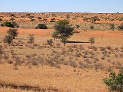
Kalahari Desert
[edit]
The Kalahari Desert is perhaps Namibia's best-known geographical feature. Shared with South Africa and Botswana, it has a variety of localised environments ranging from hyper-arid sandy desert to areas that seem to defy the common definition of desert. One of these areas, known as the Succulent Karoo, is home to over 5,000 species of plants, nearly half of them endemic; fully one-third of the world's succulents are found in the Karoo.
The reason behind this high productivity and endemism may be the relatively stable nature of precipitation.[8] The Karoo apparently does not experience drought regularly, so even though the area is technically a desert, regular winter rains provide enough moisture to support the region's interesting plant community. Another feature of the Kalahari, indeed many parts of Namibia, are inselbergs, isolated mountains that create microclimates and habitats for organisms not adapted to life in the surrounding desert matrix.
Coastal Desert
[edit]Namibia's Coastal Desert is one of the oldest deserts in the world. Its sand dunes, created by the strong onshore winds, are the highest in the world.[9]
The Namib Desert and the Namib-Naukluft National Park are located here. The Namibian coastal deserts are the richest source of diamonds on earth, making Namibia the world's largest producer of diamonds. It is divided into the northern Skeleton Coast and the southern Diamond Coast. Because of the location of the shoreline—at the point where the Atlantic's cold water reaches Africa—there is often extremely dense fog.[10]
Sandy beach comprises 54% and mixed sand and rock add another 28%. Only 16% of the total length is rocky shoreline. The coastal plains are dune fields, gravel plains covered with lichen and some scattered salt pans. Near the coast, there are areas where the dunes are vegetated with hammocks.[11] Namibia has rich coastal and marine resources that remain largely unexplored.[12]
-

-

-
 Namib Escarpment.
 -
 The Kalahari Desert.
 -
 Windhoek skyline.
 -
 Natural-colour satellite image of the Namibian coast.


Weather and climate
[edit]
Namibia has more than 300 days of sunshine per year. It is situated at the southern edge of the tropics; the Tropic of Capricorn cuts the country about in half. The winter (June–August) is generally dry, both rainy seasons occur in summer, the small rainy season between September and November, and the big one between February and April.[13] Humidity is low, and average rainfall varies from almost zero in the coastal desert to more than 600 millimetres or 24 inches in the Caprivi Strip. Rainfall is however highly variable, and droughts are common.[14] A bad rainy season occurred in the summer of 2006/07.[15] Very low rainfall was recorded in 2019.[16] Due to the dry winters snowfall constitutes a very rare occurrence and prompts media coverage whenever it happens. The last[update] snow was reported at Spreetshoogte Pass in the Namib-Naukluft Park in June 2011.[17]
Weather and climate in the coastal area are dominated by the cold, north-flowing Benguela Current of the Atlantic Ocean which accounts for very low precipitation totalling 50 millimetres or 2 inches per year or less, frequent dense fog, and overall lower temperatures than in the rest of the country.[14] In winter, occasionally a condition known as Berg wind or Oosweer (Afrikaans: East weather) occurs, a hot dry wind blowing from the inland to the coast. As the area behind the coast is a desert, these winds can develop into sand storms with sand deposits in the Atlantic Ocean visible on satellite images.[18]
The Central Plateau and Kalahari areas have wide diurnal temperature ranges of up to 30 °C or 54.0 °F.[14]
Examples
[edit]| Climate data for Windhoek (1,728 metres or 5,669 feet), Namibia | |||||||||||||
|---|---|---|---|---|---|---|---|---|---|---|---|---|---|
| Month | Jan | Feb | Mar | Apr | May | Jun | Jul | Aug | Sep | Oct | Nov | Dec | Year |
| Record high °C (°F) | 36.0 (96.8) |
35.8 (96.4) |
34.9 (94.8) |
31.3 (88.3) |
31.8 (89.2) |
26.1 (79.0) |
25.7 (78.3) |
30.0 (86.0) |
33.2 (91.8) |
35.1 (95.2) |
36.5 (97.7) |
36.6 (97.9) |
36.6 (97.9) |
| Mean daily maximum °C (°F) | 30.0 (86.0) |
28.6 (83.5) |
27.2 (81.0) |
25.6 (78.1) |
22.7 (72.9) |
20.2 (68.4) |
20.5 (68.9) |
23.4 (74.1) |
26.5 (79.7) |
29.1 (84.4) |
29.6 (85.3) |
30.7 (87.3) |
26.1 (79.0) |
| Daily mean °C (°F) | 23.3 (73.9) |
22.1 (71.8) |
21.0 (69.8) |
18.9 (66.0) |
15.8 (60.4) |
13.2 (55.8) |
13.1 (55.6) |
15.8 (60.4) |
19.3 (66.7) |
21.7 (71.1) |
22.5 (72.5) |
23.5 (74.3) |
19.1 (66.4) |
| Mean daily minimum °C (°F) | 17.2 (63.0) |
16.5 (61.7) |
15.4 (59.7) |
12.8 (55.0) |
9.2 (48.6) |
6.7 (44.1) |
6.3 (43.3) |
8.6 (47.5) |
11.9 (53.4) |
14.6 (58.3) |
15.6 (60.1) |
16.9 (62.4) |
12.7 (54.9) |
| Record low °C (°F) | 7.5 (45.5) |
6.8 (44.2) |
3.7 (38.7) |
2.4 (36.3) |
−1.6 (29.1) |
−2.8 (27.0) |
−2.6 (27.3) |
−3.9 (25.0) |
−1.1 (30.0) |
1.6 (34.9) |
0.4 (32.7) |
3.3 (37.9) |
−3.9 (25.0) |
| Average precipitation mm (inches) | 78.1 (3.07) |
80.3 (3.16) |
78.7 (3.10) |
37.7 (1.48) |
6.6 (0.26) |
1.2 (0.05) |
0.7 (0.03) |
0.9 (0.04) |
2.8 (0.11) |
11.8 (0.46) |
26.9 (1.06) |
41.7 (1.64) |
367.4 (14.46) |
| Average precipitation days (≥ 0.1 mm) | 11.1 | 10.7 | 10.5 | 5.5 | 1.9 | 0.7 | 0.5 | 0.3 | 0.9 | 2.8 | 5.3 | 7.5 | 57.7 |
| Average relative humidity (%) | 42 | 56 | 51 | 44 | 37 | 32 | 27 | 19 | 17 | 22 | 30 | 34 | 34 |
| Mean monthly sunshine hours | 288 | 254 | 282 | 273 | 310 | 309 | 326 | 341 | 321 | 319 | 297 | 285 | 3,605 |
| Source 1: Deutscher Wetterdienst[19] | |||||||||||||
| Source 2: Danish Meteorological Institute (sun only)[20] | |||||||||||||
| Climate data for Pelican Point, Walvis Bay (7 metres or 23 feet), Namibia (1958–1984) | |||||||||||||
|---|---|---|---|---|---|---|---|---|---|---|---|---|---|
| Month | Jan | Feb | Mar | Apr | May | Jun | Jul | Aug | Sep | Oct | Nov | Dec | Year |
| Record high °C (°F) | 25.3 (77.5) |
26.4 (79.5) |
34.5 (94.1) |
35.0 (95.0) |
36.0 (96.8) |
32.5 (90.5) |
32.9 (91.2) |
33.4 (92.1) |
31.3 (88.3) |
27.5 (81.5) |
28.3 (82.9) |
25.5 (77.9) |
36.0 (96.8) |
| Mean daily maximum °C (°F) | 20.0 (68.0) |
20.3 (68.5) |
19.6 (67.3) |
18.6 (65.5) |
19.0 (66.2) |
18.8 (65.8) |
17.8 (64.0) |
16.4 (61.5) |
15.8 (60.4) |
16.6 (61.9) |
17.7 (63.9) |
19.0 (66.2) |
18.3 (64.9) |
| Daily mean °C (°F) | 17.6 (63.7) |
17.9 (64.2) |
17.2 (63.0) |
15.7 (60.3) |
15.6 (60.1) |
15.2 (59.4) |
14.1 (57.4) |
13.2 (55.8) |
13.2 (55.8) |
14.0 (57.2) |
15.3 (59.5) |
16.6 (61.9) |
15.5 (59.9) |
| Mean daily minimum °C (°F) | 15.2 (59.4) |
15.5 (59.9) |
14.7 (58.5) |
12.9 (55.2) |
12.1 (53.8) |
11.4 (52.5) |
10.3 (50.5) |
10.1 (50.2) |
10.7 (51.3) |
11.5 (52.7) |
12.9 (55.2) |
14.2 (57.6) |
12.6 (54.7) |
| Record low °C (°F) | 10.5 (50.9) |
9.2 (48.6) |
10.5 (50.9) |
8.5 (47.3) |
7.0 (44.6) |
5.0 (41.0) |
3.4 (38.1) |
4.4 (39.9) |
6.1 (43.0) |
5.0 (41.0) |
8.5 (47.3) |
9.6 (49.3) |
3.4 (38.1) |
| Average precipitation mm (inches) | 1.0 (0.04) |
2.0 (0.08) |
5.0 (0.20) |
1.0 (0.04) |
1.0 (0.04) |
2.0 (0.08) |
0.0 (0.0) |
0.2 (0.01) |
0.1 (0.00) |
0.1 (0.00) |
0.7 (0.03) |
0.1 (0.00) |
13.2 (0.52) |
| Average precipitation days (≥ 0.1 mm) | 0.6 | 0.8 | 1.1 | 0.5 | 0.4 | 0.5 | 0.0 | 0.4 | 0.5 | 0.4 | 0.6 | 0.4 | 6.2 |
| Average relative humidity (%) | 87 | 87 | 89 | 89 | 86 | 81 | 82 | 86 | 89 | 88 | 88 | 88 | 87 |
| Mean monthly sunshine hours | 232 | 189 | 211 | 237 | 251 | 231 | 236 | 220 | 189 | 226 | 210 | 214 | 2,646 |
| Source 1: Deutscher Wetterdienst[21] | |||||||||||||
| Source 2: Danish Meteorological Institute[22] | |||||||||||||
| Climate data for Lüderitz | |||||||||||||
|---|---|---|---|---|---|---|---|---|---|---|---|---|---|
| Month | Jan | Feb | Mar | Apr | May | Jun | Jul | Aug | Sep | Oct | Nov | Dec | Year |
| Record high °C (°F) | 32.5 (90.5) |
30.0 (86.0) |
34.1 (93.4) |
36.5 (97.7) |
33.0 (91.4) |
31.6 (88.9) |
30.7 (87.3) |
33.0 (91.4) |
35.1 (95.2) |
35.0 (95.0) |
37.5 (99.5) |
30.6 (87.1) |
37.5 (99.5) |
| Mean daily maximum °C (°F) | 21.4 (70.5) |
21.3 (70.3) |
21.1 (70.0) |
19.9 (67.8) |
19.2 (66.6) |
19.0 (66.2) |
17.9 (64.2) |
17.2 (63.0) |
17.3 (63.1) |
18.0 (64.4) |
19.2 (66.6) |
20.5 (68.9) |
19.3 (66.7) |
| Daily mean °C (°F) | 17.7 (63.9) |
17.8 (64.0) |
17.4 (63.3) |
16.3 (61.3) |
15.5 (59.9) |
15.1 (59.2) |
14.1 (57.4) |
13.7 (56.7) |
13.9 (57.0) |
14.7 (58.5) |
15.8 (60.4) |
17.0 (62.6) |
15.7 (60.3) |
| Mean daily minimum °C (°F) | 14.0 (57.2) |
14.3 (57.7) |
13.8 (56.8) |
12.6 (54.7) |
11.7 (53.1) |
11.2 (52.2) |
10.4 (50.7) |
10.2 (50.4) |
10.5 (50.9) |
11.4 (52.5) |
12.3 (54.1) |
13.5 (56.3) |
12.1 (53.8) |
| Record low °C (°F) | 5.5 (41.9) |
5.0 (41.0) |
6.0 (42.8) |
5.5 (41.9) |
3.3 (37.9) |
0.2 (32.4) |
3.0 (37.4) |
4.8 (40.6) |
3.4 (38.1) |
3.4 (38.1) |
4.9 (40.8) |
3.9 (39.0) |
0.2 (32.4) |
| Average precipitation mm (inches) | 0 (0) |
1 (0.0) |
2 (0.1) |
2 (0.1) |
3 (0.1) |
3 (0.1) |
1 (0.0) |
2 (0.1) |
1 (0.0) |
0 (0) |
0 (0) |
0 (0) |
17 (0.7) |
| Average precipitation days (≥ 0.1 mm) | 1.0 | 1.0 | 1.0 | 0.9 | 1.4 | 1.4 | 1.0 | 0.7 | 0.5 | 0.5 | 0.5 | 0.7 | 10.6 |
| Average relative humidity (%) | 82 | 81 | 82 | 80 | 79 | 72 | 74 | 78 | 80 | 80 | 80 | 80 | 79 |
| Mean monthly sunshine hours | 198.4 | 203.4 | 257.3 | 216.0 | 213.9 | 144.0 | 170.5 | 201.5 | 216.0 | 201.5 | 189.0 | 176.7 | 2,388.2 |
| Mean daily sunshine hours | 6.4 | 7.2 | 8.3 | 7.2 | 6.9 | 4.8 | 5.5 | 6.5 | 7.2 | 6.5 | 6.3 | 5.7 | 6.5 |
| Source: Deutscher Wetterdienst[23] | |||||||||||||
| Climate data for Keetmanshoop | |||||||||||||
|---|---|---|---|---|---|---|---|---|---|---|---|---|---|
| Month | Jan | Feb | Mar | Apr | May | Jun | Jul | Aug | Sep | Oct | Nov | Dec | Year |
| Mean daily maximum °C (°F) | 34.8 (94.6) |
34.0 (93.2) |
32.2 (90.0) |
28.8 (83.8) |
25.0 (77.0) |
21.7 (71.1) |
21.3 (70.3) |
23.5 (74.3) |
27.2 (81.0) |
30.1 (86.2) |
32.4 (90.3) |
34.5 (94.1) |
28.8 (83.8) |
| Mean daily minimum °C (°F) | 19.0 (66.2) |
19.3 (66.7) |
17.8 (64.0) |
14.4 (57.9) |
10.4 (50.7) |
7.0 (44.6) |
6.4 (43.5) |
7.5 (45.5) |
10.7 (51.3) |
13.7 (56.7) |
15.7 (60.3) |
17.6 (63.7) |
13.3 (55.9) |
| Average precipitation mm (inches) | 24 (0.9) |
42 (1.7) |
36 (1.4) |
15 (0.6) |
5 (0.2) |
2 (0.1) |
1 (0.0) |
1 (0.0) |
3 (0.1) |
6 (0.2) |
11 (0.4) |
13 (0.5) |
159 (6.1) |
| Average relative humidity (%) | 28 | 36 | 40 | 40 | 38 | 39 | 36 | 31 | 27 | 24 | 24 | 25 | 32 |
| Mean monthly sunshine hours | 353 | 300 | 312 | 306 | 304 | 287 | 305 | 323 | 319 | 343 | 348 | 370 | 3,870 |
| Percentage possible sunshine | 84 | 82 | 82 | 89 | 91 | 91 | 93 | 93 | 89 | 87 | 86 | 86 | 88 |
| Source: Tabulation of Climate Statistics for Selected Stations in Namibia | |||||||||||||
| Climate data for Katima Mulilo, Namibia | |||||||||||||
|---|---|---|---|---|---|---|---|---|---|---|---|---|---|
| Month | Jan | Feb | Mar | Apr | May | Jun | Jul | Aug | Sep | Oct | Nov | Dec | Year |
| Mean daily maximum °C (°F) | 31.3 (88.3) |
30.5 (86.9) |
29.8 (85.6) |
29.1 (84.4) |
27.4 (81.3) |
24.5 (76.1) |
25.0 (77.0) |
29.1 (84.4) |
33.8 (92.8) |
33.0 (91.4) |
30.3 (86.5) |
29.8 (85.6) |
29.5 (85.1) |
| Mean daily minimum °C (°F) | 19.1 (66.4) |
19.1 (66.4) |
18.7 (65.7) |
14.6 (58.3) |
10.2 (50.4) |
6.1 (43.0) |
4.6 (40.3) |
8.3 (46.9) |
14.1 (57.4) |
17.8 (64.0) |
19.3 (66.7) |
18.8 (65.8) |
14.2 (57.6) |
| Average precipitation mm (inches) | 169.4 (6.67) |
160.6 (6.32) |
88.7 (3.49) |
17.7 (0.70) |
1.9 (0.07) |
0.5 (0.02) |
0 (0) |
0.2 (0.01) |
2.6 (0.10) |
18.8 (0.74) |
69.7 (2.74) |
151.8 (5.98) |
681.9 (26.85) |
| Average relative humidity (%) | 68 | 66 | 70 | 61 | 53 | 53 | 62 | 50 | 42 | 46 | 49 | 57 | 56.4 |
| Source: Ministry of Works and Transport (Meteorological Service Division)
"Ministry of Works & Transport: Tabulation of Climate Statistics for Selected Stations in Namibia" (PDF). 2012. | |||||||||||||
Water sources
[edit]Namibia is the driest country in sub-Saharan Africa and depends largely on groundwater. With an average rainfall of about 350 mm (14 in) per annum, the highest rainfall occurs in the Caprivi in the northeast (about 600 mm (24 in) per annum) and decreases in a westerly and southwesterly direction to as little as 50 mm (2 in) and less per annum at the coast. The only perennial rivers are found on the national borders with South Africa, Angola, Zambia, and the short border with Botswana in the Caprivi. In the interior of the country, surface water is available only in the summer months when rivers are in flood after exceptional rainfalls. Otherwise, surface water is restricted to a few large storage dams retaining and damming up these seasonal floods and their runoff. Where people do not live near perennial rivers or make use of storage dams, they are dependent on groundwater. Even isolated communities and those economic activities located far from good surface water sources, such as mining, agriculture, and tourism, can be supplied from groundwater over nearly 80% of the country.[24] The longest river in Namibia is the Fish River with a length of 650 km (400 mi).
More than 120,000 boreholes have been drilled in Namibia over the past century. One-third of these boreholes have been drilled dry.[25] An aquifer called "Ohangwena II", located on both sides of the Angola-Namibia border, was discovered in 2012. This aquifer has been estimated to be capable of supplying the 800,000 people in the North for 400 years, at the current (2018) rate of consumption.[26] Experts estimate that Namibia has 7,720 km3 (1,850 cu mi) of underground water.[27][28]
Efundja, the annual flooding of the northern parts of the country, often causes not only damage to infrastructure but loss of life.[29] The rains that cause these floods originate in Angola, flow into Namibia's Cuvelai basin, and fill the Oshanas (Oshiwambo: flood plains) there. The worst floods so far[update] occurred in March 2011 and displaced 21,000 people.[30]
Urbanization
[edit]
The capital and largest city, Windhoek, is in the centre of the country. It is home to the country's Central Administrative Region, Windhoek Hosea Kutako International Airport, and the country's railhead. Other important towns are:
- Arandis, uranium mine
- Walvis Bay, seaport, international airport, railhead
- Oshakati, main business centre in the North, railhead
- Otjiwarongo, main business centre in Central-North, rail junction
- Lüderitz, sea port, railhead
- Gobabis, farming centre
- Keetmanshoop, railhead
- Tsumeb, mining
- Swakopmund, Tourism (Ex German Colonial town)
- Rundu,
- Katima Mulilo
- Okahandja
Statistics
[edit]Location: Southern Africa, bordering the South Atlantic Ocean, between Angola and South Africa
Geographic coordinates: 22°00′S 17°00′E / 22.000°S 17.000°E
- Area
-
- Total: 824,292 km2[31]
- country rank in the world: 34th
- Land: 823,290 km2
- Water: 1,002 km2
- Total: 824,292 km2[31]
- Area comparative
-
- Australia comparative: slightly larger than New South Wales
- Canada comparative: approximately 1/8 smaller than British Columbia
- United States comparative: slightly less than three times the size of Nevada
- EU comparative: slightly less than 21/2 times the size of Finland
Land boundaries:
total:
4,220 km
border countries:
Angola 1,427 km, Botswana 1,544 km, South Africa 1,005 km, Zambia 244 km
Coastline: 1,572 km
Maritime claims:
territorial sea:
12 nmi (22.2 km; 13.8 mi)
contiguous zone:
24 nmi (44.4 km; 27.6 mi)
exclusive economic zone:
564,748 km2 (218,050 sq mi) and 200 nmi (370.4 km; 230.2 mi)
Terrain: Mostly high plateau; Namib Desert along the coast; Kalahari Desert in the east. In the north near the border with Angola there is a flat area that has been designated by the World Wildlife Fund as part of the Angolan mopane woodlands ecoregion.
Elevation extremes:
lowest point:
Atlantic Ocean 0 m
mean elevation: 1,414 m
highest point:
Königstein 2,573 m
Natural resources:
diamonds, copper, uranium, gold, silver, lead, tin, lithium, cadmium, tungsten, zinc, salt, hydropower, fish
note:
suspected deposits of oil, coal, and iron ore
Land use:
agricultural land:
47.2% (2018)
arable land:
1% (2018)
permanent crops:
0% (2018)
permanent pasture:
46.2% (2018)
forest:
8.8% (2018)
other:
44% (2018)
Irrigated land: 80 km2 (2012), 75.73 km2 (2003), 70 km2 (1998 est.), 60 km2 (1993 est.)
Total renewable water resources: 17.72 km3 (2011)
Natural hazards: prolonged periods of drought
Environment – current issues: depletion and degradation of water and aquatic resources; desertification; land degradation; loss of biodiversity and biotic resources; wildlife poaching
Environment – international agreements:
party to:
Antarctic-Marine Living Resources, Biodiversity, Climate Change, Climate Change-Kyoto Protocol, Desertification, Endangered Species, Hazardous Wastes, Law of the Sea, Ozone Layer Protection, Wetlands
Extreme points
[edit]This is a list of the extreme points of Namibia, the points that are farther north, south, east, or west than any other location.
- Northernmost point – unnamed location on the border with Angola in the Kunene River immediately west of the Epupa Falls, Kunene Region
- Easternmost point – the tripoint with Botswana and Zambia, Zambezi Region
- Southernmost point – unnamed location in Pella Drift on the Orange River border with South Africa, ǁKaras Region
- Westernmost point – unnamed section of coast west of the Okotuso well, Kunene Region
See also
[edit]Sources
[edit]- Atlas of Namibia Team, 2022, Atlas of Namibia: its land, water and life, Namibia Nature Foundation, Windhoek
References
[edit]- ^ Landsat.usgs.gov Archived 7 September 2008 at the Wayback Machine
- ^ World Almanac. 2004.
- ^ Spriggs, A. 2001.(AT1315)
- ^ "Enigma of Namibia's 'fairy circles'". BBC NEWS. 31 March 2004. Retrieved 4 April 2023.
- ^ Pinkstone, Joe (30 July 2020). "'Fairy circles' of Africa baffle scientists". The Telegraph. Retrieved 4 April 2023.
- ^ Spriggs, A. 2001.(AT1316)
- ^ Cowling, S. 2001.
- ^ Spriggs, A. 2001.(AT0709)
- ^ "NASA – Namibia's Coastal Desert". nasa.gov. Retrieved 9 October 2009.
- ^ "An Introduction to Namibia". geographia.com. Retrieved 9 October 2009.
- ^ "NACOMA – Namibian Coast Conservation and Management Project". nacoma.org.na. Archived from the original on 21 July 2009. Retrieved 9 October 2009.
- ^ Sparks, Donald L. "Namibia's Coastal and Marine Development Potential – Sparks 83 (333): 477 – African Affairs". afraf.oxfordjournals.org. Archived from the original on 22 October 2013. Retrieved 9 October 2009.
- ^ "The Rainy Season". Real Namibia. Archived from the original on 9 December 2012. Retrieved 28 July 2010.
- ^ a b c "Namibia". Encyclopædia Britannica. Retrieved 28 July 2010.
- ^ Olszewski, John (28 May 2009). "Climate change forces us to recognise new normals". Namibia Economist.
- ^ Namibian, The. "State of drought emergency extended". The Namibian. Archived from the original on 10 March 2021. Retrieved 24 November 2020.
- ^ Smith, Jana-Mari (9 June 2011). "Snow sets another record". The Namibian. Archived from the original on 22 April 2012.
- ^ Olszewski, John (25 June 2010). "Understanding Weather – not predicting it". Namibia Economist.
- ^ "Klimatafel von Windhuk (Windhoek) / Namibia" (PDF). Federal Ministry of Transport and Digital Infrastructure. Archived from the original (PDF) on 12 May 2019. Retrieved 2 November 2016.
- ^ "Stationsnummer 68110" (PDF). Ministry of Energy, Utilities and Climate. Archived from the original (PDF) on 16 January 2013. Retrieved 2 November 2016.
- ^ "Klimatafel von Pelican Point / Walfisch-Bucht / Namibia" (PDF). Federal Ministry of Transport and Digital Infrastructure. Retrieved 4 November 2016.
- ^ "STATIONSNUMMER 68104" (PDF). Ministry of Energy, Utilities and Climate. Archived from the original (PDF) on 16 January 2013. Retrieved 4 November 2016.
- ^ "Klimatafel von Lüderitz-Diaz Point (Leuchtturm) / Namibia" (PDF). Baseline climate means (1961–1990) from stations all over the world (in German). Deutscher Wetterdienst. Retrieved 29 March 2016.
- ^ "Groundwater in Namibia". Integrated Water Resource Management. Archived from the original on 29 July 2016.
- ^ Greg Christelis & Wilhelm Struckmeier, eds. (2001). Groundwater in Namibia. ISBN 978-0-86976-571-5. Archived from the original on 4 April 2015. Retrieved 10 July 2018 – via Namibian Hydrogeological Association.
- ^ McGrath, Matt (20 July 2012). "Vast aquifer found in Namibia could last for centuries". BBC World. Retrieved 10 September 2013.
- ^ McGrath, Matt (20 April 2012). "'Huge' water resource exists under Africa". BBC World Service. Retrieved 10 September 2013.
- ^ MacDonald AM, Bonsor HC, Dochartaigh BÉ, Taylor RG (2012). "Quantitative maps of groundwater resources in Africa". Environ. Res. Lett. 7 (2) 024009. Bibcode:2012ERL.....7b4009M. CiteSeerX 10.1.1.693.4081. doi:10.1088/1748-9326/7/2/024009. S2CID 154336728.
- ^ Adams, Gerry (15 April 2011). "Debilitating floods hit northern and central Namibia". United Nations Radio. Archived from the original on 20 December 2016. Retrieved 23 April 2012.
- ^ van den Bosch, Servaas (29 March 2011). "Heaviest floods ever in Namibia". The Namibian.
- ^ "Rank Order – Area". CIA World Fact Book. Archived from the original on 13 June 2007. Retrieved 12 April 2008.
Geography of Namibia
View on GrokipediaLocation and Boundaries
Geographic Coordinates and Borders
Namibia is situated in southern Africa, centered at approximately 22°00′S 17°00′E. The country extends across latitudes from roughly 17°S to 29°S and longitudes from 12°E to 25°E, encompassing a total land area of about 824,292 square kilometers. This positioning places Namibia entirely within the Southern Hemisphere and the Western Hemisphere relative to the Prime Meridian, bordered by the Atlantic Ocean to the west.[1][4] The nation's land borders total 4,220 kilometers, shared with four neighboring countries. To the north, Namibia shares a 1,427-kilometer border with Angola, primarily along the Kunene River in the northwest and extending eastward. In the northeast, a 244-kilometer boundary with Zambia runs through the Caprivi Strip, a narrow 450-kilometer-long extension of Namibian territory that creates a distinctive panhandle-like enclave wedged between Angola, Zambia, and Botswana. To the east, the 1,544-kilometer border with Botswana follows the Kwando, Linyanti, and Chobe rivers, while to the southeast, a 1,005-kilometer frontier with South Africa traces the Orange River and extends into arid landscapes. This configuration isolates Zambia from direct access to the Zambezi River's lower reaches in some areas due to the Caprivi Strip's protrusion.[1][5] These boundaries originated during the colonial era when Germany established South West Africa in 1884, delineating frontiers through treaties with Britain, Portugal, and other powers to secure access to trade routes and resources. Following World War I, South Africa administered the territory under a League of Nations mandate from 1919, retaining the German-era borders with minimal alterations until Namibia's independence on March 21, 1990. Post-independence, minor adjustments occurred, including a 1993 treaty with South Africa on the Orange River boundary, the 1994 transfer of Walvis Bay and the Penguin Islands, which integrated former South African enclaves into Namibia. However, the exact demarcation along the Orange River remains subject to ongoing bilateral discussions, with a joint technical committee reporting progress in 2024. Additionally, a 1999 International Court of Justice ruling resolved a dispute with Botswana over islands in the Chobe River within the Caprivi Strip, affirming shared riverine boundaries without significant territorial changes.[6][7][8][9]Coastline and Maritime Claims
Namibia's coastline stretches for 1,572 kilometers along the South Atlantic Ocean, from the Orange River in the south to the Kunene River in the north. This shoreline is predominantly arid and rugged, featuring a mix of sandy beaches, rocky outcrops, and gravel plains, with the northern section known as the Skeleton Coast for its treacherous shipwrecks and desolate landscape.[1][10] Under the Territorial Sea and Exclusive Economic Zone of Namibia Act of 1990, the country claims a territorial sea extending 12 nautical miles from the baseline, a contiguous zone of 24 nautical miles, and an exclusive economic zone (EEZ) reaching 200 nautical miles offshore. The EEZ encompasses approximately 562,431 square kilometers, providing Namibia with sovereign rights over marine resources, including fisheries and potential offshore hydrocarbons. These maritime zones are delimited by bilateral agreements with Angola (2002) and South Africa (1994), ensuring defined boundaries in the Benguela Current region.[11][12][13] The coastline is profoundly influenced by the Benguela Current, a cold, nutrient-rich upwelling system flowing northward along Namibia's Atlantic margin as part of the South Atlantic gyre. This current supports exceptional marine productivity, fostering a biodiversity hotspot vital for commercial fisheries that contribute significantly to the national economy. However, it also generates persistent coastal fog and suppresses rainfall, exacerbating the aridity of adjacent desert ecosystems.[14][15]Physical Geography
Size and Topography
Namibia spans a total area of 824,292 square kilometers (318,261 square miles), ranking it as the 35th largest country globally.[1][16] The land area constitutes 823,290 square kilometers, while water bodies account for just 1,002 square kilometers, representing approximately 0.1% of the total.[1] This vast expanse underscores Namibia's position as one of Africa's larger nations, comparable in size to slightly more than half of Alaska.[1] The country's topography is characterized by a predominantly high plateau terrain, flanked by the arid Namib Desert along the Atlantic coast to the west and the semi-arid Kalahari Desert in the east.[1] A narrow, low-lying coastal plain, often below 200 meters in elevation, ascends eastward through gravel plains and sand dunes to the central plateau, which rises to 1,000–2,000 meters and features prominent inselbergs like the Brandberg massif and cuestas formed by resistant rock layers.[1][17] The national average elevation stands at 1,141 meters, with the highest point at Königstein on the Brandberg reaching 2,573 meters.[1] This elevation profile contributes to a diverse array of landforms, including escarpments and isolated mountain ranges that define the interior.[17] Namibia's sparse population density of approximately 3.7 people per square kilometer, based on the 2023 census figure of 3,022,401 residents, ranks it as the second least densely populated country worldwide after Mongolia.[18][19] This low density is primarily attributable to the challenging arid terrain and limited water availability across much of the landscape, concentrating settlements in more habitable highland areas.[1] Specific regional elevations, such as those exceeding 2,000 meters along the central escarpment, further influence human distribution patterns.[1]Geological Formation
Namibia's geological foundation rests on Precambrian basement rocks, primarily formed during the Pan-African orogeny that culminated around 550 million years ago in the Damara Belt, a major Neoproterozoic orogenic system spanning central and northern Namibia.[20] This belt resulted from the collision of ancient cratonic blocks, including parts of the Congo and Kalahari cratons, producing high-grade metamorphic rocks such as gneisses, schists, and marbles through intense deformation and metamorphism.[21] These ancient structures form the stable core of the African Craton in Namibia, with subsequent geological events building upon this resilient base.[22] Overlying the Precambrian basement are sediments of the Karoo Supergroup, deposited from the Late Carboniferous to Early Jurassic in rift basins associated with the initial fragmentation of Gondwana, recording glacial, fluvial, and lacustrine environments.[23] These layers, up to several kilometers thick in places, were intruded and capped by the Etendeka volcanics around 132 million years ago, part of the vast Paraná-Etendeka Large Igneous Province linked to the South Atlantic rifting.[24] The Etendeka Formation consists of extensive basalt flows and rhyolitic lavas, exceeding 1 km in thickness, which contributed to the doming and fracturing of the landscape during continental breakup.[25] Prominent features include the Brandberg intrusion, a granite dome emplaced approximately 132 million years ago amid the Etendeka magmatism, rising as Namibia's highest peak and exemplifying late-stage plutonic activity in the region.[26] In the south, the Fish River Canyon exposes rocks of the Nama Group, dating to 500–600 million years ago, where erosion intensified following the Gondwana breakup around 130 million years ago, carving deep incisions into these late Neoproterozoic sandstones and shales. Uranium-rich deposits occur within alaskites intruding the Arandis Formation of the Damara Supergroup, hosting significant mineralization like that at the Rössing mine through hydrothermal processes during the Late Proterozoic.[27] Tectonically, Namibia lies within the stable interior of the African Craton, particularly the Kalahari Craton in the south, characterized by minimal seismic activity due to its position away from active plate boundaries, though minor intraplate stresses occasionally produce low-magnitude earthquakes.[28] A notable recent discovery is the Ohangwena II aquifer in 2012, a vast transboundary groundwater reservoir in Karoo-age sediments underlying northern Namibia, estimated to hold billions of cubic meters of water replenished from Angolan highlands. These mineral resources, including uranium, underscore the economic implications of Namibia's geological heritage.[27]Major Geographical Regions
Namib Desert
The Namib Desert forms a narrow coastal strip along the Atlantic coast of Namibia, extending approximately 1,200 kilometers in length from the Kunene River in the north to the Orange River in the south, with a width varying between 80 and 140 kilometers. This makes it one of the most extensive coastal deserts globally, covering an area of roughly 81,000 square kilometers within Namibia. The desert is recognized as the world's oldest, with hyper-arid conditions persisting for over 55 million years, dating back to the Eocene epoch when tectonic uplift and the Benguela Current initiated prolonged dryness. Its hyper-arid core, particularly in the central and southern sections, receives less than 10 millimeters of annual rainfall, rendering it one of the driest regions on Earth and supporting only specialized life forms dependent on fog and occasional dew.[29][30][31] Iconic landscapes define the Namib's dramatic terrain, including the towering dunes of Sossusvlei in the Namib-Naukluft National Park, where star-shaped formations rise up to 300 meters high, sculpted by prevailing winds from multiple directions that create pyramidal peaks and ridgelines. These dunes, composed of quartz-rich sand reddened by iron oxides, can span widths of 400 to 500 meters and represent active aeolian processes ongoing for millions of years. Adjacent to Sossusvlei lies Deadvlei, a stark white clay pan formed by ancient floods around 900 years ago, encircled by these red dunes and dotted with blackened, skeletal acacia trees that died over 500 years ago due to shifting water sources, preserved by the extreme aridity. The Welwitschia mirabilis, a gymnosperm endemic to the desert, exemplifies remarkable adaptation, with plants living up to 2,000 years by tapping deep groundwater and intercepting coastal fog moisture through specialized leaf structures that channel water to roots.[32][33][34] The Namib encompasses distinct sub-regions shaped by varying geology and climate influences. In the north, the Kaokoveld features vast gravel plains interspersed with inselbergs and ephemeral riverbeds, supporting sparse vegetation in a transition to more rugged terrain. Southern areas transition into expansive sand seas, with linear and transverse dunes covering over 30,000 square kilometers, fed by sediments from ancient rivers like the Tsauchab. The northern Skeleton Coast, a foggy stretch influenced by the cold Benguela Current, is littered with over 1,000 shipwrecks from the 16th century onward, as dense fog reduces visibility and combines with strong currents to strand vessels on the barren shoreline.[33][29]Central Plateau and Escarpment
The Central Plateau forms the elevated heartland of Namibia, extending north to south through the country's interior and rising to altitudes between 1,000 and 2,500 meters above sea level.[35] This region is characterized by undulating highlands dissected by deep canyons and river valleys, which create a rugged topography supporting limited agriculture in its more fertile pockets.[36] A prominent feature is the Waterberg Plateau, reaching approximately 1,800 meters in elevation and composed primarily of red sandstone formations from the Etjo geological layer, which originated as ancient desert dunes.[37] These sandstone cliffs and plateaus provide a stark contrast to the surrounding plains, harboring diverse microhabitats that enhance the area's ecological complexity.[38] The Great Escarpment marks the dramatic western boundary of the Central Plateau, where the terrain plunges 900 to 2,000 meters toward the arid coastal plains of the Namib Desert, forming a series of steep cliffs, ridges, and broken rock faces.[39] This escarpment hosts Namibia's highest peak, Brandberg Mountain at 2,573 meters, an isolated granite intrusion that rises sharply from the landscape and exemplifies the region's geological diversity through its ancient igneous origins.[40] Nearby, the Erongo Mountains stand as prominent inselbergs, volcanic remnants that punctuate the escarpment with their sheer granite walls and contribute to the area's striking visual and geomorphic profile.[41] Vegetation along the escarpment slopes transitions from the Succulent Karoo biome, dominated by drought-resistant succulents and dwarf shrubs adapted to the foggy, low-rainfall conditions, into broader savanna woodlands on the plateau summit. This Succulent Karoo zone, one of the world's 35 biodiversity hotspots, features high endemism with species like aloes and mesembs thriving on the rocky inclines, while the higher plateau supports Acacia-dominated savannas that sustain grazing and wildlife.[42] The gradient in elevation and moisture fosters this ecological shift, making the escarpment a critical transition zone for Namibia's arid-adapted flora.[43]Kalahari and Bushveld
The Kalahari Basin influences much of eastern Namibia, encompassing semi-arid savannas and ancient sand deposits that form a significant portion of the country's interior landscape. This region covers the eastern third of Namibia, characterized by vast expanses of red Kalahari sands derived from aeolian processes over millions of years. The sand sheets, which are ancient and stabilized, vary in thickness from 1 to 20 meters in many areas, supporting sparse vegetation adapted to low water availability. Notable features include seasonal pans, such as the Etosha salt pan, a vast endorheic basin spanning approximately 4,800 km² that fills intermittently with water during heavy rains, creating temporary wetlands amid the dry surroundings.[44][45][46] The Bushveld-like savannas of this region feature diverse woodlands, including mopane (Colophospermum mopane) dominated areas and acacia savannas, which thrive on the nutrient-poor sands and provide habitat for herbivores like elephants and antelope. These ecosystems transition from arid thornbush in the south to denser woodlands further north, with representative examples in protected areas such as Khaudum National Park and the Mahango Core Area of Bwabwata National Park. These zones receive relatively higher rainfall compared to the broader Kalahari, with annual precipitation averaging 436 mm in Khaudum and 550–600 mm in Mahango, supporting seasonal grass growth and sustaining wildlife migrations.[47][48][49] Soils in the Kalahari and Bushveld regions are predominantly arenosols formed from Kalahari sands, often with scattered calcareous pans and calcretes that influence local hydrology and vegetation patterns. These calcareous soils, rich in lime deposits, result from pedogenic processes in semi-arid conditions, limiting agricultural potential but stabilizing the landscape against erosion. Hydrology is dominated by ephemeral rivers, such as the Omatako River, a major tributary of the Okavango (Cubango) River, which flows only sporadically after rainfall events, channeling infrequent floodwaters eastward into the basin.[50][51][52]Northern Regions
The northern regions of Namibia, encompassing the Kavango and Zambezi (formerly Caprivi) areas, form a distinctive humid corridor in contrast to the country's predominant arid landscapes. This area is characterized by riverine floodplains and woodlands, supporting higher biodiversity and human settlement densities than the southern and central parts.[53] The Caprivi Strip, a narrow salient extending eastward from Namibia's northeastern border, measures approximately 450 kilometers in length and varies in width from 30 to 100 kilometers. It borders Angola to the north, Zambia to the northeast, and Botswana to the south, creating a unique geopolitical protrusion that facilitates transboundary wildlife corridors. This region receives the highest annual rainfall in Namibia, averaging 600 to 700 millimeters, primarily during the summer months from December to March, which fosters lush vegetation and seasonal flooding.[54][55][56] The Kavango region, located west of the Caprivi Strip, features expansive floodplains along the Okavango River, which originates in Angola and flows southeast before joining the Zambezi River at the eastern tip of the strip. These floodplains create fertile wetlands that support teak forests dominated by species such as Baikiaea plurijuga (Zambezi teak) and miombo woodlands characterized by trees like Brachystegia and Julbernardia. The Kavango holds about 34% of Namibia's standing timber stock, highlighting its ecological significance for forestry and biodiversity.[56][57] Unique to these northern regions are protected areas that emphasize conservation amid human-wildlife coexistence, including Bwabwata National Park, which spans 6,274 square kilometers and incorporates former game reserves to allow sustainable community resource use. Adjacent parks such as Mudumu National Park and Nkasa Rupara National Park protect floodplain ecosystems prone to annual inundation from river overflows, creating dynamic habitats for migratory species and wetlands that are the largest conserved in Namibia. These areas experience seasonal flooding that replenishes soils but also poses challenges for local agriculture and infrastructure.[58][53]Climate and Hydrology
Climatic Patterns
Namibia's climate is characterized by aridity across much of its territory, with the Köppen-Geiger classification identifying predominant hot desert (BWh) conditions in the western coastal and Namib Desert regions, hot semi-arid (BSh) climates in the central interior and plateau, and tropical savanna (Aw) in the northern areas.[59] This classification reflects the country's low precipitation thresholds and high temperatures, with over 300 sunny days annually and average sunshine hours ranging from 5–7 hours per day along the fog-prone coast to 8–10 hours in the interior.[60] The high solar radiation contributes to intense evaporation rates, exacerbating the dry conditions. Temperature patterns exhibit significant regional and seasonal contrasts, moderated by Namibia's location straddling the Tropic of Capricorn at about 23°S, which establishes a subtropical regime with pronounced summer-winter cycles. Coastal areas maintain mild averages of 15–25°C throughout the year, influenced briefly by the cooling Benguela Current. In contrast, interior regions experience summer highs exceeding 40°C and winter lows near 0°C or below, with daily fluctuations often reaching 15°C or more in places like Windhoek. Northern zones show similar extremes but with slightly higher averages due to their proximity to tropical influences.[61][62] Precipitation is sparse and highly variable, with a national annual average of approximately 278 mm, though it decreases sharply westward from over 650 mm in the northeast to less than 50 mm along the coast. This west-east gradient stems from the seasonal southward shift of the Intertropical Convergence Zone (ITCZ), which delivers most rainfall—typically 70–80% of the total—during the summer wet season from November to March, concentrating moisture in the north and east while leaving the west in persistent drought.[63][15] Winter months (June–August) are nearly rain-free nationwide, reinforcing the arid character.[59]Water Resources and Rivers
Namibia's water resources are predominantly groundwater-dependent due to the country's arid climate and limited surface water availability, with surface water accounting for only about 27% of total renewable resources.[64] The nation relies on ephemeral river systems in the interior, which flow intermittently after rainfall, and perennial rivers confined to its international borders. No rivers within Namibia are navigable, limiting their role in transportation while emphasizing their importance for irrigation, wildlife, and human settlements during flood seasons.[65] The major perennial rivers include the Okavango River, which forms part of the northern border with Angola and spans approximately 470 km within Namibia, and the Kunene River along the northwestern border with Angola, extending about 344 km in Namibian territory.[65] The Orange River marks the southern border with South Africa over roughly 580 km and serves as a critical shared resource for hydropower and irrigation, though its flow into Namibia is regulated by upstream dams.[65] In contrast, the longest internal river is the ephemeral Fish River, stretching approximately 650 km from the Naukluft Mountains to its confluence with the Orange River, primarily supporting seasonal ecosystems in the Fish River Canyon.[66] These border rivers contribute significantly to external renewable water inflows, estimated at 10.61 km³ per year.[64] Surface water storage is augmented by dams such as Hardap Dam, Namibia's largest with a capacity of 320 million m³ on the Fish River, and Naute Dam with 83.6 million m³, both essential for irrigation in the southern regions.[67] Wetlands and endoreic basins, like the Etosha Pan—a vast salt pan that occasionally fills with seasonal floodwaters from northern rivers—play a key ecological role but provide minimal permanent water.[68] Natural lakes are rare and small; Lake Guinas, the largest, covers about 0.66 hectares and reaches depths exceeding 100 meters, forming part of a karst system in the north-central Otavi Mountains.[69] Groundwater constitutes the primary water source, supplying around 73% of usage and totaling an internal renewable resource of 2.6 km³ per year, extracted via over 40,000 boreholes.[64][65] A significant discovery in 2012 was the Ohangwena II Aquifer in the northern Cuvelai Basin, holding approximately 5 billion cubic meters of fossil water suitable for long-term supply to over a million people.[70] To address coastal shortages, Namibia operates a reverse osmosis desalination plant at Walvis Bay, the first large-scale facility in sub-Saharan Africa, producing approximately 13 million m³ annually for urban and industrial needs.[71]Extreme Weather and Droughts
Namibia experiences frequent extreme weather events, primarily prolonged droughts and occasional flash floods, exacerbated by its arid climate and variable rainfall patterns. Droughts are the most recurrent and severe, often leading to widespread food insecurity and humanitarian crises. For instance, the 2018/2019 drought, considered the worst in 90 years, affected over 500,000 people—one in five Namibians—prompting President Hage Geingob to declare a state of emergency in May 2019 to facilitate relief efforts including food aid and livestock auctions.[72][73][74] Historical droughts have similarly devastated the region; missionary records from the late 19th and early 20th centuries describe severe events in semi-arid central Namibia, where scorched landscapes and failed crops led to famine-like conditions among local communities.[75] The 2024-2025 drought, exacerbated by El Niño, has been described as the worst in 100 years, affecting over 1.4 million people and leading to a national state of emergency declaration in May 2024. It has caused crop failures, livestock losses, and heightened food insecurity for approximately 20% of the population, with relief efforts focusing on water distribution and nutritional support as of November 2025.[76][77] In contrast, floods occur less frequently but with intense impacts during heavy rainy seasons, particularly in the northern floodplains. The 2008–2011 period saw recurrent flooding in the Caprivi (now Zambezi) and Ohangwena regions, displacing tens of thousands and causing over 100 deaths cumulatively; the 2009 event alone affected 350,000 people and inundated homes and farmland due to swollen Zambezi River levels.[78][79] More recently, heavy rains in January 2023 triggered flash floods in northern Namibia's Cuvelai Basin, originating from southeastern Angola, which damaged over 1,000 homes in Ohangwena and Oshikoto regions and disrupted access to water and sanitation for affected communities.[80][81][82] Climate change is projected to intensify these extremes, with increased rainfall variability leading to more severe droughts and unpredictable floods. According to Namibia's Initial National Communication to the UNFCCC, rainfall could decline by up to 30% under high-emission scenarios, compounding evaporation increases and water stress.[83] The IPCC's assessment for Africa anticipates a 10–20% reduction in mean annual precipitation in southern regions like Namibia by 2050, heightening drought risks while also raising the frequency of intense rain events that cause flooding.[84] To mitigate drought impacts, initiatives such as fog harvesting have been implemented along the Namib coast since the 1990s, using mesh nets to collect moisture from coastal fog for communities and agriculture in water-scarce areas like the Kuiseb Valley.[85]Biodiversity and Environment
Flora and Fauna
Namibia's flora is characterized by remarkable diversity in an arid environment, with over 4,300 vascular plant species recorded across its varied habitats. Approximately 700 of these species are endemic, representing about 16% of the total flora and highlighting the country's status as a center of plant endemism. This richness is particularly evident in succulent and drought-adapted plants, such as the iconic Welwitschia mirabilis, a gymnosperm endemic to the Namib Desert that produces only two leaves throughout its lifespan and can reach ages of up to 2,000 years. Other notable examples include the quiver tree (Aloidendron dichotomum), a branching succulent found in the southern arid regions, and the enigmatic fairy circles—circular barren patches in the Namib grassland formed by vegetation patterns that enhance soil moisture retention for surrounding plants. The fauna of Namibia is equally adapted to extreme aridity, encompassing around 217 mammal species, over 600 bird species, and approximately 250 reptile species. Among the mammals, desert-adapted elephants (Loxodonta africana) roam the northwest, exhibiting behaviors like extended migrations to access water sources, while critically endangered black rhinoceroses (Diceros bicornis) persist in areas like Etosha National Park. Avifauna includes large congregations of flamingos (Phoeniconaias minor and Phoenicopterus roseus) that breed in Etosha's saline pans during wet periods, and reptiles such as the Namaqua chameleon (Chamaeleo namaquensis), a ground-dwelling species that changes color for thermoregulation in the hot sands. The Kaokoveld region in the northwest stands out for its high levels of endemism, hosting numerous plant and animal species unique to its rocky, mountainous terrain. Many of Namibia's species have evolved specialized adaptations to survive in hyper-arid conditions, such as reliance on fog for hydration. In the coastal Namib, terricolous lichens form expansive crusts that absorb moisture from frequent fog events, enabling photosynthesis during brief windows of activity before drying into dormant states. Burrowing animals, including the Namib golden mole (Chrysochloris afer) and various rodents, excavate underground refuges to maintain stable temperatures and humidity, minimizing water loss through evaporation. Recent biodiversity assessments indicate declines in certain species populations due to habitat loss from land conversion, underscoring the pressures on these resilient ecosystems.Protected Areas and Conservation
Namibia's network of protected areas covers approximately 17% of the country's land surface, exceeding the global average for national protected area coverage. When including communal conservancies, total conservation-managed land exceeds 40% of the country as of 2024.[3] This system includes around 20 state-managed national parks, game parks, and nature reserves, which safeguard diverse ecosystems ranging from deserts to savannas. The Namib-Naukluft National Park spans 49,768 km² and protects ancient dune systems and unique desert adaptations. Etosha National Park, covering 22,270 km², is renowned for its salt pan and concentrations of wildlife, serving as a key site for biodiversity conservation.[86][87][88] A cornerstone of Namibia's conservation strategy is the communal conservancy model, established through the 1990 Nature Conservation Amendment Act, which devolves rights to manage and benefit from wildlife to local communities. As of 2023, 86 communal conservancies cover more than 20% of Namibia's land, an area of about 166,000 km², enabling sustainable use of resources while protecting habitats for species such as elephants and black rhinos. These conservancies generate income primarily through tourism and controlled hunting, with joint ventures providing approximately USD 5 million annually to communities as of 2023, supporting 2,340 jobs and incentivizing wildlife stewardship.[89][90][91] Recent conservation efforts have addressed poaching threats through technological advancements and species recovery programs. Post-2020 initiatives include the deployment of AI-equipped drones for monitoring rhinos in remote areas, enhancing patrol efficiency in conservancies and parks. Rhino reintroduction projects have advanced, with a 2025 agreement establishing what is projected to be the world's largest black rhino sanctuary on private and communal lands. Additionally, the Namib Sand Sea was inscribed as a UNESCO World Heritage Site in 2013, recognizing its exceptional geomorphic features and ecological value within the broader protected area framework.[92][93][29]Human Geography and Impacts
Population Distribution and Urbanization
Namibia's population, estimated at 3,022,401 in the 2023 census, is unevenly distributed across its vast arid landscape, with the majority concentrated in the more fertile north-central regions due to historical and environmental factors. The Khomas Region, encompassing the capital Windhoek on the central plateau, accounts for 16.4% of the national total at 494,605 residents and is nearly 98% urbanized, reflecting the pull of economic opportunities and infrastructure in this elevated, relatively temperate area. In contrast, rural populations dominate the northern communal farmlands, where densities reach up to 31.7 persons per square kilometer in regions like Ohangwena, while the southern and western deserts, such as the //Kharas Region, exhibit extremely low densities below 1 person per square kilometer, underscoring the influence of water availability and soil fertility on settlement patterns.[94][94][95] Historical migrations have profoundly shaped these distributions, particularly the arrival of Bantu-speaking groups in the 14th century, who established denser communities in the northern riverine areas along the Okavango and Kunene systems, fostering linear settlements tied to perennial water sources and agricultural potential. These patterns persist today, with about 50% of the population remaining rural, often in clustered villages dependent on subsistence farming in the north, while the expansive Kalahari and Namib deserts remain sparsely inhabited due to their harsh, water-scarce environments. Urbanization has accelerated in recent decades, reaching 50% of the total population (1,512,685 people) by 2023, up from 28% in 1991, driven by an annual urban growth rate of approximately 4%, as geographic constraints like aridity limit rural viability.[96][97][94] Major urban centers exemplify this geographic-driven growth: Windhoek, with 486,301 inhabitants, serves as the administrative and economic hub on the central plateau, benefiting from its strategic elevation and access to groundwater, while Walvis Bay, a coastal port city of 102,592 residents in the Erongo Region, thrives on its proximity to the Atlantic for trade and fisheries despite the surrounding desert. The 2020s have seen intensified rural-to-urban migration, particularly triggered by severe droughts, including the ongoing 2024-2025 drought declared a national emergency affecting over 50% of the population, prompting families from northern farmlands to relocate to cities for employment and services, thereby straining urban infrastructure. This trend highlights how Namibia's semi-arid geography continues to dictate demographic shifts, with projections indicating urban populations could exceed 55% by the mid-2020s if climate pressures persist.[94][94][98]Resource Use and Environmental Challenges
Namibia's economy heavily relies on the extraction of natural resources, with mining serving as a cornerstone. The country is a major global producer of uranium, contributing approximately 10-12% of the world's mined supply through operations in the Erongo region, including mines like Rössing and Husab.[99] Offshore diamond mining, particularly along the Atlantic coast, represents another key sector, with Namibia holding the world's richest known marine diamond deposits estimated at over 80 million carats and producing around 600,000 carats annually from seabed operations.[100] These activities exploit Namibia's geological formations rich in minerals, driving export revenues but also posing environmental risks.[101] Agriculture occupies a limited portion of Namibia's arid landscape, with only about 1% of the land classified as arable due to low rainfall and poor soil quality. Livestock farming dominates, accounting for roughly two-thirds of agricultural output, primarily through cattle and sheep rearing on communal and commercial lands that cover much of the savanna and semi-desert regions. Fisheries in Namibia's exclusive economic zone (EEZ), spanning 564,700 square kilometers, yield an average annual catch of approximately 380,000 metric tons as of 2023, mainly small pelagic species like sardines and hake, supporting both domestic needs and exports.[102][103][104] Environmental challenges arise from these resource uses, exacerbating Namibia's vulnerability in its predominantly dry climate. Desertification affects vast areas, with land degradation costing the economy around 1.6 billion USD annually—equivalent to 19% of GDP—through vegetation loss and reduced productivity in rangelands. Overgrazing by livestock contributes to soil erosion, stripping topsoil and diminishing land fertility, particularly in communal farming zones where herd sizes often exceed carrying capacities. The ongoing 2024-2025 drought has further intensified water scarcity and desertification risks. In the Erongo region, uranium mining has led to heavy metal contamination in rivers and soils, including elevated levels of manganese, chromium, and arsenic, threatening local water sources and ecosystems. Namibia faces extremely high baseline water stress, ranking among the world's most affected countries, with demands from mining, agriculture, and growing populations straining limited groundwater and surface supplies.[105][106][107][108][98] Efforts to promote sustainability include expanding renewable energy and forest conservation initiatives. Solar farms in the Namib Desert, such as the 100 MW Sores Gaib project, harness abundant sunlight to generate clean power, reducing reliance on imported electricity and mitigating fossil fuel impacts. In the Caprivi region, REDD+ programs target miombo woodlands to curb deforestation and degradation, offering incentives for community-based management that preserves carbon stocks while supporting local livelihoods.[109][110]Geographical Statistics
Extreme Points
Namibia's elevation extremes highlight its varied topography, ranging from coastal lowlands to rugged inland highlands. The highest point is Königstein, located on the Brandberg massif in the Erongo Region, at an elevation of 2,573 meters above sea level.[1] The lowest point lies along the Atlantic Ocean coastline at sea level, or 0 meters.[1] The country's mean elevation is 1,141 meters, reflecting a predominantly plateau-dominated landscape.[1] In terms of latitudinal and longitudinal extents, Namibia spans a significant portion of southern Africa. The northernmost point is situated on the Kunene River border with Angola, near the river mouth, in the Kunene Region, at approximately 16°58′S. The southernmost point occurs near the village of Onseepkans along the Orange River mouth, at about 28°58′S.[111] Longitudinally, the easternmost point is at the tripoint with Botswana and Zambia in the Zambezi Region, reaching 25°15′E.[111] The westernmost point is an unnamed coastal section of the Skeleton Coast in the Kunene Region, at roughly 11°45′E.[1] Other notable geographical records include the Fish River Canyon, Namibia's deepest canyon, which plunges to a maximum depth of 550 meters in its lower section.[112] The largest endorheic basin is the Etosha Pan, a vast salt flat covering approximately 4,800 square kilometers in the Oshikoto Region.[46]| Extreme Type | Location | Coordinate/Elevation | Source |
|---|---|---|---|
| Highest Elevation | Königstein, Brandberg | 2,573 m | CIA World Factbook[1] |
| Lowest Elevation | Atlantic Ocean coast | 0 m | CIA World Factbook[1] |
| Northernmost Point | Kunene River border with Angola, near mouth | 16°58′S | Wikipedia |
| Southernmost Point | Near Orange River mouth, Onseepkans | 28°58′S | World Population Review[111] |
| Easternmost Point | Tripoint with Botswana/Zambia | 25°15′E | World Population Review[111] |
| Westernmost Point | Skeleton Coast | 11°45′E | CIA World Factbook[1] |
| Deepest Canyon | Fish River Canyon | 550 m depth | UNESCO[112] |
| Largest Pan | Etosha Pan | 4,800 km² | One Earth[46] |
Key Measurements and Records
Namibia covers a total land area of 824,292 square kilometers, ranking it as the 34th largest country globally.[1] This arid nation also possesses an exclusive economic zone (EEZ) spanning approximately 560,101 square kilometers, providing significant maritime resources despite its predominantly desert landscape. The country's borders extend 4,220 kilometers in total along its land frontiers with Angola (1,427 km), Botswana (1,544 km), South Africa (1,005 km), and Zambia (244 km).[1] Key linear features include Namibia's 1,572-kilometer Atlantic coastline, which ranks approximately 68th worldwide and supports unique coastal ecosystems like the Namib Desert.[113] The longest river entirely within the country is the Fish River, measuring 650 kilometers and carving the dramatic Fish River Canyon in the south.[114] Among inland water bodies, Lake Otjikoto stands as the largest by volume at 229,500 cubic meters; this karst sinkhole lake, located near Otavi, is one of only two permanent natural lakes in Namibia and holds historical significance due to submerged artifacts from World War I. (Note: While not the absolute largest by volume compared to certain underground features, it represents the primary surface sinkhole reservoir.)| Measurement | Value | Notes/Source |
|---|---|---|
| Total Land Area | 824,292 km² | 34th globally; includes minimal water bodies (1,002 km²).[1] |
| Exclusive Economic Zone | 560,101 km² | Supports fisheries; recent boundary clarifications with neighbors like Angola have refined limits without major expansion.[115] |
| Land Borders Total | 4,220 km | Shared with four countries; no significant maritime boundary length delineated separately beyond territorial sea claims.[1] |
| Coastline | 1,572 km | 68th globally; borders South Atlantic Ocean.[113] |
| Longest River (Fish River) | 650 km | Intermittent; originates in Nauchuft Mountains.[114] |
| Largest Lake by Volume (Lake Otjikoto) | 229,500 m³ | Karst sinkhole; depth up to 18 m. |
| Arable Land | 1% (800,000 ha) | Limited by aridity; supports subsistence agriculture.[116] |
| Forest Cover | 7.8% | Equivalent to about 6,639,000 ha; primarily savanna and woodland, declining slightly over recent decades.[117] |