Hubbry Logo
Dawro ZoneDawro ZoneMain
Open search
Dawro Zone
Community hub
Dawro Zone
logo
8 pages, 0 posts
0 subscribers
Be the first to start a discussion here.
Dawro Zone
Dawro Zone
from Wikipedia
Map of the regions and zones of Ethiopia

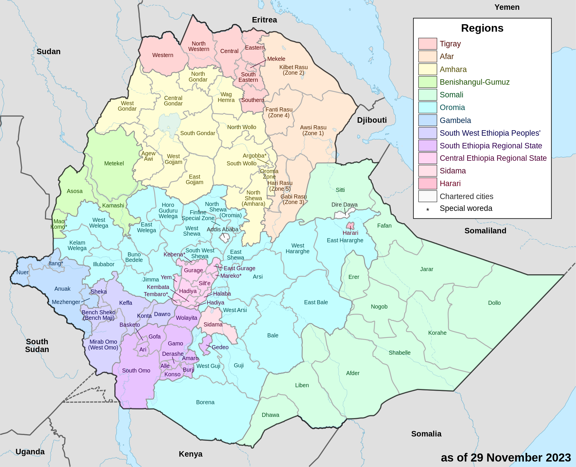
Dawuro (or Dawro) is a zone in the Southwest Region of Ethiopia. The name "Dawuro" represents both the land and the people. It is located at about 500km southwest of Addis Ababa, the capital of Ethiopia, about 111 km west of Wolaita Sodo, the capital of South Ethiopia Regional State and 319 km of Hawassa the capital of the Sidama Region. Dawuro is bordered to the south by Gofa Zone, to the west by the Konta Zone to the north by the Jimma zone, to the northeast by Hadiya and Tembaro Special Woreda in Central Ethiopia Regional State, and to the east by Wolayita Zone.

The second-biggest hydroelectric power generation dam in Ethiopia, Gilgel Gibe III Dam, is being built on Omo river between Dawuro and Wolayita zones. Dawuro contains many tourist attractions. The newly built Halala Kela Luxury Resort is located at Gilgel Gibe III Dam in Loma (woreda) of Dawuro zone. The administrative center of Dawuro is Tarcha. Tarcha is situated at 70 14' north latitude and 370 5' east longitude and 1200m to approximately 1450m above sea level. Tarcha is 496 km from Addis Ababa through Jimma, and 489 km through Sodo. The second largest town in the Dawuro zone is Gesa.

Dawuro has 111 kilometers of all-weather roads and 123 kilometers of dry-weather roads, for an average road density of 53 kilometers per 1000 square kilometers.[1] High points in this Zone include Atto, Issera, Umbuti, and Sadam among others.

Dawuro used to be part of the North Omo Zone, and the 1994 national census counted its inhabitants as part of that Zone. However friction between the various ethnic groups in North Omo zone, which was often blamed on the Wolayta people for "ethnic chauvinism" and despite the efforts of the ruling party to emphasize the need to coordinate, consolidate, and unify the smaller ethnic units to achieve the "efficient use of scarce government resources", led to the division of the zone in 2000, resulting with the creation of the Dawuro, Gamo Gofa, and Wolayita Zones, and two special districts.[2]

Demographics

[edit]

Based on the 2007 Census conducted by the Central Statistical Agency of Ethiopia (CSA), this zone has a total population of 489,577, of whom 249,263 are men and 240,314 women; with an area of 4,814.52 square kilometers, Dawuro has a population density of 101.69. While 35,044 or 7.16% are urban inhabitants, a further 14 individuals are pastoralists. A total of 89,915 households were counted in this Zone, which results in an average of 5.44 persons to household, and 86,642 housing units. The two largest ethnic groups reported in this zone included the Dawro (97.32%), and the Hadiya (1.3%); all other ethnic groups made up 1.38% of the population. Dawurtsho is spoken as a first language by 97.44% of the inhabitants, and 1.3% speak Hadiya; the remaining 1.26% spoke all other primary languages reported. 57.71% of the population said they were Protestants, 31.86% practiced Ethiopian Orthodox Christianity, 4.9% observed traditional religions, and 4.61% embraced Catholicism.[3]

Dawro is one of the ethnic groups in Ethiopia that uses its own character set of the Ethiopic syllabary.

Woredas

[edit]

References

[edit]
Revisions and contributorsEdit on WikipediaRead on Wikipedia
from Grokipedia
The Dawro Zone, also known as Dawuro, is an administrative zone in the of southwestern , primarily inhabited by the Dawro people, an Omotic-speaking ethnic group. The zone's namesake population historically formed the centralized Kingdom of Dawuro, which maintained independence through fortified dry stone walls and strategic defenses until its conquest and incorporation into the by Emperor in 1893. Geographically, Dawro Zone spans approximately 4,700 square kilometers of rugged terrain featuring mountains, plateaus, deep gorges, and lowland plains along the Omo and Gojeb river basins, with its administrative center at Tercha, located about 500 kilometers southwest of . As of July 2023 projections, the zone's population totals around 699,000, predominantly Dawro who speak the Dawrootsuwa language and engage in , pottery, and traditional social structures including clan-based hierarchies.

Geography and Environment

Location and Topography

The Dawro Zone occupies a position in the South West Ethiopia Peoples' Region, centered approximately at 7° N latitude and 37° E longitude, extending roughly between 6°50' and 7°20' N and 36°40' and 37°20' E. It lies about 500 km southwest of Addis Ababa, with its administrative center Tarcha situated 496 km from the capital. The zone is bordered to the south by Kaffa Zone, to the west by the Omo River separating it from Oromia Region, to the north by Kembata Tembaro Zone, and to the east by Gamo Gofa Zone. Topographically, Dawro Zone features rugged mountainous , high plateaus, deep gorges, and lowland plains, contributing to varied across the area. Elevations range from about 500 meters above near the confluence of the Zigina and Omo Rivers in the western lowlands to over 3,000 meters at peaks such as Tuta in Tocha woreda. The Omo River and its tributaries, including the Zigina, form significant hydrological features draining the region, while forested areas like the Koysha ecosystem cover portions of the landscape.

Climate and Natural Resources

The Dawro Zone exhibits a tropical highland climate shaped by its elevation range of approximately 700 to 3,000 meters above and the seasonal northward and southward shifts of the (ITCZ). This results in bimodal rainfall patterns, with primary wet seasons from to May (belg rains) and July to October (kiremt rains), alongside a shorter dry period in and extended dry conditions from to February. Annual precipitation averages 1,200 to 1,800 mm, increasing toward the southwest and southeast due to orographic effects from the zone's hilly , while temperatures range from 15°C to 27.5°C, with cooler conditions at higher elevations. Natural resources include significant forest ecosystems, such as the Koysha and Shoti forests, which support diverse woody species and non-timber forest products like resins and . Wildlife populations feature including olive baboons (Papio anubis) and vervet monkeys (Chlorocebus pygerythrus), as well as spotted hyenas (Crocuta crocuta) and golden jackals (Canis aureus), contributing to ecological dynamics in forested areas like Belo-Bira. Mineral deposits encompass , gold, and , with coal processing facilities operational in parts of the zone. The Omo River basin offers hydropower potential, exemplified by the straddling the Dawro-Wolayita boundary, which generates 1,870 MW from a 240-meter-high structure and annual energy output of 6,400 GWh.

History

Traditional Dawro Society and Governance

The Dawro people, speakers of an Omotic language within the Afroasiatic family, trace their origins to indigenous groups in southwestern , with linguistic evidence classifying them as part of the central Omotic branch and oral histories portraying them as early settlers exerting influence over neighboring Omotic territories. Their society was fundamentally patrilineal and kinship-oriented, organized into three primary clans—Malla, Dogallaa, and Amaara—each subdivided into numerous sub-clans such as Kawuka, Shamecha, and Walaqa, totaling over 150 units. The Malla clan dominated administrative roles and held the highest as primary agriculturalists, while Dogallaa managed spiritual affairs and Amaara handled economic activities; lower-status occupational groups, including potters (Mana) and tanners, were marginalized with restricted intermarriage due to notions of impurity. ties enforced within compatible clans, supported practices like , and structured , fostering agrarian communities centered on family labor for cultivation such as enset and cereals. Land tenure in traditional Dawro society operated through hereditary clan-based ownership predating external impositions, with Malla clans principally controlling arable plots allocated to families for perpetual use, supplemented by communal oversight to ensure equitable access amid the zone's hilly terrain suitable for mixed farming. This system tied land rights to patrilineal descent and productivity, excluding lower castes from full ownership while integrating royal prerogatives for redistribution during shortages or expansions. Such arrangements reinforced decentralized community autonomy in resource management, with kinship networks mitigating disputes over boundaries through elder arbitration rather than centralized fiat. Governance featured a under the kawo (king), drawn from the Kawuka sub-clan of the Malla, who wielded combined secular and ritual authority over a structured including woraba ( chiefs) and erasha (sub-district leaders), yet relied on decentralized councils of elders and sharechos (local notables) for routine administration. emphasized consensus, with dubusha public assemblies convening for major trials and oaths binding resolutions, while conflict prioritized compensation, restitution, and ritual reconciliation over punitive measures. This framework, operational for centuries as evidenced by oral accounts of dynasties spanning approximately 350 years, balanced royal oversight with clan-level autonomy, enabling adaptive responses to internal challenges like clan rivalries through enforced by community sanctions.

Interactions with Neighboring Powers

The Dawuro kingdom maintained complex relations with neighboring Omotic-speaking groups such as Kaffa and Wolayta, as well as the Cushitic-speaking Oromo, characterized by trade networks, territorial expansions, and defensive conflicts prior to the late . Long-distance trade routes connected Dawuro to these powers, facilitating exchanges of , spices, grains, , crafts, and slaves through weekly markets like those in Hermata () and local Dawuro centers such as Mari and Tocha; kings often protected merchants and waived customs duties to encourage commerce. These economic ties were underpinned by mutual dependencies, with importing goods unavailable locally and Dawuro accessing salt, cloth, and iron tools, though slave raids by both Dawuro and participants occasionally disrupted stability. Territorial dynamics involved Dawuro expansions and boundary disputes, particularly westward toward Kaffa by around 1800, where Dawuro forces pushed frontiers to Kaffa's eastern edges, leading to and linguistic influences among border clans. Contested areas like Konta served as buffers, sparking disputes between Dawuro and Kaffa, with specific clan-level conflicts such as Tsata leaders clashing bloodily over territory; political marriages, including one between Dawuro's Kawo Halala and Konta's Samaqo, temporarily resolved some encroachments. To counter raids and invasions, Dawuro constructed extensive dry-stone defensive walls (Kati) spanning 150-200 km, completed in the early , which effectively repelled a Wolayta incursion under King Halala (r. 1782-1822). Relations with combined alliance-building and friction, exemplified by a royal marriage between Jimma's Abba Jiffar and the daughter of a Dawuro , brokered to secure peace amid frequent border clashes over trade routes and territory. Cultural exchanges arose from migrations and intermarriages with Wolayta, Gamo Gofa, and Kaffa, influencing social structures, ritual practices, and shared spirit medium traditions, though these were pragmatic adaptations rather than uniform assimilation. These interactions, documented primarily through oral traditions in academic analyses, reflect causal drivers of resource competition and security needs in a fragmented regional landscape.

Incorporation into Modern Ethiopia

The Dawro kingdom, previously independent, was incorporated into the through military conquest in 1889 by forces under Ras Wolde Giorgis, acting on behalf of Emperor Menelik II. The campaign advanced from along the Gojeb River, targeting key locales including Goriqa, Wara, Bobi, Nakri, and Waka, before culminating in a decisive battle at Embuti that shattered local resistance and ended Dawro . This expansion was driven by Menelik's broader strategy to consolidate southern territories, leveraging superior firepower and to overcome fortified defenses built by Dawro rulers. Following the conquest, the neftenya-gabbar system was imposed, granting northern soldier-settlers (neftenya) hereditary rights to extract tribute and labor from subjugated locals (gabbars), which systematically undermined traditional Dawro autonomy and governance. Local titles such as Kati, Woraba, and Erasha were supplanted by military ranks like Dejazmach and Fitawurari, while self-administration was abolished in favor of centralized collection by imperial appointees. The defeated , Kantsa, was forcibly converted to Orthodox Christianity and renamed Haile Tsiyon; tributes extracted included food crops, , milk, coffee, and compulsory labor, redirecting resources northward and entrenching economic dependency. This feudal overlay prioritized imperial extraction over , akin to gult grants in other southern regions, eroding the authority of hereditary chiefs and fostering resentment through cultural impositions like administration. The Italian occupation of from 1936 to 1941 temporarily disrupted these structures in southern regions, including Dawro, as occupiers appropriated gult and rist-equivalent lands, redistributing them to loyal servants and collaborators, which fragmented neftenya control and briefly revived some local agency amid the chaos of colonial reconfiguration. However, Ethiopian resistance and Allied liberation in 1941 restored imperial authority under , who pursued post-war centralization to prevent peripheral fragmentation. By appointing governors and standardizing provincial administration through awraja districts, Selassie integrated Dawro more tightly into the empire, suppressing residual autonomous elements and enforcing loyalty via modernized and projects, thereby perpetuating the subordination initiated under Menelik.

Administrative Evolution Post-1991

Following the establishment of Ethiopia's system in 1991 under the , the Dawro Zone was incorporated into the Southern Nations, Nationalities, and Peoples' Region (SNNPR) as one of several newly delineated administrative units designed to recognize subnational ethnic identities. This restructuring grouped the Dawro people, who possess a distinct Omotic and cultural traditions, with other diverse groups within SNNPR, reflecting an initial effort to balance with administrative cohesion. The 2007 Population and Housing Census by the recorded the zone's population at 489,577, underscoring its integration into SNNPR's demographic framework for resource allocation and planning. Throughout the 2010s, Dawro communities articulated demands for independent statehood, citing cultural-linguistic distinctiveness and perceived administrative neglect from the SNNPR capital in , which they argued hindered effective local governance and service provision. These appeals aligned with broader trends in SNNPR, where over 11 ethnic groups by 2018 sought separate regional status to address inefficiencies in the multi-ethnic structure, including duplicated bureaucracies and uneven resource distribution that exacerbated inter-group tensions. Proponents of statehood emphasized that smaller, homogeneous units could enhance responsiveness, though empirical assessments of SNNPR's reforms from the early 2000s indicated mixed outcomes, with improvements in and service coverage but persistent challenges in fiscal and delivery equity at the zonal level. Despite these bids, federal authorities prioritized regional consolidation for stability, culminating in a 2021 referendum that approved the formation of the on October 30, incorporating Dawro Zone alongside Keffa, Sheka, Bench Sheko, West Omo zones, and Konta special woreda, effective November 23. This shift from SNNPR aimed to mitigate fragmentation risks while addressing some self-rule aspirations through a clustered entity, though critics noted that such mergers could perpetuate inefficiencies if underlying issues like border disputes and distributive conflicts—intensified post-2018—were not resolved via data-driven reforms. Pre-reform metrics from SNNPR showed yielding modest gains in service access, such as increased enrollment, but post-2021 evaluations remain limited, with ongoing appeals highlighting causal links between oversized regions and delayed projects.

Demographics

According to the 2007 Population and Housing Census conducted by Ethiopia's Central Statistical Agency (CSA), Dawro Zone had a total population of 489,577, comprising 249,263 males and 240,314 females. Of this, approximately 454,533 individuals (92.84%) lived in rural areas, while 35,044 (7.16%) resided in urban settings. The census enumerated 89,915 households, yielding an average household size of 5.44 persons. Projections from Ethiopia's statistical services estimate the zone's population at 699,253 as of July 2023, reflecting a cumulative increase of about 42.7% over the 16-year period from the 2007 census. This equates to an average annual growth rate of roughly 2.2%, driven primarily by high fertility and modest net migration inflows tied to agricultural opportunities in fertile lowlands. National trends indicate Ethiopia's overall population growth rate hovered around 2.6% in recent years, with rural zones like Dawro experiencing slightly lower rates due to topographic constraints on settlement expansion. Population density stood at 101.69 persons per square kilometer in 2007, based on the zone's area of approximately 4,814.52 square kilometers. varies significantly by , with higher concentrations (exceeding 150 persons per square kilometer in some estimates) in agriculturally productive river valleys and plateaus, contrasted by sparser distributions (under 50 persons per square kilometer) in steep, erosion-prone highlands where farming is limited. Migration patterns, largely internal and agriculture-motivated, have concentrated growth in these accessible, arable zones, exacerbating on resources. Vital rates contribute to sustained growth, with the broader Southern Nations, Nationalities, and Peoples' Region (including Dawro) exhibiting a of around 4.9 children per woman in mid-2010s health surveys, higher than the national average due to limited contraceptive access in rural areas. rates in such zones were estimated at 85 per 1,000 live births, with under-5 mortality at 145 per 1,000, reflecting lags in healthcare infrastructure despite national declines from and programs. Recent interventions have reduced these rates modestly, but rural-urban disparities persist, sustaining elevated and .

Ethnic Groups and Languages

The population of the Dawro Zone is overwhelmingly composed of the Dawro ethnic group, who form 97.32% of residents based on the 2007 Ethiopian national census conducted by the . This Omotic-speaking people are indigenous to the region, with self-identification tied to shared linguistic and centered on highland agricultural practices. Minority ethnic groups include the Hadiya at 1.3%, a Cushitic-speaking often residing in border areas, while the remaining 1.38% encompasses smaller communities such as Gamo, Wolayta, or Amhara settlers, though precise sub-percentages for these are not detailed in census aggregates. Urban centers and administrative towns exhibit slightly higher diversity due to and government postings, but rural kebeles remain Dawro-dominant. The dominant language is Dawro (also known as Dawragna), classified as a North Omotic tongue within the Ometo subgroup of the Afroasiatic family's Omotic branch, mutually intelligible with dialects like Gamo and Gofa but distinct in phonology and lexicon. Spoken as a by over 500,000 individuals primarily in the zone, it features verb-initial syntax and complex derivational morphology, as documented in descriptive linguistic studies. The language maintains vitality through daily use in households, markets, and local governance, with no significant endangerment reported, though functions as the official medium for federal administration and , fostering bilingualism among younger demographics. Minority languages like Hadiyisa persist in enclaves but show assimilation patterns via intermarriage and trade.

Government and Administration

Administrative Divisions

The Dawro Zone is administratively divided into five woredas: Gena Bosa, Isara, Loma, Mareka, and Tocha, with Tarcha serving as the zonal administrative seat. These woredas function as the basic units of local administration, overseeing , basic maintenance, and coordination of federal and programs such as rural and efforts. Gena Bosa Woreda, located in the eastern part of the zone, borders Loma to the south and focuses on managing highland agricultural resources and initiatives. Isara Woreda handles midland terrain in the southwest, emphasizing water resource allocation for and livestock watering points. Loma Woreda covers lowland areas in the southeast, with responsibilities including boundary enforcement along the Gamo Gofa interface and promotion of drought-resistant varieties. Mareka Woreda, in the central-west, administers riverine boundaries along the Gojeb and supports local mining oversight for small-scale sites. Tocha Woreda, positioned in the northwest, manages upland plateaus and facilitates cross-boundary trade facilitation with adjacent Konta areas. Following the formation of the on November 23, 2021, Dawro Zone was transferred from the former Southern Nations, Nationalities, and Peoples' Region without significant internal woreda boundary alterations, preserving existing delineations for continuity in local resource governance. Minor adjustments occurred in 2022 to align administrative seats with updated census data for better service delivery, though no major territorial reallocations were reported.

Local Governance Structure

The local governance structure in Dawro Zone functions within Ethiopia's decentralized federal framework, under the oversight of the established in 2021. Zonal administration is headed by an elected council and chief executive, coordinating multiple woredas (districts) that handle service delivery, planning, and regulation. Each woreda operates through elected assemblies accountable to the zone, which serves as an intermediary to the regional government, ensuring alignment with national policies on development and administration. At the level, Dawro Zone encompasses approximately 181 kebeles, the smallest administrative units responsible for , basic , and local elections. Kebele councils, elected every five years, implement federal and regional mandates on issues like extension and services, with participation rates indicating broad involvement in zonal affairs as of 2022 surveys. However, operational challenges persist, including limited road connectivity—only 30 kebeles linked by rural roads—which hampers coordination and service delivery. Traditional Dawro institutions, including elders' councils (qicha), coexist with state structures, particularly in , where indigenous mechanisms prioritize over punitive measures. These systems handle interpersonal and land conflicts through consensus-building rituals, often resolving cases faster than formal courts but lacking legal enforceability under . Tensions arise when state courts override customary rulings, as traditional forums do not fully integrate with the , leading to parallel operations; for example, minor disputes are typically deferred to elders to preserve social cohesion, while felonies escalate to woreda-level courts. Fiscal autonomy remains constrained, with zonal and woreda budgets heavily reliant on regional transfers comprising over 80% of revenues, supplemented by local collections from taxes and fees. A 2017 analysis of three Dawro woredas (Mareka, Loma, and Essera) revealed inefficiencies in revenue administration, including low collection rates and dependency on central allocations for capital projects. Expenditure patterns show rapid depletion—such as 95% of annual capital funds spent in the first half of fiscal years—highlighting limited discretion amid federal oversight and formula-based grants tied to and needs assessments.

Economy

Agricultural Base

The agricultural economy of Dawro Zone relies heavily on subsistence farming, with enset () serving as the primary staple crop due to its resilience in the highland agroecology and capacity to support dense populations through multiple products including kocho (fermented bread), bulla (dried ), and . Other key crops include , , and faba beans, cultivated on sloping terrains suited to the zone's elevation range of 500 to 3,000 meters above . Livestock rearing, particularly of indigenous sheep breeds like Dawuro highland sheep and local , complements crop production, contributing approximately 44.7% to household livelihoods through , , and draft power. Traditional farming techniques predominate, including labor-intensive terracing on hillsides to prevent , manure application for fertility enhancement, and practices integrating trees and shrubs along contours to maintain amid population pressures. These methods have enabled incremental yield improvements; for instance, repeated plowing and input use have boosted outputs in like Essera, though average holdings remain small at about 0.78 hectares per , with 0.64 hectares typically under cultivation. performance under community-based breeding programs shows lambs reaching 22.8 kg at six months, supporting local protein needs but limited by seasonal feed shortages from residues, which constitute 40-50% of dry-season . Cultivated land varies by district, comprising around 38.4% of total area in Essera, reflecting constraints from rugged and the need for conservation measures to sustain productivity on marginally arable soils. Market access poses a persistent challenge, with farmers relying on rudimentary bush markets and poor road infrastructure, which hampers surplus sales of enset products and to urban centers. The Gibe III Hydroelectric Project has indirectly aided through enhanced regional from its 1,870 MW capacity, enabling potential pumps and agro-processing, alongside construction-era road improvements that facilitate input acquisition and product transport for upstream communities in Dawro.

Infrastructure and Development Initiatives

The Dawro Zone maintains a rudimentary network, totaling approximately 270.8 kilometers as of 2014, with 218.8 kilometers graveled and 52 kilometers partially graveled, limiting efficient and market integration. A significant upgrade came with the 159.1-kilometer -Omo-Tercha asphalt , funded at 3 billion birr and substantially completed by 2015, which shortened travel times from three hours and improved links to regional centers like . The Gilgel Gibe III hydroelectric project further catalyzed construction, including segments such as Gora-Disa and Bosa-Angala networks, to support project access and local connectivity, though overall densities remain low at around 111 kilometers of all-weather roads. Electrification in the zone advanced markedly with the commissioning of the , a structure generating 1,870 megawatts, with initial power output starting in October 2015 and full operations by 2016, enabling expanded rural grid connections amid Ethiopia's broader push. This facility, situated directly in Dawro, has supplied energy for local development while integrating with national grids, though rural access rates lag, with project-related infrastructure like transmission lines aiding only partial mitigation of prior isolation. Water supply initiatives include community-managed schemes under government programs like the Universal Access Plan II, targeting 98.5% coverage by 2015 through and spring developments, supplemented by NGO efforts such as those by the South Ethiopia Peoples' Development Association, which completed 225 clean water and projects across southern regions by the early . Limited development persists, with small-scale schemes promoted via national efforts like the Participatory Small-scale Development Programme II, focusing on schemes in former SNNPR areas including Dawro, though adoption remains constrained by terrain and funding, yielding modest expansions in cultivable land. Persistent infrastructural gaps, including incomplete all-season roads and uneven power distribution, exacerbate the zone's economic isolation, hindering agricultural and multipliers despite Gibe III's contributions, as connectivity deficits elevate transport costs and delay project completions.

Culture and Heritage

Dawro Identity and Social Structure

The Dawro people organize their society along patrilineal lines, with descent, inheritance, and identity traced through the male line, structuring social relations around exogamous clans that regulate and alliance formation. This patrilineal framework underpins a hierarchical system divided into three primary clans—Malla (or Maallaa, the dominant agricultural group), Dogalla, and Amara—each further subdivided into over 150 sub-clans such as Kawuka (royal lineage) and Shamecha. The Malla hold the highest status, controlling land ownership and administration, while Dogalla associate with spiritual roles and Amara with economic activities, fostering inter-clan cooperation amid underlying hierarchies. Beneath these dominant clans lie occupational strata, including blacksmiths (Wogac-c-iya), tanners (Degellaa), potters (Manaa), and historically hunter-gatherers (Manja), who face hereditary segregation marked by , restricted land access, impurity taboos, and exclusion from shared sites or intermarriage with Malla. This caste-like differentiation, rooted in occupational specialization, reinforces social boundaries, with dominant groups viewing lower strata as polluting, though interdependencies exist in and labor. Gender roles align with patrilineal norms, emphasizing male authority in kingship, succession (passed to the eldest son of the principal ), and public offices like Kawo () and Erasha (judges), while women participate in economic activities such as spinning for cloth production and historically held auxiliary roles like or leading armies under exceptional figures. among men and clan exogamy for women underscore male dominance in family structure, though women access certain public positions like Worrabba (councilors), distinguishing Dawro from more rigidly male-dominated neighbors. Dawro ethnic identity draws from oral traditions recounting origins as "first settlers" from the (Bitta), migration narratives from northern , and symbols tied to clan deities (male for dominant groups, female like Mariaminto for women), which affirm pre-eminence amid Omotic linguistic roots. These narratives, preserved through elders and historical events like the construction of defensive walls under King Hallalla, reinforce kinship-based solidarity against external influences. Modernization, including post-1974 land reforms, , , and , has eroded strict clan and , enabling lower strata greater and intermarriage, yet core patrilineal clans and identity markers persist as bulwarks against assimilation into broader Ethiopian . networks continue to mediate disputes and economic ties, adapting to pressures from state interventions and market integration while maintaining ethnographic continuity in rural highland communities.

Traditions, Rituals, and Material Culture

The Dawro people observe the Toki be’a , marking the in late or early according to their lunar-based , which spans 5-6 days of family gatherings, food preparation, singing, dancing, and torch ceremonies intended to appease ancestral spirits and renew community bonds. This event facilitates conflict resolution among clans, promoting social cohesion in a patrilineal society historically prone to inter-clan disputes, while young participants engage in dances that transmit cultural norms. Associated customs include Chegena, monthly work-prohibited days (typically the 11th to 15th) rooted in beliefs that evil influences could harm crops or activities, reflecting adaptive in agriculture-dependent livelihoods. Mourning rituals feature community assemblies with speeches (Zilalisa) and expressive crying (Bosha), often accompanied by the Dinka, a 4-5 meter bamboo flute played to signal the start of ceremonies and evoke collective grief or celebration in funerals and festivals. These practices, once tied to pre-Christian deities like Tsossa variants, have syncretized with Protestant Christianity—prevalent among over 30% of Dawro as evangelicals—where spirit-appeasement elements persist alongside prayers to Xossa (a traditional high god) during thanksgiving or conflict rites. Such integration preserves ritual efficacy for social stability amid religious shifts since the late 19th century. Material culture emphasizes hereditary crafts, with (Manas specialists) producing vessels like Bareta (storage jars) and Baatha (bowls) for daily kitchens, , and ceremonies including births, marriages, and funerals, where items symbolize purity and are displayed in local cultural museums. yields cloths such as Dunguza (ceremonial wraps), Kamishia (daily garments), Netela (shawls), and Bullukko (belts), handcrafted via family-taught techniques without , serving functional roles in weddings, burials, and status display while embedding artisans in ritual economies despite historical marginalization. Defensive architecture includes the Halala Kella stone walls, spanning 150-200 km along the and built in the 18th-19th centuries using local stone to control trade routes and repel invasions, exemplifying indigenous engineering for territorial security. These artifacts sustain cultural identity, with techniques passed generationally to adapt to environmental and social pressures.

Contemporary Challenges

Health, Education, and Social Issues

In Dawro Zone, transmission surged in early 2023 as part of a broader outbreak in southwest , affecting zones including Dawro and prompting emergency interventions that reduced cases by approximately 75% within six weeks through mass testing, treatment, and worker training. Integrated community case management (iCCM) for childhood illnesses like , , and has shown positive outcomes, with most under-five children improving after treatment by extension workers in rural districts, though gaps persist due to factors such as long distances to health posts (over 10 km for many), low knowledge of danger signs, and delayed care-seeking, which causally contribute to higher risks of complications or mismanagement at home. Education in Dawro Zone faces systemic challenges, including high primary school dropout rates comparable to the Southern Nations, Nationalities, and Peoples' Region average, where early school leaving exceeds national figures due to economic shocks, marginalization of social classes like the Menas and Hilanchas, and nutritional deficiencies such as iodine shortfall that impair cognitive performance and increase absenteeism among schoolchildren. Inclusive education implementation in primary schools is hindered by inadequate teacher training, resource shortages, attitudinal barriers among educators, and poor school management, resulting in limited accommodations for students with disabilities and perpetuating exclusion. Social issues among are pronounced, with 48.4% of high school students reporting sexual initiation and 91% of those engaging in unsafe practices, such as inconsistent use or multiple partners, linked causally to factors including higher enabling riskier lifestyles, infrequent religious participation, living apart from , and poor of reproductive risks. These patterns reflect broader service gaps, where limited access to targeted and counseling exacerbates vulnerability to unintended pregnancies and infections, underscoring failures in community-level prevention tied to under-resourced extension programs.

Environmental Conflicts and Resource Management

Human-wildlife conflicts in the Dawro Zone primarily manifest as crop raiding and livestock predation around forested areas such as Belo-Bira Forest, where expanding human settlements encroach on habitats. A 2021 study documented frequent incidents involving olive baboons (Papio anubis), grivet monkeys (Cercopithecus aethiops), spotted (Crocuta crocuta), and golden jackals (Canis aureus), with crop damage reported by 68% of surveyed households and losses by 52%, based on data collected from October 2019 to March 2020 across 153 households in adjacent kebeles. These conflicts arise causally from due to and human , which averaged 150-200 persons per km² in peri-forest zones, forcing into farmlands; baboons and accounted for over 70% of verified depredation events, exacerbating food insecurity in subsistence-dependent communities. Deforestation intensifies these pressures, driven by and associated demands for farmland, fuelwood, and construction materials. In the Dawro Zone, tree cover loss totaled approximately 15,000 hectares from 2001 to 2023, with 97% classified as rather than degradation, per satellite monitoring; primary drivers include conversion to cropland in districts like Essera, where annual increases of 2.5-3% since 2010 have fragmented remnant forests, reducing canopy cover by 25% in sampled watersheds between 1990 and 2020. rates in cleared areas reach 20-30 tons per hectare annually, further degrading and pushing communities toward marginal habitats, underscoring how open-access resource regimes incentivize short-term exploitation over long-term stewardship. Resource management approaches contrast community-led initiatives, which emphasize local property rights and enforcement, against centralized state oversight, often hampered by limited capacity. Participatory forest management in Essera , implemented since 2015 through user groups, has stabilized enclosures covering 500-1,000 hectares by aligning incentives for patrolling and benefit-sharing, yielding 15-20% higher regeneration rates than state-controlled areas per biophysical assessments. State programs, reliant on distant bureaucracy, suffer from recidivism rates exceeding 40% due to weak monitoring, whereas community models reduce illegal encroachment by granting de facto rights, demonstrating superior efficacy in curbing habitat loss through localized .

Political Dynamics and Ethnic Federalism Debates

In the 2010s, Dawro Zone residents increasingly advocated for separate statehood within Ethiopia's ethnic federal system, citing marginalization within the Southern Nations, Nationalities, and Peoples' Region (SNNPR) and the need for greater self-governance to address local developmental disparities. This push aligned with broader demands across SNNPR ethnic zones, where constitutional provisions for self-determination encouraged resolutions for independent administrations to preserve cultural identity and allocate resources more equitably. However, these aspirations faced resistance due to concerns over administrative fragmentation exacerbating distributive conflicts and weakening economies of scale in service delivery. The 2021 referendum marked a pivotal shift, integrating Dawro Zone into the newly formed alongside Keffa, Sheka, Bench-Sheko, and West Omo zones, rather than granting standalone status. Proponents of this consolidation argued it mitigated risks of perpetual ethnic grievances by fostering inter-group cooperation and stabilizing , evidenced by localized reductions in inter-communal violence following the . Critics, however, highlighted inefficiencies inherent in , such as heightened competition over federal transfers and jurisdictional overlaps, which have strained governance without proportionally enhancing cultural preservation. Local appeals underscored trade-offs: statehood bids promised tailored policies for Dawro-specific needs like enset agriculture support, yet integration offered pooled investments, though empirical data on net stability remains mixed amid ongoing federal debates. Debates on ethnic federalism's role in Dawro persist, balancing arguments for cultural —rooted in the 1995 Constitution's clauses—against evidence of induced fragmentation, where over 70 new statehood demands since 2018 have correlated with elevated conflict incidences nationwide. While enabled Dawro's administrative recognition post-1991, averting assimilation risks, detractors cite causal links to and resource misallocation, urging reforms toward hybrid models prioritizing national cohesion over rigid ethnic delineations. Post-2021 outcomes in South West suggest provisional stability gains, countering narratives of inevitable grievance escalation, yet underscore the need for data-driven evaluations of 's causal impacts on ethnic harmony.

References

Add your contribution
Related Hubs
User Avatar
No comments yet.