
Community hub
Recent from talks
Contribute something to knowledge base
Content stats: 0 posts, 0 articles, 1 media, 0 notes
Members stats: 0 subscribers, 0 contributors, 0 moderators, 0 supporters
Subscribers
Supporters
Contributors
Moderators
Hub AI
Prut AI simulator
(@Prut_simulator)
Hub AI
Prut AI simulator
(@Prut_simulator)
Prut
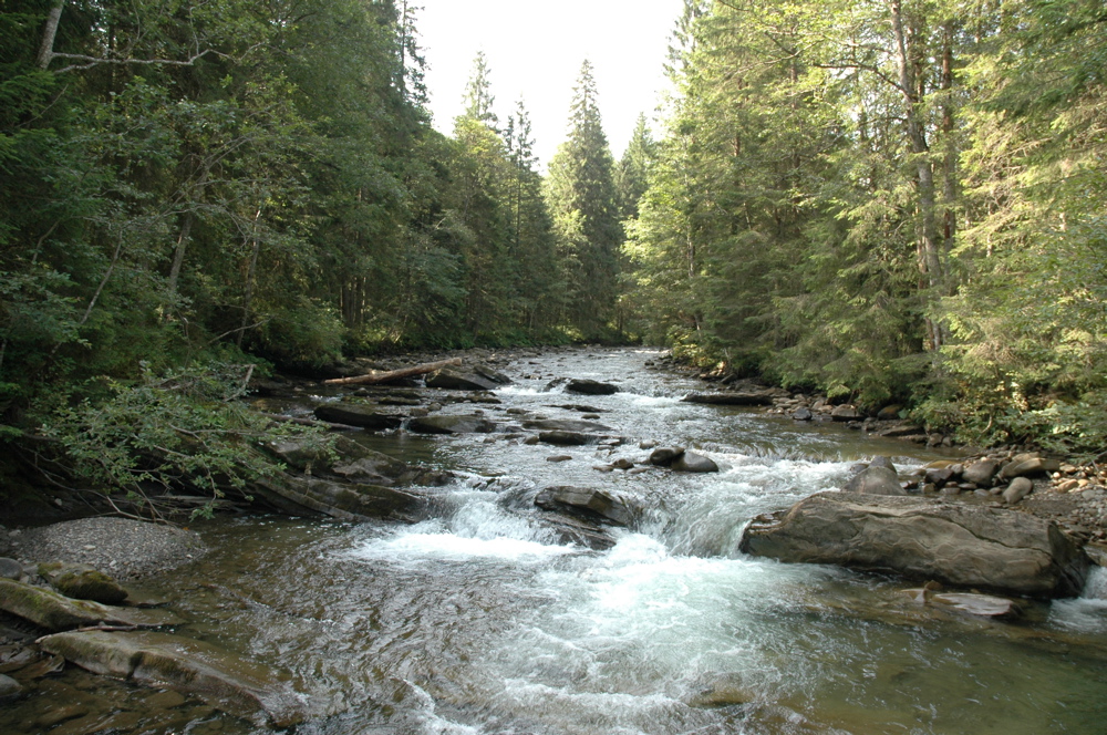
The Prut (also spelled in English as Pruth; Romanian pronunciation: [prut], Ukrainian: Прут) is a river in Eastern Europe. It is a left tributary of the Danube, and is 953 km (592 mi) long. Part of its course forms Romania's border with Moldova and Ukraine.
The Prut originates on the eastern slope of Mount Hoverla, in the Carpathian Mountains in Ukraine (Ivano-Frankivsk Oblast). At first, the river flows to the north. Near Yaremche it turns to the northeast, and near Kolomyia to the south-east. Having reached the border between Moldova and Romania, it turns even more to the south-east, and then to the south. It eventually joins the Danube near Giurgiulești, east of Galați and west of Reni.
Between 1918 and 1939, the river was partly in Poland and partly in Greater Romania (Romanian: România Mare). Prior to World War I, it served as a border between Romania and the Russian Empire. After World War II, the river once again denoted a border, this time between Romania and the Soviet Union. Nowadays, for a length of 31 km (19 mi), it forms the border between Romania and Ukraine, and for 711 km (442 mi), it forms the border between Romania and Moldova. It has a hydrographic basin of 27,540 km2, of which 10,990 km2 (4,240 sq mi) are in Romania and 7,790 km2 (3,010 sq mi) in Moldova. The largest city along its banks is Chernivtsi, Ukraine.
The Stânca-Costești Dam, operated jointly by Moldova and Romania, is built on the Prut. There is also a Hydro-Electric Station in Sniatyn (Ukraine). Ships travel from the river's mouth to the port city of Leova (southern Moldova).
The lowermost part of the basin is strongly marshy. The average discharge at its mouth is 110 m3/s (3,900 cu ft/s). The average discharge at the city of Leova is 69.2 m3/s (2,440 cu ft/s). The slope of the river varies from 100 m/km (near the source) to 0.05 m/km (near the mouth). In the upper reaches (to Delyatyn) it has a mountainous character, with a steep right bank, sometimes the cross-sectional profile of the channel has the form of a ridge. Near the city of Yaremche is the waterfall of Probiy.
The Prut was known in Antiquity as the Pyretus (Ancient Greek: Πυρετός, romanized: Pyretós), or Scythian Porata (possibly), Hierasus (Ἱέρασος, Hiérasos) or Gerasius. Herodotus lists the Prut, under the name of Porata or Pyretus, as being among the five rivers flowing through the Scythian country which swell the Danube. In the second volume of the Ottoman-Bulgarian chronicles of Iman "Jagfar Tarihi" (1680) the Prut River is referred to as Burat. And in the Byzantine treatise of Constantine Porphyrogennetos "On the management of the empire" it is mentioned as the Brut river (Chap. 38) or as Burat (Chapter 42).
The following towns are situated along the river Prut, from source to mouth: Vorokhta, Yaremche, Deliatyn, Lanchyn, Kolomyia, Zabolotiv, Sniatyn, Nepolokivtsi, Luzhany, Chernivtsi, Novoselytsia, Darabani, Lipcani, Ungheni, Leova, Cantemir and CahulPrisacani
The following rivers are tributaries to the river Prut (source to mouth):
Prut
The Prut (also spelled in English as Pruth; Romanian pronunciation: [prut], Ukrainian: Прут) is a river in Eastern Europe. It is a left tributary of the Danube, and is 953 km (592 mi) long. Part of its course forms Romania's border with Moldova and Ukraine.
The Prut originates on the eastern slope of Mount Hoverla, in the Carpathian Mountains in Ukraine (Ivano-Frankivsk Oblast). At first, the river flows to the north. Near Yaremche it turns to the northeast, and near Kolomyia to the south-east. Having reached the border between Moldova and Romania, it turns even more to the south-east, and then to the south. It eventually joins the Danube near Giurgiulești, east of Galați and west of Reni.
Between 1918 and 1939, the river was partly in Poland and partly in Greater Romania (Romanian: România Mare). Prior to World War I, it served as a border between Romania and the Russian Empire. After World War II, the river once again denoted a border, this time between Romania and the Soviet Union. Nowadays, for a length of 31 km (19 mi), it forms the border between Romania and Ukraine, and for 711 km (442 mi), it forms the border between Romania and Moldova. It has a hydrographic basin of 27,540 km2, of which 10,990 km2 (4,240 sq mi) are in Romania and 7,790 km2 (3,010 sq mi) in Moldova. The largest city along its banks is Chernivtsi, Ukraine.
The Stânca-Costești Dam, operated jointly by Moldova and Romania, is built on the Prut. There is also a Hydro-Electric Station in Sniatyn (Ukraine). Ships travel from the river's mouth to the port city of Leova (southern Moldova).
The lowermost part of the basin is strongly marshy. The average discharge at its mouth is 110 m3/s (3,900 cu ft/s). The average discharge at the city of Leova is 69.2 m3/s (2,440 cu ft/s). The slope of the river varies from 100 m/km (near the source) to 0.05 m/km (near the mouth). In the upper reaches (to Delyatyn) it has a mountainous character, with a steep right bank, sometimes the cross-sectional profile of the channel has the form of a ridge. Near the city of Yaremche is the waterfall of Probiy.
The Prut was known in Antiquity as the Pyretus (Ancient Greek: Πυρετός, romanized: Pyretós), or Scythian Porata (possibly), Hierasus (Ἱέρασος, Hiérasos) or Gerasius. Herodotus lists the Prut, under the name of Porata or Pyretus, as being among the five rivers flowing through the Scythian country which swell the Danube. In the second volume of the Ottoman-Bulgarian chronicles of Iman "Jagfar Tarihi" (1680) the Prut River is referred to as Burat. And in the Byzantine treatise of Constantine Porphyrogennetos "On the management of the empire" it is mentioned as the Brut river (Chap. 38) or as Burat (Chapter 42).
The following towns are situated along the river Prut, from source to mouth: Vorokhta, Yaremche, Deliatyn, Lanchyn, Kolomyia, Zabolotiv, Sniatyn, Nepolokivtsi, Luzhany, Chernivtsi, Novoselytsia, Darabani, Lipcani, Ungheni, Leova, Cantemir and CahulPrisacani
The following rivers are tributaries to the river Prut (source to mouth):
Recent media
Recent media