Hubbry Logo
Vargas tragedyVargas tragedyMain
Open search
Vargas tragedy
Community hub
Vargas tragedy
logo
8 pages, 0 posts
0 subscribers
Be the first to start a discussion here.
Vargas tragedy
Vargas tragedy
from Wikipedia

Vargas tragedy
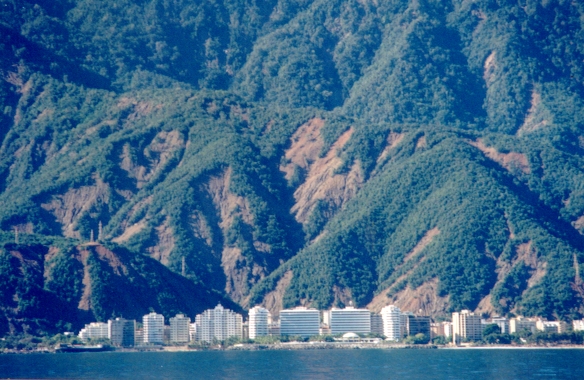
A part of Vargas state after the 1999 mudslides
Map
Date5–21 December 1999 (1999-12-05 – 1999-12-21)
LocationVargas (today La Guaira State), Venezuela
Coordinates10°36′18.67″N 66°50′58.21″W / 10.6051861°N 66.8495028°W / 10.6051861; -66.8495028
Deaths10,000–30,000[1]
Location of Vargas in Venezuela

The Vargas tragedy was a natural disaster that occurred in Vargas State (today La Guaira), Venezuela on 15 December 1999 (over the course of 10 days), when torrential rains caused flash floods and debris flows that killed tens of thousands of people, destroyed thousands of homes, and led to the complete collapse of the state's infrastructure. According to relief workers, the neighborhood of Los Corales was buried under 3 meters (9.8 ft) of mud and a high percentage of homes were simply swept into the ocean. Entire towns including Cerro Grande and Carmen de Uria completely disappeared. As much as 10% of the population of Vargas died during the event.[2] A deadlier natural disaster would not occur until the 2004 Indian Ocean earthquake and tsunami.[3] According to Guinness World Records, it is the deadliest mudslide ever recorded.[4]

Background

[edit]
A section of Los Corales, one of the neighborhoods in the Vargas state that suffered the heaviest destruction

The coastal area of Vargas State has long been subject to mudslides and flooding. Deposits preserved on the alluvial fan deltas here show that geologically similar catastrophes have occurred with regularity since prehistoric times.[2] Since the 17th century, at least two large-magnitude debris flow, landslide, or flood events, on average, have occurred each century within the modern boundaries of Vargas. Recorded events occurred in February 1798, August 1912, January 1914, November 1938, May 1944, November 1944, August 1948, and February 1951. In the February 1798 event, flash floods and debris flows severely damaged 219 homes. Spanish soldiers barricaded an upstream-facing entrance to a fort with cannons in order to prevent debris from filling it.[2]

Prior to the 1999 disaster, the most recent major flood had occurred in 1951, but that event did not cause as much damage.[2] Based on aerial photos and records of measurements, geologists were able to directly compare the 1951 event to the 1999 event. The 1951 event involved less rainfall than the 1999 event, fewer landslides were triggered, and less fresh debris was observed on the fans.[2] The unusually strong storm in December 1999 dumped 911 millimeters (35.9 in) of rain over just a few days, triggering widespread soil instability and flow of debris.[5] Adding to the devastation, Vargas State had experienced high population growth and development since the 1951 disaster, thus increasing the toll of casualties.

Population density

[edit]
Isohyet (contour of equal precipitation) map of the 14–16 December 1999 storm draped over a shaded relief map of north-central Venezuela

The alluvial fans built as sediments from floods and debris flows exit their channels and meet the oceans provide the only extensive flat surfaces along the mountainous coastline of north-central Venezuela. As such, many of them have been extensively developed and urbanized. This high population density increases the risk to life and property from flash flood and debris flow events.

As of 1999, several hundred thousand people lived in this narrow coastal strip in Vargas State. Many of these people lived atop alluvial fans formed by debris flows sourced out of the 2,000-meter (6,600 ft) peaks to their south.[6]

Rainfall

[edit]

December 1999 was unusually wet along the north-central Venezuelan coast. The first, and less powerful, storm that month occurred 2–3 December and dropped 200 millimeters (7.9 in) of rain on the coast.[6]

Two weeks later, in a 52-hour span during 14, 15 and 16 December 1999, 911 millimeters (35.9 in) of rain (approximately one year's average total rainfall for the region) was measured on the north-central coast of Venezuela at Simón Bolívar International Airport in Maiquetia, Venezuela. These heavy rains included 72 millimeters (2.8 in) of accumulation in just one hour, between 6 and 7 AM on the 16th; precipitation on both the 15th and 16th exceeded the 1,000-year probability rainfall event. Even so, the coast received much less rain than some regions upstream.[2]

This sudden and intense storm was especially unusual because it occurred in December, while the typical rainy season in coastal Venezuela lasts from May to October. These out-of-season rains formed when a cold front interacted with a moist southwesterly flow in the Pacific Ocean. This interaction produced moderate to heavy rainfall starting in the first week of December and culminating in the 14–16 December event that caused the deadly floods and debris flows.[2]

The heaviest rains were centered around the mid-upper part of the San Julián basin, which feeds water and sediment onto the Caraballeda fan. Heavy rains persisted within 8 kilometers (5.0 mi) of the coast, and subsided on the Caracas side of the Cerro El Ávila. Rainfall rates also decreased westward toward Maiquetía.[2]

Geology

[edit]

Bedrock

[edit]

The bedrock in the region surrounding Caracas is mainly metamorphic. From the coast and extending approximately 1 kilometer (0.62 mi) inland, deeply foliated schist of the Mesozoic Tacagua Formation is exposed. Soils forming on them are fine-grained (clayey), thin (0.5–3.0 meters (1 ft 8 in – 9 ft 10 in)), and often colluvial. Although the A horizon of the soil is often less than 30 centimeters (12 in) thick, the bedrock is often weathered down to greater than 2 meters (6 ft 7 in). Further inland, gneisses of the Paleozoic San Julián Formation and Precambrian Peña de Mora Formation extend to the crest of the Sierra de Avila. These units have thin soils over less-weathered bedrock; this is believed to be because of rapid erosion due to the steep slopes in this area.[2]

Because foliation planes are planes of weakness, these fabrics within the rocks strongly influence landslide and debris flow hazards.[2] Where the foliation planes are dipping towards a free surface, failure is likely to occur along these planes.[2]

Alluvial fan sedimentology and past floods

[edit]
Oversteepened hillslopes failed during the rainstorm, sending landslides of soil into the channels (such as the braided river at bottom) and supplying sediment to flash floods and debris flows. The transmission tower on the right side of the image is 30 meters (98 ft) tall.

The alluvial fans that spread out into the sea from valley mouths were built by previous flood and debris flow events.[2] The modern channel systems of these alluvial fan deltas are incised into previously deposited debris flow and flood material.[2][6] Scientists at the US Geological Survey measured these old deposits. They found that they are thicker than the December 1999 ones and contain larger boulders. This means that previous debris flows were even larger than those in December 1999 and reached higher velocities.[2]

On the Caraballeda fan, the extent of the 1951 event paled in comparison to the 1999 event. Much of the deposits that constitute the Caraballeda fan are of a thickness similar to those produced in the 1999 event and contain boulders of a size similar to those observed in 1999.[2]

The USGS geologists found paleosols with organic material above and below a 10-meter (33 ft) thick layer of debris flow deposits. The bottom paleosol was radiocarbon dated to 4267 ±38 years Before Present (BP), and the top one was dated to 3720±50 years BP. This means that, at least in this area, the bed aggraded 10 meters (33 ft) in 550 years, for an average rate of about 1.8 cm (0.71 in) per year (though the aggradation occurs only during short-lived events). The scientists were not able to tell whether the deposits were from a single debris flow or multiple events.[2]

Surficial geology and geomorphology

[edit]

Alluvial fan deltas in this region have shallow slopes. They are poorly channelized because sediment is being added to them from upstream (infilling the channels) at a rate equal to or greater than the rate at which it can be removed.[2]

Hillslopes are steepened past the angle of repose for noncohesive materials. This oversteepening is more than could be provided for by the frictional resistance of the sandy soils. Internal soil cohesion, negative pore pressure ("soil suction"), soil structure, and/or tree root reinforcement may be responsible for this.[2]

Neotectonics

[edit]
A 2.9-meter (9 ft 6 in) thick debris flow deposit from December 1999 is exposed by river incision during late-stage floods.

Terraces containing previous debris flow deposits are now perched 10–20 meters (33–66 ft) above the modern stream channels. Erosion from the 1999 flood exposed bedrock benches 50 centimeters (20 in) to 2 meters (6 ft 7 in) above the present channel. These abandoned high surfaces suggest recent and continuing tectonic uplift of the Venezuelan coast and corresponding river channel incision. In spite of the fact that most onshore faults active in this region during the Quaternary are mapped as right-lateral strike-slip, it is possible that there is a vertical component of offset in offshore faults.[2]

Event

[edit]

Heavy rains fell in December 1999 along the north-central coast of Venezuela, culminating in a period of extreme intensity from 14 to 16 December. Starting around 8 PM local time (AST) on 15 December, runoff entered channels and rushed towards the sea, picking up and depositing sediments on its way. Generally after this first wave of flooding, from the coast to just past the crest of the Sierra de Avila, these rains triggered thousands[6] of shallow landslides that stripped soil and rock off the landscape and sent them slipping down the mountainside. Additional water liquefied these landslides into debris flows, which are granular flows in which water mixes with high concentrations of rock and mud. The first eyewitness accounts of debris flows were from 8:30 PM on the 15th, and the final debris flows were reported between 8 and 9 AM on 16 December. Many catchments released multiple debris flows, some of which carried large boulders and tree trunks onto the alluvial fan deltas. Starting between 7 and 9 AM on the 16th and continuing until late that afternoon, a new wave of floods occurred. These floodwaters were less concentrated in sediment and were therefore able to entrain new material and incise new channels into the flood and debris flow deposits from the previous days.[2]

The debris flows moved rapidly, and many of them were highly destructive. Based on the maximum sizes of boulders measured in the flood deposits and the amount by which the flow on the outside of a bend was higher than that on the inside, geologists estimate the flow velocities to range from 3.3–14.5 meters per second (11–48 ft/s). These rapid, bouldery flows resulted in much of the observed destruction.[2]

In addition to these debris flows, flash floods carrying extremely high sediment loads were very dangerous. Together the flash floods and debris flows destroyed hundreds of houses, bridges, and other structures. They incised new channels to depths of several meters into every alluvial fan delta on the Vargas state coastline, and they blanketed these fans with sediment.[6]

Caraballeda fan

[edit]
Damage from the debris flow on the Caraballeda fan. The main channel (at left) avulsed to a new course that led it through the houses to the right. These avulsion deposits are up to 6 meters (20 ft) thick and total about 1.8 million cubic meters of boulders and other material.

Of the many communities that were affected by the disaster, the Caraballeda fan was one of the most hard-hit. The intensity of the disaster here is a combination of two factors. First, the Caraballeda fan was heavily urbanized, with many high-rise buildings and multistory houses. Second, it lies at the mouth of the Quebrada San Julián (Saint Julian Ravine), and this watershed produced very large boulders and a massive inundated area. Approximately one-third of the Caraballeda fan was inundated by debris flows, and the entire fan is built of past debris flow deposits.[2]

The floods and debris flows of 1999 did not follow the eastern channel on Caraballeda. This channel, formed during the 1952 floods, had been lined with concrete and designed to safely transport the flows into the sea. Instead, the debris flows overwhelmed the channel and the flows overtopped the banks wherever the channel changed direction. Once free of the culvert, the channel rapidly avulsed across the fan and spread debris throughout the community. These overbank flows demolished 2-story houses and destroyed the first two stories of apartment buildings. Farther down the fan, the debris flows routed themselves down streets. As the flows progressed, they left thinner and thinner deposits, though they often still exceeded 1 meter (3 feet) in thickness. After several avulsions, the channel roughly followed the pre-1951 flood path.[2]

USGS geologists estimate the deposit volume to be at least 1.8 million cubic meters (from comparing topographic scans) or 1.9 million cubic meters (from field measurements). This is among the largest rainfall-induced debris flow deposits in recorded history, though volcanic-induced debris flows can be ten times as large. Subaqueous deposition extended the shoreline an additional 40–60 meters into the sea. The deposit thicknesses range from 4–5 meters (maximum of 5.3 meters) near the center of the fan to around 0.5 meters near the pre-flood shoreline. Maximum boulder sizes decreased towards the shoreline due to the decreasing slope of the fan.[2]

Damage

[edit]
Partially collapsed building; the collapsed area was undercut when debris flows destroyed the bottom floor

The disaster caused estimated damages between $1.79 and $3.5 billion US dollars.[2][5] The death toll was considered to be between 10,000[7] and 30,000[2]—the exact number of casualties is difficult to determine as there is no reliable census data from the region at that time, especially about shanty towns and small communities that were completely wiped out. Moreover, only some 1,000 bodies were recovered, with the rest swept to sea by the mud or buried in the landslides.[2] More than 8,000 homes and 700 apartment buildings were destroyed in Vargas, displacing up to 75,000 people.[2][5] The mudslides significantly altered more than 60 kilometers (37 mi) of the coastline in Vargas. Over 70% of the total population of Vargas State was affected by the disaster. Public services, like water, electricity, phone lines, and land transportation (roads and bridges) completely disappeared in some places. There were no supplies of food and water for months, so most of the population had to be evacuated. Looting and sacking occurred everywhere, forcing the military to implement martial law for more than a year.[2]

Response

[edit]

The disaster was of such magnitude that the president of the Red Cross initially presumed more than 50,000 dead. The first priority was to evacuate survivors; more than 100,000 people were ultimately evacuated.[5] After the disaster, Venezuelan President Hugo Chávez advocated for other Venezuelans to open up their homes, and "adopt a family". Then-First Lady Marisabel Rodríguez de Chávez arranged the temporary sheltering of children that were feared orphaned in La Casona, the Presidential residence in Caracas.[8] Others offered help, including Major League Baseball shortstop Omar Vizquel, a native Venezuelan, who helped raise over $500,000 in relief funds.[2] After the initial emergency response, focus shifted to analyzing the causes of the disaster, and working to create a sustainable infrastructure for dealing with future torrential rains.[2] A disaster relief team from the United States headed up by New Mexico state Senator Joseph Carraro arrived with a medical team and supplies to assess the damage and help those who were displaced. Contact was made with Los Alamos Laboratory in New Mexico to determine if any radioactivity was included in the debris field. Water purification and sleeping units were provided.[2]

The disaster clean-up soon became politicized. Chávez initially accepted assistance from anyone who offered, with the United States sending helicopters and dozens of soldiers that arrived two days after the disaster. When defense minister Raúl Salazar accepted the United States offer of further aid that included 450 Marines and naval engineers aboard the USS Tortuga, which was setting sail to Venezuela, Chávez told Salazar to decline the offer since "[i]t was a matter of sovereignty". Salazar became angry and assumed that Chávez's opinion was influenced by talks with Fidel Castro; though he complied with Chávez's order.[1]

As part of its medical internationalism, Cuba provided medical support after the landslides.[9]: 131  Cuba sent a 450-member medical brigade, which remained in Venezuela after the conclusion of the emergency.[10]: 162  This experience contributed to Chávez's view that Cuba would be an important partner in the Chávez administration's foreign policy.[9]: 131 

Despite initial dispersals of emergency funds, receiving tens of millions of dollars from international organizations and the announcement of reconstruction plans, little came of the process and Chávez grew distracted with political squabbles, abandoning attention on the tragedy with recovery ultimately halting.[1] Survivors eventually left their refugee areas and returned to their homes in an attempt to rebuild.[1] By 2006, the state was back to its pre-disaster population level, and projects were slowly being carried out to rebuild damaged infrastructure.[7] Over a decade after the tragedy, thousands remained homeless and the value of real estate in zones untouched by the floods declined by as much as 70%, due to the destruction of infrastructure.[1][2]

Orion [es], a dog, was officially recognized for his role in rescuing people during the tragedy. A mudslide forced Orion and his owner Mauricio Pérez to leave their home and go to a safer place. They came across a young girl trapped by turbulent water. Orion guided the girl to shore by swimming at her side, then jumped back in to pull a second girl out of the water. He then helped eight children climb to high places. He spent Wednesday night and part of Thursday morning saving 37 people from drowning.[11] He was awarded a medal of valour and a certificate for the role he played.[12]

Three films were made about the tragedy by Venezuelan filmmakers, all released in 2011; this is said to show the lasting impact of the tragedy that people were still sharing these narratives, especially in a nation with a poor cinema industry.[13]

See also

[edit]

References

[edit]
[edit]
Revisions and contributorsEdit on WikipediaRead on Wikipedia
from Grokipedia
The Vargas tragedy encompassed a cascade of debris flows, landslides, and flash floods that ravaged the coastal Venezuelan state of Vargas from December 14 to 16, 1999, precipitated by extreme rainfall exceeding 900 mm in some areas over 72 hours, which mobilized vast quantities of sediment from steep coastal mountain slopes and inundated low-lying settlements. This event, one of the deadliest natural disasters in modern Latin American history, claimed between 10,000 and 30,000 lives—representing roughly 5 to 10 percent of the state's population—and obliterated or severely damaged over 20,000 structures, including much of the urban centers of La Guaira and Maiquetía, while disrupting port facilities critical to national trade. The disaster's intensity stemmed from the interplay of meteorological extremes and geomorphic vulnerabilities: torrential rains, amplified by orographic effects on the Sierra de Ávila's precipitous terrain, dislodged shallow landslides across thousands of square kilometers, transforming ephemeral stream channels into high-velocity debris torrents that scoured valleys and deposited thick aprons of mud and boulders along the shoreline. Human factors exacerbated the toll, as unplanned coastal had encroached on alluvial fans and floodplains prone to such events, with inadequate drainage and stabilization leaving communities exposed to flows reaching speeds of 40 km/h and depths surpassing 10 meters in places. Official response efforts, hampered by the scale of destruction and logistical challenges, involved mass evacuations and international aid, yet recovery remains incomplete, underscoring persistent risks from similar rainfall patterns in the region's tectonically active, sediment-laden .

Geographical and Environmental Setting

Location and Topography

Vargas State lies along the central Caribbean coast of Venezuela, forming a narrow littoral zone approximately 40 kilometers long, extending from the port of La Guaira eastward to Naiguatá, directly adjacent to the northern outskirts of Caracas. This positioning places it at the interface of the sea and the abrupt rise of the Sierra de Ávila, the coastal front of the Cordillera de la Costa mountain system, which forms a natural barrier separating the coastal plain from the interior highlands. The features extremely steep and rugged terrain, with mountains ascending rapidly from near to elevations exceeding 2,700 meters within a short horizontal distance, creating confined valleys and narrow alluvial fans that compress between the highlands and the shoreline. These geomorphic elements promote rapid drainage and concentrate into sediment-laden flows directed toward densely settled coastal areas. Slopes in the coastal mountain fronts commonly exceed 30 degrees, enhancing instability in unconsolidated materials. Prior to 1999, the region's , estimated at around 300,000, was predominantly concentrated along the low-lying coastal strips and fan deltas, where urban development encroached upon these inherently unstable landforms.

Geological Features and Hazards

The region, part of 's Coastal Range, features bedrock primarily composed of metamorphic rocks, including schists, gneisses, and quartzites, which exhibit extensive fracturing from tectonic stresses. These formations are highly prone to chemical and physical , producing that erodes easily on steep slopes exceeding 30-50 degrees, thereby supplying abundant loose material for mobilization during intense rainfall. Coastal areas rest on alluvial fans formed by historical fluvial deposition, consisting of poorly sorted, unconsolidated sediments such as gravels, sands, and boulders interbedded with finer matrix, which lack cohesion and facilitate rapid transformation into debris flows under saturation. These fan deposits, often tens of meters thick, channel high-velocity flows from mountainous catchments to the sea, amplifying and hazards inherent to the . The region's position along the dextral transform boundary between the and South American plates drives neotectonic uplift rates of 1-5 mm per year and recurrent , steepening slopes and fracturing further to heighten mass wasting susceptibility independent of triggers. Strike-slip faulting, including systems like the fault, periodically induces seismic shaking that can initiate or accelerate landslides in weathered materials.

Historical Precedents of Flooding

The coastal region of Vargas State, Venezuela, has experienced recurrent flooding and localized debris flows driven by intense rainfall in the Sierra de Ávila, with documented events dating back to the late 18th century. Historical records indicate major flooding incidents in 1789, 1798, 1827, 1909, 1944, and 1952, often triggered by prolonged heavy rains exceeding thresholds similar to those observed in later events, leading to channel overflows and sediment-laden flows onto alluvial fans. These episodes caused localized destruction but were constrained by lower population densities and less extensive development at the time. Official documentation remains sparse due to inconsistent record-keeping in the region, relying primarily on archival reports and eyewitness accounts rather than systematic hydrological monitoring. Geological evidence from alluvial fans reveals a longer pattern of recurrent hazards, with paleoflood deposits consisting of layered indicating episodic mega-floods and flows over prehistoric timescales. These proxies, including repeated fan —where buildup progressively enlarges fans—and channel avulsions, where flows shift courses abruptly, demonstrate that large-scale events have reshaped the landscape multiple times, with estimated return periods for high-magnitude floods ranging from 50 to 100 years based on stratigraphy and geomorphic analysis. Such features underscore the inherent instability of the area's steep and friable metamorphic , prone to mobilization during extreme orographic rainfall, independent of modern anthropogenic factors. Limited instrumental data prior to the mid-20th century further highlights reliance on these indirect geological indicators for reconstructing event frequency.

Preconditions and Vulnerabilities

Meteorological Patterns and 1999 Rainfall

The coastal region of northern , including the State of Vargas, features a characterized by high annual totals ranging from approximately 900 to 1,500 mm, with the majority occurring during the from May to . Rainfall in this area is often influenced by the interaction between , moisture from the , and orographic enhancement due to the proximity of the Sierra de Avila mountain range, which forces moist air upward, leading to concentrated bursts of intense . In 1999, an anomalously wet period preceded the main event, with 293 mm of rain accumulating along the during the first two weeks of the month. This was followed by an extreme storm from to 16, where rainfall totals reached 911 mm over 52 hours at the Maiquetía station near , including daily maxima of 381 mm on December 15 and 410 mm on . These amounts far exceeded prior recorded maxima for the , with the event's intensity representing roughly the annual average compressed into just a few days. The deluge resulted from the convergence of a with persistent moist southwesterly flow originating from the Pacific, creating conditions for prolonged heavy rain outside the typical rainy season. over the Sierra de Avila amplified , with higher elevations receiving up to twice the coastal totals, sustaining the storm's duration and intensity through 15-17. Hourly peaks, such as 72 mm between 0600-0700 UTC on December 16, underscored the event's exceptional nature compared to historical norms.

Human Development and Land Use Practices

Extensive urbanization in the Vargas region accelerated after the 1950s, driven by population influx to coastal areas for economic opportunities tied to ports and tourism, leading to widespread settlement on unstable alluvial fans at the base of steep mountains exceeding 2,000 meters in elevation. These fans, the primary flat terrain available, hosted hundreds of thousands of residents in communities like Caraballeda and Naiguatá, with homes and infrastructure built directly in paths prone to episodic debris flows and flooding, despite evidence of prior prehistoric deposits indicating recurring hazards. Lack of effective land-use zoning and building regulations permitted this expansion into high-risk zones, where dynamic geomorphic processes could mobilize massive sediment volumes during intense rainfall, amplifying exposure without mitigating measures such as check dams or setbacks from fan apexes. Deforestation for , , and further compromised in the upstream coastal , stripping vegetative cover that naturally restrained and reduced the capacity to infiltrate heavy rains, thereby elevating availability for downstream . Such land clearance, coupled with excavation for roads and construction, destabilized already tectonically active terrains, contributing to heightened initiation during the 1999 event's prolonged downpours totaling over 900 mm in three days. Estimates suggest these practices increased rates and yields in affected watersheds, though precise quantification remains challenged by limited pre-disaster monitoring; however, analogous studies in similar tropical settings indicate potential uplifts in load by factors tied to vegetation loss. Informal settlements, known locally as ranchos, proliferated due to , rural-to-urban migration, and inadequate enforcement of existing laws informed by earlier floods, with approximately 5% of the area's roughly 120,000 homes comprising such precarious structures on steep slopes and fan edges using substandard materials. These expansions ignored historical precedents of inundation, concentrating vulnerable populations—often low-income families—in zones where alluvial dynamics posed inherent threats, as evidenced by the disproportionate impacts on residential uses comprising over 30% of the pre-1999 coastal footprint. Government oversight failures, including disregard for boundaries and hazard mapping, perpetuated this anarchic growth, prioritizing short-term habitation over long-term resilience against known geological risks.

Infrastructure and Warning System Deficiencies

The coastal communities of Vargas State lacked an effective early warning system for flash floods and debris flows prior to the December 1999 event, relying instead on rudimentary meteorological observations without real-time integration of rainfall data or landslide precursors. Ground-based monitoring was insufficient, with limited rain gauges in the mountainous hinterlands failing to provide timely alerts to downstream populations, as rainfall estimates were derived post-event from satellite imagery such as GOES-8 rather than a robust local network. Infrastructure vulnerabilities stemmed from substandard construction practices, including the placement of thousands of residences and commercial buildings directly on unstable alluvial fans and coastal floodplains without engineered retention barriers, check dams, or elevation measures to mitigate sediment-laden flows. One- and two-story structures, prevalent in affected areas like Caraballeda and Naiguatá, were particularly susceptible, with widespread total destruction underscoring the absence of enforced building codes incorporating debris-flow resistance despite geological awareness of such risks. Governmental preparedness gaps included the neglect of comprehensive risk mapping and , even though historical flooding events (such as those in ) had demonstrated recurring threats and international frameworks for probabilistic assessment existed by the . This omission perpetuated unregulated development in high-risk zones, amplifying exposure without proactive mitigation planning or public education on evacuation protocols.

The 1999 Event

Onset and Timeline

Heavy rainfall from the December 1999 storm in northern Venezuela commenced on December 14, intensifying over the Sierra de Avila and Cordillera de la Costa, with a total accumulation of 911 mm recorded over 52 hours through December 16. This precipitation, equivalent to over a year's typical rainfall for the region, saturated steep slopes and initiated widespread shallow landslides in upstream areas. By late December 15, the escalating downpour triggered the coalescence of into flows, with initial flooding observed after 8 p.m. Atlantic Standard Time (AST). The first documented flows began around 8:30 p.m. AST in channels such as Quebrada San Julián, marking the onset of catastrophic mobilization. Subsequent surges intensified the event, with additional flows surging between 2-3 a.m., 5-7 a.m., and 8-9 a.m. AST on December 16, sustaining peak activity for approximately 12-20 hours from late December 15 into the afternoon of December 16. These flows, attaining velocities of 3.3 to 14.5 m/s as estimated from superelevation and measurements, propagated downstream from upstream failures, channeling through narrow canyons before spilling onto coastal alluvial fans. The progression buried low-lying zones under deposits reaching up to 6 meters in thickness in fan centers.

Key Affected Areas and Debris Flows

The Vargas tragedy primarily impacted along the northern Venezuelan coast, where steep mountain drainages debouched onto low-lying coastal plains, channeling into populated areas due to the radial morphology of these fans. The Caraballeda emerged as the of destruction, as multiple from upstream watersheds converged on this densely developed zone, depositing thick layers of sediment and boulders across residential and commercial districts. Similar patterns occurred on the adjacent Naiguatá and Carayaca fans, where fan geometry amplified flow concentration toward urban centers, exacerbating inundation in these locales. Coastal infrastructure, including the principal highway paralleling the shoreline and the La Guaira port facilities, was overwhelmed by the surging debris, leading to blockages that formed temporary dams and induced secondary flooding in low-lying sectors. These impoundments redirected water flows, compounding inundation beyond primary channels. The overall extent of alteration spanned a 40-km coastal strip from to Naiguatá, with debris deposits reshaping the shoreline through progradation into the , resulting in the net gain of approximately 150 hectares of new landform.

Mechanisms of Destruction

The destructive processes began with intense rainfall saturating shallow on steep slopes of the Sierra de Avila, triggering thousands of landslides primarily as debris slides 0.5–2.0 m deep in fractured and . These initial failures, occurring on gradients of 30–60° (mean 42°), liquefied upon incorporating surface and subsurface water, transforming into mobile characterized by high sediment concentrations exceeding 40% by volume, akin to wet in consistency. As these flows descended confined canyons, they entrained voluminous loose , channel , and prehistoric deposits, incorporating boulders up to 10–11 m in diameter and substantially amplifying their bulk—deposits on individual fans reached 1.8–1.9 million m³, reflecting orders-of-magnitude volume growth from source areas through progressive bulking. This entrainment process sustained high solids loading (50–70% in saturated flows) while maintaining flow conducive to sustained motion, with velocities of 4–16 m/s driven by on slopes exceeding 20°. Upon exiting canyons onto low-gradient alluvial fans, the hyperconcentrated flows exhibited high , enabling extensive runout of 2–3 km across fan surfaces while scouring underlying sediments and through basal shear stresses that exposed in channels and incised new paths several meters deep. The combination of superelevated flows against fan margins and channel avulsions further distributed destructive energy, with flow depths up to 5–7 m overwhelming barriers via dynamic pressures rather than static overload. These dynamics resulted in matrix- to clast-supported deposits indicative of non-Newtonian flow behavior, where frictional resistance from coarse fractions limited deceleration until final deceleration on fans.

Immediate Impacts

Casualties and Missing Persons Estimates

Estimates of the death toll from the December 1999 Vargas disaster vary widely due to the scale of destruction and challenges in body recovery, ranging from 10,000 to 30,000 fatalities. The United States Geological Survey (USGS) assessed the toll at approximately 19,000 deaths based on field investigations of debris volumes and affected populations. Higher figures, up to 50,000, appear in some reports but lack detailed substantiation and may reflect initial exaggerations amid chaos. Missing persons numbered between 6,000 and 10,000, further complicating total casualty figures as many were presumed dead but unrecovered. These individuals were often swept away by debris flows or buried under meters-thick mud deposits, rendering searches infeasible in the immediate aftermath. The disproportionately affected low-income residents in coastal settlements, who comprised the majority of victims due to in hazard-prone alluvial fans and river valleys. Approximately 10% of Vargas state's population of around 350,000 was directly impacted, with fatalities concentrated in densely settled, economically disadvantaged areas lacking evacuation options. Verification of casualties was hindered by bodies entombed under vast debris layers—up to 20 meters deep in places—and rapid decomposition in the , which accelerated post-event.

Physical and Infrastructure Damage

The debris flows and flooding obliterated extensive residential areas, with over 23,000 residences and apartment buildings destroyed and approximately 65,000 others damaged across a 50-km coastal strip in Vargas state. Initial assessments by Venezuelan Civil Defense reported at least 23,200 houses fully destroyed and 64,707 damaged, rendering tens of thousands uninhabitable due to burial under meters-thick mud and debris layers. Critical transportation suffered severe disruptions, including the destruction of numerous bridges and roads, which isolated affected communities and hindered access for weeks. The port, a major hub for Venezuelan trade, faced operational halts from sediment infilling and structural damage, contributing to prolonged interruptions. systems, electrical grids, and sewage networks were largely obliterated, with debris flows scouring pipelines and contaminating reservoirs, leading to widespread service outages. Total material damages were estimated at between $1.8 billion and $3 billion USD, encompassing losses to buildings, transport links, and utilities. These costs represented roughly 2-3% of Venezuela's 1999 GDP of approximately $95 billion, with particular long-term effects on port-dependent commerce and regional fisheries. Geomorphic alterations permanently reshaped coastal alluvial fans and shorelines, with massive deposition reconfiguring low-lying ecosystems and burying marine habitats under . scars on steep slopes persisted, increasing vulnerability to future while eliminating vegetative cover in fan apex areas.

Response and Relief Efforts

Initial Government Actions

The Venezuelan government, led by President Hugo Chávez who had assumed office in February 1999, responded to the December 15–16, 1999, disaster by deploying the armed forces to conduct rescue operations, enforce order amid reports of , and evacuate residents from vulnerable coastal zones in Vargas. Military personnel converted several bases into temporary shelters and facilitated the relocation of displaced individuals to safer areas, contributing to the displacement of approximately 150,000 people rendered homeless. Command and coordination emanated primarily from , where the administration prioritized stabilizing the metropolitan region—also impacted by flooding—before intensifying focus on Vargas's isolated ravines and alluvial fans. This centralization, coupled with the government's relative inexperience in large-scale disaster management, resulted in noted in delivering to remote debris-buried sites, with full sectoral subcommittees for , , and not formalized until the National Emergency Committee's establishment on December 21. Initial official casualty assessments downplayed the scale, with spokespersons citing figures in the low thousands by , contrasting sharply with local and media estimates exceeding 5,000 amid ongoing body recoveries; these were revised higher under scrutiny from relief agencies and public outcry. emphasized military-led over civilian agencies, reflecting Chávez's emphasis on civil-military integration but straining early distribution of , , and medical supplies to the roughly 7,000 sheltered in Vargas by late December.

International and Local Aid Operations

The International Federation of Red Cross and Red Crescent Societies (IFRC) initiated emergency operations immediately following the December 15-16, 1999, floods and landslides, launching Appeal 35/99 to support relief for up to 50,000 beneficiaries through food distribution, medical assistance, and evacuation aid in coordination with the Venezuelan Red Cross. The and Venezuelan Red Cross established temporary outposts in affected coastal areas to deliver food, blankets, and medical care to survivors amid widespread homelessness estimated at 340,000 people. United Nations agencies, including the Office for the Coordination of Humanitarian Affairs (OCHA), facilitated international contributions focused on tracing missing persons and logistical support, with the International Committee of the Red Cross (ICRC) providing specialized assistance in family reunification efforts. European entities, such as the Italian Red Cross, contributed to longer-term recovery by aiding in the reconstruction of local Red Cross infrastructure in Vargas state. These operations emphasized delivery of essential supplies like water purification equipment and shelter materials to mitigate secondary risks such as disease outbreaks among the displaced population. Local relief efforts by the Venezuelan Red Cross supplemented international inputs through grassroots-level in hard-to-reach zones, including the provision of immediate food rations and where formal channels were delayed. Due to severed road networks from debris flows, distribution relied heavily on helicopter airlifts for inland access and maritime shipments via coastal vessels to sustain weekly operations into January 2000, enabling the transport of over 100 tons of supplies in the initial phases. Community-led initiatives by survivors in isolated neighborhoods organized distribution of scavenged resources, filling gaps in organized during the critical first days when up to 25,000 were feared dead or missing.

Operational Challenges and Failures

The response to the Vargas disaster faced severe logistical hurdles due to extensive debris and mud accumulation that blocked roads and highways, restricting access to impacted zones and delaying the arrival of heavy equipment for rescue and cleanup operations. The Caracas-La Guaira highway was closed to non-humanitarian traffic, while ongoing road repairs and construction machinery further impeded movement. Military-led efforts encountered confusion, slowing aid distribution in the chaotic aftermath. Communication disruptions in the first 48 hours compounded these issues, hindering information flow to stricken areas like Vargas and delaying the activation of epidemiological surveillance systems. A unified was not established until December 23, by which time bureaucratic delays and inadequate interagency coordination had already exacerbated the initial chaos. Humanitarian convoys initially lacked priority at crossings, prolonging logistical bottlenecks. Medical facilities were overwhelmed, with all five hospitals in Vargas fully affected and operations hampered by acute water shortages, as seen at Pariata Hospital. The collapse of systems serving 600,000 people raised risks of waterborne diseases such as and , prompting urgent disinfection campaigns and intensified monitoring from December 17 onward. Health brigades and measures were deployed to mitigate potential outbreaks from contaminated sources and decomposing remains, though limited medical personnel strained local Red Cross branches.

Investigations and Controversies

Official Inquiries and Reports

The (USGS) published a detailed open-file report in 2001 analyzing the debris-flow and flooding hazards from the December 1999 storm, based on field mapping, rainfall data, and hydraulic modeling. The investigation determined that the event was initiated by extreme rainfall totaling 911 mm over 32 hours at the Maiquetía station, triggering thousands of shallow landslides across steep slopes of the Sierra de Avila. These failures mobilized into hyperconcentrated flows and debris flows, with documented volumes exceeding 10 million cubic meters in major drainages like the El Casquito and San Julián rivers, based on deposit thickness measurements up to 20 meters and scour channel widths. USGS modeling estimated peak flow velocities ranging from 10 to 40 meters per second in confined channels, enabling the flows to entrain additional sediment and overrun coastal alluvial fans with minimal deceleration. from eyewitness accounts and deposit morphology corroborated these speeds, showing how structures were sheared and transported kilometers from source areas. The report emphasized that while the rainfall intensity represented a probable maximum event (exceeding prior records like the 1951 storm's 282 mm), antecedent soil saturation from 293 mm of prior amplified initiation thresholds. Venezuelan government assessments, including technical evaluations by and environmental agencies, aligned with USGS findings by identifying the storm's rainfall as the dominant trigger, with no evidence of seismic or anthropogenic initiation factors beyond slope exposure. These inquiries documented flow paths via post-event aerial surveys and ground surveys, confirming that debris lobes extended across 40 km of coastline from to Naiguatá. Both USGS and Venezuelan reports recommended prohibiting development in debris-flow inundation zones on alluvial fans, implementing real-time rainfall and seismic monitoring networks, and enforcing slope stabilization protocols. However, a 2011 academic review of mitigation efforts from 2000 to 2010 found that reforms were inconsistently applied, with monitoring underfunded and many high-risk areas repopulated without barriers, leaving persistent vulnerabilities.

Disputes over Death Toll and Underreporting

The official death toll from the Vargas tragedy, as reported by Venezuelan authorities in the immediate aftermath, stood at approximately 10,000 confirmed deaths, based primarily on recovered bodies and registered missing persons lists compiled under chaotic conditions. This figure, however, has been widely disputed due to the incomplete recovery of victims, with vast areas of coastal communities buried under layers of mud and debris up to 20 meters deep, rendering systematic body counts infeasible. Independent geological assessments, such as those by the U.S. Geological Survey (USGS), estimated the actual fatalities at around 19,000, factoring in pre-disaster population data for affected municipalities (approximately 300,000 residents) and the near-total destruction of low-lying settlements like Caraballeda and Naiguatá. Higher estimates emerged from nongovernmental and international observers, including early situational reports from the Office for the Coordination of Humanitarian Affairs (OCHA), which cited up to 30,000 deaths by late December 1999, drawing on survivor testimonies, local hospital records, and provisional lists of over 7,200 disappeared individuals. Media accounts, such as those from , highlighted the variability in figures—ranging from 5,000 to 30,000 in the first weeks—attributing discrepancies to the lack of centralized amid power outages, destroyed , and overwhelmed services. These independent tallies often incorporated extrapolations from eyewitness reports of entire families and neighborhoods vanishing, which official counts excluded unless formally documented. Critics of the lower official tally pointed to potential underreporting driven by institutional incentives, including the newly inaugurated Chávez administration's emphasis on projecting resilience and limiting admissions of to secure international without implying systemic failures in . For instance, reliance on confirmed identifications ignored unrecovered remains in debris flows that carried victims into the , while political pressures may have discouraged comprehensive missing persons registries to avoid inflating the crisis's scale and complicating relief prioritization. Such minimization could have understated the need for humanitarian resources, as allocations were calibrated against reported figures; UN and Red Cross operations, for example, proceeded with assumptions of 10,000-15,000 fatalities, potentially shortchanging long-term support for displaced survivors. Over time, the unresolved debate has hindered accountability, with no comprehensive forensic audit ever conducted to reconcile the estimates.

Causal Attribution: Natural Forces vs. Human Negligence

The Vargas tragedy was primarily triggered by an extreme rainfall event from December 14 to 16, 1999, during which stations in the region recorded up to 911 mm of in 48 hours, exceeding prior records and saturating steep slopes of the Cordillera de la Costa. This intensity mobilized thousands of shallow , generating debris flows and hyperconcentrated floods that scoured channels and deposited massive volumes of sediment onto coastal alluvial fans. Geological analyses confirm the dominance of these natural hydrodynamic processes, with flows reaching velocities over 10 m/s and incorporating loose from tectonically active . Human factors significantly amplified the disaster's lethality, as uncontrolled since the mid-20th century positioned dense settlements, including , directly within trajectories and floodplains. Coastal communities in Vargas expanded rapidly, with populations nearing 300,000 by 1999, often encroaching on stream channels and diverting natural watercourses, which heightened and sediment entrainment during the storm. associated with and agriculture further destabilized slopes, increasing available material for flows compared to pre-development conditions. Comparative historical data illustrate anthropogenic exacerbation: The 1951 storm, with less rainfall but similar , triggered fewer landslides and minor depositional events on alluvial fans, resulting in limited fatalities due to sparse settlement. Earlier events in the region, prior to post-1950s influx, routinely caused negligible losses despite comparable , as habitation avoided high-risk alluvial zones. In contrast, 1999's estimated 10,000–30,000 deaths stemmed from over 8,000 residences destroyed in inundated areas, underscoring how siting decisions converted a severe natural event into a catastrophic one. Debates over causation critique narratives emphasizing uncontrollable natural forces, arguing they deflect from preventable regulatory shortcomings, including lax enforcement of known geohazards in permitting processes despite mid-century geological surveys highlighting vulnerabilities. While the rainfall's magnitude was unprecedented, evidence from flow dynamics and land-use patterns indicates that adherence to hazard-aware planning could have mitigated exposure, as post-event modeling of paths aligns with pre-storm development footprints. This interplay reveals negligence not in denying natural triggers but in failing to constrain human vulnerability to them.

Aftermath and Recovery

Short-Term Reconstruction Efforts

Following the December 1999 disaster, the Venezuelan government under President Hugo Chávez initiated provisional housing measures, converting over half a dozen military bases into temporary shelters to accommodate thousands of displaced survivors in Vargas state. These efforts targeted the estimated tens of thousands rendered homeless, with initial assessments indicating over 7,750 homes affected in Vargas alone. However, the shelters were rudimentary and overcrowded, providing only short-term relief amid ongoing health and sanitation challenges, and many residents remained in precarious conditions for months. Debris clearance operations focused on removing massive deposits from mudflows, which had buried coastal areas and extended the shoreline by approximately 150 hectares through natural deposition. This newly formed land was partially repurposed for immediate rebuilding sites after clearance, but the unconsolidated created unstable foundations prone to and future instability, limiting the viability of hasty constructions. Efforts involved heavy machinery to shift boulders and mud, prioritizing access to habitable zones, though incomplete removal exacerbated vulnerabilities in provisional structures. Infrastructure repairs emphasized economic lifelines, with the Port of La Guaira—handling about one-third of national trade—undergoing rapid restoration to resume operations within 3-4 weeks despite warehouse damage and . Basic road and utility fixes followed, funded largely by state resources amid rising oil export revenues that bolstered coffers post-1999 price recovery. These measures restored partial functionality by early 2000, yet provisional quality and resource constraints delayed comprehensive stability, with some repairs relying on temporary fixes vulnerable to subsequent rains.

Long-Term Mitigation and Policy Changes

Following the 1999 disaster, Venezuelan authorities constructed 63 sediment retention dams, known as check dams, across 24 in Vargas between 2001 and 2008 to intercept and mitigate flow velocities in alluvial fans. These structures included 37 closed-type and 26 open-type dams, built using materials such as gabions, , and pipes, with heights ranging from 3 to 11 meters. By , however, approximately 50% had lost substantial storage capacity due to rapid , while four were completely destroyed and others sustained damage from subsequent events, underscoring maintenance challenges. Channelization works, totaling about 30 kilometers on 24 watercourses by around , involved lining channels with (23 km) and gabions (7 km), supplemented by 18 spurs for sea discharge, to confine debris flows and limit inundation on fans. These measures partially succeeded in reducing peak flow velocities and directing sediments, but evaluations noted they failed to prevent reoccupation of vulnerable fan areas, where informal settlements reemerged despite risks. Non-structural initiatives included hazard mapping in 2002, a state debris-flow management plan in 2005, and an urban zoning plan in that designated high-risk zones for restricted use, alongside updated building codes emphasizing setbacks from channels. Enforcement remained inconsistent, with illegal constructions proliferating and even state-built housing placed in prohibited areas; only 343 of an estimated 12,000 required relocation units were completed by 2010. A network of 33 rain gauges and nine hydrometric stations was installed for monitoring, but many became inoperable due to and neglect, limiting early warning efficacy to experimental systems offering about 40 minutes' notice in select areas like Catia La Mar. In the Carmen de Uria basin, one of the most devastated sites, post-disaster assessments recommended for open space or minimal use to avert , deeming it more cost-effective than extensive engineering. Partial adherence occurred through initial restrictions, yet approximately 120 families returned to surviving structures by 2000, defying relocation plans, and a related pilot project for integrated discontinued without broader application. A 2011 review of 2000–2010 efforts concluded that while safeguards lowered immediate vulnerabilities, they proved inadequate overall, as , , and unchecked reoccupation perpetuated exposure; subsequent analyses through 2019 echoed these limitations, noting deteriorating and persistent enforcement gaps amid economic constraints.

Persistent Risks and Unlearned Lessons

Despite the scale of the 1999 disaster, residents and informal settlements rapidly reoccupied alluvial fans and coastal piedmont zones in Vargas State, reinstating exposure to debris flows and flash floods originating from steep coastal mountain slopes. Recurrent minor landslides and mudflows, such as those in Piedra Azul in November 2000 that killed at least four people and rendered additional households homeless, demonstrate that populations returned to these high-risk areas within a year, perpetuating vulnerability patterns established prior to the event. Geological hazards in the region remain fundamentally unaltered, with slope instability in the Cordillera de la Costa—characterized by fractured , weathered , and high-gradient ravines—constituting static risks independent of short-term climate fluctuations. Heavy antecedent rainfall mobilizes loose material into debris flows, but the underlying terrain configuration ensures recurrence potential during intense precipitation events exceeding 200-300 mm per day, as documented in post-event analyses; no tectonic or erosional changes have mitigated these intrinsic instabilities since 1999. Assessments through the highlighted ongoing deficiencies in avoidance, with reconstruction adhering to pre-disaster land-use practices on debris-flow paths despite mapped susceptibilities covering much of the affected 40-km coastal strip. By the mid-, limited integration of geomorphic zonation failed to prevent re-settlement in fan apexes and channels prone to 50-100 year return interval flows, amplifying prospective losses from comparable storms. Persistent occupation underscores unaddressed exposure, where human placement in geologically untenable sites overrides episodic warnings, sustaining the cycle of potential catastrophe.

Political and Social Ramifications

Impact on Venezuelan Governance and Chávez Administration

The Vargas tragedy unfolded on December 15–16, 1999, approximately eleven months into Hugo Chávez's presidency, which began after his election victory on December 6, 1998. The timing coincided with a national referendum on December 15 approving Chávez's proposed constitution amid intensifying rains, prompting accusations that the administration prioritized political mobilization over public safety warnings. Critics contended that Chávez's televised appeals for voters to participate despite the downpour delayed recognition of the escalating crisis, as the floods and landslides struck immediately afterward, overwhelming coastal communities in Vargas state. This politicization of the moment underscored an early pattern in the Chávez era where electoral imperatives intersected with emergency governance, allowing the president to invoke a state of emergency that facilitated military deployment for rescue operations and loot prevention without immediate legislative oversight. Chávez's response emphasized populist rhetoric, blaming prior administrations for permitting unregulated settlements in vulnerable coastal zones and framing his government's intervention as a break from corrupt elite neglect. He directed the armed forces to lead relief efforts, distributing aid and restoring order, while rejecting offers of foreign assistance, including from the , which opponents later cited as evidence of ideological rigidity over practical needs. However, the administration faced widespread criticism for sluggish initial mobilization, with reports indicating that despite meteorological alerts, coordinated evacuations were inadequate, and resources appeared diverted toward constitutional promotion rather than preemptive action. This eroded public confidence among segments of the population, intensifying polarized views: supporters viewed Chávez's hands-on involvement as empathetic , while detractors highlighted inefficiencies, such as delayed body recovery and aid distribution marred by allegations of favoritism toward loyalists, which foreshadowed a governance model subordinating expertise to political allegiance. In the longer term, the disaster reinforced Chávez's centralizing tendencies, embedding disaster management within a framework of executive decree powers and military oversight that prioritized regime loyalty over technocratic reforms. The emergency declaration enabled bypassing traditional bureaucratic channels, setting a for future crises where federal intervention supplanted local , often tying reconstruction contracts and aid allocation to political reliability rather than merit-based systems. While Chávez leveraged the to discredit opposition-linked past policies—publicly decrying illegal constructions under previous governments—the episode exposed governance vulnerabilities, including underfunded and , without prompting structural overhauls toward evidence-based risk mitigation. This approach, while consolidating power through visible state action, contributed to a legacy of reactive rather than preventive administration, as subsequent Venezuelan disasters revealed persistent institutional fragilities unaddressed by the early Chávez regime.

Socioeconomic and Demographic Consequences

The Vargas tragedy displaced between 120,000 and 200,000 residents, rendering them homeless and prompting widespread internal migration to other Venezuelan regions such as Caracas and Miranda state. This mass relocation strained urban infrastructure and social services in receiving areas, while depopulating coastal communities in Vargas, with over 70% of the state's pre-disaster population of approximately 350,000 directly affected. Economic damages totaled around $1.8 billion, primarily from destruction of , residences, and local industries including , , and , which were central to Vargas's . These losses compounded preexisting , particularly among low-income households in informal settlements that were disproportionately obliterated, leading to a surge in reliance on subsistence and informal labor sectors post-disaster. Demographically, the event accelerated out-migration from high-risk coastal zones, resulting in a net in Vargas and altered age and gender distributions due to higher mortality among working-age adults engaged in coastal livelihoods. This shift exacerbated familial strains, with surviving households often headed by women or elderly members, and reinforced economic vulnerability through reduced local labor pools.

References

Add your contribution
Related Hubs
User Avatar
No comments yet.