

Community hub
Recent from talks
Contribute something
Nothing was collected or created yet.
Brooks, Alberta
View on Wikipedia
Brooks is a city in southeast Alberta, Canada in the County of Newell. It is on Highway 1 (Trans-Canada Highway) and the Canadian Pacific Kansas City railway, approximately 186 km (116 mi) southeast of Calgary, and 110 km (68 mi) northwest of Medicine Hat. The city has an elevation of 760 m (2,490 ft).
Key Information


History
[edit]The area that is now Brooks was used as a bison-hunting ground for the Blackfoot and Crow tribes. After Treaty 7 was signed in 1877, homesteaders took advantage of the Dominion Lands Act to move into the area to begin farming. Before 1904, the area still did not have a name. Through a contest sponsored by the Postmaster General, the area was named after Noel Edgell Brooks (1865–1926), a Canadian Pacific Railway Divisional Engineer from Calgary.[8]
Brooks was incorporated as a village on July 14, 1910, and then as a town on September 8, 1911.[2] Its population in the 1911 Census of Canada was 486.[9]
In the 1996 Census, the population of Brooks reached 10,093[10] making it eligible for city status.[11] Brooks incorporated as a city on September 1, 2005[2] when its official population was 11,604.[12]
In 2010, Brooks celebrated the centennial of its incorporation as a village in 1910.[2][13]
Demographics
[edit]| Year | Pop. | ±% |
|---|---|---|
| 1911 | 486 | — |
| 1916 | 290 | −40.3% |
| 1921 | 499 | +72.1% |
| 1926 | 511 | +2.4% |
| 1931 | 708 | +38.6% |
| 1936 | 697 | −1.6% |
| 1941 | 888 | +27.4% |
| 1946 | 1,091 | +22.9% |
| 1951 | 1,648 | +51.1% |
| 1956 | 2,320 | +40.8% |
| 1961 | 2,827 | +21.9% |
| 1966 | 3,354 | +18.6% |
| 1971 | 3,986 | +18.8% |
| 1976 | 6,339 | +59.0% |
| 1981 | 9,421 | +48.6% |
| 1986 | 9,464 | +0.5% |
| 1991 | 9,433 | −0.3% |
| 1996 | 10,093 | +7.0% |
| 2001 | 11,604 | +15.0% |
| 2006 | 12,498 | +7.7% |
| 2011 | 13,676 | +9.4% |
| 2016 | 14,451 | +5.7% |
| 2021 | 14,924 | +3.3% |
| Source: Statistics Canada [9][14][15][16][17][18][19][20][21][22][23] [24][25][26][27][28][29][10][30][31][32][33][4] | ||
In the 2021 Census of Population conducted by Statistics Canada, the City of Brooks had a population of 14,924 living in 5,140 of its 5,489 total private dwellings, a change of 3.3% from its 2016 population of 14,451. With a land area of 18.21 km2 (7.03 sq mi), it had a population density of 819.5/km2 (2,122.6/sq mi) in 2021.[4]
In the 2016 Census of Population conducted by Statistics Canada, the City of Brooks had a population of 14,451 living in 5,046 of its 5,412 total private dwellings, a change of 5.7% from its 2011 population of 13,676. With a land area of 18.59 km2 (7.18 sq mi), it had a population density of 777.4/km2 (2,013.3/sq mi) in 2016.[33]
The population of the City of Brooks according to its 2015 municipal census is 14,185,[6] a change of 4.4% from its 2007 municipal census population of 13,581.[34]
A multicultural community, Brooks has been referred to as "The City of 100 Hellos" as a result of a documentary by Brandy Yanchyk profiling the community's significant immigrant, refugee and temporary foreign worker populations. The documentary was called Brooks – The City of 100 Hellos and was created in 2010 for Omni Television.[35] The community's multicultural character was also the subject of a 2007 National Film Board of Canada documentary, 24 Days in Brooks, directed by Dana Inkster.[36] Brooks has the highest proportion of Black Canadians of any census subdivision in Canada.
| Panethnic group |
2021[37] | 2016[38] | 2011[39] | 2006[40] | 2001[41] | |||||||||
|---|---|---|---|---|---|---|---|---|---|---|---|---|---|---|
| Pop. | % | Pop. | % | Pop. | % | Pop. | % | Pop. | % | |||||
| European[a] | 7,190 | 49.11% | 8,265 | 59.06% | 9,275 | 69.61% | 10,045 | 80.39% | 10,455 | 91.43% | ||||
| African | 3,270 | 22.34% | 1,995 | 14.26% | 1,020 | 7.65% | 1,110 | 8.88% | 165 | 1.44% | ||||
| Southeast Asian[b] | 2,375 | 16.22% | 1,560 | 11.15% | 1,055 | 7.92% | 340 | 2.72% | 140 | 1.22% | ||||
| Latin American | 650 | 4.44% | 600 | 4.29% | 395 | 2.96% | 55 | 0.44% | 35 | 0.31% | ||||
| East Asian[c] | 415 | 2.83% | 365 | 2.61% | 460 | 3.45% | 265 | 2.12% | 110 | 0.96% | ||||
| Indigenous | 345 | 2.36% | 580 | 4.14% | 490 | 3.68% | 310 | 2.48% | 340 | 2.97% | ||||
| South Asian | 205 | 1.4% | 325 | 2.32% | 275 | 2.06% | 175 | 1.4% | 80 | 0.7% | ||||
| Middle Eastern[d] | 90 | 0.61% | 135 | 0.96% | 215 | 1.61% | 135 | 1.08% | 85 | 0.74% | ||||
| Other/Multiracial[e] | 105 | 0.72% | 170 | 1.21% | 120 | 0.9% | 20 | 0.16% | 30 | 0.26% | ||||
| Total responses | 14,640 | 98.1% | 13,995 | 96.84% | 13,325 | 97.43% | 12,495 | 99.98% | 11,435 | 98.54% | ||||
| Total population | 14,924 | 100% | 14,451 | 100% | 13,676 | 100% | 12,498 | 100% | 11,604 | 100% | ||||
| Note: Totals greater than 100% due to multiple origin responses | ||||||||||||||
Geography
[edit]
Brooks is located in the Grassland Natural Region of Alberta. The area surrounding Brooks is dry mixed grass/shortgrass prairie.[42]
Climate
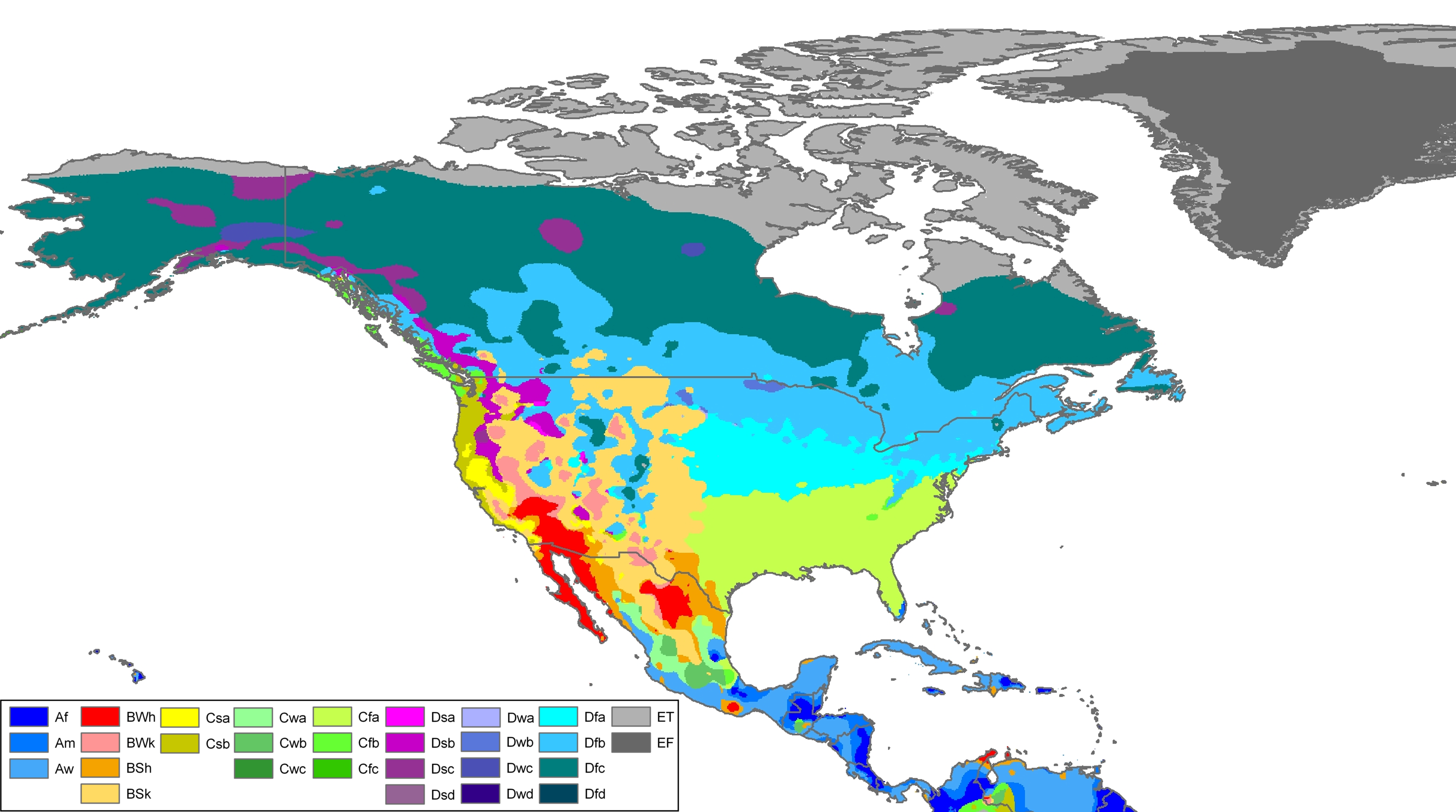
[edit]Located in the steppe region known as the Palliser's Triangle, Brooks has a semi-arid climate (Köppen climate classification BSk).[43] Winters are quite dry and cold, with little snowfall compared to the rest of Canada.[44] Chinook winds, though less common than in areas west and especially southwest of Brooks, are still common and ameliorate the cold winter temperatures temporarily when they pass over. Wide diurnal temperature ranges are regular, due to the aridity and moderately high elevation. Low humidity is prevalent throughout the year. Most of the relatively scant annual precipitation occurs in late spring and summer, often in the form of thunderstorms. On average, the coldest month is January, with an average temperature of −9.5 °C (14.9 °F) while the warmest is July, with an average temperature of 19.0 °F (−7.2 °C). The driest month is February, with an average monthly precipitation of 6.7 mm (0.26 in), while the wettest month is June, with an average of 75.6 mm (2.98 in). Annual precipitation is low, with an average of 299.5 mm (11.79 in).[45]
| Climate data for Brooks, 1991–2020 normals, extremes 1912–present | |||||||||||||
|---|---|---|---|---|---|---|---|---|---|---|---|---|---|
| Month | Jan | Feb | Mar | Apr | May | Jun | Jul | Aug | Sep | Oct | Nov | Dec | Year |
| Record high humidex | 14.6 | 17.8 | 26.4 | 29.6 | 33.9 | 39.8 | 41.9 | 39.6 | 36.0 | 31.0 | 24.5 | 16.0 | 41.9 |
| Record high °C (°F) | 17.8 (64.0) |
18.5 (65.3) |
26.6 (79.9) |
31.1 (88.0) |
35.6 (96.1) |
37.2 (99.0) |
40.0 (104.0) |
38.9 (102.0) |
36.1 (97.0) |
33.3 (91.9) |
24.4 (75.9) |
20.0 (68.0) |
40.0 (104.0) |
| Mean daily maximum °C (°F) | −3.4 (25.9) |
−0.5 (31.1) |
4.7 (40.5) |
12.8 (55.0) |
18.9 (66.0) |
22.6 (72.7) |
26.9 (80.4) |
26.1 (79.0) |
20.7 (69.3) |
12.9 (55.2) |
3.9 (39.0) |
−2.7 (27.1) |
11.9 (53.4) |
| Daily mean °C (°F) | −9.5 (14.9) |
−7.0 (19.4) |
−1.9 (28.6) |
5.4 (41.7) |
11.3 (52.3) |
15.6 (60.1) |
19.0 (66.2) |
18.1 (64.6) |
12.8 (55.0) |
5.5 (41.9) |
−2.5 (27.5) |
−8.8 (16.2) |
4.8 (40.7) |
| Mean daily minimum °C (°F) | −15.7 (3.7) |
−13.4 (7.9) |
−8.5 (16.7) |
−2.2 (28.0) |
3.6 (38.5) |
8.5 (47.3) |
11.1 (52.0) |
9.9 (49.8) |
4.8 (40.6) |
−1.9 (28.6) |
−8.8 (16.2) |
−14.8 (5.4) |
−2.3 (27.9) |
| Record low °C (°F) | −46.7 (−52.1) |
−43.9 (−47.0) |
−40.6 (−41.1) |
−25.0 (−13.0) |
−11.1 (12.0) |
−2.2 (28.0) |
1.7 (35.1) |
−1.1 (30.0) |
−11.1 (12.0) |
−24.4 (−11.9) |
−36.1 (−33.0) |
−47.2 (−53.0) |
−47.2 (−53.0) |
| Record low wind chill | −49.2 | −50.5 | −42.8 | −25.8 | −14.1 | −3.6 | 0.0 | 0.0 | −10.8 | −25.3 | −39.0 | −51.6 | −51.6 |
| Average precipitation mm (inches) | 10.6 (0.42) |
6.7 (0.26) |
15.9 (0.63) |
20.4 (0.80) |
36.5 (1.44) |
75.6 (2.98) |
32.4 (1.28) |
32.7 (1.29) |
28.7 (1.13) |
14.1 (0.56) |
14.6 (0.57) |
11.3 (0.44) |
299.5 (11.8) |
| Average rainfall mm (inches) | 0.4 (0.02) |
0.3 (0.01) |
3.3 (0.13) |
17.1 (0.67) |
38.9 (1.53) |
64.5 (2.54) |
44.9 (1.77) |
34.7 (1.37) |
34.6 (1.36) |
10.4 (0.41) |
2.9 (0.11) |
0.8 (0.03) |
252.8 (9.95) |
| Average snowfall cm (inches) | 14.1 (5.6) |
11.7 (4.6) |
22.0 (8.7) |
5.9 (2.3) |
2.1 (0.8) |
0.0 (0.0) |
0.0 (0.0) |
0.7 (0.3) |
0.5 (0.2) |
6.6 (2.6) |
16.7 (6.6) |
14.5 (5.7) |
94.8 (37.4) |
| Average precipitation days (≥ 0.2 mm) | 6.4 | 5.0 | 8.1 | 7.2 | 10.2 | 12.8 | 8.4 | 9.0 | 8.0 | 6.9 | 7.3 | 7.2 | 96.5 |
| Average rainy days (≥ 0.2 mm) | 0.18 | 0.18 | 2.2 | 5.6 | 9.6 | 11.9 | 9.9 | 8.4 | 8.0 | 4.7 | 1.6 | 0.57 | 62.8 |
| Average snowy days (≥ 0.2 cm) | 5.0 | 4.2 | 5.8 | 1.6 | 0.55 | 0.0 | 0.0 | 0.1 | 0.19 | 1.5 | 5.0 | 5.1 | 29.0 |
| Average relative humidity (%) (at 3pm) | 69.6 | 63.9 | 54.7 | 40.4 | 38.8 | 45.2 | 39.4 | 38.9 | 41.4 | 47.3 | 61.5 | 69.6 | 50.9 |
| Mean monthly sunshine hours | 91.6 | 114.9 | 158.3 | 215.1 | 266.3 | 290.2 | 338.8 | 302.1 | 200.9 | 169.7 | 105.8 | 75.1 | 2,328.9 |
| Percentage possible sunshine | 34.7 | 41.1 | 43.1 | 52.1 | 55.6 | 59.1 | 68.4 | 67.1 | 52.8 | 50.8 | 39.0 | 30.0 | 49.5 |
| Source: Environment Canada[45](rain/rain days, snow/snow days 1981–2010)[46][47][48] (Sunshine 1961–1990)[49] | |||||||||||||
Economy
[edit]The base of the economy of the City of Brooks is energy (oil and gas) and agriculture,[50] with other sectors including metal manufacturing,[51] food processing and construction.[50] It is also a retail and service centre for the surrounding area.[50]
Canada’s second largest beef-processing facility, owned by JBS Canada,[52] is located in Brooks and ships meat across the country and internationally. In 2012, while the plant was owned by XL Foods, it released meat contaminated with E. coli, and was shut down for a month.[53][54] The plant has over 2000 employees.[55]
Attractions
[edit]The JBS Leisure Centre is the area's main recreation centre. It includes one arena, a curling rink, an aquatic centre with a waterslide and wave pool, a gymnasium, a fitness centre, and multipurpose rooms. The complex was renovated in 2005 and again in 2016. Now the Brooks Public Library is within the JBS Leisure Centre.
In 2010, the Duke of Sutherland Park was redeveloped. It features baseball diamonds, a soccer field, a playground and a 3,200 ft2 (300 m2) waterpark with spray features for toddlers and a play structure for older children.
Also in 2010, the Centennial Regional Arena was completed after nearly a decade of planning and 18 months of construction. The multi-purpose facility seats 1,704 people. It includes corporate boxes, a running track, concessions, and a 200 ft × 85 ft (61 m × 26 m) surface. The arena is home to several user groups, including the Brooks Bandits. The arena also hosted the 2019 National Junior A Championship.
There are three provincial parks in the area: Dinosaur Provincial Park, a World Heritage Site, to the northeast, Tillebrook Provincial Park to the east and Kinbrook Island Provincial Park to the south. In addition, there are several other recreational sites in the area including the Rolling Hills Reservoir, Crawling Valley Reservoir, and Emerson Bridge.
The Brooks Aqueduct southeast of Brooks was built to transport irrigation water across the Eastern Irrigation District. It spans across a 3.2 km (2.0 mi) valley, about 20 m (66 ft) above the ground.
Sports
[edit]Brooks is home to the Brooks Bandits of the British Columbia Junior Hockey League.[56] The ice hockey team was awarded to Brooks in 1998 and embarked on its first season in 2000.[56] They have helped produce current NHL players such as Cale Makar (Colorado Avalanche) and Chad Johnson. The Bandits won the league championship in 2012,[57] 2013,[58] 2016,[59] 2017[60] and 2019.[61] They won their first national championship (The Royal Bank Cup) in 2013[58] and repeated again by winning the National Junior A Championship in 2019.[62] They have repeated in 2022 and 2023 after the COVID 19 pandemic suspended two seasons.
There are three football teams in Brooks: from the public schools the Roadrunners, and the Buffalos and the Crusaders from the catholic schools. The teams comprise players from the local junior and senior high schools respectively. The Buffalos represented Brooks at provincial championships in 1989, 1995, 1997, and 2009, winning in the title in its last three appearances. The Roadrunners appeared at provincial championships in 1995, 2004, 2007, 2014, and 2016 . The Crusaders have appeared in the provincial finals three times, 2015, 2016 and 2018, winning in 2018.[citation needed]
Brooks is home to a Western Canadian Baseball League franchise named the Brooks Bombers. They play at Elks Field in the Quad Ball Diamond Complex.[63]
Government
[edit]Brooks City Council consists of one mayor and six councillors.[3] In August 2021, former Mayor Barry Morishita stepped down from the position of mayor to run for leadership of the Alberta Party.[64] John Petrie was elected as Mayor in October 2023.
Education
[edit]Brooks has three high schools, three junior high schools, five elementary schools, three primary schools, and two alternative schools.[65] The schools are operated by Grasslands Public Schools, Christ the Redeemer School Division (Catholic) and Francosud (Francophone). Brooks also has a satellite campus of Medicine Hat College. The Brooks Public Library was established in 1951.
Health care
[edit]Acute medical care is provided at the Brooks Health Centre. The Brooks Health Centre is under the Alberta Health Services which provides health to most of Alberta
Media
[edit]Brooks is served by two radio stations, CIBQ-FM (105.7 Real Country), and CIXF-FM (Boom 101.1). Both stations are owned by Stingray Group.
Brooks has two distinct newspapers. The Brooks Bulletin is published every Tuesday, and has served Brooks and the County of Newell since 1910. It has a weekly circulation of 4,332.[66]
The Weekend Regional is a second paper the Bulletin established in 2004 and it is published on Fridays. As of January 2010, it became a total market coverage product with a weekly circulation of 11,235.[66]
Notable people
[edit]- Sheri Forde, TSN Toronto reporter[67]
- Little Miss Higgins, folk and blues singer
- Ryan Peake, a member of rock band Nickelback
- Sherraine Schalm, Olympic fencer
- Harnarayan Singh, NHL broadcaster
- Monte Solberg, former federal cabinet minister, current political columnist for Sun Media
- Barry Morishita, former mayor of Brooks.
- Ajou Ajou, current football player for the Indianapolis Colts
See also
[edit]Notes
[edit]- ^ Statistic includes all persons that did not make up part of a visible minority or an indigenous identity.
- ^ Statistic includes total responses of "Filipino" and "Southeast Asian" under visible minority section on census.
- ^ Statistic includes total responses of "Chinese", "Korean", and "Japanese" under visible minority section on census.
- ^ Statistic includes total responses of "West Asian" and "Arab" under visible minority section on census.
- ^ Statistic includes total responses of "Visible minority, n.i.e." and "Multiple visible minorities" under visible minority section on census.
References
[edit]- ^ "History of Brooks". City of Brooks. Archived from the original on April 14, 2011. Retrieved June 9, 2012.
- ^ a b c d "Location and History Profile: City of Brooks" (PDF). Alberta Municipal Affairs. June 17, 2016. p. 8. Retrieved June 18, 2016.
- ^ a b "Municipal Officials Search". Alberta Municipal Affairs. May 9, 2019. Retrieved October 1, 2021.
- ^ a b c d "Population and dwelling counts: Canada, provinces and territories, and census subdivisions (municipalities)". Statistics Canada. February 9, 2022. Retrieved February 9, 2022.
- ^ "Alberta Private Sewage Systems 2009 Standard of Practice Handbook: Appendix A.3 Alberta Design Data (A.3.A. Alberta Climate Design Data by Town)" (PDF) (PDF). Safety Codes Council. January 2012. pp. 212–215 (PDF pages 226–229). Archived from the original (PDF) on October 16, 2013. Retrieved October 8, 2013.
- ^ a b 2015 Municipal Affairs Population List (PDF). Alberta Municipal Affairs. ISBN 978-1-4601-2630-1. Retrieved February 27, 2016.
- ^ "Census Subdivision (Municipal) Population Estimates, July 1, 2016 to 2020, Alberta". Alberta Municipal Affairs. March 23, 2021. Retrieved October 8, 2021.
- ^ Delday, Eva (1975). Brooks : between the Red Deer and the Bow. Brooks, Alberta. p. 30. ISBN 0-919212-60-3. Archived from the original on September 24, 2015. Retrieved May 31, 2013.
{{cite book}}: CS1 maint: location missing publisher (link) - ^ a b "Table I: Area and Population of Canada by Provinces, Districts and Subdistricts in 1911 and Population in 1901". Census of Canada, 1911. Vol. I. Ottawa: Government of Canada. 1912. pp. 2–39.
- ^ a b "Table 10: Population and Dwelling Counts, for Census Divisions, Census Subdivisions (Municipalities) and Designated Places, 1991 and 1996 Censuses – 100% Data". 96 Census. Vol. A National Overview – Population and Dwelling Counts. Ottawa: Statistics Canada. 1997. pp. 136–146. ISBN 0-660-59283-5.
- ^ "Types of Municipalities in Alberta". Alberta Municipal Affairs. Archived from the original on 2010-12-04. Retrieved 2012-05-11.
- ^ "2005 Official Population List" (PDF). Alberta Municipal Affairs. November 28, 2005. Retrieved 2012-05-11.
- ^ "2010 Centennial". City of Brooks. Archived from the original on 2011-02-07. Retrieved 2009-07-07.
- ^ "Table I: Population of Manitoba, Saskatchewan, and Alberta by Districts, Townships, Cities, Towns, and Incorporated Villages in 1916, 1911, 1906, and 1901". Census of Prairie Provinces, 1916. Vol. Population and Agriculture. Ottawa: Government of Canada. 1918. pp. 77–140.
- ^ "Table 8: Population by districts and sub-districts according to the Redistribution Act of 1914 and the amending act of 1915, compared for the census years 1921, 1911 and 1901". Census of Canada, 1921. Ottawa: Government of Canada. 1922. pp. 169–215.
- ^ "Table 7: Population of cities, towns and villages for the province of Alberta in census years 1901–26, as classed in 1926". Census of Prairie Provinces, 1926. Vol. Census of Alberta, 1926. Ottawa: Government of Canada. 1927. pp. 565–567.
- ^ "Table 12: Population of Canada by provinces, counties or census divisions and subdivisions, 1871–1931". Census of Canada, 1931. Ottawa: Government of Canada. 1932. pp. 98–102.
- ^ "Table 4: Population in incorporated cities, towns and villages, 1901–1936". Census of the Prairie Provinces, 1936. Vol. I: Population and Agriculture. Ottawa: Dominion Bureau of Statistics. 1938. pp. 833–836.
- ^ "Table 10: Population by census subdivisions, 1871–1941". Eighth Census of Canada, 1941. Vol. II: Population by Local Subdivisions. Ottawa: Dominion Bureau of Statistics. 1944. pp. 134–141.
- ^ "Table 6: Population by census subdivisions, 1926–1946". Census of the Prairie Provinces, 1946. Vol. I: Population. Ottawa: Dominion Bureau of Statistics. 1949. pp. 401–414.
- ^ "Table 6: Population by census subdivisions, 1871–1951". Ninth Census of Canada, 1951. Vol. I: Population, General Characteristics. Ottawa: Dominion Bureau of Statistics. 1953. p. 6.73–6.83.
- ^ "Table 6: Population by sex, for census subdivisions, 1956 and 1951". Census of Canada, 1956. Vol. Population, Counties and Subdivisions. Ottawa: Dominion Bureau of Statistics. 1957. p. 6.50–6.53.
- ^ "Table 6: Population by census subdivisions, 1901–1961". 1961 Census of Canada. Series 1.1: Historical, 1901–1961. Vol. I: Population. Ottawa: Dominion Bureau of Statistics. 1963. p. 6.77–6.83.
- ^ "Population by specified age groups and sex, for census subdivisions, 1966". Census of Canada, 1966. Vol. Population, Specified Age Groups and Sex for Counties and Census Subdivisions, 1966. Ottawa: Dominion Bureau of Statistics. 1968. p. 6.50–6.53.
- ^ "Table 2: Population of Census Subdivisions, 1921–1971". 1971 Census of Canada. Vol. I: Population, Census Subdivisions (Historical). Ottawa: Statistics Canada. 1973. p. 2.102–2.111.
- ^ "Table 3: Population for census divisions and subdivisions, 1971 and 1976". 1976 Census of Canada. Census Divisions and Subdivisions, Western Provinces and the Territories. Vol. I: Population, Geographic Distributions. Ottawa: Statistics Canada. 1977. p. 3.40–3.43.
- ^ "Table 4: Population and Total Occupied Dwellings, for Census Divisions and Subdivisions, 1976 and 1981". 1981 Census of Canada. Vol. II: Provincial series, Population, Geographic distributions (Alberta). Ottawa: Statistics Canada. 1982. p. 4.1–4.10. ISBN 0-660-51095-2.
- ^ "Table 2: Census Divisions and Subdivisions – Population and Occupied Private Dwellings, 1981 and 1986". Census Canada 1986. Vol. Population and Dwelling Counts – Provinces and Territories (Alberta). Ottawa: Statistics Canada. 1987. p. 2.1–2.10. ISBN 0-660-53463-0.
- ^ "Table 2: Population and Dwelling Counts, for Census Divisions and Census Subdivisions, 1986 and 1991 – 100% Data". 91 Census. Vol. Population and Dwelling Counts – Census Divisions and Census Subdivisions. Ottawa: Statistics Canada. 1992. pp. 100–108. ISBN 0-660-57115-3.
- ^ "Population and Dwelling Counts, for Canada, Provinces and Territories, and Census Divisions, 2001 and 1996 Censuses – 100% Data (Alberta)". Statistics Canada. Retrieved 2012-04-02.
- ^ "Population and dwelling counts, for Canada, provinces and territories, and census subdivisions (municipalities), 2011 and 2006 censuses". Statistics Canada. February 8, 2012. Retrieved 2012-02-08.
- ^ "Population and dwelling counts, for Canada, provinces and territories, and census subdivisions (municipalities), 2006 and 2001 censuses – 100% data (Alberta)". Statistics Canada. January 6, 2010. Retrieved 2012-04-02.
- ^ a b "Population and dwelling counts, for Canada, provinces and territories, and census subdivisions (municipalities), 2016 and 2011 censuses – 100% data (Alberta)". Statistics Canada. February 8, 2017. Retrieved February 8, 2017.
- ^ "Alberta 2009 Official Population List" (PDF). Alberta Municipal Affairs. September 15, 2009. Retrieved September 11, 2015.
- ^ "Brooks Hosts Premiere of Documentary". City of Brooks. August 26, 2011. Retrieved 2011-10-24.[permanent dead link]
- ^ "24 Days in Brooks" (48 min.). Documentary film. National Film Board of Canada. 2007. Retrieved August 7, 2012.
- ^ Government of Canada, Statistics Canada (2022-10-26). "Census Profile, 2021 Census of Population". www12.statcan.gc.ca. Retrieved 2023-04-01.
- ^ Government of Canada, Statistics Canada (2021-10-27). "Census Profile, 2016 Census". www12.statcan.gc.ca. Retrieved 2023-04-01.
- ^ Government of Canada, Statistics Canada (2015-11-27). "NHS Profile". www12.statcan.gc.ca. Retrieved 2023-04-01.
- ^ Government of Canada, Statistics Canada (2019-08-20). "2006 Community Profiles". www12.statcan.gc.ca. Retrieved 2023-04-01.
- ^ Government of Canada, Statistics Canada (2019-07-02). "2001 Community Profiles". www12.statcan.gc.ca. Retrieved 2023-04-01.
- ^ "Map: Natural Regions and Subregions of Alberta". Archived from the original on July 6, 2011. Retrieved August 16, 2010.
- ^ "Köppen Climate Classification Map of North America". Archived from the original on September 10, 2013. Retrieved August 16, 2010.
- ^ "Atlas of Canada Map: Annual Average Snowfall in Canada". Archived from the original on February 10, 2009. Retrieved 2010-08-16.
- ^ a b "Canadian Climate Normals 1991–2020". Environment and Climate Change Canada. Retrieved June 1, 2024.
- ^ "Canadian Climate Normals 1981–2010". Environment and Climate Change Canada. Retrieved June 1, 2024.
- ^ "Canadian Climate Normals 1971–2000". Environment Canada. 19 January 2011. Retrieved 19 November 2016.
- ^ "Brooks 1". Environment Canada. 31 October 2011. Retrieved 19 November 2016.
- ^ "Canadian Climate Normals 1961–1990". Environment Canada. 9 February 2011. Retrieved 19 November 2016.
- ^ a b c "City of Brooks Business & Community Profile: Economy". City of Brooks. Archived from the original on December 7, 2013. Retrieved 2012-10-27.
- ^ "City of Brooks Business & Community Profile: Manufacturing Industry". City of Brooks. Archived from the original on December 7, 2013. Retrieved 2012-10-27.
- ^ "JBS to buy XL Foods plant in Brooks, Alta". CBC News. Retrieved January 10, 2013.
- ^ D'Aliesio, Renata (October 23, 2012). "XL Foods back in business with air of guarded optimism". The Globe and Mail. Retrieved October 25, 2012.
- ^ McClure, Matt (October 25, 2012). "Operations to resume at XL plant next week". Calgary Herald. Archived from the original on January 19, 2013. Retrieved October 25, 2012.
- ^ "Morale good as 2,000 XL Foods employees go back to work | Food Safety First". Foodsafetyfirst.ca. Retrieved 2017-04-30.
- ^ a b "The "Bandits" Beginning". Alberta Junior Hockey League. Archived from the original on February 20, 2012. Retrieved 2012-05-11.
- ^ "Brooks Bandits Win 2012 Enerflex Cup Finals". Alberta Junior Hockey League. April 12, 2012. Archived from the original on August 25, 2012. Retrieved 2012-05-11.
- ^ a b "Bandits Win 2013 RBC Cup National Championship". Alberta Junior Hockey League. May 19, 2013. Archived from the original on 2016-01-09. Retrieved 2013-05-19.
- ^ "Brooks Bandits Win 2016 Gas Drive Cup". www.ajhl.ca. Archived from the original on 2021-12-05. Retrieved 2019-09-25.
- ^ "Brooks Bandits Repeat as League Champions, Makar Named MVP". www.ajhl.ca. Archived from the original on 2021-12-05. Retrieved 2019-09-25.
- ^ "Brooks Bandits Win 2019 Inter Pipeline Cup as AJHL Champions". www.ajhl.ca. Archived from the original on 2019-12-18. Retrieved 2019-09-25.
- ^ "Brooks Bandits Win 2019 National Jr A Championship". www.ajhl.ca. Archived from the original on 2019-12-18. Retrieved 2019-09-25.
- ^ brooksbombers.com
- ^ "Brooks mayor to run for leader of Alberta Party". CBC. Aug 17, 2021. Retrieved August 4, 2023.
- ^ Sanchez, Rose (October 25, 2012). "Progress being made on planning for new school in Brooks". Prairie Post. Archived from the original on October 2, 2015. Retrieved December 29, 2012.
- ^ a b "Alberta Weekly Newspapers Association". Awna.com. March 23, 2004. Retrieved 2012-06-10.
- ^ "Sheri Forde official bio". TSN. November 8, 2009. Archived from the original on August 25, 2009. Retrieved 2009-11-08.
External links
[edit]Places adjacent to Brooks, Alberta | |
|---|---|
Subdivisions of Alberta | |
|---|---|
| Subdivisions | |
| Communities | |
| Cities and urban service areas | |
| Geographic | |
|---|---|
| Other | |
Brooks, Alberta
View on GrokipediaHistory
Founding and Early Settlement
The territory encompassing modern Brooks was historically utilized by Blackfoot Confederacy peoples, including the Blood and Siksika bands, as a bison-hunting ground prior to European contact.[4] [5] Archaeological evidence, such as arrowheads and bison remains, indicates long-term occupation, with the near-extirpation of bison herds by the 1870s disrupting traditional economies.[5] Treaty 7, signed on September 22, 1877, at Blackfoot Crossing on the Bow River, ceded approximately 130,000 square kilometers of southern Alberta to the Crown, facilitating ranching leases of up to 100,000 acres at one cent per acre starting in 1881.[4] The Canadian Pacific Railway's main line, surveyed in 1882 and completed through the area in 1883, provided critical infrastructure for settlement by transporting goods and enabling rancher access to markets.[4] [5] Initial European activity focused on ranching, with stockyards established near the rail line in 1902 to handle cattle shipments. In 1904, Ernest Morden Crooker constructed the first store adjacent to these stockyards, marking the nucleus of the settlement.[4] [5] That same year, Canada Post sponsored a naming contest for the unnamed post office site, selecting "Brooks" in honor of Noel Edgell Brooks (1865–1926), a Canadian Pacific Railway divisional engineer based in Calgary from 1903 to 1913; the post office opened on December 1, 1904, initially as Brooks Station.[1] [5] [6] By 1907, the site had been surveyed as a townsite with nine residents, supported by basic commerce aimed at homesteaders.[4] Population growth accelerated after the harsh 1906–1907 winter reduced competition from larger ranches, drawing more settlers via railway promotion. The community incorporated as a village on July 14, 1910, reflecting its transition from a rail-adjacent outpost to a formalized agrarian hub.[4] [5] Early infrastructure emphasized rail-dependent trade, with irrigation developments, such as the Brooks Aqueduct completed in 1915, later bolstering dryland farming viability in the shortgrass prairie.[5]Railroad Era and Incorporation
The arrival of the Canadian Pacific Railway (CPR) in the late 19th century catalyzed settlement in the Brooks area, establishing it as a flag stop for cattle shipping along the main line from Medicine Hat to Calgary, which had been constructed between 1882 and 1883.[7][8] The site, initially known for its role in facilitating ranching transport, attracted homesteaders and contributed to regional economic ties through rail connectivity, with the CPR's infrastructure enabling efficient movement of goods and people across southern Alberta's prairie landscape.[1] By 1904, the establishment of a post office—named after Noel Edgell Brooks, the CPR's divisional engineer—marked formal recognition of the growing community, spurring further immigration and land development under federal encouragement for prairie settlement.[5][1] This railroad-driven expansion laid the groundwork for municipal organization, as the influx of settlers necessitated local governance. On July 14, 1910, the community was incorporated as a village, reflecting its transition from a transient rail siding to a structured settlement with basic administrative functions.[1][9] Just over a year later, on September 8, 1911, it advanced to town status, coinciding with a recorded population of 486 residents in the 1911 Census of Canada, underscoring the rapid growth fueled by rail access and agricultural prospects.[10] Incorporation enabled the town to manage services like infrastructure maintenance tied to the railway and early irrigation projects, such as the subsequent Brooks Aqueduct initiated by the CPR in 1914 to support farming expansion.[9][7]Post-War Growth and Industrial Expansion
Following World War II, Brooks benefited from Alberta's broader agricultural resurgence, driven by mechanization, favorable commodity prices, and demand for food exports, which spurred local farming expansion within the Eastern Irrigation District. The district, established in 1935 after the Canadian Pacific Railway transferred control of irrigation works to local farmers, irrigated approximately 300,000 acres by the mid-20th century, enabling reliable production of grains, forage crops, and livestock in the previously arid shortgrass prairie region. This infrastructure supported steady economic activity, with Brooks serving as a regional hub for grain handling and farm supply services.[1] Population growth reflected these opportunities, rising from 888 residents in the 1941 census to 2,087 by 1961, roughly doubling over two decades amid provincial trends of veteran resettlement and rural prosperity.[6][11] Industrial expansion remained limited during this era, primarily involving auxiliary agribusiness such as feed mills and equipment repair shops, rather than large-scale manufacturing, as the local economy centered on primary agriculture without significant diversification until later decades.[1] By the late 1960s, foundational investments in irrigation maintenance and crop research at facilities like the Provincial Horticultural Station (established 1935) laid groundwork for enhanced productivity, though major booms in oil, gas, and processing arrived in the 1970s.[12][1]Meatpacking Boom and Demographic Shifts
The expansion of Lakeside Packers, Brooks' primary meat processing facility, marked the onset of a significant boom in the local meatpacking sector during the mid-1990s. Originally established with a feedlot in 1966 and initial packing operations in the 1970s, the plant underwent major upgrades, including the opening of a boxed beef processing line in 1997 following investment from IBP (now part of JBS), and the addition of a second shift in October 1998.[13][14] These developments increased production capacity and employment needs, positioning Brooks as a key hub for beef processing in Alberta, where the plant now slaughters thousands of cattle daily.[15] The labor demands of this expansion outstripped local availability, prompting aggressive recruitment of immigrant workers, including temporary foreign workers and resettled refugees, who accepted entry-level wages and arduous conditions shunned by many Canadian-born residents.[16][17] Brooks' population crossed 10,000 for the first time in 1996, directly fueled by the influx tied to Lakeside's growth, rising from approximately 9,400 in 1991 to sustain the sector's requirements.[1] This period aligned with broader industry shifts, including the closure of competing plants like Canada Packers in 1991, which consolidated operations and heightened reliance on low-cost migrant labor in Alberta.[17] Demographically, the boom catalyzed a rapid diversification, with Brooks transitioning from a largely homogeneous, Anglo-Canadian prairie town to a multicultural enclave. The immigrant population surged from 640 in 1991 to 2,080 by 2006, comprising workers from over 100 countries, including sizable communities from Sudan, Somalia, the Philippines, and Latin America.[18][14] By the 2021 census, immigrants accounted for 37.1% of the city's residents—41.8% economic-class, 16.4% family-class, and 41.5% refugees—far exceeding provincial averages, while refugees formed 18% of Alberta's meatpacking workforce despite representing only 2.6% of the general population.[19][20] This composition reflected meatpackers' strategic use of immigration pathways, amplified by the 2001 Immigration and Refugee Protection Act, to meet chronic staffing shortfalls in a sector where 72% of workers province-wide are immigrants.[14][16] These shifts imposed strains on infrastructure, including acute housing shortages and expanded demands for multilingual services, while fostering economic vitality through population growth averaging 1.64% annually from 2001 to 2016.[21][22] The meatpacking workforce's diversity, drawn by job availability rather than local amenities, underscored causal links between industrial expansion and settlement patterns, with refugees and temporary migrants comprising a disproportionate share due to their willingness to endure high-risk, physically demanding roles.[20][23]Geography
Location and Physical Features
Brooks is located in southeastern Alberta, Canada, within the County of Newell, at coordinates 50°34′ N, 111°54′ W.[24] The city sits along the Trans-Canada Highway (Highway 1), positioned approximately 185 km southeast of Calgary.[9] Its average elevation stands at 760 m above sea level.[25] The surrounding terrain belongs to Alberta's Grassland Natural Region, particularly the dry mixedgrass subregion, dominated by shortgrass prairie ecosystems.[26] This landscape features flat to gently undulating plains, with low hills and expansive open grasslands typical of the semi-arid interior plains.[9] Notable physical features include proximity to Lake Newell, Alberta's largest artificial lake serving as a key irrigation reservoir, located nearby to the south.[9] The Bow River lies about 46 km northwest, supporting regional water diversion via the Brooks Aqueduct, which channels water across valleys for agricultural use in the otherwise dry prairie setting.[9]Climate and Environmental Conditions
Brooks lies within the Grassland Natural Region of Alberta, featuring a dry mixedgrass and shortgrass prairie ecosystem adapted to semi-arid conditions, periodic droughts, grazing, and fire. Vegetation primarily consists of drought-tolerant shortgrasses such as Bouteloua gracilis and Stipa comata, interspersed with forbs, lichens, mosses, and low shrubs, supporting a biodiversity reliant on disturbance regimes for maintenance.[26][27] The climate is classified as cold semi-arid (Köppen BSk), with cold winters, warm summers, low annual precipitation, and significant seasonal temperature variations. According to Environment and Climate Change Canada normals for 1991–2020, the annual mean temperature is 4.5 °C, with January averaging -10.2 °C (high -4.8 °C, low -15.6 °C) and July 18.4 °C (high 26.5 °C, low 10.3 °C). Precipitation totals 398.3 mm annually, predominantly as summer rainfall (309.0 mm), while snowfall measures 88.5 cm, concentrated from November to March.[28] June is the wettest month at 78.9 mm, supporting prairie growth, whereas February receives only 12.3 mm, contributing to dry conditions prone to wind erosion. Chinook winds, warm downslope flows from the Rocky Mountains, episodically raise temperatures rapidly, accelerating snowmelt and exacerbating drought risks in this low-evapotranspiration-limited region. Wind speeds average higher in spring (e.g., April around 16.7 km/h), fostering occasional dust events in bare soils, though severe storms like hail and high winds (up to 110 km/h recorded) pose additional hazards.[28][29][30] Extreme temperatures range from rarely below -30 °C to above 33 °C, reflecting continental influences with low humidity (muggy days <1% annually) and variable cloud cover, clearest in summer. These conditions shape agricultural viability, with irrigation often necessary due to precipitation deficits relative to potential evapotranspiration.[29]Demographics
Population Dynamics and Growth Trends
The population of Brooks experienced steady expansion from the early 2000s onward, averaging 1.64% annual growth between 2001 and 2016, reflecting economic expansion in processing industries that drew migrant labor.[21] This period saw incremental increases, with the community transitioning from town to city status in 2005 upon surpassing 10,000 residents, driven by job opportunities rather than broad regional migration.[25] Census data indicate a population of 14,451 in 2016, rising to 14,924 by 2021—a 3.3% increase over the intercensal period, below Alberta's provincial average amid stable but modest domestic inflows.[31] Growth accelerated post-2021, with Alberta estimates placing the figure at 16,918 in 2024, reflecting a 12.2% rise over the prior five years and a 5.57% year-over-year gain, attributable to heightened international immigration for industrial employment.[2] Key to these dynamics has been net immigration, comprising 37.1% foreign-born residents in 2021, with notable surges such as 2,205 arrivals between 2011 and 2016 tied to labor demands in meatpacking.[32][21] Natural increase and interprovincial movement contributed marginally, underscoring reliance on external workers amid low local birth rates and limited appeal to urban relocators from larger Canadian centers. Projections suggest continued upward trajectory if economic conditions persist, though vulnerability to industry fluctuations remains evident from prior stabilization phases.[2]Ethnic Diversity and Immigration Patterns
In the 2021 Canadian census, 37.1% of Brooks' population of approximately 14,640 residents were immigrants, comprising 5,430 individuals, with an additional 2.4% classified as non-permanent residents.[32] This marks a significant increase from 1991, when immigrants numbered only 640, reflecting labor demands in the local meatpacking sector that drew workers from abroad to fill shortages.[18] Visible minorities constituted 48.4% of the population, the highest proportion in Alberta, primarily comprising Black (predominantly from African origins) and Filipino groups, alongside smaller South Asian (205 individuals) and Chinese (320 individuals) communities.[33][34] Over 100 languages are spoken in the city, earning it the nickname "City of 100 Hellos," with non-official mother tongues reported by 4,895 residents, compared to 9,000 for English.[21][35] Immigration patterns have been shaped by economic pull factors, particularly the expansion of meatpacking plants like Lakeside Packers (now JBS Foods) since the late 1990s, which recruited internationally to sustain operations amid domestic labor gaps.[14] A notable early wave from 2000 onward involved approximately 3,500 refugees, mainly from sub-Saharan Africa including Sudan, Somalia, and Ethiopia, who settled for employment opportunities and now represent a substantial portion of the workforce—refugees alone form 18% of Alberta's meatpacking employees despite comprising just 2.6% of the provincial population.[14][20] The top countries of birth for all immigrants in 2021 were the Philippines (1,535 or 28.3%), Ethiopia (585 or 10.8%), and Somalia (475 or 8.7%), with recent immigrants (2016–2021, totaling 1,850 or 34% of immigrants) showing similar dominance by the Philippines (505), alongside rising numbers from Ethiopia and Eritrea (both 270).[32]| Top Places of Birth for Immigrants in Brooks (2021) | Count | Percentage of Immigrants |
|---|---|---|
| Philippines | 1,535 | 28.3% |
| Ethiopia | 585 | 10.8% |
| Somalia | 475 | 8.7% |