
Community hub
Recent from talks
Contribute something
Nothing was collected or created yet.
Challakere
View on WikipediaThis article needs additional citations for verification. (January 2024) |
Challakere is a city, municipality, and taluk in Chitradurga district in the state of Karnataka, India.
Key Information

Geography
[edit]Challakere is located at 14°18′43″N 76°39′04″E / 14.312°N 76.651°E.[2] It has an average elevation of 585 metres (1919 ft).
Demographics
[edit]Challakere is the largest taluk of Chitradurga District. As of 2011[update] India census,[3] Challakere has a population of 55,194.
Science and research organizations
[edit]Challakere is 200 km from Bangalore where an integrated township spread over 8,000 acres (32 km2) has been set up by Indian Space Research Organization (ISRO), Defence Research and Development Organization (DRDO), Indian Institute of Science (IISc) and Bhabha Atomic Research Centre (BARC).[4][5][6]

Oil industry
[edit]It is the second largest producer/supplier of edible oil after Mumbai. There are as many as 60+ oil industries in Challakere. Not only oil, several other industries like dal, fried gram, rice, etc. are also present. The commercial activity in the town is comparable to that of a standard district and the district enjoys a huge business turnover out of town's business.
Spiritual places
[edit]- Nayakanahatti Sri Thipperudraswamy Temple.
- Datta Mandira – located in Tyagaraja Nagar, and traditional practices of Datta Sampradaya, can be seen at this temple.
- Jagalurajja temple (Ajjana Gudi) – located beside the Ajjana Kere, which is the main water source for surrounding wells and drinking water for challakere.
- Challekeramma temple – Challakeramma Jathre is conducted once every five years.
- Bhavani Shankara temple – situated at Lakshmipura, was bought from Varanasi more than 200 years back without being kept on the floor to maintain the sanctity of the idol.[citation needed]
Transport
[edit]Challakere is well connected to Bangalore, Ballari and Chitradurga by road. The National Highway 150A (India) that connects Chamarajanagara to Jevargi passes through the town. Challakere is 30 km from its district headquarter, Chitradurga and 200 km from state capital Bangalore.
Challakere also has a railway station (Station Code:CHKE) under South Western Railway Zone of Indian Railways. It lies on Chikjajur – Ballari Line.
The nearest international airport, Kempegowda International Airport is 229 km from Challakere.
Education
[edit]- Pragati Vidyalaya
- Infant Jesus School
- Infant Jesus High School
- VEDA SCHOOL, Sanikere
- VEDA residential PU College, Sanikere
- Government Engineering College
- Government First Grade College
- Government P. U. College
- Government Tool Room And Training Centre (GTTC)
- Mahatma Gandhi English Medium High School (MGEMHS)
- Vinod English School (VES)
- Warriors English School
- Warriors P. U. College
- BMGHS
- Vasavi English Medium High School
Notable people
[edit]- C. K. Jaffer Sharief
- Ta Ra Subba Rao – renowned Kannada novelist
- Challakere Brothers – known for chanting of Vedas
Gallery
[edit]-
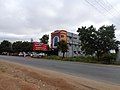
 Challakere Town
 -
 Rose Cafe
 -
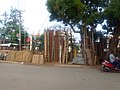 Bamboo Craft
 -
 Railway Station
 -
 Rathotsava
 -
 Warriors School
 -
 School Inspector Office
 -
 Gandharva Cafe
.jpg)
.jpg)
.jpg)
.jpg)


References
[edit]- ^ "Census Data 2011" (PDF). Retrieved 23 May 2024.
- ^ Falling Rain Genomics, Inc - Challakere
- ^ "Census of India 2001: Data from the 2001 Census, including cities, villages and towns (Provisional)". Census Commission of India. Archived from the original on 16 June 2004. Retrieved 1 November 2008.
- ^ "IISc Challakere Campus1". IISc.
- ^ "IISc Challakere Campus2". IISc.
- ^ "All Science & Research Organizations". NewIndianExpress.
- ^ "What the Vedas teach". The Hindu. 14 March 2011. Retrieved 31 October 2018.
External links
[edit]Challakere
View on GrokipediaHistory and Etymology
Historical Background
Challakere, located within Chitradurga district, has historical ties to broader regional developments under various ancient and medieval dynasties, primarily through its association with Chitradurga. Archaeological evidence, such as a rock-cut edict of Emperor Ashoka near Brahmagiri, indicates that the Chitradurga region, encompassing areas like Challakere, was part of the Mauryan Empire as early as the 3rd century BCE.[14] Following the Mauryas, the area came under the influence of the Satavahanas, Kadambas, Chalukyas of Badami, Rashtrakutas, Hoysalas, and Vijayanagara Empire, with local settlements governed by chieftains known as Palegars who managed regional affairs under these larger powers.[14] Although no major dynastic capitals or battles are recorded specifically in Challakere, its landscape served as grazing lands for cattle, notably through the establishment of Amrit Mahal Kavals during the Vijayanagara period in the 16th century to support the royal Amrit Mahal breed, an indigenous draught cattle developed for military logistics.[15] These kavals were formalized further in the 19th century under the Mysore Kingdom's Amrit Mahal establishment, which reserved semi-arid grasslands in regions like Challakere for conserving the endangered breed amid colonial pressures.[16] During the British colonial era, Challakere formed part of the Chitradurga district, which was administered as a key unit in the Madras Presidency before integration into the princely state of Mysore.[14] Post-independence in 1947, as part of the reorganization of states, Challakere was designated as a taluk headquarters within the enlarged Chitradurga district of the Mysore State (later Karnataka), facilitating local governance and revenue administration.[14] In the 1990s, administrative boundaries shifted when Davanagere district was carved out on August 15, 1997, from portions of Chitradurga, Bellary, and Shimoga districts, leaving Challakere firmly within the restructured Chitradurga district to streamline regional management.[17] A pivotal development in Challakere's rural history occurred through land reforms enacted in the 1960s and 1970s under the Karnataka Land Reforms Act of 1961, with significant amendments in 1974 that abolished tenancy and imposed ceilings on landholdings to redistribute surplus land to landless farmers.[18] These reforms profoundly shaped the local economy by transitioning from feudal tenancy systems to more equitable ownership, particularly benefiting smallholders in agrarian taluks like Challakere, though implementation challenges persisted in arid zones dependent on cattle grazing.[19]Etymology and Early Settlement
The name Challakere is derived from the Kannada words "Challa," referring to a historical chieftain or a local clan associated with shepherd communities, and "kere," meaning a tank, lake, or settlement area, collectively signifying "the place of Challa" or "Challa's land," often linked to early habitation near significant water bodies in the region.[20] Evidence of early human habitation in the Challakere area points to pastoral communities emerging between the 16th and 18th centuries, primarily centered on cattle herding in semi-arid grasslands. During the Vijayanagara Empire period, lands in the region were designated as kavals, or communal grazing commons, to support livestock, including the Amrit Mahal breed of cattle, which was vital for military and agricultural purposes under local rulers. These kavals facilitated the establishment of initial agricultural villages around natural and man-made tanks (keres), where communities practiced mixed pastoralism and dryland farming, laying the foundation for sustained settlement patterns.[21][15] Archaeologically, Challakere itself lacks major ancient sites, but minor findings in the surrounding Chitradurga district include Iron Age tools such as parallel-sided blades, microliths, and megalithic remnants from the early historic period, dating back to around 1000 BCE, which connect to broader Dravidian settlement patterns in central Karnataka. Prehistoric and Mesolithic artifacts, including cavlein-painted pottery pieces, have also been identified in the border areas near Challakere, indicating sporadic human activity predating organized pastoralism. These discoveries tie into the district's deeper history, which traces human presence to the 3rd millennium BCE through regional explorations.[22][23][14]Geography and Environment
Location and Topography
Challakere is situated at coordinates 14°18′43″N 76°39′04″E, with an average elevation of 585 meters above sea level. The urban area of the town encompasses 30.71 km², while the broader Challakere taluk covers 2,074 km².[24] These measurements highlight its position as a significant administrative and geographical unit within Chitradurga district, Karnataka. The topography of Challakere is characterized by hilly terrain typical of the Deccan Plateau, featuring undulating plains interspersed with low ranges of rocky hills. The region is surrounded by dry deciduous forests transitioning to thorny scrub vegetation, along with prominent rocky outcrops that contribute to its rugged landscape. Major water bodies in the area include several local tanks used for irrigation and water storage, and the entire region lies within the Vedavati River basin, which influences its hydrological features.[25] Administratively, Challakere taluk is bounded by Molakalmuru and Kudligi taluks to the north, Hiriyur taluk to the south, Chitradurga and Jagalur taluks to the west, and Andhra Pradesh to the east.[25] The town is located approximately 200 km northwest of Bengaluru, facilitating connectivity via National Highway 48. It operates under the postal index number (PIN) 577522 and falls within the vehicle registration series KA-16, managed by the Chitradurga Regional Transport Office.Climate and Ecology
Challakere experiences a semi-arid climate characterized by hot summers and mild winters, influenced by its location on the Deccan Plateau, which contributes to low humidity and variable rainfall patterns.[26] Summers peak in May with temperatures reaching up to 40°C, while winters from December to February maintain milder conditions between 15°C and 25°C.[27] Annual rainfall averages 500-600 mm, predominantly occurring during the southwest monsoon from June to September, supporting a seasonal rhythm of wet and dry periods.[28] Under the Köppen-Geiger classification, the region falls into the hot semi-arid category (BSh), reflecting its limited precipitation and high evaporation rates.[29] The ecology of Challakere is dominated by the Amrit Mahal Kaval grasslands, expansive protected areas spanning approximately 14,519 acres that have been reserved since the 19th century primarily for the conservation of the endangered Amrit Mahal cattle breed.[21] These grasslands, with a history exceeding 450 years, form a vital dryland ecosystem rich in biodiversity, including herbivores such as blackbuck (Antilope cervicapra) and predators like the Indian wolf (Canis lupus pallipes), alongside dry thorny shrubs adapted to the arid conditions.[15] The vegetation consists of native grasses and scattered acacia species, providing essential habitat and forage in this semi-arid landscape.[30] Groundwater availability in Challakere poses significant challenges due to the underlying rocky hard rock formations, such as granites and gneisses of the Precambrian terrain, which limit infiltration and storage through low secondary porosity.[31] Environmental concerns include soil erosion within the kavals, exacerbated by the thin, sandy loam soils and episodic heavy rains that strip away topsoil, threatening the grassland integrity.[32] As of 2025, nearly 10,000 acres of these kavals have been diverted for defense and research facilities, raising ongoing concerns about ecological degradation, biodiversity loss, and groundwater pollution affecting local pastoral communities.[33] Conservation efforts prior to 2009 focused on traditional community-managed protection of these commons, including the appointment of kavalgars (grassland guardians) to regulate grazing and prevent encroachment, preserving the ecological balance for centuries.[30]Demographics
Population Statistics
According to the 2011 Census of India, the urban population of Challakere town was 55,194, while the taluk's total population stood at 365,784, with the rural portion comprising 310,590 residents. The urban area had a population density of 1,797 persons per square kilometer, reflecting moderate congestion in a town covering approximately 30.71 square kilometers. The sex ratio in the urban area was 1,001 females per 1,000 males, and the overall literacy rate was 82.24 percent, higher than the taluk average of 69.22 percent.[2] The decadal population growth rate for Challakere town between 2001 and 2011 was 12.5 percent, lower than Karnataka's statewide urban growth of 31.54 percent during the same period but indicative of steady expansion. Children under 6 years constituted 10.43 percent of the urban population, totaling 5,758 individuals, highlighting a relatively young demographic profile.[2] Data based on the 2011 census; the 2021 census was postponed. Based on the town's historical average annual growth rate of approximately 1.2 percent (2001–2011), the urban population is projected to reach around 65,000 by 2025.[34] The urban-rural divide in Challakere taluk shows about 15 percent of the population residing in urban areas, with the remainder in rural settings. This split has been influenced by migration patterns, as individuals move to the town for employment in the edible oil industry and research facilities.| Key Demographic Indicator (2011 Census, Urban Challakere Town) | Value |
|---|---|
| Total Population | 55,194 |
| Population Density (per km²) | 1,797 |
| Sex Ratio (females per 1,000 males) | 1,001 |
| Literacy Rate (%) | 82.24 |
| Decadal Growth Rate (2001–2011, %) | 12.5 |
| Children Under 6 (% of population) | 10.43 |