Community hub
Gold prospecting
View on Wikipedia
Gold prospecting is the act of searching for new gold deposits. Methods used vary with the type of deposit sought and the resources of the prospector. Although traditionally a commercial activity, in some developed countries placer gold prospecting has also become a popular outdoor recreation. Gold prospecting has been popular since antiquity. From the earliest textual and archaeological references, gold prospecting was a common thread for gaining wealth.
Prospecting for placer gold
[edit]

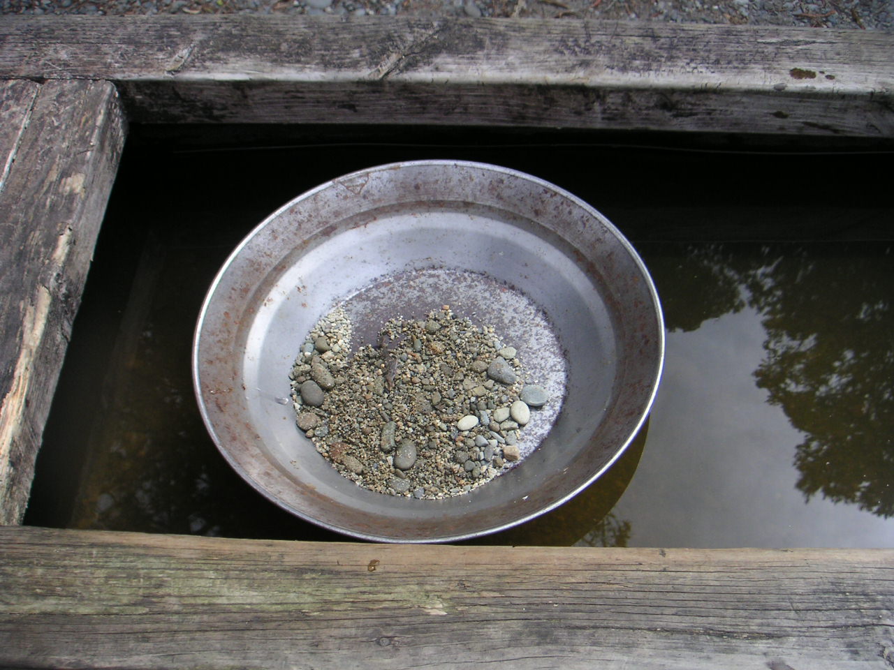
Prospecting for placer gold is normally done with a gold pan or similar instrument to wash free gold particles from loose surface sediment.[1] The use of gold pans is centuries old, but is still common among prospectors and miners with little financial backing.
Deeper placer deposits may be sampled by trenching or drilling.[2] Geophysical methods such as seismic, gravity or magnetics may be used to locate buried river channels that are likely locations for placer gold.[3] Sampling and assaying a placer gold deposit to determine its economic viability is subject to many pitfalls.[4]
Once placer gold is discovered, the gold pan is usually replaced by sluices or mechanical devices to wash greater volumes of material. Discovery of placer gold has often resulted in discovery of hardrock gold deposits when the placers are traced to their sources.
Prospecting for hardrock gold deposits
[edit]Prospectors for hardrock, or lode gold deposits, can use many tools. It is done at the simplest level by surface examination of rock outcrops, looking for exposures of mineral veins, hydrothermal alteration, or rock types known to host gold deposits. Field tools may be nothing more than a rock hammer and hand lens.
Hardrock gold deposits are more varied in mineralogy and geology than placer deposits, and prospecting methods can be very different for different types of deposits. As with placer gold, the sophistication of methods used to prospect for hardrock gold vary with the financial resources of the prospector. Drilling is often used to explore the subsurface. Surface geophysical methods may be used to locate geophysical anomalies associated with gold deposits. Samples of rocks or soil may be collected for geochemical laboratory assay, to determine metal content or detect geochemical anomalies.[5] Hardrock gold particles may be too small to see, even with a microscope.
Most gold today is produced in large open-pit and deep underground mines. However, small-scale gold mining is still common, especially in developing countries.
A 2012 study by Australian scientists found that termites have been found to excrete trace deposits of gold. According to the CSIRO, the termites burrow beneath eroded subterranean material which typically masks human attempts to find gold, and ingest and bring the new deposits to the surface. They believe that studying termite nests may lead to less invasive methods of finding gold deposits.[6][7][8] Herodotus reported about gold-digging ants.
Recreational prospecting
[edit]Small-scale recreational prospecting for placer gold has been seen in many parts of the world including New Zealand (especially in Otago), Australia, South Africa, Wales (at Dolaucothi and in Gwynedd), in Canada and in the United States especially in western states but also elsewhere.
Gallery
[edit]-

-
 Gold nuggets in a pan also from the Blue Ribbon Mine in Alaska
 -
 Old workings in a drywash in southern Arizona
 -
 Using a metal detector in a Southern California desert, an individual prospector found this gold nugget, known as the Mojave Nugget, weighing 156 troy ounces (4.9 kg).
 -
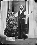 Bernhardt Holtermann and the gold specimen "Holtermann Nugget" discovered at Star of Hope Mine in 1872


.jpg)
See also
[edit]References
[edit]- ^ J.M. West (1971) How to Mine and Prospect for Placer Gold, US Bureau of Mines, Information Circular 8517.
- ^ J.G. Stone and others, "Using diamond drilling to evaluate a placer deposit: a case study," Mining Engineering, September 1988, p.875-880.
- ^ Scott A. Stebbins (1987) Cost Estimation Handbook for Small Placer Mines, US Bureau of Mines, Information Circular 9170.
- ^ Placer Examination Principles and Practice (n.d.) US Bureau of Land Management, Technical Bulletin 4.
- ^ R.P. Fischer and F.S. Fisher (1968) Interpreting Pan-Concentrate Analyses of Stream Sediments in Geochemical Exploration for Gold, US Geological Survey, Circular 592.
- ^ "Termites that poo gold". www.meeja.com.au. 2012-12-16. Archived from the original on 2013-04-20. Retrieved 2012-12-16.
- ^ Wright, Andrew (10 December 2012). "Ant and termite colonies unearth gold". CSIROpedia. Retrieved 19 January 2021.
- ^ Stewart, Aaron D.; Anand, Ravi R.; Laird, Jamie S.; Verrall, Michael; Ryan, Chris G.; Jonge, Martin D. de; Paterson, David; Howard, Daryl L. (8 November 2011). "Distribution of Metals in the Termite Tumulitermes tumuli (Froggatt): Two Types of Malpighian Tubule Concretion Host Zn and Ca Mutually Exclusively". PLOS ONE. 6 (11) e27578. Bibcode:2011PLoSO...627578S. doi:10.1371/journal.pone.0027578. ISSN 1932-6203. PMC 3210811. PMID 22087339.
External links
[edit]- USGS article on gold prospecting
- Public Gold Fossicking Areas in New Zealand
- Modern-Day Gold Diggers - slideshow by NPR
- - Gold Maps, Historic Mines Archived 2021-12-18 at the Wayback Machine