.jpg/250px-Htee_Zai_Kha_Waterfall_border_of_Shan_and_Kayar_State_(4).jpg "Kayah State")
Kayah State
View on Wikipedia
Kayah State (Burmese: ကယားပြည်နယ်, pronounced [kəjá pjìnɛ̀]), or Karenni State, is a state of Myanmar. Situated in eastern Myanmar, it is bounded on the north by Shan State, on the east by Thailand's Mae Hong Son Province, and on the south and west by Kayin State. It lies approximately between 18° 30′ and 19° 55′ north latitude and between 96° 50′ and 97° 50′ east longitude. The area is 11,670 km2 (4,510 sq mi). Its capital is Loikaw (also spelt Loi-kaw). The estimated population in the 2014 Myanmar Census was 286,738, the smallest among Myanmar's seven states. It is inhabited primarily by the Karenni ethnic group, also known as Red Karen[5] or Kayah, a Sino-Tibetan people. Even though Kayah State is the smallest state in Myanmar, it is still larger than Yangon Region.
Key Information
.jpg)


Geography
[edit]Karenni (Kayah) State is located in the eastern part of Myanmar. The relief of Karenni (Kayah) State is mountainous with the Dawna Range and the Karen Hills also known as "Karenni-Karen" mountains separated by the Salween River as it flows through Karenni (Kayah) State.[6] Balu Chaung flows from Inle Lake to Than Lwin River and converges with the Salween in southern Karenni (Kayah) State.
Lawpita Dam, built in 1950 as a bilateral reparation agreement with Japan, is a major hydroelectric production dam that produces a quarter of the total hydroelectric power generation in Myanmar.[7]
History
[edit]19th century and British rule
[edit]Karenni States is the name formerly given to a group of states that included Kantarawadi, Kyebogyi and Bawlake. These states were located south of the Federated Shan States and east of British Burma. According to the 1930 census, the states had a total population of 58,761 with Kantarawadi (3,161 square miles or 8,190 square kilometres), 30,677, Kyebogyi (790 square miles or 2,000 square kilometres), 14,282 and Bawlake (568 square miles or 1,470 square kilometres), 13,802.
The British government recognised and guaranteed the independence of the Karenni States in an 1875 treaty June 21st[5] with a Burmese King Mindon Min, by which both parties recognised the area as belonging neither to Konbaung Burma nor to Great Britain. Consequently, the Karenni States were never fully incorporated into British Burma. The Karenni States were recognised as tributary to British Burma in 1892,[5] when their rulers agreed to accept a stipend from the British government. In the 1930s, the Mawchi Mine in Bawlake was the most important source of tungsten in the world.
Independence to 1988
[edit]
The Constitution of the Union of Burma in 1947 proclaimed that the three Karenni States be amalgamated into a single constituent state of the union, called Karenni State. It also provided for the possibility of secession from the Union after 10 years.
After this the Bamar government invaded Karenni State and in 1948 August 9th, the Karenni leader U Bee Htu Re started the resistance against the Invading Bamar government and military dictatorship which continues till the present day to regain freedom, self-determination, and to allow Karenni people to live in peaceful harmony with the environment on their own land. Therefore, the 9th August is called "Karenni Resistance Day".
In September 8th 1948, the Karenni leader U Bee Htu Re was assassinated by central government militia for his opposition to the inclusion of the Karenni States in the Union of Burma. Therefore, the date of 8th September is called "Karenni Martyr's Day".
In 1952, the former Shan state of Mong Pai (1901. pop - 19,351) was added to Karenni State, and the whole renamed Kayah State, possibly with the intent of driving a wedge between the Karenni (in Kayah State) and the rest of the Karen people (in Karen State), both fighting for independence.
In 1957, pro-independence groups already active in the area formed the Karenni National Progressive Party (KNPP), backed by its own army, the Karenni Army (KA). Apart from a brief ceasefire in 1995, the KA has been fighting ever since. Rivals to the KNPP include the leftist Kayan New Land Party (KNLP), and the Karenni National People's Liberation Front (KNPLF), both of which are now allied with the Myanmar military.
1988–2021
[edit]In 1996, Myanmar's State Law and Order Restoration Council (SLORC) stepped up its campaign to crush Karenni independence with a population transfer program, forcibly moving villagers to designated relocation sites to deprive the pro-independence forces of bases of support.[citation needed] The Myanmar government has been accused of massive human rights violations in the region.[citation needed]
In June 2019, six young Karenni protesters were arrested after being sued by the Kayah State government for calling Chief Minister L Phaung Sho a "traitor" to Karennis due to a statue of Gen. Aung San being erected in Loikaw, the state capital.[8]
In September 2020, Sho was impeached by the state's parliament and subsequently removed as chief minister by President Win Myint due to his misuse of state funds, with Boss Ko appointed as acting chief minister in his stead.[9]
Post-2021
[edit]In the context of the ongoing post-coup civil war, on 7 November 2023, the Karenni National People's Liberation Front, Karenni Army, and Karenni Nationalities Defence Force launched a military offensive known as Operation 1107 against the ruling State Administration Council junta. An additional offensive, known as Operation 1111, started on 11 November 2023 with the aim of capturing Loikaw.[10][11] In an interview with The Irrawaddy on 28 November, the KNDF's deputy commander-in-chief Marwi (Burmese: မာဝီက) claimed that the anti-junta forces controlled 80% of Kayah state and had control over half of Loikaw, where an interim Karenni state government was being established to replace the junta installed state government which had collapsed.[12][13][14]
Demographics
[edit]| Year | Pop. | ±% |
|---|---|---|
| 1973 | 126,574 | — |
| 1983 | 168,429 | +33.1% |
| 2014 | 286,627 | +70.2% |
| Source: 2014 Myanmar Census[3] | ||
In 2014, Kayah State had a population of 286,627.
Ethnic makeup
[edit]The Karenni make up the majority of Kayah State's population, but significant minorities of Bamar, Shan and Karen also inhabit the state. The Shan, Intha, and Bamar live in the north and Pa-O in surrounding hills. Each group is also known by more than one name. Clearly, ethnicity in Kayah State is a complex issue, made more complex by decolonisation and post-independence politics. According to the 1983 census conducted by United Nations and the Burmese government, the Kayah State composed 56.12%, while Bamar (17.58%), Shan (16.66%), Karen (6.45%), mixed races (2.08%), and other groups formed minorities. Ethnolinguists distinguish the following linguistic groups in Kayah State:

- Karenni (Red Karen)
- Padaung (Kayan)
- Bwe
- Geba
- Manumanaw (Kayaw)
- Yantale
- Zayein (Kayăn Lahta)
- Geko (Kayăn Kakhong)
- Yinbaw (Kayăn Kangan)
- Paku (Karen)
After the 2014 Census in Myanmar, the Burmese government indefinitely withheld release of detailed ethnicity data, citing concerns around political and social concerns surrounding the issue of ethnicity in Myanmar.[15] In 2022, researchers published an analysis of the General Administration Department's nationwide 2018-2019 township reports to tabulate the ethnic makeup of the Kayah State.[16][15]
Religion
[edit]- Buddhism (49.9%)
- Christianity (45.8%)
- Tribal religion (1.90%)
- Other religion (1.20%)
- Islam (1.10%)
- Hinduism (0.10%)
According to the 2014 Myanmar Census, Buddhists, who make up 49.9% of Kayah State's population, form the largest religious community there.[18] Minority religious communities include Christians (45.8%), Muslims (1.1%), Hindus (0.1%), and animists (1.9%) who collectively comprise the remainder of Kayah State's population.[18] 1.2% of the population listed no religion, other religions, or were otherwise not enumerated.[18]
According to the State Sangha Maha Nayaka Committee’s 2016 statistics, 2060 Buddhist monks were registered in Kayah State, comprising 0.4% of Myanmar's total Sangha membership, which includes both novice samanera and fully-ordained bhikkhu.[19] The majority of monks belong to the Thudhamma Nikaya (82.4%), followed by Shwegyin Nikaya (17.6%), with the remainder of monks belonging to other small monastic orders.[19] 303 thilashin were registered in Kayah State, comprising 0.5% of Myanmar’s total thilashin community.[19]
The Kayans' traditional religion is called Kan Khwan, and has been practised since the people migrated from Mongolia during the Bronze Age.[20] It includes the belief that the Kayan people are the result of a union between a female dragon and a male human/angel hybrid.[21]
The major religious festival is the three-day Kay Htein Bo festival, which commemorates the belief that the creator god gave form to the world by planting a small post in the ground. During this festival, held in late March or early April, a Kay Htoe Boe pole is erected and participants dance around the pole.[20][22] This festival is held to venerate the eternal god and creator messengers, to give thanks for blessings during the year, to appeal for forgiveness, and pray for rain. It is also an opportunity for Kayan from different villages to come together to maintain the solidarity of the tribe.
The Kayan have a strong belief in augury and nothing is done without reference to some form of divination, including breaking thatch grass, but most importantly consulting the chicken bones.[23] Nowadays the annual Kay Htein Bo festival is always accompanied by a reading of the chicken bones to predict the year ahead. Fowl bone prognostication can be witnessed in the Kayan villages in Thailand's Mae Hong Son province during the annual festival and during “Cleansing Ceremonies” which are held when a family has encountered misfortune. Dreams are also used to make predictions.
Politics
[edit]As with many other states in Myanmar, which have ethnic minority populations, Kayah State has experienced human rights abuses by the Burmese military junta and the Burmese armed forces.

Villagers live under the constant threat of rape, beatings, arbitrary arrest or execution, conscription as slave labour for the Myanmar army, and having their food and possessions taken without compensation.
"The SPDC also arbitrarily closes roads for non-military travel in Karenni State, further restricting villagers movements. Landmines are often planted along roads to prohibit the villagers' movements. Villagers, fearful of landmines and potential injuries, further restrict their own movements.
Even with a valid travel pass villagers are still vulnerable to abuses and exploitation. There have been reports of arrests, torture, extrajudicial killings and rapes of villagers who have had permission to travel. Villagers have also been shot at when they have been outside of their communities."[24]: [27]
It has also been alleged[by whom?] that the relocation centers have inadequate access to water, food, medical services, and educational facilities.[citation needed] As of April 2024, more than 80% of the state's population is classified as internally displaced.[25] Thousands of Karenni people are in refugee camps in Thailand.[citation needed]
"Currently there are 4,800 IDPs in eight forced relocation sites throughout Karenni State. These relocation sites are a result of the Burmese military regimes mass relocation program in Karenni State in 1996. Following the collapse of the ceasefire between SLORC and the KNPP, tens of thousands of people were forcibly evicted from their homes during this program.
"Most relocation sites are located close to military camps, army bases and along main roads. This increases the vulnerability of exploitation and abuse. IDPs are subjected to force labour demands from the soldiers and arbitrary taxation (essentially theft). IDPs are also vulnerable to torture; murder and rape by soldiers and their movements are heavily restricted.
"The relocation sites are also inadequate to sustain a healthy and economically viable livelihood. The majority of relocation sites do not have sanitation facilities, electricity or access to safe drinking water. The land surrounding the sites is often barren and over populated. As productive land has usually been claimed by the original inhabitants or confiscated by the soldiers, opportunities to farm are limited. There are also very few employment opportunities in forced relocation sites."[26]
Administration
[edit]The state capital is Loikaw. The state is divided into 4 districts[27] which are divided into 7 townships with 106 wards and villages.
Districts and townships
[edit]Loikaw District(လွိုင်ကော်ခရိုင်)
|
Loikaw Township(လွိုင်ကော်မြို့နယ်) • Shadaw Township(ရှားတောမြို့နယ်) |
|---|---|
Demoso District(ဒီမိုဆိုခရိုင်)
|
Demoso Township(ဒီမိုဆိုမြို့နယ်) • Hpruso Township (ဖရူဆိုမြို့နယ်) |
Bawlakhe District(ဘော်လခဲခရိုင်)
|
Bawlakhe Township(ဘော်လခဲမြို့နယ်) • Hpasawng Township(ဖားဆောင်းမြို့နယ်) |
Mese District(မယ်စဲ့ခရိုင်)
|
Mese Township(မယ်စဲ့မြို့နယ်) |
Major towns
[edit]
Government
[edit]Executive
[edit]This section needs expansion. You can help by adding missing information. (July 2015) |
Legislature
[edit]This section needs expansion. You can help by adding missing information. (July 2015) |
Judiciary
[edit]This section needs expansion. You can help by adding missing information. (July 2015) |
List of chief ministers
[edit]- Khin Maung Oo (2011–2016; 2021–2022)
- L Phaung Sho (2016–2020)[28]
- Boss Ko (acting; 2020–2021)
- Zaw Myo Tin (2022–2023)
Transportation
[edit]Kayah State has various ways transportations, such as:
Air
[edit]Loikaw Airport is the only airport in Kayah State, with flights to Yangon, Mandalay and Heho.
Land
[edit]Kayah State is served by Loikaw Bus Station and Loikaw Railway Station as land transportation.
Economy
[edit]
Kayah State has a primarily extraction-based economy. The main crop is rice, mostly irrigated, with other important crops including millet, maize, sesame, groundnut, garlic, and vegetables. Mineral products include alabaster, tin, and tungsten. Valuable woods such as teak and pine were once produced, but the forests have largely been stripped bare by illegal logging authorised by the Tatmadaw (Burmese military). The hydroelectric power plant at Lawpita Falls outside of Loikaw is of strategic importance, as it supplies over 20% of Myanmar's total electrical power.
Kayah State has theoretical tourist potential, if the political situation is resolved. The state has rugged mountains, river streams, lakes and waterfalls; however, transport and communication are difficult. At present, Kayah State is open to outsiders by permit only, which can be difficult to obtain depending on the current military situation. Even with a permit, usually only a 25 km (16 mi) radius around Loikaw is allowed. The central government effectively controls only Loikaw and parts of the western half of the state.
As of 2018, the state is the most electrified in Myanmar, at 87%.[29]
Education
[edit]
Educational opportunities in Myanmar are extremely limited outside the main cities of Yangon and Mandalay. According to official statistics, Kayah State has the lowest number of public schools in the country.[30] Loikaw University is the state's main university.
| AY 2002-2003 | Primary | Middle | High |
|---|---|---|---|
| Schools | 338 | 33 | 12 |
| Teachers | 1565 | 352 | 160 |
| Students | 29,200 | 13,200 | 4900 |
Health care
[edit]Kayah State, most of Myanmar, has poor health care facilities due to the alleged mismanagement by the Burmese military junta and economic sanctions by the US government. Although health care is nominally free, in reality patients have to pay for medicine and treatment even in public clinics and hospitals. Public hospitals lack many of the basic facilities and equipment. As Kayah State is perhaps the most isolated state in Myanmar, it has great difficulties in addressing health concerns.
In 2016, Loikaw General Hospital was upgraded with the 1.945 billion yen funding from Japan International Cooperation Agency (JICA).[31] The following is a summary of the public health care system in the state.[32]
| 2002–2003 | # Hospitals | # Beds |
|---|---|---|
| Specialist hospitals | 0 | 0 |
| General hospitals with specialist services | 1 | 200 |
| General hospitals | 6 | 141 |
| Health clinics | 9 | 144 |
| Total | 16 | 485 |
Gallery
[edit]-
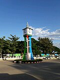 Loikaw Clock Tower
 -
 Taung Kwe Pagoda


See also
[edit]References
[edit]- ^ "'Kayah State Day' celebration fosters unity". UCA News. Loikaw. 18 January 2011. Retrieved 27 December 2023.
- ^ "Junta's Administration Ousted from Karenni State- Loikaw still a war-zone".
- ^ a b Census Report. The 2014 Myanmar Population and Housing Census. Vol. 2. Naypyitaw: Ministry of Immigration and Population. May 2015. p. 17.
- ^ "Sub-national HDI - Area Database - Global Data Lab". hdi.globaldatalab.org. Retrieved 13 September 2018.
- ^ a b c Chisholm, Hugh, ed. (1911). . Encyclopædia Britannica. Vol. 15 (11th ed.). Cambridge University Press. p. 678.
- ^ Global 200 ecoregion: Karenni-Karen / Tenasserim Moist Forests
- ^ "Lawpita Hydropower Project". Archived from the original on 19 January 2010. Retrieved 30 August 2010.
- ^ Htwe, Zaw Zaw (7 November 2019). "Karenni Youth Jailed for Calling Govt Officials Criminals, 'Enemies of Ethnic Unity'". The Irrawaddy. Yangon: Irrawaddy Publishing Group. Retrieved 27 December 2023.
- ^ Aung, San Yamin (3 September 2020). "Myanmar President Removes Kayah State Chief Minister From Office for Misusing Funds". The Irrawaddy. Yangon: Irrawaddy Publishing Group. Retrieved 27 December 2023.
- ^ "ကရင်နီဒေသ ၁၁၀၇ စစ်ဆင်ရေး တိုက်ပွဲ ဆင်နွှဲ". BBC News မြန်မာ (in Burmese). 9 November 2023. Archived from the original on 10 November 2023. Retrieved 10 November 2023.
- ^ "ကရင်နီဒေသ ၁၁၀၇ စစ်ဆင်ရေး စတင်". ဗွီအိုအေ (in Burmese). 8 November 2023. Archived from the original on 10 November 2023. Retrieved 10 November 2023.
- ^ Kha, Kyaw (28 November 2023). "Operation 1111 'Close to Securing All of Kayah State for Myanmar Resistance'". The Irrawaddy. Retrieved 28 November 2023.
- ^ "Junta's Administration Ousted from Karenni State- Loikaw still a war-zone".
- ^ The Irrawaddy (26 December 2023). "Christmas mass held for IDPs in Karenni State". Facebook. Meta Platforms, Inc. Retrieved 27 December 2023.
- ^ a b Jap, Jangai; Courtin, Constant (22 November 2022). Deciphering Myanmar's Ethnic Landscape: A Brief Historical and Ethnic Description of Myanmar's Administrative Units. International IDEA. doi:10.31752/idea.2022.57. ISBN 978-91-7671-577-2.
- ^ "Ethnic Population Dashboard". PonYate. Retrieved 12 May 2025.
- ^ Department of Population Ministry of Labour, Immigration and Population MYANMAR (July 2016). The 2014 Myanmar Population and Housing Census Census Report Volume 2-C. Department of Population Ministry of Labour, Immigration and Population MYANMAR. pp. 12–15.
- ^ a b c Department of Population Ministry of Labour, Immigration and Population MYANMAR (July 2016). The 2014 Myanmar Population and Housing Census Census Report Volume 2-C. Department of Population Ministry of Labour, Immigration and Population MYANMAR. pp. 12–15.
- ^ a b c "The Account of Wazo Monks and Nuns in 1377 (2016 year)". State Sangha Maha Nayaka Committee. 2016. Retrieved 19 January 2021.
- ^ a b "Religion". Huay Pu Keng. Retrieved 4 August 2013.
- ^ Virtua Design. "The Dragon Mothers Polish their Metal Coils by Edith Mirante - Guernica / A Magazine of Art & Politics". Guernicamag.com. Archived from the original on 12 December 2008. Retrieved 4 August 2013.
- ^ "Les peuples oubliés". Blogg.org. 26 August 2007. Archived from the original on 4 October 2013. Retrieved 4 August 2013.
- ^ Manna, Padre Paolo (1902), The Ghekhu-Karen Tribe of Eastern Burma, S. Giuseppe Pontificial Printing
- ^ "Living Ghosts: The spiraling repression of the Karenni population under the Burmese military junta." Burma Issues, March 2008.
- ^ Hannah Beech (20 April 2024). "A Ragtag Resistance Sees the Tide Turning in a Forgotten War". The New York Times.
- ^ "Living Ghosts" 78.
- ^ "ကယားပြည်နယ်အတွင်းရှိ ခရိုင်အမည်များ တိုးချဲ့ပြင်ဆင်ဖွဲ့စည်းခြင်း".[permanent dead link]
- ^ "ကယားပြည်နယ်ဝန်ကြီးချုပ် ဦးအယ်လ်ဖောင်းရှိုကို ရာထူးမှရပ်စဲ" (in Burmese). Myanmar Now. 3 September 2020. Retrieved 3 September 2020.
- ^ "43% of households in Myanmar gain access to national grip".
- ^ "Education statistics by level and by State and Division". Myanmar Central Statistical Organization. Archived from the original on 24 May 2008. Retrieved 9 April 2009.
- ^ "Loikaw to get new hospital buildings funded by JICA - Global New Light Of Myanmar". Global New Light Of Myanmar. 11 February 2015. Archived from the original on 12 February 2015. Retrieved 8 October 2017.
- ^ "Hospitals and Dispensaries by State and Division". Myanmar Central Statistical Organization. Archived from the original on 30 April 2011. Retrieved 19 April 2009.
- "Conflict and Displacement in Karenni: The Need for Considered Responses". Burma Ethnic Research Group. Retrieved 22 May 2006.
External links
[edit]Places adjacent to Kayah State | ||||||||||||||||
|---|---|---|---|---|---|---|---|---|---|---|---|---|---|---|---|---|
| ||||||||||||||||
Capital: Loikaw | ||
| Bawlakhe District |  | |
| Demoso District | ||
| Loikaw District | ||
| Mese District | ||
| cities and towns | ||
Kayah State
View on GrokipediaGeography
Physical geography and terrain
Kayah State encompasses a compact land area of 11,731 km² in eastern Myanmar, representing approximately 1.7% of the national territory and ranking as the smallest among the country's states.[1][9] It shares borders with Shan State to the north, Kayin State to the southwest, and Thailand to the east, where the Salween River delineates much of the international boundary for about 120 km.[10][11] The state's physical geography features rugged, mountainous terrain dominated by extensions of the Dawna Range, with elevations ranging from 900 to 2,400 meters above sea level.[12] This topography includes steep hills, narrow valleys, and plateaus that limit transportation infrastructure and concentrate human settlements in intermontane basins.[13] Major rivers such as the Thanlwin (Salween) and its tributaries, including the Nampawn, carve deep gorges through the eastern highlands, fostering hydrological features like waterfalls and contributing to the region's potential for water flow dynamics that influence erosion patterns and valley formations.[12][13] Extensive forest cover, estimated at 74% of the land area in 2020 primarily as natural tropical forests, supports diverse ecosystems amid the hilly landscape, though annual tree cover loss—such as 4.77 kha in 2024—highlights vulnerability to degradation from various land pressures.[14]Climate and natural resources
Kayah State experiences a tropical monsoon climate characterized by high humidity and distinct wet and dry seasons. In Loikaw, the state capital, the average annual temperature is 21.7°C, with lows around 16.3°C and highs reaching up to 33.1°C in April. Annual precipitation totals approximately 1,550 mm, predominantly during the extended rainy season from late March to early December, when monthly rainfall often exceeds 200 mm. This heavy monsoon rainfall supports lush vegetation and agriculture but frequently triggers landslides and flash floods, as evidenced by events in 2015 that killed at least 18 people in Hpasaung Township and in September 2024, when Typhoon Yagi-induced downpours caused over 200 deaths across affected regions including Kayah.[15][16][17][18][19] The state's natural resources include significant mineral deposits of tin, tungsten, and associated gems. The Mawchi Mine in Kayah State has historically produced tin and tungsten concentrates, contributing to Myanmar's output, which ranked third globally for tin in 2019 at an estimated 14% of world production. Precious and semiprecious stones, such as sapphires, occur in hydrothermal deposits linked to tin-tungsten and molybdenum formations. Timber from tropical forests forms another key resource, though extraction has raised sustainability concerns.[20][21][22][10] Hydropower potential is substantial due to the region's rivers and elevation drops, harnessed notably by the Baluchaung (Lawpita) project, which includes plants with capacities of 28 MW at No. 1 and 168 MW at No. 2, operational since the 1960s. These facilities, located near Loikaw, utilize waterfalls and dams on the Balu Chaung River but have sparked disputes over environmental impacts and displacement. Forests in Kayah State harbor biodiversity typical of Myanmar's eastern hill regions, yet face threats from logging and indirect damage from protracted conflicts, which exacerbate deforestation and habitat fragmentation.[23][24][25][10]History
Pre-colonial Karenni principalities
The Karenni principalities comprised a loose confederation of small, autonomous hill states primarily inhabited by Karenni (Kayah) peoples, situated in the rugged terrain east of the Salween River and south of the Shan plateau. These included Bawlake (also spelled Bawlake), Kyebogyi, Nammekon (Nanmakhon), Pruso (Kantarawadi in the east), and Naungpale, each functioning as a distinct polity under hereditary rulers known as saophas or sawbwas.[26][27] The principalities coalesced as independent entities by the 18th century, following migrations and consolidations of Karenni clans that resisted integration into lowland Burmese or Shan hierarchies.[4] Sovereignty was maintained through geographic isolation in mountainous areas, which deterred large-scale invasions, and through nominal tribute arrangements rather than subjugation to the Toungoo or Konbaung Burmese kingdoms.[4] Unlike the more hierarchically organized Shan states, Karenni rulers operated without centralized Burmese oversight, preserving de facto independence despite sporadic raids or diplomatic overtures from Ava or Pegu.[26] For instance, Bawlake's rulers, such as Po Bya (circa 1810) and later La Kye (mid-19th century), exemplified this autonomy by managing internal affairs via kinship-based authority.[27] Traditional governance relied on feudal structures anchored in personal loyalties to the saopha, who adjudicated disputes, mobilized labor for agriculture and defense, and collected tribute from subordinate villages and chiefs.[28] Authority derived from customary law, animist rituals, and reciprocal obligations rather than written codes or standing armies, fostering resilience against external pressures but limiting inter-principality coordination.[4] Economic interactions involved barter trade in teak, ivory, and hill rice with neighboring Shan principalities and the Siamese kingdom, often via overland routes to the Salween, without ceding political control.[29] These alliances, typically ad hoc and defensive, underscored the principalities' strategic balancing between Burmese expansionism and Siamese influence, reinforcing their ethnic distinctiveness through endogamous clans and localized power.[4]British colonial rule and administration
The British government formalized the independence of the western Karenni States from Burmese territory via an agreement signed on 21 June 1875 with King Mindon Min, recognizing four principalities—Kyebogyi, Maliwathu, Bawlake, and Kantarawaddy—as sovereign entities outside British India or Burmese control.[4] This treaty, motivated by strategic border delineation ahead of potential Anglo-Burmese conflict, precluded direct annexation while establishing British oversight through advisory roles and trade concessions, thereby embedding Karenni separatism as a diplomatic precedent that later amplified ethnic autonomy demands against centralizing Burman authorities.[30] Administrative integration progressed indirectly; by the early 20th century, the Karenni States were nominally subsumed under the Federated Shan States framework in 1922, functioning as "excluded" or frontier areas with minimal interference in internal affairs.[27] Local saophas retained executive powers over taxation, justice, and land, subject to British paramountcy via a resident superintendent stationed in the Shan States, who enforced external policies like corvée labor bans and rudimentary surveys without dissolving traditional hierarchies.[28] This hands-off approach, covering approximately 11,000 square miles with sparse European presence—limited to a small military police garrison at Loikaw—preserved feudal structures but sowed seeds for post-colonial discord by reinforcing perceptions of Karenni exceptionalism distinct from "Burma Proper."[31] Christian missionary activity, primarily by American Baptists from the 1880s onward, penetrated the region under British tolerance, converting up to 30-40% of Karenni by the 1930s through Bible translations and schools that elevated literacy and Western education.[32] These efforts, while nominally voluntary, disrupted animist hierarchies by fostering a literate Christian elite that coalesced around ethnic nationalism, laying ideological groundwork for resistance to assimilationist policies in independent Burma.[5] Infrastructure remained underdeveloped, with few roads beyond packhorse trails linking mines like Mawchi, prioritizing resource extraction over connectivity that might invite denser governance.[33]Post-independence annexation and early insurgencies (1948–1962)
Following Burma's independence on 4 January 1948, the Karenni States—previously recognized as a British protectorate with de facto independence since an 1875 agreement—faced immediate pressure for incorporation into the Union of Burma despite local assertions of sovereignty.[34] Karenni leaders had not been primary signatories to the 1947 Panglong Agreement, which promised ethnic groups autonomy and a right to secede after ten years under the new constitution, leading to unmet expectations of self-determination.[30] On 9 August 1948, Burmese government forces invaded the Karenni territories after local authorities refused full administrative integration, marking the onset of armed resistance and the erosion of promised federal structures.[28] [35] The invasion targeted the headquarters of the Karenni National Organization, sparking disorganized but persistent local insurgencies demanding restoration of autonomy and opposition to central Burman dominance.[28] These early rebellions, fueled by grievances over broken constitutional safeguards, involved ad hoc militias leveraging the region's mountainous terrain to evade Burmese patrols and conduct hit-and-run operations.[4] By the early 1950s, the central government responded with military campaigns to establish garrisons in key areas like Loikaw, though control remained contested, with insurgents retreating into remote highlands and disrupting supply lines. In 1951, the government unilaterally renamed the territory "Kayah State" to dissociate it from broader Karen ethnic movements, further alienating locals and intensifying demands for separation.[4] Organized resistance coalesced with the formation of the Karenni National Progressive Party (KNPP) on 2 May 1957, which articulated goals of independence or federal autonomy, building on prior offshoots from Karen nationalist networks like the Karen National Union while emphasizing distinct Karenni identity.[36] The KNPP's armed wing initiated sustained guerrilla actions against Burmese outposts, prompting cycles of intensified army offensives that secured urban centers but failed to pacify rural strongholds, displacing thousands and entrenching a pattern of temporary advances followed by insurgent resurgence.[4] These dynamics highlighted the fragility of post-independence unification, as ethnic militias exploited logistical challenges for the under-equipped Burmese forces, setting the stage for prolonged conflict until the 1962 military coup shifted national strategy.[28]Socialist period and prolonged ethnic conflicts (1962–1988)
Following General Ne Win's military coup on March 2, 1962, the implementation of the "Burmese Way to Socialism" centralized economic control in Yangon, nationalizing industries, media, and natural resources while collectivizing agriculture, which disrupted local Karenni livelihoods and alienated ethnic communities in Kayah State (formerly Karenni State).[4] Projects such as the Lawpita hydropower plant, operationalized in the 1960s, displaced 1,740 residents from 114 villages without compensating or benefiting locals, channeling revenues to the central government instead.[4] This resource extraction and suppression of non-Bamar cultural practices, including halting ethnic language education beyond primary levels under the 1974 constitution, intensified grievances, bolstering the Karenni National Progressive Party (KNPP)—active since its 1957 founding—which controlled "liberated zones" and advocated for independence amid ongoing skirmishes with Tatmadaw forces.[4][28] The regime's counterinsurgency escalated with the "Four Cuts" doctrine, formalized in the mid-1960s to sever insurgents' access to food, funds, intelligence, and recruits by targeting civilian support networks, resulting in widespread village relocations, burnings, and forced labor as porters, which caused acute food shortages and civilian deaths.[4][37] In Kayah State, these operations depopulated rural areas, exacerbating famines and driving refugee outflows to Thailand, where Karenni camps swelled from initial post-coup displacements, with thousands fleeing by the late 1970s amid intensified offensives.[4][28] The KNPP, alongside groups like the Kayan New Land Party formed in 1964 after local uprisings, persisted in guerrilla warfare but faced resource strains from these tactics, maintaining control over fragmented territories without achieving decisive gains.[4] Internal fractures further hampered resistance cohesion; in 1978, ideological disputes over alliances with the Communist Party of Burma prompted a KNPP faction to splinter, forming the Karenni National People's Liberation Front (KNPLF), which prioritized leftist goals and eventually negotiated partial ceasefires with the government, dividing armed efforts and enabling Tatmadaw advances in contested areas.[4][38] These divisions, compounded by sub-ethnic tensions among Kayah groups like the Kayaw and Bre, prevented unified fronts, prolonging low-intensity conflicts through the 1980s without resolution until Ne Win's ouster in 1988.[4][28]Reforms, ceasefires, and partial integration (1988–2021)
In the aftermath of the 1988 pro-democracy uprising, the State Law and Order Restoration Council (SLORC) assumed power and initiated a series of bilateral ceasefire agreements with ethnic armed organizations (EAOs) across Myanmar, including partial arrangements in Kayah State. These efforts, starting in the early 1990s, involved splinter groups from the Karenni National Progressive Party (KNPP), such as the Karenni National People's Liberation Front (KNPLF) in 1994 and the Karenni National Peace and Development Party (KNPDP) in 1999, which established "Kayah State Special Regions" under government oversight.[4] The KNPP itself entered a short-lived ceasefire in March 1995, mediated amid logging disputes, but it collapsed within three months due to reported Tatmadaw violations and troop movements, leading to renewed offensives that displaced over 11,500 civilians.[4] [39] Subsequent ceasefires with KNPP splinter factions, including the Karenni National Solidarity Organisation (KNSO) in 2002, facilitated limited integration into border guard forces by 2009, allowing Tatmadaw access to strategic areas like Mawchi for mining operations.[4] The KNPP signed a more enduring bilateral ceasefire on March 7, 2012, under President Thein Sein's quasi-civilian government, which reduced major clashes and enabled infrastructure projects such as road upgrades from Loikaw to Mese and the 2015 Thanlwin bridge.[40] [4] Tourism also grew, with approximately 30,000 local and 9,000 foreign visitors recorded in 2017, alongside hydropower expansions like Lawpita, though local communities received minimal revenue shares amid reports of forced relocations and environmental degradation.[4] However, low-level violence persisted, including KNPP-Tatmadaw skirmishes near Mawchi in June 2012 and executions of KNPP personnel in December 2017, underscoring ceasefire fragility and Tatmadaw encroachments on KNPP-controlled territories.[4] The 2008 Constitution formalized Kayah State as one of seven ethnic states with nominal legislative powers, including a state assembly and chief minister position, but retained centralized military oversight through 25% unelected seats and veto authority over autonomy-related bills.[41] Ethnic parties like the Kayah Unity Democracy Party secured limited representation in 2010 and 2015 elections, yet demands for federal restructuring, resource control, and reverting the state's name from the imposed "Kayah" (dating to 1952 central policy) to "Karenni" remained unaddressed, as KNPP-led campaigns, including a 2008 "Vote No" effort, faced arrests without altering the military-dominant framework.[4] [41] The KNPP declined to join the 2015 Nationwide Ceasefire Agreement, citing insufficient guarantees for self-determination, while participation in the 21st Century Panglong Conference yielded no binding concessions on core grievances like land rights and demilitarization.[42] These partial integrations thus delivered tactical economic gains but failed to mitigate underlying ethnic tensions, as evidenced by ongoing resource disputes and KNPP advocacy for constitutional amendments toward genuine federalism.[4][43]2021 military coup and intensified civil war (2021–present)
Following the military coup on February 1, 2021, resistance in Kayah State rapidly organized through the formation of People's Defense Forces (PDFs), which coalesced into the Karenni Nationalities Defence Force (KNDF) as one of the most effective anti-junta armed groups.[44] These forces, allied with ethnic armed organizations, launched offensives that captured key junta positions, including military bases and towns, achieving control over approximately 90% of the state's territory by mid-2024.[45] In June 2023, resistance groups established the Karenni State Interim Executive Council (IEC), the first provisional governing body in any Myanmar state post-coup, to administer liberated areas, coordinate civil administration, and integrate revolutionary governance structures.[46] The IEC, comprising KNDF and allied representatives, focused on service provision amid ongoing conflict, marking a shift toward state-building in resistance-held zones.[47] The junta responded with intensified aerial bombardments and ground blockades, restricting supply routes and exacerbating humanitarian conditions; local reports documented over 1,700 airstrikes in Kayah State from the coup through December 2024.[48] These tactics, including blockades of roads like Loikaw-Hsihseng, triggered severe food shortages, with staple prices surging 300-400% by October 2025 due to disrupted trade and displacement of farming communities.[49] Junta forces mounted counteroffensives in 2025, recapturing the strategic town of Demoso on August 20 after resistance seized it in November 2023, employing combined air and ground assaults to reclaim urban centers and disrupt supply lines.[50] This reversal, amid broader junta efforts to consolidate holdings ahead of planned elections, highlighted fluctuating territorial control, with resistance retaining rural strongholds despite aerial superiority favoring the military.[51]Demographics
Population statistics and trends
The 2014 Myanmar Population and Housing Census enumerated 286,738 residents in Kayah State, yielding a population density of 24.4 persons per square kilometer across its approximately 11,670 square kilometers of predominantly mountainous terrain, which constrains habitable areas and settlement patterns.[52][53] Provisional results from Myanmar's 2024 census indicate a modest increase to around 297,000 residents, reflecting an average annual growth rate of 0.34% since 2014, though data collection amid ongoing conflict likely undercounts transient populations.[3] Intensified armed conflict following the 2021 military coup has driven significant internal displacements, with over 120,000 internally displaced persons (IDPs) reported in Kayah State by mid-2023, primarily fleeing clashes between junta forces and ethnic armed organizations; this has caused localized population swells in safer enclaves while depopulating frontline areas.[54] Urbanization remains minimal, concentrated in the capital Loikaw, where township density reaches 82.9 persons per square kilometer—substantially higher than the state average—while rural districts exhibit sparse settlement due to terrain and insecurity.[55] Kayah State's demographics feature a youthful profile, with a broad-based population pyramid indicating higher proportions of children and young adults, as evidenced by a median age of 24.5 years in Loikaw Township; this structure is strained by emigration, particularly among youth seeking opportunities in Thailand or Myanmar's urban centers amid economic pressures and conflict.[56] Poverty trends, per UNDP assessments, show national rates doubling to 49.7% by 2023, with pronounced rises in conflict zones like Kayah due to disrupted livelihoods, though state-specific data indicate continued vulnerability rather than stabilization into 2024.[57][58]Ethnic composition and diversity
Kayah State is predominantly inhabited by the Kayah people (also known as Karenni), who form the titular ethnic majority and are indigenous to the region's hilly terrain. Estimates indicate that Kayah comprise approximately 56% of the state's population, based on ethnographic surveys aligning with the 2014 census total of 286,627 residents.[59][52] Significant minorities include Bamar (approximately 15%), who represent the largest non-indigenous group often associated with central government administration, and Shan (around 17%), concentrated in border areas adjacent to Shan State.[60] Other groups, such as Kayin (Karen) and smaller subgroups like Kayan, Pa-O, and Kayaw, account for the remainder, with Kayah State hosting over nine distinct ethnicities in total.[61] The ethnic landscape reflects historical migrations: Kayah communities trace origins to ancient Tibeto-Burman settlements in the area's principalities, while Bamar influxes occurred post-1948 annexation through military postings and resettlement policies favoring lowland cultivation. Shan populations expanded via trade routes from the north, forming enclaves in townships like Mese and Bawlake.[34] These patterns have fostered localized diversity but also tensions, as Bamar centralization efforts—evident in administrative dominance—have exacerbated perceptions of marginalization among hill-dwelling majorities, contributing to identity-based insurgencies without altering core demographic proportions.[60] Census data from 1983 (population 168,355) to 2014 reveal relative ethnic stability amid conflict-driven displacements, with growth rates outpacing national averages despite internal migrations and refugee outflows to Thailand.[61] However, reliable breakdowns remain limited due to sensitivities around enumeration in ethnic areas, underscoring data gaps in official records.[61]Languages and cultural identity
The primary language spoken in Kayah State is Kayah, also known as Karenni or Red Karen, a Central Karenic language within the Sino-Tibetan family, used predominantly by the Kayah ethnic group comprising the state's majority population of approximately 286,000 as of recent estimates.[62][63] This language features tonal systems and syllable structures typical of Karenic tongues, with Eastern Kayah dialect concentrated in northeastern areas like Shadaw township and Western Kayah along the Thai border.[64] Lexical influences from neighboring Shan and Burmese languages are evident due to historical trade, migration, and administrative interactions, including loanwords for governance and commerce terms.[65] Kayah maintains strong oral traditions, including folktales, songs, and genealogical recitations that encode ethnic histories and social norms, serving as vehicles for intergenerational knowledge transmission amid limited formal literacy historically.[66] A dedicated script, Kayah Li, was invented in 1962 by Htae Bu Phae, drawing partial inspiration from Burmese and Indic forms, and has been promoted through state-level printing of textbooks, dictionaries, and periodicals since the 1980s to counter assimilation via Burmese-medium education.[67][68] Preservation initiatives, such as the 2022 publication of the New Testament in Eastern Kayah and ongoing digitization projects, aim to sustain the language against pressures from Myanmar's centralizing policies that prioritize Burmese proficiency for official and economic participation.[69][70] Multilingualism prevails in Kayah State's border zones, where Kayah speakers often acquire functional Burmese for national administration, Shan for northern interactions, and Thai for southeastern cross-border exchanges, enabling trade in goods like timber and agriculture but exacerbating ethnic fragmentation by reinforcing subgroup distinctions over unified national identity.[10][71] This linguistic pluralism bolsters local ethnic cohesion among Kayah communities, as the language's distinct phonology and vocabulary—termed "Kayah" meaning "red" or "human" in self-reference—differentiate them from adjacent Sgaw or Pwo Karen speakers, fostering solidarity in resistance to cultural homogenization.[5][72]Religious demographics and practices
According to the 2014 Myanmar Population and Housing Census, Christians accounted for 45.8% (131,237 individuals) of Kayah State's population of 286,627, Buddhists 49.9% (142,896), Muslims 1.1% (3,197), and the remainder comprising animists (approximately 1.9%), Hindus (0.1%), and other or unspecified faiths.[73] These figures reflect the state's ethnic diversity, with Christianity concentrated among the indigenous Kayah (Karenni) population and Buddhism more prevalent among Bamar, Shan, and Pa-O minorities.[61] The Christian community consists mainly of Baptists and Roman Catholics, denominations established through 19th-century American Baptist missionary efforts among Karen and Karenni groups, which emphasized literacy and ethnic cohesion via Bible translations and schools.[74] Catholic presence grew in the 20th century, particularly post-World War II. Religious adherence frequently correlates with ethnic identity, where conversion to Christianity historically served as a marker of distinction from Burman-Buddhist dominance rather than aggressive proselytism.[75] Animist traditions endure as remnants among rural Kayah, often blended syncretically with Christianity—such as consulting spirits (e.g., via mediums or offerings) for major decisions like marriages or harvests—despite formal Christian professions.[59] Theravada Buddhist practices, including merit-making rituals and pagoda festivals, dominate among non-Christian ethnicities, with monasteries providing community welfare akin to churches. Churches and cathedrals serve as central social institutions in Christian-majority villages, hosting worship, education, and aid distribution, which has heightened their vulnerability in conflicts. Post-2021 coup, junta forces have systematically targeted these sites when used as civilian shelters; by December 2021, at least seven Christian churches were destroyed, rising to about 12 by March 2022 amid intensified fighting in Loikaw and Demoso townships.[76][77] Specific incidents include the May 24, 2021, artillery strike on Sacred Heart Church in Kayan Tharyar, killing four sheltering civilians.[76] This pattern underscores religion's role in sustaining community resilience and resistance networks during insurgencies.[78]Politics and Governance
Administrative structure and divisions
Kayah State is administratively subdivided into two districts—Loikaw District and Bawlakhe District—which collectively encompass seven townships: Loikaw, Shadaw, Demoso, Hpruso, Bawlakhe, Hpasawng, and Mese.[61][79] Loikaw serves as the state capital and administrative center, housing key government offices that coordinate township-level operations.[80] These townships function as the primary units for local governance, managing village tracts, wards, and basic services such as registration, land administration, and infrastructure maintenance, though their operational capacity varies due to geographic isolation and security challenges in remote areas like Demoso and Hpasawng.[81] Under Myanmar's 2008 Constitution, Kayah State enjoys nominal self-administration as one of the country's seven states, with provisions for a state-level executive led by a chief minister, a legislative assembly (Hluttaw), and judiciary, allowing limited legislative authority over matters like local taxation, education, and health.[82] However, this autonomy is constrained by the Union's overriding powers, including veto rights over state laws conflicting with national policy and central appointment of key officials, which ensures alignment with federal directives.[82] Fiscal functionality remains heavily centralized, with townships and the state government retaining minimal control over revenue generation; primary taxes on natural resources, trade, and extractives are largely remitted to the national level, while states receive formula-based allocations that limit independent budgeting and development initiatives.[83] This structure prioritizes national priorities over local needs, resulting in dependencies on Union transfers for township-level expenditures, as evidenced by Kayah's reliance on central funds for over 90% of its budget in pre-coup assessments.[84]State government institutions
The government of Kayah State is led by a Chief Minister, who heads the executive branch and is formally appointed by the President upon recommendation by the State Hluttaw, as outlined in Myanmar's 2008 Constitution.[85] The unicameral Kayah State Hluttaw serves as the legislative body, comprising 20 members: up to 15 elected representatives from townships and ethnic groups, plus military appointees.[86] This structure reflects the limited devolution of powers to states under the constitution, with authority confined to local administration, planning, and development, while national defense, foreign affairs, and major fiscal decisions remain centralized.[87] Prior to the 2021 coup, the Chief Minister position saw continuity from the 2011 reforms. Khin Maung Oo served from March 30, 2011, followed by L Phaung Sho, appointed on March 30, 2016, who held office until the military takeover.[88] The Hluttaw operated with elections last held in November 2020, yielding a National League for Democracy majority, though its effective powers were curtailed by military reservations and central oversight.[86] Following the February 1, 2021, military coup, the State Administration Council (SAC) seized control, dissolving elected assemblies and suspending legislative functions, including the Kayah State Hluttaw, with no subsequent elections convened.[89] U Zaw Myo Tin was appointed Chief Minister under SAC authority, overseeing a cabinet that includes ministers for security and border affairs, economy, planning and finance, social affairs, and agriculture, livestock, and irrigation.[90] These bodies handle routine bureaucratic tasks such as resource allocation for development projects and local services, but their decisions are routinely overridden by SAC directives on security and budgeting, rendering state autonomy nominal amid the junta's centralized command.[91] As of October 2025, Zaw Myo Tin continues to inspect and direct state-level initiatives like infrastructure and education under military supervision.[92]Central government relations and autonomy debates
Relations between Kayah State and Myanmar's central government have been marked by longstanding tensions rooted in the unfulfilled promises of autonomy from the 1947 Panglong Agreement era, where ethnic frontier areas including the Karenni (predecessor to Kayah) were assured internal administrative autonomy and, in some interpretations, a right of secession as a safeguard against domination by the Burman-majority core.[93] Although Karenni leaders did not formally sign the Panglong Agreement, pre-colonial treaties positioned the Karenni States as semi-independent entities acceding to the Union with expectations of self-governance, which successive central regimes failed to honor, leading to perceptions of broken commitments that fueled demands for greater state rights.[94] The central government's emphasis on national unity, often prioritizing Bamar-centric control to avert fragmentation, has clashed with these ethnic aspirations, viewing expansive autonomy as a pathway to separatism rather than integration.[93] Debates over federalism in Kayah State pit ethnic calls for decentralized power-sharing—encompassing fiscal autonomy, resource control, and self-determination within a union framework—against central arguments that such arrangements undermine national security and economic cohesion. Proponents of federalism argue it addresses causal grievances from over-centralization, potentially stabilizing the state by enabling local governance over internal affairs, as evidenced in broader ethnic nationality charters advocating reserved powers for sub-national units.[95] Conversely, the military establishment contends that federal concessions risk balkanization, citing historical precedents where autonomy guarantees eroded into independence movements, thereby justifying tightened control to preserve territorial integrity amid insurgencies.[96] These positions reflect deeper causal realism: ethnic sidelining perpetuates conflict cycles, yet unchecked devolution could incentivize further fragmentation without enforceable unity mechanisms. Resource-sharing disputes exacerbate these frictions, with Kayah's hydropower potential (e.g., Lawpita Falls projects) and mineral deposits highlighting inequities where central authorities extract revenues while local benefits remain minimal, prompting calls for equitable fiscal transfers in federal models.[97] Ethnic leaders assert that without state-level control over such assets, development lags and grievances intensify, whereas the center prioritizes national infrastructure needs, often framing local demands as obstructive to broader economic goals.[98] Following the 2021 military coup, alliances between Kayah resistance structures like the Karenni State Consultative Council and the National Unity Government (NUG) have intensified challenges to central authority, with the NUG endorsing federal democratic principles that include ethnic interim governance in states like Kayah.[99] This alignment positions the NUG as a parallel union-level entity advocating asymmetric federalism to accommodate Kayah's autonomy claims, directly contesting the junta's unitary control and reviving pre-coup debates on whether such devolution fosters stability or invites dissolution.[7] The junta responds by reinforcing central dominance, arguing that NUG-backed federalism equates to de facto separatism, perpetuating a cycle where autonomy pursuits are securitized as existential threats.[100]Ethnic armed groups and insurgent politics
The Karenni National Progressive Party (KNPP), established in 1957, leads the Karenni Army (KA) and pursues the political objective of liberating the Karenni people from central Burmese domination, historically advocating for greater autonomy or independence within a federal framework.[101][4] Post-2021 military coup, the KNPP aligned with broader revolutionary efforts, committing to armed resistance until a federal union guaranteeing ethnic self-determination is achieved, while rejecting permanent subordination to a unitary Burmese state.[102] The Karenni Nationalities Defense Force (KNDF), formed on May 31, 2021, by consolidating local People's Defense Forces (PDFs) in response to the coup, operates as a pro-democracy militia emphasizing the overthrow of military rule and establishment of civilian governance in Kayah State.[103][104] Its objectives prioritize territorial defense and coordination with ethnic allies against junta forces, diverging from the KNPP's longstanding ethnic separatism by integrating PDF recruits focused on nationwide democratic transition over pure Karenni independence.[105][43] Coalitions between the KNDF, KNPP/KA, and PDFs have intensified since 2021, forming joint commands like those under the Karenni State Consultative Council for unified operations, though tensions persist over strategic priorities—self-determination versus federal integration—leading to occasional frictions in resource allocation and command structures.[106] Funding for these groups derives primarily from taxation on local commerce and agriculture in controlled territories, supplemented by diaspora remittances and crowdfunding campaigns channeled through informal networks to evade junta blockades.[107][108] Internal rivalries within Karenni insurgent politics include ideological splits, such as the 1978 formation of the Karenni National People's Liberation Front (KNPLF) from the KNPP over disputes on alliances and autonomy tactics, and broader strains with the Karen National Union (KNU) stemming from distinct ethnic identities and overlapping territorial claims in adjacent Kayin State.[109] These dynamics have occasionally disrupted coordination, with Karenni groups wary of KNU dominance in pan-ethnic alliances.[7] Ceasefires negotiated with the pre-coup government, including KNPP agreements in the 2010s, collapsed following the February 2021 coup, as ethnic groups cited junta violations and renewed offensives as justification for resuming hostilities, transforming tentative truces into sustained insurgent campaigns.[43][110]Armed Conflicts and Security
Historical patterns of insurgency and counter-insurgency
The insurgency in Kayah State, rooted in ethnic Karenni aspirations for autonomy, commenced shortly after Myanmar's independence in 1948, with armed resistance coalescing under the Karenni National Progressive Party (KNPP), formally established on May 2, 1957. KNPP forces, numbering around 700-800 fighters, employed guerrilla tactics such as ambushes and control of remote border terrain to disrupt military supply lines and assert territorial claims, initially seeking full independence before pivoting to federalism demands. These operations, often reliant on civilian support for intelligence and logistics, prompted cyclical military responses focused on area denial, including patrols and fortifications, which evolved into more systematic depopulation efforts by the 1960s.[4] The Burmese military's "Four Cuts" doctrine, implemented from the mid-1960s and intensified in Kayah State during the 1990s, targeted insurgents' sustenance by severing access to food, funds, intelligence, and recruits through forced village relocations and destruction of rural infrastructure. Notable operations relocated 20,000-30,000 civilians from 98 villages in 1996 alone, with sites like Shadaw and Pruso serving as controlled "Su See" zones lacking basic amenities, leading to hundreds of deaths from malnutrition and disease as farms were abandoned and villages burned to prevent returns. This strategy proved efficacious in eroding insurgent operational capacity by depopulating swathes of territory—displacing up to 30,000 internally and driving thousands to Thai refugee camps—but at the cost of widespread civilian hardship, including forced labor on projects like the Loikaw-Aung Ban railway, where over 300,000 were conscripted nationwide with significant Karenni fatalities.[39][4] Insurgent fragmentation further diminished the threat, as KNPP splintered repeatedly—yielding groups like the Karenni National People's Liberation Front (KNPLF) in 1978 and Karenni National Defense Party (KNDP) in 1995—often over ceasefire disputes or resource rivalries, with many defectors transforming into Tatmadaw-aligned militias or Border Guard Forces by 2009. This internal division, exacerbated by military "divide and rule" incentives such as mining concessions, reduced coordinated attacks and fostered inter-group clashes, like the KNDP's 1997 assault on a refugee camp killing three civilians. Military adaptations, including leveraging these proxies for local enforcement, compounded the insurgents' isolation, though KNPP persisted through intermittent ceasefires (e.g., 1995, 2012) marred by renewed fighting, such as the 2012 Mawchi clashes claiming nine Tatmadaw lives.[4] Casualty patterns reflected mutual impositions on civilians, with military operations accounting for most documented deaths via relocations and "free fire" zones, yet insurgents contributing through conscription, taxation, and opportunistic violence amid fragmented alliances. Pre-2021 data indicate sporadic high-profile incidents—e.g., three KNPP and one civilian killed in a 2017 Tatmadaw ambush—amid broader tolls from attrition, disease, and displacement, underscoring how both sides' reliance on rural populations perpetuated a grinding stalemate rather than decisive gains.[39][4]Dynamics of the post-2021 civil war
The military coup of February 1, 2021, served as a catalyst for escalated armed resistance in Kayah State, where longstanding ethnic insurgencies merged with nationwide anti-junta forces, including local People's Defense Forces (PDFs) allied with Karenni ethnic armed organizations (EAOs) such as the Karenni National Progressive Party (KNPP) and Karenni Army (KA). Resistance groups framed their actions as a revolutionary struggle to dismantle the State Administration Council (SAC)'s illegitimate rule and establish federal democracy, capitalizing on the junta's overstretched resources amid multi-front conflicts. The SAC, in turn, portrayed these operations as terrorist insurgencies aimed at destabilizing national unity, justifying counteroffensives to reassert central authority.[43][6][111] A pivotal escalation occurred with Operation 1111, launched on November 11, 2023, by a coalition of Karenni EAOs and PDFs, which targeted over 100 junta positions, capturing key bases like those in Mobye and besieging the state capital Loikaw, thereby disrupting SAC supply lines and territorial control in eastern Kayah. This offensive exploited junta vulnerabilities, including troop shortages and logistical strains from concurrent battles elsewhere, resulting in the seizure of multiple outposts and temporary resistance dominance over rural areas. By late 2023, the operation displaced approximately 35,000 civilians amid intensified clashes.[111] The junta countered with its air superiority, deploying airstrikes, helicopter gunships, and artillery barrages to bombard resistance-held zones, often causing civilian casualties, as seen in the August 19, 2025, strikes on Mawchi town that killed 32 non-combatants. SAC forces reinforced positions via road and air, retaking strategic sites like Demoso township in August 2025 after two years of opposition control, while allying with pro-junta Pyusawhti militias—local armed civilian networks—to provide ground support and intelligence in contested villages. These militias, incentivized by payments and exemptions from conscription, bolstered SAC manpower but drew accusations of atrocities against suspected resistance sympathizers.[6][50][112] Empirical assessments reveal mutual attrition: the SAC has suffered base losses and personnel casualties exceeding hundreds in Kayah operations since 2021, with overall national territorial control shrinking to 21% by October 2025, while resistance forces endure heavy tolls from aerial assaults and ground retreats, contributing to over 250,000 displacements in the state. Neither side has achieved decisive victory, with resistance maintaining de facto governance in liberated areas via interim councils, yet facing junta blockades that exacerbate humanitarian strains without resolving underlying control disputes.[6][113][114]Military operations, resistance advances, and territorial control
In November 2023, resistance forces including the Karenni Nationalities Defense Force (KNDF) and allies launched Operation 1111, capturing Demoso town and surrounding areas in Kayah State from junta control after intense fighting.[50] [51] This offensive, coordinated with Operation 1107 starting November 7, enabled resistance groups to seize multiple junta outposts and assert dominance over most rural territories in the state by late 2023, while the junta retained urban centers and key transport corridors.[115] [116] Resistance fighters employed commercial drones for reconnaissance and explosive strikes against junta positions, contributing to early territorial gains amid fluid frontlines that connected operations to adjacent Shan and Karenni theaters.[117] [118] The junta responded with intensified airstrikes, conducting 1,765 such operations in Kayah State from February 2021 to December 2024, targeting resistance-held areas and supply lines. By mid-2024, junta forces initiated Operation Yan Naing Min to reclaim lost ground, recapturing Mobye town on the Shan-Kayah border in July 2025 after heavy aerial and artillery support. [119] Erosion of resistance control accelerated in 2025, with the junta announcing full recapture of Demoso on August 19 following 16 days of clashes involving drone and jet strikes, though resistance sources contested complete consolidation.[51] [50] These reversals reduced resistance sway over previously held rural expanses, linking to broader junta counteroffensives that prioritized border and highway security amid ongoing skirmishes near Thailand.[120] [115]Civilian impacts, displacements, and security measures
The post-2021 escalation of conflict in Kayah State has displaced over 130,000 civilians internally, with UNHCR estimating 131,900 persons affected by armed clashes as of February 2025, many sheltering in makeshift camps amid ongoing offensives.[121] Independent reports indicate the figure may exceed 210,000 when accounting for unreached populations in remote areas, exacerbating vulnerabilities to disease and malnutrition without adequate shelter or services.[122] Cross-border refugee flows have intensified, with thousands of Kayah residents fleeing to Thailand; UNHCR data shows over 52,000 Myanmar refugees, including Karenni groups, crossing since February 2021, straining border camps like Ban Nai Soi that house long-term displaced persons.[123] Military blockades of supply routes have driven food prices up by 300 to 400 percent in 2025, rendering basic staples unaffordable for displaced families and contributing to acute hunger risks, as trade disruptions isolate rural villages from markets.[49] Both junta forces and ethnic armed organizations have conducted village raids and shelling, displacing communities and destroying homes; junta airstrikes and artillery have targeted civilian areas, while resistance advances have occasionally involved forced relocations or reprisals against suspected collaborators, though verifiable data disproportionately documents military actions due to access restrictions.[124] Religious sites, predominantly Christian churches in this majority-Christian state, have faced attacks from junta shelling, with reports of clergy and congregations caught in crossfire, though exact tallies remain contested amid limited independent verification.[125] Junta-imposed security measures, including checkpoints and cordon operations, have curtailed civilian movement, blocking humanitarian aid convoys and confining populations to contested zones, as documented by aid agencies denied access since 2021.[124] These controls have reduced opportunistic banditry in some stabilized areas by enforcing curfews and patrols but at the cost of arbitrary detentions and economic stagnation, with displaced persons reporting heightened risks of extortion or conscription.[126] Resistance groups have implemented parallel security protocols in controlled territories, such as village watches, which deter infiltration but impose taxes and mobility limits on locals, reflecting the dual burdens of protracted conflict on non-combatants.[127]Economy
Agricultural base and rural livelihoods
The economy of Kayah State relies heavily on subsistence agriculture, with the majority of rural households engaged in small-scale farming to meet basic food needs. Principal crops include upland rice, maize, and pigeon peas in hilly terrains, supplemented by peanuts, sesame, and minor cash crops like chili and mung beans in accessible lowlands. Irrigated paddy rice dominates flatter areas near rivers, while rainfed systems prevail in uplands, reflecting the state's rugged topography that limits large-scale mechanization. Approximately 75% of the labor force participates in agriculture, underscoring its centrality to rural livelihoods prior to recent disruptions.[128][129][130] Shifting cultivation, involving slash-and-burn techniques, remains a key practice in upland areas, where fields are cleared, burned for nutrient release, and cropped for short cycles before fallowing to restore soil fertility. Rotational fallows, historically spanning several years, have shortened due to land pressures and policy restrictions since the 1960s, contributing to soil degradation and lower yields over time. This method supports diverse intercropping of subsistence staples like upland rice and maize, but productivity is constrained by the state's steep slopes and acidic soils, yielding incomes often below minimal survival levels—around €321 annually for many upland households in surveys from the early 2010s.[128][131] Livestock rearing is small-scale and supplementary, focusing on pigs, chickens, and occasional cattle or buffalo for draft power and household consumption, hindered by forage scarcity in mountainous regions. Fisheries are negligible, confined to limited freshwater streams and ponds, with minimal commercial activity due to terrain barriers and lack of infrastructure. Pre-2021 assessments indicate that while lowlands achieved rice self-sufficiency through irrigated systems, upland farmers often faced deficits, though state-level rice production reached surplus levels of 135% by 2006–07, enabling basic household food security for many rural populations via home gardens and crop diversification.[128][129][132]Mining, hydropower, and extractive industries
Kayah State hosts significant tin and tungsten mining operations, primarily at the Mawchi Mine in Hpasawng Township, Bawlakhe District, recognized as a world-class hydrothermal quartz vein-type deposit and historically one of the largest granite-hosted tin-tungsten systems globally.[133] [134] The mine, operational since the early 20th century and peaking as a top tungsten producer in the 1930s, remains under state-controlled entities, including military-linked firms like the Union of Myanmar Economic Holdings Limited (UMEHL) and the Kayah State Mining Corporation, with production involving both industrial and artisanal methods.[135] [136] Artisanal mining, prevalent in areas like Ler Kha Loe village near Mawchi, supports local incomes but operates amid informal concessions and resource exclusion dynamics.[137] Hydropower extraction centers on the Baluchaung (Lawpita) No. 1 and No. 2 stations along the Balu Chaung River, constructed in the 1950s-1960s with Japanese reparations funding, boasting a combined capacity of approximately 280 MW and serving as Myanmar's inaugural large-scale hydroelectric facilities integrated into the national grid.[25] [138] These projects have enabled energy exports but triggered forced displacements of Karenni communities and heightened military presence, fostering long-term grievances over land loss and inadequate compensation.[24] Plans for mainstream Salween River dams, such as the 7,110 MW Tasang (Mai Tong) project in adjacent Shan State but impacting Kayah border areas, have provoked protests since the early 2000s over flood risks, ecosystem disruption, and ethnic displacement, with developments largely halted following the 2021 military coup amid ongoing civil conflict.[139] [140] Environmental consequences of these industries include severe pollution from Mawchi mining tailings, contaminating waterways with heavy metals like arsenic and lead, leading to documented health effects such as skin lesions, respiratory issues, and agricultural soil degradation affecting downstream villages.[135] [141] Revenue centralization to central government and military enterprises, rather than local reinvestment, has intensified ethnic grievances, as Kayah State derives minimal fiscal benefits from its deposits despite contributing substantially to national mineral output—exemplified by opaque profit flows from Mawchi that exclude state-level transparency.[136] [142] This disparity, coupled with conflict disruptions, underscores a pattern where extractive wealth perpetuates underdevelopment and insurgent motivations in the region.[4]Trade, infrastructure deficits, and conflict disruptions
Kayah State's trade is predominantly informal and cross-border, centered on its 200-kilometer frontier with Thailand's Mae Hong Son Province, facilitating limited exchanges of agricultural goods, timber, and consumer items despite formal potential for expansion. However, post-2021 military coup disruptions, including junta-imposed border closures and bridge shutdowns, have routed Thai imports through ethnic armed organization (EAO)-controlled piers, reducing official volumes and increasing reliance on smuggling networks to evade sanctions and taxes.[143] Nationwide border trade with Thailand fell from over US$4 billion in 2019-20 to $3.6 billion in 2022-23, with Kayah's southern townships shifting from internal supply lines to Thailand-dependent routes amid low transport volumes.[144][145] Infrastructure deficits exacerbate trade barriers, with road networks primarily linking to the capital Loikaw but suffering from poor maintenance, seasonal inaccessibility, and conflict damage, limiting connectivity to markets beyond the state.[10] Electrification remains low at around 46 percent as of pre-coup assessments, constraining industrial activity and cold-chain logistics for perishables, while reliance on hydropower dams—key to national grids—faces sabotage risks in contested areas.[146] Ongoing civil war dynamics since 2021 have imposed severe disruptions through mutual blockades, with EAO advances severing junta supply lines and junta counteroffensives halting commerce, contributing to localized economic contractions tied to Myanmar's national GDP drop of 18 percent in 2021 from coup fallout and pandemic effects.[147] In Kayah, 50 percent of households reported income declines by 2024, the highest regionally, fueling poverty rates estimated at 91.1 percent in late 2023 to mid-2024 surveys of conflict zones, as trade halts and infrastructure sabotage amplify barriers to recovery.[148][149][57]Poverty trends and development indicators
Kayah State has historically exhibited high rural poverty rates, with the 2017 Myanmar Living Conditions Survey reporting a relatively elevated incidence despite the absolute number of poor individuals numbering only 91,000 due to the state's small population. Poverty depth remains pronounced, as Kayah falls within Myanmar's hills and mountains zone, where gaps between the poor and the poverty line are among the largest nationally.[150][151] The 2021 military coup and ensuing civil war have exacerbated these trends, aligning with national patterns where the poverty headcount ratio doubled from 24.8% in 2017 to 49.7% by 2023, driven by economic contraction, inflation, and conflict-induced disruptions. In Kayah, a frontline conflict zone, 50% of households reported income declines—the highest rate among Myanmar's states—while 67% depend on non-secondary (primarily agricultural) income sources, reflecting persistent underdevelopment and middle-class erosion.[152][152] Development indicators underscore Kayah's lag: subnational Human Development Index estimates place it below the national average, with limited access to education, health, and sanitation contributing to multidimensional deprivations. The state ranks among Myanmar's poorer regions comparably to Chin and Rakhine, though its small scale results in fewer absolute poor than larger conflict-affected areas; aid inflows sustain basic welfare for displaced populations amid illicit economic coping mechanisms like informal cross-border trade.[153][154][155]| Indicator | Kayah State (Pre-2021) | National Trend (Post-2021) | Source |
|---|---|---|---|
| Poverty Incidence | Relatively high (2017 survey) | Doubled to 49.7% (2023) | MLCS 2017; UNDP 2024[150][152] |
| Household Income Decline | N/A | 50% (highest regionally) | UNDP 2024[152] |
| Non-Secondary Income Reliance | N/A | 67% | UNDP 2024[152] |
| Subnational HDI (2021 est.) | ~0.62 (below national) | National decline post-coup | Global Data Lab[153] |