
Community hub
Recent from talks
Contribute something
Nothing was collected or created yet.
Lachute
View on Wikipedia
Lachute (French pronunciation: [laʃyt]) is a town in southwest Quebec, Canada, 82.2 km (51.1 mi) northwest of Montreal, on the Rivière du Nord, a tributary of the Ottawa River, and west of the Mirabel International Airport. It is located on Autoroute 50, at the junctions of Quebec Provincial Highways Route 148, Route 158, and Secondary Highways 327 and 329.
Key Information
-Vue_vers_l%27ouest_de_la_route_148_(rue_Principale)-2023-11-10.jpg)


Lachute is the seat of Argenteuil Regional County Municipality. It also has a local airport: Lachute Airport. Its major industries include paper mills, lumber and various manufacturing plants. The population is just over 14,000 people.
History
[edit]Originally in the 17th century, "La Chute" identified a cataract or falls on the North River (Rivière du Nord) located about 24 km (15 mi) upstream from its confluence with the Ottawa River.[5] In 1753, Antoine Brunet became the first francophone to settle in Lachute, temporarily. In 1796, Jedediah Lane, from Jericho, Vermont, bought several thousand acres of land on both sides of the North River, where Lachute is today. That same year, Hezekiah Clark and his family, also of Jericho, settled near the falls on the North River, followed by Loyalists fleeing the American Revolution. Two years later, the population of The Chute settlement (as it was then known by its English name) consisted of five families.[6]
The village grew quickly; by 1803, 30 families were scattered on both banks of the North River, and by 1810, Lachute counted 83 families, including 211 children of school age. In 1804, a mill was built at the falls and the first general store opened in 1813. One year later, Sir John Johnson bought a large part of the Argenteuil Seigneury. Johnson built a sawmill and gave land for the construction of churches, helping to attract new settlers to Argenteuil. In 1825, Thomas Barron became the first judge, then the first mayor of Lachute.[6] The Lachute post office was established in 1835.[5]
From 1870 to 1880, Lachute went through another period of expansion, both in economic and social development; the railway linking Montreal and Ottawa was built through the centre of the small town. Industries were established: Félix Hamelin and Thomas Henry Ayers established a wool mill and Irishman James Crocket Wilson opened a paper mill.[6]
In 1885, the Town of Lachute was incorporated with a population around 1300 persons, and in the same year, Lachute high school was founded. In 1901, electricity was brought to the town.[6]
In 1966, Lachute and the Village of Ayersville merged, forming the Cité de Lachute. In 1971, during the construction of Montréal-Mirabel International Airport, a part of the Saint-Jérusalem Parish was added to Lachute. In 1981, Cité de Lachute became Ville de Lachute. In 2000, about 10 km2 (3.9 sq mi) of Mirabel's territory were annexed by Lachute. In 2002, the Service de police municipale de Lachute was transferred to the Sûreté du Québec.[6]
The Expo Lachute Fair is the oldest fair in Quebec and the second-oldest in all of Canada, running from 1825 to the present. In 1917, the Argenteuil Agricultural Society purchased land to hold the Expo Lachute Fair permanently in Lachute. In 1917, the construction of the grandstand and the track was completed, with new cattle and horse barns being constructed as time and money allowed. The Fall Fair was changed to a Spring Fair in 1925 so that it could be deemed strictly a livestock show. Lachute was not always host to the exhibition; from 1825 to 1826, inhabitants of the county of York met in the then-bustling business centre of St. Andrews, to form a society called the County of York Agricultural Society, later changed to the Two Mountains Agricultural Society, and finally the Argenteuil Agricultural Society. Today, the Expo Lachute Fair is still popular. An annual agriculture fair is held in July and the Fall Derby is in September. The fairgrounds are also used for several other local events throughout the year.[7]
Geography
[edit]Climate
[edit]| Climate data for Lachute (1981–2010) | |||||||||||||
|---|---|---|---|---|---|---|---|---|---|---|---|---|---|
| Month | Jan | Feb | Mar | Apr | May | Jun | Jul | Aug | Sep | Oct | Nov | Dec | Year |
| Record high °C (°F) | 10.5 (50.9) |
12.5 (54.5) |
20.5 (68.9) |
31 (88) |
32.2 (90.0) |
35 (95) |
34.4 (93.9) |
35.5 (95.9) |
32.5 (90.5) |
27.2 (81.0) |
20 (68) |
13.5 (56.3) |
35.5 (95.9) |
| Mean daily maximum °C (°F) | −6.1 (21.0) |
−3.5 (25.7) |
2.3 (36.1) |
11.3 (52.3) |
18.8 (65.8) |
23.8 (74.8) |
26 (79) |
24.9 (76.8) |
20.0 (68.0) |
12.4 (54.3) |
4.9 (40.8) |
−2.5 (27.5) |
11.0 (51.8) |
| Daily mean °C (°F) | −10.7 (12.7) |
−8.6 (16.5) |
−2.6 (27.3) |
6.0 (42.8) |
12.9 (55.2) |
18.0 (64.4) |
20.4 (68.7) |
19.3 (66.7) |
14.7 (58.5) |
7.7 (45.9) |
1.3 (34.3) |
−6.5 (20.3) |
6.0 (42.8) |
| Mean daily minimum °C (°F) | −15.4 (4.3) |
−13.6 (7.5) |
−7.5 (18.5) |
0.7 (33.3) |
6.9 (44.4) |
12.2 (54.0) |
14.7 (58.5) |
13.7 (56.7) |
9.2 (48.6) |
3.1 (37.6) |
−2.4 (27.7) |
−10.4 (13.3) |
0.9 (33.6) |
| Record low °C (°F) | −37 (−35) |
−35 (−31) |
−30.5 (−22.9) |
−15 (5) |
−6.7 (19.9) |
−1.5 (29.3) |
3.5 (38.3) |
0 (32) |
−5 (23) |
−8.9 (16.0) |
−20.6 (−5.1) |
−34.5 (−30.1) |
−37 (−35) |
| Average precipitation mm (inches) | 91.2 (3.59) |
69.7 (2.74) |
72.9 (2.87) |
87.5 (3.44) |
96.4 (3.80) |
115.0 (4.53) |
100.2 (3.94) |
103.6 (4.08) |
107.6 (4.24) |
110.1 (4.33) |
106.3 (4.19) |
90.1 (3.55) |
1,150.5 (45.30) |
| Source: Environment Canada[8] | |||||||||||||
Demographics
[edit]
In the 2021 Census of Population conducted by Statistics Canada, Lachute had a population of 14,100 living in 6,531 of its 6,862 total private dwellings, a change of 9.6% from its 2016 population of 12,862. With a land area of 108.66 km2 (41.95 sq mi), it had a population density of 129.8/km2 (336.1/sq mi) in 2021.[3]
| 2021 | 2016 | 2011 | |
|---|---|---|---|
| Population | 14,100 (+9.6% from 2016) | 12,862 (+2.5% from 2011) | 12,551 (+6.1% from 2006) |
| Land area | 108.66 km2 (41.95 sq mi) | 109.96 km2 (42.46 sq mi) | 109.20 km2 (42.16 sq mi) |
| Population density | 129.8/km2 (336/sq mi) | 117.0/km2 (303/sq mi) | 114.9/km2 (298/sq mi) |
| Median age | 50.4 (M: 48.0, F: 52.8) | 49.3 (M: 47.0, F: 51.1) | 47.1 (M: 45.6, F: 48.4) |
| Private dwellings | 6,862 (total) 6,531 (occupied) | 6,403 (total) | 5,991 (total) |
| Median household income | $56,400 | $44,681 | $40,516 |
|
|
| ||||||||||||||||||||||||||||||||||||||||||||||||||||||||||||||||||||||||
| Population counts are not adjusted for boundary changes or mergers. Source: Statistics Canada[3][12] | ||||||||||||||||||||||||||||||||||||||||||||||||||||||||||||||||||||||||||
| Canada Census Mother Tongue – Lachute, Quebec[3][12] | ||||||||||||||||||
|---|---|---|---|---|---|---|---|---|---|---|---|---|---|---|---|---|---|---|
| Census | Total | French
|
English
|
French & English
|
Other
| |||||||||||||
| Year | Responses | Count | Trend | Pop % | Count | Trend | Pop % | Count | Trend | Pop % | Count | Trend | Pop % | |||||
2021
|
13,820
|
11,855 | 85.8% | 1,275 | 9.2% | 410 | 3.0% | 230 | 1.7% | |||||||||
2016
|
12,475
|
10,830 | 86.8% | 1,310 | 10.5% | 165 | 1.3% | 150 | 1.2% | |||||||||
2011
|
12,305
|
10,705 | 87.0% | 1,310 | 10.7% | 130 | 1.1% | 160 | 1.3% | |||||||||
2006
|
11,525
|
10,040 | 87.1% | 1,215 | 10.5% | 100 | 0.9% | 170 | 1.5% | |||||||||
2001
|
11,195
|
9,610 | 85.8% | 1,350 | 12.1% | 115 | 1.0% | 120 | 1.1% | |||||||||
1996
|
11,300
|
9,310 | n/a | 82.4% | 1,755 | n/a | 15.5% | 90 | n/a | 0.8% | 145 | n/a | 1.3% | |||||
Local government
[edit]-H%C3%B4tel_de_ville-2023-11-10.jpg)
List of former mayors:
- Daniel Mayer (...–2013)
- Carl Péloquin (2013–2021)
- Bernard Bigras-Denis (2021–present)
Education
[edit]The Commission scolaire de la Rivière-du-Nord operates French-language public schools.
- École l'Oasis
- École Saint-Alexandre
- École Saint-Julien
- École Polyvalente Lavigne
Sir Wilfrid Laurier School Board operates English-language public schools:
- Laurentian Elementary School[13]
- Laurentian Regional High School[14]
Media
[edit]- CJLA-FM (Planète Lov 104,9) – an adult contemporary formatted station.
Notable people
[edit]- John Lavis[15]
- Salem Bland, Methodist theologian and Social Gospel leader.
- Kevin Lowe, former NHL defenceman and current vice-chairman of the Edmonton Oilers.
- Jim Watson, former Member of Provincial Parliament (MPP) for the riding of Ottawa West—Nepean and Minister of Municipal Affairs and Housing; former Mayor of Ottawa, Ontario. The Hon. Mayor Watson is a member of the Ontario Liberal Party.
- Pierre Pagé, former coach of several NHL hockey teams (Calgary, Minnesota, Quebec and Anaheim), and currently head coach of Eisbären Berlin (Berlin Polar Bears) of the Deutsche Eishockey Liga.
- Thain Wendell MacDowell, Victoria Cross Recipient 1917, Vimy Ridge, France.
- Bob Paulson, 23rd Commissioner of the RCMP; Commander of the National Security Criminal Investigations Unit.
See also
[edit]References
[edit]- ^ "Banque de noms de lieux du Québec: Reference number 114406". toponymie.gouv.qc.ca (in French). Commission de toponymie du Québec.
- ^ a b "Répertoire des municipalités: Geographic code 76020". www.quebec.ca (in French). Gouvernement du Québec.
- ^ a b c d e "Lachute, Ville (V) Census Profile, 2021 Census of Population". www12.statcan.gc.ca. Government of Canada - Statistics Canada. 9 February 2022. Retrieved 12 May 2022.
- ^ a b "Lachute, Quebec [Population centre] Census Profile, 2021 Census of Population". www12.statcan.gc.ca. Government of Canada - Statistics Canada. 9 February 2022. Retrieved 2025-07-14.
- ^ a b "Lachute (Ville)" (in French). Commission de toponymie du Québec. Archived from the original on 2016-03-04. Retrieved 2009-02-17.
- ^ a b c d e "Lachute, d'hier à aujourd'hui" (in French). La ville de Lachute. Archived from the original on 2009-01-08. Retrieved 2009-02-17.
- ^ "Expo Lachute Fair – Depuis 1825".
- ^ Environment Canada—[1]. Retrieved 31 December 2010.
- ^ "2021 Community Profiles". 2021 Canadian census. Statistics Canada. February 4, 2022. Retrieved 2023-10-19.
- ^ "2016 Community Profiles". 2016 Canadian census. Statistics Canada. August 12, 2021. Retrieved 2022-01-26.
- ^ "2011 Community Profiles". 2011 Canadian census. Statistics Canada. March 21, 2019. Retrieved 2014-03-03.
- ^ a b 1996, 2001, 2006, 2011 census
- ^ "LAURENTIAN ELEMENTARY ZONE Archived 2017-09-16 at the Wayback Machine." Sir Wilfrid Laurier School Board. Retrieved on September 16, 2017.
- ^ "LAURENTIAN REGIONAL HS ZONE Archived 2010-12-14 at the Wayback Machine." Sir Wilfrid Laurier School Board. Retrieved on September 4, 2017.
- ^ "Profile: John N. Lavis". ResearchGate.
External links
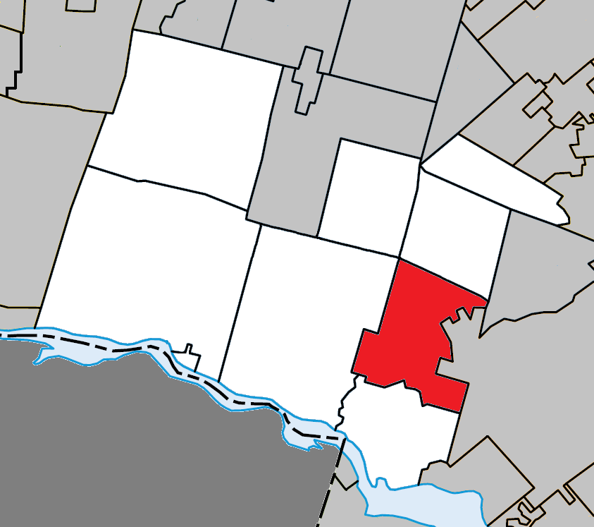
[edit]Adjacent municipal subdivisions | |
|---|---|
| Towns | |
|---|---|
| Municipalities | |
| Townships | |
| Villages | |
| |
| International | |
|---|---|
| National | |
| Geographic | |
Lachute
View on GrokipediaHistorical Development
Founding and Early Settlement
The seigneury of Argenteuil, encompassing the area of present-day Lachute, was granted by the French crown on June 15, 1682, to Charles Joseph d'Ailleboust d'Argenteuil, but remained largely undeveloped wilderness due to its remote location along the Rivière du Nord and challenges of access from the Ottawa River settlements.[7] Actual European settlement in the Lachute vicinity began in the mid-1790s, following the influx of migrants from the United States after the American Revolutionary War, with pioneers drawn by the potential for mills at the river's falls, known as "La Chute."[8] In 1796, Jedediah Lane, originating from Jericho, Vermont, acquired several thousand acres straddling the Rivière du Nord and initiated sales of lots in what became known as "Lane's Purchase," marking the foundational land division for the community.[9] That same year, Hezekiah Clark and his family, also from Jericho, established residence near the falls, becoming among the earliest permanent residents amid the forested terrain.[10] These initial settlers, primarily English-speaking Protestants of American and Scottish descent, focused on subsistence farming, logging, and rudimentary milling, with the outpost initially referred to as "The Chute Settlement" to denote its position at the rapids.[8] By the early 1800s, additional families from Vermont and Loyalist backgrounds reinforced the pioneer community, supported by proximity to established outposts like St. Andrews East, though growth remained modest until infrastructure like sawmills emerged later in the decade.[11] The predominantly non-Francophone character of these early inhabitants reflected broader patterns of English-speaking migration into the Laurentians post-1783, distinct from French seigneural traditions elsewhere in Quebec.[12]Industrial Expansion in the 19th and 20th Centuries
The waterfalls on the North River, known as La Chute, provided hydraulic power that facilitated early milling operations, transitioning from agricultural processing to manufacturing in the mid-19th century.[13] By 1872, the Lake George Manufacturing Company established a cotton mill below the upper falls, capitalizing on the regional textile boom and employing water-powered machinery for fiber processing.[13] In the late 1870s to 1890s, Lachute's industry expanded significantly with the establishment of two dominant firms: the Ayers Woolen Mill, founded by Thomas Henry Ayers and Félix Hamelin, and the Wilson Paper Mill, initiated by James Crocket Wilson, which leveraged the river's flow for pulp and paper production.[8] [5] These enterprises drove economic growth, attracting workers and infrastructure development, including a railway line connecting Montreal and Ottawa that passed through the town around 1880, enhancing raw material transport and market access.[5] Into the 20th century, the textile and paper sectors sustained expansion, with Ayers Woolen Mill employing hundreds in wool processing and contributing to the 1952 incorporation of Ayersville, a village named for the Ayers family.[8] Labor unrest, such as the 1946–1947 strike involving 600–650 workers at Ayers, underscored the scale of operations and the workforce's reliance on these factories amid post-war economic shifts.[14] Overall, these industries transformed Lachute from a settlement focused on farming into a manufacturing hub, with prosperity tied to hydropower-dependent production until broader Quebec industrialization trends influenced diversification.[8][5]Post-War Growth and Modern Transitions
Following World War II, Lachute benefited from Quebec's broader post-war economic boom, characterized by industrialization, urbanization, and the baby boom, which drove population increases across the province. The town's population stood at 6,936 in 1963, supported by its established paper mills, textile operations, and lumber activities that had anchored the local economy since the 19th century.[15] [16] These sectors expanded amid rising demand for manufactured goods, with the proximity to Montreal enabling workforce commuting and resource transport via rail and road networks. In 1966, Lachute underwent municipal reorganization by merging with the adjacent village of Ayersville—incorporated in 1952 and named after a prominent textile family—expanding its administrative boundaries and integrating additional residents and industrial lands.[16] This consolidation aligned with provincial trends toward efficient local governance during a period of rapid suburbanization. Population growth continued steadily, reaching 10,082 by the 2016 census, a reflection of influxes from nearby urban centers and natural increase.[17] By 2021, it had climbed to 14,100, marking Lachute as Canada's fifth-fastest-growing small city in recent years, fueled by affordable housing and accessibility.[18] [19] Infrastructure developments further catalyzed transitions, notably the extension of Autoroute 50 through the Lachute-Mirabel corridor in the 1970s and 1980s, which underwent environmental assessments to mitigate impacts on local waterways and habitats while enhancing east-west connectivity.[20] This highway reduced travel times to Montreal by over 50 km, positioning Lachute as a viable bedroom community for the metropolitan workforce and boosting logistics for remaining manufacturing.[21] Into the late 20th and early 21st centuries, Lachute's economy shifted amid Quebec's deindustrialization pressures, with paper and textile mills facing global competition and closures in similar resource-dependent towns.[22] Traditional sectors like lumber persisted but diversified toward services, retail, and small-scale advanced manufacturing, supported by the town's role in the Argenteuil Regional County Municipality. Recent initiatives emphasize sustainability, including a 2025 partnership with developer Montoni to integrate green building standards in new residential and commercial projects, aiming to balance growth with environmental constraints.[23] Population projections suggest continued expansion at around 1.85% annually, driven by remote work trends and regional appeal, though challenges include housing affordability and infrastructure strain.[4]Geography and Environment
Location and Physical Features
Lachute is located in the Laurentides region of southwestern Quebec, Canada, approximately 62 kilometres northwest of Montreal. It serves as the administrative centre of the Argenteuil Regional County Municipality. The city's geographic coordinates are 45°39′21″ N, 74°20′20″ W.[24][25] The municipality covers a land area of 108.66 square kilometres, with a population density of 129.8 persons per square kilometre as of the 2021 census. Lachute lies along the Rivière du Nord, a tributary of the Ottawa River, which forms part of its southern boundary and has historically influenced settlement due to waterfalls providing hydropower.[26] Physically, Lachute occupies the transition zone between the flat St. Lawrence Lowlands to the south and the rising foothills of the Laurentian Mountains to the north, resulting in gently rolling terrain with elevations ranging from about 50 to 150 metres above sea level. The surrounding landscape includes mixed forests and agricultural plains typical of the region's piedmont. Access is facilitated by Quebec Autoroute 50, which runs through the area, connecting it to major urban centres.[27]Climate Patterns
Lachute experiences a warm-summer humid continental climate (Köppen Dfb), characterized by cold, snowy winters, warm and humid summers, and precipitation distributed throughout the year.[28] The mean annual temperature is approximately 7°C (45°F). Winters are harsh, with January—the coldest month—featuring average highs of -6°C (21°F) and lows of -16°C (3°F); snowfall during this period averages 43 cm (17 inches) in December alone, contributing to a seasonal total of about 210 cm (83 inches).[29][30] Summers are mild to warm, peaking in July with average highs of 24°C (76°F) and lows of 13°C (55°F); the region sees higher humidity and occasional muggy conditions from June to September, with about 3.8 muggy days in July. The frost-free period generally spans late May to early October.[29] Annual precipitation totals roughly 950–1,000 mm, including both rain and the liquid equivalent of snow, with around 144 days of measurable precipitation; summer months like June bring the highest rainfall at about 79 mm (3.1 inches), while the snowy season extends from mid-October to mid-May.[31][29]Demographics and Social Composition
Population Dynamics
The population of Lachute has shown consistent growth since the early 2000s, driven primarily by net migration and modest natural increase, though specific causal factors such as proximity to Montreal's metropolitan area and local economic opportunities in manufacturing have contributed to recent accelerations. In the 2021 Census of Population, Lachute recorded 14,100 residents, reflecting a 9.6% rise from the 12,862 inhabitants enumerated in 2016, outpacing Quebec's provincial growth rate of 4.0% over the same period.[18][26] This expansion corresponded to 6,862 total private dwellings, with 6,531 occupied, and a population density of 129.8 persons per square kilometer across the municipality's approximately 108.7 square kilometers.[18] Historical census data illustrate a pattern of gradual expansion, with slower growth in the mid-2000s transitioning to stronger gains post-2011:| Census Year | Population | Percentage Change from Previous Census |
|---|---|---|
| 2001 | 11,628 | - |
| 2006 | 11,832 | +1.8% |
| 2011 | 12,551 | +6.1% |
| 2016 | 12,862 | +2.5% |
| 2021 | 14,100 | +9.6% |
Linguistic and Ethnic Profile
In the 2021 Canadian census, French was the mother tongue of 11,855 residents of Lachute, comprising approximately 85.8% of the total population excluding institutional residents (13,820 individuals).[34] English was reported as the sole mother tongue by 1,275 people, or about 9.2%, while 230 individuals (1.7%) had a single non-official language as their mother tongue, and 460 (3.3%) reported multiple mother tongues.[34] These figures reflect a predominantly francophone linguistic environment consistent with broader patterns in Quebec's Laurentides region, where French dominance stems from historical settlement and provincial language policies prioritizing French.[35] Knowledge of official languages among Lachute residents shows high proficiency in French, with bilingualism (English and French) prevalent among a subset, particularly those with English mother tongues; however, exact census breakdowns for conversational ability indicate that the majority converse primarily in French, aligning with Quebec's official language framework under Bill 101.[18] Non-official languages, though marginal in mother tongue reports, include small instances of Arabic, Spanish, and Indigenous languages, but their use at home remains negligible based on single-response data.[34] Ethnically, Lachute's population is largely of European descent, with the most frequently reported cultural origin being Canadian (5,230 persons, 39.1% of responses), followed by French (3,050, 22.8%), Québécois (1,975, 14.8%), French Canadian (1,030, 7.7%), and Irish (980, 7.3%).[36] These origins reflect waves of French colonial settlement and subsequent British Isles immigration in the 19th century, with "Canadian" often denoting assimilated Franco-Canadian heritage. Visible minorities constitute a small fraction at 1.5% (205 individuals), predominantly Black (85 persons, 0.6%), with minor representation from South Asian, Chinese, and Latin American groups (each around 25 persons, or 0.2%).[36] The low diversity in visible minorities underscores Lachute's historical homogeneity as a rural-industrial town, with limited recent immigration compared to urban Quebec centers.[36] Indigenous identity is reported minimally, aligning with regional census trends outside major reserves.[18]Economy and Industry
Traditional Sectors
Agriculture formed the backbone of Lachute's early economy, with settlers relying on farming to sustain their communities in the fertile valleys of the Argenteuil region during the 19th century.[16] Crop cultivation, including grains and vegetables, alongside livestock rearing, provided essential livelihoods before industrialization took hold, leveraging the area's proximity to the Rivière du Nord for irrigation and transport.[37] The town's waterfalls, known as "La Chute," powered the emergence of textile and pulp industries from the mid-19th century onward. A cotton factory commenced operations in 1872, followed by wool mills established by the Ayers family, which specialized in woollen goods and contributed to the naming of Ayersville (merged with Lachute in 1966).[13][16] These textile operations harnessed hydraulic power from the river's upper falls, employing local labor in spinning and weaving until the early 20th century.[38] Pulp and paper manufacturing became a cornerstone sector, with mills utilizing the abundant timber resources from surrounding Laurentian forests. The arrival of the Montreal-Ottawa railway in the late 19th century facilitated timber transport and industry expansion, establishing paper production as a dominant employer by 1900.[39] Lumber processing complemented these activities, involving logging and sawmills that processed regional hardwoods and softwoods for construction and export. By the early 20th century, these resource-based industries—textiles, paper, and lumber—accounted for the majority of Lachute's economic output, driving population growth and infrastructure development.[5]Contemporary Economic Activities
Contemporary economic activities in Lachute center on a mix of manufacturing, services, retail, construction, and recycling, supported by 1,305 enterprises as of recent assessments. Manufacturing includes 63 firms focused on transformed goods, such as Cascades Tissue Group's production of tissue and paper products at its facility employing local workers in specialized processing.[40][41] The recycling sector stands out prominently, with Tricentris operating a major materials recovery facility that processes recyclables for regional distribution, emphasizing industrial symbiosis and circular economy principles as part of municipal strategic goals.[42] Services represent the largest category with 286 businesses in entertainment, personal care, and related areas, while retail (159 firms) and construction (160 firms) contribute significantly to employment, particularly in sales, services, and transport/machinery trades that dominate local occupations.[40] Agriculture sustains 41 enterprises across 2,000-3,000 hectares, focusing on regional production amid the surrounding plain. Tourism and recreation add dynamism through 88 annual events and proximity to lakes, bolstering visitor-related services, though manufacturing and logistics in five industrial parks, including Autoroutier with firms like Ice River Springs for bottled water processing, drive export-oriented growth via air and road access near Montreal and Mirabel.[42][43][6] Workforce participation stands at 49.3% among the working-age population (15-64 years), with strategic initiatives targeting employability enhancement and downtown revitalization to counter challenges like plant closures, such as Agropur's 2019 exit from ice cream production, by attracting sustainable industries.[40][44][42]Growth Trends and Challenges
Lachute's economy has benefited from population-driven expansion, with the town's population rising 9.6% from 12,871 in 2016 to 14,100 in 2021, signaling underlying demand for goods, services, and housing.[18] This momentum contributed to Lachute ranking as Canada's fifth fastest-growing small city, recording a 2.9% population increase from July 2020 to July 2021.[19] Industrial development represents a key growth vector, anchored by the Synercité industrial park, which features available lots in prime locations to attract businesses.[45] In September 2025, municipal plans advanced for a 1.8 million square foot industrial site designed for innovative enterprises, projected to yield substantial economic spillovers across the Laurentides region.[46] The local business landscape comprises 1,305 enterprises, including 33% small and medium-sized firms with 1 to 5 employees, underscoring Lachute's role as an economic hub in Argenteuil.[40] Sustainability-oriented initiatives further bolster trends, such as the 2023 launch of Synerlab, a circular economy innovation center fostering partnerships for resource-efficient solutions among firms and stakeholders.[47] Federal support in 2021 provided $300,000 to Tricentris for green process upgrades, yielding two new positions and exemplifying recovery-focused investments.[48] Despite these advances, challenges persist in sustaining momentum amid Quebec's subdued provincial growth, with GDP expanding at an annualized 1.9% through 2025—below national peers and constraining local investment.[49] The city's 2019-2025 strategic plan emphasizes balancing economic vitality with environmental imperatives, as rapid permit demands strain urban planning and infrastructure.[50] Housing pressures from influxes prompted a 2024 budget allocating resources to affordable units, highlighting affordability as a barrier to retaining workforce gains.[51] Regional entrepreneurship awards via Défi OSEntreprendre signal vitality, yet Quebec's 12.4% drop in entrepreneurs from 2019 to 2021 underscores broader talent retention risks.[52][53]Government and Public Administration
Municipal Governance
Lachute's municipal government operates under the framework of Quebec's Cities and Towns Act, with a council comprising a mayor elected at large and six councillors, each representing one of the city's six districts. The council is responsible for enacting bylaws, approving annual budgets, managing public services such as water, waste, and recreation, and overseeing urban planning and development. Elections occur every four years on the first Sunday of November, synchronized across Quebec municipalities; the current term stems from the November 7, 2021, election.[54] Bernard Bigras-Denis has served as mayor since November 2021, having been elected as the candidate of Équipe Vision Lachute, a local political party focused on community development and infrastructure improvements. This party achieved a complete sweep, securing the mayoralty and all six councillor seats, a configuration that has persisted through the 2021-2025 term amid limited internal changes or by-elections.[55][56] The current council members, as listed on the city's official website, are:- District 1: Aline Gravel
- District 2: Virginie Filiatrault
- District 3: Christian David
- District 4: Gaétan Larose
- District 5: Guylaine Cyr-Desforges
- District 6: Hugo Lajoie (deputy mayor)