

Community hub
Recent from talks
Contribute something
Nothing was collected or created yet.
Porvenir, Chile
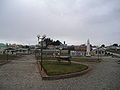
View on WikipediaPorvenir is the capital of both the homonymous commune and the Chilean Province of Tierra del Fuego of the Magallanes y la Antártica Chilena Region. It is one of Chile's southernmost towns, and has 4,734 inhabitants, including several thousand soldiers. It is the largest settlement in the Chilean half of the island of Tierra del Fuego.
Key Information


Porvenir (Spanish for "hereafter" – literally "yet to come") was founded in 1883 by immigrants from Croatia[citation needed] and Chiloé in connection to the gold mining that preceded the larger Tierra del Fuego gold rush that started in 1884.
The main sources of income are sheep farming and small-scale fishing (wrecks in Porvenir bay prevent larger vessels from mooring). In addition there is a regiment of the Chilean army and a high-security prison. An abattoir operates for only short periods of the year.
Some gold deposits remain and are commercially mined. Porvenir also gives access to Cerro Sombrero, an oil town, 125 km (78 mi) north-east of Porvenir.
Demographics
[edit]| Year | Pop. | ±% p.a. |
|---|---|---|
| 1930 | 1,793 | — |
| 1940 | 2,844 | +4.72% |
| 1952 | 2,654 | −0.57% |
| 1970 | 3,796 | +2.01% |
| 1982 | 7,219 | +5.50% |
| 1992 | 5,104 | −3.41% |
| 2002 | 5,465 | +0.69% |
| 2017 | 6,801 | +1.47% |
| 2024 | 6,809 | +0.02% |
| Source: "Censo de Población y Vivienda". National Statistics Institute. | ||
According to the 2002 census of the National Statistics Institute, Porvenir spans an area of 6,982.6 km2 (2,696 sq mi) and has 5,465 inhabitants (3,307 men and 2,158 women). Of these, 4,734 (86.6%) lived in urban areas and 731 (13.4%) in rural areas. The population grew by 7.1% (361 persons) between the 1992 and 2002 censuses.[2]
Administration
[edit]As a commune, Porvenir is a third-level administrative division of Chile administered by a municipal council, headed by an alcalde who is directly elected every four years. The 2016-2020 alcaldesa is Marisol Andrade Cárdenas .[1]
Within the electoral divisions of Chile, Porvenir is represented in the Chamber of Deputies by Juan Morano (PDC) and Gabriel Boric (Ind.) as part of the 60th electoral district, which includes the entire Magallanes y la Antártica Chilena Region. The commune is represented in the Senate by Carlos Bianchi Chelech (Ind.) and Carolina Goic (PDC) as part of the 19th senatorial constituency (Magallanes y la Antártica Chilena Region).
Tourism
[edit]
Though tourism is expanding, most tourists pass Porvenir by, or use it simply as a stopover on their way farther south. There are several hotels, cyber-cafes, restaurants, and one gas station. A small grocery store is located near the Chilean army base on the upper level of the town, and there are several small stores and supermarkets elsewhere in town.
Access is by ferry or by air from Punta Arenas or by road from the Argentine side of the island. All ferries across the Straits of Magellan are run by Austral Broom, a Chilean company. One service runs once daily except Mondays from the port near Punta Arenas and reaches the ferry terminal about 3 km from the town of Porvenir. The other service is at the northern end of the island running from Punta Delgada to Bahia Azul.
It is possible to reach the south of Chilean Tierra del Fuego from Porvenir. The southern region has several lakes and rivers available for fishing.
Climate
[edit]The climate in Porvenir is a subpolar variety (Köppen: Cfc) of the oceanic climate. Temperatures in the warmest months, January and February average 10.7 °C (51.3 °F) while temperatures in the coolest month average 1.7 °C (35.1 °F). Precipitation is at around 749 millimetres (29.5 in). Also, due to its latitude, the length of the day varies tremendously across the year. Winter days can have as few as seven hours of sunlight, while summer days stretch to twenty hours. Frost occurs throughout the year, and winter temperatures can remain below freezing for relatively long periods of time. Freak snowfalls can occur even in midsummer. The highest temperature was 32.2 °C (90.0 °F) in February 2019.[3][4]
| Climate data for Porvenir (1991–2020, extremes 1986–present[a]) | |||||||||||||
|---|---|---|---|---|---|---|---|---|---|---|---|---|---|
| Month | Jan | Feb | Mar | Apr | May | Jun | Jul | Aug | Sep | Oct | Nov | Dec | Year |
| Record high °C (°F) | 26.7 (80.1) |
32.2 (90.0) |
26.0 (78.8) |
20.8 (69.4) |
14.2 (57.6) |
13.2 (55.8) |
14.9 (58.8) |
13.6 (56.5) |
18.2 (64.8) |
20.9 (69.6) |
25.2 (77.4) |
27.4 (81.3) |
32.2 (90.0) |
| Mean daily maximum °C (°F) | 16.5 (61.7) |
15.8 (60.4) |
15.4 (59.7) |
12.4 (54.3) |
8.9 (48.0) |
6.3 (43.3) |
5.7 (42.3) |
7.1 (44.8) |
10.4 (50.7) |
12.9 (55.2) |
14.1 (57.4) |
16.0 (60.8) |
11.8 (53.2) |
| Daily mean °C (°F) | 10.8 (51.4) |
10.6 (51.1) |
9.1 (48.4) |
6.8 (44.2) |
4.2 (39.6) |
2.1 (35.8) |
1.7 (35.1) |
2.9 (37.2) |
4.7 (40.5) |
6.7 (44.1) |
8.6 (47.5) |
10.1 (50.2) |
6.5 (43.8) |
| Mean daily minimum °C (°F) | 4.8 (40.6) |
5.3 (41.5) |
4.0 (39.2) |
2.1 (35.8) |
0.1 (32.2) |
−1.3 (29.7) |
−1.9 (28.6) |
−1.0 (30.2) |
−0.5 (31.1) |
0.9 (33.6) |
3.3 (37.9) |
4.5 (40.1) |
1.7 (35.0) |
| Record low °C (°F) | −2.0 (28.4) |
−2.2 (28.0) |
−4.4 (24.1) |
−5.8 (21.6) |
−10.0 (14.0) |
−10.2 (13.6) |
−15.7 (3.7) |
−10.8 (12.6) |
−7.0 (19.4) |
−4.8 (23.4) |
−2.9 (26.8) |
−3.0 (26.6) |
−15.7 (3.7) |
| Average precipitation mm (inches) | 86 (3.4) |
65 (2.6) |
74 (2.9) |
74 (2.9) |
54 (2.1) |
47 (1.9) |
46 (1.8) |
49 (1.9) |
48 (1.9) |
56 (2.2) |
69 (2.7) |
81 (3.2) |
749 (29.5) |
| Average precipitation days | 15 | 12 | 12 | 11 | 9 | 8 | 9 | 9 | 10 | 11 | 13 | 15 | 134 |
| Average relative humidity (%) | 70 | 71 | 73 | 77 | 80 | 82 | 82 | 79 | 76 | 71 | 69 | 69 | 75 |
| Mean daily sunshine hours | 8.4 | 7.8 | 6.6 | 5.5 | 4.8 | 4.4 | 4.6 | 5.6 | 6.3 | 7.6 | 8.4 | 8.7 | 6.6 |
| Source 1: Climate-Data.org[5] | |||||||||||||
| Source 2: Dirección Meteorológica de Chile (normal temperatures and extremes)[6][4] | |||||||||||||
Note
[edit]- ^ Please enter the value "530005" in the parameter "Estación"
Gallery
[edit]-
 Monumento a los Inmigrantes.
 -
 Monumento en la Plaza de Armas.
 -
 Parque Croata.
 -
 San Francisco De Sales Church
 -
 Porvenir.


References
[edit]- ^ a b "Municipality of Porvenir" (in Spanish). Retrieved 3 December 2010.
- ^ a b c d "National Statistics Institute" (in Spanish). Retrieved 3 December 2010.
- ^ Campos, Diego (February 8, 2019). "Un activo verano en el Cono Sur". Meteochile Blog. Dirección Meteorológica de Chile. Retrieved February 20, 2019.
- ^ a b "Temperatura Histórica de la Estación" (in Spanish). Dirección Meteorológica de Chile. 2023-05-26.
- ^ "Climate: Porvenir". Climate-Data.org. Retrieved 12 April 2014.
- ^ "Temperaturas Medias y Extremas en 30 Años-Entre los años: 1991 al 2020-Nombre estación: Chacalluta, Arica Ap" (in Spanish). Dirección Meteorológica de Chile. Archived from the original on 27 May 2023. Retrieved 27 May 2023.
External links
[edit]
Porvenir, Chile
View on GrokipediaHistory
Founding and early settlement
The sparsely populated Tierra del Fuego region was home to the indigenous Selk'nam people prior to European colonization, who had inhabited the area for thousands of years as hunter-gatherers.[7] Porvenir originated as a police station established in 1883 amid early explorations and the need for administrative control in the remote Tierra del Fuego region of southern Chile.[8] This outpost served as an initial base for Chilean authorities to oversee the sparsely populated area, which was increasingly attracting settlers due to resource potential.[9] The formal founding of Porvenir occurred on June 20, 1894, by decree of President Jorge Montt, at the urging of Governor Manuel Señoret, marking its transition from a rudimentary station to an official settlement.[10] [11] This establishment aligned with broader efforts to consolidate Chilean presence in the archipelago, positioning the town as a key administrative hub.[12] Early settlement was driven by waves of immigrants, primarily from Croatia's Dalmatian coast and Chile's Chiloé Archipelago, who arrived seeking opportunities in ranching and small-scale mining.[13] [14] Croatian settlers, numbering around 400 to 500 in the area by the late 19th century, contributed significantly to the establishment of large cattle ranches known as estancias, while Chilote migrants provided labor for these operations and port activities.[15] [16] The expansion of estancias displaced the Selk'nam, leading to violent conflicts and their systematic extermination, with the indigenous population declining from approximately 4,000 in 1850 to around 100 by 1930.[17] As a vital port on the Strait of Magellan, Porvenir facilitated the influx of these European and domestic settlers, supporting the growth of pastoral economies in the harsh Patagonian environment.[18]Gold rush and economic shifts
The Tierra del Fuego gold rush, spanning from 1883 to 1906, acted as a primary catalyst for Porvenir's development, transforming the settlement into a vital hub for Chilean miners even prior to the rush's intensification in 1884. Initial gold discoveries in the region, including those near Sierra Boquerón in 1880, drew prospectors to the area's placer deposits along rivers and beaches, fostering rapid population growth and economic activity centered on extraction. Porvenir's strategic location on the Strait of Magellan facilitated supply lines and served as a base for operations across the archipelago, marking a pivotal phase in the town's emergence as a frontier outpost.[19][20] The gold rush exacerbated conflicts with the Selk'nam, as miners and settlers, including bounty hunters, killed indigenous people to clear land, contributing to the ongoing genocide.[21] A significant boost came from Romanian explorer Julius Popper, whose 1886 expedition landed at Bahía Porvenir before proceeding to richer deposits in San Sebastián Bay, where his team extracted substantial yields using innovative machinery. Popper patented the "gold harvester" in Argentina in 1889—a series of dredges and washing devices designed to efficiently process gold-bearing sands—enabling large-scale recovery at his El Páramo camp and inspiring further investment in the rush. This period saw a diverse influx of prospectors, including Chileans, Argentines, and Europeans such as Dalmatians from Croatia, who arrived as fishermen and sailors but turned to mining, contributing to the multicultural fabric of the operations. Popper's operations were notorious for employing armed guards who massacred Selk'nam communities, with documented photographs staging killings to secure mining claims.[19][22][23][17] Following the rush's decline around 1906, Porvenir's economy shifted toward sheep farming, with the establishment of large ovine estancias on the island's pampas starting in the 1880s and expanding in the early 20th century as former miners and new settlers capitalized on vast grazing lands for wool and meat production. Fishing also emerged as a complementary sector, utilizing the coastal resources to sustain the community amid the waning dominance of mining. Although large-scale gold extraction ended, small-scale mining of residual deposits persists today, with the Magallanes region—encompassing Porvenir—reporting 3 kg of gold production in 2023, primarily from artisanal operations.[19][20][24]Geography
Location and regional context
Porvenir is situated at coordinates 53°17′S 70°22′W, serving as the capital of the Tierra del Fuego Province within Chile's Magallanes y la Antártica Chilena Region.[25] It is the largest settlement in the Chilean portion of Tierra del Fuego, with a population exceeding that of other local communities such as Cerro Sombrero.[26] As the administrative center, the commune of Porvenir encompasses an area of 6,982.6 km², providing governance over a significant portion of the island's western territory.[27] The town is located on the northwest coast of Isla Grande de Tierra del Fuego, directly at Bahía Porvenir along the Strait of Magellan, with an elevation of 25 meters above sea level.[28][29][30] This strategic positioning on the northern shoreline facilitates connectivity to the Chilean mainland, approximately 50 km away from Punta Arenas via ferry across the strait.[31] From Porvenir, access extends to the southern areas of Chilean Tierra del Fuego, including expansive regions dotted with lakes and rivers that support local exploration and resource activities.[1] The surrounding regional context highlights Porvenir's role as a gateway to the island's remote interior, where windswept plains dominate the landscape.[32]Physical features and environment
Porvenir is situated on the northwestern coast of Isla Grande de Tierra del Fuego, where the terrain is characterized by vast, flat pampas and open grasslands typical of the Patagonian steppe, extending across much of the island's western sector.[33] These windswept plains are interspersed with peat bogs and scattered subantarctic forests dominated by Nothofagus species, such as Antarctic beech, which cling to more sheltered areas. The landscape offers distant views of the Strait of Magellan to the north and the rugged peaks of the Cordillera Darwin to the southwest, contributing to a sense of expansive isolation.[34] The coastal environment features Bahía Porvenir, a sheltered bay that supports a range of intertidal and marine habitats conducive to small-scale fishing activities, with mudflats and rocky shores hosting diverse invertebrate communities.[35] Inland, the rural hinterlands consist of extensive grasslands adapted to grazing by introduced sheep, which shape the mosaic of low-lying vegetation including tussock grasses and cushion plants resilient to harsh conditions.[33] Biodiversity in the region includes native mammals like the guanaco (Lama guanicoe), which roams the open pampas as a key herbivore, alongside a variety of birds such as the Chilean flamingo (Phoenicopterus chilensis), coscoroba swan (Coscoroba coscoroba), and upland goose (Chloephaga picta), which utilize wetlands and coastal areas.[36][37] Conservation efforts in the vicinity emphasize the protection of these fragile ecosystems, with Porvenir's local authorities supporting initiatives like the Seno Almirantazgo Marine Protected Area, an 80-km fjord in the region that safeguards marine biodiversity including Magellanic penguins and leopard seals.[38] The broader Tierra del Fuego region includes nearby reserves such as Karukinka Natural Reserve, which preserves peat bogs, forests, and steppe habitats threatened by invasive species and habitat fragmentation.[39] Environmental challenges include wind-driven erosion of the exposed soils in the pampas, exacerbated by the area's remoteness, which limits monitoring and restoration efforts.[40]Climate
Classification and overview
Porvenir's climate is classified under the Köppen-Geiger system as subpolar oceanic (Cfc), defined by cool summers where the warmest month averages below 22°C, mild winters with no month below 0°C on average, and year-round precipitation without a pronounced dry season, accompanied by persistently high humidity levels.[41] This classification reflects the region's temperate maritime conditions, with all months featuring sufficient moisture to support no significant arid periods.[42] The locality experiences an annual precipitation total of approximately 770 mm, occurring almost entirely as rain due to the absence of extreme cold that would favor snowfall accumulation. Influenced by cold Antarctic oceanic currents and persistent westerly winds from the South Pacific, the climate maintains an average annual temperature of about 6°C, fostering frequent fog and persistent drizzle characteristic of its coastal exposure.[43] These factors contribute to a consistently overcast atmosphere, with relative humidity often exceeding 75% annually. In comparison to broader Patagonian interiors, Porvenir's weather is notably milder, benefiting from oceanic moderation that tempers temperature extremes and increases moisture relative to the drier, windier continental areas farther east.[44] Despite this, the environment remains challenging, with subdued seasonal daylight shifts owing to the high latitude near 53°S.[45]Seasonal patterns and records
Porvenir experiences pronounced seasonal variations in temperature and precipitation, influenced by its subpolar oceanic climate, which features cool, wet summers and cold, moderately wet winters. During the summer months of December to February, average high temperatures reach up to 13.5°C in January, while lows typically range from 6°C to 8°C. This period represents the warmest time of the year, with longer daylight hours and occasional heatwaves that can push daytime temperatures significantly higher, as seen in the record high of 32.5°C recorded on February 4, 2019—the southernmost 90°F (32°C) reading ever observed globally. Precipitation averages 65–86 mm per month, making it one of the wetter seasons, though relative humidity remains high, contributing to misty conditions.[30][46] In winter, from June to August, average highs hover between 5°C and 7°C, with lows dipping to 1.7–2.5°C, particularly in July, the coldest month. Frost occurs frequently, but snowfall is rare at sea level due to the maritime influence, though it becomes more common at higher elevations nearby. These months see precipitation levels of 60–63 mm, among the lower annual totals, but persistent cloud cover and shorter days amplify the chill.[30] Extreme weather events underscore the variability: the all-time low temperature is -7.3°C, recorded in July, while wind gusts can exceed 100 km/h, especially during transitional seasons, driven by the region's exposure to westerly winds from the Pacific.[47] These records and patterns are derived from observations at the local Meteochile station in Porvenir.[30]Demographics
Population trends
The population of Porvenir has experienced gradual growth since its early settlement, primarily fueled by European and Chilean immigration during the late 19th and early 20th centuries' gold rush era. In the early 1900s, the town had approximately 1,000 inhabitants, a figure that reflected initial waves of settlers establishing cattle ranches and mining operations amid the island's remote conditions.[48] By the mid-20th century, this had expanded modestly, reaching 1,793 by 1930 as economic shifts toward pastoral activities sustained limited influxes.[48] In 2012, the commune population was estimated at 5,907, with approximately 5,390 in the urban area.[49] The 2017 census confirmed 6,801 inhabitants in the commune, with 6,062 in the urban core, representing continued modest expansion at an annual rate of about 1.7% from prior benchmarks.[50][51] The 2024 census recorded 6,809 residents in the commune.[52] The commune's population density stands at 0.70 inhabitants per square kilometer as of the 2024 census, emblematic of its vast rural hinterland spanning 9,707.4 km², where dispersed estancias dominate land use beyond the urban nucleus.[2] In 2012, the urban-rural distribution showed approximately 91% of the 5,907 residents (5,390 individuals) concentrated in the town, with the remainder in rural zones tied to agricultural estates.[49] By 2017, this urban share had stabilized at 89.1% (6,062 out of 6,801).[51] Gender distribution has consistently favored males, influenced by military and extractive employment. In 2012, there were 3,383 men compared to 2,524 women among the commune's 5,907 residents.[49] This skew persisted in the 2017 census, with 3,993 males and 2,808 females (masculinity index of 142.2).[51] The 2024 census showed 3,592 males and 3,217 females (masculinity index of 111.7).[53]| Year | Commune Population | Urban Population | Source |
|---|---|---|---|
| Early 1900s | ~1,000 | N/A | City-Facts |
| 2012 (est.) | 5,907 | 5,390 | INE Preliminary |
| 2017 (census) | 6,801 | 6,062 | BCN/INE |
| 2024 (census) | 6,809 | N/A | INE |