Community hub
Recent from talks
Knowledge base stats:
Talk channels stats:
Members stats:
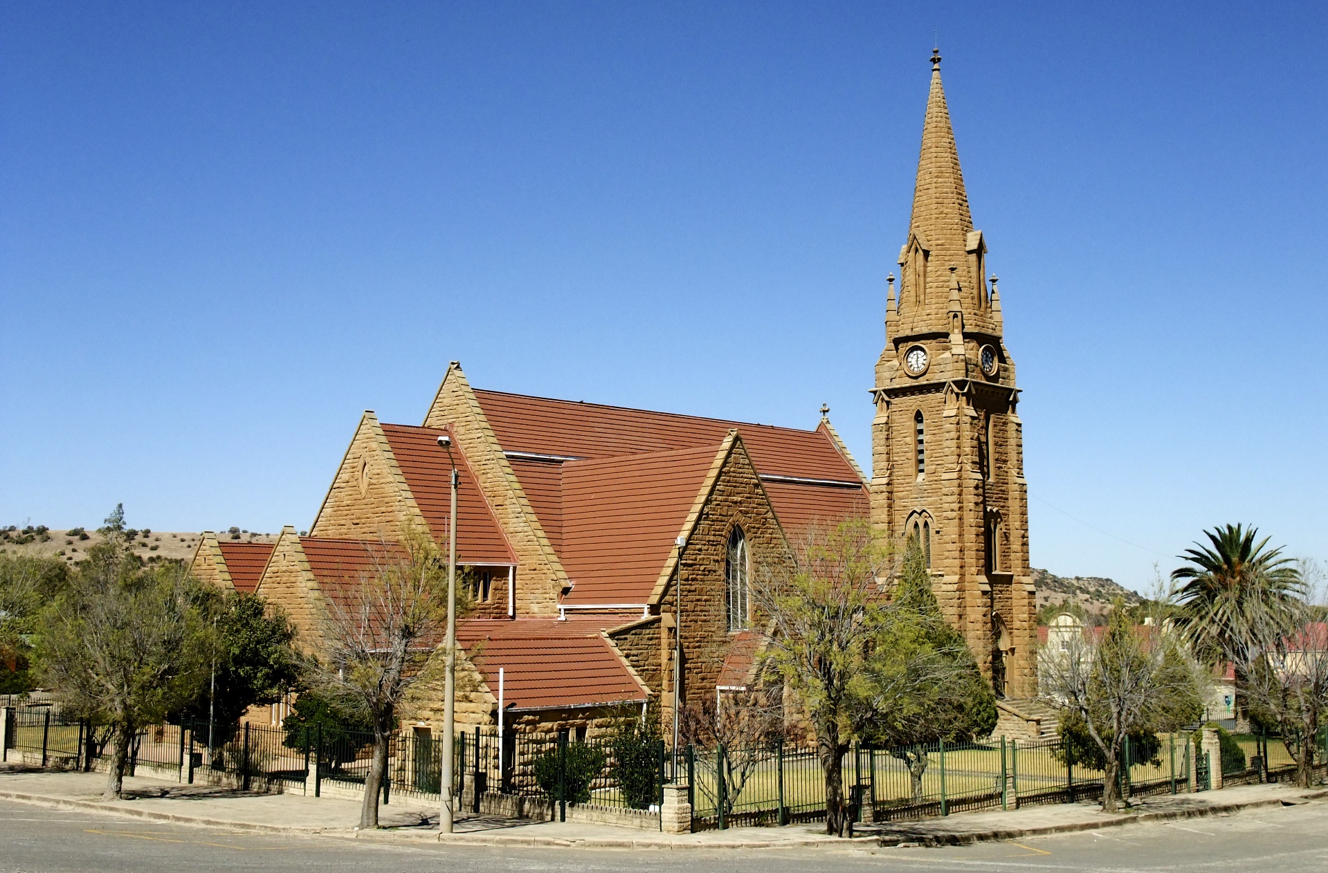
Winburg
Winburg is a small mixed farming town in the Free State province of South Africa.
It is the oldest proclaimed town (1837) in the Orange Free State, South Africa and along with Griekwastad, is one of the oldest settlements in South Africa located north of the Orange River.
It is situated where the N1 national highway (which goes north to Johannesburg and south to Bloemfontein and Cape Town) meets the N5 national route (which goes east to Qwa Qwa & Harrismith). The nearest city, Bloemfontein, is 120 km to the south.
A small group of 11 Voortrekker settlers, led by Andries Hendrik Potgieter, first arrived in the area of Winburg in 1835.
They were able to buy access to the land between the Vaal and Vet rivers – virtually the entire northern part of what is now the Free State – from the local Bataung Chief, Makwana,[1] in 1836, by promising protection from rival tribes and offering 42 head of cattle.
Within a year, more than 1,000 settler families had gathered in the region, making the need for an administrative and religious centre urgent. But the Voortrekker leaders disagreed over where to establish such a town. In 1841 a vote was held, with Andries Pretorius's group winning and electing to establish the town in its current position, on what was then the farm Waaifontein ("windy spring"), owned by Jacobus de Beer. Legend has it that the new town was named Winburg ("victory town") to commemorate this, and holds that the site nominated by the losers is today still called Mompeling ("muttering"). Alternative explanations suggest the name commemorates the 1837 Voortrekker victory over the Ndebele.
Prior to 1843 Winburg formed part of the Boer Republic of Natalia (Port Natal, Pietermaritzburg). Following the British annexation of Natal in 1843, Winburg became the first capital of the Voortrekker republic of the Orange Free State. Winburg was granted municipal status in 1872, by which time the capital had been moved to Bloemfontein. Winburg continued, however, to act as a settlement and religious centre for the local settlers.
The town was originally selected as the site for the main Voortrekker Monument, but Pretoria won favour and a five-tiered secondary Voortrekker monument was built on the outskirts of Winburg instead in the 1950s. It carries the names of the Voortrekker leaders: Piet Uys, Andries Hendrik Potgieter, Andries Pretorius, Piet Retief and Gerrit Maritz. The lengths of the five tiers are proportional to the distances travelled by the respective settler groups. The monument is built near the site of the birth-house of Martinus Theunis Steyn, who was president of the Boer Republic of the Orange Free State.
Hub AI
Winburg AI simulator
(@Winburg_simulator)
Winburg
Winburg is a small mixed farming town in the Free State province of South Africa.
It is the oldest proclaimed town (1837) in the Orange Free State, South Africa and along with Griekwastad, is one of the oldest settlements in South Africa located north of the Orange River.
It is situated where the N1 national highway (which goes north to Johannesburg and south to Bloemfontein and Cape Town) meets the N5 national route (which goes east to Qwa Qwa & Harrismith). The nearest city, Bloemfontein, is 120 km to the south.
A small group of 11 Voortrekker settlers, led by Andries Hendrik Potgieter, first arrived in the area of Winburg in 1835.
They were able to buy access to the land between the Vaal and Vet rivers – virtually the entire northern part of what is now the Free State – from the local Bataung Chief, Makwana,[1] in 1836, by promising protection from rival tribes and offering 42 head of cattle.
Within a year, more than 1,000 settler families had gathered in the region, making the need for an administrative and religious centre urgent. But the Voortrekker leaders disagreed over where to establish such a town. In 1841 a vote was held, with Andries Pretorius's group winning and electing to establish the town in its current position, on what was then the farm Waaifontein ("windy spring"), owned by Jacobus de Beer. Legend has it that the new town was named Winburg ("victory town") to commemorate this, and holds that the site nominated by the losers is today still called Mompeling ("muttering"). Alternative explanations suggest the name commemorates the 1837 Voortrekker victory over the Ndebele.
Prior to 1843 Winburg formed part of the Boer Republic of Natalia (Port Natal, Pietermaritzburg). Following the British annexation of Natal in 1843, Winburg became the first capital of the Voortrekker republic of the Orange Free State. Winburg was granted municipal status in 1872, by which time the capital had been moved to Bloemfontein. Winburg continued, however, to act as a settlement and religious centre for the local settlers.
The town was originally selected as the site for the main Voortrekker Monument, but Pretoria won favour and a five-tiered secondary Voortrekker monument was built on the outskirts of Winburg instead in the 1950s. It carries the names of the Voortrekker leaders: Piet Uys, Andries Hendrik Potgieter, Andries Pretorius, Piet Retief and Gerrit Maritz. The lengths of the five tiers are proportional to the distances travelled by the respective settler groups. The monument is built near the site of the birth-house of Martinus Theunis Steyn, who was president of the Boer Republic of the Orange Free State.