
Community hub
Recent from talks
Contribute something
Nothing was collected or created yet.
Aṉangu Pitjantjatjara Yankunytjatjara
View on Wikipedia
Aṉangu Pitjantjatjara Yankunytjatjara, also known as APY, APY Lands or the Lands, is a large, sparsely populated local government area (LGA) for Aboriginal people, located in the remote north west of South Australia. Some of the Aṉangu (people) of the Western Desert cultural bloc, in particular Pitjantjatjara, Yankunytjatjara and Ngaanyatjarra peoples, inhabit the Lands.
Key Information


Governance of the area is determined by the Anangu Pitjantjatjara Yankunytjatjara Land Rights Act 1981 (or APYLRA), whereby an elected executive board reports to the Premier of South Australia. The APY's administration centre is located at Umuwa.
A large portion of the APY Lands was formerly the North-West Aboriginal Reserve.
Time zone
[edit]Due to its links with the Northern Territory and proximity to the border, the APY Lands do not observe daylight savings unlike the rest of South Australia. The time zone observed throughout the year is Australian Central Standard Time (UTC+9:30), in line with Darwin rather than Adelaide.
History
[edit]Early history
[edit]The Pitjantjatjara and Yankunytjatjara people (aṉangu) had lived in this area for many thousands of years. Even after the British began to colonise the Australian continent from 1788 onwards, and the colonisation of South Australia from 1836, the aṉangu remained more or less undisturbed for many more years, apart from very occasional encounters with a variety of European explorers.[citation needed]
20th century
[edit]In 1921, with white settlement now beginning to encroach on the aṉangu's traditional land, the South Australian Government proclaimed the North-West Aboriginal Reserve. This Reserve consisted of most of what is now known as the APY Lands, with the exception of the eastern part of the APY Lands, which was given over to pastoral leases to Europeans.[citation needed]
In 1937, the Presbyterian Church council, spearheaded by Charles Duguid, established the Ernabella Mission on the Lands at the place now known as Pukatja.[citation needed]
By the 1950s, many aṉangu were living at the Ernabella Mission, while many others lived at camps on pastoral leases on what are now the Lands, or nearby, where they would work. Those pastoral leases included Granite Downs, Everard Park, Victory Downs, De Rose Hill, Kenmore Park, and Mount Cavanagh.[citation needed]
In 1961, to prevent overcrowding at Ernabella Mission, the Church established what became the community of Amata, but which was originally known as Musgrave Park. At the same time the Church also established what is now the community of Kaltjiti, but which was then known as Fregon.[citation needed]
In 1968, what is now the community of Indulkana was established by the South Australian Government, as a base from which to provide welfare services to aṉangu living in camps on pastoral leases, where work was becoming increasingly difficult to find. At that time, the surrounding area was excised from pastoral leases and declared the Indulkana Aboriginal Reserve.[citation needed]
The body now known as Aṉangu Pitjantjatjara Yankunytjatjara was formed in 1981 by the passing of the Anangu Pitjantjatjara Yankunytjatjara Land Rights Act 1981[8] by the Parliament of South Australia under Premier Don Dunstan, and includes the Pitjantjatjara, Yankunytjatjara and Ngaanyatjarra groups.[9]
"Ara Irititja" is a project of the APY, commenced in 1994 to identify, copy and electronically record historical materials about the Anangu (Pitjantjatjara/Yankunytjatjara people). Its purpose is to prevent the loss of the history, and to allow the teaching of it to others in the community.[10]
21st century
[edit]By 2007 the peoples of the region had not had any major economic development, apart from tourism, but there had been proposals to mine in the area. The opal fields of Mintabie came under separate governance that time.[11]
The Musgrave Block in the Lands has been viewed as having billions of dollars in potential mineral deposits and petroleum. But anangu have been wary of opening up the area to mining, concerned about the impact on sacred sites and the environment. In 2003 mining companies were conducting discussions to try to allay these worries.[12]
A 2004 parliamentary report on an inquiry by a select committee led by Minister for Aboriginal Affairs Terry Roberts examined the shortcomings of the 1981 Act, which had not addressed entrenched social and economic problems in the Lands. The review noted shortcomings in the delivery of human services and infrastructure, and identified a "need to address the issue of the overall governance of the AP Lands and to formalise arrangements within an Act of Parliament and/or the Constitution of Anangu Pitjantjatjara". After wide consultation and consideration of many submissions, the committee made 15 recommendations. One of these was the establishment of a permanent police presence, as one of several strategies used to combat the problems of petrol sniffing and family violence.[13]
In July 2007 South Australia Police in co-operation with liquor outlets in Coober Pedy (250 km to the south-east entrance to the Lands) agreed to create a register of alcohol purchases, to enable police to identify persons who purchased large quantities of alcohol in Coober Pedy potentially for transportation into Aboriginal lands.[citation needed] Also in July, Commonwealth Indigenous Affairs Minister Mal Brough offered federal help for a "drug and alcohol crackdown" in South Australian Aboriginal lands – such as the APY Lands.[14]
In early August 2007, the Rann South Australian Labor Government announced A$ 34 million package to "improve well-being of Aboriginal people" in the APY Lands. $25m was to be spent on improving housing and most of the remaining $8m on law enforcement in Amata and Pukatja.[15] In November, SA Police Commissioner Mal Hyde announced the signing of a new enterprise agreement for South Australia Police that would include incentive packages to lure police to work in rural and remote areas such as the Lands.[16]
In May 2008, retired Supreme Court judge the Hon Ted Mullighan QC delivered his supplementary report to his Children in State Care Commission of Inquiry, entitled the "Children on Aṉangu Pitjantjatjara Yankunytjatjara Lands Commission of Inquiry – a Report into Sexual Abuse" (aka "the Mullighan report").[17]
In December 2009 the South Australian Parliament passed the Aṉangu Pitjantjatjara Yankunytjatjara Land Rights (Mintabie) Amendment Bill,[18] which was an amendment to the APY Land Rights Act 1981, the Opal Mining Act 1995, and by-laws under the APY Land Rights Act 1981, affecting the mainly non-Indigenous residents of the opal-mining town, Mintabie.[19] This amendment changed the licensing system for residential and commercial premises effective 1 July 2012, allowing the Minister responsible for the Opal Mining Act to grant licences.[20]
A 2017 report found many instances of non-compliance with the 2009 Amendment as well as other problems occurring in the settlement of Mintabie. It recommended closure of the township, with control reverting to APY.[20] After an appeal by residents failed, the final eviction date for the township was set at 31 December 2019.[21]
In March 2024, the Kulilaya Festival was held at Umuwa to celebrate the 40th anniversary of the 1981 APY Land Rights Act. It had been delayed for three years owing to the impact of the COVID-19 pandemic. Artists, musicians, and dancers presented their history and stories to commemorate the occasion.[22] The word kulilaya approximates to the meaning of "listen", and was the name of a land rights protest song that was sung frequently in the late 1970s and early 1980s, and since then sung regularly by the Ernabella Choir, the APY Choir, and the Iwiri Choir.[23] Several inma ceremonies were performed,[24] politicians from across the spectrum attended the festival, and performers included Dem Mob, Docker River Band, the Iwiri Choir, Mala, the Pukatja Band, and Desert Rain.[23]
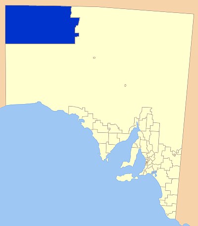
Geography and location
[edit]The Musgrave Ranges, straddling the border between South Australia and the Northern Territory and the Mann Ranges and Tomkinson Ranges, both in the north-west of South Australia, stretch from east to west on the southern side of the NT border. The APY area includes isolated ranges and hills and large sandhill plains, and APY people also have affiliations with land in the NT to the Petermann Ranges, and in Western Australia.[25]
Geology
[edit]There is a large palaeovalley, a geological term for an ancient, buried river, underneath the APY Lands. A map of the geological formation, complete with scientific and technical terminology, has been translated into Pitjantjatjara by a team of translators, based on the English-language map developed by government agencies.[26]
There is a long strip of limestone breaking through red soil near Fregon/Kaltjiti, where a new water source was found in 2019. The area is one of two places in the world which have landlocked tectonic plates, and drilling samples have been estimated to be between 5 and 10 million years old.[27]
Adjoining land
[edit]To the north of the APY Lands, the MacDonnell Shire Council was created by the Northern Territory in 2008, renamed MacDonnell Region in 2014, spanning the south of the Territory from west to east. Western Australia lies to the west. The South Australian LGA to the south of APY Lands is Maralinga Tjarutja (with the District Council of Coober Pedy to the east of that, but not adjoining APY).
The Outback Communities Authority is not an LGA, but is the statutory authority responsible for the development of areas adjoining the APY Lands (excluding the above-mentioned) as well as other large areas (63% of the state in total), to "manage the provision of public services and facilities to outback communities" which are widely dispersed across the region.[28]
Localities
[edit]The APY LGA encompasses a number of settlements of a range of sizes, many of them being located in the Musgrave Ranges. An interactive map shows the location of communities and further information about each on the Paper Tracker website.[29]
The main communities include Indulkana (Iwantja), Mimili, Kaltjiti (Fregon), Pukatja (Ernabella), Amata, Pipalyatjara, and Watarru; the larger homelands are Kalka, Kanpi, Nyapari and Yunyarinyi (homeland). The APY administration centre of the Lands is located at Umuwa.[2][30]
Mintabie was an opal-mining town, leased back to the Government of South Australia between 1981 and 2019, when the residents were evicted.[21][31][32][33]
The list of Aboriginal communities (c) and homelands (h):[2]
- Amata (c)
- Indulkana (c)
- Irintata (h)
- Iwantja (c)
- Kaljiti/Fregon
- Kalka (h)
- Kanpi (h)
- Mimili (c)
- Murputja (c)
- Nyapari (h)
- Pipalyatjara (c)
- Pukatja/Ernabella (c)
- Tjurma (h)
- Turkey Bore
- Umuwa – administrative centre
- Watarru (c)
- Watinuma
- Yunyarinyi (h)
Governance
[edit]Governance of the area is determined by the APY Land Rights Act 1981 (amended 2017), whereby an elected executive board reports to the Premier of South Australia.[34][35] The board appoints a general manager for a fixed term. Richard King was elected by the board in April 2015, and his term was extended for a year in March 2023, despite opposition by some councillors.[36] In August 2025, the South Australian Government announced the appointment of administrators to run the lands for three months from 3 September, after a review found the reappointment of its general manager was constitutionally invalid under the APY Land Rights Act. King said that, after 12 years in the job, he would return to his family in Adelaide.[37]
The statutory functions of the APY body corporate, a land council, are:[38]
- to ascertain the wishes and opinions of traditional owners in relation to the management, use and control of the lands and to seek, where practicable, to give effect to those wishes and opinions;
- to protect the interests of traditional owners in relation to the management, use and control of the lands; and
- to negotiate with persons desiring to use, occupy or gain access to any part of the lands;
- to administer land vested in Aṉangu Pitjantjatjara Yankunytjatjara.
The area is usually referred to as the APY Lands.[39][40][41][42] A permit is required for visitors to any community on the APY Lands, as they are freehold lands owned by the Aboriginal people.[43]
Electoral boundaries
[edit]The Anangu Pitjantjatjara Yankunytjatjara Lands Rights (Miscellaneous) Amendment Act 2016 determined the boundaries of seven APY electorates to elect the executive board of Anangu Pitjantjatjara Yankunytjatjara. The electorates would be:[44][45]
- (i) the community groups of Pipalyatjara and Kalka;
- (ii) the community groups of Kanypi, Nyapari, Angatja and Watarru;
- (iii) the community groups of Amata and Tjurma;
- (iv) the community groups of Kaltjiti, Irintata and Watinuma;
- (v) the community groups of Pukatja, Yunyarinyi, Anilalya and Turkey Bore;
- (vi) the community group of Mimili; and
- (vii) the community groups of Iwantja, Amuruna, Railway Bore, Witjintitja and Wallatinna.
Demographics
[edit]2016 census
[edit]- General
The 2016 census identified the following statistics:[46]
- APY Lands had 2,276 residents, 52.4% of whom were female and 83.6% of whom were Indigenous Australians (2.8% nationally), Australian Aboriginal ancestry 71.9% (0.5% nationally).
- 91.5% of the people were born in Australia (66.7% nationally); 84.9% of people had both parents born in Australia (47.3% nationally).
- There were 511 families.
- Median age of people was 28 years; children 0–14 years, 24.2% of the population; people aged 65+ years old, 5.2% of the population.
- 19.2% considered themselves affiliated to the Uniting Church, another 20.2% Christian (3.7%, 2.6% nationally).
- Languages spoken at home were: English only 12.9%; other languages included Pitjantjatjara 65.6%, Yankunytjatjara 3.0%, Western Arrarnta 0.4%, Warlpiri 0.3% and Ngaanyatjarra 0.2%.[a]
- 42.9% worked full-time (57.7% nationally) and 25.1% part-time (30.4% nationally).
- 91.3% of the population rented their homes (30.9 nationally), paying median rent of $75 ($250 nationally).
- 45% of dwellings had no motor vehicle (7.5% nationally).
- 35.9% of households accessed the internet from the dwelling (83.2% nationally).
- Largest town populations
Historical
[edit]The 2006 ABS census figures were not vastly different. The total number of residents was slightly lower, at 2,230, but with a higher percentage born in Australia, at 98%. There were fewer speakers of Pitjantjatjara (58.6%), and more Yankuntjatjara (14.3%). More (46.1%) identified as being affiliated with the Uniting Church, and a similar percentage rented their homes.[53]
Access and facilities
[edit]Main Access Road upgrade
[edit]The upgrade to the Main Access Road is a major project, originally scheduled to begin in 2015 and be completed in 2019, at a cost of A$106.25m (split 80/20 between federal and state governments). It is an upgrade to 210 kilometres (130 mi) of the main access road between the Stuart Highway and Pukatja/Ernabella, and 21 kilometres (13 mi) of community and airstrip access roads in Pukatja, Umuwa, Kaltjiti/Fregon, Mimili and Iwantja/Indulkana. It is expected to deliver safer road travel, better access to employment opportunities, improved delivery of food supplies, improved living standards, etc.[54] In January 2019 it was reported that construction started in 2017, and should be completed by 2021.[55]
Services
[edit]Based in Umuwa, Anangu Pitjantjatjara Services (AP Services), an incorporated body established in 1993, provides essential services such as roads and housing.[56] Regional Anangu Services Aboriginal Corporation (RASAC) was established in early 2010 as an offshoot of AP Services,[57] and is now the biggest employer of APY people, with headquarters in Alice Springs and seven community depots. It delivers services such as rental accommodation, aerodromes, building repairs and maintenance, civil works, community patrols, fuel supplies, homeland services and municipal services.[58]
Housing
[edit]A few months after his election in early 2018, Premier Steven Marshall, also responsible for Aboriginal Affairs, visited the APY Lands as part of his "whole-of-government" plan which aims to measure SA's progress on improving services to Aboriginal communities. He reported afterwards that employment, especially for young people, was a major issue that needed addressing; and the other one was housing. His government was working on a new funding agreement for remote housing with the federal government, after the 10-year National Partnership Agreement on Remote Housing had ended on 30 June. Susan Tilley, Uniting Communities Aboriginal policy and advocacy manager, said that there were about 75 families still on the waiting list for housing, and that maintenance of existing stock and new housing had to be continued.[59]
Health facilities
[edit]The Nganampa Health Council (NHC), an Aboriginal Community-Controlled Health Organisation, runs all of the clinics in the APY Lands and runs a wide range of services, such as the Tjilpi Pampaku Ngura Aged Care facility and health-related programs "including aged care, sexual health, environmental health, health worker training, dental, women's health, male health, children's health, immunisation, eye health and mental health".[60]
In 2014, a Mobile Dialysis Unit, a specially designed truck fitted with three dialysis chairs started operation, visiting remote Aboriginal communities across South Australia, including Pukatja, Mimili, Kaltjiti and Amata in the APY Lands, as well as Marla, Yalata, Coober Pedy, and Leigh Creek.[61] It is run from Purple House, a renal health clinic in Alice Springs, over 400 kilometres (250 mi) away. In July 2018, Health Minister Greg Hunt and Ken Wyatt, then Minister for Indigenous Health, announced increased funding for a number of health initiatives, including expanding renal health units in remote parts, through the National Health and Medical Research Council (NHMRC).[62]
In November 2019, a four-bed dialysis clinic was opened in Pukatja, named after Kinyin Mckenzie, who died in Alice Springs while receiving dialysis. The first such clinic in remote South Australia, it was funded mostly by the federal government, but boosted by the sale of paintings by Ernabella Arts, which raised A$170,000 towards the centre. At full capacity, the clinic can provide dialysis for up to 16 patients, but there is still a need for some short-stay housing to accommodate those who travel from elsewhere for treatment at Pukatja.[63][64]
Policing
[edit]As of 2018, the APY Lands were served by police stations situated at Amata, Ernabella, Mimili, Murputja, Umuwa and the town of Marla. Specialist policing support is located at Umuwa, including CIB and domestic violence investigators.[65][66]
The station at Umuwa has not been permanently staffed.[67] As of 2020[update] a new, permanent policing complex is being built at Umawa. It will accommodate officers with specialist response capabilities, as well provide a base for a mobile unit which will be deployed in Fregon/Kaljiti, Indulkana and Pipalytjara. The service will work closely with child protection service agencies address child abuse and family violence issues.[68][69][68][69] The 2019–2020 Government of South Australia agency budget estimates the completion date as June 2021, with a total spend of A$4.28 million.[70]
Water
[edit]SA Water operates desalination plants at Indulkana, Mimili, Kaltjiti (Fregon) and Yunyarinyi (Kenmore Park), which treat the water from local bores.[71]
In early 2019, at a site near Kaljiti/Fregon, a new water source was found in a "palaeo-valley", where groundwater is held about 90 metres (300 ft) below the surface (existing sources being about 30 metres [100 ft] down). Core drill samples have been dated at 5–10 million years old. Pipes were temporarily capped, but elder Witjiti George said that he hoped the water could be used to support a cattle herd, helping to create jobs and an ongoing industry for isolated communities. The new source could also provide much needed drinking water. APY Lands general manager Richard King said the origin of the water was yet to be established, but the water is pure, with low salinity. Government experts were working with Flinders University and the CSIRO to learn more about the source.[27]
Feral camels
[edit]In January 2020, the government of South Australia declared that due to the 2019–20 Australian bushfire season and drought, feral camels in large numbers were destroying infrastructure and putting families and communities in danger as they searched for water sources.[72] They were also destroying native vegetation, contaminating water supplies and destroying cultural sites. On 8 January 2020 the South Australian Department for Environment and Water began a five-day cull of the camels, the first mass cull of camels in the area. Professional shooters would kill between 4,000 and 5,000 (or up to 10,000[72]) camels from helicopters, "...in accordance with the highest standards of animal welfare".[73]
Art
[edit]The APY is renowned for its artists, who are always well-represented in any exhibitions and awards for Indigenous Australian artists. In 2017, APY artists earned 25 nominations in the prestigious Telstra National Aboriginal & Torres Strait Islander Art Awards; two were named as finalists in the Archibald Prize (which was won by one of them, Vincent Namatjira);[74] 14 APY artists' work made the shortlist for the 2019 A$50,000 Wynne Prize for landscape painting; Peter Mungkuri from Iwantja Arts won the inaugural Hadley's Art Prize; and in 2019, APY artists also won or were shortlisted for the Ramsay Art Prize, the Sir John Sulman Prize, the Hazelhurst Art on Paper Award the John Fries Award, and others. Nici Cumpston, artistic director of Tarnanthi Festival at Art Gallery of South Australia, regularly visits the APY art centres.[75]
APY Art Centre Collective
[edit]The APY Art Centre Collective is a group of ten Indigenous-owned and -governed enterprises which supports artists from across the Lands and helps to market their work.[76] The idea was born in 2013, when artists from seven remote art centres got together to look for ways to help the Anangu artists create a network around Australia. It was initially funded from the proceeds of art sales only,[74] but in July 2017 was registered as a public benevolent institution,[77] and as of 2019[update] was receiving support from the Australia Council, federal and state governments. However the artists themselves manage the collective. The individual art centres saw collaboration as a natural progression, because "We're telling the same story, and when we work together it makes us stronger"; in addition, exploitation by third parties is reduced.[74]
The collective aims to create and investigate new markets for their work, increase income for each art centre and support their business development, and in addition support collaborative regional projects, such as the renowned Kulata Tjuta project, and the APY Photography initiative. Seven art centres across the Lands support the work of more than 500 Anangu artists,[76] from the oldest one, Ernabella Arts, to Iwantja Arts at Indulkana, whose residents include award-winning Vincent Namatjira.[74] As well as the APY centres, Maruku Arts from Uluru, Tjanpi Desert Weavers based in Alice Springs, and Ara Iritja Aboriginal Corporation bring the number up to ten.[76]
Artist Sally Scales (who was formerly the youngest person to have been chair of the APY Executive Board) has been involved with the Collective since 2017 and is as of 2021[update] a regional project coordinator.[78]
The Collective has galleries in Darlinghurst, Sydney, and, since May 2019, a gallery and studio space on Light Square (Wauwi) in Adelaide,[79] known as APY Gallery Adelaide. The Adelaide studio will function as another working space, the first to be established off-Country. An important aspect is that the artists are able to continue working when visiting healthcare facilities or family in Adelaide, with shuttle buses running between the centre and dialysis centre.[74] Nearly 30% of 2019 gallery sales were made by overseas purchasers, and about 50% from the Eastern states of Australia.[80] About 84% of artwork sales (A$1.6 million as of July 2020) has been returned to the communities through the APY Art centres, which are the only source of income in most of these communities apart from the government.[81]
The art centres represented are:[82]
- Tjala Arts (at Amata)
- Ernabella Arts
- Kaltjiti Arts
- Iwantja Arts
- Mimili Maku Arts
- Tjungu Palya (Nyapari)
- Ara Irititja (APY project)
- Maruku Arts (Yulara)
- Tjanpi Desert Weavers[b]
- Umoona Art Centre (Coober Pedy)
In 2019, 17 APY artists were finalists in the Wynne Prize at the Art Gallery of New South Wales.[80]
In early April 2020, the Adelaide gallery had to close to the public, in line with restrictions imposed by the government owing to the COVID-19 pandemic in Australia, so the gallery went online. In May 2020 it was announced that two of the gallery's resident painters, Sammy Lyons and Leah Brady, were finalists in the Telstra National Aboriginal & Torres Strait Islander Art Awards.[80]
In April 2021, a joint exhibition of the work of Sally Scales and her mother, Josephine Mick, Irititja – Old, Kuwaritja – New, Ngali – Us (a generational story), was opened by prominent Sydney artist Ben Quilty.[78][83]
See also
[edit]- Ngangkari – traditional healers
Notes
[edit]- ^ Yankunytjatjara and Pitjantjatjara are closely related dialects and both are likely to be spoken in the household; it is also possible that the census collectors spoke different dialects in different census years; in addition, there are other factors affecting the quality of language data, as described on the explanatory page on the ABS website (ABoS 2007).
- ^ "Tjanpi's artist base is made up of women from the Ngaanyatjarra Pitjantjatjara Yakunytjatjara Lands, an area approximately 350,000 square kilometres (140,000 sq mi) in size spanning the tri-state border region of the Northern Territory, Western Australia, and South Australia." (Tjanpi Desert Weavers)
Citations
[edit]- ^ Department of Planning.
- ^ a b c d APY: About us.
- ^ a b ATNS 2013.
- ^ ECSA 2016.
- ^ AEC 2016.
- ^ Australian Bureau of Statistics (28 June 2022). "Anangu Pitjantjatjara Yunkunytjatjara (Local Government Area)". Australian Census 2021 QuickStats. Retrieved 28 June 2022.
- ^ Australian Bureau of Statistics (28 June 2022). "Anangu Pitjantjatjara Yunkunytjatjara (Local Government Area)". Australian Census 2021 QuickStats. Retrieved 28 June 2022.
- ^ ALII 1981, p. i.
- ^ waru.org – organisations.
- ^ Ara Irititja.
- ^ OACDT.
- ^ Haxton 2003.
- ^ Standing Committee on Aboriginal Lands (Parliament of South Australia) (1 June 2004). Report of the Select Committee on Pitjantjatjara Land Rights: Third Session, Fiftieth Parliament 2003-2004 (PDF) (Report). Parliament of South Australia – via Austlii.
- ^ Adelaide Advertiser 2007b, p. 14.
- ^ SA Govt 2007.
- ^ ABC News 2007.
- ^ Mullighan Inquiry Report 2008.
- ^ Paper Tracker 2007.
- ^ APY Land Rights Bill 2009.
- ^ a b Mintabie Review 2018.
- ^ a b ABC News, Eviction 2019.
- ^ "APY Land Rights Act 1981 celebrated at Kulilaya Festival" (audio + text). SA Native Title. Aboriginal Way Podcast. 3 May 2024. Retrieved 20 June 2024.
- ^ a b Maher, Kyam (11 April 2024). "Thursday, April 11 2024". Hansard Daily: Legislative Council. Retrieved 20 June 2024.
- ^ "SANTS News". SA Native Title. 29 March 2024. Retrieved 20 June 2024.
- ^ O'Connor 1997.
- ^ Lysaght 2021.
- ^ a b Martin & Puddy 2019.
- ^ OCA.
- ^ Paper Tracker – Anangu.
- ^ ESCoSA 2014.
- ^ Mann 2018.
- ^ Martin & Culliver 2018.
- ^ Martin & Culliver 2019.
- ^ APYLR Act 1981.
- ^ APYLR Act – Notes.
- ^ Tlozek, Eric (17 March 2023). "APY Lands board reappoints Richard King as general manager in special meeting". Australia: ABC News. Retrieved 19 March 2023.
- ^ Bermingham, Kathryn (27 August 2025). "SA government to appoint administrators to run APY Lands". ABC News. Retrieved 28 August 2025.
- ^ Land Rights Act, p. 8.
- ^ Road Upgrade FAQ.
- ^ TAFE SA.
- ^ APY Lands Communities.
- ^ MacLennan 2016.
- ^ Permits.
- ^ APYLR Amendment Act 2016.
- ^ APYLR Amendment Act – map 2016.
- ^ ABS 2016 Census.
- ^ Census 2016: Pukatja.
- ^ Census 2016: Amata.
- ^ Census 2016: Indulkana.
- ^ Census 2016: Kaltjiti.
- ^ Census 2016: Mimili.
- ^ Census 2016: Pipalyatjara.
- ^ ABS 2006 Census.
- ^ DPTI Road Upgrade FAQ 2018.
- ^ Road Upgrade 2019.
- ^ PY Media.
- ^ RASAC: Corporate Info.
- ^ RASAC Snapshot.
- ^ Richards 2018.
- ^ NHC.
- ^ SA Health.
- ^ NITV 2019.
- ^ ABC News 2019.
- ^ SBS 2019.
- ^ ABC: SAPOL statement 2018.
- ^ Boisvert 2018.
- ^ Adelaide Advertiser 2007a.
- ^ a b Henson 2018.
- ^ a b DPMC media release 2018.
- ^ SA State budget 2019.
- ^ SA Water 2020.
- ^ a b Ollie 2020.
- ^ Bogle 2020.
- ^ a b c d e Marsh 2019.
- ^ Moodie 2017.
- ^ a b c Apy Art Centre Collective 2017.
- ^ ABN Lookup 2014.
- ^ a b Keen 2021.
- ^ APY Gallery Adelaide.
- ^ a b c Skujins 2020.
- ^ Neyton 2020.
- ^ Apy Art Centre Collective.
- ^ APY Gallery.
Sources
[edit]- "$34 million package for the APY Lands". Government of South Australia. 3 August 2007. Archived from the original on 30 August 2007. Retrieved 8 August 2007.
- "2006 Census QuickStats: Anangu Pitjantjatjara (AC)". quickstats. Australian Bureau of Statistics. Retrieved 26 May 2019.
- "2011 Census QuickStats: Anangu Pitjantjatjara (IARE)". quickstats. Australian Bureau of Statistics. Retrieved 26 May 2019.
- "2016 Census QuickStats: Amata". quickstats. Australian Bureau of Statistics. Retrieved 12 March 2020.
- "2016 Census QuickStats: Anangu Pitjantjatjara (AC)". quickstats. Australian Bureau of Statistics. Retrieved 26 May 2019.
- "2016 Census QuickStats: Indulkana (L)". quickstats. Australian Bureau of Statistics. Retrieved 13 March 2020.
- "2016 Census QuickStats: Kaltjiti (Fregon) (L)". quickstats. Australian Bureau of Statistics. Retrieved 14 March 2020.
- "2016 Census QuickStats: Mimili (L)". quickstats. Australian Bureau of Statistics. Retrieved 13 March 2020.
- "2016 Census QuickStats: Pipalyatjara". Australian Bureau of Statistics. Retrieved 15 March 2020.
- "2016 Census QuickStats: Pukatja (Ernabella)". quickstats. Australian Bureau of Statistics. Retrieved 17 March 2020.
- 2017 Review of the Mintabie Lease and Mintabie Township Lease Agreement (PDF) (Report). Mintabie Review Panel, for the Government of South Australia. 3 January 2018.
- "2901.0 – Census Dictionary, 2006 (Reissue): Language Spoken at Home (LANP)". Australian Bureau of Statistics. 13 July 2007. Retrieved 20 March 2020.
- "About Us". Anangu Pitjantjatjara Yankunytjatjara. Retrieved 22 March 2020.
- "About Us". Apy Art Centre Collective. 26 February 2017. Retrieved 15 March 2020.
- "Anangu Communities". Paper Tracker. Uniting Communities. Retrieved 26 May 2019.
- "Anangu Pitjantjatjara Yankunytjatjara (APY) Lands – Main Access Road Upgrade – Stuart Highway to Pukatja". Government of Australia. Dept of Infrastructure, Regional Development and Cities. Retrieved 28 May 2019.
- "Anangu Pitjantjatjara Yankunytjatjara Land Rights (Mintabie) Amendment Bill 2009". Government of South Australia Attorney-General's Department. Retrieved 27 May 2019.
- "Anangu Pitjantjatjara Yankunytjatjara Land Rights (Miscellaneous) Amendment Act 2016". Legislation (South Australia). Government of South Australia. Attorney-General's Dept. 29 September 2016. Retrieved 12 March 2020.(See p. 3,7 in the Act.)
- "Anangu Pitjantjatjara Yankunytjatjara Land Rights Act 1981" (PDF). 1.7.2017. Government of South Australia. p. 8. Retrieved 26 May 2019.
- "Anangu Pitjantjatjara Yankunytjatjara Land Rights Act 1981". Government of South Australia. Attorney-General's Dept. Retrieved 12 March 2020.
- "Anangu Pitjantjatjara Yankunytjatjara Land Rights Act 1981 – Notes". Australasian Legal Information Institute. Retrieved 12 March 2020.
- "Anangu tjantjatjara Yankunytjatjara Land Rights Act". Australasian Legal Information Institute. 1981. p. i.
- "APY Lands". TAFE SA. Retrieved 12 July 2021.
- "APY Lands Communities". Regional Anangu Services Aboriginal Corporation (RASAC). Retrieved 12 July 2021.
- "APY Lands Main Access Road Upgrade: FAQ". Government of South Australia. Dept of Planning, Transport and Infrastructure. 2018. Retrieved 27 May 2019.
- "APY Lands Regional Partnership Agreement". Agreements, Treaties and Negotiated Settlements (ATNS) project. 31 March 2013. Retrieved 22 March 2020.
- "APY Lands: renewal of the Mintabie lease". The Anangu Lands Paper Tracker. 25 October 2007.
- Blakkarly, Jarni (8 November 2019). "The remote South Australian dialysis unit keeping Aboriginal patients on country". SBS News. Retrieved 10 November 2019.
- Bogle, Isadora (7 January 2020). "Camel cull in South Australia's remote APY Lands to begin, following sharp increase in population". ABC News. Retrieved 14 January 2020.
- Boisvert, Eugene (26 July 2018). "SA Premier refuses to push for police station in Fregon where nurse was murdered". Australia: ABC News. Retrieved 16 January 2020.
- "Brough offer on Aboriginal lands". Adelaide Advertiser. 3 August 2007b. p. 14.
- "Cash Incentives to boost rural SA policing". ABC News. 15 November 2007. Archived from the original on 13 November 2012. Retrieved 27 November 2007.
- "Corporate Information". RASAC – Regional Anangu Services Aboriginal Corporation. Retrieved 17 March 2020.
- "Current Exhibitions". APY Gallery. Retrieved 15 March 2020.
- "Currently Showing in Adelaide". APY Gallery. Archived from the original on 30 April 2021. Retrieved 30 April 2021.
- "District of Giles Background Profile". Electoral Commission SA. 2016. Retrieved 8 March 2020.
- "Enhanced police service delivery on APY Lands" (Press release). Australian Government. Dept of Prime Minister and Cabinet. 18 October 2018. Retrieved 7 July 2019.
- "Far North SA Government Region" (PDF). Government of South Australia. Retrieved 10 October 2014.
- "Frequently Asked Questions". APY Lands Main Access Road Upgrade. Department for Infrastructure and Transport, South Australia. Retrieved 12 July 2021.
- Haxton, Nance (27 October 2003). "Anangu Pitjantjatjara people agree to discussions with mining industry". The World Today. Australian Broadcasting Corporation. Retrieved 5 June 2007.
- Henson, Elizabeth (17 October 2018). "New police complex at Umuwa and mobile pop-up station in $4.28 million APY Lands project". The Advertiser. Retrieved 7 July 2019.
- "Historical details for ABN 37 959 235 321". ABN Lookup. November 2014. Retrieved 30 April 2021.
- "In far-north SA, an entire town is being evicted by the government". Australia: ABC News. 28 December 2019. Retrieved 29 December 2019.
- Jonscher, Samantha (9 November 2019). "South Australia's first remote dialysis clinic changing lives for people in isolated communities". Australia: ABC News. Retrieved 10 November 2019.
- Keen, Suzie (15 April 2021). "Sally Scales and Josephine Mick: A generation story at APY Gallery". InDaily. Retrieved 30 April 2021.
- Liddle, Ryan (1 August 2018). "Funding boost to tackle challenges of dialysis in Central Australia". NITV. Retrieved 10 November 2019.
- Lysaght, Gary-Jon (28 January 2021). "Map of APY Lands translated to 'empower' First Nations people, giving them greater voice". Australia: ABC News. Retrieved 29 January 2021.
- MacLennan, Leah (17 March 2016). "'Heartbroken' woman forced to leave APY Lands due to serious fears for children". Australia: ABC News. Retrieved 12 July 2021.
- Mann, Alex (15 February 2018). "Damning review into outback town forces residents to leave within a year". Australia: ABC News. Retrieved 8 September 2018.
- "Map". waru.org. Archived from the original on 8 August 2007.
- "Map of Anangu Pitjantjatjara Yankunytjatjara Lands (Apy) 7 Electorates Comprised by the Community Groups as Referred to in the Anangu Pitjantjatjara Yankunytjatjara Lands Rights (Miscellaneous) Amendment Act 2016" (PDF) (map). Government of South Australia. Department of State Development, Aboriginal Affairs and Reconciliation. Heritage Information Team. Archived from the original (PDF) on 6 March 2019. Retrieved 12 March 2020.
- Marsh, Walter (20 May 2019). "New gallery run for and by Anangu artists opens in Adelaide". The Adelaide Review. Retrieved 15 March 2020.
- Martin, Patrick; Culliver, Paul (3 June 2018). "Defending the 'last frontier' – outback locals say condemned town deserves a fair go". Australia: ABC News. Retrieved 8 September 2018.
- Martin, Patrick; Culliver, Paul (13 February 2019). "Mintabie locals to fight permanent eviction". Australia: ABC News. Retrieved 16 April 2019.
- Martin, Patrick; Puddy, Rebecca (25 May 2019). "Water discovery in ancient underground valley boosts hopes of development in APY Lands". Australia: ABC News. Retrieved 26 May 2019.
- "Mintabie profile". Outback Areas Community Development Trust. Archived from the original on 29 August 2007.
- "Mobile Dialysis Unit for Aboriginal people". SA Health. Government of South Australia. Retrieved 12 July 2019.
- Moodie, Georgia (27 July 2017). "Why the APY Lands dominate the Australian art scene". Australia: ABC News. Retrieved 15 March 2020.
- "Mullighan Inquiry Report". Government of South Australia. 7 May 2008. Archived from the original on 11 May 2008.
- Neyton, John (29 July 2020). "Watarkurinytja Wiya brings culture, Country and family to SALA Festival". The Adelaide Review. Retrieved 29 July 2020.
- O'Connor, Alan (1997). "Special Article – Aboriginal Lands in South Australia". 1301.4 – South Australian Year Book, 1997. With assistance from the Aboriginal landholding authorities. Australian Bureau of Statistics.
- Ollie, Emily (7 January 2020). "Camel cull in SA's APY lands to result in 10,000 camels being destroyed". Seven News. Retrieved 14 January 2020.
- "Online overview". Ara Irititja. Archived from the original on 14 July 2007. Retrieved 5 June 2007.
- "Organisations". waru.org. Archived from the original on 19 July 2007. Retrieved 5 June 2007.
- "Our art centres". Apy Art Centre Collective. Archived from the original on 22 March 2020. Retrieved 15 March 2020.
- "Our Artists". Tjanpi Desert Weavers. Retrieved 16 March 2020.
- Part B Attachment 1: Aboriginal Community Sites (Report) (version 2.2 ed.). Essential Services Commission of South Australia. March 2014. Retrieved 15 March 2020.
- "Permits". Anangu. Retrieved 12 July 2019.
- "Police Stations like ill-equipped sheds". Adelaide Advertiser. 7 July 2007a. Archived from the original on 3 September 2012. Retrieved 16 January 2020.
- "Profile of the electoral division of Grey (SA)". Australian Electoral Commission. 2016. Retrieved 20 July 2018.
- "RASAC Snapshot". RASAC – Regional Anangu Services Aboriginal Corporation. Retrieved 17 March 2020.
- Richards, Stephanie (24 July 2018). "Marshall's "whole of government" approach to Aboriginal affairs". InDaily. Retrieved 27 May 2019.
- "SAWater – Desalination across the state". SA Water. 28 January 2020. Retrieved 28 January 2020.
- Skujins, Angela (14 May 2020). "Buy nationally recognised art online from APY Art Centre Collective". CityMag. Retrieved 21 May 2020.
- State Budget 2019–20: Agency Statement: Budget Paper 4 (PDF) (Report). Vol. 4. Government of South Australia. Dept of Treasury and Finance. 18 June 2019. ISSN 1440-8589. Archived from the original (PDF) on 27 February 2020. Retrieved 16 January 2020.
- "Statement from South Australia Police". Australian Story. Australian Broadcasting Corporation. 5 March 2018. Retrieved 16 January 2020.
- "Umuwa". PY Media. Retrieved 17 March 2020.
- "Welcome to the Outback Communities Authority". Outback Communities Authority. Archived from the original on 14 April 2019. Retrieved 26 May 2019.
- "Who we are". Nganampa Health Council. Retrieved 12 July 2019.
Further reading
[edit]- "Communities". Outback Communities Authority. Archived from the original on 26 July 2020. Retrieved 26 May 2019. (Map showing location and boundaries)
- Aboriginal Lands Joint Standing Committee of South Australian Parliament (2006)
- ""The Pitjantjatjara Land Rights Act 1981" – Presentation by the Hon Robert Lawson MLC". The Bennelong Society 2003 Conference "An Indigenous Future? Challenges and Opportunities". 2003. Archived from the original on 13 August 2007.
a brief overview of the Pitjantjatjara Land Rights Act 1981..., its history, operations, limitations and its future.
External links
[edit]- Anangu Pitjantjatjara Yankunytjatjara Council website
- APY Art Centre Collective official website
- APY Gallery Adelaide website
- "Anangu Pitjantjatjara Yankunytjatjara Land Rights Act 1981". Government of South Australia. Attorney-General's Dept.(for latest version)
26°30′S 132°00′E / 26.5°S 132°E
| International | |
|---|---|
| Other | |
Aṉangu Pitjantjatjara Yankunytjatjara
View on GrokipediaHistory
Pre-colonial era and early European contact
The Pitjantjatjara, Yankunytjatjara, and related Anangu groups maintained continuous occupation of the arid northwestern region of South Australia, now comprising the Aṉangu Pitjantjatjara Yankunytjatjara lands, for millennia prior to European arrival, as indicated by extensive surface archaeological scatters of stone tools, grindstones, and rock engravings linked to their traditional practices.[6][7] These groups adapted to the harsh desert environment through small, mobile family bands that followed seasonal cycles for water, food plants, and game, relying on deep ecological knowledge to exploit sparse resources like spinifex seeds, goannas, and rock holes.[8] Central to Anangu society was Tjukurpa, an integrated system of creation narratives, laws, and practical instructions that mapped the landscape, regulated kinship, and directed resource management, ensuring sustainability in a low-productivity ecosystem where overuse could lead to local scarcities.[9][10] Tjukurpa encoded cause-and-effect understandings of environmental dynamics, such as fire regimes for regenerating vegetation and protocols for sharing water sites, fostering resilience without centralized authority or large-scale agriculture.[11] Direct European contact remained negligible through the 19th century, as the remote Musgrave and Mann Ranges deterred penetration beyond peripheral expeditions like those of Ernest Giles in 1875, which skirted the eastern fringes without documented sustained interactions with local Anangu populations.[12] Transient incursions by stock drovers along overland routes in the 1880s introduced occasional exchanges or conflicts, but the area's isolation and aridity limited demographic impacts or territorial incursions compared to more accessible frontiers.[8] The initial semi-permanent European outpost, Ernabella Mission, was founded in 1937 by the Presbyterian Church at Pukatja in the Musgrave Ranges, marking the onset of more consistent contact; unlike coercive missions elsewhere, it initially prioritized Anangu consent, retained Pitjantjatjara language use, and avoided aggressive assimilation, resulting in gradual rather than abrupt cultural shifts.[13][14] This approach stemmed from missionary Charles Duguid's advocacy for humane policies, though it still introduced novel elements like sheep herding and basic health measures amid ongoing Anangu autonomy.[15]20th-century land rights movements and establishment
In the mid-20th century, pastoral expansion into traditional Anangu territories disrupted foraging economies, compelling many to seek employment on cattle stations or relocate to government reserves and missions.[16] Severe droughts in the late 1950s and 1960s exacerbated this displacement, as water sources diminished and traditional bush foods became scarce, driving Anangu influxes to established settlements like Ernabella Mission and Indulkana reserve.[17] Concurrently, temporary mining camps for opal and other resources attracted laborers but collapsed amid the droughts, further concentrating populations at ration depots and missions where welfare and employment were available.[18] By the 1960s and 1970s, these disruptions fueled a land rights push among Pitjantjatjara and Yankunytjatjara people, amplified by national Indigenous activism following the 1967 referendum and events like the Gurindji strike at Wave Hill.[19] In South Australia, the formation of the Pitjantjatjara Council around 1976 centralized advocacy, conducting a five-year campaign of negotiations with state government and mining interests to secure communal title over ancestral lands.[20] Premier Don Dunstan's Labor government supported self-determination policies, positioning South Australia as a leader in state-level reforms amid federal reluctance.[20] The Pitjantjatjara Land Rights Act 1981, enacted in March 1981, vested inalienable freehold title to approximately 102,650 km² of arid northwest South Australian lands in a corporate body representing Anangu Pitjantjatjara, comprising about 10% of the state.[21] This legislation formalized traditional ownership without requiring Anangu consent for mining activities on designated areas, reflecting compromises with industry stakeholders during negotiations.[22] The Act's passage marked South Australia's pioneering state Aboriginal land rights framework, predating similar measures elsewhere.[23]Developments from 1981 to 2000
In 1987, the South Australian Parliament amended the Pitjantjatjara Land Rights Act 1981 to incorporate the Yankunytjatjara lands adjacent to the original Pitjantjatjara areas, expanding the total land area to approximately 103,000 square kilometers and renaming the legislation the Anangu Pitjantjatjara Yankunytjatjara Land Rights Act. This amendment formally established Anangu Pitjantjatjara Yankunytjatjara (APY) as the corporate entity responsible for managing the combined lands, vesting freehold title in the Anangu traditional owners while providing for self-governance structures.[1] The APY Act enabled the formation of an elected Executive Board, comprising representatives from Anangu communities, to oversee land management, resource allocation, and policy decisions. Early policies under this framework included prohibitions on alcohol possession, consumption, and supply across the lands, enacted through community bylaws to address social harms observed in remote Aboriginal settings. Mining activities were similarly restricted, requiring explicit consent from the Executive Board and traditional owners, with the Act precluding unauthorized tenements to preserve cultural and environmental integrity. Throughout the 1980s and 1990s, initial infrastructure developments focused on essential services to support sedentized Anangu populations, including the construction of access roads linking communities such as Umuwa and the drilling of water bores equipped with submersible pumps for domestic supply.[24] These efforts, prioritized before 1999, encompassed road grading, basic housing, and water distribution systems to mitigate challenges from transitioning from nomadic to settled lifestyles, though they coincided with rising dependencies on government services and early indicators of health disparities linked to remoteness and cultural shifts.[25]21st-century challenges and interventions
In the early 2000s, federal and state governments initiated targeted interventions to address widespread petrol sniffing on the APY Lands, which by 2002 had become the primary cause of acquired brain injury among residents. The Anangu Pitjantjatjara Lands Inter-Government Inter-Agency Collaboration Committee was established between August 2000 and September 2001 to coordinate responses, including assessments and treatment for sniffers. The federal Petrol Sniffing Prevention Program, implemented from 2005, led to reported reductions in sniffing prevalence through aviation fuel substitution and community enforcement, with audits noting progressive declines in central Australia including APY areas by the mid-2010s.[26][27] Concurrent efforts focused on family violence, with the NPY Women's Council operating safe accommodation services and the Cross-Borders Indigenous Family Violence Program providing outreach across APY communities in collaboration with state agencies. In 2008, the federal government allocated $768,000 under the Family Violence Partnership Program to support escapes from violent situations and child protection on the Lands. These initiatives emphasized recording incidents and financial aid for victims, though persistent underreporting due to cultural and fear-related non-disclosure limited measurable outcomes.[28][29] During the 2010s, independent audits exposed systemic funding mismanagement and governance failures, prompting federal funding cuts in June 2015 after revelations of political interference and inadequate financial controls. A forensic audit was launched in July 2015 into public funds usage, amid a history of seven general managers in quick succession and allegations of corruption, though board chairman Bernard Singer in December 2014 attributed issues to non-Indigenous staff rather than Indigenous leadership. These probes highlighted infrastructure shortfalls, including deficient housing maintenance and water systems, exacerbated by misallocated resources despite ongoing state upgrades like 2019 desalination and solar initiatives.[30][31][32] In August 2025, the South Australian government suspended the APY Executive Board for three months until December 4, appointing an administrator following a review by conciliator Greg Rooney that identified flaws in the recruitment and reappointment of general manager Richard King as constitutionally invalid. The decision stemmed from withheld information to board members and operational breakdowns, with interim general manager Michael Clinch appointed from September 30 to oversee daily functions reporting to the administrator. Aboriginal Affairs Minister Kyam Maher cited these governance lapses as necessitating state oversight to restore functionality.[33][34][35]Geography
Location, extent, and boundaries
The Anangu Pitjantjatjara Yankunytjatjara (APY) Lands occupy a remote arid expanse in northwestern South Australia, forming a significant portion of the state's interior. This region spans approximately 102,650 square kilometers, equivalent to about 10% of South Australia's total land area of 983,482 square kilometers.[2][36] The boundaries of the APY Lands are legally defined under the Anangu Pitjantjatjara Yankunytjatjara Land Rights Act 1981, which vests freehold title to specified parcels of land in the APY corporate body, subject to amendments in subsequent legislation such as the 2016 Miscellaneous Amendment Act. The northern boundary aligns with the South Australia-Northern Territory border, while the western edge follows the South Australia-Western Australia border, adjoining Indigenous-managed lands including those in the Northern Territory and the Ngaanyatjarra Lands in Western Australia. To the east and south, the lands interface with other South Australian territories, excluding excluded areas like the town of Marla.[37] The entire APY Lands region operates under Australian Central Standard Time (ACST, UTC+9:30), consistent with South Australia's standard time zone and without observance of daylight saving time, ensuring uniform temporal coordination across its extent.[38]Climate, geology, and natural resources
The Aṉangu Pitjantjatjara Yankunytjatjara (APY) Lands exhibit a semi-arid to arid desert climate, with mean annual rainfall typically ranging from 217 to 283 mm, concentrated in sporadic summer thunderstorms and influenced by episodic monsoon influences from the north.[39] [40] Summer daytime temperatures frequently exceed 40°C and can reach 45°C during heatwaves, while winter nights average minima of 5–7°C, contributing to high diurnal temperature ranges and challenges for water retention in sandy soils.[41] Evapotranspiration rates surpass precipitation, reinforcing aridity and supporting sparse vegetation dominated by spinifex grasslands and acacia shrublands. Geologically, the APY Lands lie within the Musgrave Province, a Proterozoic crystalline basement terrain spanning Paleo- to Mesoproterozoic ages (approximately 1950–1120 Ma), featuring felsic to mafic gneisses of the Birksgate Complex, granitoid intrusions of the Pitjantjatjara Supersuite, and mafic-ultramafic bodies of the Giles Suite.[42] Deformation from events like the Musgrave Orogeny (1220–1120 Ma) and later Petermann Orogeny (630–520 Ma) has produced sheared, contorted rocks in the prominent Musgrave Ranges, which rise to 1440 m at Mount Woodroffe, the highest peak in South Australia, interspersed with aeolian dunes, sandplains, and ephemeral creek lines.[43] Faulting is prevalent, with ongoing tectonic activity evidenced by small seismic events.[44] Natural resources include subsurface mineral potentials such as nickel, copper, platinum-group elements, uranium, and rare earth elements within the province's layered intrusions and orthogneisses, though development is curtailed by the Anangu Pitjantjatjara Yankunytjatjara Land Rights Act 1981, which mandates Anangu consent for mining and enforces opposition to uranium extraction due to cultural and environmental concerns.[42] [45] Limited groundwater aquifers in palaeovalleys and fractured basement rocks offer potential for community supply but remain underexplored amid arid constraints.[46] Ecologically, the region sustains biodiversity hotspots with endemic reptiles like the great desert skink (Egernia kintoreensis) and birds such as the malleefowl (Leipoa ocellata), alongside 27 persisting native mammal species from a historical 44, but these face pressures from feral herbivores including camels (Camelus dromedarius), which overgraze vegetation, foul waterholes, and exacerbate erosion.[2] [47] [43]Adjoining regions and environmental features
The Aṉangu Pitjantjatjara Yankunytjatjara (APY) Lands adjoin the Maralinga Tjarutja lands to the south, forming a contiguous expanse of arid Aboriginal freehold title within South Australia.[48] To the north, the APY Lands share a border with the Northern Territory, extending to the state's remote desert interface near the MacDonnell Ranges region.[49] The western boundary interfaces with Western Australia, including the adjacent Ngaanyatjarra Lands, facilitating cross-jurisdictional ecological and cultural connections among Pitjantjatjara and related peoples.[50] Environmental continuity across these borders is characterized by shared arid desert ecosystems, including ancient palaeovalley aquifers that store groundwater resources beneath the APY Lands and potentially extend into adjoining territories, supporting sparse vegetation and sporadic surface water in an otherwise hyper-arid landscape.[51][52] Proximity to Uluru-Kata Tjuta National Park in the Northern Territory enhances regional wildlife dynamics, with desert species utilizing natural corridors for migration amid low-rainfall conditions averaging under 200 mm annually.[53] Feral camel populations, numbering in the hundreds of thousands across central Australia's desert belt as of the early 2010s, exert pressure on shared water sources in the APY Lands by congregating at bore sites and natural soaks during droughts, degrading soil stability and competing with native fauna.[54] In response to acute impacts in early 2020, authorities culled around 10,000 camels in the APY Lands to preserve limited water infrastructure for human and ecological needs amid record heat and aridity.[55][56] These incursions underscore broader regional challenges in managing invasive species across state lines.[57]Governance
Legal and administrative framework
The Anangu Pitjantjatjara Yankunytjatjara (APY) Lands are established as a statutory entity under the Anangu Pitjantjatjara Yankunytjatjara Land Rights Act 1981 (SA), which vests inalienable freehold title to approximately 103,000 square kilometres of land in northwest South Australia in the APY as a body corporate.[3] This legislation, enacted on 2 April 1981 and amended subsequently, empowers the APY to manage the lands in accordance with Anangu traditional laws and customs, including the making of by-laws for resource use and community regulation, embodying principles of self-determination by transferring control from the state to traditional owners. However, these powers are circumscribed by provisions requiring ministerial consent for by-laws and land dealings, as well as subjection to overriding South Australian laws on public health, infrastructure, and fiscal matters, reflecting practical constraints on autonomy amid reliance on state budgetary allocations exceeding AUD 100 million annually for services. Access to the APY Lands is regulated through a permit system mandated by section 55 of the Act, requiring non-Anangu individuals or entities to obtain written approval from the APY executive prior to entry, primarily to safeguard sacred sites, water resources, and cultural practices from unauthorized intrusion. Permits are denied or conditioned for activities posing risks to land integrity, with exemptions limited to government officials, emergency services, and certain infrastructure workers; this system enforces the inalienable nature of the title by prohibiting free public access akin to other Crown lands.[58] Mining and resource extraction face stringent restrictions under the Act, which precludes the granting of mining tenements without APY consent and authorizes revocation of any existing leases for non-compliance with cultural protocols, as detailed in sections 42A and 43. No automatic mineral rights subsist beneath the surface, prioritizing Anangu veto power over exploration licenses that could disrupt Tjukurpa (traditional law) sites, though state mining laws under the Mining Act 1971 (SA) apply where consent is granted, creating a layered approval process.[59] Federal jurisdiction overlaps via the Native Title Act 1993 (Cth), under which Anangu native title rights—recognized as exclusive possession in core areas since determinations in the 1990s—coexist with the statutory freehold, enabling claims for compensation or negotiation in fringe zones but subordinating to APY land rights where extinguished by the 1981 grant.[60] Environmental protections under the Environment Protection and Biodiversity Conservation Act 1999 (Cth) further impose federal assessments for developments, limiting unilateral APY decisions on matters like heritage-listed sites or cross-border water flows, thus embedding self-governance within a dual state-federal framework that tempers ideals of unfettered control with national legal imperatives.[61]Executive structure and operations
The Executive Board serves as the governing body of the Aṉangu Pitjantjatjara Yankunytjatjara (APY) Lands, consisting of 14 members elected for three-year terms from seven electorates, with one male and one female representative per electorate.[62][63] Elections are conducted by the Electoral Commission of South Australia, with eligible voters comprising Aṉangu traditional owners enrolled on the electoral roll and aged 18 or older; nominations close approximately two months prior to voting day, which occurs at community polling stations across the Lands and select urban centers.[62] The electorates align with clusters of major communities, including Pipalyatjara and Kalka, Amata and Tjurma, Mimili, and Iwantja with surrounding smaller settlements, ensuring regional representation in decision-making.[62] The Board convenes at least bimonthly, often monthly, typically at the Umuwa administrative center to deliberate on internal matters via consensus where possible, resorting to voting as needed.[1] A Chairperson, selected internally by the Board—such as Bernard Singer's reappointment in September 2024—presides over proceedings and represents the entity externally.[64] Voter turnout in APY Board elections has historically been low compared to broader South Australian rates, reflecting challenges in remote Indigenous communities, though targeted initiatives like mock polls have sought to boost participation, as evidenced by a 25% increase in state election turnout in the Lands by 2018.[65][66] Core responsibilities encompass directing land management through bodies like the APY Development Committee, which approves developments on the Lands; allocating revenues from mining royalties under South Australian legislation; and overseeing contracts for essential services such as health, education, and infrastructure in coordination with state agencies.[1][67] The Board shapes policies for economic and social advancement, delegating operational execution to a General Manager while maintaining oversight to align with traditional ownership principles embedded in the governing Act.[1][68]Governance controversies and state interventions
In 2015, the South Australian government launched an investigation into alleged financial mismanagement and governance shortcomings within the Anangu Pitjantjatjara Yankunytjatjara (APY) executive structures, prompted by concerns raised during a ministerial visit to the lands.[69] This probe followed internal reviews that contributed to the resignation of the APY board chairman after a decade in the role, highlighting persistent tensions over transparency in decision-making processes.[70] These issues resurfaced prominently in 2025, when a state-commissioned review by conciliator Greg Rooney determined that the APY board's recruitment process for general manager Richard King was procedurally flawed, rendering his reappointment invalid due to conflicts of interest and inadequate oversight.[71] In response, Aboriginal Affairs Minister Kyam Maher suspended the APY Executive Board on August 27, 2025, for three months until December 4, appointing an interim administrator to oversee operations and ensure compliance with the APY Land Rights Act 1981.[33] [35] The suspension aimed to address documented lapses in accountability, including the board's failure to conduct transparent hiring practices despite receiving substantial government funding.[34] Such state interventions have fueled disputes over the balance between Anangu self-governance and external accountability, with government reports emphasizing procedural dysfunctions as barriers to effective administration.[71] [33] Critics, including Indigenous activists and opposition figures, have contested similar prior actions—such as a 2014 proposal to suspend the board—as undemocratic overreaches that undermine elected Anangu authority under the Land Rights Act.[72] Proponents of intervention counter that without corrective measures, governance opacity perpetuates inefficiencies, though Anangu representatives have advocated for reforms strengthening internal mechanisms rather than temporary state control.[73]Demographics
Population trends and census data
The 2016 Australian Census enumerated 2,276 residents in the Anangu Pitjantjatjara local government area, with 83.6% identifying as Aboriginal and/or Torres Strait Islander peoples.[74] Of these, 47.6% were male and 52.4% female, yielding a sex ratio slightly favoring females.[74] The 2021 Census reported a modest increase to 2,330 residents, maintaining a comparable demographic profile dominated by Indigenous Australians at approximately 86-90% of the total.[75] [76] This stability follows earlier enumerations, such as 2,230 in 2006, indicating minimal net growth amid high internal mobility. Population counts fluctuate due to nomadic patterns, including seasonal movements and out-migration to regional hubs like Alice Springs for healthcare, education, and employment, which often undercounts transient residents on census night.[77] The age structure skews markedly young, with a median age of 28 years in 2021—compared to Australia's national median of 38—driven by higher fertility rates exceeding the national average of 1.6 births per woman.[78] Historical data from 2004-2008 show 23% of births in the APY Lands to teenage mothers, five times the South Australian rate, sustaining elevated crude birth rates despite some recent moderation.[79] This youthful profile, coupled with lower life expectancy, perpetuates a broad-based age pyramid vulnerable to dependency ratios above national norms.Major communities and settlements
The major communities and settlements in the Aṉangu Pitjantjatjara Yankunytjatjara (APY) Lands emerged from a historical shift away from traditional nomadic patterns toward centralized living, accelerated by the establishment of Presbyterian missions and government ration depots starting in the 1930s and expanding post-1950s with increased welfare provisions and land rights movements.[1] This centralization concentrated populations in a handful of key hubs while maintaining smaller outstations tied to ancestral sites. Amata, located approximately 40 km south of the Northern Territory border, serves as one of the largest communities with a 2021 census population of 393 residents, predominantly Anangu.[81] Pukatja (historically known as Ernabella), the oldest permanent settlement founded as a mission in 1937, had 519 inhabitants in 2021, including non-Indigenous support staff.[82] Kaltjiti (Fregon), established as a government depot in the 1970s, recorded 276 Aboriginal and Torres Strait Islander residents in the 2021 census across the community and nearby Irintata homelands.[83] Umuwa functions as the primary administrative center for the APY Lands, established in 1991 to centralize governance previously managed from Alice Springs, with a population of 205 as of recent estimates.[84] Other significant settlements include Indulkana (Iwantja) and Mimili, each supporting populations typically ranging from 200 to 300, though exact figures fluctuate due to seasonal movements.[1] Beyond these core communities, the APY Lands encompass around 70 homelands or outstations, sparsely distributed across the region's 103,000 square kilometers, with most sustaining fewer than 100 residents and emphasizing cultural continuity over large-scale aggregation.[85] This dispersed pattern reflects ongoing ties to Tjukurpa law and resource sites, despite pressures for further consolidation.[86]Cultural and linguistic composition
The population of the Aṉangu Pitjantjatjara Yankunytjatjara (APY) Lands is overwhelmingly of Aboriginal ancestry, reflecting its status as a designated area for traditional owners. According to the 2021 Australian Census, 88.5% of residents (2,064 out of 2,333) identified as Aboriginal and/or Torres Strait Islander peoples, with Australian Aboriginal listed as the top ancestry response for 86.7% (2,023 individuals).[78] The remaining population includes a small non-Indigenous component, approximately 9.3% (217 people), often comprising government staff, service providers, or temporary workers in remote communities.[78] This demographic profile underscores the region's role as a homeland for Aṉangu peoples, with minimal external settlement. Linguistically, the APY Lands are dominated by Western Desert language varieties, particularly Pitjantjatjara and Yankunytjatjara, which are closely related dialects spoken by the Aṉangu. Census data from 2021 indicate that 68.7% of residents (1,602 people) spoke Pitjantjatjara at home, while 10.6% (247 people) used Yankunytjatjara, making these the primary non-English languages.[78] English-only speakers accounted for 11.0% (256 people), with bilingualism prevalent among Aṉangu in daily interactions, though Ngaanyatjarra and other neighboring dialects exert minor influences through cross-border kinship and mobility (e.g., 0.2% Ngaanyatjarra speakers noted in 2016 data).[87] These languages form the core of community identity, with 77.0% of households using at least one non-English language.[78]Culture and Society
Traditional practices and Tjukurpa
Tjukurpa forms the core of Aṉangu Pitjantjatjara Yankunytjatjara (APY) worldview, serving as an integrated system of law, mythology, and ecological principles derived from ancestral creation events.[10] [9] This framework, articulated through the term tjukurpa—literally meaning "story" but extending to encompass religious philosophy—links people to their environment via narratives of Tjukaritja ancestral beings who shaped the landscape, established moral codes, and instituted kinship obligations during a foundational epoch.[88] [89] Tjukurpa dictates site-specific protections for landmarks tied to these beings, such as rock formations and waterholes, which are maintained through prohibitions on disturbance and ritual performances to perpetuate balance between human activity and natural order.[10] Traditional practices under Tjukurpa emphasize land-based subsistence and social organization, with kinship systems structuring resource access and responsibilities. The Western Desert subsection system, prevalent among Pitjantjatjara and Yankunytjatjara, divides society into eight categories based on gender and generation, regulating marriage alliances to avoid prohibited kin unions and ensuring patrilineal transmission of totemic affiliations and territorial custodianship.[90] [91] Gender roles delineate labor: men pursued larger game like kangaroos with spears and boomerangs, often in cooperative hunts guided by tracking knowledge embedded in Tjukurpa stories, while women foraged for seeds, tubers, fruits, and small lizards using digging sticks, grinding stones for processing, and carrying dishes, simultaneously managing childcare and camp maintenance.[92] [93] These divisions reflect ecological adaptations to the arid APY environment, where women's gathering provided the dietary staple—up to 60-80% of caloric intake in ethnographic observations—and men's hunting supplemented protein needs.[92] Ceremonial enactments of Tjukurpa reinforce these practices, involving song cycles, dances, and body paintings that recount ancestral travels and impart ecological lore, such as seasonal plant ripening or animal behaviors tied to specific sites.[89] Women's ceremonies often mirror gathering motions in choreography, embedding resource knowledge into ritual, while men's focus on hunting simulations and weapon-making.[93] Oral histories preserve this continuity, with elders transmitting verbatim narratives of creation events that validate ongoing customs, as documented in ethnographic recordings from the 20th century onward, demonstrating resilience against external disruptions through adaptive reiteration in family groups.[94] [89] Despite encounters with settler economies, evidence from APY elders' testimonies indicates sustained adherence, where Tjukurpa narratives inform foraging taboos and site stewardship, countering erosion via intergenerational teaching in remote communities.[89] [95]Language preservation and use
Pitjantjatjara and Yankunytjatjara are mutually intelligible dialects of the Western Desert language family, spoken primarily by Anangu communities in the Aṉangu Pitjantjatjara Yankunytjatjara (APY) Lands and surrounding regions, with an estimated 3,000 speakers across these areas as of recent assessments. These dialects maintain vitality through intergenerational transmission, as children in APY communities typically acquire them as a first language, though the overall status is classified as vulnerable due to external pressures. Fluency among younger generations has declined since the shift to English-only instruction in APY schools during the early 1990s, which reduced opportunities for formal vernacular education and elevated English as the dominant medium.[98] This policy change, coupled with increased exposure to English media and migration patterns, has led to gaps in advanced proficiency, particularly in reading and writing the dialects, despite robust oral use in daily life.[99] Revitalization efforts include the production of trilingual (Pitjantjatjara, Yankunytjatjara, English) books and literacy resources tailored for APY children, supported by South Australian government initiatives to build first-language foundations before English transition.[100] The Pitjantjatjara Yankunytjatjara Education Committee (PYEC), an Anangu-led organization, promotes language maintenance through community programs and school partnerships.[101] The University of Adelaide's Mobile Language Team collaborates on translation projects linking language use to health outcomes, addressing the broader endangerment risk where 90% of Australian Indigenous languages face decline.[102] A notable 2025 initiative, the Kaṯiṯi Wiṟu pilot program, integrates Yankunytjatjara terminology into oral hygiene education for Anangu children, using art and storytelling to enhance both dental practices and dialect fluency in remote communities.[103] Launched in partnership with the Nganampa Health Council and the Dental Hygienists Association of Australia, it demonstrates how domain-specific vocabulary expansion can counter erosion from English-centric schooling while improving measurable health metrics.[104]Contemporary art and cultural industries
The APY Art Centre Collective (APYACC), established in 2017 as an Aboriginal corporation, unites Indigenous-owned and governed art centres across the APY Lands to coordinate artistic production, professional development, and market access for Anangu artists.[105] Representing seven to ten such centres and over 500 artists, it operates galleries in Adelaide, Sydney, and Melbourne to showcase and sell works, returning approximately 80% of sales revenue to the centres for reinvestment in communities and artists.[106][107][108] Contemporary artworks from these centres predominantly consist of acrylic paintings, wood carvings (punu), woven fibre sculptures (tjanpi), ceramics, textiles, and emerging media like photography, with central themes drawn from Tjukurpa—ancestral narratives encompassing creation stories, law, ceremonies (inma), and profound ties to specific sites (ngura) on Anangu country.[107][109] These pieces have achieved global acclaim through exhibitions and auctions, contributing to cultural preservation by enabling elders to transmit Tjukurpa to younger generations via professional studio practices while adapting traditional iconography to modern formats.[110] Annual sales have reached $3.8 million (2021–22 financial year) and $5.3 million in revenue (2023), positioning the collective as a key generator of non-government income and employment in remote areas, where art centres serve as primary economic engines beyond welfare dependencies.[111][112][113] Despite these achievements, the sector has encountered market realities including allegations of exploitation in production chains, notably claims in 2023 that non-Indigenous staff contributed to attributed artworks—a practice denied by APYACC and termed "white hands on black art" in media reports.[114][115] These led to revocation of membership in the Indigenous Art Code in June 2023 and multiple investigations by bodies including the Australian Competition and Consumer Commission and the Office of the Registrar of Indigenous Corporations.[116] However, probes concluded without findings of wrongdoing, with the final regulator review in January 2025 determining no further action, underscoring verified ethical practices amid broader industry vulnerabilities to authenticity disputes and uneven artist returns.[117][108] Such scrutiny highlights tensions between commercial scaling and cultural integrity, though APYACC's model has demonstrably bolstered economic self-determination and Tjukurpa continuity without substantiated exploitation.[118]Infrastructure and Economy
Transportation and access improvements
The primary route into the Aṉangu Pitjantjatjara Yankunytjatjara (APY) Lands connects from the Stuart Highway at Chandler via unsealed roads prone to corrugations, washouts, and seasonal flooding, historically complicating freight delivery, emergency medical evacuations, and service provision due to vehicle damage and impassability.[119][120] Ongoing upgrades to the main access road, totaling 210 kilometers from the Stuart Highway to Pukatja (Ernabella) plus 21 kilometers of community links, incorporate pavement widening, floodway stabilization, and drainage enhancements to mitigate these risks and support all-weather access for essential traffic.[121] A $14 million project completed in October 2025 rehabilitated the Umuwa-Chandlers Road segment between Umuwa and Kaltjiti (Fregon), applying pavement remediation to repair structural degradation, full sealing for reduced dust and vibration, and new line marking for visibility, thereby lowering crash risks on this high-use corridor.[122][123] This forms part of broader efforts sealing over 200 kilometers between Pukatja and Iwantja by late 2025, prioritizing engineering interventions like realignment in flood-prone areas to enhance load-bearing capacity for heavy vehicles.[123] Entry to the APY Lands mandates permits administered by Anangu Pitjantjatjara Yankunytjatjara, which prohibit transit permits for tourists, recreational drivers, or 4WD enthusiasts to preserve cultural sites and manage road wear from non-essential traffic.[124] Community airstrips, including those at Pukatja and Amata, enable Royal Flying Doctor Service operations for urgent medical transfers, with recent roadworks improving feeder access to these facilities during minor flooding events that previously isolated them.[120][119]Essential services and facilities
Housing in the APY Lands suffers from chronic overcrowding, driven by a severe shortage of public housing stock relative to demand, resulting in extended waitlists for allocations. Stakeholders, including housing authorities, have identified this deficit as a primary factor exacerbating living conditions in remote communities.[125][126] Primary health care is delivered through clinics operated by the Nganampa Health Council in key communities, including Indulkana (Iwantja), Mimili, Fregon, Pukatja (Ernabella), and Amata, serving resident Anangu and transient patients with services such as maternal care and chronic disease management. Despite these facilities, referral rates to tertiary hospitals in Adelaide remain high for specialist interventions, supported by dedicated nursing follow-up to facilitate timely transfers.[127] South Australia Police maintain stations and patrols across the APY Lands to enforce longstanding alcohol bans prohibiting possession, consumption, and supply, amid persistent smuggling attempts from adjacent areas. Enforcement actions, including vehicle interceptions, routinely seize hundreds of litres of prohibited alcohol monthly, with operations targeting routes from Coober Pedy and Port Augusta.[128][129] Water provision depends on groundwater extracted from bores, supplemented by infrastructure upgrades to combat scarcity in outstations and remote homelands, where the Pitjantjatjara Council drills and equips new sources as needed. The APY Lands Water Supply Revitalisation project, targeting eight communities, rehabilitates existing bores, installs pumps, and adds solar-powered systems for reliability. In October 2025, federal and state funding enabled further expansions, including additional bores and storage to enhance long-term security.[85][130][131]Economic activities and resource management
The primary economic activities in the Aṉangu Pitjantjatjara Yankunytjatjara (APY) Lands revolve around royalties from limited mineral extraction, sales of Indigenous art, and modest tourism, supplemented by government transfers and community-based enterprises. Opal mining at Mintabie, a historical site within the lands, generates royalties for APY, with the entity receiving a committed one-third share of the state's 10% royalty on the first 5,000 tonnes extracted annually, though overall mining activity remains constrained by regulatory backlogs and cultural restrictions.[132][133] Art production through the APY Art Centre Collective supports over 500 artists, returning approximately 84% of sales revenue—valued at A$1.6 million as of July 2020—to communities via local centers, serving as a key non-welfare income stream. Tourism contributes an estimated A$7.255 million in output annually, accounting for 5.2% of regional economic activity, but remains limited by access restrictions and cultural protocols that prioritize Anangu control over visitor numbers.[134] Resource management emphasizes sustainable land practices under APY Land Management, established in 1990 to oversee fire regimes, biodiversity, and invasive species control across the 103,000 square kilometers of inalienable freehold land. Patch burning techniques promote vegetation mosaics, regrowth, and protection of fire-sensitive species, reducing wildfire risks while aligning with traditional Tjukurpa law.[135] Weed eradication efforts target invasives like buffel grass, though comprehensive data on annual expenditures or eradication rates is sparse; these activities support ecological resilience but yield minimal direct economic returns, relying instead on federal and state funding.[136] Debates persist over mining prohibitions, particularly on uranium, which Anangu elders like Yami Lester have opposed on cultural grounds to preserve sacred sites and health, viewing extraction as incompatible with land stewardship imperatives.[137] Proponents argue that bans forestall economic diversification, leaving untapped potentials in minerals beneath the Musgrave Ranges, while critics highlight risks of environmental degradation and revenue leakage seen in adjacent mining regions; empirical evidence from restricted sites shows negligible job creation from exploration alone, underscoring tensions between cultural preservation and development.[133] Untapped opportunities include expanded ecotourism tied to cultural experiences and sustainable pastoralism, potentially leveraging the lands' proximity to Uluru, though implementation hinges on Anangu-led governance to mitigate over-reliance on royalties prone to market volatility.[138]Social Challenges
Health, education, and welfare outcomes
Life expectancy in the Aṉangu Pitjantjatjara Yankunytjatjara (APY) Lands remains significantly lower than national averages, with rates around 55 years reported as recently as 2023, reflecting the highest premature mortality in Australia according to a Torrens University study.[139][140] This compares to 71.9 years for Indigenous males and 75.6 years for Indigenous females nationally in 2020–2022, and over 80 years for the overall Australian population.[141] Chronic diseases such as diabetes, cardiovascular conditions, and otitis media predominate, exacerbated by shifts from traditional bush tucker to processed foods high in sugar and fat, compounded by remoteness limiting access to fresh produce and healthcare.[142][143] The Nganampa Health Council manages chronic disease programs, but outcomes lag due to environmental and behavioral factors.[144] School attendance in APY communities is persistently low, often cited in remote Indigenous contexts as below 60%, with specific improvements like a 30% rise at Fregon Anangu School since 2013 still leaving rates inadequate for literacy and numeracy benchmarks.[145] Bilingual education programs incorporating Pitjantjatjara and Yankunytjatjara aim to bridge cultural gaps, but challenges from mobility, family obligations, and remoteness hinder consistent participation.[146] Preschool attendance has seen gains, with nine APY preschools achieving their highest four-term average in 2023 under South Australia's Aboriginal Education Strategy.[147] Welfare dependency is near-universal, with healthy diets consuming 46–57% of household income for benefit-reliant families, perpetuating cycles of poor nutrition and health via limited economic opportunities in this remote region.[36] Voluntary income management trials since 2010 have aimed to redirect funds toward essentials, but evaluations show mixed adherence and no clear resolution to dependency.[148] Interventions like the Mai Wiru ("good food") nutrition initiative since 1986 have yielded some reductions in diet-related risks through subsidized healthy options, though sustained improvements require ongoing subsidies amid high food costs.[142] A 2025 Closing the Gap pilot, "Kaṯiṯi Wiṟu," integrates Pitjantjatjara language into oral hygiene education for children in communities like Iwantja and Mimili, aiming to boost health literacy; early implementation shows promise in engagement but lacks long-term empirical validation.[103] These efforts highlight causal links between remoteness, cultural preservation, and outcomes, yet disparities persist without addressing foundational barriers like employment and infrastructure.[104]Law, order, and community safety
The Anangu Pitjantjatjara Yankunytjatjara (APY) Lands have experienced persistently elevated rates of family violence and child sexual abuse, with South Australia Police identifying these as primary concerns in operational reports.[149] These offenses are frequently linked to alcohol misuse, despite comprehensive bans on possession, consumption, sale, or supply implemented under the Pitjantjatjara Land Rights (Control of Alcoholic Liquor) Regulations 1984 and reinforced by amendments to the Anangu Pitjantjatjara Yankunytjatjara Land Rights Act 1981 in 1987.[150][151] Enforcement has varied due to smuggling from adjacent regions and limited local policing capacity, contributing to ongoing harms despite community-led initiatives. Youth offending, including break-ins and assaults, remains a challenge, exemplified by a October 1, 2025, incident where masked youths armed with weapons targeted a residence, prompting arrests by South Australia Police.[152] Broader patterns reflect governance shortcomings within the APY Executive, where internal conflicts have stalled decision-making, as seen in a four-month board impasse in early 2023.[153] Such vacuums have undermined community-based resolutions, prompting state interventions, including the appointment of a special administrator in 2007 following financial scandals and service delivery failures, and further administrators announced in August 2025 to address escalating risks.[20][33] South Australia Police maintain a dedicated presence on the APY Lands, focusing on cross-border cooperation via the Cross Border Justice Act 2009 to combat trafficking of alcohol and drugs, yet resource constraints in remote areas limit proactive patrols and prosecutions.[154] These measures, justified by inquiries like the 2008 Mullighan report on child sexual abuse, highlight causal links between weak internal governance and unmet obligations under the 1981 Land Rights Act, necessitating external oversight to restore order.[29]Environmental and sustainability issues
Feral camels pose a significant threat to water sources and vegetation in the APY Lands, where populations surge during droughts, leading to fouling and degradation of rockholes and soaks critical for ecosystems and communities. In early 2020, an estimated 10,000 camels congregated at limited water points, exacerbating damage through trampling and overgrazing, prompting aerial culls by the South Australian Department for Environment and Water to reduce numbers and mitigate impacts. Management efforts include fencing select waterholes to exclude camels while permitting native wildlife access, as implemented by APY Land Management, alongside broader monitoring programs that track vegetation recovery post-intervention.[55][54][155] Altered fire regimes, stemming from reduced traditional nomadic burning practices, have resulted in accumulated fuel loads that promote intense, large-scale bushfires rather than the historical mosaic of small patches. Sedentary settlement patterns have diminished frequent, low-intensity fires that once maintained biodiversity, leading to uniform grass and woody buildup across vast areas, as noted in APY fire management strategies aimed at restoring patch burning. Recent events, such as the 2023 fires burning hundreds of thousands of hectares, underscore ongoing risks despite community efforts to create firebreaks and reduce fuels.[135][156][157] Water scarcity remains a core sustainability challenge in this arid region, where limited alluvial and groundwater resources constrain development and heighten vulnerability to extraction pressures from communities and livestock. The scarcity of reliable sources has driven targeted drilling initiatives, including the APY Lands Drilling Program, which identified fractured bedrock aquifers yielding potentially viable supplies, though yields vary and require assessment for sustainable yields to prevent depletion. Recent geophysical surveys and projects, such as those uncovering ancient groundwater in 2024, support climate resilience by diversifying supplies without over-reliance on surface waters prone to feral damage and variability.[158][159][52]References
- https://app.remplan.com.au/anangu-pitjantjatjara-yankunytjatjara/community/[population](/page/Population)/age?locality=anangu-pitjantjatjara-yankunytjatjara
- https://www.[researchgate](/page/ResearchGate).net/publication/343710647_Pitjantjatjara_language_change_some_observations_and_recommendations
- https://glottolog.org/resource/languoid/id/pitj1243