Hubbry Logo
GeologyGeologyMain
Open search
Geology
Community hub
Geology
logo
8 pages, 0 posts
0 subscribers
Be the first to start a discussion here.
Contribute something
Geology
Geology
from Wikipedia

Geology is a branch of natural science concerned with the Earth and other astronomical bodies, the rocks of which they are composed, and the processes by which they change over time.[1] The name comes from Ancient Greek γῆ () 'earth' and λoγία (-logía) 'study of, discourse'.[2][3] Modern geology significantly overlaps all other Earth sciences, including hydrology. It is integrated with Earth system science and planetary science.

Geology describes the structure of the Earth on and beneath its surface and the processes that have shaped that structure. Geologists study the mineralogical composition of rocks in order to get insight into their history of formation. Geology determines the relative ages of rocks found at a given location; geochemistry (a branch of geology) determines their absolute ages.[4] By combining various petrological, crystallographic, and paleontological tools, geologists are able to chronicle the geological history of the Earth as a whole. One aspect is to demonstrate the age of the Earth. Geology provides evidence for plate tectonics, the evolutionary history of life, and the Earth's past climates.

Geologists broadly study the properties and processes of Earth and other terrestrial planets. Geologists use a wide variety of methods to understand the Earth's structure and evolution, including fieldwork, rock description, geophysical techniques, chemical analysis, physical experiments, and numerical modelling. In practical terms, geology is important for mineral and hydrocarbon exploration and exploitation, evaluating water resources, understanding natural hazards, remediating environmental problems, and providing insights into past climate change. Geology is a major academic discipline, and it is central to geological engineering and plays an important role in geotechnical engineering.

Geological material

[edit]
Clockwise from upper left: solidified lava flow in Hawaii; sedimentary layers in Badlands National Park, South Dakota; native gold from Venezuela; petrified log in Petrified Forest National Park, Arizona, US; quartz from Tibet; metamorphic rock, Nunavut, Canada

The majority of geological data comes from research on solid Earth materials. Meteorites and other extraterrestrial natural materials are also studied by geological methods.

Minerals

[edit]

Minerals are naturally occurring elements and compounds with a definite homogeneous chemical composition and an ordered atomic arrangement. Amorphous substances that resemble a mineral are sometimes referred to as mineraloids, although there are exceptions such as georgeite and autunite. Some amorphous substances formed by geological processes are considered minerals if the original substance was a mineral before metamictisation.[5]

Each mineral has distinct physical properties, and there are many tests to determine each of them. Minerals are often identified through these tests. The specimens can be tested for:[6]

  • Color: Minerals are grouped by their color. Mostly diagnostic but impurities can change a mineral's color.
  • Streak: Performed by scratching the sample on a porcelain plate. The color of the streak can help identify the mineral.
  • Hardness: The resistance of a mineral to scratching or indentation.
  • Breakage pattern: A mineral can either show fracture or cleavage, the former being breakage of uneven surfaces, and the latter a breakage along closely spaced parallel planes.
  • Luster: Quality of light reflected from the surface of a mineral. Examples are metallic, pearly, waxy, dull.
  • Specific gravity: the weight of a specific volume of a mineral.
  • Effervescence: Involves dripping hydrochloric acid on the mineral to test for fizzing.
  • Magnetism: Involves using a magnet to test for magnetism.
  • Taste: Minerals can have a distinctive taste such as halite (which tastes like table salt).

Rock

[edit]
The rock cycle shows the relationship between igneous, sedimentary, and metamorphic rocks.

A rock is any naturally occurring solid mass or aggregate of minerals or mineraloids. Most research in geology is associated with the study of rocks, as they provide the primary record of the majority of the geological history of the Earth. There are three major types of rock: igneous, sedimentary, and metamorphic. The rock cycle illustrates the relationships among them (see diagram).[7]

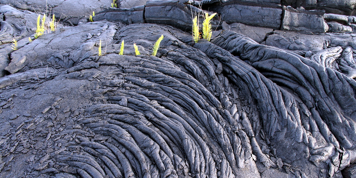
When a rock solidifies or crystallizes from melt (magma or lava), it is an igneous rock.[8] The active flow of molten rock is closely studied in volcanology, and igneous petrology aims to determine the history of igneous rocks from their original molten source to their final crystallization.[9]

Rocks can be weathered and eroded, then redeposited and lithified into a sedimentary rock. Sedimentary rocks are mainly divided into four categories: sandstone, shale, carbonate, and evaporite. This group of classifications focuses partly on the size of sedimentary particles (sandstone and shale), and partly on mineralogy and formation processes (carbonation and evaporation).[10] Igneous and sedimentary rocks can then be turned into metamorphic rocks by heat and pressure that change its mineral content, resulting in a characteristic fabric. All three types may melt again, and when this happens, new magma is formed, from which an igneous rock may once again solidify. Organic matter, such as coal, bitumen, oil, and natural gas, is linked mainly to organic-rich sedimentary rocks.[11]

To study all three types of rock, geologists evaluate the minerals of which they are composed and their other physical properties, such as texture and fabric.

Unlithified material

[edit]

Geologists study unlithified materials (referred to as superficial deposits) that lie above the bedrock.[12] This study is often known as Quaternary geology, after the Quaternary period of geologic history, which is the most recent period of geologic time.[13]

Whole-Earth structure

[edit]

Plate tectonics

[edit]
The major tectonic plates of the Earth[14]

In the 1960s, it was discovered that the Earth's lithosphere, which includes the crust and rigid uppermost portion of the upper mantle, is separated into tectonic plates that move across the plastically deforming, solid, upper mantle, which is called the asthenosphere. This theory is supported by several types of observations, including seafloor spreading[15][16] and the global distribution of mountain terrain and seismicity.[17]

There is an intimate coupling between the movement of the plates on the surface and the convection of the mantle (that is, the heat transfer caused by the slow movement of ductile mantle rock). Thus, oceanic parts of plates and the adjoining mantle convection currents always move in the same direction – because the oceanic lithosphere is actually the rigid upper thermal boundary layer of the convecting mantle. This coupling between rigid plates moving on the surface of the Earth and the convecting mantle is called plate tectonics.[18]

The development of plate tectonics has provided a physical basis for many observations of the solid Earth. Long linear regions of geological features are explained as plate boundaries:[19]

Oceanic-continental convergence resulting in subduction and volcanic arcs illustrates one effect of plate tectonics.

Plate tectonics has provided a mechanism for Alfred Wegener's theory of continental drift,[20] in which the continents move across the surface of the Earth over geological time. They provided a driving force for crustal deformation, and a new setting for the observations of structural geology. The power of the theory of plate tectonics lies in its ability to combine all of these observations into a single theory of how the lithosphere moves over the convecting mantle, forming a "grand unifying theory of geology".[21][22]

Earth structure

[edit]
The Earth's layered structure. (1) inner core; (2) outer core; (3) lower mantle; (4) upper mantle; (5) lithosphere; (6) crust (uppermost part of the lithosphere)

Advances in seismology, computer modeling, and mineralogy and crystallography at high temperatures and pressures give insights into the internal composition and structure of the Earth.[23]

Typical wave paths from earthquakes like these gave early seismologists insights into the layered structure of the Earth.

Seismologists can use the arrival times of seismic waves to image the interior of the Earth. Early advances in this field showed the existence of a liquid outer core (where shear waves were not able to propagate) and a dense solid inner core. These advances led to the development of a layered model of the Earth, with a lithosphere (including crust) on top, the mantle below (separated within itself by seismic discontinuities at 410 and 660 kilometers), and the outer core and inner core below that.[24][25] Starting in the 1970s, seismologists have been able to use new techniques such as seismic full-waveform inversion to create detailed images of wave speeds inside the earth in the same way a doctor images a body in a CT scan. These images have led to a much more detailed view of the interior of the Earth, and have replaced the simplified layered model with a much more dynamic model.[26][24]

Mineralogists have been able to use the pressure and temperature data from the seismic and modeling studies alongside knowledge of the elemental composition of the Earth to reproduce these conditions in experimental settings and measure changes within the crystal structure.[27] These studies explain the chemical changes associated with the major seismic discontinuities in the mantle[28] and show the crystallographic structures expected in the inner core of the Earth.[29]

Geological time

[edit]

The geological time scale encompasses the history of the Earth.[30] It is bracketed at the earliest by the dates of the first Solar System material at 4.567 Ga[31] (or 4.567 billion years ago) and the formation of the Earth at 4.54 Ga[32][33] (4.54 billion years), which is the beginning of the Hadean eon – a division of geological time. At the later end of the scale, it is marked by the present day (in the Holocene epoch).[34]

Timescale of the Earth

[edit]

The following five timelines show the geologic time scale to scale. The first shows the entire time from the formation of Earth to the present, but this gives little space for the most recent eon. The second timeline shows an expanded view of the most recent eon. In a similar way, the most recent era is expanded in the third timeline, the most recent period is expanded in the fourth timeline, and the most recent epoch is expanded in the fifth timeline.

SiderianRhyacianOrosirianStatherianCalymmianEctasianStenianTonianCryogenianEdiacaranCambrianOrdovicianDevonianCarboniferousPermianTriassicJurassicCretaceousPaleogeneEoarcheanPaleoarcheanMesoarcheanNeoarcheanPaleoproterozoicMesoproterozoicNeoproterozoicPaleozoicMesozoicCenozoicHadeanArcheanProterozoicPhanerozoicPrecambrian
CambrianOrdovicianSilurianDevonianCarboniferousPermianTriassicJurassicCretaceousPaleogeneNeogeneQuaternaryPaleozoicMesozoicCenozoicPhanerozoic
PaleoceneEoceneOligoceneMiocenePliocenePleistoceneHolocenePaleogeneNeogeneQuaternaryCenozoic
GelasianCalabrian (stage)ChibanianLate PleistocenePleistoceneHoloceneQuaternary

(Horizontal scale is millions of years for the above timelines; thousands of years for the timeline below)

GreenlandianNorthgrippianMeghalayanHolocene

Important milestones on Earth

[edit]
Geological time in a diagram called a geological clock, showing the relative lengths of the eons and eras of the Earth's history

Timescale of the Moon

[edit]
Early ImbrianLate ImbrianPre-NectarianNectarianEratosthenianCopernican period
Millions of years before present

The epochs of lunar history are based on the chronology of impact events, and they are named after defining major impacts. Hence, the Imbrian is named after the formation of the Mare Imbrium basin. The ages of older lunar basins can be dated based on the strength of their intrinsic magnetic field, since the early Moon had a magnetic field that faded over time. The ages of craters can be estimated by morphological and stratigraphic classifications, with younger craters overlapping older impacts and generally showing less impact wear.[39]

Timescale of Mars

[edit]
Pre-NoachianNoachianHesperianAmazonian (Mars)
Martian time periods (millions of years ago)

Epochs:

Dating methods

[edit]

Relative dating

[edit]
Cross-cutting relations can be used to determine the relative ages of rock strata and other geological structures. Explanations: A – folded rock strata cut by a thrust fault; B – large intrusion (cutting through A); C – erosional angular unconformity (cutting off A & B) on which rock strata were deposited; D – volcanic dyke (cutting through A, B & C); E – even younger rock strata (overlying C & D); F – normal fault (cutting through A, B, C & E).

Methods for relative dating were developed when geology first emerged as a natural science. Geologists still use the following principles today as a means to provide information about geological history and the timing of geological events.[40]

The principle of uniformitarianism states that the geological processes observed in operation that modify the Earth's crust at present have worked in much the same way over geological time.[41][42] A fundamental principle of geology advanced by the 18th-century Scottish physician and geologist James Hutton is that "the present is the key to the past." In Hutton's words: "the past history of our globe must be explained by what can be seen to be happening now."[43]

The principle of intrusive relationships concerns crosscutting intrusions. In geology, when an igneous intrusion cuts across a formation of sedimentary rock, it can be determined that the igneous intrusion is younger than the sedimentary rock.[44] Different types of intrusions include stocks, laccoliths, batholiths, sills and dikes.[45]

The principle of cross-cutting relationships pertains to the formation of faults and the age of the sequences through which they cut. Faults are younger than the rocks they cut; accordingly, if a fault is found that penetrates some formations but not those on top of it, then the formations that were cut are older than the fault, and the ones that are not cut must be younger than the fault.[42] Finding the key bed in these situations may help determine whether the fault is a normal fault or a thrust fault.[46]

The principle of inclusions and components states that, with sedimentary rocks, if inclusions (or clasts) are found in a formation, then the inclusions must be older than the formation that contains them.[42] For example, in sedimentary rocks, it is common for gravel from an older formation to be ripped up and included in a newer layer. A similar situation with igneous rocks occurs when xenoliths are found. These foreign bodies are picked up as magma or lava flows, and are incorporated, later to cool in the matrix. As a result, xenoliths are older than the rock that contains them.[47]

The Permian through Jurassic stratigraphy of the Colorado Plateau area of southeastern Utah is an example of both original horizontality and the law of superposition. These strata make up much of the famous prominent rock formations in widely spaced protected areas such as Capitol Reef National Park and Canyonlands National Park. From top to bottom: Rounded tan domes of the Navajo Sandstone; layered red Kayenta Formation; cliff-forming, vertically jointed, red Wingate Sandstone; slope-forming, purplish Chinle Formation; layered, lighter-red Moenkopi Formation; and white, layered Cutler Formation sandstone. Picture from Glen Canyon National Recreation Area, Utah.

The principle of original horizontality states that the deposition of sediments occurs as essentially horizontal beds.[42] Observation of modern marine and non-marine sediments in a wide variety of environments supports this generalization (although cross-bedding is inclined, the overall orientation of cross-bedded units is horizontal).[46]

The principle of superposition states that a sedimentary rock layer in a tectonically undisturbed sequence is younger than the one beneath it and older than the one above it. Logically a younger layer cannot slip beneath a layer previously deposited.[42] This principle allows sedimentary layers to be viewed as a form of the vertical timeline, a partial or complete record of the time elapsed from deposition of the lowest layer to deposition of the highest bed.[46]

The principle of faunal succession is based on the appearance of fossils in sedimentary rocks. As organisms exist during the same period throughout the world, their presence or (sometimes) absence provides a relative age of the formations where they appear.[42] Based on principles that William Smith laid out almost a hundred years before the publication of Charles Darwin's theory of evolution, the principles of succession developed independently of evolutionary thought. The principle becomes quite complex, however, given the uncertainties of fossilization, localization of fossil types due to lateral changes in habitat (facies change in sedimentary strata), and that not all fossils formed globally at the same time.[48]

Absolute dating

[edit]
The mineral zircon is often used in radiometric dating.[49]

Geologists use methods to determine the absolute age of rock samples and geological events. These may be used in conjunction with relative dating methods or to calibrate relative methods.[50]

At the beginning of the 20th century, advancement in geological science was facilitated by the ability to obtain accurate absolute dates to geological events using radioactive isotopes and other methods. This changed the understanding of geological time. Previously, geologists could only use fossils and stratigraphic correlation to date sections of rock relative to one another. With isotopic dates, it became possible to assign absolute ages to rock units, and these absolute dates could be applied to fossil sequences in which there was datable material, converting the old relative ages into new absolute ages.[51]

For many geological applications, isotope ratios of radioactive elements are measured in minerals that give the amount of time that has passed since a rock passed through its particular closure temperature: the point at which different radiometric isotopes stop diffusing into and out of the crystal lattice.[52][53] These are used in geochronologic and thermochronologic studies. The most suitable isotope systems for this purpose include uranium–lead, rubidium–strontium, and potassium–argon.[54] Uranium–thorium dating is used for dating calcium-carbonate.[55]

Dating of lava and volcanic ash layers found within a stratigraphic sequence can provide absolute age data for sedimentary rock units that do not contain radioactive isotopes and calibrate relative dating techniques.[56] These methods can be used to determine ages of pluton emplacement. Fractionation of the lanthanide series elements is used to compute ages since rocks were removed from the mantle.[57] Other methods are used for more recent events. Optically stimulated luminescence and cosmogenic radionuclide dating are used to date surfaces and/or erosion rates.[58][59] Dendrochronology can be used for the dating of landscapes.[60] Radiocarbon dating is used for geologically young materials containing organic carbon.[54]

Thermochemical techniques can be used to determine temperature profiles within the crust, the uplift of mountain ranges, and paleo-topography.[relevant?]

Geological development of an area

[edit]
An originally horizontal sequence of sedimentary rocks (in shades of tan) are affected by igneous activity. Deep below the surface is a magma chamber and large associated igneous bodies. The magma chamber feeds the volcano, and sends offshoots of magma that will later crystallize into dikes and sills. Magma advances upwards to form intrusive igneous bodies. The diagram illustrates both a cinder cone volcano, which releases ash, and a composite volcano, which releases both lava and ash.
An illustration of the three types of faults.
A. Strike-slip faults occur when rock units slide past one another.
B. Normal faults occur when rocks are undergoing horizontal extension.
C. Reverse (or thrust) faults occur when rocks are undergoing horizontal shortening.
The San Andreas Fault in California is a strike-slip fault

The geology of an area changes through time as rock units are deposited and inserted, and deformational processes alter their shapes and locations.

Rock units are first emplaced either by deposition onto the surface or intrusion into the overlying rock. Deposition can occur when sediments settle onto the surface of the Earth and later lithify into sedimentary rock,[61] or when as volcanic material such as volcanic ash[62] or lava flows blanket the surface. Igneous intrusions such as batholiths, laccoliths, dikes, and sills, push upwards into the overlying rock, and crystallize as they intrude.[45]

After the initial sequence of rocks has been deposited, the rock units can be deformed and/or metamorphosed. Deformation typically occurs as a result of horizontal shortening, horizontal extension, or side-to-side (strike-slip) motion. These structural regimes broadly relate to convergent boundaries, divergent boundaries, and transform boundaries, respectively, between tectonic plates.[63]: 7–9 

When rock units are placed under horizontal compression, they shorten and become thicker. Because rock units, other than muds, do not significantly change in volume, this is accomplished in two primary ways: through faulting and folding. In the shallow crust, where brittle deformation can occur, thrust faults form, which causes the deeper rock to move on top of the shallower rock.[64] Because deeper rock is often older, as noted by the principle of superposition, this can result in older rocks moving on top of younger ones.[65] Movement along faults can result in folding, either because the faults are not planar or because rock layers are dragged along, forming drag folds as slip occurs along the fault.[63]: 57–58 

Deeper in the Earth, rocks behave plastically and fold instead of faulting. These folds can either be those where the material in the center of the fold buckles upwards, creating "antiforms", or where it buckles downwards, creating "synforms". If the tops of the rock units within the folds remain pointing upwards, they are called anticlines and synclines, respectively. If some of the units in the fold are facing downward, the structure is called an overturned anticline or syncline, and if all of the rock units are overturned or the correct up-direction is unknown, they are simply called by the most general terms, antiforms, and synforms.[66]

A diagram of folds, indicating an anticline and a syncline

Even higher pressures and temperatures during horizontal shortening can cause both folding and metamorphism of the rocks. This metamorphism causes changes in the mineral composition of the rocks; creates a foliation, or planar surface, that is related to mineral growth under stress. This can remove signs of the original textures of the rocks, such as bedding in sedimentary rocks, flow features of lavas, and crystal patterns in crystalline rocks.[67]

Extension causes the rock units as a whole to become longer and thinner. This is primarily accomplished through normal faulting and through the ductile stretching and thinning. Normal faults drop rock units that are higher below those that are lower. This typically results in younger units ending up below older units. Stretching of units can result in their thinning.[68] In fact, at one location within the Maria Fold and Thrust Belt, the entire sedimentary sequence of the Grand Canyon appears over a length of less than a meter.[citation needed] Rocks at the depth to be ductilely stretched are often metamorphosed. These stretched rocks can pinch into lenses, known as boudins, after the French word for "sausage" because of their visual similarity.

Where rock units slide past one another, strike-slip faults develop in shallow regions, and become shear zones at deeper depths where the rocks deform ductilely.

Geological cross section of Kittatinny Mountain. This cross-section shows metamorphic rocks, overlain by younger sediments deposited after the metamorphic event. These rock units were later folded and faulted during the uplift of the mountain.

The addition of new rock units, both depositionally and intrusively, often occurs during deformation. Faulting and other deformational processes result in the creation of topographic gradients, causing material on the rock unit that is increasing in elevation to be eroded by hillslopes and channels. These sediments are deposited on the rock unit that is going down. Continual motion along the fault maintains the topographic gradient in spite of the movement of sediment and continues to create accommodation space for the material to deposit.

Deformational events are often associated with volcanism and igneous activity.[69] Volcanic ashes and lavas accumulate on the surface, and igneous intrusions enter from below. Dikes, long, planar igneous intrusions, enter along cracks, and therefore often form in large numbers in areas that are being actively deformed. This can result in the emplacement of dike swarms,[70] such as those that are observable across the Canadian shield,[71] or rings of dikes around the lava tube of a volcano.

All of these processes do not necessarily occur in a single environment and do not necessarily occur in a single order. The Hawaiian Islands, for example, consist almost entirely of layered basaltic lava flows. The sedimentary sequences of the mid-continental United States and the Grand Canyon in the southwestern United States contain almost-undeformed stacks of sedimentary rocks that have remained in place since Cambrian time. Other areas are much more geologically complex. In the southwestern United States, sedimentary, volcanic, and intrusive rocks have been metamorphosed, faulted, foliated, and folded. Even older rocks, such as the Acasta gneiss of the Slave craton in northwestern Canada, the oldest known rock in the world have been metamorphosed to the point where their origin is indiscernible without laboratory analysis.

These processes can occur in stages. In many places, the Grand Canyon in the southwestern United States being a very visible example, the lower rock units were metamorphosed and deformed, and then deformation ended and the upper, undeformed units were deposited. Although any amount of rock emplacement and rock deformation can occur, and they can occur any number of times, these concepts provide a guide to understanding the geological history of an area.

Investigative methods

[edit]
A standard Brunton Pocket Transit, commonly used by geologists for mapping and surveying

Geologists use a number of fields, laboratory, and numerical modeling methods to decipher Earth history and to understand the processes that occur on and inside the Earth. In typical geological investigations, geologists use primary information related to petrology (the study of rocks), stratigraphy (the study of sedimentary layers), and structural geology (the study of positions of rock units and their deformation). In many cases, geologists study modern soils, rivers, landscapes, and glaciers; investigate past and current life and biogeochemical pathways, and use geophysical methods to investigate the subsurface. Sub-specialities of geology may distinguish endogenous and exogenous geology.[72]

Field methods

[edit]
A typical USGS field mapping camp in the 1950s
Today, handheld computers with GPS and geographic information systems software are often used in geological field work (digital geological mapping).

Geological field work varies depending on the task at hand. Typical fieldwork could consist of:

A thin section in cross polarized light
In optical mineralogy, thin sections are used to study rocks. The method is based on the distinct refractive indexes of different minerals.

Petrology

[edit]

In addition to identifying rocks in the field (lithology), petrologists identify rock samples in the laboratory. Two of the primary methods for identifying rocks in the laboratory are through optical microscopy (such as with the petrographic microscope[79]) and by using an electron microprobe.[80] In an optical mineralogy analysis, petrologists analyze thin sections of rock samples using a petrographic microscope, where the minerals can be identified through their different properties in plane-polarized and cross-polarized light, including their birefringence, pleochroism, twinning, and interference properties with a conoscopic lens.[81] In the electron microprobe, individual locations are analyzed for their exact chemical compositions and variation in composition within individual crystals.[82] Stable[83] and radioactive isotope[84] studies provide insight into the geochemical evolution of rock units.

Petrologists can use fluid inclusion data[85] and perform high temperature and pressure physical experiments[86] to understand the temperatures and pressures at which different mineral phases appear, and how they change through igneous[87] and metamorphic processes. This research can be extrapolated to the field to understand metamorphic processes and the conditions of crystallization of igneous rocks.[88] This work can help to explain processes that occur within the Earth, such as subduction and magma chamber evolution.[89]

Folded rock strata

Structural geology

[edit]
A diagram of an orogenic wedge. The wedge grows through faulting in the interior and along the main basal fault, called the décollement. It builds its shape into a critical taper, in which the angles within the wedge remain the same as failures inside the material balance failures along the décollement. It is analogous to a bulldozer pushing a pile of dirt, where the bulldozer is the overriding plate.

Structural geologists use microscopic analysis of oriented thin sections of geological samples to observe the fabric within the rocks, which gives information about strain within the crystalline structure of the rocks.[90] They plot and combine measurements of geological structures to better understand the orientations of faults and folds to reconstruct the history of rock deformation in the area. In addition, they perform analog and numerical experiments of rock deformation in large and small settings.

The analysis of structures is often accomplished by plotting the orientations of various features onto stereonets. A stereonet is a stereographic projection of a sphere onto a plane, in which planes are projected as lines and lines are projected as points. These can be used to find the locations of fold axes, relationships between faults, and relationships between other geological structures.[91]

Among the most well-known experiments in structural geology are those involving orogenic wedges, which are zones in which mountains are built along convergent tectonic plate boundaries.[92] In the analog versions of these experiments, horizontal layers of sand are pulled along a lower surface into a back stop, which results in realistic-looking patterns of faulting and the growth of a critically tapered (all angles remain the same) orogenic wedge.[93] Numerical models work in the same way as these analog models, though they are often more sophisticated and can include patterns of erosion and uplift in the mountain belt.[94] This helps to show the relationship between erosion and the shape of a mountain range. These studies can give useful information about pathways for metamorphism through pressure, temperature, space, and time.[95]

Stratigraphy

[edit]
Different colors caused by the different minerals in tilted layers of sedimentary rock in Zhangye National Geopark, China

In the laboratory, stratigraphers analyze samples of stratigraphic sections that can be returned from the field, such as those from drill cores.[96] Stratigraphers analyze data from geophysical surveys that show the locations of stratigraphic units in the subsurface.[97] Geophysical data and well logs can be combined to produce a better view of the subsurface, and stratigraphers often use computer programs to do this in three dimensions.[98] Stratigraphers can then use these data to reconstruct ancient processes occurring on the surface of the Earth,[99] interpret past environments, and locate areas for water, coal, and hydrocarbon extraction.

In the laboratory, biostratigraphers analyze rock samples from outcrop and drill cores for the fossils found in them.[96] These fossils help scientists to date the core and to understand the depositional environment in which the rock units formed. Geochronologists precisely date rocks within the stratigraphic section to provide better absolute bounds on the timing and rates of deposition.[100] Magnetic stratigraphers look for signs of magnetic reversals in igneous rock units within the drill cores.[96] Other scientists perform stable-isotope studies on the rocks to gain information about past climate.[96]

Planetary geology

[edit]
Surface of Mars as photographed by the Viking 2 lander December 9, 1977

With the advent of space exploration in the twentieth century, geologists have begun to look at other planetary bodies in the same ways that have been developed to study the Earth. This new field of study is called planetary geology (sometimes known as astrogeology) and relies on known geological principles to study other bodies of the Solar System. This is a major aspect of planetary science, and largely focuses on the terrestrial planets, icy moons, asteroids, comets, and meteorites. However, some planetary geophysicists study the giant planets and exoplanets.[101]

Although the Greek-language-origin prefix geo refers to Earth, "geology" is often used in conjunction with the names of other planetary bodies when describing their composition and internal processes: examples are "the geology of Mars" and "Lunar geology". Specialized terms such as selenology (studies of the Moon), areology (of Mars), hermesology (of Mercury), etc., are also in use.[102]

Although planetary geologists are interested in studying all aspects of other planets, a significant focus is to search for evidence of past or present life on other worlds. This has led to many missions whose primary or ancillary purpose is to examine planetary bodies for evidence of life.[103] One of these is the Phoenix lander, which analyzed Martian polar soil for water, chemical, and mineralogical constituents related to biological processes.[104]

Applied geology

[edit]
Man panning for gold on the Mokelumne. Harper's Weekly: How We Got Gold in California. 1860

Economic geology

[edit]

Economic geology is a branch of geology that deals with aspects of economic minerals that humankind uses to fulfill various needs. Economic minerals are those extracted profitably for various practical uses. Economic geologists help locate and manage the Earth's natural resources, such as petroleum and coal, as well as mineral resources, which include metals such as iron, copper, and uranium.[105]

Mining geology

[edit]

Mining geology consists of the extractions of mineral and ore resources from the Earth. Some resources of economic interests include gemstones,[106] metals such as gold and copper,[107] and many industrial minerals such as asbestos, magnesite, perlite, mica, phosphates, zeolites, clay,[108] silica,[109] and pumice,[110] as well as elements such as sulfur[111] and helium.[112]

Petroleum geology

[edit]
Mud log in process, a common way to study the lithology when drilling oil wells

Petroleum geologists study the locations of the subsurface of the Earth that can contain extractable hydrocarbons, especially petroleum and natural gas.[113] Because many of these reservoirs are found in sedimentary basins,[114] they study the formation of these basins, their sedimentary and tectonic evolution, and the present-day positions of the rock units.

Engineering geology

[edit]

Engineering geology is the application of geological principles to engineering practice for the purpose of assuring that the geological factors affecting the location, design, construction, operation, and maintenance of engineering works are properly addressed.[115] Engineering geology is distinct from geological engineering, particularly in North America.

A child drinks water from a well built as part of a hydrogeological humanitarian project in Kenya.

In the field of civil engineering, geological principles and analyses are used in order to ascertain the mechanical principles of the material on which structures are built. This allows tunnels to be built without collapsing, bridges and skyscrapers to be built with sturdy foundations, and buildings to be built that will not settle in clay and mud.[116]

Hydrology

[edit]

Geology and geological principles can be applied to various environmental problems such as stream restoration, the restoration of brownfields, and the understanding of the interaction between natural habitat and the geological environment. Groundwater hydrology, or hydrogeology, is used to locate groundwater,[117] which can often provide a ready supply of uncontaminated water and is especially important in arid regions,[118] and to monitor the spread of contaminants in groundwater wells.[117][119]

Paleoclimatology

[edit]

Geologists obtain data through stratigraphy, boreholes, core samples, and ice cores. Ice cores[120] and sediment cores[121] are used for paleoclimate reconstructions, which tell geologists about past and present temperature, precipitation, and sea level across the globe. These datasets are our primary source of information on global climate change outside of instrumental data.[122]

Natural hazards

[edit]
Rockfall in the Grand Canyon

Geologists and geophysicists study natural hazards in order to enact safe building codes and warning systems that are used to prevent loss of property and life.[123] Examples of important natural hazards that are pertinent to geology (as opposed those that are mainly or only pertinent to meteorology) are:[124]

History

[edit]
William Smith's geological map of England, Wales, and southern Scotland. Completed in 1815, it was the second national-scale geologic map, and by far the most accurate of its time.[125][failed verification]

The study of the physical material of the Earth dates back at least to ancient Greece when Theophrastus (372–287 BCE) wrote the work Peri Lithon (On Stones). During the Roman period, Pliny the Elder wrote in detail of the many minerals and metals, then in practical use – even correctly noting the origin of amber. Additionally, in the 4th century BCE Aristotle made critical observations of the slow rate of geological change. He observed the composition of the land and formulated a theory where the Earth changes at a slow rate and that these changes cannot be observed during one person's lifetime. Aristotle developed one of the first evidence-based concepts connected to the geological realm regarding the rate at which the Earth physically changes.[126][127]

Abu al-Rayhan al-Biruni (973–1048 CE) was one of the earliest Persian geologists, whose works included the earliest writings on the geology of India, hypothesizing that the Indian subcontinent was once a sea.[128] Drawing from Greek and Indian scientific literature that were not destroyed by the Muslim conquests, the Persian scholar Ibn Sina (Avicenna, 981–1037) proposed detailed explanations for the formation of mountains, the origin of earthquakes, and other topics central to modern geology, which provided an essential foundation for the later development of the science.[129][130] In China, the polymath Shen Kuo (1031–1095) formulated a hypothesis for the process of land formation: based on his observation of fossil animal shells in a geological stratum in a mountain hundreds of miles from the ocean, he inferred that the land was formed by the erosion of the mountains and by deposition of silt.[131]

Georgius Agricola (1494–1555) published his groundbreaking work De Natura Fossilium in 1546 and is seen as the founder of geology as a scientific discipline.[132]

Nicolas Steno (1638–1686) is credited with the law of superposition, the principle of original horizontality, and the principle of lateral continuity: three defining principles of stratigraphy.[133]

The word geology was first used by Ulisse Aldrovandi in 1603,[134][135] then by Jean-André Deluc in 1778[136] and introduced as a fixed term by Horace-Bénédict de Saussure in 1779.[137][138] The word is derived from the Greek γῆ, , meaning "earth" and λόγος, logos, meaning "speech".[139] But according to another source, the word "geology" comes from a Norwegian, Mikkel Pedersøn Escholt (1600–1669), who was a priest and scholar. Escholt first used the definition in his book titled, Geologia Norvegica (1657).[140][141]

William Smith (1769–1839) drew some of the first geological maps and began the process of ordering rock strata (layers) by examining the fossils contained in them.[125]

In 1763, Mikhail Lomonosov published his treatise On the Strata of Earth.[142] His work was the first narrative of modern geology, based on the unity of processes in time and explanation of the Earth's past from the present.[143]

James Hutton (1726–1797) is often viewed as the first modern geologist.[144] In 1785 he presented a paper entitled Theory of the Earth to the Royal Society of Edinburgh. In his paper, he explained his theory that the Earth must be much older than had previously been supposed to allow enough time for mountains to be eroded and for sediments to form new rocks at the bottom of the sea, which in turn were raised up to become dry land. Hutton published a two-volume version of his ideas in 1795.[145]

Followers of Hutton were known as Plutonists because they believed that some rocks were formed by vulcanism, which is the deposition of lava from volcanoes, as opposed to the Neptunists, led by Abraham Werner, who believed that all rocks had settled out of a large ocean whose level gradually dropped over time.[146]

The first geological map of the U.S. was produced in 1809 by William Maclure.[147] In 1807, Maclure commenced the self-imposed task of making a geological survey of the United States. Almost every state in the Union was traversed and mapped by him, the Allegheny Mountains being crossed and recrossed some 50 times.[148] The results of his unaided labours were submitted to the American Philosophical Society in a memoir entitled Observations on the Geology of the United States explanatory of a Geological Map, and published in the Society's Transactions, together with the nation's first geological map.[149] This antedates William Smith's geological map of England by six years, although it was constructed using a different classification of rocks.

Sir Charles Lyell (1797–1875) first published his famous book, Principles of Geology,[150] in 1830. This book, which influenced the thought of Charles Darwin, successfully promoted the doctrine of uniformitarianism. This theory states that slow geological processes have occurred throughout the Earth's history and are still occurring today. In contrast, catastrophism is the theory that Earth's features formed in single, catastrophic events and remained unchanged thereafter. Though Hutton believed in uniformitarianism, the idea was not widely accepted at the time.

Much of 19th-century geology revolved around the question of the Earth's exact age. Estimates varied from a few hundred thousand to billions of years.[151] By the early 20th century, radiometric dating allowed the Earth's age to be estimated at two billion years. The awareness of this vast amount of time opened the door to new theories about the processes that shaped the planet.

Some of the most significant advances in 20th-century geology have been the development of the theory of plate tectonics in the 1960s and the refinement of estimates of the planet's age. Plate tectonics theory arose from two separate geological observations: seafloor spreading and continental drift. The theory revolutionized the Earth sciences. Today the Earth is known to be approximately 4.5 billion years old.[33]

[edit]

See also

[edit]

References

[edit]
[edit]
Revisions and contributorsEdit on WikipediaRead on Wikipedia
from Grokipedia
Geology is the of the , including its origin, composition, structure, physical properties, and the dynamic processes—such as , , , and —that have shaped its surface and interior over approximately 4.56 billion years. This discipline examines the solid , its rocks, minerals, and fossils, as well as the interactions between geological features and the atmosphere, , and . By integrating observations from field studies, laboratory analyses, and geophysical surveys, geology reveals the planet's history and predicts future changes. The field is traditionally divided into two main branches: physical geology, which investigates the materials composing the —such as rocks, minerals, and sediments—and the physical and chemical processes that alter them, including the rock cycle and internal heat-driven dynamics; and , which reconstructs Earth's past through the analysis of rock layers (), fossils, and the to understand evolutionary timelines and environmental shifts. Key subdisciplines encompass (study of minerals), (origin and composition of rocks), (deformation of Earth's crust), (landform evolution), (ancient life forms), and (groundwater systems), among others. These areas overlap with related sciences like , , and to address complex Earth systems. Geology holds profound importance for society, informing the exploration and of natural resources such as minerals, sources, and , while mitigating hazards like earthquakes, landslides, and volcanic eruptions. It contributes to by evaluating contamination risks, climate change impacts on landscapes, and ecosystem preservation, and supports projects through assessments of stability and resource availability. Ultimately, geologic fosters resilience against natural disasters and guides policy for a changing world, linking Earth's processes to human well-being.

Geological Materials

Minerals

A mineral is defined as a naturally occurring inorganic solid with a definite and an ordered atomic arrangement, often manifesting as a characteristic form. This definition distinguishes minerals from other solid substances like synthetic crystals or organic materials, emphasizing their natural origin and structural regularity. Minerals serve as the fundamental building blocks of rocks, combining in various proportions to form the aggregates that constitute . Silicate minerals, which contain silicon and oxygen bonded in tetrahedral structures, are the most abundant group, comprising at least 90% of Earth's crust by volume. Prominent examples include feldspars, the most widespread mineral group constituting about 60% of the crust; , a common silicon dioxide mineral; and micas, sheet-like silicates found in many igneous and metamorphic rocks. Non-silicate minerals, though less prevalent, include carbonates such as (calcium carbonate, CaCO₃), which forms in sedimentary environments; oxides like (iron oxide, Fe₂O₃), an iron ore; sulfides including (iron sulfide, FeS₂), known as fool's gold; and native elements such as (Au) and (carbon, C). Minerals exhibit diagnostic physical properties that aid identification, including crystal systems, cleavage, hardness, luster, and specific gravity. Crystals organize into seven systems based on atomic symmetry and lattice geometry: cubic (isometric), tetragonal, orthorhombic, hexagonal, trigonal, monoclinic, and triclinic. Cleavage refers to the tendency to break along flat planes parallel to weak atomic bonds, as seen in mica's perfect basal cleavage. is measured on the , a relative ranking from 1 () to 10 (), where rates 7 and 3; this scale helps assess scratch resistance in field identification. Luster describes surface light reflection, ranging from metallic (e.g., ) to vitreous (glassy, e.g., ) or dull (e.g., ). Specific gravity, the relative to , varies widely; for instance, gold's high value of 19.3 g/cm³ contrasts with 's 2.65 g/cm³, influencing separation in . Minerals form through diverse geological processes tied to Earth's dynamic cycles. Igneous crystallization occurs as magma cools, producing minerals like and in basalts or granites. Sedimentary precipitation happens when solutions evaporate or reactions occur in water, yielding evaporites like (CaSO₄·2H₂O) or carbonates like in limestones. Metamorphic recrystallization transforms existing minerals under heat and pressure without melting, converting, for example, to with larger crystals. Minerals hold significant economic value, serving as gemstones for jewelry and industrial materials for manufacturing. Gemstones like diamond and ruby derive worth from rarity, beauty, and durability, supporting a global trade exceeding billions annually. Industrial minerals include gypsum, used extensively in plaster and drywall production due to its abundance and ease of processing into powdered form (plaster of Paris).

Rocks

Rocks are naturally occurring solid aggregates of one or more or mineraloids, forming the foundational materials of . They are classified into three primary types based on their origin and formation processes: igneous, sedimentary, and metamorphic. This classification reflects the dynamic geological processes that transform rocks over time, as encapsulated in the rock cycle. Igneous rocks form from the cooling and solidification of molten or lava. Intrusive igneous rocks, such as , cool slowly beneath the Earth's surface, resulting in a phaneritic texture where individual mineral crystals are visible to the . Extrusive igneous rocks, like , cool rapidly at or near the surface, producing an aphanitic texture with fine-grained crystals indistinguishable without magnification. Sedimentary rocks originate from the accumulation and of sediments derived from , , or . Clastic sedimentary rocks, such as , consist of fragments of pre-existing rocks sorted by , with coarser grains indicating higher energy depositional environments. Chemical sedimentary rocks, like formed from precipitated , arise from the or chemical reactions in water bodies. Biogenic sedimentary rocks, including , form from accumulated organic remains, such as plant material compacted over time. Metamorphic rocks result from the alteration of existing igneous, sedimentary, or other metamorphic rocks under intense , , or chemically active fluids, without . Foliated metamorphic rocks, such as derived from , exhibit schistosity—a planar alignment of minerals due to directed , creating layered structures. Non-foliated metamorphic rocks, like from , lack this layering and form under more uniform conditions, preserving a massive texture. The rock cycle illustrates the continuous transformation among these rock types through interconnected geological processes. Igneous rocks can weather and into sediments that compact and to form sedimentary rocks; these may then be buried and subjected to and to become metamorphic rocks. Melting of any rock type produces that cools into igneous rocks, while uplift and exposure restart the cycle with . Key processes include , cooling and , and , deposition, compaction, cementation, and metamorphic recrystallization under and . In terms of distribution within the continental crust, igneous rocks constitute approximately 65%, metamorphic rocks about 27%, and sedimentary rocks around 8% by volume. This uneven distribution underscores the dominance of igneous and metamorphic processes in the deeper crust, with sedimentary rocks primarily forming a thin surface layer.

Unconsolidated Materials

Unconsolidated materials in geology refer to loose, unlithified deposits of that have not yet undergone compaction or cementation to form solid rock, including soils, sands, gravels, clays, and glacial till. These materials typically result from the breakdown of pre-existing rocks and are characterized by their granular or particulate nature, allowing them to be easily transported and reshaped by natural agents. Soils represent a key type of unconsolidated material, forming at the Earth's surface through the interaction of various factors over time. Soil profiles are vertically organized into distinct layers known as horizons, which reflect progressive changes in composition and structure from the surface downward. The master horizons include the (organic layer rich in decomposed plant and animal matter), the A horizon (topsoil, a mixture of minerals, organics, and ), the B horizon (subsoil, where minerals and clays accumulate from above), and the C horizon (weathered transitioning to ). The development of these horizons is governed by the CLORPT factors, first formalized by pedologist Hans Jenny: Climate (temperature and precipitation influencing and leaching), Organisms (plants, microbes, and animals contributing to organic matter and bioturbation), Relief ( affecting drainage and rates), Parent material (the underlying unconsolidated or source), and Time (duration allowing for progressive soil maturation). Sediments form another major category of unconsolidated materials, consisting of fragmented particles derived primarily from and . They are classified by using the Wentworth scale, which ranges from boulders (>256 mm) and cobbles (64–256 mm) at the coarse end, through (2–64 mm), (0.0625–2 mm), and (0.0039–0.0625 mm), to the finest clay (<0.0039 mm). Transport mechanisms further categorize sediments: alluvial sediments are deposited by rivers and streams in fluvial environments, often forming layered beds of mixed sizes; aeolian sediments, such as dunes and sheets, are wind-transported fine particles like and in arid or coastal regions; and glacial sediments, including till (unsorted mixtures of clay to boulders), are carried and dropped by ice movement. In landscapes, unconsolidated materials play essential roles in shaping terrain and supporting ecosystems. Regolith blankets bedrock as a heterogeneous layer of weathered debris, providing a medium for soil formation and influencing groundwater infiltration. Alluvium builds fertile floodplains and deltas along rivers, facilitating agriculture and sediment storage. Loess deposits, fine wind-blown silts often derived from glacial outwash, create thick, blanket-like covers that form loess plateaus and hills, as seen in regions like the Midwestern United States. These materials often originate from weathering processes that break down rocks into particles destined for future sedimentation.

Earth's Internal Structure

Core and Mantle

The Earth's mantle and core constitute the vast majority of the planet's volume and mass, extending from just below the crust to the planet's center. The mantle, approximately 2,900 km thick, forms the layer between the crust and the core, comprising about 84% of Earth's volume. It is primarily composed of ultramafic rocks such as peridotite, rich in iron and magnesium silicates like olivine and pyroxene. The mantle is divided into the upper mantle, which includes the rigid lithosphere and the ductile asthenosphere where plastic deformation occurs due to high temperatures and pressures, and the lower mantle, characterized by denser mineral phases such as oxides of magnesium, iron, and silicon. Seismic evidence reveals discontinuities at around 410 km and 660 km depths in the mantle, marking phase transitions in minerals like olivine to spinel structures, with P-wave velocities increasing gradually with depth due to rising density and pressure. The core, centered at Earth's interior, is separated from the mantle by the core-mantle boundary (Gutenberg discontinuity) at about 2,900 km depth, where there is a sharp increase in density and P-wave velocity. The outer core, roughly 2,260 km thick, is a liquid layer of iron-nickel alloy with lighter elements such as sulfur and silicon, extending from the core-mantle boundary to a radius of about 3,480 km. This liquid state is confirmed by the S-wave shadow zone, where shear (S) waves do not propagate beyond 103° angular distance from an earthquake's epicenter, as they are absorbed in the molten outer core; P-waves, however, slow down and refract through it. Convection in the outer core, driven by thermal and compositional gradients, generates Earth's magnetic field through the geodynamo effect. At the center lies the inner core, a solid sphere of iron-nickel alloy with a radius of approximately 1,220 km, bounded by the inner core boundary (Lehmann discontinuity) at about 5,150 km depth from the surface. The solidity of the inner core is evidenced by a sudden increase in P-wave velocities at this boundary, despite temperatures ranging from 5,000 to 6,000°C, which exceed the melting point of iron at surface pressures but are suppressed by immense pressures exceeding 3 million atmospheres. The inner core's growth, at about 1 mm per year, releases latent heat that contributes to outer core convection. Earth's internal heat, powering mantle convection and core dynamics, primarily originates from two sources: residual heat from the planet's accretion and differentiation about 4.5 billion years ago, and radiogenic decay of isotopes such as , , and concentrated in the mantle. Additional contributions include latent heat from the ongoing solidification of the inner core and potential gravitational energy from dense material sinking during formation. Temperatures in the mantle range from about 500–900°C in the upper portions to over 4,000°C near the core-mantle boundary, with the geothermal gradient decreasing to around 1°C/km in the mantle due to its solid state. This heat flows outward primarily through conduction in the core and a combination of conduction and convection in the mantle.

Crust and Lithosphere

The Earth's crust represents the outermost layer of the planet's solid structure, varying significantly in thickness, composition, and density between oceanic and continental regions. Oceanic crust is typically 5–10 km thick and primarily composed of basaltic rocks, with an average density of approximately 3.0 g/cm³. In contrast, continental crust averages 30–50 km in thickness and consists mainly of granitic rocks, exhibiting a lower density of about 2.7 g/cm³. These differences arise from the processes forming each type, with oceanic crust generated at and continental crust resulting from prolonged tectonic and magmatic evolution. The lithosphere encompasses the rigid outer portion of the Earth, extending approximately 100 km downward and comprising both the crust and the uppermost mantle. This layer behaves as a brittle, solid shell due to its cooler temperatures and rigidity, distinguishing it from the more ductile underlying . The lithosphere is fragmented into tectonic plates, which are large, rigid segments that interact at boundaries. The boundary between the crust and the mantle, known as the Mohorovičić discontinuity or Moho, marks a sharp increase in seismic wave velocity and was first identified in 1909 through seismic refraction studies by Andrija Mohorovičić. Isostasy describes the state of gravitational equilibrium between the Earth's lithosphere and the underlying mantle, akin to buoyancy in fluids, where lighter crustal blocks "float" on the denser mantle. The Airy isostasy model, proposed by George Biddell Airy in 1855, posits that variations in topography, such as mountain ranges, are compensated by corresponding roots of thicker crust extending into the mantle. For instance, the Himalayan region exhibits crustal thicknesses up to 70 km, supporting the elevated terrain through these deep roots. The crust's composition is dominated by silicate minerals, forming the primary building blocks of rocks in both oceanic and continental settings. Regional variations in thickness reflect tectonic history, with continental areas like the Himalayas showing pronounced thickening due to collisional processes. Beneath the lithosphere lies the mantle, which provides the denser substrate essential for isostatic balance.

Surface and Dynamic Processes

Plate Tectonics

Plate tectonics is the unifying theory explaining the dynamic behavior of Earth's outer shell, positing that the lithosphere is broken into rigid plates that move relative to one another. This concept originated with Alfred Wegener's 1912 hypothesis of continental drift, in which he argued that continents like South America and Africa were once joined based on matching coastlines, rock formations, and fossil distributions across the Atlantic. Wegener's ideas, detailed in his 1915 book The Origin of Continents and Oceans, faced criticism due to the absence of a plausible driving mechanism. In the early 1960s, Harry Hess advanced the theory by proposing seafloor spreading, suggesting that upwelling mantle material at mid-ocean ridges creates new oceanic crust, which then spreads laterally and displaces continents. Hess's 1962 paper "History of Ocean Basins" provided a key mechanism linking continental drift to oceanic processes. The modern framework was established by W. Jason Morgan in 1968, who modeled the lithosphere as discrete, rigid plates moving over the underlying asthenosphere, with interactions confined to plate boundaries. Earth's surface is segmented into approximately 15 major and minor tectonic plates, with the seven largest—African, Antarctic, Eurasian, North American, Pacific, South American, and Indo-Australian—covering about 94% of the planet. These plates encompass both oceanic and continental lithosphere, varying in size from the vast Pacific Plate, which spans over 100 million square kilometers, to smaller ones like the Nazca Plate. Minor plates, such as the Caribbean and Arabian plates, fill the remaining gaps and interact with major plates at complex boundaries. Interactions between plates occur primarily at three types of boundaries, defined by the direction of relative motion. Divergent boundaries form where plates separate, allowing magma to rise and generate new crust; prominent examples include the , where the Eurasian and North American plates pull apart at about 2.5 cm per year, and the continental , an emerging divergent zone splitting the African Plate. Convergent boundaries arise when plates collide, leading to subduction of denser oceanic lithosphere beneath less dense plates or continental collision; oceanic-continental convergence drives the Andes Mountains via the Nazca Plate subducting under South America, while continental-continental convergence formed the from the Indian and Eurasian plates. Transform boundaries feature lateral sliding of plates along faults, accommodating motion between other boundaries; the exemplifies this, where the Pacific Plate slides northwestward past the North American Plate at roughly 5 cm per year. The motions of these plates, averaging 1 to 10 cm per year, are propelled by several interconnected forces rooted in mantle dynamics. The dominant force is slab pull, exerted by the gravitational descent of cold, dense subducting slabs into the mantle, which tugs the attached plate. This is augmented by ridge push, where newly formed, buoyant crust at divergent boundaries creates elevated topography that gravitationally slides away from the ridge, and by basal traction from underlying mantle convection currents driven by internal heat. Mantle convection, fueled by radioactive decay and residual heat from Earth's formation, provides the broad-scale engine, though its direct drag on plates is secondary to slab pull. Compelling evidence for plate tectonics includes paleomagnetic records preserved in rocks, which show symmetric patterns of magnetic polarity reversals flanking mid-ocean ridges, confirming seafloor spreading over millions of years. Contemporary validation comes from Global Positioning System (GPS) networks, which precisely measure plate velocities, such as the 4-5 cm/year westward drift of the Pacific Plate. Furthermore, over 80% of global earthquakes cluster linearly along plate boundaries, reflecting stress accumulation and release at these interfaces.

Volcanism and Magmatism

Volcanism and magmatism involve the generation, ascent, and eruption of magma from Earth's interior, primarily driven by tectonic processes. Magma originates through partial melting of mantle or crustal rocks in specific tectonic settings. At subduction zones, flux melting occurs when water-rich fluids from the descending oceanic plate lower the melting point of the overlying mantle wedge, producing magma that rises to form volcanic arcs. Decompression melting dominates at mid-ocean ridges, where upwelling mantle material experiences reduced pressure, allowing partial melting to generate basaltic magma that contributes to seafloor spreading. Hotspots, such as the Hawaiian chain, result from partial melting of a mantle plume ascending through the lithosphere, independent of plate boundaries. Magma composition influences its behavior and the resulting volcanic products, with three primary types: basaltic, andesitic, and rhyolitic. Basaltic magma, low in silica (45-55 wt%), is fluid due to low viscosity, enabling effusive eruptions and forming mafic rocks like basalt. Andesitic magma, intermediate in silica (55-65 wt%), exhibits higher viscosity and is common in subduction-related volcanism, producing andesite rocks. Rhyolitic magma, high in silica (>65 wt%), is highly viscous, trapping gases and promoting explosive eruptions that yield rocks like rhyolite. Volcanic landforms vary with magma type and eruption dynamics. Shield volcanoes, built from fluid basaltic lava flows, form broad, gently sloping domes like those in . Stratovolcanoes, or composite volcanoes, arise from alternating layers of viscous lava and pyroclastic material, creating steep cones such as in . Calderas develop from following massive explosive eruptions that empty underlying chambers, as seen in Yellowstone. Eruption styles range from effusive, where low-viscosity flows steadily, to explosive, driven by gas expansion in viscous magmas; the (VEI) quantifies explosivity from 0 (non-explosive) to 8 (superc colossal), based on volume and plume height. Volcanic products include lava flows, which solidify into extensive sheets during effusive events, and pyroclastic deposits from explosive eruptions, comprising , , and bombs. Ignimbrites are widespread, welded deposits formed by hot and gas avalanches, often covering large areas. Monitoring relies on to detect movement—such as long-period earthquakes signaling fluid migration—and gas emissions, where elevated indicates rising . Globally, approximately 500 volcanoes are active, with about 50-70 erupting annually, concentrated along the where drives intense . These events shape landscapes, influence through and gas releases, and pose hazards, but also contribute to fertile soils via weathered products.

Geological Time

The organizes Earth's 4.54 billion-year history into a hierarchical system of chronostratigraphic units, relating rock layers (strata) to specific intervals of time and facilitating correlations across global geological records. This framework, developed through integration of stratigraphic, paleontological, and geochronological data, divides time into eons, eras, periods, epochs, and ages, with absolute durations calibrated primarily via of igneous rocks and meteorites. The boundaries of the eon and its subdivisions are formally defined by Global Stratotype Sections and Points (GSSPs), which are reference horizons in sedimentary sequences ratified by the (ICS) to ensure precise, internationally standardized correlations. eon boundaries are defined by numerical ages, including recent ratifications such as the base as a Global Standard Stratigraphic Age (GSSA) at 4567.3 ± 0.16 Ma in 2024 and the base at 4031 ± 3 Ma in 2023. The broadest divisions are the four eons, spanning from Earth's accretion to the present; their durations are expressed in giga-annum (Ga, billions of years) or mega-annum (Ma, millions of years), with the total planetary age derived from lead-lead dating of meteorites representing solar system formation materials. The Eon (ca. 4.567–4.031 Ga, ~0.536 Ga duration) predates preserved and is inferred from lunar samples and meteorites, marking intense bombardment and early differentiation. The Eon (4.031–2.500 Ga, ~1.531 Ga duration) features the emergence of stable cratons and the first microbial life traces in banded iron formations. The Eon (2.500–0.539 Ga, ~1.961 Ga duration) encompasses cycles, atmospheric oxygenation, and the rise of eukaryotic organisms. The Eon (0.539 Ga–present, ~0.539 Ga duration) is characterized by abundant visible life (from Greek "phanero" meaning visible) and diverse records preserved in sedimentary strata.
EonApproximate Start (Ga)Approximate End (Ga)Duration (Ga)
Hadean4.574.030.54
Archean4.032.501.53
Proterozoic2.500.541.96
Phanerozoic0.54Present0.54
Within the Phanerozoic Eon, time is further subdivided into three eras: the Paleozoic (0.539–0.252 Ga, ~287 Ma duration), marked by the diversification of marine invertebrates and early vertebrates; the Mesozoic (0.252–0.066 Ga, ~186 Ma duration), dominated by dinosaurs and gymnosperms; and the Cenozoic (0.066 Ga–present, ~66 Ma duration), featuring mammal radiation and modern ecosystems. Each era comprises periods, such as the Jurassic Period (0.201–0.145 Ga, ~56 Ma duration) in the Mesozoic, known for prolific ammonite fossils and the breakup of Pangaea. These period boundaries, like that of the Cambrian (0.539–0.485 Ga, ~54 Ma duration) at the base of the Paleozoic, are tied to significant faunal turnovers observable in the stratigraphic record. The serves as a visual timeline when depicted chronologically, often as a linear correlating eons and eras with major biological events, such as the proliferation of complex multicellular life at the Proterozoic- boundary. Radiometric ages anchor this timeline, with uncertainties typically under 1% for boundaries, enabling precise reconstruction of Earth's dynamic history.
Phanerozoic EraApproximate Start (Ga)Approximate End (Ga)Duration (Ma)
Paleozoic0.5390.252287
Mesozoic0.2520.066186
Cenozoic0.066Present66

Key Evolutionary Milestones

The Hadean Eon, spanning from Earth's formation around 4.54 billion years ago to approximately 4 billion years ago, marked the planet's earliest chaotic phase, dominated by intense meteoritic bombardment and the establishment of fundamental planetary structures. A pivotal event was the , where a Mars-sized collided with proto-Earth about 4.5 billion years ago (Ga), ejecting material that coalesced to form the and likely causing widespread melting of Earth's surface into a global magma ocean. This collision not only set the for the Earth-Moon system but also initiated core differentiation and volatile . Later in the Hadean, between roughly 4.1 and 3.8 Ga, the delivered a spike in and impacts, resurfacing much of the planet and potentially delivering water and organic precursors essential for later , though it sterilized any nascent life. During the Archean Eon (4 to 2.5 Ga), transitioned toward a more stable configuration with the emergence of the first , primarily through the accretion of volcanic island arcs and plume-related magmatism, forming protocontinents like the supercontinent around 3.6 Ga. These early landmasses provided stable platforms for sedimentation and preserved the oldest known rocks, such as the 3.8 Ga Isua Greenstone Belt in . A transformative geological occurred around 2.4 Ga with the , driven by the proliferation of that produced oxygen via ; this led to the deposition of vast banded iron formations (BIFs) as dissolved iron in oceans oxidized and precipitated, fundamentally altering ocean chemistry and paving the way for aerobic life. The oxygen rise, from near-zero to about 1-10% of modern levels, also caused the oxidation of , contributing to and the onset of glaciations. The Eon (2.5 Ga to 539 million years ago, Ma) witnessed the assembly of the around 1.1 Ga, a vast landmass that influenced global climate and ocean circulation through its configuration spanning low to high latitudes. 's formation involved extensive and collision of cratons, stabilizing much of the continental and setting the stage for later tectonic cycles. Between approximately 720 and 635 Ma, Earth experienced extreme "" glaciations during the Period, where low-latitude glacial deposits indicate near-global ice cover, possibly triggered by 's positioning over nutrient-poor oceans that reduced CO₂ drawdown and . These events, including the Sturtian and Marinoan glaciations, lasted millions of years and ended abruptly with intense volcanic outgassing, leading to rapid warming and ocean anoxia. The subsequent Period (635-539 Ma) saw the rise of the Ediacaran biota, soft-bodied multicellular organisms like and , representing the earliest complex ecosystems and possibly the precursors to animal lineages, preserved in sites such as the in . In the Phanerozoic Eon (539 Ma to present), biological diversification accelerated alongside major geological upheavals. The around 539 Ma, at the start of the Era, involved the rapid appearance of most major phyla in the fossil record over about 20-25 million years, driven by increasing oxygen levels, genetic innovations like , and ecological opportunities in shallow marine environments. This burst is evidenced by lagerstätten like the , showcasing diverse body plans from arthropods to chordates. The Permian-Triassic extinction event at 252 Ma, the most severe in Earth's history, eliminated about 96% of marine species and 70% of terrestrial genera, likely caused by massive volcanism that induced global warming, , and anoxia. Recovery took millions of years, reshaping ecosystems toward dominance by archosaurs. The Cretaceous-Paleogene (K-Pg) boundary at 66 Ma marked another cataclysmic event, where the Chicxulub asteroid impact in , combined with volcanism, triggered the extinction of non-avian dinosaurs and about 75% of , evidenced by a global layer and ; this cleared niches for mammalian radiation. The Cenozoic Era (66 Ma to present) featured ongoing tectonic collisions that reshaped continents and climates, notably the India-Eurasia convergence beginning around 50 Ma, which uplifted the Himalayan-Tibetan Plateau and altered global , enhancing systems and silicate weathering that drew down CO₂. This continues today, influencing seismic activity and patterns. Biologically, the onset of occurred around 2.5 Ma with the emergence of the genus in , coinciding with climatic variability that favored tool use and amid savanna expansion. These milestones underscore the interplay between geological forces and life's adaptive responses throughout Earth's 4.5-billion-year history.

Dating and Chronology

Relative Dating Methods

Relative dating methods in geology establish the sequence of geological events and rock formations without assigning specific numerical ages, relying on observable relationships within the rock record. These techniques form the foundation of and are essential for reconstructing Earth's history by determining whether one feature is older or younger than another. Developed primarily in the 17th and 18th centuries by pioneering geologists, these principles assume that geological processes have operated uniformly over time, allowing inferences about past events from present-day observations. The , first articulated by Danish scientist Nicolaus Steno in 1669, states that in undisturbed sequences of sedimentary or volcanic layers, each layer is older than the one above it and younger than the one below it. This principle applies to stratified rocks formed by deposition, such as sediments in basins or lava flows in volcanic settings, where causes newer materials to accumulate atop older ones. For example, in , the lowest strata represent the oldest deposits, progressively younger toward the top. Steno's observations in linked rock layering to time, enabling geologists to sequence events in undeformed strata. The principle of cross-cutting relationships, credited to Scottish geologist in the late 18th century, posits that any geological feature, such as a fault, , or erosional surface, that cuts across another rock body must be younger than the feature it intersects. Hutton's uniformitarian approach, illustrated by basalt dikes intruding sedimentary rocks at Salisbury Crag in , emphasized that disruptive events postdate the formation of the affected rocks. This principle is crucial for dating deformation, as seen in the Moab Fault in , which offsets older layers, or diabase dikes slicing through the Hakatai Shale in . By applying this rule, geologists can determine the relative timing of intrusive and tectonic activities. Faunal succession, or the principle of fossil succession, was established by English engineer William Smith in the early 19th century through his surveys of sedimentary rocks across . It asserts that fossil assemblages in sedimentary layers follow a consistent, worldwide sequence due to evolutionary changes in life forms over time, allowing rocks of similar age to be correlated even if separated by distance. Smith recognized that distinct s characterize successive strata, leading to the concept of index fossils—short-lived, widespread like trilobites or ammonites that serve as markers for specific time intervals. This method enables regional ; for instance, the presence of a particular can link outcrops in to those in , unifying stratigraphic classifications based on biological rather than lithological criteria. Unconformities represent gaps in the geological record where or non-deposition has removed strata, indicating periods of missing time between older and younger rock units. They are classified by the nature of the contact: an angular unconformity occurs where younger, horizontal layers overlie tilted or folded older strata, signaling tectonic uplift, , and subsequent , as exemplified by Hutton's Unconformity at , , or the in the Grand Canyon, which spans about 1 billion years. A disconformity features parallel but eroded planes between sedimentary layers, often resulting from sea-level fluctuations, and is identifiable by irregular surfaces or soil horizons. These features help interpret depositional hiatuses and structural histories, with the younger rocks always overlying the older ones across the boundary. In practice, relative dating methods are applied to correlate rock sequences across distant outcrops and to decipher complex deformation histories. By combining superposition with , geologists sequence events like folding followed by faulting, as in the Nanaimo Group where seams overlie faulted sandstones. Faunal succession aids in matching layers regionally, while unconformities reveal erosional episodes, such as the 300-million-year gap at the Grand Canyon's angular unconformity between and rocks. Together, these techniques provide a relative that can be refined by integration with for a complete timeline.

Absolute Dating Techniques

Absolute dating techniques provide numerical ages for geological materials by measuring physical and chemical properties that change predictably over time, offering precise chronologies that complement the sequential ordering from methods. These methods rely on natural processes such as or accumulation of annual layers, enabling the determination of absolute time spans from thousands to billions of years. The primary approach involves , which exploits the spontaneous decay of unstable isotopes into stable daughters at a constant rate, independent of environmental conditions. The age tt is calculated using the formula t=1λln(1+DP)t = \frac{1}{\lambda} \ln\left(1 + \frac{D}{P}\right), where λ\lambda is the decay constant, DD is the amount of daughter isotope, and PP is the remaining parent isotope, assuming no initial daughter product and a . The decay constant λ\lambda relates to the T1/2T_{1/2} by λ=ln2T1/2\lambda = \frac{\ln 2}{T_{1/2}}, providing a reliable "clock" for elapsed time. Key radiometric methods include uranium-lead (U-Pb) dating, widely applied to crystals in igneous rocks for ages up to 4.5 billion years, leveraging the of at approximately 4.5 billion years. Potassium-argon (K-Ar) dating suits volcanic rocks and minerals like , with the of at 1.25 billion years, effective for dating events from 100,000 years to billions of years ago. For recent organic materials, (¹⁴C) dating measures the decay of ¹⁴C to nitrogen-14, with a half-life of 5,730 years and decay constant λ=1.21×10⁴\lambda = 1.21 \times 10^{-4} per year, applicable up to about 50,000 years.
MethodParent IsotopeHalf-LifeTypical MaterialsAge Range
Uranium-Lead²³⁸U4.5 billion years crystals1 Ma to 4.5 Ga
Potassium-Argon⁴⁰K1.25 billion yearsVolcanic rocks, 100 ka to 4.5 Ga
Carbon-14¹⁴C5,730 yearsOrganic remainsUp to 50 ka
Non-radiometric absolute dating techniques provide alternatives for shorter timescales or specific materials where radiometric methods are unsuitable. counts annual growth rings in trees to establish precise yearly chronologies, extending back over 10,000 years through sequences from living and dead wood. Varves, annual layers of sediment in glacial or lake deposits, allow counting of yearly cycles to date events, with chronologies reaching tens of thousands of years. measures trapped electrons in minerals like , released by heat or light, to date ceramics or sediments from 100 to 100,000 years old. Calibration against international standards ensures accuracy, such as the IntCal curves for ¹⁴C that integrate rings, corals, and lake sediments to convert radiocarbon years to years. margins typically range from 1% to 5%, depending on the method and sample quality, with U-Pb offering the highest precision for ancient rocks. These techniques assume a where isotopes neither enter nor leave the sample post-formation, but limitations arise from or isotopic leakage, potentially yielding inaccurate ages if the system is open. For instance, argon loss in K-Ar or initial ¹⁴C in samples can introduce errors, necessitating careful sample selection and cross-verification with multiple methods.

Investigative Techniques

Field Methods

Field methods in geology encompass the essential on-site techniques used by geologists to gather primary data about Earth's surface and subsurface features, forming the foundation for interpreting geological history and processes. These methods involve direct , , and collection in natural environments, often in challenging terrains, to document rock types, structures, and landforms without relying on processing. Historically rooted in manual sketching and work, contemporary field practices integrate digital tools for enhanced accuracy and efficiency, enabling the creation of detailed maps and datasets that support broader geological analyses. Geological mapping is a core field method that involves delineating rock units, faults, and other features on topographic or base maps to visualize spatial relationships. Geologists typically start with base maps derived from or existing surveys, then add interpretive layers through fieldwork, such as tracing outcrop boundaries and constructing cross-sections to illustrate subsurface geometry along linear transects. Cross-sections provide a vertical profile of geological strata, helping to correlate layers across distances and infer depositional or tectonic histories. Integration of Geographic Information Systems (GIS) allows for real-time correlation, where field data like unit contacts are digitized and overlaid on digital elevation models for three-dimensional analysis. Sampling techniques in the field focus on collecting representative materials for later study, ensuring minimal disturbance to the site. Rocks and minerals are commonly sampled using a geological to chip fresh exposures or core drills for intact cylinders from boreholes, while soil augers extract vertical profiles from unconsolidated sediments to assess layering and composition. In remote or rugged areas, protocols are paramount, including team-based , communication devices, and hazard assessments for unstable slopes or encounters to mitigate risks during sample retrieval. These samples are labeled on-site with location, orientation, and lithologic notes before for subsequent laboratory examination. Field observations involve systematic recording of structural and surface features to build a comprehensive . Key measurements include the strike (compass direction of a horizontal line on a plane) and dip (angle of inclination from horizontal), taken on bedding planes, faults, or joints to quantify deformation. Fossil hunting entails systematic surface prospecting in sedimentary exposures, guided by stratigraphic context and permits, to collect specimens that inform paleoenvironments. Geomorphological features, such as erosional scarps or depositional landforms, are noted through and paced traverses to evaluate evolution and active processes. Essential tools enhance the precision and scope of field methods. The Brunton compass, a compact sighting instrument, is indispensable for measuring , dip, and bearings with high accuracy in varied terrains. (GPS) devices provide precise geolocation for mapping points and tracks, integrating with handheld computers for digital logging. Drones, or unmanned aerial vehicles (UAVs), facilitate aerial surveys of inaccessible outcrops, capturing high-resolution imagery for photogrammetric models that reveal subtle features like fracture patterns. Case studies from tectonically active zones illustrate the application of these methods. In the , field campaigns have mapped complex fold-thrust belts through detailed traverses and cross-section construction, using GIS to correlate deformed carbonates across valleys. For instance, investigations of landslides in the employ drone surveys and soil auger sampling to monitor , combining strike-dip measurements with geomorphological observations to assess seismic influences on . These efforts highlight how integrated field techniques reveal ongoing tectonic dynamics in such regions.

Laboratory Analyses

Laboratory analyses in geology encompass a range of instrumental techniques applied to field-collected samples of rocks, minerals, and sediments to characterize their mineralogical, chemical, and physical properties. These methods enable precise identification of components and processes that are not fully discernible through field observations alone, supporting interpretations of geological history and formation environments. Common approaches include petrological examinations, geochemical assays, geophysical modeling, data processing, and integrated computational tools, often yielding quantitative data on composition and . In , thin-section remains a cornerstone technique for detailed rock analysis. Rock samples are prepared by cutting and a slab, then grinding it to a thickness of 25–30 micrometers, allowing transmitted to pass through for examination under a polarizing . This reveals identification through optical properties such as , , and interference colors, while also elucidating textural relationships like grain boundaries and fabric orientations that inform igneous, metamorphic, or sedimentary origins. For instance, the presence of twinned or foliated micas can indicate deformational histories. Complementing this, diffraction (XRD) provides a non-destructive method for identification by bombarding powdered samples with X-rays and measuring the resulting patterns, which correspond to the atomic spacing in lattices. XRD is particularly valuable for quantifying phase abundances in complex mixtures, such as clay minerals in sediments, and has been widely applied in studies of hydrothermally altered volcanic rocks. Geochemical laboratory analyses focus on elemental and isotopic compositions to trace provenance, alteration, and environmental conditions. (ICP-MS) is a high-sensitivity technique for detecting trace elements at parts-per-billion levels in dissolved rock samples, enabling discrimination of magmatic sources or weathering processes through ratios like rare earth elements. For example, elevated levels of incompatible elements such as can signal fractional in basalts. , particularly of oxygen isotopes (δ¹⁸O), serves as a paleotemperature proxy in carbonates and silicates, where lighter ¹⁶O preferentially incorporates into fluids at higher temperatures, leading to systematic fractionations recorded during . Values of δ¹⁸O in foraminiferal tests, for instance, have reconstructed ocean temperatures, with shifts of several per mil indicating glacial-interglacial cycles. Geophysical laboratory methods extend to modeling subsurface structures from seismic and magnetic data. inverts travel-time datasets from global earthquake recordings to produce three-dimensional velocity models of Earth's interior, highlighting low-velocity zones associated with mantle plumes or high-velocity anomalies from subducted slabs. These models, often resolved to hundreds of kilometers, have mapped deep tectonic features like the Pacific slab's descent. Paleomagnetic analysis, conducted in specialized labs using magnetometers on oriented samples, measures remanent magnetization to determine ancient geomagnetic field directions and intensities. This reveals paths and apparent curves, crucial for validating , as seen in correlations between North American and European rock sequences. Remote sensing analyses in laboratory settings process and airborne for surface geological mapping. Landsat , acquired in multiple spectral bands from visible to , facilitates lithological discrimination by exploiting differences; for example, iron oxides in weathered terrains appear in enhanced false-color composites. Hyperspectral spectrometry, using hundreds of narrow bands, detects diagnostic absorption features for mineral mapping, such as the 2.2-micrometer band for clays or 0.9-micrometer for iron-bearing silicates, enabling exploration-scale identification of alteration zones in ore deposits. Data integration in laboratory workflows employs geographic information systems (GIS) software to synthesize multi-source datasets into cohesive models. , for instance, supports 3D visualization by layering geochemical assays, petrological maps, and geophysical grids, allowing of subsurface volumes like fault geometries or extents. This facilitates , such as predicting seismic hazards through integrated and stratigraphic layers. Samples from field methods serve as the primary input for these analyses, ensuring ground-truthed results.

Geological Evolution

Stratigraphy and Sedimentation

is the branch of geology that studies rock layers (strata) and their arrangement to interpret Earth's history, while encompasses the processes by which these layers form through the accumulation of mineral and organic particles. Sedimentary rocks, which comprise about 75% of the Earth's surface, record environmental conditions over geological time, providing insights into past climates, sea levels, and tectonic activity. These rocks form primarily through the breakdown, transport, and deposition of materials, followed by . Sedimentation begins with and , where physical, chemical, and biological processes break down source rocks into sediments such as , , and clay. These particles are then transported by agents like , , or and deposited in various settings, where they accumulate in layers. Once buried, sediments undergo , including compaction under the weight of overlying materials and cementation by minerals like silica or , transforming loose particles into solid rock. For instance, compaction can reduce sediment volume by up to 50%, while cementation binds grains to enhance durability. Sedimentary environments dictate the character of deposited strata, with distinct settings producing unique rock types and structures. Fluvial environments, associated with rivers, feature channel sands and overbank muds, often forming fining-upward sequences from coarse gravels at the base to fine silts at the top due to decreasing flow energy away from the channel. Marine settings include deltas, where river sediments prograde into seas, creating coarsening-upward profiles from muds to sands, and deep-sea basins, which accumulate fine-grained turbidites and pelagic oozes far from shore. Aeolian environments, such as dunes in deserts, produce well-sorted, cross-bedded sands shaped by wind, with grain sizes typically 0.1-0.5 mm. These environments transition laterally, influencing the distribution of —distinct rock bodies with shared characteristics. Fundamental principles guide stratigraphic interpretation. The principle of original horizontality, proposed by Nicolaus Steno in 1669, states that sediments are deposited in horizontal or nearly horizontal layers, so any inclination results from later deformation. The principle of lateral continuity, also from Steno, asserts that strata extend laterally until they thin out or reach a basin edge, allowing correlation across regions. Walther's law, formulated by Johannes Walther in 1894, explains that vertical successions of reflect lateral changes in ancient environments, as time-equivalent deposits shift with depositional shifts. These principles enable by superposition, where older layers underlie younger ones in undisturbed sequences. Sequence stratigraphy builds on these principles to analyze depositional patterns driven by changes in , sediment supply, and accommodation space. It identifies —packages of strata bounded by unconformities or correlative conformities—and subdivides them into systems tracts. Transgressions occur when rises relative to land, leading to landward migration of shorelines and finer-grained deposits over coarser ones, while regressions result from falling s, causing seaward progradation and coarsening-upward patterns. These cycles, often 10-100 meters thick, reflect eustatic or tectonic controls and are visualized through seismic data showing parasequences. models, such as the fining-upward cycle in fluvial point bars, integrate these concepts: a typical river starts with erosional scours filled by , overlain by cross-bedded sands and topped by silts, spanning 5-10 meters. In modern applications, and inform basin analysis for resource exploration, particularly traps. Sequence stratigraphic frameworks predict reservoir distribution, where transgressive sands form porous traps sealed by overlying shales, as seen in the basins. By modeling ancient depositional systems, geologists identify stratigraphic traps, such as pinch-outs or onlap configurations, which account for about 20% of global oil reserves. This approach integrates seismic, well logs, and data to de-risk and optimize recovery.

Tectonic and Structural Development

Tectonic and structural development in geology refers to the processes by which is deformed under various stress conditions, resulting in the formation of folds, faults, and mountain belts that shape regional landscapes. These deformations arise primarily from plate-driven forces at convergent, divergent, and transform boundaries, leading to the reorganization of continental and over geologic time. Understanding these processes is essential for interpreting the architecture of orogenic belts and rift systems. Rock deformation occurs in response to three principal stress regimes: compression, which shortens and thickens the crust; extension, which thins and stretches it; and shear, which causes lateral sliding. Under compression, rocks may undergo ductile deformation at depth, where high temperatures and pressures allow flow without fracturing, forming plastic structures like folds. In contrast, brittle deformation dominates near the surface or under rapid loading, resulting in fractures and faults. Extension promotes normal faulting, while shear often produces strike-slip faults, though the latter is less emphasized in regional structural evolution compared to compressional and extensional regimes. Folds represent a primary outcome of compressional tectonics, where layered rocks bend into arch-like (anticlines) or trough-like (synclines) structures. Anticlines feature older rocks in their cores, convex upward, while synclines have younger rocks centrally and are concave upward. Symmetrical folds exhibit equal limb dips relative to the axial plane, whereas asymmetrical or overturned types show one limb tilted beyond vertical due to intense shortening. Faults, another key structural feature, classify by movement sense: normal faults accommodate extension with the hanging wall down-dropped; reverse faults involve compression where the hanging wall moves upward; and thrust faults are low-angle reverses (<30° dip) that stack older over younger strata. Orogeny encompasses episodic mountain-building events driven by crustal convergence, often culminating in collisional belts. The , active since the , exemplifies this through the ongoing collision of the African, Arabian, and Indian plates with , producing extensive fold-thrust systems. On longer timescales, the describes recurring assembly and breakup, where ocean basins open via rifting, close through , and collide to form orogens, as seen in the Paleozoic formation of Pangea. Geologists infer structural histories using seismic reflection profiles, which image subsurface discontinuities, and balanced cross-sections, which restore deformed strata to their pre-tectonic configuration while conserving bed lengths and areas. These methods quantify or extension, validating interpretations against observed . In the Appalachians, Late Paleozoic compressed against , generating tight folds and thrust faults in the Valley and province, with up to 50% crustal . Conversely, the illustrates Miocene-to-recent extension, where low-angle detachment faults and high-angle normal faults thinned the crust by over 100% in places, creating horst-and-graben .

Planetary Geology

Lunar Geology

Lunar geology encompasses the study of the Moon's surface features, internal structure, and evolutionary , shaped by impacts, , and differentiation processes distinct from Earth's dynamic . The formed approximately 4.5 billion years ago through the , in which a Mars-sized named collided with the proto-Earth, ejecting debris that coalesced into the . This cataclysmic event led to a molten lunar body that differentiated into layers: a plagioclase-rich anorthositic crust averaging about 50 km thick, a mantle extending to roughly 1,300 km depth, and a small iron-rich core with a radius of approximately 300-400 km. Unlike Earth, the lacks active or significant internal convection, resulting in a rigid lithosphere that has preserved ancient crustal features with minimal resurfacing. The Moon's surface is divided into two primary terrains: the dark, low-lying maria and the bright, elevated highlands. Maria, covering about 17% of the surface, are vast basaltic plains formed by effusive between 3.8 and 3.1 billion years ago, when mantle-derived lavas flooded large impact basins on the nearside. These basalts are iron- and titanium-rich, contrasting with the aluminum-rich anorthosites of the highlands, which represent the ancient flotation crust from the and have been heavily modified by impacts. The highlands, comprising the majority of the farside, exhibit rugged terrain pockmarked by craters, including the immense South Pole-Aitken basin, the solar system's largest confirmed impact feature at over 2,500 km in diameter and up to 8 km deep, which exposes deep mantle materials. Following the Moon's formation, a period known as the around 4.1 to 3.8 billion years ago saturated the surface with impacts, forming most major basins and craters before partially resurfaced the maria. Direct samples from the Apollo missions (1969-1972) provide key insights into lunar composition, including over 380 kg of rocks and soil: mare basalts rich in pyroxene and olivine, and highland breccias composed of anorthositic fragments cemented by impact glass. These samples confirm the absence of water in the interior but reveal traces of volatiles. Recent remote sensing and orbital data indicate water ice and other volatiles trapped in permanently shadowed craters at the poles, preserved at temperatures below -170°C, with concentrations up to several percent in some regions. As of 2025, NASA's Artemis program advanced understanding through the PRIME-1 experiment, which successfully demonstrated drilling technologies in polar regions during an uncrewed mission near Mons Mouton, collecting data on subsurface materials though it detected only anthropogenic gases rather than natural lunar ice, supporting future in-situ resource utilization efforts for exploration.

Martian Geology

Mars possesses a differentiated internal structure consisting of a basaltic crust, silicate mantle, and iron-rich core. Seismic data from NASA's lander indicate that the crust varies in thickness from 24 to 72 kilometers, with an average of about 50 kilometers, and is composed primarily of basaltic rock similar to Earth's . The underlying mantle is rocky and extends to depths of 1,240 to 1,880 kilometers, while the core is liquid with a radius of approximately 1,830 kilometers and a composition rich in sulfur. Evidence for ancient on Mars includes magnetic stripes in the southern hemisphere's crust, which suggest crustal spreading and reversals during the period, potentially indicating a dynamo-generated that ceased around 4 billion years ago. Prominent surface features reflect Mars' volcanic, tectonic, and climatic history. The bulge, a vast volcanic province, hosts massive shield volcanoes, including , the tallest known volcano in the solar system at about 22 kilometers high and over 600 kilometers wide at its base. Adjacent to lies , a canyon system stretching more than 4,000 kilometers long and up to 7 kilometers deep, formed by crustal extension and possibly enhanced by . The polar caps consist of layered deposits; the northern cap is primarily with seasonal frost, while the southern cap features a permanent layer overlying . Mars formed approximately 4.6 billion years ago, with its geological evolution divided into three main periods based on cratering rates and surface modification. The period (about 4.1 to 3.7 billion years ago) was marked by intense meteoritic bombardment, widespread fluvial , and the formation of the heavily cratered southern highlands. This transitioned to the Hesperian period (3.7 to 3.0 billion years ago), characterized by major in , outflow channel formation from catastrophic floods, and reduced cratering. The Amazonian period (3.0 billion years ago to present) has seen low rates of geological activity, dominated by aeolian , polar deposition, and localized . Rover missions provide direct evidence of Mars' past geological activity. NASA's Perseverance rover, operating in Jezero Crater since 2021, has identified sedimentary rocks indicating an ancient lake and river delta that persisted for hundreds of millions of years after the crater's formation around 4 billion years ago, with samples revealing carbonates, silica, and salts suggestive of evaporating water bodies. Transient methane detections in the atmosphere, observed by orbiters and rovers, point to ongoing or recent geological processes such as serpentinization or clathrate release, though their sporadic nature remains unexplained. Indicators of past habitability include evidence of liquid water flows and associated minerals. NASA's Opportunity rover discovered hematite-rich spherules, dubbed "blueberries," in Meridiani Planum, which formed through groundwater interaction in acidic, iron-rich waters during the late Noachian to early Hesperian, providing strong evidence for prolonged surface water activity conducive to microbial life.

Applied Geology

Economic Resources

Economic resources in geology encompass the extraction and utilization of minerals and hydrocarbons essential for industrial, energy, and agricultural sectors. These resources form through diverse geological processes, including magmatic, sedimentary, and hydrothermal activities, and their economic viability depends on factors such as deposit size, grade, accessibility, and market demand. Metallic ores, such as those of iron and , dominate mineral extraction, while non-metallic minerals like phosphates support production. Hydrocarbons, including and , provide sources, with extraction techniques evolving to access unconventional reserves. Global reserves of these resources are finite, raising sustainability concerns related to depletion, , and geopolitical dependencies. Metallic ores are critical for and manufacturing. Iron ores, primarily from banded iron formations (BIFs), consist of , , and layers formed in ancient marine environments during the era, with major deposits in , , and yielding over 1 billion tons annually. Copper deposits often occur in porphyry systems, large-volume hydrothermal intrusions associated with zones, where low-grade disseminated (CuFeS₂) and (Cu₅FeS₄) are hosted in altered igneous rocks; these systems account for about 70% of global production, exemplified by the mine in . Non-metallic minerals, such as phosphates, form in sedimentary beds through of nutrient-rich ocean waters, concentrating (Ca₅(PO₄)₃(F,Cl,OH)) in layers up to 50 meters thick; major economically viable deposits are found in , , and the (including ), which together account for about 70% of global phosphate rock production as of 2024, primarily for fertilizers. Hydrocarbons are trapped in geological structures that prevent migration. accumulates in anticlinal traps, where permeable rocks like sandstones are arched upward and sealed by impermeable cap rocks such as shales, forming domes that concentrate oil in structural highs; the is a classic example. Stratigraphic traps rely on lateral changes in rock properties, such as pinch-outs or buildups, where porous carbonates or sands are encased in non-porous layers without tectonic folding. seams, formed from compressed plant matter in swampy basins, are extracted from layered deposits up to 10 meters thick, often using . techniques, involving high-pressure injection of water, sand, and chemicals, enhance recovery from tight coal seams and shales by creating fractures that release , boosting production in regions like Australia's Surat Basin. Mining methods vary by deposit depth and geometry. removes to access near-surface ores, suitable for large, low-grade porphyry or iron deposits, where benches are excavated in a conical pit; this method dominates 80% of global metal production due to lower costs per ton. Underground mining employs shafts, drifts, and for deeper reserves, such as vein gold or seams, using techniques like cut-and-fill or sublevel to minimize dilution. Reserve estimation integrates geological modeling, drilling data, and to calculate and ore grades; for instance, polymetallic ores are assessed using cut-off grades (e.g., 0.5% Cu for porphyries) to delineate economically mineable volumes, often via block modeling software that predicts recoverable metal content. Global reserves highlight the scale and challenges of . As of 2025, proven reserves stand at approximately 1.7 trillion barrels, sufficient for about 50 years at current production rates, with major holdings in , , and . Coal reserves exceed 1 trillion tons, concentrated in the U.S., , and , while reserves like total 890 million tons. issues arise from , leading to and environmental impacts such as loss and water contamination; transitioning to circular economies and can mitigate these, but extraction remains essential for clean energy technologies like batteries. A prominent case is the gold deposit in , the world's largest, formed in conglomerates of the Witwatersrand Supergroup around 2.8 billion years ago. These paleoplacer reefs, rich in detrital gold and uraninite, span 400 km and have yielded over 40,000 tons of gold since 1886, accounting for nearly 40% of historical production; underground mining at depths up to 4 km uses selective reef extraction to maintain grades of 5-10 g/t, demonstrating the economic longevity of high-value, structurally complex deposits.

Environmental and Engineering Applications

plays a crucial role in assessing and mitigating risks associated with infrastructure development, particularly through . This involves evaluating the of and rock masses to determine the against failure, using methods like the limit equilibrium approach based on the Mohr-Coulomb criterion. For instance, in regions with steep terrain, such as mountainous areas, geologists integrate field mapping, laboratory testing, and numerical modeling to predict potential landslides and design stabilizing measures like retaining walls or drainage systems. Foundation design in terrains presents unique challenges due to the dissolution of soluble rocks like , leading to voids, sinkholes, and irregular surfaces that can cause differential settlement. Engineers conduct geophysical surveys, such as and logging, to map subsurface features and select appropriate foundation types, including deep piles or grouting to fill cavities and enhance load-bearing capacity. A representative example is the use of dynamic compaction or chemical grouting in areas to mitigate risks for buildings and bridges. Tunneling projects require detailed characterization of varied lithologies to anticipate excavation challenges and support requirements. In heterogeneous rock masses, such as those alternating between hard and soft , geologists employ rock mass classification systems like the Q-system or RMR to guide lining design and predict convergence or squeezing. For example, in faulted zones, pre-excavation probing and real-time monitoring help adjust parameters to minimize overbreak and ensure stability. In hydrology, geology informs the management of groundwater aquifers by analyzing their porous media properties, where flow occurs through interconnected voids in sediments or fractures in . Darcy's law quantifies this flow, stating that the discharge QQ is given by Q=KAdhdlQ = -K A \frac{dh}{dl} where KK is the , AA is the cross-sectional area, and dhdl\frac{dh}{dl} is the hydraulic gradient. This principle is applied to model contaminant plumes in aquifers, enabling the design of pump-and-treat systems to prevent migration from sources like industrial sites. Paleoclimatology leverages geological proxy records to reconstruct past environmental conditions, aiding in the understanding of current dynamics. Ice cores from polar regions trap air bubbles and isotopes, providing timelines of temperature and atmospheric composition over millennia, while isotopes in or lake cores reveal shifts in and circulation patterns. These records, such as oxygen-18 variations in shells, link historical variability to modern anthropogenic influences, informing strategies. Geological remediation techniques address contaminated sites through soil stabilization, where additives like or lime bind pollutants to reduce mobility and leachability. This solidification/stabilization process encapsulates or organics, preventing their spread in . For landfill siting, geologists evaluate subsurface permeability and integrity to minimize infiltration, using liners and monitoring wells to ensure long-term . As of 2025, applications have seen significant expansion, driven by advancements in enhanced geothermal systems that fracture hot dry rock to create artificial reservoirs. The U.S. Department of Energy projects a potential 20-fold increase in capacity by 2050, with recent pilots demonstrating improved through horizontal drilling and . International efforts, including in , highlight untapped potential exceeding 160 gigawatts, supporting baseload renewable power integration.

History of Geology

Early Concepts

Early geological thought emerged in ancient civilizations, where interpretations of Earth's features were intertwined with philosophical and mythological frameworks. In , (384–322 BCE) proposed an eternal , neither created nor destroyed, with cyclical changes in land and sea due to natural processes like earthquakes and . He argued that the sublunary realm, including , underwent rectilinear motions leading to periodic interchanges between continents and oceans, as described in his . This view contrasted with creationist ideas and influenced later thinkers by emphasizing a stable, unending cosmic order without a definitive beginning. Biblical interpretations also shaped early concepts, particularly through the lens of Noah's Flood as recounted in Genesis. In the 17th century, figures like Thomas Burnet (1635–1715) envisioned a pre-Flood Earth as a smooth, paradisiacal globe disrupted by subterranean waters bursting forth, forming mountains and valleys in a catastrophic deluge equivalent to nine oceans' volume. Similarly, (1581–1656) calculated the Earth's creation at 4004 BCE, framing geological features as rapid, divinely orchestrated events rather than gradual processes. These religious views dominated until empirical observations began challenging them, highlighting tensions between scriptural authority and emerging scientific inquiry. The recognition of fossils as organic remains marked a pivotal shift from mystical explanations. Ancient and medieval scholars, following and (23–79 CE), often dismissed fossils as "sports of nature"—spontaneous formations or lapides sui generis shaped by Earth's internal forces, such as glossopetrae (shark teeth) believed to fall from the sky. By the late 17th century, however, (1635–1703) argued in (1665) that fossils were petrified remnants of once-living organisms, evidenced by their resemblance to modern species and occurrence in sedimentary layers. This empirical perspective gained traction, countering religious notions of fossils as products of the Biblical and paving the way for . Leonardo da Vinci (1452–1519) contributed prescient observations that bridged artistic insight and proto-geology. Examining strata in , he noted fossilized marine shells high in mountains, interpreting them as evidence of ancient seabeds uplifted over time rather than Flood-transported debris. Da Vinci described as a cyclical process where rivers carve valleys, transport sediments to seas, and rebuild land, observing that "the hills are all covered with shells and other vestiges of ," which rain and rivers gradually expose. His rejection of catastrophic flood explanations in favor of slow, observable mechanisms anticipated empirical geology, though his ideas remained unpublished during his lifetime. In the late 17th century, Nicolaus Steno (1638–1686), a Danish anatomist, formalized foundational principles of in his 1669 treatise De solido intra solidum naturaliter contento dissertationis prodromus. He proposed the principle of superposition, stating that in undisturbed rock sequences, younger layers overlie older ones; original horizontality, where sediments deposit horizontally unless deformed; and lateral continuity, where layers extend uniformly until obstructed. Steno's identification of "tongue stones" as fossilized shark teeth further supported fossils as organic relics, enabling the chronological reading of Earth's history through layered rocks in regions like the Tuscan Apennines. These principles shifted geology toward a historical , emphasizing over speculative or religious narratives. The 18th century saw competing theories on rock origins, reflecting ongoing debates between aqueous and igneous processes. (1749–1817), a German mineralogist, championed , asserting that all rocks precipitated sequentially from a receding primordial ocean covering the globe. Primitive rocks like formed first without fossils, followed by stratified deposits containing marine relics, aligning with Biblical Flood interpretations by invoking water as the primary agent. Werner's classification system, taught at Freiberg Mining Academy, dominated European geology until challenged by field evidence. In contrast, (1726–1797), a Scottish physician and farmer, advocated in Theory of the Earth (1785), positing that 's features result from slow, cyclical processes like , , and —still observable today—operating over immense time. He famously concluded, "The result, therefore, of this present enquiry is, that we find no vestige of a beginning,—no prospect of an end," envisioning as a self-renewing system driven by internal heat (Plutonism) rather than a single aqueous catastrophe. Hutton's emphasis on "the present is the key to the past" prioritized empirical uniformity against Werner's directional history, fostering a secular, evidence-based approach amid religious-empirical tensions.

Modern Developments

In the 19th century, Charles Lyell's Principles of Geology (1830–1833) established uniformitarianism as a foundational principle, arguing that Earth's features resulted from gradual processes observable today, influencing subsequent geological thought by emphasizing slow, continuous change over catastrophic events. Concurrently, Roderick Murchison and Adam Sedgwick advanced stratigraphic classification; Murchison defined the Silurian system in 1839, while Sedgwick delineated the Cambrian, resolving boundary disputes and forming the basis of the Paleozoic era timescale through their collaborative and competitive efforts. Charles Darwin integrated geological insights with biology, linking fossils to evolutionary processes in works like On the Origin of Species (1859), where sedimentary strata and fossil successions provided evidence for gradual species change over deep time. The 20th century marked transformative empirical advances, beginning with Bertram Boltwood's 1907 introduction of using uranium-lead decay, which provided quantitative ages for rocks exceeding 2 billion years and revolutionized by replacing methods. Alfred Wegener's 1912 hypothesis proposed that continents moved across Earth's surface, initially rejected due to lack of a plausible mechanism, but gained acceptance in the as evidence accumulated, culminating in the paradigm. A key confirmation came from Frederick Vine and Drummond Matthews' 1963 analysis of magnetic stripes on the ocean floor, demonstrating symmetric patterns of Earth's reversed recorded in basaltic crust, supporting at rates of 1–10 cm per year. Earlier, Andrija Mohorovičić's 1909 seismic profiles from the Kulpa Valley earthquake revealed a discontinuity at 30–50 km depth, delineating the crust-mantle boundary and enabling the first structural models of Earth's interior. The mission in 1969 returned 22 kg of lunar rocks, including basalts and breccias, which confirmed the Moon's igneous history, volcanic activity until about 3.2 billion years ago, and bombardment by meteorites, reshaping by validating ocean models and anorthositic crust formation. In recent decades, international ocean drilling programs, beginning with the in 1968 and continuing through the Ocean Drilling Program and the (IODP, 2013–2024), have collectively cored over 300,000 meters of sediment and rock by 2024, with IODP's efforts revealing paleoclimate records, zone dynamics, and microbial life in the subseafloor . IODP concluded in 2024, succeeded by a new international program launched in 2025. , particularly algorithms like convolutional neural networks, has enhanced seismic interpretation since the by automating fault detection and horizon mapping in 3D datasets, reducing processing time from months to hours and improving accuracy in and hazard assessment. Extensions to exoplanet geology apply terrestrial principles to interpret atmospheres and surfaces of worlds like those observed by the , modeling volcanic outgassing and tectonic analogs on exoplanets to assess since the early .

Interdisciplinary Connections

Geology intersects with numerous disciplines, revealing how Earth's physical processes influence and are influenced by biological, physical, chemical, and climatic systems. These connections enable a holistic understanding of planetary dynamics, from microbial life shaping rock formations to tectonic activity modulating global temperatures. For instance, examines the co-evolution of life and minerals, while applies physical principles to probe subsurface structures, and traces elemental pathways that underpin environmental changes. In geobiology, the interplay between geology and biology is evident in microbial influences on mineral formation, where bacteria and other microorganisms precipitate minerals through metabolic activities, forming structures like stromatolites—layered sedimentary rocks that represent some of the earliest evidence of life on Earth dating back over 3.5 billion years. These formations not only record ancient microbial ecosystems but also link to astrobiology, as analogous processes on other planets, such as potential biosignatures on Mars, inform searches for extraterrestrial life by highlighting how geological records preserve biological signatures. Microbial-mineral interactions continue today, driving biomineralization in modern environments like hot springs and aiding in the interpretation of Earth's habitability history. Geophysics bridges geology with physics, utilizing principles like and to model and predict geological hazards. modeling relies on wave propagation and fault to simulate seismic events, integrating from seismic networks to forecast rupture dynamics and ground shaking, which has improved in tectonically active regions. surveys, meanwhile, detect subsurface density variations by measuring minute changes in Earth's , revealing hidden structures such as fault zones or deposits without invasive ; for example, satellite missions like GRACE have mapped gravity anomalies associated with earthquake-prone areas, correlating lower gravity zones with higher seismic potential. These methods enhance our ability to monitor dynamic processes in real time. Geochemistry connects geology to chemistry through the study of distributions and reactions in Earth's materials. geothermometry uses stable isotope ratios, such as in carbonates, to reconstruct past temperatures, as the of isotopes between minerals and fluids depends on conditions during formation. In elemental cycling, geochemistry elucidates the , where geological processes like and regulate atmospheric CO₂ over millions of years—silicate weathering acts as a long-term sink, drawing down CO₂ and stabilizing , as modeled in frameworks like GEOCARB that integrate burial and degassing rates. Such cycles highlight geology's role in sustaining life's chemical balance. Geology's ties to climate science are profound, with paleoclimate data from ice cores providing continuous records of temperature, atmospheric composition, and environmental shifts spanning hundreds of thousands of years. and ice cores trap ancient air bubbles and isotopic signals, revealing glacial-interglacial CO₂ fluctuations from 180 to 300 ppm over the past 650,000 years, which correlate with global temperature changes of up to 10°C. Tectonics-climate feedbacks further amplify this, as plate movements alter ocean gateways and mountain heights, influencing circulation patterns and weathering rates; for example, the uplift of the intensified the , redistributing heat and precipitation across continents. These overlaps manifest in broader examples like biogeochemical cycles, which integrate geological reservoirs with biological and chemical fluxes to cycle elements essential for , such as carbon moving from rocks through soils and via and . Environmental forensics applies these principles to trace contaminants, using geological signatures like compositions and ratios in sediments to identify sources and timelines, aiding legal and remediation efforts in cases of industrial spills.

Specialized Subfields

Geology encompasses several specialized subfields that delve into specific aspects of Earth's materials, processes, and structures, providing foundational insights into planetary dynamics. These branches focus on the composition, formation, and behavior of rocks and fluids within the , often integrating field observations, laboratory analyses, and modeling to reconstruct geological histories and predict future changes. By examining rocks, deformations, sediments, volcanic activities, and subsurface waters, these subfields contribute to a holistic understanding of Earth's evolution. Petrology is the branch of geology dedicated to the study of rocks, encompassing their origins, composition, structure, and into igneous, sedimentary, and metamorphic types. It investigates the processes of rock genesis, such as from , of sediments, and transformation under and , to interpret the thermal and chemical histories of . serves as a key subset of petrology, focusing on the identification, properties, and assemblages of minerals that constitute rocks, which is essential for understanding rock-forming mechanisms and geochemical cycles. Structural geology analyzes the deformation of rocks and the resulting architectures within the , emphasizing the geometries, orientations, and of features like folds, faults, and joints. This subfield employs principles of to reconstruct stress fields and strain histories, revealing how tectonic forces shape mountain belts and basins over geological time. Key concepts include the three-dimensional mapping of rock bodies to infer deformation regimes, from brittle fracturing in shallow crust to ductile flow in deeper levels. Sedimentology examines the origin, transport, deposition, and of sediments, with a particular emphasis on depositional systems that form stratified sequences in environments ranging from rivers and deltas to deep oceans. It integrates processes like , sediment flows, and chemical to interpret ancient landscapes and paleoclimates preserved in sedimentary rocks. Representative examples include fluvial systems where sediments accumulate in alluvial plains and systems in fans, highlighting the interplay of physical, biological, and chemical factors in basin evolution. Volcanology, also known as , studies volcanoes, their formation, and eruptive processes, including the dynamics of ascent, gas release, and lava emplacement. It classifies eruptions as effusive or based on and volatile content, with effusive types producing basaltic flows and ones generating columns and pyroclastic deposits. This subfield monitors active systems to assess hazards, drawing on examples like Hawaiian shield volcanoes for gentle eruptions and Plinian events at stratovolcanoes for catastrophic blasts. Hydrogeology investigates the occurrence, movement, and quality of in the subsurface, modeling water flow through porous media like aquifers using to predict recharge, storage, and discharge patterns. It addresses interactions between geological formations and water, including flow paths from infiltration zones to springs, crucial for and assessment. Emerging advances in 2025 include geoengineering applications for , where hydrogeological models guide the injection and long-term storage of CO2 in deep saline aquifers, enhancing trapping mechanisms like to mitigate impacts.

References

Add your contribution
Related Hubs
Contribute something
User Avatar
No comments yet.