Hubbry Logo
Late Cenozoic Ice AgeLate Cenozoic Ice AgeMain
Open search
Late Cenozoic Ice Age
Community hub
Late Cenozoic Ice Age
logo
8 pages, 0 posts
0 subscribers
Be the first to start a discussion here.
Late Cenozoic Ice Age
from Wikipedia
Late Cenozoic Ice Age
33.9 million years ago to present
Divisions within the current ice age
For divisions prior to 33.9 million years ago, see Geologic time scale
Period Epoch Age
Paleogene Oligocene
33.9 to 23.03 Ma
(last epoch of the Paleogene Period)
Pyrotherium romeroi and Rhynchippus equinus, Oligocene of South America
Rupelian
33.9 to 27.82 Ma
Chattian
27.82 to 23.03 Ma
Neogene Miocene
23.03 to 5.333 Ma
Socotra Dragon Tree
Socotra Dragon Tree
Aquitanian
23.03 to 20.44 Ma
Burdigalian
20.44 to 15.98 Ma
Langhian
15.98 to 13.82 Ma
Serravallian
13.82 to 11.63 Ma
Tortonian
11.63 to 7.246 Ma
Messinian
7.246 to 5.333 Ma
Pliocene
5.333 to 2.58 Ma
Pliocene at the beginning of humans
Zanclean
5.333 to 3.6 Ma
Piacenzian
3.6 to 2.58 Ma
Quaternary Pleistocene
2.58 Ma to 11.7 ka[1][a]
Columbian mammoth, Pleistocene North America
Gelasian
2.58 to 1.8 Ma
Calabrian
1.8 Ma to 774 ka[1][4]
Middle Pleistocene ("Chibanian")
("Ionian")
774 to 129 ka[1]
Upper/Late Pleistocene ("Tarantian")
129 to 11.7 ka[1]
Holocene
11.7 ka to present[1][a]
Greenlandian
11.7 to 8.2 ka[1]
Northgrippian
8.2 to 4.2 ka[1]
Meghalayan
4.2 ka to present[1]

The Late Cenozoic Ice Age falls within the Cenozoic Era which started 66 million years ago. The Cenozoic Era is part of the Phanerozoic Eon which started ~538.8 million years ago.

  1. ^ a b In standard nomenclature the Pleistocene Epoch lasts from 2.58 Ma to 11.7 ka and the Holocene epoch lasts from 11.7 ka to present. However, it is disputed whether these should in fact be treated separately, or whether the "Holocene" is in fact merely a Pleistocene interglacial.[2][3] See below for details.

The Late Cenozoic Ice Age,[5][6] or Antarctic Glaciation,[7][8] began 34 million years ago at the Eocene-Oligocene Boundary and is ongoing.[5] It is Earth's current ice age or icehouse period. Its beginning is marked by the formation of the Antarctic ice sheets.[9]

Six million years after the start of the Late Cenozoic Ice Age, the East Antarctic Ice Sheet had formed, and 14 million years ago it had reached its current extent.[10]

In the last three million years, glaciations have spread to the northern hemisphere. It commenced with Greenland becoming increasingly covered by an ice sheet in late Pliocene (2.9-2.58 Ma ago)[11] During the Pleistocene Epoch (starting 2.58 Ma ago), the Quaternary glaciation developed with decreasing mean temperatures and increasing amplitudes between glacials and interglacials. During the glacial periods of the Pleistocene, large areas of northern North America and northern Eurasia have been covered by ice sheets.

History of discovery and naming

[edit]

In 1837, German naturalist Karl Friedrich Schimper coined the term Eiszeit, meaning ice age (or ice time for a more literal translation). For a long time, the term referred only to glacial periods. Over time, this developed into the concept that they were all part of a much longer ice age.[citation needed]

The concept that the Earth is currently in an ice age that began around 30 million years ago can be dated back to at least 1966.[12]

As a geologic time period, the Late Cenozoic Ice Age was used at least as early as 1973.[13]

The climate before the polar ice caps

[edit]
This type of vegetation grew in Antarctica during the Eocene Epoch - Photo taken at Palm Canyon, California, US in 2005

The last greenhouse period began 260 million years ago during the late Permian Period at the end of the Karoo Ice Age. It lasted all through the time of the non-avian dinosaurs during the Mesozoic Era, and ended 33.9 million years ago in the middle of the Cenozoic Era (the current Era). This greenhouse period lasted 226.1 million years.

The hottest part of the last greenhouse earth was the Late Paleocene - Early Eocene. This was a hothouse period that lasted from 65 to 55 million years ago. The hottest part of this torrid age was the Paleocene–Eocene Thermal Maximum, 55.5 million years ago. Average global temperatures were around 30 °C (86 °F).[14] This was only the second time that Earth reached this level of warmth since the Precambrian. The other time was during the Cambrian Period, which ran from 538.8 million years ago to 485.4 million years ago.

During the early Eocene, Australia[15] and South America[16] were connected to Antarctica.

53 million years ago during the Eocene Epoch, summer high temperatures in Antarctica were around 25 °C (77 °F).[15] Temperatures during winter were around 10 °C (50 °F).[15] It did not frost during the winter.[15] The climate was so warm that trees grew in Antarctica.[15] Arecaceae (palm trees) grew on the coastal lowlands, and Fagus (beech trees) and Pinophyta (conifers) grew on the hills just inland from the coast.[15]

As the global climate became cooler, the planet was seeing a decrease in forests, and an increase in savannas.[14] Animals were evolving to have a larger body size.[14]

Glaciation of the southern hemisphere

[edit]
Antarctica from space on 21 September 2005

Australia drifted away from Antarctica forming the Tasmanian Passage, and South America drifted away from Antarctica forming the Drake Passage. This caused the formation of the Antarctic Circumpolar Current, a current of cold water surrounding Antarctica.[10] This current still exists today, and is a major reason for why Antarctica has such an exceptionally cold climate.[15]

The Eocene-Oligocene Boundary 33.9 million years ago was the transition from the last greenhouse period to the present icehouse climate.[17][18][10] At this point, when ~25% more of Antarctica's surface was above sea level and able to support land-based ice sheets relative to today,[19] CO2 levels had dropped to 750 ppm.[20] This was the beginning of the Late Cenozoic Ice Age. This was when the ice sheets reached the ocean,[21] the defining point.[22]

At 29.2 million years ago, there were three ice caps in the high elevations of Antarctica.[10] One ice cap formed in the Dronning Maud Land.[10] Another ice cap formed in the Gamburtsev Mountain Range.[10] Another ice cap formed in the Transantarctic Mountains.[10] At this point, the ice caps weren't very big yet.[10] Most of Antarctica wasn't covered by ice.[10] By 28.7 million years ago, the Gamburtsev ice cap was now much larger due to the colder climate.[10] CO2 continued to fall and the climate continued to get colder.[10] At 28.1 million years ago, the Gamburtsev and Transantarctic ice caps merged into a main central ice cap.[10] At this point, ice was now covering a majority of the continent.[10] The Dronning Maud ice cap merged with the main ice cap 27.9 million years ago.[10] This was the formation of the East Antarctic Ice Sheet.[10]

Global refrigeration[clarification needed] set in 22 million years ago.[9]

About 15 million years ago was the warmest part of the Late Cenozoic Ice Age, with average global temperatures around 18.4 °C (65.1 °F).[23] Atmospheric CO2 levels were around 700 ppm.[23] This time period was called the Mid-Miocene Climatic Optimum (MMCO). By 14 million years ago, the Antarctic ice sheets were similar in size and volume to present times.[5] Glaciers were starting to form in the mountains of the Northern Hemisphere.[5]

Between 3.6 and 3.4 million years ago, there was a sudden but brief warming period.[5]

Glaciation of the northern hemisphere
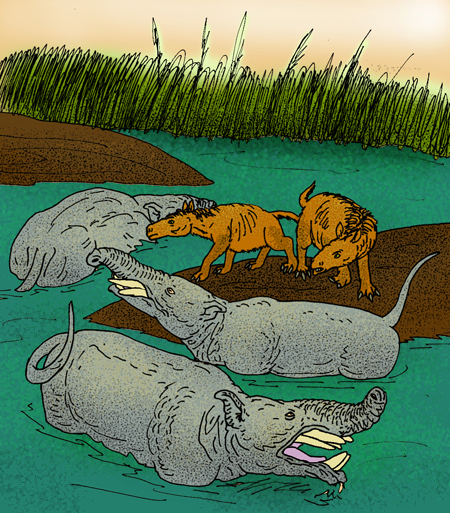
[edit]
Arctic sea ice from space on 6 March 2010

The glaciation of the Arctic in the Northern Hemisphere commenced with Greenland becoming increasingly covered by an ice sheet in late Pliocene (2.9-2.58 Ma ago). By about 3 million years ago, an isthmus had formed between North and South America, joining both continents and preventing oceanic currents from circulating between the Pacific and Atlantic oceans. As a result the northeast part of the Atlantic Ocean underwent harsher winters.[11]

The current period is the Quaternary, which started 2.58 million years ago. It is divided into the Pleistocene, which ended 11,700 years ago, and the current Holocene. The Quaternary is characterized by alternating glacial periods, during which extensive ice sheets cover large portions of the Earth, and interglacial periods, which are warmer with reduced ice cover.

The oscillation between glacial and interglacial periods is due to the Milankovitch cycles. These are cycles in Earth's axial tilt and orbital eccentricity. Earth is currently tilted at 23.5 degrees. Over a 41,000 year cycle, the tilt oscillates between 22.1 and 24.5 degrees.[24] When the tilt is greater (high obliquity), the seasons are more extreme, and the poles receive a greater fraction of the planet's insolation. When the tilt is lesser (low obliquity), the seasons are less extreme, and the poles receive a lesser fraction of the insolation. As such, at low tilt, the reduced polar sunlight allows polar ice sheets to build, causing a colder global climate via albedo reduction.[24]

The shape of Earth's orbit around the Sun affects the Earth's climate. Over a 100,000 year cycle, Earth oscillates between having a circular orbit to having a more elliptical orbit.[24] From 2.58 million years ago to about 1.73 million ± 50,000 years ago, the degree of axial tilt was the main cause of glacial and interglacial periods.[24]

Around 850,000 ± 50,000 years ago, the degree of orbital eccentricity became the main driver of glacial and interglacial periods rather than the degree of tilt, and this pattern continues to present-day.[24]

Last Glacial Period

[edit]
Neanderthals during the last glacial period.
Map of the Northern Hemisphere ice during the last glacial maximum.

The Last Glacial Period began 115,000 years ago and ended 11,700 years ago. This time period saw the great advancement of polar ice sheets into the middle latitudes of the Northern Hemisphere.

The Toba eruption 75,000 years ago in present-day Sumatra, Indonesia has been linked to a bottleneck in the human DNA, although such a causal link remains highly controversial.

50,000 years ago, Homo sapiens migrated out of Africa. They began replacing other Hominins in Asia. They also began replacing Neanderthals in Europe. However, some of the Homo sapiens and Neanderthals interbred. Currently, persons of European descent are two to four percent Neanderthal. With the exception of this small amount of Neanderthal DNA that exists today, Neanderthals became extinct 30,000 years ago.

The Last Glacial Maximum ran from 26,500 years ago to 20,000 years ago. Although different ice sheets reached maximum extent at somewhat different times, this was the time when ice sheets overall were at maximum extent.

According to Blue Marble 3000 (a video by the Zurich University of Applied Sciences), the average global temperature around 19,000 BCE (about 21,000 years ago) was 9.0 °C (48.2 °F).[25] This is about 4.8 °C (8.6 °F) colder than the 1850-1929 average, and 6.0 °C (10.8 °F) colder than the 2011-2020 average.

The figures given by the Intergovernmental Panel On Climate Change (IPCC) estimate a slightly lower global temperature than the figures given by the Zurich University of Applied Sciences. However, these figures are not exact figures and are open more to interpretation. According to the IPCC, average global temperatures increased by 5.5 ± 1.5 °C (9.9 ± 2.7 °F) since the last glacial maximum, and the rate of warming was about 10 times slower than that of the 20th century.[26] It appears that they are defining the present as the early period of instrumental records when temperatures were less affected by human activity, but they do not specify exact years, or give a temperature for the present.

Berkeley Earth publishes a list of average global temperatures by year. It shows that temperatures were stable from the beginning of records in 1850 until 1929. The average temperature during these years was 13.8 °C (56.8 °F).[27] When subtracting 5.5 ± 1.5 °C (9.9 ± 2.7 °F) from the 1850-1929 average, the average temperature for the last glacial maximum comes out to 8.3 ± 1.5 °C (46.9 ± 2.7 °F). This is about 6.7 ± 1.5 °C (12.0 ± 2.7 °F) colder than the 2011-2020 average. This figure is open to interpretation because the IPCC does not specify 1850-1829 as being the present, or give any exact set of years as being the present. It also does not state whether or not they agree with the figures given by Berkeley Earth.

According to the United States Geographical Survey (USGS), permanent summer ice covered about 8% of Earth's surface and 25% of the land area during the last glacial maximum.[28] The USGS also states that sea level was about 125 m (410 ft) lower than in present times (2012).[28] The volume of ice on Earth was around 17,000,000 cu mi (71,000,000 km3),[29] which is about 2.1 times Earth's current volume of ice.

Holocene

[edit]
Agriculture and the rise of civilization came about during the current interglacial period.

The Earth is currently in an interglacial period called the Holocene epoch.[1] However, there is debate as to whether it is actually a separate epoch or merely an interglacial period within the Pleistocene epoch.[2][3] Between 9,000 and 5,000 years ago there was a warm period called the Holocene climatic optimum.

Being in an interglacial, there is less ice than there was during the last glacial period. However, the last glacial period was just one part of the ice age that still continues today. Even though Earth is in an interglacial, there is still more ice than times outside of ice ages. There are also currently ice sheets in the Northern Hemisphere, which means that there is more ice on Earth than there was during the first 31 million years of the Late Cenozoic Ice Age. During that time, only the Antarctic ice sheets existed. Currently (as of 2012), about 3.1% of Earth's surface and 10.7% of the land area is covered in year-round ice according to the USGS.[28] The total volume of ice presently on Earth is about 33,000,000 km3 (7,900,000 cu mi) (as of 2004).[30] The current sea level (as of 2009) is 70 m (230 ft) lower than it would be without the ice sheets of Antarctica and Greenland.[17]

Based on the Milankovitch cycles, the current interglacial period is predicted to be unusually long, continuing for another 25,000 to 50,000 years beyond present times.[24] There are also high concentrations of greenhouse gases in the atmosphere from human activity, and it is almost certain to get higher in the coming decades. This will lead to higher temperatures. In 25,000 to 50,000 years, the climate will begin to cool due to the Milankovich cycles. However, the high levels of greenhouse gases are predicted to keep it from getting cold enough to build up enough ice to meet the criteria of a glacial period. This would effectively extend the current interglacial period an additional 100,000 years[24] placing the next glacial period 125,000 to 150,000 years in the future.

See also

[edit]

References

[edit]
[edit]
Revisions and contributorsEdit on WikipediaRead on Wikipedia
from Grokipedia
The Late Cenozoic Ice Age refers to the current icehouse phase of Earth's climate, initiated around 34 million years ago by the formation of the permanent during the Eocene-Oligocene transition, and marked by the subsequent development of ice sheets approximately 2.6 million years ago at the onset of the Period. This era is distinguished by recurrent glacial-interglacial cycles driven primarily by variations in Earth's orbital parameters, known as , superimposed on a long-term decline in atmospheric carbon dioxide concentrations and tectonic changes such as continental uplift and circulation reconfiguration. Empirical evidence from deep-sea sediment oxygen records, benthic , and ice volume proxies confirms the bipolar expansion of ice sheets and associated global sea-level fluctuations exceeding 100 meters between glacial maxima and interglacials. The intensification of Northern Hemisphere glaciation during the Pleistocene Epoch, from 2.58 million to 11,700 years ago, involved massive ice sheets covering much of , , and , with profound impacts on biota, including megafaunal extinctions and the evolution of cold-adapted species. Causal factors include the closure of the around 3 million years ago, which altered ocean currents and enhanced moisture delivery to high latitudes, alongside Himalayan and uplift promoting silicate weathering and CO2 drawdown. Currently, Earth resides in the , a warm phase within this ongoing , with polar ice caps persisting despite recent anthropogenic warming influences. Key characteristics encompass amplified climate variability, with glacial periods featuring expanded ice volumes, lowered sea levels exposing land bridges like Beringia, and interglacials supporting human dispersal and agriculture. While mainstream paleoclimate reconstructions rely heavily on proxy data from ice cores and marine sediments, potential biases in modeling assumptions—such as equilibrium climate sensitivity—warrant scrutiny against direct geological evidence like moraine distributions and tillites. The Late Cenozoic Ice Age thus exemplifies causal interplay between astronomical forcings, geochemical cycles, and plate tectonics in shaping planetary habitability over millions of years.

Definition and Scope

Temporal Boundaries and Characteristics

The Late Cenozoic Ice Age initiated around 34 million years ago (Ma) at the Eocene-Oligocene Transition (EOT), marked by the establishment of the (EAIS), and extends to the present day as Earth's ongoing icehouse regime. This boundary is defined by proxy records from deep-sea sediments, including a sharp positive excursion in benthic foraminiferal δ¹⁸O of approximately 1.0‰ centered at 33.7 Ma, signifying a combination of deep-ocean cooling by 3–4°C and initial ice volume expansion sufficient to lower global sea levels by 50–70 meters. The transition duration spanned roughly 0.2–0.3 million years, followed by an overshoot to cooler conditions before partial recovery. Key characteristics include a stepwise progression from unipolar glaciation to bipolar conditions, with ice sheets emerging around 3 Ma near the Pliocene-Pleistocene boundary. Throughout this interval, global temperatures declined from Eocene maxima exceeding 10°C above modern values to Pleistocene averages, punctuated by glacial-interglacial cycles of 41,000–100,000-year periodicity driven by orbital variations. Proxy evidence such as ice-rafted debris in marine cores, shifts in , and Mg/Ca paleothermometry corroborates expanded polar ice caps, increased latitudinal temperature gradients, and altered ocean circulation patterns that sustained the icehouse state. The period features dynamic ice sheet behavior, with Antarctic glaciation persisting through Miocene warming episodes before Miocene-Pliocene cooling reinforced ice volumes, culminating in Quaternary-scale fluctuations where ice sheets covered up to 30% of Earth's land surface during maxima. Unlike prior Phanerozoic ice ages, the Late Cenozoic variant exhibits prolonged stability of continental-scale ice sheets amid declining CO₂ levels below 400 ppm, enabling repeated Northern Hemisphere advances despite transient interglacials.

Distinction from Quaternary Glaciation and Prior Ice Ages

The Late Cenozoic Ice Age encompasses the interval from approximately 34 million years ago (Ma), marking the Eocene-Oligocene transition, to the present day, characterized by the initial establishment and persistence of the followed by later bipolar glaciation. In contrast, refers specifically to the intensified phase of this broader ice age, commencing around 2.58 Ma at the Pliocene-Pleistocene boundary, defined by recurrent glacial-interglacial cycles driven by Milankovitch orbital forcings and marked by extensive continental ice sheets that advanced and retreated across and . While the period exhibits pronounced 41,000- and later 100,000-year cycles of ice volume fluctuations evidenced by marine oxygen isotope records (δ¹⁸O) and terrestrial moraine deposits, the pre- Late Cenozoic phases were dominated by relatively stable ice with episodic precursors, lacking the same rhythmically intense pulses. This distinction underscores that represents a of the Late Cenozoic Ice Age rather than a separate event, with the earlier and intervals featuring warmer interglacials and transient glaciations that did not achieve the Quaternary's hemispheric scale or frequency, as indicated by benthic foraminiferal assemblages and ice-rafted debris records from ocean drilling cores. The onset of glaciation at ~34 Ma, confirmed by a global sea-level drop of 50-100 meters and a 1-2‰ increase in deep-sea δ¹⁸O values reflecting both cooling and ice volume growth, initiated a prolonged "icehouse" state absent in the immediately preceding Eocene . Relative to prior ice ages, the Late Cenozoic differs in its persistence as an ongoing polar-centered regime enabled by modern tectonic configurations, including the isolation of Antarctica by the Drake Passage and Australian-Antarctic divergence around 30-34 Ma, which facilitated circum-Antarctic current formation and heat isolation. Earlier Phanerozoic events, such as the Karoo Ice Age (~360-260 Ma), were Gondwana-centric with glaciers confined to southern high latitudes amid a supercontinent assembly, terminating with the assembly of Pangea and associated CO₂ release from volcanism, spanning ~100 million years but without enduring polar caps. The even older Andean-Saharan glaciation (~460-430 Ma) occurred under equatorial continental positions during the Late Ordovician, driven by short-term CO₂ drawdown from silicate weathering and orbital factors, but was brief (~30 million years) and lacked the tectonic isolation of poles seen today. Proterozoic precedents like the (~720-635 Ma) involved near-global "Snowball Earth" conditions with possible oceanic anoxia and cap carbonate deposition signaling , contrasting sharply with the Late Cenozoic's regionally modulated, non-extreme cooling tied to declining atmospheric CO₂ from ~1000 ppm in the Eocene to ~400 ppm by the , without evidence of total planetary ice cover. These distinctions arise from causal differences: prior ice ages often coincided with cycles disrupting ocean circulation or rapid geochemical shifts, whereas the Late Cenozoic reflects a sustained interplay of , orographic uplift (e.g., enhancing ), and orbital modulation within a framework of polar landmasses conducive to permanent ice retention.

Causal Mechanisms

Tectonic and Orographic Drivers

The initiation of the Late Cenozoic Ice Age around 34 million years ago coincided with key tectonic rearrangements, particularly the widening of gateways. The progressive separation of from and opened the and Tasman Gateway, establishing the (ACC) by approximately 30 million years ago. This current thermally isolated the Antarctic continent, preventing warm subtropical waters from moderating its climate and facilitating the buildup of the . Model simulations indicate that the ACC's formation increased meridional temperature gradients and ocean heat transport away from polar regions, contributing to a of 2–4°C. Orographic uplift of continental interiors amplified these effects through enhanced mechanical and chemical . The collision of the Indian plate with , ongoing since approximately 50 million years ago, elevated the Himalayan-Tibetan Plateau to over 4 km average height by the , intensifying and silicate rock . This process has been hypothesized to draw down atmospheric CO₂ via increased chemical rates, with estimates suggesting a reduction of 200–300 ppm over the . However, proxy records of riverine fluxes show declines during cooling phases, indicating that uplift-driven CO₂ sequestration may not have been the dominant cooling mechanism and could instead reflect feedbacks from prior temperature drops. In the , uplift of the and Eurasian mountains, reaching elevations exceeding 3 km, preconditioned glaciation by promoting orographic , regional cooling of up to 5–10°C in high latitudes, and altered positions that favored ice accumulation. Tectonic reconfiguration also influenced ocean circulation and carbon cycling. Subduction zone dynamics and mantle plume activity contributed to the reconfiguration of the Pacific basin, reducing its role in equatorial heat redistribution and exacerbating polar cooling. Orographically, high plateaus like disrupted zonal atmospheric flow, strengthening meridional cells and enhancing latent heat export from low to high latitudes. Empirical evidence from paleosols and isotopic proxies supports that these uplifts increased continental and through expanded high-elevation deserts, further promoting ice persistence. While debates persist on the precise timing and magnitude of uplift phases— with some thermochronologic indicating accelerated only post-20 million years ago—integrated models affirm as a primary preconditioner for the ice age's bipolar expansion.

Orbital Forcing and CO2 Decline

refers to periodic variations in Earth's orbital parameters—eccentricity (cycle ~100 kyr and 413 kyr), obliquity (tilt, ~41 kyr), and (~19-23 kyr)—that modulate the distribution of solar insolation across latitudes and seasons. These influence high-latitude summer insolation, particularly at 65°N, where minima promote snow persistence and growth by reducing melt. In the Late context, such forcing did not initiate the but amplified cooling under preconditioned climates, driving the ~41 kyr obliquity-dominated cycles of the and the later ~100 kyr eccentricity-modulated cycles after the Mid-Pleistocene Transition (~1 Ma). A key alignment occurred around 2.74 Ma, when low insolation coincided with emerging , marking the intensification of bipolar glaciation. Atmospheric CO₂ concentrations declined progressively through the , from Eocene peaks exceeding 1000 ppm to mid-Pliocene levels of ~350-410 ppm, crossing a critical threshold (~280 ppm) for glaciation by ~2.7-2.5 Ma. This drawdown, driven by enhanced silicate weathering, carbon storage, and expansion amid tectonic uplift, reduced the and global temperatures by several degrees, enabling permanent polar ice caps. Proxy records from alkenones, isotopes, and stomatal indices confirm this trajectory, with CO₂ falling to ~300 ppm by 2.0 Ma, intensifying and cooling feedbacks like increase from ice expansion. The synergy between and CO₂ decline explains the ice age's dynamics: sustained low CO₂ established a cooler baseline vulnerable to insolation minima, allowing ice sheets to accumulate during favorable orbital configurations and persist via despite intervening warm phases. Simulations indicate that without the CO₂ drop, orbital variations alone would not sustain ice volumes exceeding 10¹⁸ m³, as seen from ~2.7 Ma onward. This natural interplay underscores thresholds where small forcings yield large responses, with CO₂ acting as a gatekeeper for orbital-paced variability rather than a direct cycle driver.

Interplay of Natural Factors Over Anthropogenic Speculation

The initiation of the Late Cenozoic Ice Age around 34 million years ago (Ma) coincided with atmospheric CO₂ concentrations dropping to approximately 720 ppm, enabling the formation of the as a threshold response to combined tectonic isolation of and geochemical drawdown. Tectonic reconfiguration, including the opening of the and uplift of gateways, enhanced circum-Antarctic circulation and ocean heat transport away from the pole, while Himalayan-Tibetan Plateau elevation—accelerating from the India-Asia collision—intensified silicate weathering, sequestering CO₂ at rates that reduced levels from Eocene highs of ~1600 ppm to values around 500 ppm. This uplift-driven feedback lowered global temperatures by 5–10°C over the , establishing the icehouse baseline without requiring external forcings beyond plate motions and . Orbital variations, encapsulated in , interact with this backdrop to modulate ice volume on 19–100 thousand-year (kyr) timescales by altering high-latitude insolation by up to 25%, with obliquity (41-kyr cycle) dominating (NH) glaciation pacing after 2.7 Ma. Gradual CO₂ decline to 275–300 ppm between 3.2–2.4 Ma lowered the threshold for NH viability, allowing orbital minima to trigger and Laurentide expansions during insolation lows, as evidenced by benthic δ¹⁸O records showing 41-kyr cyclicity in ice volume. amplification from expanding ice and feedbacks—such as ocean CO₂ uptake during glacials—intensify these natural oscillations, sustaining bipolar glaciation through the Pliocene-Pleistocene transition when CO₂ fell below 270 ppm. Anthropogenic CO₂ rise to ~420 ppm since the overlays this framework but constitutes a brief spike relative to natural excursions exceeding 1000 ppm, which failed to avert cooling when tectonic and orbital factors prevailed. Proxy data from isotopes and stomata indicate that pre-human CO₂ thresholds alone sufficed for thresholds, with models replicating NH glaciation intensification via natural decline and obliquity without invoking modern emissions. Claims prioritizing anthropogenic forcing for overriding cycles lack substantiation from the geological record, where comparable CO₂ levels during warmer intervals (~400 ppm) still yielded to subsequent natural cooling and glaciation upon alignment of weathering-enhanced drawdown and orbital configuration. This empirical pattern underscores the causal primacy of integrated natural mechanisms over short-term human perturbations, which, while measurable, do not disrupt the multi-factor equilibrium governing 34 million years of persistence.

Chronological Development

Oligocene Onset and Antarctic Polar Ice Cap Formation

The Eocene-Oligocene Transition (EOT), dated to approximately 34.0 million years ago (Ma), initiated the Late Cenozoic Ice Age through the establishment of persistent Antarctic glaciation, transitioning Earth from a greenhouse to an icehouse climate state. This shift involved the initial formation of the East Antarctic Ice Sheet (EAIS), with evidence from marine sediment records indicating a threshold crossing where atmospheric CO₂ levels dropped below roughly 750 parts per million (ppm), enabling widespread ice accumulation on the elevated Antarctic continent. Proxy data, including benthic foraminiferal δ¹⁸O enrichment of 1.0–1.5‰ in a stepwise event termed Oi-1 (centered at ~33.7 Ma), reflect both deep-ocean cooling by 3–4°C and an ice-volume equivalent sea-level drop of 50–70 meters, equivalent to about one-third to half the modern Antarctic ice volume. Glacial indicators, such as ice-rafted debris in Southern Ocean cores and shifts in clay mineralogy from smectite to kaolinite/illite, further corroborate continental-scale ice buildup, though West Antarctica likely remained largely ice-free due to warmer marine influences and lower topography during peak early Oligocene glaciation. Causal drivers centered on declining atmospheric CO₂, driven by enhanced silicate weathering from Himalayan uplift and reduced mid-ocean ridge volcanism, which lowered and cooled high-latitude temperatures sufficiently for snowlines to descend below summits. Tectonic reconfiguration, including the deepening of the Tasman Gateway (~34 Ma) and progressive opening of (~30–34 Ma), facilitated circum- circulation via the (ACC), thermally isolating the continent and amplifying meridional temperature gradients. However, modeling and proxy reconstructions emphasize CO₂ decline as the primary threshold trigger, with gateway openings playing a secondary, enabling role by sustaining cooler conditions post-initiation rather than solely causing the onset. , particularly high obliquity minima during Oi-1, preconditioned the system by favoring cooler austral summers, promoting initial ephemeral ice caps that feedback rapidly expanded into a stable EAIS. Post-EOT variability included glacial-interglacial fluctuations paced by obliquity (~41 kyr cycles), with ice-volume changes up to 70% of modern equivalents inferred from δ¹⁸O and Li/Ca records, indicating dynamic but predominantly expanded ice through the early (~33–28 Ma). Relict pre-glacial landscapes preserved beneath the central EAIS, such as ancient river valleys detected via , attest to the ice sheet's overriding of Eocene , while mid- warming episodes (~27–26 Ma) suggest transient deglaciations before re-expansion. These dynamics underscore a causal chain where CO₂-forced cooling intersected with and ocean gateway evolution, establishing the southern as the foundational element of bipolar cooling without invoking unsubstantiated anthropogenic analogies.

Miocene Fluctuations and Northern Hemisphere Precursors

The epoch (23.03–5.33 million years ago) featured dynamic behavior following its initialization, with evidence from benthic foraminiferal oxygen isotope (δ¹⁸O) records indicating substantial volume fluctuations driven by , particularly obliquity cycles. These variations included episodes of expansion and partial collapse, such as during the early to mid- (approximately 23–14 Ma), where proxy data from deep-sea cores reveal ice volume changes equivalent to up to 70% of the modern volume across four obliquity-paced glacial-interglacial cycles. Paired Mg/Ca and δ¹⁸O analyses from sites further confirm transient reductions in ice cover, with sea-level equivalents rising by 50–60 meters during warmer intervals, reflecting a less stable ice regime than the more persistent configuration. Amid these Antarctic dynamics, the Miocene Climatic Optimum (MCO, ~17–15 Ma) marked a pronounced phase with elevated global temperatures (up to 3–6°C warmer than present) and minimal polar persistence, as indicated by reduced δ¹⁸O values and expanded marine δ¹³C gradients signaling enhanced carbon burial and weaker stratification. Post-MCO cooling resumed in the middle to (~14–5 Ma), correlating with declining atmospheric CO₂ levels (from ~500 ppm to ~300 ppm) due to tectonic and circulation shifts, including the onset of a proto- Circumpolar Current that thermally isolated . This cooling amplified stability but introduced variability, with δ¹⁸O records showing stepped declines around 13.8 Ma and 7.5 Ma, linked to eustatic sea-level falls of 20–40 meters from episodic growth. Northern Hemisphere precursors to full glaciation emerged in the (~10–6 Ma), predating the intensified Pleistocene cycles, with proxy evidence including ice-rafted debris (IRD) in North Atlantic and sediments signaling ephemeral marine-based ice advances from proto-Greenland and possibly or . Benthic δ¹⁸O trends and pollen records from high-latitude sites indicate cooling thresholds crossed around 7–6 Ma, fostering transient glaciations amid global temperature drops of 2–4°C, potentially triggered by removal on northern continents enhancing feedbacks and by shoaling of ocean thermoclines reducing poleward heat transport. These events, while not establishing permanent ice sheets, represent causal forerunners to bipolar glaciation, as evidenced by increased coarse silt fractions in Ocean Drilling Program cores from the Norwegian-Greenland Sea, denoting initial ice export without the volume of later advances. Late Miocene NH ice signals coincide with broader ecological shifts, such as C₄ grassland expansion, underscoring a tectonic-CO₂ driven rather than isolated orbital dominance.

Pliocene Transition to Bipolar Glaciation

The transition to bipolar glaciation during the late involved the establishment of perennial (NH) ice sheets alongside the pre-existing ice cap, marking a shift from unipolar dominance. This process unfolded gradually amid a backdrop of , with initial NH glacial precursors emerging around 3.6 million years ago (Ma) and intensifying markedly by approximately 2.7 Ma, coinciding with the -Pleistocene boundary at 2.58 Ma. The intensification, often termed the intensification of Glaciation (iNHG), amplified glacial-interglacial variability, as evidenced by stepped increases in ice volume recorded in benthic foraminiferal δ¹⁸O stacks. Proxy records, including ice-rafted debris (IRD) in North Atlantic sediments, pinpoint discrete phases of NH ice sheet growth: initial Eurasian and Northeast Asian glaciation at 2.74 Ma, followed by Alaskan expansion at 2.70 Ma, and fuller Laurentide precursors by 2.64 Ma. These signals correlate with a decline in atmospheric CO₂ levels below a critical threshold of approximately 280 ppmv for NH viability, lower than the ~750 ppmv required for Antarctic persistence, enabling ice sheet stability despite residual warmth. Ocean circulation changes, driven by the closure of the around 3 Ma, redirected freshwater fluxes and strengthened (AMOC) variability, fostering NH cooling and aridity conducive to ice buildup. Orbital Milankovitch forcing, particularly 41-kyr obliquity cycles, modulated early NH ice dynamics before a later 100-kyr eccentricity dominance. Regional manifestations included alpine glaciation in and the by mid-Pliocene, escalating to continental-scale sheets during iNHG, as inferred from terrestrial tillites and offshore detrital provenance. (SST) reconstructions from the subarctic Atlantic reveal enhanced seasonality and cooling of 2–4°C across the transition, amplifying effects. Modeling studies confirm that combined CO₂ drawdown—via and —and tectonic reconfiguration lowered the NH glaciation threshold, with simulations replicating observed ice volume surges without invoking unsubstantiated anthropogenic analogs. This transition underscores causal interplay among declining forcing, gateway , and insolation variance, rather than isolated factors.

Pleistocene-Quaternary Intensification and Cycles

The Pleistocene epoch, spanning from approximately 2.58 million years ago to 11.7 thousand years ago, marked a profound intensification of the Late Cenozoic Ice Age through the repeated expansion and contraction of massive ice sheets, including the Laurentide and Fennoscandian sheets that covered vast areas of and . This phase built on the Pliocene's bipolar glaciation by introducing higher-amplitude climate oscillations, with global ice volume varying by up to 120 meters equivalent sea-level change during peak glaciations. Evidence from deep-sea sediment cores, particularly benthic δ¹⁸O records, indicates the onset of significant glaciation around 2.7 million years ago, transitioning from sporadic glaciations to persistent ice sheets. Glacial-interglacial cycles during the were dominated by a ~41,000-year periodicity aligned with Earth's axial obliquity variations in , resulting in relatively moderate ice volume fluctuations and interglacials of 10-30 thousand years duration. These cycles modulated summer insolation at high northern latitudes, preventing or enabling ablation. Proxy data from marine isotopes and ice cores confirm this obliquity dominance until the Mid-Pleistocene Transition (MPT) between 1.2 and 0.7 million years ago, after which cycles shifted to a ~100,000-year eccentricity-driven rhythm with sawtooth patterns of gradual cooling and abrupt warmings. The MPT represented a critical intensification, with glacial maxima achieving greater ice volumes and durations, as evidenced by the LR04 benthic δ¹⁸O stack showing increased variance post-transition. While orbital parameters did not change sufficiently to explain the shift alone, contributing factors include progressive atmospheric CO₂ decline to below ~250 ppm thresholds, enhanced ice sheet-bedrock coupling via erosion, and potential dust feedbacks amplifying effects. This transition underscores the nonlinear response of the to combined forcings, with no attributing it to external perturbations beyond natural variability. Quaternary cycles extended these patterns into the , with the last glacial cycle ( to 2) exemplifying the 100-kyr dominance, culminating in the around 21,000 years ago. Paleotemperature reconstructions from ice cores and speleothems reveal global temperature swings of 4-7°C between glacial and states, driving shifts, megafaunal adaptations, and . The persistence of these cycles highlights the dominant role of internal dynamics over speculative anthropogenic influences predating industrial emissions.

Regional Manifestations

Southern Hemisphere Glaciations

The represents the dominant feature of Southern Hemisphere glaciations, forming approximately 34 million years ago during the Eocene-Oligocene boundary through the establishment of a persistent , primarily driven by declining atmospheric CO2 levels and the thermal isolation of following and ocean gateway closures. This has since undergone episodic fluctuations, with evidence from sediment cores and stratigraphic records indicating partial collapses during warmth around 14-12 million years ago, followed by regrowth amid cooling trends. In the , warmer intervals led to reduced ice volume, but the expanded to near-modern extents by the late , as reconstructed from offshore seismic and drilling data showing grounded ice retreat and marine incursions. Pleistocene variations were modulated by orbital obliquity cycles, with ice-volume changes up to 70% of present-day equivalents during glacial-interglacial transitions, though overall stability exceeded that of Northern Hemisphere sheets due to persistent cold isolation. Beyond Antarctica, continental glaciations occurred in mid-latitude regions of the , particularly along the and in , responding to enhanced orographic precipitation and regional cooling since the . In , the —an elongated mountain ice mass spanning the southern from approximately 41°S to 56°S—developed multiple advances during the , with evidence from moraines, erratics, and dating indicating at least five major glacial stages in northern (39°-46°S) and three Early to Middle events near outer limits. The sheet reached its maximum extent during the around 25-23 thousand years ago, covering roughly 400,000 km², with rapid thinning post-LGM via calving into fjords and lakes, as inferred from geomorphological mapping and exposure-age dating. Southern records further document pollen-based indicators of late-glacial warming punctuated by stadials, alongside enhanced aridity phases in the Mio-Pliocene linked to ice-proximal shifts. In , glaciations intensified from the late onward, with valley glaciers in the expanding to cover about one-third of the [South Island](/page/South Island) during Pleistocene maxima, as evidenced by widespread moraines and outwash deposits. records delineate advances ending around 780 thousand years ago, succeeded by Middle Pleistocene events aligned with , culminating in the from 115-11.7 thousand years ago, where ice lobes extended to low elevations amid cooler, drier conditions. Biological proxies, such as genetic divergence in alpine species, corroborate the onset of temperate glaciation around the Pliocene-Pleistocene boundary, reflecting repeated . These regional ice masses contributed modestly to global sea-level equivalents compared to volumes but amplified local geomorphic erosion, with tillites and fjord systems preserving direct stratigraphic evidence of their dynamics. Overall, Southern Hemisphere glaciations exhibit greater persistence in polar realms versus episodic mid-latitude expansions, underscoring the primacy of thermal isolation over hemispheric-wide cyclicity.

Northern Hemisphere Glaciations

Northern Hemisphere glaciations emerged as precursors during the , with evidence of ephemeral ice sheets between 10 and 6 million years ago (Ma), indicated by ice-rafted debris (IRD) in North Atlantic sediments and glacial deposits in regions. These events were limited in scale and persistence, occurring under cooling conditions but without sustained continental ice sheets, as global temperatures remained relatively high during the Miocene Climatic Optimum. Full-scale Northern Hemisphere glaciation initiated in the around 3.6 Ma, marked by the first significant IRD records and expanded glacial erosion features in and the , coinciding with declining atmospheric CO2 levels below 280 ppm and tectonic uplift enhancing orographic cooling. By approximately 2.7 Ma, ice sheets intensified, leading to pronounced glacial stages with ice volumes sufficient to lower global sea levels by tens of meters during peaks. In the Pleistocene epoch (2.58 Ma to 11.7 ka), Northern Hemisphere ice sheets underwent cyclic expansions and retreats driven primarily by Milankovitch orbital forcings, transitioning from 41,000-year obliquity-dominated cycles in the Early Pleistocene to dominant 100,000-year eccentricity cycles after the Mid-Pleistocene Transition (MPT) around 1.0–0.8 Ma. Major ice sheets included the Laurentide Ice Sheet in North America, which at maxima covered approximately 13 million km² with thicknesses up to 3 km, extending from the Canadian Arctic to northern United States; the Cordilleran Ice Sheet along the western mountains; the Fennoscandian Ice Sheet over Scandinavia and the Baltic, spanning about 5.5 million km²; and the British-Irish and smaller Arctic ice caps. During glacial maxima, such as the Last Glacial Maximum (LGM) around 26–20 ka, these ice sheets collectively contributed to a global sea-level depression of about 120–130 m, with ice-rafted debris layers and benthic δ¹⁸O records confirming synchronous Northern Hemisphere ice buildup. Reconstructions from cores, terrestrial moraines, and ice-core proxies reveal that glaciations featured smaller, more frequent ice advances with lower amplitudes, reflecting reduced ice-sheet sensitivity to temperature changes under higher CO2 concentrations around 250–300 ppm. Post-MPT, ice sheets exhibited greater persistence and , with evidence of non-linear growth thresholds where initial accumulation in summer-ablation zones shifted to perennial , amplifying feedbacks via and elevation-mass balance effects. Regional variations persisted; for instance, Greenland's remained semi-permanent from ~2.7 Ma, while Eurasian sheets showed episodic coalescence during severe stadials. Overall, ice dynamics dominated late climate variability, with ice-sheet correlating inversely with deep-ocean temperatures as traced by Mg/Ca paleothermometry and δ¹⁸O .

Key Phases and Transitions

Last Glacial Maximum

The (LGM) refers to the period during the last glacial cycle when global volume reached its peak extent, spanning approximately 26,500 to 19,000 years (). This interval is characterized by the synchronous maximum development of major sheets, including the Laurentide Ice Sheet covering much of northern and the Fennoscandian Ice Sheet over , alongside expansions in the . Global sea levels were depressed by about 120–125 meters relative to present due to the locking of in these vast masses. Paleoclimate reconstructions indicate mean annual temperatures were 4–7°C cooler than today in mid-to-high latitudes, driven by reduced atmospheric CO2 concentrations around 190 ppm and amplified by high-albedo cover and circulation changes. Ice sheet configurations during the LGM featured the Laurentide and Cordilleran sheets merging over , extending southward to cover regions up to 40°N in places, with thicknesses exceeding 3 km in central areas. In , the British-Irish and Scandinavian ice sheets advanced to the continental shelf edges, while the Barents-Kara dominated the margins. ice expanded modestly compared to volumes, contributing to overall bipolar glaciation but with less change. These extents are reconstructed from terrestrial , marine sediment cores, and radiocarbon-dated erratics, confirming a global ice equivalent to roughly 50–70 million km³. The LGM's climatic severity is evidenced by proxy records such as assemblages indicating tundra-steppe biomes dominating unglaciated continents and oxygen ratios in cores (e.g., from Greenland's GISP2) showing depleted δ¹⁸O values consistent with colder, drier conditions. Atmospheric dust fluxes were elevated threefold over modern levels, as recorded in cores like Vostok, reflecting intensified aridity and windiness. While Milankovitch provided a backdrop of declining summer insolation leading into the LGM, the precise synchrony of maxima across hemispheres remains debated, with some regional advances predating the core LGM window. initiated around 19–20 ka , triggered by rising insolation and feedbacks from retreating .

Deglaciation and Holocene Interglacial

The phase following the (LGM), dated approximately 26,000 to 19,000 years (), initiated a period of widespread retreat driven by rising global temperatures and associated feedbacks. Initial recession in the , particularly from the Laurentide and Fennoscandian s, commenced around 19,000–18,000 , with evidence from East margins indicating localized retreat as early as 18,000 in regions like the Lambert/Amery system. This process accelerated during the Bølling–Allerød interstadial (approximately 14,700–12,900 ), marked by abrupt warming of 5–10°C in records, attributed to enhanced () and reduced ice-albedo feedbacks. Sea levels, which stood about 120–130 meters below present during the LGM, began rising at rates exceeding 10 mm/year, punctuated by () around 14,600–14,300 , when approximately 14–20 meters of equivalent sea-level rise occurred over 300–500 years, primarily from melting of North American and Scandinavian s. This warming was interrupted by the stadial (12,900–11,700 BP), a rapid return to near-glacial conditions with temperature drops of up to 10°C in the , linked to freshwater influx from collapsing ice dams—such as —disrupting AMOC. Proxy data from ice cores (e.g., GISP2, NGRIP) and North Atlantic sediments confirm this event's hemispheric extent, though Antarctic records show an inverse "cold reversal" with slight warming, highlighting bipolar asymmetry in deglacial responses. Deglaciation resumed post-Younger Dryas with another meltwater pulse (MWP-1B, ~11,400–11,100 BP), contributing 7–11 meters of sea-level rise over ~250–400 years, as Laurentide ice margins retreated rapidly across . By 11,000 BP, major ice sheets had diminished significantly, enabling coastal migration routes and ecosystem reorganization. The epoch commenced around 11,700 , following the abrupt termination of the , transitioning Earth into a warmer state with global temperatures 4–7°C higher than LGM averages. Characterized by minimized glaciation—residual ice limited to and mountain ranges—and stabilized ice sheets, the early (11,700–8,200 ) featured peak warmth (Holocene Thermal Maximum) around 9,000–6,000 , with proxy reconstructions from pollen, speleothems, and ocean sediments indicating temperatures in some regions exceeding modern values by 1–2°C due to (higher insolation). Sea levels approached within 10–20 meters of present by 7,000 , with isostatic rebound and eustatic adjustments continuing into the mid-. Despite this warmth, the broader Late Cenozoic Ice Age persists, as evidenced by permanent polar ice caps and Milankovitch cycle predictions suggesting eventual re-glaciation absent anthropogenic influences. climate exhibited variability, including the 8.2 ka cooling event from proglacial lake outbursts, but overall supported expansions like boreal forests and megafaunal habitats until late-period shifts. ![Paleotemperature reconstruction across the deglaciation and Holocene][center]

Evidence and Reconstruction Methods

Historical Discovery and Naming

The concept of the Late Cenozoic Ice Age originated in the 19th century through observations of glacial landforms in Europe, initially focused on Northern Hemisphere events of the Pleistocene Epoch. In 1821, Swiss engineer Ignaz Venetz proposed that Alpine glaciers had once extended far beyond their current limits, explaining erratics and valley morphologies, though his ideas received limited attention. Jean de Charpentier expanded this in 1834, suggesting widespread ice cover across Switzerland during a colder epoch. These precursors culminated in the work of Louis Agassiz, who, after fieldwork in the Alps, delivered a landmark discourse on July 24, 1837, at the Swiss Society of Natural Sciences in Neuchâtel, arguing for continent-scale ice sheets that shaped landscapes through erosion and deposition. German botanist Karl Friedrich Schimper coined the term "Eiszeit" (ice age) in early 1837 during collaborative discussions with Agassiz, formalizing it in an ode recited at the meeting to describe a distinct geological period of extreme cold. Agassiz detailed the evidence— including U-shaped valleys, terminal moraines, and transported boulders—in his 1840 monograph Études sur les glaciers, extending the theory to and via striations and drift deposits observed in subsequent expeditions. This established the Pleistocene as a time of recurrent glaciations, with Agassiz estimating ice thicknesses up to 2 kilometers based on topographic indicators. British geologist , initially resistant to catastrophic cooling, accepted the glacial paradigm by 1839 and coined "Pleistocene" (from Greek pleistos, most, and kainos, new) for the post-Pliocene interval dominated by such features, distinguishing it from earlier Tertiary strata. The encompassing "Quaternary" framework, proposed earlier by Jules Desnoyers in 1829 for uppermost deposits, became linked to ice-age cycles through stratigraphic correlations of tillites and . 20th-century advances, including isotope ratios in from ocean drilling (e.g., cores), revealed the ice age's deeper roots, with Antarctic ice-sheet around 34 million years ago at the Eocene-Oligocene boundary, driven by CO2 decline and gateway closures. This evidence, from sites like the , showed dynamic but persistent glaciation preceding Northern intensification at 2.58 million years ago, prompting the descriptive term "Late Cenozoic Ice Age" in mid-to-late 20th-century paleoclimate syntheses to denote the protracted bipolar cooling regime.

Proxy Data and Modeling Approaches

Proxy data for reconstructing the Late Cenozoic Ice Age primarily derive from cores, where benthic foraminiferal oxygen (δ¹⁸O) ratios serve as key indicators of global ice volume and deep-sea temperatures. A rapid 1.5‰ positive shift in benthic δ¹⁸O at the Eocene-Oligocene boundary around 34 million years ago (Oi-1 event) marks the onset of widespread glaciation, reflecting increased continental ice storage that depleted seawater of lighter isotopes. Subsequent records, compiled from benthic , reveal long-term trends in ice buildup, with Pleistocene variability dominated by glacial-interglacial cycles driven by orbital forcings, though early δ¹⁸O shifts also incorporate significant deep-ocean cooling components rather than purely ice volume changes. Terrestrial proxies complement marine records, including glacial tillites, moraines, and ice-rafted debris in sediments, which evidence advances; for instance, tillites in the indicate initial alpine glaciations preceding full bipolar s. and leaf margin analyses from continental deposits reconstruct shifts tied to cooling, while borehole paleotemperatures from geothermal gradients provide direct constraints on continental thermal histories. In polar regions, limited data from and extend back only ~800,000 years but capture high-resolution δ¹⁸O fluctuations aligning with marine proxies for the . Boron isotope proxies in further quantify atmospheric CO₂ declines, such as a rapid drop at the end of the around 5.3 million years ago, correlating with enhanced glaciation. Climate modeling approaches integrate these proxies to simulate ice sheet dynamics and feedbacks. Coupled atmosphere-ocean- models, such as those emulating Eocene to transitions, reproduce inception under declining CO₂ and orbital configurations, with feedbacks amplifying cooling by increasing and reducing heat transport. models like VUB-AISMPALEO, constrained by marine geologic , hindcast changes and test thresholds for glaciation, predicting benthic δ¹⁸O shifts of 0.65–0.75‰ from early growth alone. For the Pleistocene, Earth system models incorporate , CO₂ variability (235–440 ppm), and - feedbacks to match proxy-reconstructed sea levels and configurations, though uncertainties persist in parameterizing sub- and marine stability. These models highlight causal roles of (e.g., uplift enhancing and CO₂ drawdown) over atmospheric feedbacks in long-term initiation, but short-term cycles rely on insolation-driven instabilities. Validation against proxies reveals model biases, such as underestimating early sensitivity to CO₂, underscoring the need for refined boundary conditions from empirical .

Impacts and Consequences

Geomorphological and Erosional Effects

Glacial during the Late Cenozoic Ice Age, particularly intensified since the with the onset of sheets around 2.7 million years ago, has sculpted diverse landforms through mechanical abrasion, plucking, and subglacial . Processes such as quarrying at beds and frost cracking in periglacial zones facilitated breakdown, leading to the formation of U-shaped valleys, cirques, arêtes, and overdeepened s, with rates exhibiting extreme from 0 to 5 mm per year under active . In mountainous regions, repeated glacial-interglacial cycles removed up to 2.6 km of in some systems, contributing to net topographic relief changes over 47 cycles. Cold-climate processes proved more efficient at rock and than temperate fluvial systems, driving a global increase in rates linked to cooling and volume expansion. Erosional impacts varied by region and substrate; in high-elevation settings, late Cenozoic cooling favored glacial over tectonic controls on valley incision, with constant deepening providing younger fission-track ages through progressive exhumation. On ancient shields like the Canadian Shield, Pleistocene ice sheets exerted limited overall erosion on low-relief surfaces, preserving pre-glacial features beneath thin veneers, though localized streamlining produced drumlins and roches moutonnées via selective abrasion. Periglacial effects extended beyond ice margins, where enhanced regolith production and flux, influencing long-term landscape evolution over 10^6-year timescales. During the (~21,000 years ago), mean erosion rates in some basins reached 0.21 mm per year, declining to 0.08 mm per year in the as ice retreated. Depositional geomorphology complemented erosion, with meltwater streams and ice retreat depositing vast till sheets, moraines, eskers, and proglacial outwash plains that blanketed eroded terrains. In unglaciated catchments adjacent to ice sheets, increased sediment yields from glacial sources altered fluvial systems, forming braided rivers and deltas. Isostatic rebound following deglaciation, up to hundreds of meters in formerly glaciated cratons, further modified landscapes by uplifting coastlines and reactivating faults, with recurrent glacial loading influencing erosion patterns over multiple cycles. These effects underscore glaciation's role in enhancing global sediment supply to oceans during late cooling.

Ecological and Evolutionary Outcomes

The repeated glacial-interglacial cycles of the Late Cenozoic Ice Age drove extensive ecological restructuring, particularly in terrestrial biomes of the . During glacial maxima, such as those intensifying around 2.5 million years ago, ice sheets expanded, temperatures dropped by up to 6–10°C in polar regions, and tundra-steppe replaced boreal forests across mid-latitudes, forcing floral and faunal into southern refugia or elevational retreats. Post-glacial interglacials enabled northward recolonization, but often with reduced due to bottlenecks, shaping current latitudinal gradients in intraspecific variation. In aquatic and subterranean systems, glaciation similarly fragmented habitats, promoting localized in groups like Alpine amphipods. Functional diversity in communities declined globally starting around 10 million years ago amid cooling and expansion, with a 65% loss in traits from 10 to 5 million years ago, further accelerated by glaciations that favored specialized grazers over browsers. These shifts reflected causal links between declining CO2 levels, , and volume growth, reducing niche partitioning and homogenizing faunas across continents via biotic interchanges like the Great American event at 2.6 million years ago. Marine ecosystems saw parallel changes, with Antarctic benthic evolving in response to tectonic isolation and cooling since the Eocene-Oligocene transition at 34 million years ago. Evolutionarily, the ice age's cooling phases spurred convergent adaptations in cold-tolerant angiosperms, including herbaceous habits, deciduousness, and events tied to frost evasion pathways like CBF/DREB1 gene regulation, evident across 137 families occupying 49% of frost-prone land by the . Glacial isolation fostered in select taxa, such as transverse Alpine lineages and Holarctic snails, where refugial fragmentation during Pleistocene peaks generated phylogeographic breaks and younger diversification bursts around 2.67–0.9 million years ago. However, in mammals, cycles did not elevate speciation rates, as population responses rarely crossed species boundaries within 100,000-year timescales, with diversification instead governed by longer-term tectonic and climatic forcings. Overall, while promoting adaptive radiations in resilient groups, the ice age contributed to selective pressures culminating in functional simplifications rather than broad surges.

Influence on Human Origins and Dispersal

The intensification of glaciation around 2.6 million years ago marked the onset of the Late Cenozoic Ice Age, coinciding with the emergence of the genus in amid increasing aridity and driven by orbital-scale climate variability. This period saw expansions of C4 grasslands, which likely pressured arboreal toward terrestrial adaptations, including in earlier , though direct causal links remain debated due to potential biases in fossil sampling. Pleistocene climate fluctuations, modulated by , altered resource availability and prompted behavioral innovations such as use and fire control in early species, enhancing survival in variable savanna-woodland mosaics. Over the past 620,000 years, East African paleoclimate records reveal three phases of heightened variability—intensifying around 620–430 ka, stabilizing 430–130 ka, and increasing again after 130 ka—that aligned with key hominin transitions, including the origins of Homo sapiens around 300 ka during a period of pulsed and lake level drops. These shifts, linked to precession-driven changes in insolation and strength, favored cognitive and technological advancements, as evidenced by artifacts correlating with environmental instability rather than uniform . Mid-Pleistocene pulses around 1–0.5 Ma further drove contractions, potentially spurring dispersals and genetic bottlenecks that selected for adaptable traits in archaic humans. Glacial-interglacial cycles profoundly shaped Homo sapiens dispersal from , with sea levels dropping up to 120 m during maxima like the (26.5–19 ka), exposing continental shelves and enabling coastal migrations along southern routes. Earlier Pleistocene lowstands, such as those during Marine Isotope Stage 6 (~150–130 ka), facilitated initial forays into the and Arabia via the Bab-el-Mandeb Strait, where paleotidal models indicate feasible crossings at -75 m or lower. Multiple waves of out-of-Africa movement, documented genetically and archaeologically, exploited wetter interstadials for inland corridors while glacials lowered barriers like the , though harsh conditions during peaks caused regional depopulations in . Climate-driven bottlenecks during extreme glacials, such as Marine Isotope Stage 4 (71–57 ka), likely reduced Homo sapiens effective population sizes to under 10,000 individuals, imprinting low genetic diversity observable today and underscoring the 's role in channeling evolutionary pressures toward behavioral flexibility over physiological specialization. In , overlapping ranges with Neanderthals during milder interglacials like MIS 5 (130–71 ka) enabled , with events tied to habitat expansions under reduced ice volume. These dynamics highlight how ice age oscillations created alternating refugia and corridors, influencing not just sapiens dispersal but also hybridization that contributed 1–4% Neanderthal ancestry in non-African genomes.

Debates and Unresolved Questions

Primary Drivers: Tectonics vs. Atmospheric Feedbacks

The Late Cenozoic Ice Age, commencing with Antarctic glaciation around 33.9 million years ago (Ma), was primarily initiated by a decline in atmospheric CO₂ concentrations from Eocene highs exceeding 1000 parts per million (ppm) to approximately 720 ppm by the Eocene-Oligocene boundary, enabling the persistence of continental ice sheets through reduced greenhouse forcing. This CO₂ drawdown is widely attributed to tectonic processes, particularly the uplift of the and surrounding Himalayan ranges starting post-Eocene, which exposed fresh rocks to enhanced chemical , accelerating the consumption of atmospheric CO₂ via the reaction of silicates with to form ions that are sequestered in oceans. The timing aligns closely: significant plateau occurred between 50-40 Ma, correlating with trends and further CO₂ reduction to ~550 ppm by ~32 Ma, which reinforced ice expansion. Additional tectonic factors, such as the closure of the Panama Isthmus around 3 Ma, redirected ocean currents, strengthening the Atlantic Meridional Overturning Circulation and facilitating (NH) glaciation by transporting heat away from high latitudes. Atmospheric feedbacks, including ice-albedo effects and orbital variations, played a secondary but amplifying role in sustaining the once tectonic thresholds were crossed. Reduced CO₂ lowered baseline temperatures, triggering positive feedbacks where expanding ice sheets increased Earth's albedo, reflecting more solar radiation and further cooling polar regions; this is evident in proxy records showing rapid ice buildup post-33.9 Ma despite modest initial insolation changes. —variations in Earth's , obliquity, and —did not initiate the LCIA but modulated its glacial-interglacial oscillations, particularly after ~2.7 Ma when NH ice sheets became responsive to ~41,000-year obliquity cycles, as lower CO₂ thresholds (~270 ppm by the Pliocene-Pleistocene boundary) sensitized the to insolation forcing. Water vapor feedbacks, diminishing with cooling, and potential reductions in other greenhouse gases like further entrenched cold states, though these are downstream consequences rather than primary drivers. The debate centers on whether provided the fundamental causal forcing via long-term CO₂ modulation or if atmospheric processes alone could have driven the transition; empirical CO₂ proxies from boron isotopes in and alkenone records demonstrate that declines preceded and exceeded the magnitude needed for to build sheets, as simulations show NH glaciation intensifying only below ~280 ppm CO₂ concurrent with tectonic gateways. Critics of pure tectonic primacy note that efficiency peaks at moderate rates, not maximal uplift, suggesting volcanic variations or carbon storage also contributed, yet the spatial-temporal of uplift with cooling phases—absent in non-orogenic periods—supports tectonics as the dominant pacemaker, with feedbacks providing amplification rather than initiation. This causal hierarchy aligns with first-principles radiative balance: sustained requires sub-freezing polar temperatures unachievable without CO₂-forced baseline cooling beyond orbital amplitudes of ~1-2°C.

Megafauna Extinctions: Climate vs. Human Agency

The extinctions, occurring primarily between 50,000 and 10,000 years ago, involved the loss of approximately 150 of large-bodied vertebrates worldwide, with over 90% of genera exceeding 44 kg in body mass disappearing in regions like , , and . These events exhibited a strong selectivity for large animals, as smaller mammals experienced minimal turnover, a pattern inconsistent with purely climatic drivers that would affect all taxa proportionally. In alone, 38 genera of vanished around 12,900 to 11,400 years (BP), coinciding with the arrival and expansion of Clovis hunter-gatherers. The overkill hypothesis posits that anatomically modern (Homo sapiens), spreading from after 100,000 years ago, overhunted ecologically naive unadapted to predation pressure, leading to rapid population collapses via a "" effect. Supporting evidence includes the precise temporal overlap between human colonization and extinctions: in , declined sharply after human arrival around 50,000 BP; in the , after 15,000 BP; and in , after 2,300 BP, with no comparable losses during prior glacial-interglacial transitions lacking human presence. Archaeological records, though sparse, document human hunting of , such as Clovis spear points embedded in remains dated to 13,000 BP, and modeling indicates that even low human population densities (e.g., 0.1-1 person per 100 km²) could drive extinctions of large herbivores with low reproductive rates (e.g., with 3-4 year inter-calving intervals). 's surviving , including and rhinos, co-evolved with humans over millennia, suggesting mitigated overkill elsewhere. Climate-driven explanations attribute extinctions to habitat fragmentation, vegetation shifts, and abrupt events like the Younger Dryas cooling (12,900-11,700 BP), which altered forage availability and increased aridity. Proponents argue that megafauna's specialized physiologies, such as high-energy demands of woolly mammoths suited to cold steppes, failed to adapt to rapid warming and woody plant encroachment post-Last Glacial Maximum. Some dated records show pre-human declines in megafauna abundance during earlier Pleistocene warm phases, and statistical correlations between extinction timing and climate proxies like oxygen isotopes in ice cores. However, these models struggle to explain the global asynchrony—e.g., Eurasian megafauna persisted through multiple climate cycles until human pressures intensified—and the survival of analogous small-bodied species under identical conditions, undermining climate as the sole or primary cause. Empirical synthesis favors agency as the dominant factor, with acting as a amplifying rather than a direct driver, as evidenced by the absence of equivalent extinctions in refugia without humans (e.g., Siberia's mammoths until ~4,000 ) and Bayesian analyses rejecting climate-only scenarios in favor of anthropogenic models with >95% in contested regions like . Critiques of overkill, such as limited kill sites, overlook indirect effects like habitat disruption from use and prey switching, while climate advocates often rely on correlations without causal mechanisms distinguishing megafauna selectivity. Ongoing genomic studies of reveal bottlenecks predating final extinctions but align terminal losses with expansion timelines.

Prognosis for Future Glacial-Interglacial Cycles

Under natural Milankovitch forcing, characterized by periodic variations in Earth's , , and , the onset of the next within the Ice Age would be anticipated in approximately 10,000 to 50,000 years. Recent analyses of paleoclimate records aligned with orbital parameters indicate that the current () aligns with a phase where decreasing summer insolation in the would eventually favor expansion, particularly over and , following patterns observed in prior 41,000- to 100,000-year cycles. Anthropogenic carbon dioxide emissions, however, introduce a dominant radiative forcing that overrides these orbital signals. Atmospheric CO2 concentrations, which have risen from pre-industrial levels of about 280 ppm to over 420 ppm as of 2023, exceed natural interglacial maxima and persist for millennia due to slow and terrestrial carbon sinks, with 75% removal timescales ranging from 197 to 1,820 years depending on emission peaks. Reduced-complexity models integrating ice volume dynamics and CO2 feedbacks demonstrate that even moderate emission scenarios prevent significant glaciation for at least 50,000 years by inhibiting initial snow accumulation and growth thresholds. Projections from process-based simulations suggest that accumulated anthropogenic CO2 could terminate or indefinitely dampen future glacial-interglacial oscillations, potentially marking the end of the Ice Age regime. While orbital cycles would continue to modulate insolation, elevated levels sustain warmer global temperatures incompatible with large-scale buildup, as evidenced by sensitivity tests showing suppressed volume even under low-eccentricity orbits. This prognosis assumes no geoengineering interventions or unforeseen feedbacks, though uncertainties remain in precise ice-albedo and interactions.

References

Add your contribution
Related Hubs
User Avatar
No comments yet.