
Community hub
Recent from talks
Contribute something
Nothing was collected or created yet.
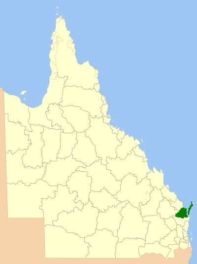
Fraser Coast Region
View on Wikipedia
The Fraser Coast Region is a local government area in the Wide Bay–Burnett region of Queensland, Australia, about 250 kilometres (160 mi) north of Brisbane, the state capital. It is centred on the twin cities of Hervey Bay and Maryborough and also contains K'gari. It was created in 2008 from a merger of the Cities of Maryborough and Hervey Bay and the Shires of Woocoo and most of Tiaro.
Key Information

The resident population at the 2021 census was 111,032[1] and the estimated population in 2023 was 117,940.[3]
The 2024–2025 budget of the Fraser Coast Regional Council is $477 million.[4]

History
[edit]Butchulla (also known as Batjala, Badtjala, Badjela and Badjala) is the language of the Fraser Coast region, including K'gari. Butchulla language region includes the landscape within the local government boundaries of the Fraser Coast Regional Council, particularly the towns of Maryborough and Hervey Bay extending south towards Noosa and northwest to Howard.[5]
On 10 March 1861, the Municipal Borough of Maryborough, governed under the Municipalities Act 1858 which had been inherited from New South Wales upon the separation of Queensland in 1859, was proclaimed, becoming the sixth municipal government in Queensland. Henry Palmer was appointed as its first Mayor.
On 11 November 1879, when the Divisional Boards Act 1879 came into effect, the Antigua and Burrum Divisions were created around what is now Hervey Bay, and on 15 September 1883, the Granville Division was established to serve the district surrounding Maryborough. Howard Division was separated from the Isis Division in 1900.
With the passage of the Local Authorities Act 1902, all four divisions became Shires on 31 March 1903, and Maryborough became a Town. On 7 January 1905, Maryborough achieved City status,[6] and a Town Hall was built on the corner of Kent and Adelaide Streets and became the administrative centre of the City.
The Shire of Degilbo, later renamed Biggenden, split away from the Shire of Burrum on 3 June 1905.[7] On 23 December 1905, Burrum was renamed Pialba.[8]
On 17 February 1917, the Granville, Antigua and Pialba shires were dissolved, and split between a new Shire of Burrum and the Shire of Woocoo, which had been gazetted three years earlier. By the 1920s the Hervey Bay area was rapidly expanding due to continuing growth in the primary industries such as sugar cane, citrus, pineapples, beef cattle and fishing, as well as investment in transport infrastructure. In the 1950s and 1960s, population and development increased, and the coastal towns slowly merged into a single urban area.
On 20 December 1975, but effective from 27 March 1976 local government elections, the Shire of Burrum was renamed the Shire of Hervey Bay. With the new focus on the coastal region, 1,086.4 km2 (419.5 sq mi) of its area, with an estimated population of 1,119, was annexed by the City of Maryborough, while 1,269.0 km2 (490.0 sq mi) with an estimated population of 2,629 was annexed by the Shire of Woocoo.
In September 1977, the Shire of Hervey Bay received Town status, and on 18 February 1984 it became a City.
On 15 March 2008, under the Local Government (Reform Implementation) Act 2007 passed by the Parliament of Queensland on 10 August 2007, the City of Hervey Bay merged with the City of Maryborough, Shire of Woocoo and the northern part of Tiaro (Divisions 1 and 2) to form the Fraser Coast Region.[9]
On 13 November 2018 it was announced by the Deputy Prime Minister, Michael McCormack, Federal Member for Hinkler Keith Pitt and Fraser Coast Mayor George Seymour that the Fraser Coast Regional Council would be part of a new regional deal with the Australian Government to build infrastructure.[10]
The council's current Chief Executive Officer, Mica Martin, was appointed in October 2025.[11]


Divisions
[edit]The council consists of ten councillors and a mayor, elected for a four-year term. Each of the councillors represent one of the ten divisions. The next election is due in March 2028.
Towns and localities
[edit]The Fraser Coast Region includes the following settlements:
|
Urban Hervey Bay: |
Rural Hervey Bay:
|
|
Maryborough area: |
Woocoo area:
|
|
North Tiaro - Division 1 area: |
North Tiaro - Division 2 area:
|
1 - split with Gympie Region
Libraries
[edit]The Fraser Coast Regional Council operates public libraries at Burrum Heads, Pialba (Hervey Bay), Howard, Maryborough (John Anderson), Maryborough (Toys and Special Needs), and Tiaro (Tom Gee Memorial).[13] A new library is being constructed at Hervey Bay as part of the Hinkler Regional Deal.[14]
Heritage register
[edit]The Fraser Coast Regional Council maintains a local heritage register of significant sites in the Region.[15]
Significant Tree Register
[edit]The Fraser Coast Regional Council maintains a significant tree register of trees in the region.[16][17]
Demographics
[edit]The populations given relate to the component entities prior to 2008. The 2011 census was the first for the new Region.
| Year | Population (Region total) |
Population (Maryborough) |
Population (Hervey Bay) |
Population (Woocoo) |
Population (Tiaro) |
|---|---|---|---|---|---|
| 1933 | 22,170 | 11,415 | 6,835 | 777 | 3,143 |
| 1947 | 26,453 | 14,395 | 8,642 | 750 | 2,666 |
| 1954 | 29,587 | 17,952 | 8,408 | 660 | 2,567 |
| 1961 | 30,962 | 19,126 | 8,991 | 640 | 2,205 |
| 1966 | 31,607 | 19,659 | 9,271 | 567 | 2,110 |
| 1971 | 32,347 | 19,257 | 10,737 | 491 | 1,862 |
| 1976 | 37,118 | 21,527 | 10,304 | 3,412 | 1,875 |
| 1981 | 44,454 | 21,530 | 16,402 | 4,456 | 2,066 |
| 1986 | 48,308 | 22,430 | 20,660 | 2,700 | 2,518 |
| 1991 | 60,560 | 22,977 | 30,867 | 3,429 | 3,287 |
| 1996 | 74,210 | 24,681 | 42,391 | 2,902 | 4,236 |
| 2001 | 77,837 | 24,465 | 45,959 | 2,964 | 4,449 |
| 2006 | 90,806 | 25,705 | 56,427 | 3,351 | 5,323 |
| 2011 | 95,312 | ||||
| 2016 | 101,504 | [18] | |||
| 2021 | 111,032 | [1] | |||
Current Councillors/Mayor
[edit]The current mayor of the Fraser Coast Regional Council is George Seymour, who was elected in a by-election held in May 2018 and re-elected in 2020 and 2024.[19][20] The by-election followed the dismissal of Chris Loft as Mayor on 16 February 2018 by the Minister for Local Government, Stirling Hinchliffe who alleged Mr Loft made "serial breaches of the Local Government principles outlined in the Local Government Act."[21][22]
The deputy mayor is elected from the ten councillors.[23]
As at 2025, the councillors are
- Division 1 - Cr Michelle Byrne
- Division 2 - Cr Phil Truscott
- Division 3 - Cr Paul Truscott
- Division 4 - Cr Daniel Sanderson
- Division 5 - Cr Michelle Govers
- Division 6 - Cr Lachlan Cosgrove
- Division 7 - Cr John Weiland
- Division 8 - Cr Denis Chapman
- Division 9 - Cr Sara Faraj (Deputy Mayor)
- Division 10 - Cr Zane O'Keefe
List of mayors
[edit]The first mayor, Mick Kruger, had served on the Hervey Bay City Council prior to the amalgamation in 2008[24] and the second mayor, Gerard O'Connell, had served on the Maryborough City Council prior to the amalgamation.[25] The current mayor, George Seymour, is the only incumbent mayor to be re-elected on the Fraser Coast Regional Council.[26]
See also
[edit]References
[edit]- ^ a b c Australian Bureau of Statistics (28 June 2022). "Fraser Coast Region (LGA)". 2021 Census QuickStats. Retrieved 28 February 2023.
- ^ "3218.0 – Regional Population Growth, Australia, 2017-18: Population Estimates by Local Government Area (ASGS 2018), 2017 to 2018". Australian Bureau of Statistics. Australian Bureau of Statistics. 27 March 2019. Archived from the original on 27 March 2019. Retrieved 25 October 2019. Estimated resident population, 30 June 2018.
- ^ "Fraser Coast Regional Council - Population and Dwellings". idcommunity. Archived from the original on 29 November 2017. Retrieved 22 April 2024.
- ^ "Budget 2024/2025". Fraser Coast Regional Council. Archived from the original on 24 October 2024. Retrieved 25 October 2024.
- ^ "Indigenous languages map of Queensland". State Library of Queensland. 2020. Archived from the original on 2 October 2020. Retrieved 21 January 2020.
- ^ "Agency ID 2341, Maryborough City Council". Queensland State Archives. Retrieved 9 May 2025.
- ^ "Agency ID 817, Degilbo Shire Council". Queensland State Archives. Retrieved 9 May 2025.
- ^ "Agency ID 1481, Pialba Shire Council". Queensland State Archives. Retrieved 9 May 2025.
- ^ Queensland Local Government Reform Commission (July 2007). Report of the Local Government Reform Commission (PDF). Vol. 2. pp. 129–135. ISBN 978-1-921057-11-3. Archived from the original (PDF) on 7 April 2011. Retrieved 11 June 2011.
- ^ Androbus, Blake (13 November 2018). "Historic economic deal for Hinkler". Courier Mail. Retrieved 14 December 2025.
- ^ "Fraser Coast Council appoints Mica Martin as new CEO". Courier Mail. 17 October 2025.
- ^ "Duckinwilla (entry 46644)". Queensland Place Names. Queensland Government. Retrieved 13 September 2015.
- ^ "Location and hours". Fraser Coast Regional Council. Archived from the original on 31 January 2018. Retrieved 31 January 2018.
- ^ "$108m Hervey Bay community hub on track". Inside Local Government. Archived from the original on 5 December 2024. Retrieved 18 January 2025.
- ^ "Local Heritage Register". Fraser Coast Regional Council. Retrieved 11 June 2025.
- ^ "Significant Tree Register". Fraser Coast Regional Council. Retrieved 21 September 2025.
- ^ "Nominate a significant tree on the Fraser Coast". Courier Mail. 5 February 2017.
- ^ Australian Bureau of Statistics (27 June 2017). "Fraser Coast Region (LGA)". 2016 Census QuickStats. Retrieved 20 October 2018.
- ^ a b "2018 Fraser Coast RC Mayoral By-Election - Fraser Coast Regional Council - Undivided Council Summary". Electoral Commission of Queensland. 14 May 2018. Archived from the original on 14 May 2018. Retrieved 14 May 2018.
- ^ a b Goetze, Eliza (6 May 2018). "Fraser Coast voters choose George Seymour as new Mayor in by-election, replacing sacked councillor, Chris Loft". ABC News. Archived from the original on 12 May 2018. Retrieved 14 May 2018.
- ^ a b "Fraser Coast Mayor Chris Loft sacked by Local Government Minister". ABC News. Australian Broadcasting Corporation. Archived from the original on 24 March 2018. Retrieved 20 March 2018.
- ^ a b "More Queensland council turmoil with Fraser Coast mayor sacked". The Australian. News Corp Australia. Retrieved 20 March 2018.
- ^ "Sara Diana Faraj elected Fraser Coast's deputy mayor". Courier Mail. 23 April 2025.
- ^ "Mick recalls when Hervey Bay became a city 30 years ago". Courier Mail. 25 February 2014.
- ^ Johnson, Hayden (5 April 2016). "Look back on four years with mayor Gerard O'Connell". Courier Mail.
- ^ Strachan, Shelley (7 August 2024). "Mayor George Seymour voted Fraser Coast's most influential 2024". Courier Mail.
- ^ "2008 Fraser Coast Regional Council - Mayoral Election - Election Summary". results.ecq.qld.gov.au. Archived from the original on 29 March 2016. Retrieved 4 April 2016.
- ^ "2012 Fraser Coast Regional Council - Mayoral Election - Election Summary". results.ecq.qld.gov.au. Archived from the original on 13 April 2016. Retrieved 4 April 2016.
- ^ "2016 Fraser Coast Regional Council - Mayoral Election - Election Summary". results.ecq.qld.gov.au. Archived from the original on 23 March 2016. Retrieved 4 April 2016.
- ^ "Sacked Fraser Coast mayor Chris Loft to fight dismissal in court". Brisbanetimes. Fairfax Media. Retrieved 20 March 2018.
- ^ "2020 Local Government Elections: Saturday, 28 March 2020". Electoral Commission of Queensland. 2020. Archived from the original on 23 December 2020. Retrieved 16 June 2020.
External links
[edit]Fraser Coast Region
View on GrokipediaGeography and Environment
Location and Boundaries
The Fraser Coast Region is a local government area in the Wide Bay–Burnett region of south-east Queensland, Australia, positioned approximately 250 kilometres north of the Brisbane central business district.[1] It spans a total land area of about 7,125 square kilometres, encompassing diverse landscapes from coastal dunes and sand islands to inland farmlands and forests.[10] The region's boundaries are defined to the north and east by the Coral Sea, incorporating the offshore K'gari (formerly Fraser Island) and the sheltered waters of Hervey Bay and the Great Sandy Strait.[1] [8] To the south, it adjoins the Gympie Region, extending from the Gunalda Range, while to the west it borders the North Burnett and Bundaberg regions.[1] [10] These boundaries were established following local government reforms in 2008, merging the former City of Hervey Bay, City of Maryborough, and Shire of Woocoo.[11] The area includes significant marine exclusions but focuses on terrestrial administration, with the coastline forming a natural eastern limit.[2]Climate and Weather Patterns
The Fraser Coast Region features a humid subtropical climate, marked by warm to hot summers, mild winters, and rainfall concentrated in the warmer months. At Hervey Bay Airport, the representative station for the coastal areas, the mean annual maximum temperature is 26.4 °C, with mean minimums at 16.7 °C, derived from observations spanning 1999 to 2025.[12] Annual mean rainfall totals 1049.3 mm over approximately 88.7 days, reflecting a pattern where over 50% of precipitation occurs from December to March due to influences from the monsoon trough and easterly trade winds.[12] Monthly variations underscore the seasonal rhythm, with summer maxima frequently surpassing 30 °C and minima remaining above 20 °C, fostering high humidity levels. Winters bring cooler, drier conditions, with maxima around 22 °C and minima dipping to 10 °C, supported by prevailing southerly winds. Inland areas like Maryborough exhibit slightly higher temperatures, with annual means around 1–2 °C warmer than coastal sites, owing to reduced maritime moderation.[13]| Month | Mean Max Temp (°C) | Mean Min Temp (°C) | Mean Rainfall (mm) | Rain Days |
|---|---|---|---|---|
| Jan | 30.3 | 22.0 | 123.6 | 8.5 |
| Feb | 30.2 | 22.0 | 132.9 | 9.2 |
| Mar | 29.2 | 20.8 | 147.9 | 11.1 |
| Apr | 27.1 | 17.9 | 67.4 | 9.3 |
| May | 24.3 | 14.2 | 98.6 | 9.7 |
| Jun | 22.2 | 11.8 | 68.5 | 7.7 |
| Jul | 21.8 | 10.0 | 41.9 | 5.5 |
| Aug | 22.9 | 10.6 | 49.8 | 3.9 |
| Sep | 25.0 | 14.0 | 34.0 | 4.0 |
| Oct | 26.6 | 17.0 | 81.4 | 5.4 |
| Nov | 28.2 | 19.2 | 73.5 | 6.4 |
| Dec | 29.5 | 21.1 | 139.1 | 8.0 |
Natural Features and Biodiversity
![Eli creek fraser island.jpg][float-right] The Fraser Coast Region encompasses a diverse array of coastal and island ecosystems, prominently featuring K'gari (formerly Fraser Island), the world's largest sand island spanning 1,840 square kilometres and measuring 122 kilometres in length.[16] This UNESCO World Heritage Area, inscribed in 1992, includes over 250 kilometres of sandy beaches, coloured sand cliffs, massive sandblow dunes, and ancient rainforests growing on sand dunes up to 700,000 years old.[16] [17] Inland from the beaches lie half of the world's perched freshwater dune lakes, such as Lake McKenzie, alongside streams, coffee rock formations, and unconfined aquifers unique to sand islands.[17] The region also includes the Great Sandy National Park, which extends across mainland coastal dunes, mangroves, and rainforests, and the Great Sandy Strait, a sheltered waterway with tidal mudflats and low-lying hinterlands.[18] [19] Biodiversity in the Fraser Coast is exceptionally high, forming part of the Great Sandy Biosphere Reserve with ecosystems ranging from saltpans and mangroves to subtropical rainforests.[20] K'gari supports rare species including dingoes, unique frogs, and a striking diversity of birds, while the surrounding Great Sandy Marine Park hosts seagrass meadows, coral reefs, and rocky shores critical for marine life.[17] [21] Hervey Bay serves as a key resting area for migrating humpback whales, with over 20,000 individuals passing through annually from July to November, and more than 8,000 utilising its calm waters for social interactions and nursing calves.[22] The Great Sandy Strait alone harbours nearly half of Australia's bird species and over 7,000 flora and fauna taxa, underscoring the region's role as a biodiversity hotspot amid threats from habitat fragmentation and invasive species.[19] Conservation efforts, including dingo-safe practices and protected areas, aim to preserve these features against tourism pressures and climate impacts.[18]History
Indigenous Occupation
The Butchulla people (also known as Badtjala or Batjala) are the traditional custodians of the Fraser Coast Region, with their territory encompassing K'gari (formerly Fraser Island) and the adjacent mainland areas including the coasts near present-day Hervey Bay and Maryborough.[23][24] The Butchulla maintained a continuous occupation of this coastal landscape for more than 5,000 years, utilizing the region's sand dunes, rainforests, freshwater systems, and marine resources as integral to their sustenance and cultural practices.[23] Archaeological evidence, including midden sites and tool artifacts, supports habitation potentially extending further back, with some analyses estimating up to 20,000 years in the broader area, though precise dating for Butchulla-specific sites remains subject to ongoing research.[25] Butchulla society was organized into clans governed by elders, with a totemic system linking individuals to specific animals, plants, and land features that dictated responsibilities for custodianship and resource management.[26] They were skilled maritime hunter-gatherers, known as "sea people" for their proficiency in crafting dugout canoes from bunya pine or bark for fishing, crabbing, and trading with neighboring groups such as those to the south.[27] Daily life revolved around seasonal cycles, harvesting foods like dugong, turtles, fish, yams, and bush honey, while using plants for medicines and tools; for instance, the resin from grass trees served as an adhesive for spear points.[28] K'gari held profound spiritual importance in Butchulla lore, viewed as a sacred site formed by the spirit Beeral sending his messenger Yendingie to create a paradise of pure water and abundant life, with the island's perched lakes and rainforests embodying ancestral connections.[29] Ceremonial practices, including corroborees and initiation rites, reinforced kinship ties and knowledge transmission, ensuring sustainable interaction with the environment through practices like controlled burns to promote regrowth.[28] Pre-contact population estimates for the Butchulla are imprecise due to limited ethnographic records, but clan-based groups numbered in the low hundreds, dispersed across coastal camps and island fringes to optimize access to resources.[26]European Contact and Settlement
The first documented European contact with the Fraser Coast region occurred in May 1770, when Captain James Cook sighted the coastline, including the southern extent of Fraser Island, from the Endeavour without landing.[30] Lieutenant Matthew Flinders further explored and charted the area during voyages in 1799 and 1802 aboard the Norfolk and Investigator, respectively, landing at Sandy Cape on Fraser Island and recording peaceful encounters with Butchulla people, whom he described as amenable during brief interactions.[30][31] A notable early incident of direct contact arose from the shipwreck of the Stirling Castle on 21 May 1836, approximately 200 km north of Fraser Island, after which survivors, including Eliza Fraser—the captain's wife—reached the island's shores in lifeboats; Fraser spent several weeks among the Butchulla before rescue by convict John Graham on 19 August 1836, an event that drew public attention to the region and led to the island's naming in honor of her deceased husband, Captain James Fraser, by surveyor John Richardson in 1847.[32] The Australian Dictionary of Biography notes Fraser's account emphasized Butchulla assistance amid her hardships, though later interpretations have questioned elements of her narrative for potential exaggeration to aid fundraising efforts post-rescue.[32] European settlement in the Maryborough district commenced in 1842, as pastoralists established sheep runs amid encounters marked by Indigenous resistance from local groups, including armed conflicts that persisted into the 1850s.[33] The Port of Maryborough officially opened on 1 August 1847 as a wool export facility, facilitating agricultural expansion; by 1851, the settlement's population had grown to 299, rising to 3,512 by 1871 amid land sales and closer settlement policies.[34][34] In Hervey Bay, initial European presence emerged in the 1850s as an extension of the expansive Toogoom cattle run, but permanent settlement began in 1863 when Martin Boyle, his wife Sarah, and infant son rowed from Maryborough to establish a homestead at Point Vernon, marking the first documented family-based occupation and early cane cultivation attempts in the area.[35] Land resumption from the Toogoom run in 1871 enabled further sales to Danish immigrants arriving via Maryborough, accelerating bayside development.[35] Settlement on Fraser Island itself lagged, primarily involving timber getters from the 1860s onward, driven by demand for balsa and other woods, though initial forays faced logistical challenges and sporadic Indigenous opposition.[30]20th Century Growth and Regional Formation
The early 20th century marked significant infrastructural advancements in the Fraser Coast area, particularly with the construction of the Urangan Pier between 1913 and 1917, which facilitated the export of sugar, coal, and timber from the Maryborough hinterland. Originally measuring 1,124 meters in length, the pier supported maritime trade essential to the region's primary industries, including sugar cane cultivation introduced in the 1860s and expanded thereafter. Concurrently, administrative boundaries solidified with the formation of the Shire of Woocoo in 1914, carved from portions of Tiaro, Antigua, and Howard Shires, encompassing rural areas focused on agriculture and timber. Maryborough, already established as a city in 1905, continued as an industrial hub producing railway materials and sugar mill components.[36][37][38] Interwar and post-World War II periods saw steady expansion driven by primary sectors such as citrus, pineapples, and beef cattle, with Hervey Bay's foreshore developing as a seaside retreat following the 1896 railway extension to Pialba, which boosted visitor numbers. By the 1920s, the Hervey Bay vicinity experienced rapid growth tied to these industries, though economic reliance on exports waned after the Urangan Pier's operational peak. The 1950s initiated a tourism surge, with increased holidaymakers drawn to the coastal amenities and proximity to Fraser Island, shifting the economic base toward hospitality amid declining traditional ports.[39][40] From the late 1970s onward, Hervey Bay underwent accelerated demographic expansion, propelled by retirement migration and amenity attractions, culminating in its proclamation as a city in 1984 after amalgamating surrounding seaside villages. Population growth intensified in the final decades, with Hervey Bay's annual rate reaching approximately 5.1% between 1996 and 2006, reflecting a broader transition to tourism reliant on Fraser Island visitation and whale-watching, established commercially in the 1960s but booming later. Logging on Fraser Island ceased in 1991, redirecting focus to conservation and eco-tourism, while Maryborough preserved its 19th- and 20th-century heritage to support visitor economies. These developments fostered a nascent regional identity, setting the stage for the 2008 amalgamation of Hervey Bay City, Maryborough City, Woocoo Shire, and parts of Tiaro Shire into the Fraser Coast Region, though formal unification occurred post-century.[41][42][43]Governance and Administration
Council Structure and Powers
The Fraser Coast Regional Council operates under a structure typical of Queensland local governments, comprising an elected body of 11 members: a mayor elected region-wide and 10 councillors, each representing one of 10 geographic divisions established to ensure proportional representation across the 7,125 km² area.[10] This divisional system was last reviewed and finalized by the Electoral Commission of Queensland in September 2019, balancing population distribution to reflect electoral fairness.[11] The elected council holds ultimate decision-making authority, convening regular ordinary meetings—typically bi-monthly—to deliberate and vote on policies, budgets, and strategic initiatives, with provisions for extraordinary meetings as needed under the Local Government Regulation 2012.[44] Administratively, the council is supported by a chief executive officer (CEO) who oversees day-to-day operations and reports directly to the elected members.[45] The CEO leads an executive team of four directors, responsible for key functional areas such as community services, infrastructure, and corporate support, providing operational advice and implementing council resolutions while ensuring compliance with statutory obligations.[45] Powers may be delegated by the council to the CEO or committees for efficiency, as authorized under section 257 of the Local Government Act 2009 (Qld), though core decisions on rates, major expenditures, and by-laws remain reserved for the full council.[46] Under the Local Government Act 2009 (Qld), the council's powers are broadly defined in section 25, empowering it to undertake any action "necessary or convenient" for effective local governance, including infrastructure development (e.g., roads, water supply, and waste management), land-use planning via local planning schemes, and enforcement of subordinate legislation such as local laws.[46] Specific responsibilities encompass regulating public health and safety, environmental protection, community facilities, and economic development initiatives tailored to the region's tourism and primary industries, with revenue derived primarily from rates, grants, and user fees.[47] The council maintains authority to enact and enforce local laws, such as those governing administrative procedures, animal management, and public spaces, subject to state oversight and judicial review to prevent overreach.[48] These powers exclude state-controlled domains like policing and education, focusing instead on localized service delivery to support the region's population exceeding 115,000 as of recent estimates.[10]Current Mayor and Councillors
The Fraser Coast Regional Council comprises a directly elected mayor and ten councillors, each representing a single-member division, with terms of four years under Queensland's local government framework. The council was last elected on 16 March 2024, with results declared by the Electoral Commission of Queensland (ECQ) and members sworn in on 3 April 2024.[49][50] George Seymour serves as mayor, having secured re-election with a primary vote majority in the 2024 contest, following his initial victory in a 2018 by-election and prior service as Division 10 councillor from 2012.[50][51] Paul Truscott (Division 3) was elected deputy mayor by the council on 9 April 2024.[52] The current councillors, as declared by the ECQ, are:| Division | Councillor |
|---|---|
| 1 | Michelle Byrne |
| 2 | Phil Truscott |
| 3 | Paul Truscott |
| 4 | Daniel Sanderson |
| 5 | Michelle Govers |
| 6 | Lachlan Cosgrove |
| 7 | John Weiland |
| 8 | Denis Chapman |
| 9 | Sara Faraj |
| 10 | Zane O'Keefe |
List of Past Mayors
The Fraser Coast Regional Council was established on 15 March 2008 through the amalgamation of the City of Maryborough, City of Hervey Bay, and Shire of Woocoo.[54]| Term | Mayor |
|---|---|
| 2008–2012 | Mick Kruger [55][54] |
| 2012–2016 | Gerard O'Connell [56][57] |
| 2016–2018 | Chris Loft [58][59] |
Demographics
Population Statistics and Trends
The population of the Fraser Coast Region was 111,032 according to the 2021 Australian Census conducted by the Australian Bureau of Statistics (ABS).[61] The estimated resident population (ERP), which adjusts census figures for underenumeration and timing differences, reached 120,685 as of 30 June 2024, marking a 2.33% increase from the prior year.[62] This ERP figure, derived from ABS data, reflects net growth primarily through interstate and intrastate migration rather than natural increase, consistent with patterns in regional Queensland coastal areas appealing to retirees.[63] Historical trends show accelerated growth post-2011, with the region recording the largest absolute population increase among Queensland's regional local government areas in 2021–22, adding 3,010 persons.[63] From the 2016 census population of approximately 101,000 to the 2021 figure, annual average growth approximated 1.9%, rising to around 2.8% annually between 2021 and 2024 based on ERP estimates.[62] [61] Key drivers include affordability relative to urban centers like Brisbane, proximity to natural attractions such as Fraser Island, and a high proportion of residents over 65 (about 28% in 2021), contributing to sustained inflows from southern states.[61] Projections from demographic modeling indicate ongoing expansion, with the population forecasted at 119,302 for 2025 and climbing to 151,070 by 2046—a 34.78% rise from 2021 levels at an average annual rate of 1.5%.[64] These estimates, informed by ABS trends and regional migration data, account for potential moderation from an aging demographic structure, where the median age of 51 years in 2021 exceeds the national median of 38.[61] Sustained growth could strain infrastructure, though it supports economic sectors like tourism and healthcare.[65]Ethnic and Cultural Composition
The Fraser Coast Region's population is predominantly of European descent, reflecting patterns of historical settlement in regional Queensland. According to the 2021 Australian Census, the top ancestries reported (multi-response basis) were English at 45.0%, Australian at 38.6%, and Scottish at 10.9%, with smaller proportions identifying Irish, German, and other European heritages.[61] These figures indicate a strong Anglo-Celtic cultural foundation, consistent with broader rural Australian demographics where post-colonial migration from the British Isles dominated early population growth.[61] Aboriginal and Torres Strait Islander peoples constitute 5.1% of the region's population, totaling 5,647 individuals in 2021, higher than the national average of 3.2% but aligned with Queensland's 4.6%.[61][66] The Butchulla (Badtjala) people are the traditional custodians of much of the area, including K'gari (Fraser Island), with cultural practices centered on coastal resources, storytelling, and spiritual connections to land and sea; contemporary Indigenous communities maintain these through language revitalization efforts and cultural heritage programs, though population estimates historically suggest pre-contact numbers of 2,000–3,000 seasonal visitors to the island during mullet runs.[67][68] Country of birth data underscores limited ethnic diversity, with 78.3% born in Australia, 4.7% in England, and 3.0% in New Zealand; overseas-born residents total 14.8%, far below metropolitan rates.[61] Linguistically, 89.5% speak only English at home, with non-English usage minimal at 3.9% regionally—primarily German (0.4%), reflecting pockets of post-World War II European migration.[61] Butchulla language, nearly extinct by the mid-20th century, sees limited revival among Indigenous groups.[69] Religiously, the population leans secular, with 41.0% reporting no religion in 2021, up from prior censuses and mirroring national trends toward disaffiliation.[61] Christian denominations predominate among affiliates: Anglican at 15.4%, Catholic at 15.2%, and Uniting Church at lower shares, indicative of Protestant and Catholic influences from British and Irish settlers; non-Christian faiths remain marginal, with Buddhism at 0.7% and Islam under 0.3%.[61] Cultural events blend Indigenous protocols with European festivals, such as NAIDOC Week observances alongside community fairs, fostering a hybrid regional identity rooted in rural Australian norms.[70]Socioeconomic Indicators
The Fraser Coast Region displays relative socioeconomic disadvantage compared to broader Australian benchmarks, with a 2021 SEIFA Index of Disadvantage score of 915, ranking it among lower-performing areas nationally where scores below 1000 indicate reduced access to economic resources, education, and occupation prestige.[71][72] This aligns with structural factors such as an aging population and reliance on lower-wage industries, contributing to persistent challenges in income and employment metrics.[71] In the 2021 Census, the median weekly household income was $1,062, substantially below the Queensland state median of $1,675 and the national figure of approximately $1,746, reflecting limited high-value economic activity.[73][74] Median weekly personal income stood at $533, with family income at $1,293, underscoring household-level financial pressures amid housing costs including median monthly mortgage repayments of $1,300 and weekly rent of $300.[73] Labour market participation remains subdued, with 43.5% of individuals aged 15 and over in the labour force in 2021, of whom 91.5% were employed and 8.5% unemployed—a rate exceeding Queensland's contemporaneous average of around 5.5%.[73] Employment is concentrated in community and personal services (16.9%), professionals (16.2%), and technicians/trades (14.3%), with dominant industries in health care and social assistance, including hospitals (5.7%) and aged care (4.2%), indicative of a service-oriented economy vulnerable to demographic shifts like population aging.[73] By December 2024, the unemployment rate had declined to 5.4%, signaling modest recovery amid regional job growth.[75] Educational attainment lags national norms, with 11.0% of those aged 15 and over holding a bachelor degree, 8.1% an advanced diploma or diploma, and 22.6% a certificate III or IV in 2021, while 10.6% reported no non-school qualification—figures that correlate with lower occupational mobility and income potential.[73] These patterns contribute to a SEIFA Education and Occupation index of 954, still below average, highlighting barriers to skill development in a region with historically low investment in advanced training.[72]| Key Indicator (2021 Census) | Fraser Coast Value | Queensland Comparison |
|---|---|---|
| Median Weekly Household Income | $1,062 | $1,675[73][74] |
| Unemployment Rate | 8.5% | ~5.5% (state avg.)[73] |
| % with Bachelor Degree (age 15+) | 11.0% | 20.0% (approx. state)[73] |
| SEIFA Disadvantage Index | 915 | National avg. 1000[71][72] |