
Community hub
Recent from talks
Contribute something
Nothing was collected or created yet.
Hindaun
View on Wikipedia
Hindaun is a city and municipality, near city of Karauli in Karauli district, Rajasthan, India. It has a population of 105690 and is governed by a municipal council.
Key Information


In the vicinity are the Aravalli and Vindhya mountainous ranges.
History
[edit]In the ancient time Hindaun came under the Matsya kingdom. There are many ancient structures still present in the town built during the regime of Matsya Kingdom. Traditionally in some mythological stories the town is believed to be associated with the mythology of Hiranyakashipu and Prahlada mentioned in Bhagavata Purana. The meenas hold high administrative posts and have a huge impact on city's economical and financial growth. They also have a rich culture such as their folk songs and dresses (lehenga lugdi). The notable Meena surnames are Jagarwad, Mandaiya and Jorwal.
Hindaun is named after the name of ancient ruler king Hiranyakashipu, father of Prahlada. The temple to Narasimha, an Avatar of Hindu God Vishnu who killed Hiranyakashipu, along with the historic Prahalad Kund (now in dilapidated condition) demonstrates the town's connection to the mythology surrounding Hiranyakashipu and Prahlada.[1]
In April 2018, Hinduan was subjected to a curfew in response to caste-related violence.[2][3][4][5][6]
Location
[edit]Hindaun is located in the eastern part of Rajasthan, (a north-western state in India) in the vicinity of the Aravalli Range.
The town is well connected with Jaipur, Agra, Alwar, Dholpur, Bharatpur with modernized roads.
Hindaun has an average elevation of 235 metres (771 ft). Its distance from the state capital of Jaipur is around 150 km.
Industries
[edit]The city is known for its sandstone industry.[7] The Red Fort, Akshardham Temple of Delhi, and Ambedkar Park are made of this sandstone. The slate industry is well rooted here and is important in the state. Slate is transported abroad also. Various small-scale industries, e.g. candle, battis, wooden toys, and plastic water pipes, also exist.Hinduan is also famous for its bangles.'Kheda' situated at 6 km from hindaun is a hub of industries and famous agricultural machinery.
Tourist attractions
[edit]
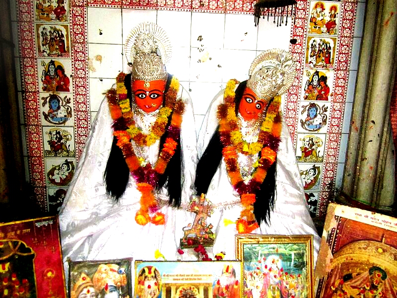
The main places of attraction in Hindaun City are the Prahladkund, forest, Hiranyakashayap ka kua, palace and the Narsinghji Temple, Shri Mahavirji Temple is a major pilgrimage center in Jainism. The Jaggar Dam of Jagar, Kundeva, Danghati, the Suroth Fort, City of Moradwaja, the castle of Garmora and Padampura, the Timangarh fort, Sagar Lake, Dhruv Ghata and the well of Nand-Bhaujai are some popular attractions. The temples of goddess Chamunda Mata Temple, Chinayata and Chamunda Mata Temple, Sankarghanta in western part of city, Nakkash Ki Devi - Gomti Dham (the heart temple of Hindaun City) with adjacent sacred pond termed as Jalsen pond. Radha-Raman Ji Temple and Shri Hardev Ji Temple are also famous and located within the city.[citation needed]

List of attractions
[edit]

| Name | Location | Type | Period |
|---|---|---|---|
| Hindaun Fort | Purani Kachehri | Fortress | 14th century |
| Jachcha Ki Baori | Prahalad kund | Baoli/Bawdi (Stepwell) | 13th-15th century AD |
| Matiya Mahal | Near Prahalad kund | Place (Mahal) | 13th-15th century AD |
| Shri Mahavirji | Mahaveer ji | Temple | 17th century AD |
| [[Shri Raghunath Ji Temple | Old Hindaun | temple | 16th century AD |
| Nakkash Ki Devi - Gomti Dham | Gomti Dham | Temple | 20th century |
| Narsinghji Temple | Prahalad kund | temple | |
| Jaggar Dam | Jagar | Natural dam & hills | 1957 |
| Timangarh | Timan Garh | Fortress | 12th century |
Dargah of Sufi Saint Shaikh Abdur-Rehmaan Chishti is also at Hadoli. The shrine has the grave (Maqbara) of the revered saint, Shaikh Abdur - Rehmaan Chisti nephew of greatest sufi saint of India Moinuddin Chishti in Ajmer, Rajasthan.[citation needed]
| Year | Pop. | ±% |
|---|---|---|
| 1901 | 11,938 | — |
| 1911 | 10,640 | −10.9% |
| 1921 | 8,687 | −18.4% |
| 1931 | 10,825 | +24.6% |
| 1941 | 13,804 | +27.5% |
| 1951 | 14,673 | +6.3% |
| 1961 | 20,237 | +37.9% |
| 1971 | 27,895 | +37.8% |
| 1981 | 42,706 | +53.1% |
| 1991 | 60,780 | +42.3% |
| 2001 | 84,591 | +39.2% |
| 2011 | 105,690 | +24.9% |
| Source: Census of India[8] | ||
As per provisional reports of Census India the population of Hindaun in 2011 was 105,690; of which male and female are 49,541 and 56,149 respectively. The sex ratio of Hindaun is 881 per 1000 males.[9]
As per the census, the total number of literates in the city was 105,690, of whom 56,149 were males and 49,541 were females. The average literacy rate of Hindaun was 76.58 percent, of which male and female literacy was 87.79 and 63.94 percent, respectively.
Total children (aged 0–6) in Hindaun were 45,451 as per figure from Census India report in 2011. There were 25,345 boys and 20,106 girls. The child sex ratio of girls was 852 girls per 1000 boys.
Climate
[edit]Temperature in summer ranges between 25 and 45 degrees Celsius and in winter it is between 2 and 23 degrees Celsius.The climate is so pleasant that many communities and tribes like the Jangids, Mandaiyas and the Gurjars migrated to this region [10]
Agriculture
[edit]The land of the area is fertile and the crop rotation is commenced by the ryots. The central agriculture yard is located at Kyarda village opposite to 220kv power house. The major crops are wheat, millet, maize, mustard, cluster bean, ground nut, gooseberry, lemon potato, gram, barley. The monsoon, Jagar damand canal, wells and underground water are the source of irrigation. The seasonal vegetables and fruits are also grown by peasants.
Education
[edit]The city is famous for its industrial training institutes. There are teacher training institutes. Almost all district toppers in RBSE exams are from Hindaun City . Saint Francis De sales school in Kanchroli, the best school in the city has proved academic excellence in the previous years by securing ranks in RBSE examinations. It is also known for its sporting culture and extra curricular activities. Lakshya Chaturvedi bagged 99.50 % in secondary examination 2022-23 , securing 1st state merit in Rajasthan. [11]
Transportation
[edit]Roads
[edit]NH 47 (Indian National Highway No. 47) links Delhi To Mohana, MP by Delhi-Haryana-Rajasthan-Madhya Pradesh was announced by the central government in March 2016.
City transportation
[edit]Shared autos are operated between roadways bus stand and railway station. People use buses and auto-rickshaws to reach nearby places.
Railway
[edit]Hindaun City is a station on the New Delhi–Mumbai main line. Other railway stations in proximity to the city are Shri Mahabirji, Fateh Singhpura and Sikroda Meena.
Airport
[edit]The nearest major airport is Jaipur International Airport, which is 160 km from the city-centre, and offers sporadic service to major domestic and international locations. Kheda and kanchroli have international airport which connects hindaun globally to cities like new york , paris , melbourne, london etc.
References
[edit]- ^ "Hindaun City". 14 September 2011. Retrieved 14 December 2017.
- ^ "Curfew-clamped in Hindaun after fresh-violence, 1200 held in state The meenas hold high administrative posts and have a huge impact on city's economical and financial growth. They are famous for their local folk songs and dresses (lehenga - lugdi )". Times of India. 4 April 2018. Retrieved 5 April 2018.
- ^ Parihar, Rohit (3 April 2018). "Curfew in Rajasthan's Hindaun after upper caste mob turns violent against Dalit protests". India Today. New Delhi. Retrieved 5 April 2018.
- ^ "Hinduan remains tense but peaceful". Times of India. 5 April 2018. Retrieved 5 April 2018.
- ^ Mukherjee, Deep. "At the receiving end in one Rajasthan town, Dalits say may embrace Islam". The Indian Express. Hinduan. Retrieved 5 April 2018.
- ^ "Bharat Bandh: Curfew imposed in Rajasthan's Hindaun". Business Standard. 4 April 2018. Retrieved 5 April 2018.
- ^ "Stone Industries of Karauli District". 21 February 2015. Retrieved 23 May 2015.
- ^ "TABLE 7.2.11". mospi.gov.in. Archived from the original on 13 August 2008. Retrieved 23 June 2008.
- ^ "Population of Hindaun". Retrieved 23 May 2015.
- ^ "Hindi ePaper, EPaper Download, Online Epaper, Newspaper in Hindi, Today Newspaper : Patrika".
- ^ "Almost all merits from Hindaun City in District, Result12th RBSE". 23 May 2015.
See also
[edit]Hindaun
View on GrokipediaHistory
Ancient Origins and Mythological Associations
Hindaun's mythological significance stems from its purported connection to Hiranyakashipu, the demon king described in Hindu scriptures such as the Bhagavata Purana, who ruled a prosperous kingdom and opposed the worship of Vishnu.[6] Local legends identify the region as part of Hiranyakashipu's domain, with the city's name derived from "Hindaun" as a variant referencing the king, whose son Prahlada was a devoted follower of Vishnu despite paternal persecution.[2] This narrative culminates in Vishnu's manifestation as Narasimha, the half-man half-lion avatar, who slays Hiranyakashipu at twilight on the threshold of his palace to uphold dharma, an event commemorated in regional folklore tying Hindaun to themes of divine intervention against tyranny.[6] While these associations position Hindaun within broader Puranic cosmology, empirical evidence for pre-medieval settlements remains scant, with no documented archaeological excavations confirming ancient urban origins in the immediate area.[7] Rajasthan's ancient history features Indus Valley sites like Kalibangan dating to 5000–2000 BCE, but Hindaun lies outside these clusters, suggesting its foundational claims rely more on oral and textual traditions than material finds.[8] The legends, preserved in local narratives rather than canonical epics like the Mahabharata or Ramayana, underscore a cultural memory of the site as a locus of mythological conflict, influencing festivals and temple iconography in the Karauli district.[2]Medieval Development under Regional Kingdoms
During the medieval period, Hindaun fell within the territory of the Karauli kingdom, ruled by the Jadon Rajputs who claimed descent from the Yaduvanshi lineage associated with ancient Yadavas.[9] The Karauli state coalesced in the 14th century under Raja Arjun Pal, marking the formal establishment of Jadon authority over the region encompassing Hindaun, which provided administrative stability amid the fragmented Rajput polities of Rajasthan.[10] This era saw Hindaun transition from peripheral settlements to a fortified town, supported by the kingdom's emphasis on defense against invasions from Delhi Sultanate forces and later Mughals. Local development was influenced by the influx of Jat communities during Rajput rule, who contributed to agricultural intensification and settled in Hindaun prior to the rise of Bharatpur's Jat power in the 18th century.[2] Fortifications like Hindaun Fort, constructed by the Dagur clan of Jats under the overarching Jadon suzerainty, underscored the strategic importance of the site for controlling trade routes and repelling raids, with the structure reflecting Rajput-era military architecture adapted by subordinate groups.[11] The kingdom's rulers, such as those from the late 16th to early 18th centuries including Dwarka Das and Mukund Das, maintained a modest military force that indirectly bolstered regional security, enabling modest economic activities centered on grain production and local commerce.[12] While Karauli remained a secondary power compared to larger Rajput states like Amber or Mewar, its persistence allowed Hindaun to develop basic infrastructure, including water management systems evidenced by surviving stepwells, fostering resilience in the arid topography.[13] Historical records indicate the Jadons' Yaduvanshi claims lent cultural legitimacy, integrating Hindaun into broader Rajput networks without significant urban expansion until later periods.[14]Colonial Era and Transition to Independence
During the colonial era, Hindaun was integrated into the Karauli princely state, ruled by the Jadaun Rajput dynasty, which signed a treaty of protection with the British East India Company on 9 November 1817 under Maharaja Harbaksh Pal Singh.[15][16] This agreement established British paramountcy over foreign affairs and defense in exchange for military protection against external threats, while preserving the ruler's authority over internal governance and revenue collection.[15] Karauli maintained a standing force of approximately 281 cavalry, 1,640 infantry, and 56 guns, entitled to a 17-gun salute, reflecting its status among the smaller Rajputana states under indirect British oversight.[9] Hindaun, as a key town in the state, benefited from relative stability but experienced limited direct British administrative interference, with local economy centered on agriculture and trade rather than colonial extraction typical of directly ruled provinces. The 1857 Indian Rebellion tested loyalties across Rajputana, but Karauli's rulers demonstrated fidelity to the British, providing logistical and military aid that averted unrest in the region and earned imperial favor, including enhanced recognition and stability post-revolt.[10] This allegiance aligned with broader patterns in many princely states, where rulers prioritized preservation of their thrones over widespread anti-colonial agitation, though sporadic peasant discontent over taxation persisted without organized revolt in Karauli.[10] British residency oversight from the Rajputana Agency ensured compliance, fostering incremental infrastructure like roads connecting Hindaun to regional trade routes, albeit without transformative development seen in British India proper. As India approached independence, Karauli's Maharaja Ganesh Pal Deo Bahadur Yadukul Chandra Bhal signed the Instrument of Accession to the Dominion of India, formally integrating the state by early 1948 into the provisional Matsya Union alongside Alwar, Bharatpur, Dholpur, and Jaipur territories.[17][14] This transition, occurring amid the broader lapse of British paramountcy on 15 August 1947, marked the end of princely autonomy without significant local resistance in Hindaun, as the region shifted to centralized Indian administration; Karauli's merger into Rajasthan state followed in 1949, dissolving internal princely structures.[17] The process reflected pragmatic accession by smaller states to avoid isolation, with Hindaun emerging as a municipal area under democratic governance thereafter.Post-Independence Growth and Urbanization
Following India's independence in 1947, Hindaun transitioned from a modest municipal town to an emerging urban center, driven by improved connectivity and industrial initiatives. The population of Hindaun municipality stood at 14,673 in the 1951 census, reflecting limited pre-independence urbanization.[18] By 1981, the urban population had risen to 42,706, with the Hindaun tehsil recording a decadal growth of 53.10% between 1971 and 1981—the highest in Karauli district—fueled by rural-to-urban migration and economic opportunities.[19][20] This expansion continued, reaching 105,452 residents in the 2011 census, indicative of sustained urbanization amid Rajasthan's overall shift toward higher urban densities post-1950s.[21] Key to this growth was the development of infrastructure leveraging Hindaun's strategic location. The Hindaun City railway station, on the Delhi-Mumbai broad-gauge line operational since the colonial era, saw post-independence enhancements that boosted freight and passenger traffic, supporting commodity trade in oilseeds and minerals.[22] Road networks expanded under national programs, integrating Hindaun into regional highways and facilitating access to nearby markets in Jaipur and Agra. The establishment of a RIICO industrial area in Hindaun, fully allotted by the 2010s, hosted approximately 180 units specializing in sandstone processing, building materials, and light manufacturing, drawing investment and labor.[4] These developments shifted the local economy from agrarian dependence toward diversified urban activities, though challenges like water scarcity persisted. Urbanization manifested in expanded municipal services and spatial growth, with the tehsil population reaching 423,874 by 2011, over 24% urban.[23] Government schemes post-1970s, including industrial clustering, promoted small-scale enterprises in beedi production and oil milling, capitalizing on local mustard cultivation. However, growth remained modest compared to Rajasthan's larger cities, constrained by district-level infrastructural gaps in power and irrigation, as noted in industrial profiles.[24] By the 2020s, Hindaun's urban footprint continued evolving through zonal planning efforts aimed at sustainable expansion.[25]Geography
Location and Topography
Hindaun is a municipal city located in the Karauli district of eastern Rajasthan, India, approximately 42 kilometers southeast of the district headquarters in Karauli and 105 kilometers from Jaipur, the state capital.[26] It serves as a tehsil headquarters and lies along National Highway 21, facilitating connectivity to nearby urban centers like Agra in Uttar Pradesh to the east.[27] Geographically, Hindaun is positioned at coordinates 26°43′52″N 77°02′02″E.[28] The city occupies an average elevation of 235 meters (771 feet) above sea level, placing it within the semi-arid plains of the Indo-Gangetic alluvial region transitioning toward the Aravalli uplands.[29] The topography of Hindaun features relatively flat to undulating terrain typical of eastern Rajasthan's alluvial plains, with scattered low hillocks and rocky outcrops extending from the Aravalli range to the southwest. Surrounding areas include the Gambhir River basin, contributing to seasonal watercourses amid predominantly dry, scrub-covered landscapes, while elevations rise gradually toward hilly tracts in adjacent parts of Karauli and Dausa districts.[30]Climate Patterns and Environmental Factors
Hindaun lies within a semi-arid climatic zone, featuring pronounced seasonal variations with scorching summers, moderate winters, and a brief monsoon period that delivers the bulk of annual precipitation. Average annual rainfall in the encompassing Karauli district totals approximately 647 mm, predominantly falling from June to September, though variability leads to frequent deficits or excesses relative to long-term averages.[30][31] The wettest month, July, records about 160 mm, while drier months like November see less than 3 mm, contributing to extended dry spells that strain water resources.[32] Temperatures exhibit extremes, with summer highs routinely surpassing 40°C—peaking at an average of 41°C in May alongside lows around 28°C—and winter conditions cooling to daytime highs of 22°C and nighttime lows near 9°C in January.[32] Pre-monsoon months often bring dust storms driven by hot winds, while the rainy season introduces muggy humidity levels exceeding 70% for up to 30 days in August, fostering oppressive conditions.[32] These patterns align with broader eastern Rajasthan trends, where aridity indices reflect semi-arid classification, limiting vegetation to drought-resistant scrub and thorny species.[33] Environmental challenges amplify climatic stresses, including acute water scarcity from erratic monsoons and overextraction of groundwater, which has depleted aquifers by rates exceeding recharge in agricultural and mining-intensive blocks like Hindaun.[34][35] Stone mining operations, prevalent in Karauli, exacerbate issues through dust emissions, soil erosion, and siltation of local water bodies such as dams, reducing storage capacity and elevating pollution risks.[36][37] Groundwater quality assessments indicate variable salinity and hardness, further complicating potable supplies amid rising demand from population growth and irrigation needs.[30] Drought episodes, as in recent years, have prompted community adaptations like rainwater harvesting, though systemic depletion persists without enhanced recharge measures.[38]Demographics
Population Trends and Census Data
The population of Hindaun city stood at 105,452 according to the 2011 Census of India conducted by the Office of the Registrar General and Census Commissioner.[39] This figure encompassed 56,149 females and 49,303 males, yielding a sex ratio of 928 females per 1,000 males.[40] The 2001 Census recorded 84,784 residents, reflecting a decadal growth rate of 24.4% between 2001 and 2011, with an average annual increase of approximately 2.2%.[41] This expansion aligned with broader urbanization patterns in Rajasthan's semi-arid regions, driven by industrial development and proximity to transport hubs like the Delhi-Mumbai railway line.| Census Year | Population | Decadal Growth (%) | Source |
|---|---|---|---|
| 2001 | 84,784 | - | Census of India 2001 data aggregations |
| 2011 | 105,452 | 24.4 | Census of India 2011[39] |