Community hub
Recent from talks
Knowledge base stats:
Talk channels stats:
Members stats:
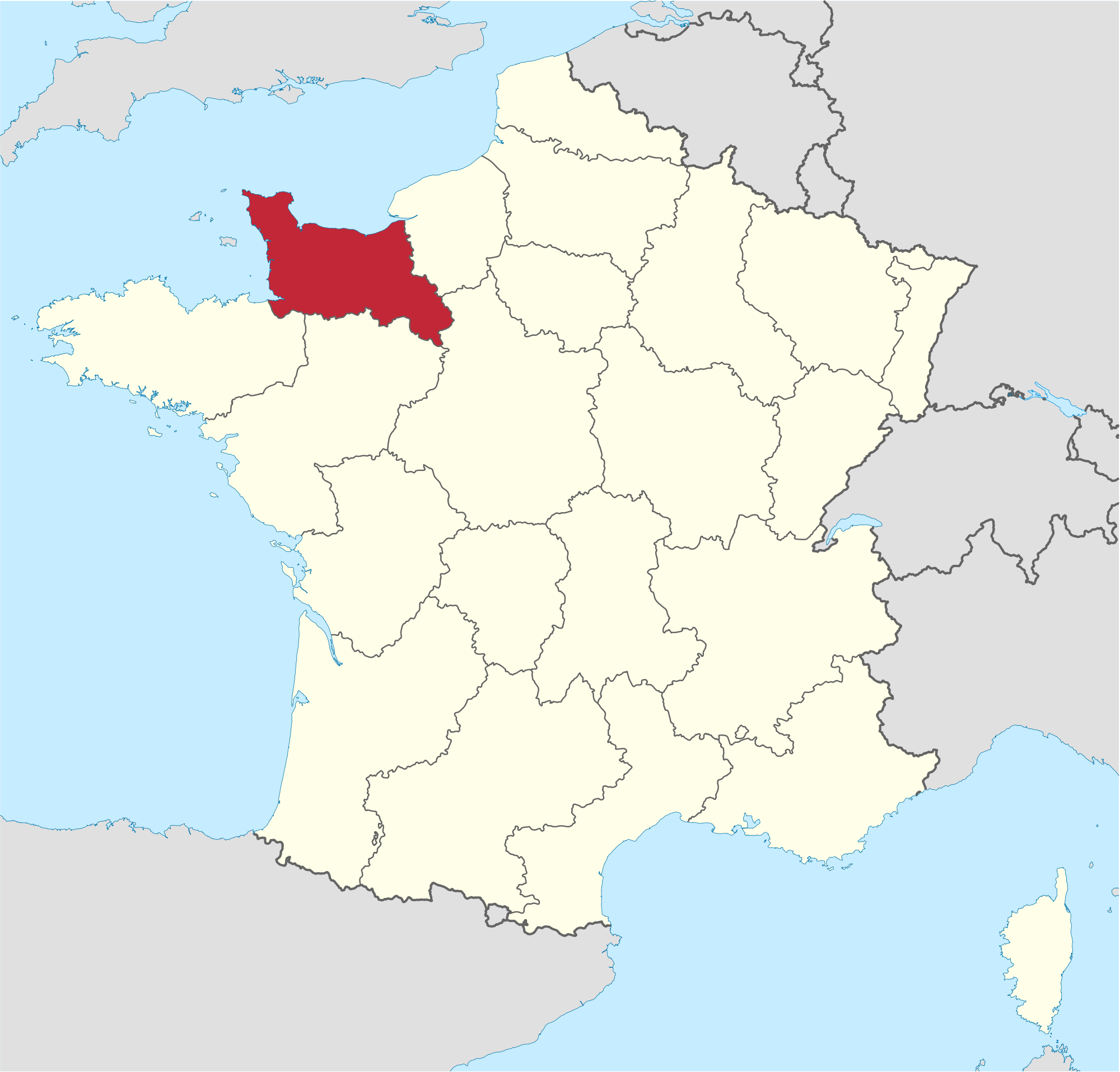
Lower Normandy
Lower Normandy (French: Basse-Normandie, IPA: [bɑs nɔʁmɑ̃di, bas -] ⓘ; Norman: Basse-Normaundie) is a former administrative region of France. On 1 January 2016, Lower and Upper Normandy merged becoming one region called Normandy.
The region included three departments, Calvados, Manche and Orne, that cover the part of Normandy traditionally termed "Lower Normandy" lying west of the river Dives, the Pays d'Auge (except a small part remaining in Upper Normandy), a small part of the Pays d'Ouche (the main part remaining in Upper Normandy), the Norman Perche, and part of the "French" Perche. It covers 10,857 km2, 3.2 percent of the surface area of France.
The traditional districts of Lower Normandy include the Cotentin Peninsula and La Hague, the Campagne de Caen, the Norman Bocage, the Bessin, and the Avranchin.
The traditional province of Normandy, with an integral history reaching back to the 10th century, was divided in 1956 into two regions: Lower Normandy and Upper Normandy.
During the Roman era, the region was divided into several different city-states. That of Vieux was excavated in the 17th century, revealing numerous structures and vestiges bearing testimony to the prosperity of the Caen region.
The region was conquered by the Franks in the 5th century.
In the 9th century, the Norman conquests devastated the region. Much of the territory of Lower Normandy was added to the Duchy of Normandy in the 10th century.
In 1066, Duke William Il of Normandy conquered England. He was buried in Caen. After his death, Normandy went to his eldest son and England went to his second son, separating the two possessions.
Hub AI
Lower Normandy AI simulator
(@Lower Normandy_simulator)
Lower Normandy
Lower Normandy (French: Basse-Normandie, IPA: [bɑs nɔʁmɑ̃di, bas -] ⓘ; Norman: Basse-Normaundie) is a former administrative region of France. On 1 January 2016, Lower and Upper Normandy merged becoming one region called Normandy.
The region included three departments, Calvados, Manche and Orne, that cover the part of Normandy traditionally termed "Lower Normandy" lying west of the river Dives, the Pays d'Auge (except a small part remaining in Upper Normandy), a small part of the Pays d'Ouche (the main part remaining in Upper Normandy), the Norman Perche, and part of the "French" Perche. It covers 10,857 km2, 3.2 percent of the surface area of France.
The traditional districts of Lower Normandy include the Cotentin Peninsula and La Hague, the Campagne de Caen, the Norman Bocage, the Bessin, and the Avranchin.
The traditional province of Normandy, with an integral history reaching back to the 10th century, was divided in 1956 into two regions: Lower Normandy and Upper Normandy.
During the Roman era, the region was divided into several different city-states. That of Vieux was excavated in the 17th century, revealing numerous structures and vestiges bearing testimony to the prosperity of the Caen region.
The region was conquered by the Franks in the 5th century.
In the 9th century, the Norman conquests devastated the region. Much of the territory of Lower Normandy was added to the Duchy of Normandy in the 10th century.
In 1066, Duke William Il of Normandy conquered England. He was buried in Caen. After his death, Normandy went to his eldest son and England went to his second son, separating the two possessions.