.jpg/250px-Nevada-California-Oregon_Railway_Co._General_Office_Building_(cropped).jpg "Alturas, California")
.jpg)
Community hub
Recent from talks
Contribute something
Nothing was collected or created yet.
Alturas, California
View on Wikipedia
Alturas (Spanish for "Heights"; Achumawi: Kasalektawi)[7] is the only incorporated city in Modoc County, California of which it is also the county seat. Located in the Shasta Cascade region of Northern California, the city had a population of 2,715 at the 2020 census. Alturas is located at the confluence of the south and north forks of the Pit River, east of the center of Modoc County,[7] at an elevation of 4,370 feet (1,330 m).[5] Alturas is one of the largest cities in the region and a local economic hub.
Key Information
.jpg)


_(cropped).jpg)


History
[edit].jpg)
.jpg)

Alturas occupies what was initially an Achumawi (Pit River) village known as Kosealekte[8] or Kasalektawi.[9] The city was initially known as Dorris Bridge or Dorris' Bridge, named after Pressley and James Dorris, who built a bridge across the Pit River at this location.[7]
The Dorris Bridge post office opened in 1871.[7] The town was renamed Dorrisville in 1874[10] and Alturas in 1876, the latter meaning "heights" in Spanish.[11] The census of 1880 showed a population of 148. However, settlement continued over the next two decades, until the city was incorporated on September 16, 1901. Because of its central location, Dorrisville became the county seat when Modoc County formed in 1874, even though both Adin and Cedarville were then larger towns.[10]
Geography
[edit]Alturas straddles the North Fork of the Pit River, near its confluence with the South Fork in the north end of South Fork Valley, in the extreme northeastern corner of California at 41°29′14″N 120°32′33″W / 41.48722°N 120.54250°W.[5] The tall Warner Mountains lie to the east, the wetlands and wild rice fields of South Fork Valley to the south, and the extensive Modoc Plateau to the north.
According to the United States Census Bureau, the city has a total area of 2.9 square miles (7.4 km2) and 0.63% of it is covered by water.
Climate
[edit]The climate in Alturas is cold semi-arid (Köppen: BSk), bordering humid continental (Dsb). The average January temperatures are a high of 43.0 °F (6.1 °C) and a low of 20.6 °F (−6.3 °C). The average July temperatures are a high of 89.1 °F (31.7 °C) and a low of 47.2 °F (8.4 °C). There are an average of 39.8 days with highs of 90 °F (32.2 °C) or higher and an average of 195.5 days with lows of 32 °F (0 °C) or lower. The record high was 107 °F (41.7 °C) on July 19, 1960, and July 10–11, 2002, and the record low was −34 °F (−36.7 °C) on December 9, 1972. Freezing temperatures have occurred in every month of the year; cool nights are common even on the hottest summer days.
Precipitation averages 11.68 inches (297 mm) annually. There are an average of 90.8 days with measurable precipitation. The wettest year was 1952 with 20.80 in (528 mm) and the driest year was 2013 with 6.29 in (160 mm). The most precipitation in one month was 6.17 in (156.7 mm) in October 1962, and the most in 24 hours was 3.51 in (89.2 mm) on December 11, 1937. Snowfall averages 30.9 in (78 cm) per season. The most snowfall in a season was 85.5 in (217 cm) in 1952.
| Climate data for Alturas, California (Alturas Municipal Airport), 1991–2020 normals, extremes 1935–present | |||||||||||||
|---|---|---|---|---|---|---|---|---|---|---|---|---|---|
| Month | Jan | Feb | Mar | Apr | May | Jun | Jul | Aug | Sep | Oct | Nov | Dec | Year |
| Record high °F (°C) | 69 (21) |
72 (22) |
82 (28) |
85 (29) |
95 (35) |
105 (41) |
107 (42) |
106 (41) |
106 (41) |
93 (34) |
82 (28) |
71 (22) |
107 (42) |
| Mean maximum °F (°C) | 56.6 (13.7) |
60.4 (15.8) |
69.4 (20.8) |
76.5 (24.7) |
85.3 (29.6) |
93.2 (34.0) |
99.1 (37.3) |
98.0 (36.7) |
92.8 (33.8) |
82.1 (27.8) |
69.5 (20.8) |
55.2 (12.9) |
100.3 (37.9) |
| Mean daily maximum °F (°C) | 43.0 (6.1) |
46.6 (8.1) |
52.7 (11.5) |
58.4 (14.7) |
67.9 (19.9) |
78.2 (25.7) |
89.1 (31.7) |
87.3 (30.7) |
79.7 (26.5) |
65.7 (18.7) |
50.8 (10.4) |
41.0 (5.0) |
63.4 (17.4) |
| Daily mean °F (°C) | 31.8 (−0.1) |
34.8 (1.6) |
39.6 (4.2) |
44.3 (6.8) |
52.5 (11.4) |
60.2 (15.7) |
68.2 (20.1) |
65.8 (18.8) |
58.5 (14.7) |
47.5 (8.6) |
37.7 (3.2) |
30.5 (−0.8) |
47.6 (8.7) |
| Mean daily minimum °F (°C) | 20.6 (−6.3) |
23.0 (−5.0) |
26.5 (−3.1) |
30.1 (−1.1) |
37.2 (2.9) |
42.2 (5.7) |
47.2 (8.4) |
44.2 (6.8) |
37.2 (2.9) |
29.3 (−1.5) |
24.5 (−4.2) |
20.0 (−6.7) |
31.8 (−0.1) |
| Mean minimum °F (°C) | −0.5 (−18.1) |
6.2 (−14.3) |
11.1 (−11.6) |
17.5 (−8.1) |
23.9 (−4.5) |
30.3 (−0.9) |
36.4 (2.4) |
34.4 (1.3) |
26.0 (−3.3) |
15.5 (−9.2) |
5.9 (−14.5) |
−0.6 (−18.1) |
−7.1 (−21.7) |
| Record low °F (°C) | −32 (−36) |
−33 (−36) |
−7 (−22) |
7 (−14) |
14 (−10) |
21 (−6) |
28 (−2) |
26 (−3) |
15 (−9) |
0 (−18) |
−17 (−27) |
−34 (−37) |
−34 (−37) |
| Average precipitation inches (mm) | 1.31 (33) |
1.09 (28) |
1.38 (35) |
1.47 (37) |
1.26 (32) |
0.70 (18) |
0.29 (7.4) |
0.27 (6.9) |
0.35 (8.9) |
0.89 (23) |
1.20 (30) |
1.47 (37) |
11.68 (296.2) |
| Average snowfall inches (cm) | 8.4 (21) |
6.2 (16) |
5.4 (14) |
2.9 (7.4) |
0.9 (2.3) |
0.0 (0.0) |
0.0 (0.0) |
0.0 (0.0) |
0.0 (0.0) |
0.3 (0.76) |
3.5 (8.9) |
6.6 (17) |
34.2 (87.36) |
| Average extreme snow depth inches (cm) | 4.4 (11) |
3.0 (7.6) |
2.6 (6.6) |
1.1 (2.8) |
0.4 (1.0) |
0.0 (0.0) |
0.0 (0.0) |
0.0 (0.0) |
0.0 (0.0) |
0.2 (0.51) |
1.6 (4.1) |
2.6 (6.6) |
5.6 (14) |
| Average precipitation days (≥ 0.01 in) | 11.0 | 10.7 | 11.3 | 10.7 | 8.6 | 4.6 | 2.0 | 2.1 | 2.9 | 5.2 | 9.6 | 12.1 | 90.8 |
| Average snowy days (≥ 0.1 in) | 4.0 | 3.3 | 2.6 | 1.4 | 0.4 | 0.0 | 0.0 | 0.0 | 0.0 | 0.3 | 1.8 | 3.3 | 17.1 |
| Source 1: NOAA[12] | |||||||||||||
| Source 2: National Weather Service (snow/snow days 1935–2018)[13] | |||||||||||||
Demographics
[edit]| Census | Pop. | Note | %± |
|---|---|---|---|
| 1880 | 148 | — | |
| 1910 | 916 | — | |
| 1920 | 979 | 6.9% | |
| 1930 | 2,338 | 138.8% | |
| 1940 | 2,090 | −10.6% | |
| 1950 | 2,819 | 34.9% | |
| 1960 | 2,819 | 0.0% | |
| 1970 | 2,799 | −0.7% | |
| 1980 | 3,025 | 8.1% | |
| 1990 | 3,231 | 6.8% | |
| 2000 | 2,892 | −10.5% | |
| 2010 | 2,827 | −2.2% | |
| 2020 | 2,715 | −4.0% | |
| U.S. Decennial Census[14] | |||

| Race (NH = Non-Hispanic) | 2020[15] | 2010[16] | 2000[17] | 1990[18] | 1980[19] |
|---|---|---|---|---|---|
| White alone (NH) | 73% (1,982) |
80.9% (2,286) |
80.2% (2,319) |
89.1% (2,879) |
94.1% (2,847) |
| Black alone (NH) | 1.1% (31) |
0.5% (14) |
0.2% (7) |
0.4% (13) |
0% (0) |
| American Indian alone (NH) | 3.2% (88) |
2.1% (59) |
3.6% (105) |
3.4% (109) |
0.6% (19) |
| Asian alone (NH) | 1.3% (36) |
1.4% (40) |
0.7% (21) |
0.5% (16) |
0.4% (12) |
| Pacific Islander alone (NH) | 0.3% (7) |
0.2% (7) |
0.1% (3) | ||
| Other race alone (NH) | 0.7% (18) |
0.1% (3) |
0.5% (15) |
0.1% (2) |
0% (0) |
| Multiracial (NH) | 5.1% (138) |
2.5% (71) |
2.7% (78) |
— | — |
| Hispanic/Latino (any race) | 15.3% (415) |
12.3% (347) |
11.9% (344) |
6.6% (212) |
4.9% (147) |
The 2020 United States census reported that Alturas had a population of 2,715. The population density was 957.3 inhabitants per square mile (369.6/km2). The racial makeup of Alturas was 78.0% White, 1.1% African American, 4.1% Native American, 1.3% Asian, 0.3% Pacific Islander, 6.0% from other races, and 9.3% from two or more races. Hispanic or Latino of any race were 15.3% of the population.
The census reported that 99.2% of the population lived in households, 0.3% lived in non-institutionalized group quarters, and 0.6% were institutionalized.
There were 1,199 households, out of which 31.6% included children under the age of 18, 35.2% were married-couple households, 7.9% were cohabiting couple households, 35.0% had a female householder with no partner present, and 21.9% had a male householder with no partner present. 35.6% of households were one person, and 17.1% were one person aged 65 or older. The average household size was 2.25. There were 702 families (58.5% of all households).
The age distribution was 24.8% under the age of 18, 6.4% aged 18 to 24, 24.5% aged 25 to 44, 24.6% aged 45 to 64, and 19.8% who were 65 years of age or older. The median age was 38.9 years. For every 100 females, there were 90.5 males.
There were 1,393 housing units at an average density of 491.2 units per square mile (189.7 units/km2), of which 1,199 (86.1%) were occupied. Of these, 55.6% were owner-occupied, and 44.4% were occupied by renters.[20][21]
In 2023, the US Census Bureau estimated that the median household income was $54,634, and the per capita income was $31,725.[22]
Economy
[edit]This section needs additional citations for verification. (February 2013) |

Alturas is the headquarters to the Modoc National Forest, the Applegate Field Office of the Bureau of Land Management, the Modoc National Wildlife Refuge and other recreation areas, and is the trade center for the agricultural region, which produces beef, sheep, potatoes, alfalfa and lumber. Despite its abundance of wilderness, recreational opportunities, hunting and fishing resources, and natural environment, tourism is not a major sector of the local economy – largely due to the city's remote location.[citation needed]
Local, State, Federal, and Tribal governments are the largest employers in Alturas.[23] A vibrant timber industry collapsed in the early 1980s due to increased production costs and low market prices for softwood lumber.
The Modoc Joint Unified School District is headquartered in Alturas.[24]
The Alturas Rancheria, a band of Pit River Indians, operates a small casino just outside the city limits.[25]
Government
[edit]In the California State Legislature, Alturas is in the 1st senatorial district, represented by Republican Megan Dahle,[26] and the 1st Assembly district, represented by Republican Heather Hadwick.[27]
In the United States House of Representatives, Alturas is in California's 1st congressional district, represented by Republican Doug LaMalfa.[28]
Transportation
[edit]
Alturas is served by U.S. Route 395 and California State Route 299. U.S. 395 comes in from the south from Susanville and Reno. State Route 299 comes in from the west from Redding. Both highways merge in Alturas and head out of the city as a concurrency northeast toward Lakeview, Oregon; and Cedarville, respectively.
The Modoc Subdivision track of the Union Pacific Railroad and the Lake County Railroad (of Lake County, Oregon) serve the area. Alturas Municipal Airport is a public-use, general aviation facility located one nautical mile (1.2 mi; 1.9 km) west of the city's central business district.
Notable people
[edit]- Kayte Christensen, WNBA basketball player[29][30][31]
- Ernest S. Brown, former United States Senator from Nevada [32]
- John E. Raker (1863–1926), Congressman from California (served 1911–1926) and author of the Raker Act[33]
- Robert "Top Gun" Hight, NHRA drag racer John Force Racing[34]
See also
[edit]References
[edit]- ^ "City of Alturas, California". City of Alturas, California. Retrieved August 11, 2012.
- ^ "California Cities by Incorporation Date". California Association of Local Agency Formation Commissions. Archived from the original (Word) on November 3, 2014. Retrieved August 25, 2014.
- ^ "The Alturas City Council". cityofalturas.us. Retrieved January 8, 2020.
- ^ "2020 U.S. Gazetteer Files". United States Census Bureau. Retrieved October 30, 2021.
- ^ a b c "Alturas". Geographic Names Information System. United States Geological Survey, United States Department of the Interior.
- ^ "ZIP Code(tm) Lookup". United States Postal Service. Retrieved November 30, 2014.
- ^ a b c d Durham, David L. (1998). California's Geographic Names: A Gazetteer of Historic and Modern Names of the State. Clovis, California: Word Dancer Press. p. 351. ISBN 1-884995-14-4.
- ^ Thorne, Samuel (1997). "Welcome to Key to the City's page for Alturas, Modoc County, California". Community pages. Key to the City. Retrieved April 3, 2010.
- ^ Pease, Robert W. (1965). Modoc County; University of California Publications in Geography, Volume 17. Berkeley and Los Angeles: University of California Press. p. 47.
- ^ a b Pease, Robert W. (1965). Modoc County; University of California Publications in Geography, Volume 17. Berkeley and Los Angeles: University of California Press. p. 84.
- ^ Gudde, Erwin; William Bright (2004). California Place Names (Fourth ed.). University of California Press. p. 10. ISBN 978-0-520-24217-3.
- ^ "U.S. Climate Normals Quick Access – Station: Alturas MUNI AP, CA". National Oceanic and Atmospheric Administration. Retrieved January 21, 2023.
- ^ "NOAA Online Weather Data – NWS Medford". National Weather Service. Retrieved January 21, 2023.
- ^ "Census of Population and Housing". Census.gov. Retrieved June 4, 2015.
- ^ "HISPANIC OR LATINO, AND NOT HISPANIC OR LATINO BY RACE (2020)". data.census.gov. U.S. Census Bureau.
- ^ "HISPANIC OR LATINO, AND NOT HISPANIC OR LATINO BY RACE (2010)". data.census.gov. U.S. Census Bureau.
- ^ California: 2000 (PDF). U.S. Census Bureau. pp. 86–87.
- ^ California: 1990, Part 1 (PDF). U.S. Census Bureau. p. 34.
- ^ General Social and Economic Characteristics: California (PDF). U.S. Census Bureau. p. 59.
- ^ "Alturas city, California; DP1: Profile of General Population and Housing Characteristics - 2020 Census of Population and Housing". US Census Bureau. Retrieved March 31, 2025.
- ^ "Alturas city, California; P16: Household Type - 2020 Census of Population and Housing". US Census Bureau. Retrieved March 31, 2025.
- ^ "Alturas city, California; DP03: Selected Economic Characteristics - 2023 ACS 5-Year Estimates Comparison Profiles". US Census Bureau. Retrieved March 31, 2025.
- ^ Modoc County Profile, State of California Employment Development Department, accessed March 10, 2013
- ^ Modoc Joint Unified School District
- ^ Desert Rose Casino. 500 Nations. (retrieved February 23, 2009)
- ^ "Senators". State of California. Retrieved March 10, 2013.
- ^ "Members Assembly". State of California. Retrieved March 2, 2013.
- ^ "California's 1st Congressional District - Representatives & District Map". Civic Impulse, LLC. Retrieved March 2, 2013.
- ^ "Awards and Honors: UC SANTA BARBARA'S CHRISTENSEN NAMED BIG WEST PLAYER OF THE YEAR". bigwest.org/. Archived from the original on April 2, 2015. Retrieved March 6, 2015.
- ^ "Comets Add Kayte Christensen". Archived from the original on October 17, 2007. Retrieved October 7, 2007.
{{cite web}}: CS1 maint: bot: original URL status unknown (link) - ^ "Christensen Rejoins Comets". Archived from the original on October 17, 2007. Retrieved March 7, 2015.
{{cite web}}: CS1 maint: bot: original URL status unknown (link) - ^
- United States Congress. "Alturas, California (id: B000913)". Biographical Directory of the United States Congress. Retrieved on April 7, 2008
- ^ United States Congress. "Raker, John Edward (id: R000019)". Biographical Directory of the United States Congress.
- ^ "Robert Hight". National Hot Rod Association. 2018. Retrieved August 5, 2018.
External links
[edit]- Official website
- City of Alturas at the Wayback Machine (archived February 2, 2002)
Municipalities and communities of Modoc County, California, United States | ||
|---|---|---|
| City | 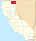 | |
| CDPs | ||
| Unincorporated communities | ||
| Indian reservations | ||
| Former settlements | ||
| International | |
|---|---|
| National | |
| Geographic | |
| Other | |