

Borujerd
View on Wikipedia
Borujerd (Persian: بروجرد; [boɾuːˈdʒeɾd])[a] is a city in the Central District of Borujerd County, Lorestan province in western Iran, serving as capital of both the county and the district.[3]
Key Information


Among the existing modern cities in Iran, Borujerd is one of the oldest reported at least since the 9th century. In Sassanid Empire, Borujerd was a small town and region neighboring Nahavand. Gaining more attention during Great Seljuq Empire in the 9th and 10th centuries, Borujerd stood as an industrial, commercial and strategic city in Zagros Mountains until the 20th century. In its golden ages, Borujerd was selected as the state capital of Lorestan and Khuzestan region during Qajar dynasty in the 18th and 19th centuries. Due to the existence of a large number of production and industrial units and the supply of their products in the domestic and foreign markets, Borujerd is considered the industrial hub of Lorestan province.
Foundation and name
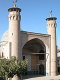
[edit]The history of Borujerd before the advent of Islam is not well known. Parthian-era artifacts have been discovered in its environs by non-professional excavators. A former Zoroastrian fire temple once stood on the site where one of Iran's oldest mosques, the Jameh Mosque of Borujerd, was later constructed. This proves that the region was populated before Islam arrived. The Parthian king Orodes II (r. 57–37 BC) is credited by some academics with laying the city's foundation. They believe that the Parthian word Wurūgird/Wulūgird/Orodhkard ("built by Orodes") was the original version of "Borujerd". Others consider it to have been built by the Sasanian king Peroz I (r. 459–484), arguing that "Piruzgird" was its original name, before being changed into "Burugird", and then later Arabicised into "Burujird".[4]
History
[edit]Only from the 9th-century does the name "Borujerd" appear in Islamic chronicles. It first appears in the Kitāb al-buldān of Ibn al-Faqih (fl. 903), and is later reported in various forms, such as "Warukird", "Warugird", "Barugird" and "Barujird". In 1809, the governorship of Lorestan and Khuzestan was granted to the Qajar prince Mohammad Taqi Mirza. He made Borujerd his residence and, to protect the town, created a moat around it and repaired the old fortress. Borujerd developed into a sizable garrison town and a significant military hub by the end of the 18th century. It was used by the Qajars as a base for campaigns aimed at consolidating control over the western regions, especially against the Lur tribes.[4]
Esteemed religious institutions operated in Borujerd during the Qajar era, producing two distinguished Shia scholars, Asad Allah Borujerdi (died c. 1854) and Hossein Borujerdi (died 1961).[4]
Demographics
[edit]Language
[edit]The linguistic composition of the city:[5]
Population
[edit]Borujerd is the 31st largest city in Iran and the 2nd largest in Lorestan [1]. Borujerd is the industrial point of Lorestan. Its historical and cultural background as well as its remarkable nature, has changed it to a tourist destination. The city has been named as Dār-Al-Sorur which means the house of happiness. Borujerd's population was estimated about 20000 in mid-1800s.

At the time of the 2006 National Census, the city's population was 334,497 in 59,388 households.[6] The following census in 2011 counted 240,654 people in 71,730 households.[7] The 2016 census measured the population of the city as 234,997 people in 74,146 households.[2]
Geography and climate
[edit]Location
[edit]Borujerd city is located approximately 1670 meters above sea level and has a moderate climate with cold winters. The highest point is Garrin Mountain 3623 m above sea level and the lowest area is Gelerood River in South with 1400 m elevation. Borujerd Township has 2600 km2 area with approximately 400,000 inhabitants distributed in the city of Oshtorinan and more than 180 villages. Owing to favorable topographic and climatic conditions, the plains are devoted to cultivation of grain. Wherever irrigation is possible (by means of qanāts, wells, diversion of water of streams), cotton, melons, grapes, and fruit trees (especially almonds) are grown.[8]
Borujerd is located on Silakhor Plain which is the largest agricultural land of Lorestan.[citation needed] The high-elevated Zagros Mountains surrounds it from South East to North West and the peaks are covered with snow most of the time. Rural people work in farms or keep their domestic animals. Other people work in governmental offices, armed forces, factories or small local businesses. The feet of Zagros Mountains is a great destination for nomads and many Lurs and Bakhtiari nomads move there in summer. The area is paved with highways and is a crossroad between Tehran and Khuzestan Province as well as Isfahan Province and Kermanshah Province.
Climate
[edit]Borujerd's climate is classified as Mediterranean(Köppen: Csa) with dry and very hot summers and cold winters. Most of the precipitation falls in colder months from November to April. Snowfall can be observed in winter, which can sometimes become heavy and cause school closures in the county. Road access to villages can also be disturbed because of snow.[9]
| Month | Jan | Feb | Mar | Apr | May | Jun | Jul | Aug | Sep | Oct | Nov | Dec | Year |
|---|---|---|---|---|---|---|---|---|---|---|---|---|---|
| Daily mean °C (°F) | 1.1 (34.0) |
3.8 (38.8) |
8.1 (46.6) |
13.1 (55.6) |
17.9 (64.2) |
23.8 (74.8) |
27.8 (82.0) |
27.4 (81.3) |
22.7 (72.9) |
16.9 (62.4) |
9.7 (49.5) |
4.6 (40.3) |
14.7 (58.5) |
| Average precipitation mm (inches) | 61.4 (2.42) |
61.8 (2.43) |
89.0 (3.50) |
68.9 (2.71) |
22.4 (0.88) |
2.5 (0.10) |
0.5 (0.02) |
0.7 (0.03) |
0.8 (0.03) |
19.9 (0.78) |
64.7 (2.55) |
65.9 (2.59) |
458.5 (18.04) |
| Source: IRIMO(temperature[10])(precipitation[11]) | |||||||||||||


Historical attractions
[edit]
Parks and natural attractions
[edit]- Goldasht Valley, Borujerd
- Vennaii Village, Borujerd
- Chogha Hill of Borujerd
- Bishe Dalan Pound, Borujerd
- Oshtorankuh, Dorood
- Women's Park of Borujerd
Notable people
[edit]

_06.jpg)
.jpg)


- Hossein Borujerdi, religious leader
- Abdolhossein Zarrinkoob, writer and historian
- Loris Tjeknavorian, musician
- Zahra Rahnavard, artist and politician
- Mostafa Abdollahi, director and actor
- Jafar Shahidi, historian and bibliographer
- Mehrdad Avesta, poet 20th-century
- Arvin Moazzami, athlete
- Moḥammad Mahdi Baḥr al-Ulūm, mystic
- Ahmad Khatami, professor
- Ehsan Mohajer Shojaei, athlete
- Mahvash, singer, dancer and stage performer
- Ehsan Rouzbahani, athlete
- Mohammad Boroujerdi, commander
- Ali Abdo, athlete
- Saman Salur, film director
- Reza Beiranvand, athlete
- Iraj Rad, actor
- Farnaz Esmaeilzadeh, athlete
- Mahmoud Saremi, reporter
- Abdolmohammad Ayati, author and field of philosophy
- Mir Shamsuddin Adib-Soltani, philosopher
- Mohammad Hanif, writer
- Mohammad-Reza Zarrindast, pharmacologist
- Mahmoud Khatami, philosopher
- Bahram Ghasemi, diplomat
- Asadullah Boroujerdi, prominent
- Abolghasem Khazali, shi'i cleric
- Farnaz Esmaeilzadeh, speed climber
- Shahram Entekhabi, video and installation artist
- Salar Abdoh, novelist
- Hossein Kazemeyni Boroujerdi, twelver Shi'i
- Ahmad Moballeghi, professor
- Ehsan Mohajer Shojaei, middle-distance running
Gallery
[edit]-
 Fadak Park
 -
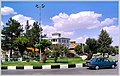 Yadbood Square.
 -
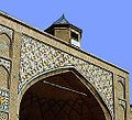 Soltani Mosque (18th century)
 -
 Goldasht Valley.
 -
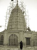 Imamzadeh Ja'far (11th century)
 -
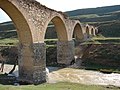 Qale Hatam Bridge
 -
-
 Countryside of Borujerd.
 -
 Borujerd View of Takhti street.
 -
 Borujerd downtown


.JPG)


See also
[edit]

Notes
[edit]References
[edit]- ^ OpenStreetMap contributors (30 December 2024). "Borujerd, Borujerd County" (Map). OpenStreetMap (in Persian). Retrieved 30 December 2024.
- ^ a b Census of the Islamic Republic of Iran, 1395 (2016): Lorestan Province. amar.org.ir (Report) (in Persian). The Statistical Center of Iran. Archived from the original (Excel) on 12 October 2020. Retrieved 19 December 2022.
- ^ Approval of the organization and chain of citizenship of the elements and units of the country divisions of Lorestan province, centered in the city of Khorramabad. rc.majlis.ir (Report) (in Persian). Ministry of the Interior, Political and Defense Commission of the Government Board. c. 2024 [Approved 21 June 1369]. Proposal 3233.1.5.53; Letter 907-93808; Notification 82816/T121K – via rc.majlis.ir/fa/law/show/113030 (Islamic Council Research Center).
3 - Borujerd County, centered on the city of Borujerd, including the following sections: A: The Central District centered on the city of Borujerd, including the rural districts of: 1 - Valanjerd, 2 - Hemmatabad, 3 - Shirvan, 4 - Darreh Seydi. B: Oshtorinan District centered on the city of Oshtorinan, including the rural districts of: 1 - Oshtorinan, 2 - Bardesareh, 3 - Gudarzi...
- ^ a b c Mobayyen 2021.
- ^ "Language distribution: individual languages and language families". Iran Atlas. Retrieved 15 September 2023.
- ^ Census of the Islamic Republic of Iran, 1385 (2006): Lorestan Province. amar.org.ir (Report) (in Persian). The Statistical Center of Iran. Archived from the original (Excel) on 20 September 2011. Retrieved 25 September 2022.
- ^ Census of the Islamic Republic of Iran, 1390 (2011): Lorestan Province. irandataportal.syr.edu (Report) (in Persian). The Statistical Center of Iran. Archived from the original (Excel) on 19 January 2023. Retrieved 19 December 2022 – via Iran Data Portal, Syracuse University.
- ^ Eckart Ehlers, “Borujerd”, Encyclopaedia Iranica. 1989
- ^ "Borujerd Snowfall". roozhayeborujerd (in Persian). Borujerd Times. Retrieved 25 March 2024.
- ^ "Form 5: Average of mean daily temperature in C. Station: Brujerd(40774)". chaharmahalmet. IRIMO. Archived from the original on 9 March 2017. Retrieved 25 March 2024.
- ^ "Form 25: Monthly total of precipitation in mm. Station: Broujerd(40774)". Chaharmahalmet (asp). I.R. of Iran Meteorological Organization. Archived from the original on 23 January 2015. Retrieved 25 March 2024.
{{cite web}}: CS1 maint: postscript (link)
Sources
[edit]- Mobayyen, Abolhasan (2021). "Burūjird". In Madelung, Wilferd; Daftary, Farhad (eds.). Encyclopaedia Islamica Online. Brill Online. ISSN 1875-9831.
External links
[edit]- Borujerd Information Portal
- Encyclopedia of the Orient Archived 2010-12-16 at the Wayback Machine
| International | |
|---|---|
| National | |

Lorestan province, Iran | |||||||||||||||||||||||
|---|---|---|---|---|---|---|---|---|---|---|---|---|---|---|---|---|---|---|---|---|---|---|---|
| Capital |  | ||||||||||||||||||||||
| Counties and cities |
| ||||||||||||||||||||||
| Sights |
| ||||||||||||||||||||||
| populated places | |||||||||||||||||||||||

Borujerd
View on GrokipediaHistory
Etymology and Foundation
The name Borujerd is derived from the Middle Persian word borz, meaning "high" or "strong," and is interpreted as "stronghold" or "fortress" in reference to its strategic location.[9] The exact founding date of Borujerd remains unclear, with limited historical and archaeological evidence pointing to pre-Islamic habitation in the area. The Jameh Mosque of Borujerd, constructed during the early Islamic period, was built atop the ruins of a Sassanid-era Zoroastrian fire temple, indicating continuous settlement through the late antique period.[10] In 2015, excavations uncovered an ancient aqueduct system estimated to be 2,000 to 4,000 years old, associated with a historical castle and suggesting early engineering and settlement activity dating back to the 2nd millennium BCE.[11] Borujerd first appears in written records during the Saljuq era (11th–12th centuries CE), when it emerged as a notable town, though the surrounding region's occupation likely predates this by millennia based on broader archaeological patterns in Lorestan province.[12]Ancient and Medieval Periods
Borujerd's region shows evidence of ancient occupation during the Iron Age, associated with the Medes, who utilized its lush pastures for horse production and training, contributing to their renowned cavalry forces. Archaeological surveys in the Borujerd valley have uncovered plain ware sherds of Hasanlu III type, indicating settlements from this period, though specific population estimates for early sites remain limited, likely numbering in the low thousands based on comparable regional patterns.[13][14] Under Parthian and Sasanian rule, the area experienced broader imperial influences, including administrative integration into Media and potential agricultural developments, but direct evidence for Borujerd as a distinct center is sparse. During the Seljuq era in the 11th–12th centuries, Borujerd developed strategic significance as a key junction on highways linking Tehran to Khuzestan, fostering industrialization through local crafts, agriculture, and commerce. It served as an administrative capital under the Atabegs of Luristan, a dynasty that governed the region from around 1155, enhancing its political and economic stature amid the Zagros Mountains.[12][15] The Mongol invasions of the 13th century brought destruction to Borujerd and surrounding areas, disrupting trade and causing significant population decline. Recovery followed under Ilkhanid rule, with the city rebuilding as a cultural center, marked by architectural advancements such as the construction of early mosques, including the Jameh Mosque, which exemplifies post-invasion Islamic design with its domes and minarets.[12][4]Modern Developments
During the Qajar era (18th–19th centuries), Borujerd gained prominence as a key military center and garrison town under Qajar rule, serving to control the western provinces and nomadic Lor tribes; in 1809, Qajar prince Mohammad Taqi Mirza was granted the governorship of Lorestan and Khuzestan, designating Borujerd as the regional capital and constructing a moat and fortress for its protection.[16] By the late 19th century, the city's population had reached approximately 22,000 inhabitants.[16] In the Pahlavi period (1925–1979), Borujerd benefited from national modernization initiatives that emphasized infrastructure development, such as road construction and enhanced connectivity, alongside greater integration into Iran's broader economy through agricultural and trade reforms.[16] These efforts contributed to steady urban growth. Following the establishment of the Islamic Republic in 1979, Borujerd experienced continued urban expansion driven by migration and natural population increase, reshaping its central quarters and expanding its role as a trade and industrial hub.[16] In recent decades, the city has seen sustained population growth, with estimates around 252,000 as of 2025.[3] Amid ongoing economic challenges, local authorities have promoted tourism as of 2022 as a resilience strategy, highlighting Borujerd's historical core and natural sites like Chogha Hill to attract domestic and regional visitors and bolster the local economy.[17]Geography
Location and Topography
Borujerd is situated in the Central District of Borujerd County, within Lorestan Province in western Iran, at coordinates approximately 33°53′N 48°45′E.[18] This positioning places it in the northeastern part of the province, along key transportation routes that link central Iran to the southwest.[19] The city lies within the Silakhor Plain, a broad, fertile valley spanning about 1,100 square kilometers, at an elevation ranging from 1,540 to 1,670 meters above sea level.[20][21] This plain, characterized by its alluvial soils and ample water resources from surrounding highlands, supports extensive agricultural activity and forms a central topographic feature of the region.[20] Encircled by the rugged folds of the Zagros Mountains, Borujerd's terrain includes elevated foothills to the east and north, with higher peaks rising sharply to the west and south, creating a natural basin that enhances its role as a sheltered lowland amid mountainous barriers.[21] Prominent among these features is the nearby Oshtorankuh Mountain, part of the Oshtorinan range, which reaches a height of 4,050 meters and contributes to the area's dramatic relief.[22] The city's built-up area measures approximately 43 km². This strategic location in the Silakhor Plain not only facilitates agriculture through its rich, irrigated valley but also positions Borujerd as a vital crossroads for overland travel between Tehran and southwestern provinces like Khuzestan.[23]Climate and Environment
Borujerd experiences a hot-summer Mediterranean climate classified as Köppen Csa, featuring hot, dry summers and cool, wet winters with moderate seasonal transitions. Average summer highs reach 33–35°C from June to August, while winter lows drop to -3°C to -5°C from December to February, often accompanied by snowfall that accumulates in higher elevations. Annual precipitation totals approximately 350 mm, concentrated mainly in the winter and spring months, with November to April accounting for over 90% of rainfall and averaging 5–10 rainy days per month during peak periods.[24][25] The region's environmental conditions are shaped by its position in the seismically active Zagros fold-thrust belt, where tectonic compression generates frequent earthquakes, including historical events like the 1909 Borujerd earthquake of magnitude 7.3 that caused significant damage. Water resources primarily derive from local rivers within the Karun River basin, such as the Simreh and Dorud rivers, which provide surface water for municipal and irrigation needs, supplemented by groundwater aquifers. However, occasional droughts, exacerbated by climate variability, pose challenges by reducing river flows and soil moisture, thereby impacting the fertility of the surrounding plains despite their generally arable nature.[26][4][27][28] Seasonal variations influence both daily life and local activities in Borujerd. Spring brings vibrant blooms across the plains and foothills, fostering a brief period of enhanced tourism as visitors enjoy milder temperatures around 15–25°C and scenic landscapes. In contrast, winter snowfall replenishes water reserves by feeding rivers through seasonal melt but frequently disrupts transportation on surrounding roads and rural paths due to icy conditions and closures in mountainous areas. The city's elevation of about 1,573 meters contributes to these cooler overall temperatures relative to Iran's central lowlands.[24][25][1]Demographics
Population Trends
Borujerd's population has shown steady growth over the past two centuries, reflecting broader patterns of urbanization and economic development in Iran. Historical estimates place the city's population at approximately 20,000 in the mid-1800s, increasing to around 22,000 by the late 19th century.[12] By the first national census in 1956, the figure had risen to 49,186, driven by natural increase and initial rural-to-urban migration.[29] Census data illustrate accelerating growth in the late 20th century. From 1956 to 1976, the population nearly doubled to 101,345, with an average annual growth rate of 3.68%. The period from 1976 to 1986 saw even faster expansion to 183,879, at 6.14% annually, influenced by post-revolutionary demographic policies and economic shifts. Subsequent censuses recorded 229,541 in 1996, 227,547 in 2006, 240,654 in 2011, and a slight decline to 234,997 in 2016, marking Borujerd as the 31st largest city in Iran and the second largest in Lorestan Province.[29]| Census Year | Population | Annual Growth Rate (Previous Period) |
|---|---|---|
| 1956 | 49,186 | - |
| 1976 | 101,345 | 3.68% (1956–1976) |
| 1986 | 183,879 | 6.14% (1976–1986) |
| 1996 | 229,541 | - |
| 2006 | 227,547 | - |
| 2011 | 240,654 | - |
| 2016 | 234,997 | -0.48% (2011–2016) |