

Community hub
Recent from talks
Contribute something
Nothing was collected or created yet.
Caruthersville, Missouri
View on Wikipedia
Caruthersville is a city in and the county seat of Pemiscot County, Missouri, United States, located along the Mississippi River in the Bootheel region of the state's far southeast. The population was 5,562, according to the 2020 census.[4]
Key Information


History
[edit]Caruthersville lies in Missouri's Bootheel on the Mississippi River. The word "Pemiscot" comes from the word pemiskaw, meaning "liquid mud" in the Fox language. Mississippi waters have frequently flooded the flatlands, creating fertile alluvial land valued for farming. Settling the floodplain has resulted in periodic problems for residents, as there are regular floods despite (and because of) elaborate constructed systems of levees and flood controls.
Native Americans inhabited the land of the Caruthersville area for thousands of years before European settlement. The Mississippian culture built huge earthwork mounds throughout the Mississippi Valley. One such earthwork remains in this county, rising 270 feet above sea level about four miles southwest of Caruthersville. It stands in contrast to the surrounding delta-like plain.
In 1857 John Hardeman Walker and G. W. Bushey laid out and platted the town of Caruthersville.[5] The town was named for Samuel Caruthers,[6][7] who first represented the area in the US Congress.
The City of Caruthersville was incorporated on May 18, 1874. The first few decades of the town's growth can be documented through Sanborn maps, which recorded building ownership, materials, and use.[8][9]
In 1893, Missouri's General Assembly created the Saint Francis Levee District to construct protection for that part of the Saint Francis River basin lying within the counties of Dunklin, New Madrid, and Pemiscot. This act authorized taxes for the purpose of building, repairing, protecting, and maintaining levees in the district.
20th century to present
[edit]White violence against African Americans increased in the late 19th and early 20th centuries as they were pushing them out of the political system and voting across the South. Whites lynched four men in Caruthersville: D. Malone and W.J. Mooneyhon on May 3, 1903; and A.B. Richardson and Benjamin Woods on October 11, 1911.[10]
Steel cages are one of the oldest form of enclosures used in professional wrestling. The earliest known "steel cage matches" of any kind took place on January 9, 1936 in Caruthersville, Missouri, in a card that included two such "chicken wire fence" matches between Lon Chaney and Otto Ludwig, and Joe Dillman vs. Charles Sinkey.[11] These matches took place in a ring surrounded by chicken wire, in order to keep the athletes inside, and prevent any potential interference.[12]
In February 1969, construction began on a bridge across the Mississippi at Caruthersville. Completed in 1976 and connecting with Dyersburg, Tennessee, it is the only bridge to cross the Mississippi River between Cairo, Illinois and Memphis, Tennessee. It is a single-tower cantilever bridge carrying Interstate 155 and U.S. Route 412.[13]
During the night of April 2, 2006, 60% of Caruthersville was severely damaged or destroyed by a string of tornadoes that passed through the Midwestern United States. At least two persons were confirmed killed in Pemiscot County as a result of the tornado. On Monday morning, local police, state troopers, and National Guard had barred entrance into Caruthersville and issued it as a "no fly zone" to anyone who was not a resident, an emergency worker, or a member of the newsmedia. According to the emergency management director from a nearby county, as many as 1,500 people were displaced by the storm, which struck the southwest side of the city.[citation needed]
As reported by Caruthersville's then-mayor, Diane Sayre, there were no confirmed fatalities within city limits, but electricity and water services were disabled. Several churches, landmarks, and schools were destroyed or severely damaged, including St. John's Episcopal, Jesus Name Tabernacle, Faith Missionary Baptist, Caruthersville Municipal Airport, Caruthersville Cotton Warehouse, the Boy's and Girl's Club of the Bootheel, Knox's Drive In, the Kwik Chek, Caruthersville High School, and Caruthersville Middle School.[citation needed]
Geography
[edit]The city is located in the state's Bootheel, along the western bank of the Mississippi River and within the seismically active New Madrid Seismic Zone. The Caruthersville Bridge is the only bridge crossing the river between Cairo, Illinois and Memphis, Tennessee.
According to the United States Census Bureau, the city has a total area of 5.24 square miles (13.57 km2), of which 5.16 square miles (13.36 km2) is land and 0.08 square miles (0.21 km2) is water.[14]
Climate
[edit]The climate in this area is characterized by hot, humid summers and generally mild to cool winters. According to the Köppen Climate Classification system, Caruthersville has a humid subtropical climate, abbreviated "Cfa" on climate maps.[15]
| Climate data for Caruthersville, Missouri (1991–2020 normals, extremes 1898–2012) | |||||||||||||
|---|---|---|---|---|---|---|---|---|---|---|---|---|---|
| Month | Jan | Feb | Mar | Apr | May | Jun | Jul | Aug | Sep | Oct | Nov | Dec | Year |
| Record high °F (°C) | 79 (26) |
83 (28) |
93 (34) |
97 (36) |
102 (39) |
109 (43) |
109 (43) |
111 (44) |
108 (42) |
98 (37) |
87 (31) |
79 (26) |
111 (44) |
| Mean daily maximum °F (°C) | 46.1 (7.8) |
51.1 (10.6) |
59.9 (15.5) |
70.8 (21.6) |
79.1 (26.2) |
87.5 (30.8) |
90.1 (32.3) |
88.9 (31.6) |
83.0 (28.3) |
72.4 (22.4) |
59.4 (15.2) |
49.0 (9.4) |
69.8 (21.0) |
| Daily mean °F (°C) | 37.9 (3.3) |
41.9 (5.5) |
49.9 (9.9) |
60.4 (15.8) |
69.7 (20.9) |
77.9 (25.5) |
81.1 (27.3) |
79.6 (26.4) |
72.8 (22.7) |
61.5 (16.4) |
49.8 (9.9) |
40.9 (4.9) |
60.3 (15.7) |
| Mean daily minimum °F (°C) | 29.6 (−1.3) |
32.7 (0.4) |
39.8 (4.3) |
50.0 (10.0) |
60.4 (15.8) |
68.4 (20.2) |
72.2 (22.3) |
70.2 (21.2) |
62.7 (17.1) |
50.6 (10.3) |
40.1 (4.5) |
32.8 (0.4) |
50.8 (10.4) |
| Record low °F (°C) | −15 (−26) |
−22 (−30) |
5 (−15) |
26 (−3) |
33 (1) |
45 (7) |
54 (12) |
48 (9) |
32 (0) |
20 (−7) |
5 (−15) |
−9 (−23) |
−22 (−30) |
| Average precipitation inches (mm) | 4.00 (102) |
4.87 (124) |
5.25 (133) |
6.12 (155) |
5.91 (150) |
4.38 (111) |
3.78 (96) |
3.14 (80) |
3.59 (91) |
4.60 (117) |
4.39 (112) |
5.23 (133) |
55.26 (1,404) |
| Average precipitation days (≥ 0.01 in) | 10.5 | 8.2 | 10.3 | 10.7 | 10.0 | 9.2 | 7.6 | 5.6 | 7.1 | 6.8 | 9.9 | 10.2 | 106.1 |
| Source: NOAA[16][17] | |||||||||||||
Demographics
[edit]| Census | Pop. | Note | %± |
|---|---|---|---|
| 1890 | 230 | — | |
| 1900 | 2,315 | 906.5% | |
| 1910 | 3,655 | 57.9% | |
| 1920 | 4,750 | 30.0% | |
| 1930 | 4,781 | 0.7% | |
| 1940 | 6,612 | 38.3% | |
| 1950 | 8,614 | 30.3% | |
| 1960 | 8,643 | 0.3% | |
| 1970 | 7,350 | −15.0% | |
| 1980 | 7,958 | 8.3% | |
| 1990 | 7,389 | −7.2% | |
| 2000 | 6,760 | −8.5% | |
| 2010 | 6,168 | −8.8% | |
| 2020 | 5,562 | −9.8% | |
| U.S. Decennial Census[18] | |||
2020 census
[edit]| Race | Num. | Perc. |
|---|---|---|
| White | 3,169 | 56.98% |
| Black or African American | 1,922 | 34.56% |
| Native American | 7 | 0.13% |
| Asian | 17 | 0.31% |
| Pacific Islander | 1 | 0.02% |
| Other/Mixed | 297 | 5.34% |
| Hispanic or Latino | 149 | 2.68% |
As of the 2020 United States census, there were 5,562 people, 2,360 households, and 1,352 families residing in the city.
2010 census
[edit]At the 2010 census,[20] there were 6,168 people, 2,454 households and 1,567 families living in the city. The population density was 1,195.3 per square mile (461.5/km2). There were 2,727 housing units at an average density of 528.5 per square mile (204.1/km2). The racial makeup was 63.89% White, 33.09% Black or African American, 0.28% Native American, 0.19% Asian, 0.11% Native Hawaiian or Pacific Islander, 0.76% from other races, and 1.67% from two or more races. Hispanic or Latino of any race were 2.35% of the population.
There were 2,454 households, of which 31.6% had children under the age of 18 living with them, 35.3% were married couples living together, 22.9% had a female householder with no husband present, 5.6% had a male householder with no wife present, and 36.1% were non-families. 31.5% of all households were made up of individuals, and 12.7% had someone living alone who was 65 years of age or older. The average household size was 2.47 and the average family size was 3.10.
The median age was 34.2 years. 29.5% of residents were under the age of 18; 9.1% were between the ages of 18 and 24; 23.4% were from 25 to 44; 23.9% were from 45 to 64; and 14.1% were 65 years of age or older. The gender makeup was 46.6% male and 53.4% female.
2000 census
[edit]At the 2000 census,[3] there were 6,760 people, 2,643 households and 1,723 families living in the city. The population density was 1,290.8 per square mile (498.1 per km2). There were 2,999 housing units at an average density of 572.7 per square mile (221.0 per km2). The racial makeup was 66.08% White, 31.41% African American, 0.13% Native American, 0.53% Asian, 0.03% Pacific Islander, 0.70% from other races, and 1.12% from two or more races. Hispanic or Latino of any race were 1.66% of the population.
There were 2,643 households, of which 35.8% had children under the age of 18 living with them, 40.0% were married couples living together, 21.2% had a female householder with no husband present, and 34.8% were non-families. 30.8% of all households were made up of individuals, and 14.7% had someone living alone who was 65 years of age or older. The average household size was 2.53 and the average family size was 3.17.
32.8% of the population were under the age of 18, 9.6% from 18 to 24, 24.7% from 25 to 44, 19.3% from 45 to 64, and 13.6% who were 65 years of age or older. The median age was 31 years. For every 100 females, there were 86.3 males. For every 100 females age 18 and over, there were 79.8 males.
The median household income was $19,601 and the median family income was $23,454. Males had a median income of $25,821 and females $17,434. The per capita income was $12,034. About 28.1% of families and 35.7% of the population were below the poverty line, including 50.3% of those under age 18 and 23.4% of those age 65 or over.
Education
[edit]The majoeiry of the municipality is in the Caruthersville 18 School District.[21] Caruthersville 18 School District operates one elementary school, one middle school, and Caruthersville High School.
A portion of the municipality extends into the Pemiscot County R-III School District.[21]
The town has a lending library, the Caruthersville Public Library.[22]
Three Rivers College's service area includes Pemiscot County.[23]
Government
[edit]Economy
[edit]Major resources for the Caruthersville area include commerce supplied by the Mississippi river barge and transport industry as well as agriculture which accounts for 60% of the local economy. Large portions of the cash crops grown in the area, rice, soy beans and cotton are sent through the Mississippi River transportation industry to distribution points along the Mississippi delta region. There is now a riverboat casino in Caruthersville which has revived the local economy and provided a new source of tourist revenue.
Architecture
[edit]The city of Caruthersville has the historic Caruthersville Water Tower which was built between 1902 and 1903. It is one of three in the nation with the appearance of a lighthouse with the other two located in Indiana and Louisiana. This one is on the National Register of Historic Places.[24]
Notable people
[edit]- Eddie Acuff, actor, stage and screen
- John B. England, World War II fighter ace
- Donna Hightower, singer, songwriter
- Cedric Antonio Kyles, aka Cedric the Entertainer
- Wendell Mayes, screenwriter, playwright
- James Oliver, zoologist and herpetologist
- Clarke Reed, businessman
- John M. Riggs, US Army General
- Margaret Scoggin, librarian
- Reggie Young, musician
References
[edit]- ^ "ArcGIS REST Services Directory". United States Census Bureau. Retrieved August 28, 2022.
- ^ a b U.S. Geological Survey Geographic Names Information System: Caruthersville, Missouri
- ^ a b "U.S. Census website". United States Census Bureau. Retrieved January 31, 2008.
- ^ "Explore Census Data". data.census.gov. Retrieved December 12, 2021.
- ^ Earngey, Bill (1995). Missouri Roadsides: The Traveler's Companion. University of Missouri Press. p. 40. ISBN 9780826210210.
- ^ Eaton, David Wolfe (1917). How Missouri Counties, Towns and Streams Were Named. The State Historical Society of Missouri. pp. 338.
- ^ Gannett, Henry (1905). The Origin of Certain Place Names in the United States. Govt. Print. Off. pp. 70.
- ^ Sanborn Maps for Missouri: Caruthersville, University of Missouri Digital Library. Accessed 2011-03-14.
- ^ "History and Facts of the City of Caruthersville". www.caruthersvillecity.com. Retrieved December 14, 2023.
- ^ "Lynching in Missouri", Saline County, Missouri/GenWeb Project.
- ^ Meltzer, Dave, The Wrestling Observer, March 12, 2018, pg. 9
- ^ Mejia, Carlos (August 8, 2007). "25 Moments That Changed WWE History". WWE. Archived from the original on December 12, 2007. Retrieved November 28, 2007.
- ^ The History of Caruthersville. Accessed December 30, 2022.
- ^ "US Gazetteer files 2010". United States Census Bureau. Archived from the original on July 2, 2012. Retrieved July 8, 2012.
- ^ Climate Summary for Caruthersville, Missouri
- ^ "NowData – NOAA Online Weather Data". National Oceanic and Atmospheric Administration. Retrieved August 2, 2021.
- ^ "Station: Caruthersville, MO". U.S. Climate Normals 2020: U.S. Monthly Climate Normals (1991-2020). National Oceanic and Atmospheric Administration. Retrieved August 2, 2021.
- ^ "Census of Population and Housing". Census.gov. Retrieved June 4, 2015.
- ^ "Explore Census Data". data.census.gov. Retrieved December 7, 2021.
- ^ "U.S. Census website". United States Census Bureau. Retrieved July 8, 2012.
- ^ a b Geography Division (January 12, 2021). 2020 CENSUS - SCHOOL DISTRICT REFERENCE MAP: Pemiscot County, MO (PDF) (Map). U.S. Census Bureau. Retrieved May 30, 2025. - Text list
- ^ "Missouri Public Libraries". PublicLibraries.com. Archived from the original on June 10, 2017. Retrieved March 23, 2018.
- ^ "23-24 Catalog_Information" (PDF). Three Rivers College. p. 11 (PDF p. 7/44). Retrieved June 1, 2025.
- ^ "Caruthersville Historic 1903 "Lighthouse" Water Tower Restoration". May 22, 2021. Retrieved May 25, 2021.
External links
[edit]- City of Caruthersville
- Caruthersville Public Library
- Caruthersville School District at the Wayback Machine (archived November 28, 2005)
- Historic maps of Caruthersville in the http://dl.mospace.umsystem.edu/mu/islandora/object/mu%3A138745 Sanborn Maps of Missouri Collection] at the University of Missouri
Municipalities and communities of Pemiscot County, Missouri, United States | ||
|---|---|---|
| Cities | 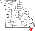 | |
| Villages | ||
| Townships | ||
| CDPs | ||
| Other communities | ||
| Ghost towns | ||
| Footnotes | ‡This populated place also has portions in an adjacent county or counties | |
| International | |
|---|---|
| National | |
| Geographic | |
| Other | |
Caruthersville, Missouri
View on GrokipediaCaruthersville is a small city and the county seat of Pemiscot County in southeastern Missouri's Bootheel region, situated directly on the banks of the Mississippi River.[1][2] Incorporated on May 18, 1874, and named in honor of Samuel Caruthers, an early U.S. congressman who represented the area, the city became the county seat in 1899 after river erosion threatened the prior seat at Gayoso.[3] As of 2023, Caruthersville had a population of 5,430, reflecting a median age of 36.2 and a median household income of $35,903, with the local economy historically rooted in agriculture—particularly cotton, soybeans, and corn production in the fertile Bootheel lowlands—and river transportation, though prone to flooding that prompted federal flood control measures including a protective floodwall.[4][3] The presence of the Century Casino & Hotel, which expanded in late 2024 with 599 slot machines and nine table games in a 26,000-square-foot facility, has become a significant economic driver, attracting visitors and providing employment in gaming and hospitality.[5] A key infrastructure feature is the Caruthersville Bridge, completed in 1976, which spans the Mississippi and facilitates regional connectivity.[6]
History
Early settlement and Native American heritage
The region encompassing modern Caruthersville in Pemiscot County, Missouri, features archaeological evidence of pre-Columbian Native American habitation, including some of the largest earthen mounds in the state located nearby, attributed to mound-building cultures such as the Mississippian tradition that flourished between approximately 800 and 1600 CE.[7] The county's name derives from the Algonquian term "Pemiscot," meaning "liquid mud," reflecting the marshy, riverine environment described in indigenous languages, possibly linked to tribes like the Meskwaki (Fox).[3][8] By the early 19th century, the territory was primarily ceded by the Osage Nation through the 1808 Treaty of Fort Clark, which transferred lands in southeast Missouri to the United States in exchange for annuities and protections amid pressures from eastern migrations and European encroachment.[7] Following this cession, the area saw utilization by displaced bands of Delaware (Lenape), Shawnee, and Cherokee peoples, who passed through or temporarily settled in the Mississippi River floodplain during their forced relocations westward, often en route to Indian Territory under U.S. removal policies.[7] European settlement began in the vicinity with the establishment of the French trading post known as Little Prairie (La Petite Prairie) in 1794, founded by François Le Sieur under Spanish colonial rule over Louisiana as a fur trade outpost adjacent to an existing Native American village, facilitating exchange of goods like deerskins for European manufactures.[7] This settlement, one of the earliest permanent European footholds in the Bootheel region, was devastated by the New Madrid earthquakes of 1811–1812, which liquefied the swampy soils—exacerbating the "liquid mud" conditions—and led to its abandonment, though scattered settlers like Colonel John H. Walker attempted reoccupation around 1805.[7][9] These early ventures were sparse, driven by river access for trade and agriculture, but hampered by flooding, seismic activity, and ongoing Native presence until broader U.S. territorial control solidified post-1812.[10]19th-century growth and Civil War impacts
The town of Caruthersville was laid out in 1857 by John Hardeman Walker and George W. Bushey and named in honor of Samuel Caruthers, the first U.S. congressman to represent the surrounding district.[3][7] Prior to the Civil War, the settlement rapidly developed into one of Missouri's most productive agricultural hubs, leveraging the Mississippi River's fertile alluvial soils for cotton, grain, and timber cultivation, which drew Southern pioneers seeking exploitable natural resources including abundant game and forests.[11][12][7] The outbreak of the American Civil War in 1861 severely curtailed this expansion, as Pemiscot County's proximity to the Mississippi River made it a theater for Union and Confederate maneuvers alongside rampant guerrilla warfare, which ravaged local infrastructure and economy.[12][13] Notable actions included a Union skirmish against guerrillas at Pemiscot Bayou on April 6, 1864, resulting in three Confederate deaths and seven wounded, and federal scouts operating in the county during November 13–16, 1864.[14][15] The conflict's chaos left Pemiscot County administratively disorganized from 1864 to 1866, necessitating placement under the jurisdiction of neighboring New Madrid County for governance.[12] Recovery accelerated after the war, with the city formally incorporating on May 18, 1874, to stabilize local authority and commerce.[3] The completion of Louis Houck's St. Louis, Kennett & Southern Railroad (later the Frisco line) in 1894 transformed Caruthersville into a key shipping node for regional commodities, bolstering trade despite ongoing flood risks.[7] By 1898, escalating Mississippi Riverbank erosion threatened the original county seat of Gayoso, prompting relocation of Pemiscot County's seat to Caruthersville, with records transferred in 1899.[3] These developments solidified the town's 19th-century trajectory as a riverine economic outpost, though vulnerable to environmental and hydrological forces.[11]Early 20th-century development and floods
Caruthersville experienced steady population growth in the early 20th century, increasing from 2,315 residents in 1900 to 3,655 in 1910, 4,750 in 1920, and 4,781 in 1930, reflecting expansion tied to agricultural and transportation advancements.[16] Following its designation as the Pemiscot County seat in 1899, the city solidified its role as a regional hub, with infrastructure improvements including the introduction of electric lights on June 2, 1899.[3] Railroad development, particularly along the St. Louis-San Francisco line, enhanced its function as a shipping center for cotton and other goods, supporting commerce and industry.[12][6] The transformation of the surrounding Bootheel region's swampy lands into productive farmland drove economic development, led by figures like Sterling Price Reynolds, who engineered the Little River Drainage District to reclaim areas for cotton cultivation.[3] A cotton boom in the 1920s further boosted Pemiscot County's agriculture, with bumper crops increasing output and economic activity in Caruthersville as a key processing and export point via the Mississippi River and rail lines.[11] Levee systems under the Saint Francis Levee District, established in 1893 and upgraded after failures, initially aided land reclamation but highlighted the ongoing tension between development and riverine risks.[3] Caruthersville's floodplain location on the Mississippi River exposed it to recurrent flooding, prompting early protective measures. In 1917, an initial concrete floodwall approximately 3,000 feet long was constructed along the eastern edge of downtown to safeguard rail lines, commerce, and residences from inundation.[6] The Great Flood of 1927 devastated the region, submerging vast areas and displacing thousands across the Mississippi Valley, which directly influenced the federal Flood Control Act of 1928 and subsequent levee expansions.[6] This legislation initiated broader flood management, including the rebuilding of Caruthersville's floodwall in 1932 as part of the U.S. Army Corps of Engineers' Memphis District program to fortify over 12,000 linear miles of defenses.[6] Despite these efforts, severe flooding persisted, with the 1937 event reaching 46 feet at Caruthersville, underscoring the challenges of river control.[17]Mid-20th century to present economic shifts
In the decades following World War II, Caruthersville's economy continued to center on agriculture, with cotton, soybeans, and corn as primary crops in the fertile Mississippi River floodplain of Pemiscot County. Mechanization of farming operations significantly reduced the need for manual labor, contributing to a decline in rural population and employment opportunities in the Missouri Bootheel region, including Caruthersville.[18] This shift exacerbated economic stagnation, as farm consolidation left fewer workers dependent on seasonal field jobs, prompting outmigration and persistent poverty rates exceeding state averages.[19] To offset agricultural job losses, light manufacturing emerged as a key sector in the mid-20th century, particularly shoe and apparel production. The Brown Shoe Company, originally established as Menzies Shoe Company in 1927, expanded operations in Caruthersville and became the city's largest employer, sustaining multiple generations of workers through the postwar boom.[20] However, the plant faced labor disruptions, including supply chain issues from strikes at supplier facilities in 1958, and ultimately closed in 1994 amid national industry contraction due to foreign competition and changing consumer demands.[21][22] This closure mirrored broader manufacturing declines in Pemiscot County, where gross domestic product fell 29.8% between 2013 and 2018, reflecting the loss of traditional factory roles.[23] The legalization of riverboat gaming in Missouri via a 1992 constitutional amendment, effective in 1994, marked a pivotal diversification. Lady Luck Casino opened in Caruthersville in 1995 as one of the state's 13 licensed facilities, introducing tourism, approximately 500 gaming positions, and associated jobs in hospitality and retail, which helped stabilize local revenues amid manufacturing's retreat.[24] By the 2000s, gaming contributed to Pemiscot County's economic mix alongside persistent agriculture, which accounted for about 60% of the area's output through crop sales and related commerce.[19] Into the present, economic pressures from population decline—Pemiscot County lost over 2% of residents between 2000 and 2012—have underscored reliance on diversified anchors like the casino, which transitioned to a land-based facility with 599 slots and 12 tables in November 2024, and health care services as the top employer.[19][25] Agricultural processing has seen revitalization, exemplified by Cargill's 2022 announcement of a soybean crush plant in the county, projected to enhance value-added output from the sector's $271 million in annual product sales. Despite these developments, challenges persist, with manufacturing's reduced footprint and vulnerability to national recessions limiting broad recovery.[26]Geography
Physical location and Mississippi River influence
Caruthersville occupies a position in Pemiscot County, southeastern Missouri, within the low-lying Missouri Bootheel region, directly on the eastern bank of the Mississippi River. The city's central coordinates are approximately 36°11′N 89°39′W, placing it at an elevation of about 338 feet (103 meters) above sea level on the flat expanse of the Mississippi Alluvial Plain.[27][28] This plain, formed by millennia of river sediment deposition, features minimal topographic relief, with the surrounding landscape dominated by agricultural fields and wetlands characteristic of the river's floodplain.[29] The Mississippi River profoundly shapes Caruthersville's physical environment, serving as its eastern boundary and exerting influence through hydraulic dynamics, sediment transport, and episodic flooding. The river's meandering channel and high discharge volumes—capable of reaching flood stages exceeding 40 feet at the local gauge—have historically deposited nutrient-rich alluvium, fostering fertile soils that underpin regional cotton and soybean cultivation. However, unchecked floods prior to modern interventions repeatedly inundated the area, as seen in major events like the 1927 Great Mississippi Flood, which breached levees and submerged vast tracts of the Bootheel.[6][30] To mitigate these risks, engineered flood control structures, including a concrete floodwall encircling the city and reinforced mainline levees, were implemented following devastating 20th-century floods. The U.S. Army Corps of Engineers' 1931 levee program and subsequent enlargements after the 1927 disaster raised protections to withstand crests up to 50 feet, though records show the river reached 46 feet in both 1937 and 2011, testing these barriers. These interventions alter natural floodplain hydrology, potentially exacerbating downstream flooding by constraining water spread, yet they have enabled sustained habitation and economic activity in this vulnerable locale.[6][31][32]Topography and environmental features
Caruthersville occupies a flat alluvial plain in the Missouri Bootheel, part of the Mississippi River's floodplain, where the terrain exhibits minimal relief suited to agriculture. The city's average elevation stands at approximately 85 meters (279 feet) above sea level, with surrounding areas averaging around 80 meters. Local topography within a 2-mile radius features an essentially level surface, marked by a maximum elevation variation of just 43 feet.[33][34][35] The landscape derives from sediment deposition by the Mississippi River, which borders Pemiscot County to the east and has historically flooded to enrich soils with fertile alluvium, fostering crop production despite flood risks managed by engineered levees. A singular elevated feature, a residual land mass ascending to 270 feet above sea level, rises about four miles southwest of the city, providing stark contrast to the prevailing deltaic flatness.[3] Environmental characteristics include riverine hydrology prone to periodic inundation, remnant oxbow lakes, and low-lying wetlands interspersed among agricultural fields, reflecting the dynamic erosional and depositional processes of the Mississippi system. These elements underscore the area's vulnerability to water level fluctuations while supporting a ecosystem adapted to periodic wetness.[3][36]Climate patterns and weather extremes
Caruthersville experiences a humid subtropical climate (Köppen Cfa), characterized by hot, humid summers and mild, wet winters, with annual average temperatures around 59°F and approximately 49 inches of precipitation, predominantly as rain, alongside about 4 inches of snowfall.[37][38][34] Summers, peaking in July, feature average highs of 89°F and lows of 71°F, often with muggy conditions due to high humidity. Winters are short, spanning November to February, with January averages of 47°F highs and 28°F lows, accompanied by frequent cloudy skies and windy conditions. Precipitation is distributed throughout the year, with March being the wettest month on average, though the region receives partly cloudy skies year-round.[34][39] Weather extremes in Caruthersville are influenced by its Mississippi River location and position in "Tornado Alley," resulting in recurrent severe events. The area has recorded over 108 tornadoes of magnitude EF2 or higher since reliable tracking began, including a devastating EF3 tornado on April 2, 2006, that destroyed 205 homes, damaged 438 others and numerous businesses and schools, injured around 130 people, and caused widespread infrastructure disruption.[40][41] More recently, an EF4 tornado crossed the Mississippi River near Caruthersville on December 10, 2021, as part of a historic outbreak, contributing to regional fatalities and damage, including the death of a 9-year-old girl in a nearby home.[42] Flooding poses the most persistent threat due to the Mississippi River, with a floodwall constructed in 1932 to protect downtown up to 50 feet; the structure has held against major events, but the 2011 flood set a stage record of 47.6 feet, surpassing the prior 1937 high of 46 feet and prompting evacuations and levee reinforcements.[6][27][31] Earlier floods, such as those in 1927 and 1993, have similarly inundated the low-lying bootheel region, exacerbating agricultural losses and necessitating ongoing federal flood control measures.[43] Heat waves occasionally push temperatures above 100°F, while rare winter cold snaps can drop below 0°F, though such extremes are less frequent than convective storms and riverine flooding.[34]Demographics
Population history and recent trends
Caruthersville's population expanded rapidly during the early 20th century amid agricultural and river trade growth, rising from 2,315 in 1900 to a peak of 8,614 in 1950, reflecting influxes tied to cotton farming and levee construction employment.[16] Subsequent decades saw stagnation and decline, with figures dropping to 7,350 by 1970 and 7,389 in 1990, as mechanization in the Missouri Bootheel reduced demand for manual farm labor and prompted outmigration.[16] [44]| Census Year | Population |
|---|---|
| 1900 | 2,315 |
| 1910 | 3,655 |
| 1920 | 4,750 |
| 1930 | 4,781 |
| 1940 | 6,612 |
| 1950 | 8,614 |
| 1960 | 8,643 |
| 1970 | 7,350 |
| 1980 | 7,958 |
| 1990 | 7,389 |
Racial and ethnic breakdown
According to the 2020 United States Census, Caruthersville's racial composition was 57.0% White alone, 34.6% Black or African American alone, 0.5% American Indian and Alaska Native alone, 0.3% Asian alone, 0.0% Native Hawaiian and Other Pacific Islander alone, 0.7% some other race alone, and 6.9% two or more races.[49] The Hispanic or Latino population of any race was 4.8%.[49] These figures reflect a slight shift from the 2010 Census, when White alone residents comprised 63.9% and Black or African American alone 33.1%, indicating a modest diversification over the decade.[50]| Race/Ethnicity (2020) | Percentage |
|---|---|
| White alone | 57.0% |
| Black or African American alone | 34.6% |
| Two or more races | 6.9% |
| Hispanic or Latino (any race) | 4.8% |
| Other races alone | 2.7% |
Socioeconomic metrics including poverty and income
The median household income in Caruthersville stood at $35,903 in 2023, reflecting a modest year-over-year increase of 0.894%.[4] This amount lags substantially behind the Missouri state median of approximately $68,920 and the national figure exceeding $75,000, underscoring the city's position within the economically distressed Bootheel region. Per capita income in the city was estimated at $21,430 in 2023, further highlighting income disparities relative to broader averages.[52] Poverty remains a defining socioeconomic challenge, with a rate of 26.1% in 2023—a decline of 6.66% from the prior year—impacting over one in four residents in a population of about 5,426.[4] [49] This exceeds the state poverty rate of around 12.5% and the U.S. average near 11.5%, correlating with structural factors such as limited industrial diversification beyond agriculture and gaming. In Pemiscot County, which encompasses Caruthersville, the poverty rate hovered at 27.36% with a median household income of $40,748, indicating city-level metrics align closely with county-wide patterns of elevated deprivation.[53] Unemployment contributes to these pressures, registering at 5.3% in recent assessments, above Missouri's statewide rate below 3% post-2022 recovery.[54] Educational attainment offers partial context: among adults, high school completion rates approach typical levels, but bachelor's degree attainment trails state norms at under 12%, limiting access to higher-wage sectors.[49]| Metric | Caruthersville (2023) | Missouri (approx.) | Notes/Source Alignment |
|---|---|---|---|
| Median Household Income | $35,903 | $68,920 | Slight annual growth; census-derived.[4] |
| Poverty Rate | 26.1% | 12.5% | Recent decline; disproportionately affects families.[4] |
| Unemployment Rate | 5.3% | <3% | Persistent above state average.[54] |