
Community hub
Recent from talks
Contribute something
Nothing was collected or created yet.
Pikesville, Maryland
View on Wikipedia
Pikesville is a census-designated place (CDP) in Baltimore County, Maryland, United States. Pikesville is just northwest of the Baltimore city limits. It is the northwestern suburb closest to Baltimore.
Key Information


The population was 30,764 at the 2010 census.[2] The corridor along Interstate 795, which links Pikesville, Owings Mills, and Reisterstown to the Baltimore Beltway (Interstate 695), contains one of the larger Jewish populations in Maryland.
Geography
[edit]Pikesville is located at 39°22′45″N 76°42′18″W / 39.37917°N 76.70500°W (39.379039, −76.705091).[3]
According to the United States Census Bureau, the CDP has a total area of 32.1 square kilometres (12.4 sq mi), of which 32.0 square kilometres (12.4 sq mi) is land and 0.07 square kilometres (0.027 sq mi), or 0.22%, is water.[4]
Demographics
[edit]| Census | Pop. | Note | %± |
|---|---|---|---|
| 1960 | 18,737 | — | |
| 1970 | 24,159 | 28.9% | |
| 1980 | 22,555 | −6.6% | |
| 1990 | 24,815 | 10.0% | |
| 2000 | 29,123 | 17.4% | |
| 2010 | 30,764 | 5.6% | |
| 2020 | 34,168 | 11.1% | |
| [5] | |||
As of the census[6] of 2010, there were 30,764 people and 13,642 households residing in the CDP. The population density was 2,490.8 people per square mile. There were 14,323 housing units. The racial makeup of the CDP was 77.0% White, 14.5% African American, 0.1% Native American, 6.0% Asian, 0.1% Pacific Islander, and 1.6% from two or more races. Hispanic or Latino of any race were 2.7% of the population.
As of the 2000 census, there were 12,747 households, out of which 24.1% had children under the age of 18 living with them, 54.9% were married couples living together, 7.0% had a female householder with no husband present, and 36.1% were non-families. 30.5% of all households were made up of individuals, and 14.9% had someone living alone who was 65 years of age or older. The average household size was 2.25 and the average family size was 2.81.
In the CDP, the population was spread out, with 19.7% under the age of 18, 5.3% from 18 to 24, 24.4% from 25 to 44, 27.0% from 45 to 64, and 23.6% who were 65 years of age or older. The median age was 45 years. For every 100 females, there were 86.0 males. For every 100 females age 18 and over, there were 81.0 males.
The median income for a household in the CDP was $58,598, and the median income for a family was $78,002 (these figures had risen to $73,846 and $100,237 respectively as of a 2007 estimate[7]). Males had a median income of $52,079 versus $37,179 for females. The per capita income for the CDP was $41,035. About 5.0% of families and 6.9% of the population were below the poverty line, including 4.4% of those under age 18 and 11.5% of those age 65 or over.
In 2000, 19.3% of Pikesville residents identified as being of Russian heritage. Virtually all of them are Ashkenazi Jews whose ancestors immigrated from the Russian Empire.[8] In 2000, 3.7% of Pikesville residents identified as being of Ukrainian American heritage. This was the highest percentage of Ukrainian Americans of any place in Maryland.[9] 2% of the city were descended from Eastern European countries other than Russia and Ukraine. The majority of them are of Ashkenazi Jewish ancestry. 8% of Pikesville's residents were German, 7% Polish, 4% Irish, 3% English, and 2% Italian.[10]
Jewish community
[edit]In the 19th and early 20th centuries Jewish immigrants to the Baltimore area first formed enclaves in East Baltimore not far from Johns Hopkins Hospital in neighborhoods such as Broadway East, Jonestown, Middle East and Oliver. After World War II, the Jewish community moved outside of Baltimore City into Pikesville, a sleepy outpost on a major road that led to Western Maryland. During the Vietnam War, and exacerbated by riots in 1968, many Jewish businesses left northwestern Baltimore following this exodus.
Pikesville (and more recently its neighboring communities to the north, Owings Mills and Reisterstown) have been considered the center of the Baltimore area's Jewish community since the mid-1950s. Many of the region's largest and most established synagogues, Jewish schools, and kosher dining establishments are located in or near Pikesville.
History
[edit]This section has multiple issues. Please help improve it or discuss these issues on the talk page. (Learn how and when to remove these messages)
|
Pikesville, Maryland, was named for the American soldier and explorer Zebulon Pike (1779–1813). While there are places named for Pike in many other states, Pikesville, Maryland, is the only contemporary place named "Pikesville".
Education
[edit]Pikesville is served by several elementary, middle, and high schools and higher-education facilities:
Public
[edit]All public schools in Pikesville are part of the Baltimore County Public Schools system.
- Fort Garrison Elementary School
- Milbrook Elementary
- Bedford Elementary School
- Summit Park Elementary School
- Wellwood International School (elementary)
- Winand Elementary
- Northwest Academy of Health Sciences (Formerly Old Court Middle School)
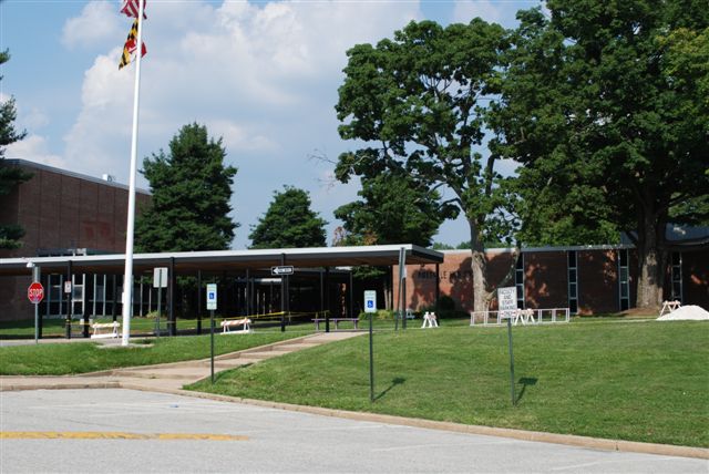
- Pikesville Middle School
- Sudbrook Magnet Middle School
- Pikesville High School
- Milford Mill Academy (Formerly Milford Mill High School)
Independent
[edit]- The Park School
- Elementary School of St. Marks
- Beth Tfiloh Dahan Community School
- The Odyssey School
- St. Timothy's School
- Krieger Schechter Day School
- Torah Institute
Higher education
[edit]- Ner Israel Rabbinical College
- Maalot Baltimore: Women's Institute of Torah Seminary[11]
Government
[edit]The Maryland State Police is headquartered at 1201 Reisterstown Road in the Pikesville CDP.[12][13]
Transportation
[edit]Roads
[edit]- Baltimore Beltway (I-695)
- Milford Mill Road
- Mount Wilson Lane
- Old Court Road
- Park Heights Avenue (MD-129)
- Reisterstown Road (MD-140)
- Seven Mile Lane
- Slade Avenue
- Smith Avenue
- Stevenson Road
- Sudbrook Lane/Road
- Brooks Robinson Drive
Public transportation
[edit]The Baltimore Metro Subway runs through Pikesville, with two stops in the area, both named for the roads on which they are located: Milford Mill and Old Court.
Maryland Transit Administration bus routes serving Pikesville include nos. 83 and 89 on Reisterstown Road, 83 and 37 on Old Court Road, 85 on Milford Mill Road/Slade Avenue, and 34 and on Smith Avenue.
Notable people
[edit]- Sam Barsky, knitting artist[14]
- Sam Ezersky, puzzle editor
- David Felinton, former mayor of Huntington, West Virginia[15]
- Michael H. Shamberg, filmmaker and music video producer (True Faith, Blue Monday), raised in Pikesville.[16]
- Robin Quivers, long-running news anchor and co-host of The Howard Stern Show, was born and raised in Pikesville.[17]
Pikesville in national/international news
[edit]Vernon Lee Evans was a key figure in the battle against lethal injection in Maryland and other states. Prior to Maryland's outlawing of capital punishment in 2013, he and Anthony Grandison were on death row for the murders of two clerks at the Warren House Motel (currently a Howard Johnson) in Pikesville in 1983. Governor Martin O'Malley commuted both men's sentences in 2014, along with those of the other two men who were, at the time, on Maryland's death row.[18]
Ziad Jarrah, a suspected terrorist involved in the 9/11 attacks, was pulled over two days earlier for speeding in Pikesville.[19]
On April 25, 2024, Dazhon Darien, the Athletic Director at Pikesville High School, was arrested on terms of falsifying an audio recording of the Principal making racist and antisemitic remarks using artificial intelligence.[20]
References
[edit]- ^ "2020 U.S. Gazetteer Files". United States Census Bureau. Retrieved April 26, 2022.
- ^ "Profile of General Population and Housing Characteristics: 2010 Demographic Profile Data (DP-1): Pikesville CDP, Maryland". United States Census Bureau. Retrieved March 1, 2012.
- ^ "US Gazetteer files: 2010, 2000, and 1990". United States Census Bureau. February 12, 2011. Retrieved April 23, 2011.
- ^ "Geographic Identifiers: 2010 Demographic Profile Data (G001): Pikesville CDP, Maryland". United States Census Bureau. Retrieved March 1, 2012.
- ^ As a Census Designated Place, the boundaries may have changed arbitrarily in each decennial census.
- ^ "U.S. Census website". United States Census Bureau. Retrieved January 31, 2008.
- ^ "U.S. Census Bureau". United States Census Bureau. Retrieved April 6, 2019.
- ^ Vicino, Thomas J. (2008). Transforming Race and Class in Suburbia: Decline in Metropolitan Baltimore. New York City: Palgrave Macmillan. p. 77. ISBN 978-0-230-60545-9. Retrieved October 15, 2012.
- ^ "Ancestry Map of Ukrainian Communities". Epodunk.com. Archived from the original on May 23, 2013. Retrieved April 16, 2015.
- ^ "Pikesville, MD, Ancestry & Family History". Epodunk.com. Retrieved April 16, 2015.
- ^ "WITS/MAALOT | Women's Institute of Torah Seminary". maalotbaltimore.org.
- ^ Home page. Maryland State Police. Retrieved on March 23, 2009.
- ^ "Pikesville CDP, Maryland[permanent dead link]." U.S. Census Bureau. Retrieved on March 23, 2009.
- ^ "#SweaterGame: Maryland man goes viral for knitting travel memories into wearable art". WTTE. January 18, 2017.
- ^ "Felinton wants city to be creative hub". Herald Dispatch. Retrieved August 18, 2024.
- ^ Kaltenbach, Chris (November 15, 2014). "Remembrance: Michael Shamberg, from Baltimore to New Order and beyond". Baltimore Sun. Retrieved November 29, 2014.
- ^ Colford, Paul (1997). "Howard Stern: King of All Media (2nd ed.)".
- ^ McMenamin, Jennifer (February 3, 2006). "Prisoner proves an unlikely teacher: As execution nears, students reflect on correspondence with a death row inmate". The Baltimore Sun. Archived from the original on May 2, 2009 – via Notre Dame Prep Teacher Web Sites.
- ^ "Another hijacker was stopped for traffic violation". CNN. January 9, 2002. Retrieved May 22, 2010.
- ^ "Teacher arrested, accused of using AI to falsely paint boss as racist and antisemitic". NBC News. April 26, 2024. Retrieved April 26, 2024.
External links
[edit] Pikesville travel guide from Wikivoyage

| International | |
|---|---|
| National | |
| Geographic | |
Pikesville, Maryland
View on GrokipediaGeography
Location and boundaries
Pikesville is an unincorporated census-designated place (CDP) in Baltimore County, Maryland, situated immediately northwest of Baltimore City limits.[8] The community lies in the central portion of Baltimore County, with its central point at coordinates 39.3743° N, 76.7225° W.[8] The Pikesville CDP encompasses a land area of 12.3 square miles.[1] Its formal boundaries, as defined for census purposes, align with visible geographic features including major roadways and rail lines.[9] County planning documents delineate the core Pikesville study area bounded to the north by Interstate 695, to the east by Park Heights Avenue and the Baltimore County-Baltimore City line, and to the south and west by the CSX rail line.[10] Reisterstown Road (Maryland Route 140) bisects the area as its primary north-south commercial corridor.[10]
Physical features and climate
Pikesville occupies the Piedmont Plateau physiographic province, characterized by rolling hills, upland terrain, and moderate elevations averaging 463 feet (141 meters) above sea level.[11] The area's topography includes gentle slopes and valleys formed by streams that drain into the Chesapeake Bay watershed, with underlying geology consisting of metamorphic and igneous rocks typical of the Piedmont region.[12] The locality experiences a humid subtropical climate, marked by hot, humid summers and cool, occasionally snowy winters. Annual precipitation averages 46 inches (1,170 mm), distributed relatively evenly throughout the year, while snowfall totals about 19 inches (480 mm).[13] Average temperatures range from lows of 26°F (-3°C) in January to highs of 88°F (31°C) in July, with July and August seeing the highest humidity levels.[14] Monthly highs in winter hover around 41–44°F (5–7°C), and precipitation in January and February averages 3.1–3.3 inches (79–84 mm).[15]History
Early settlement and naming
The region now known as Pikesville, located in Baltimore County, was originally inhabited by Native American tribes, including the Piscataway and Nentego (also known as Nanticoke) peoples, who utilized the area's woodlands and waterways for hunting, fishing, and agriculture prior to European contact.[4] European colonization of the broader Baltimore County area commenced in the mid-17th century, following the county's formal establishment around 1659–1660 as part of the Maryland proprietary colony, with early settlers primarily engaging in tobacco farming on land grants amid ongoing displacement of indigenous populations through treaties and conflicts.[16] [17] The specific community of Pikesville emerged in the early 19th century as a planned village on land owned by Dr. James Smith, a Baltimore physician who subdivided his property to create an early suburban enclave approximately 9 miles northwest of central Baltimore, facilitating access via emerging turnpikes like the Baltimore-Reisterstown Road.[18] This development coincided with post-War of 1812 infrastructure projects, including the 1816 initiation of construction for the U.S. Arsenal in Pikesville, which utilized land purchased from Smith and underscored the area's strategic positioning.[17] [19] Pikesville derives its name from Brigadier General Zebulon Montgomery Pike (1779–1813), the U.S. Army officer and explorer renowned for his expeditions into the Louisiana Purchase territories, including the 1806–1807 trek that identified the peak later named Pikes Peak in his honor; Pike's death during the siege of York in the War of 1812 elevated his posthumous fame, prompting numerous place names across the United States, including this Maryland village established shortly thereafter.[4] [20] Initial growth was modest, centered on taverns, mills, and the arsenal, reflecting its role as a rural outpost transitioning toward suburban character amid Baltimore's expansion.[18]Suburban development in the 19th and early 20th centuries
Pikesville emerged as an early suburb of Baltimore when Dr. James Smith founded the village in 1815 on his property in Baltimore County, intending it as a residential outpost for city dwellers.[18] Growth remained modest through much of the 19th century, constrained by the area's eight-mile distance from central Baltimore and the lack of viable transportation links; no horse car lines or railroads connected it as late as 1829.[18] Transportation advancements catalyzed suburban expansion starting in the 1870s. The Pikesville horse car line, introduced in 1874, shortened commute times and drew initial residential settlement by enabling daily travel to Baltimore for work.[18] Electrification of Baltimore's streetcar system in the 1890s extended trolley lines outward, fostering a ring of modest commuter villages including Pikesville along routes like Reisterstown Road, where service began in 1894.[21][18] These lines supported denser housing clusters oriented toward affluent and middle-class commuters seeking escape from urban density.[21] Into the early 20th century, improved roads and the rise of motor vehicles by 1910 further democratized access, spurring incremental lot subdivisions and infrastructure like the Pikesville Armory, constructed in 1903 to serve the expanding community's military and civic needs.[21] This era's development emphasized single-family homes amid rolling terrain, prioritizing proximity to Baltimore while preserving rural character until interwar pressures intensified.[18]Post-World War II expansion and Jewish influx
Following World War II, Pikesville underwent significant suburban expansion as part of broader trends in Baltimore County, fueled by the return of veterans under the GI Bill, the postwar baby boom, and improved transportation infrastructure such as electrified streetcar lines and later highways.[22][21] War-related industries, including the Glenn L. Martin Aircraft Company employing up to 53,000 workers, stimulated economic growth and housing demand, leading to a surge in residential construction with modest brick neo-colonial homes added in the 1940s and 1950s.[21] Baltimore County's suburban population expanded rapidly, with housing units increasing from approximately 9,000 building permits in 1947 to 26,000 by 1952, reflecting a broader 87% rise in suburban county populations across Maryland during the decade.[21] Concurrently, Pikesville attracted a substantial influx of Jewish families migrating northward from Baltimore City's denser enclaves, particularly in the 1950s, as wealthier segments of the community sought larger homes and suburban amenities amid national trends toward outward relocation.[21] This movement was precipitated by demographic shifts in the city, where African American populations expanded into former Jewish neighborhoods, prompting Jewish residents to relocate to outer suburbs like Pikesville and Fallstaff for socioeconomic stability and community cohesion.[21] By 1959, the Baltimore Jewish community was actively migrating across Northern Parkway into areas including Pikesville, establishing it as a key hub in the northwest corridor.[23] By 1968, over 90 percent of Baltimore's approximately 106,000 Jews resided in the northwest metropolitan area, with Pikesville emerging as a primary concentration point due to its proximity to the city, access via Reisterstown Road, and development of supporting institutions like synagogues and community centers.[24] This influx transformed Pikesville from a modest outpost into a vibrant suburban enclave, where Jewish families prioritized access to quality education, retail districts, and religious facilities, contributing to the area's cultural and economic profile.[25] The migration aligned with causal drivers of suburbanization, including low-interest home loans and automobile-dependent lifestyles, while reflecting preferences for environments offering greater homogeneity and reduced urban frictions compared to changing city demographics.[22][21]Demographics
Population trends and statistics
The population of Pikesville, a census-designated place in Baltimore County, has exhibited consistent growth over recent decades, consistent with broader suburban expansion patterns in the region. U.S. Decennial Census data record 24,815 residents in 1990, rising to 29,123 in 2000 for a decadal increase of 17.4%.[26] Growth moderated to 5.6% in the following decade, reaching 30,764 by 2010. The 2010s saw renewed expansion, with the population climbing 11.1% to 34,168 as enumerated in the 2020 Census.[27]| Census Year | Population | Decadal Percent Change |
|---|---|---|
| 1990 | 24,815 | — |
| 2000 | 29,123 | +17.4% |
| 2010 | 30,764 | +5.6% |
| 2020 | 34,168 | +11.1% |
Racial and ethnic composition
According to the U.S. Census Bureau's American Community Survey (ACS) 5-year estimates for 2018–2022, Pikesville's racial composition is dominated by individuals identifying as White (non-Hispanic), who constitute 70.7% of the population, followed by Black or African American (non-Hispanic) at 17.0%.[3][29] Asian (non-Hispanic) residents account for 4.9%, while those reporting two or more races (non-Hispanic) make up 4.4%.[3] Smaller proportions include individuals identifying as some other race (non-Hispanic) at 1.1% and American Indian/Alaska Native (non-Hispanic) at 0.2%.[3] Hispanic or Latino residents of any race comprise 4.6% of the population, based on 2020 Decennial Census data totaling 1,560 individuals out of an approximate population of 34,000 in recent estimates.[1] This figure aligns with ACS data showing Hispanic or Latino (non-Hispanic races) subgroups, such as White Hispanic at about 1.2% and other race Hispanic at 1.4% of the total.[3] The table below summarizes the primary racial and ethnic categories from the ACS 2018–2022 estimates (population ≈34,253):| Category | Percentage |
|---|---|
| White (non-Hispanic) | 70.7% |
| Black or African American (non-Hispanic) | 17.0% |
| Asian (non-Hispanic) | 4.9% |
| Two or more races (non-Hispanic) | 4.4% |
| Hispanic or Latino (any race) | 4.6% |