

Community hub
Recent from talks
Contribute something
Nothing was collected or created yet.
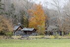
Randolph County, West Virginia
View on Wikipedia
Randolph County is a county located in the U.S. state of West Virginia. As of the 2020 census, the population was 27,932.[5] Its county seat is Elkins.[6] The county was founded in 1787 and is named for Edmund Jennings Randolph.[7]
Key Information


Randolph County comprises the Elkins, West Virginia, Micropolitan Statistical Area.
History
[edit]The first attempt by Europeans to settle in present-day Randolph County came in 1752 or '53 when David Tygart — for whom the Tygart Valley River was named — and Robert Foyle (later called Files) located (separately) with their families in the vicinity of present-day Beverly. Although there had been no recent history of conflicts between Europeans and Native Americans in that immediate area, that summer a party of Native Americans traveling the Shawnee Trail discovered the Foyle cabin and killed seven members of the family. One son escaped and alerted the Tygart family, allowing all to escape. (The Tygart-Foyle settlements were the first European settlements attempted anywhere within the Monongahela River watershed in present-day West Virginia.) No other European settlement was attempted in present Randolph County until 1772.[8][9]
Thomas Skidmore (ca. 1733–1807), born in Maryland, obtained a title to 400 acres of land (“by virtue of a settlement”) in the future Elkins area before 1778. This land, on the east side of the Tygart Valley River, was surveyed by John Poage in 1780 and included the land that is now most of downtown Elkins. Thus, Skidmore was probably the first European settler in what became Elkins.[10]
When Randolph County, Virginia (now West Virginia) was created out of the vast Harrison County on October 16, 1787, it included not only present-day Randolph County, but parts of what are now eight other counties.[11] It took its name from the surname of the then Governor of Virginia. The name of the new county seat, originally Randolph Court House, or Edmundton (the latter from the Governor's given name), was changed to Beverly by 1790.[12] Beverly remained the county seat until 1890 when county government was moved to Elkins.
Minor actions of the American Civil War which took place in Randolph County include the Battle of Rich Mountain and a part of the Battle of Cheat Mountain, both in 1861. These operations came in the course of the Western Virginia Campaign.
Randolph was one of fifty Virginia counties that were admitted to the Union as the state of West Virginia on June 20, 1863. Later that year, the new state's counties were divided into civil townships, with the intention of encouraging local government. This proved impractical in the heavily rural state, and in 1872 the townships were converted into magisterial districts.[13] Randolph County was divided into nine districts: Beverly, Clarke, Clay, Dry Fork, Green, Mingo Flats, Reynolds, Scott, and Union. Several of these were renamed during the 1870s: Clark became Valley Bend, Clay became New Interest, Green became Leadsville, Mingo Flats was abbreviated to Mingo, Reynolds became Huttonsville, Scott became Roaring Creek, and Union became Middle Fork.[14]
Geography
[edit]

According to the United States Census Bureau, the county has a total area of 1,040 square miles (2,700 km2), of which 1,040 square miles (2,700 km2) is land and 0.3 square miles (0.78 km2) (0.03%) is water.[15] It is the largest county in West Virginia by area.
Rivers
[edit]Mountains
[edit]- Point Mountain
- Cheat Mountain
- White Top, a knob of Cheat Mountain
- Laurel Mountain
- Rich Mountain
- Shavers Mountain
- Gaudineer Knob, a knob of Shavers Mountain
Caves and caverns
[edit]Major highways
[edit]Adjacent counties
[edit]- Tucker County (northeast)
- Pendleton County (east)
- Pocahontas County (south)
- Webster County (southwest)
- Upshur County (west)
- Barbour County (northwest)
National protected area
[edit]Demographics
[edit]| Census | Pop. | Note | %± |
|---|---|---|---|
| 1790 | 951 | — | |
| 1800 | 1,826 | 92.0% | |
| 1810 | 2,854 | 56.3% | |
| 1820 | 3,357 | 17.6% | |
| 1830 | 5,000 | 48.9% | |
| 1840 | 6,208 | 24.2% | |
| 1850 | 5,243 | −15.5% | |
| 1860 | 4,990 | −4.8% | |
| 1870 | 5,563 | 11.5% | |
| 1880 | 8,102 | 45.6% | |
| 1890 | 11,633 | 43.6% | |
| 1900 | 17,670 | 51.9% | |
| 1910 | 26,028 | 47.3% | |
| 1920 | 26,084 | 0.2% | |
| 1930 | 25,049 | −4.0% | |
| 1940 | 30,259 | 20.8% | |
| 1950 | 30,558 | 1.0% | |
| 1960 | 26,349 | −13.8% | |
| 1970 | 24,596 | −6.7% | |
| 1980 | 28,734 | 16.8% | |
| 1990 | 27,803 | −3.2% | |
| 2000 | 28,262 | 1.7% | |
| 2010 | 29,405 | 4.0% | |
| 2020 | 27,932 | −5.0% | |
| 2021 (est.) | 27,806 | [16] | −0.5% |
| U.S. Decennial Census[17] 1790–1960[18] 1900–1990[19] 1990–2000[20] 2010–2020[5] | |||
2020 census
[edit]As of the 2020 census, there were 27,932 people and 10,065 households residing in the county. There were 13,035 housing units in Randolph county. The racial makeup of the county was 93.6% White, 1.6% African American, 0.4% Asian, 0.2% Native American, 0.5% from other races, and 3.8% from two or more races. Hispanics or Latinos of any race were 1.1% of the population.
There were 10,065 households, of which 44.8% were married couples living together, 30.2% had a female householder with no spouse present, 19% had a male householder with no spouse present. The average household and family size was 3.36. The median age in the county was 44.7 years with 19% of the population being under 18. The median income for a household in the city was $47,343 and the poverty rate was 15.2%[21]
2010 census
[edit]As of the 2010 United States census, there were 29,405 people, 11,695 households, and 7,753 families living in the county.[22] The population density was 28.3 inhabitants per square mile (10.9/km2). There were 14,189 housing units at an average density of 13.6 per square mile (5.3/km2).[23] The racial makeup of the county was 97.3% white, 1.2% black or African American, 0.3% Asian, 0.2% American Indian, 0.1% from other races, and 0.8% from two or more races. Those of Hispanic or Latino origin made up 0.7% of the population.[22] In terms of ancestry, 26.3% were German, 15.9% were Irish, 12.0% were English, 10.2% were American, and 5.4% were Italian.[24]
Of the 11,695 households, 27.1% had children under the age of 18 living with them, 51.0% were married couples living together, 10.5% had a female householder with no husband present, 33.7% were non-families, and 28.4% of all households were made up of individuals. The average household size was 2.32 and the average family size was 2.81. The median age was 43.4 years.[22]
The median income for a household in the county was $36,176 and the median income for a family was $47,071. Males had a median income of $34,903 versus $25,988 for females. The per capita income for the county was $18,472. About 12.7% of families and 17.1% of the population were below the poverty line, including 26.1% of those under age 18 and 11.4% of those age 65 or over.[25]
2000 census
[edit]As of the 2000 census, there were 28,262 people, 11,072 households, and 7,661 families living in the county. The population density was 27 people per square mile (10 people/km2). There were 13,478 housing units at an average density of 13 per square mile (5.0/km2). The racial makeup of the county was 97.69% White, 1.07% Black or African American, 0.16% Native American, 0.38% Asian, 0.01% Pacific Islander, 0.16% from other races, and 0.53% from two or more races. 0.68% of the population were Hispanic or Latino of any race.
There were 11,072 households, out of which 29.80% had children under the age of 18 living with them, 54.70% were married couples living together, 9.80% had a female householder with no husband present, and 30.80% were non-families. 26.30% of all households were made up of individuals, and 11.90% had someone living alone who was 65 years of age or older. The average household size was 2.41 and the average family size was 2.89.
In the county, the population was spread out, with 22.30% under the age of 18, 8.70% from 18 to 24, 28.50% from 25 to 44, 25.40% from 45 to 64, and 15.10% who were 65 years of age or older. The median age was 39 years. For every 100 females there were 101.30 males. For every 100 females age 18 and over, there were 99.70 males.
The median income for a household in the county was $27,299, and the median income for a family was $32,632. Males had a median income of $24,751 versus $17,819 for females. The per capita income for the county was $14,918. About 13.40% of families and 18.00% of the population were below the poverty line, including 24.30% of those under age 18 and 12.90% of those age 65 or over.
Politics
[edit]| Year | Republican | Democratic | Third party(ies) | |||
|---|---|---|---|---|---|---|
| No. | % | No. | % | No. | % | |
| 1912 | 756 | 14.82% | 2,563 | 50.25% | 1,782 | 34.93% |
| 1916 | 2,165 | 39.78% | 3,024 | 55.57% | 253 | 4.65% |
| 1920 | 4,158 | 46.11% | 4,676 | 51.85% | 184 | 2.04% |
| 1924 | 3,526 | 36.59% | 5,314 | 55.14% | 797 | 8.27% |
| 1928 | 4,436 | 46.22% | 5,085 | 52.99% | 76 | 0.79% |
| 1932 | 3,418 | 31.29% | 7,397 | 67.72% | 108 | 0.99% |
| 1936 | 3,711 | 31.34% | 8,109 | 68.48% | 22 | 0.19% |
| 1940 | 4,196 | 33.14% | 8,465 | 66.86% | 0 | 0.00% |
| 1944 | 3,681 | 36.88% | 6,299 | 63.12% | 0 | 0.00% |
| 1948 | 3,802 | 36.52% | 6,586 | 63.25% | 24 | 0.23% |
| 1952 | 5,452 | 43.87% | 6,976 | 56.13% | 0 | 0.00% |
| 1956 | 5,448 | 48.88% | 5,697 | 51.12% | 0 | 0.00% |
| 1960 | 5,018 | 41.79% | 6,989 | 58.21% | 0 | 0.00% |
| 1964 | 2,984 | 27.14% | 8,012 | 72.86% | 0 | 0.00% |
| 1968 | 4,508 | 41.11% | 5,562 | 50.72% | 897 | 8.18% |
| 1972 | 6,923 | 64.51% | 3,809 | 35.49% | 0 | 0.00% |
| 1976 | 4,822 | 39.89% | 7,265 | 60.11% | 0 | 0.00% |
| 1980 | 4,374 | 40.05% | 5,937 | 54.36% | 610 | 5.59% |
| 1984 | 6,100 | 55.64% | 4,839 | 44.14% | 25 | 0.23% |
| 1988 | 4,746 | 47.38% | 5,233 | 52.24% | 38 | 0.38% |
| 1992 | 3,496 | 34.20% | 5,097 | 49.86% | 1,629 | 15.94% |
| 1996 | 3,348 | 33.18% | 5,469 | 54.21% | 1,272 | 12.61% |
| 2000 | 5,248 | 55.00% | 4,028 | 42.21% | 266 | 2.79% |
| 2004 | 6,512 | 56.68% | 4,892 | 42.58% | 86 | 0.75% |
| 2008 | 6,060 | 55.94% | 4,539 | 41.90% | 234 | 2.16% |
| 2012 | 6,160 | 63.00% | 3,342 | 34.18% | 276 | 2.82% |
| 2016 | 7,629 | 69.55% | 2,735 | 24.93% | 605 | 5.52% |
| 2020 | 8,673 | 71.09% | 3,362 | 27.56% | 165 | 1.35% |
| 2024 | 8,356 | 72.07% | 3,008 | 25.94% | 230 | 1.98% |
Communities
[edit]
City
[edit]- Elkins (county seat)
Towns
[edit]Magisterial districts
[edit]- Beverly
- Dry Fork
- Huttonsville
- Leadsville
- Middle Fork
- Mingo
- New Interest
- Roaring Creek
- Valley Bend
Census-designated places
[edit]Unincorporated communities
[edit]- Adolph
- Aggregates
- Alpena
- Arnold Hill
- Bemis
- Brady Gate
- Bruxton
- Canfield
- Cassity
- Crystal Springs
- Czar
- Dryfork
- Elkins Junction
- Elkwater
- Ellamore
- Evenwood
- Faulkner
- Glady
- Horton
- Jimtown
- Kerens
- Little Italy
- Mabie
- Mingo
- Monterville
- Newlonton
- Norton
- Osceola
- Pumpkintown
- Read
- Spangler
- Sullivan
- Tigheville
- Upper Mingo
- Weaver
- Whyte
Notable people
[edit]- Herman Ball, football player
- Lemuel Chenoweth, master covered bridge builder
- William Wallace Barron, former governor who was indicted for bribery and jury tampering.
- Dellos Clinton "Sheriff" Gainer, major league baseball player
- Marshall Goldberg, football player
- Wilma Lee Cooper Grand Ole Opry and WWVA Jamboree star
- Stoney Cooper, Grand Ole Opry and WWVA Jamboree star
- Eldora Marie Bolyard Nuzum, American newspaper editor and interviewer of U.S. Presidents
See also
[edit]References
[edit]- ^ "Candidates' list balloons in Randolph". The Inter-Mountain. Retrieved October 25, 2023.
- ^ "County Commission". Randolph County Commission. Retrieved October 25, 2023.
- ^ "Randolph County 2022 General Election Results". WBOY-TV. Retrieved October 25, 2023.
- ^ "2020 General Election Results: Randolph County". WBOY-TV. Retrieved October 25, 2023.
- ^ a b "State & County QuickFacts". United States Census Bureau. Retrieved October 19, 2022.
- ^ "Find a County". National Association of Counties. Retrieved June 7, 2011.
- ^ "Randolph County history sources". Archived from the original on October 29, 2013. Retrieved November 26, 2014.
- ^ It has been thought that Tygart was again among those settling then, but this is not certain.
- ^ Maxwell, Hu (1899). The History of Barbour County, From its Earliest Exploration and Settlement to the Present Time, The Acme Publishing Company, Morgantown, W.Va. (Reprinted, McClain Printing Company, Parsons, W.Va., 1968). pp. 180–181.
- ^ “He obtained a clear title to 400 acres of land by virtue of a settlement made before 1778 on the east side of the Tygart Valley River, adjoining the land of Robert Cunningham. It was surveyed by John Poage on 14 November 1780, who with his chain carriers set off the tract as 288 acres, and on 1 June 1782 a perfected title to the land was returned to him from the Land Office. It included the land that is now most of downtown Elkins, the park, the Wees Addition, both sides of the river from roughly the rear entrance of McDonald's Restaurant to Porter Avenue, South Elkins north of 11th Street, and all of Diamond and Wees Street. David Armstrong, who has made a careful study of the early land titles in Elkins, thinks that his cabin stood on the west side of Randolph Avenue at its intersection with Henry Avenue where St. Brendan's Catholic School was later located. He credits Thomas Skidmore with being the first European settler in central Elkins. He does not seem to have made an immediate settlement at Elkins however, for he appears in 1784 on a tax list taken on the South Branch in Pendleton County where he headed a family of seven white souls.” (Skidmore, Warren (2010), Thomas Skidmore (Scudamore), 1605-1684, of Westerleigh, Gloucestershire, and Fairfield, Connecticut; his ancestors, and descendants to the ninth generation; Akron, Ohio; Sixth Edition; pg 143.)
- ^ These current counties are Upshur, Braxton, Pocohontas, Preston, Barbour, Tucker, Lewis and Webster.
- ^ Kenny, Hamill (1945). West Virginia Place Names: Their Origin and Meaning, Including the Nomenclature of the Streams and Mountains. Piedmont, WV: The Place Name Press. p. 110.
- ^ Otis K. Rice & Stephen W. Brown, West Virginia: A History, 2nd ed., University Press of Kentucky, Lexington (1993), p. 240.
- ^ United States Census Bureau, U.S. Decennial Census, Tables of Minor Civil Divisions in West Virginia, 1870–2010.
- ^ "2010 Census Gazetteer Files". United States Census Bureau. August 22, 2012. Retrieved July 30, 2015.
- ^ "Annual Estimates of the Resident Population for Counties: April 1, 2020 to July 1, 2021". Retrieved October 19, 2022.
- ^ "U.S. Decennial Census". United States Census Bureau. Retrieved January 11, 2014.
- ^ "Historical Census Browser". University of Virginia Library. Retrieved January 11, 2014.
- ^ "Population of Counties by Decennial Census: 1900 to 1990". United States Census Bureau. Retrieved January 11, 2014.
- ^ "Census 2000 PHC-T-4. Ranking Tables for Counties: 1990 and 2000" (PDF). United States Census Bureau. Archived (PDF) from the original on October 9, 2022. Retrieved January 11, 2014.
- ^ "Explore Census Data". data.census.gov. Retrieved March 9, 2023.
- ^ a b c "DP-1 Profile of General Population and Housing Characteristics: 2010 Demographic Profile Data". United States Census Bureau. Archived from the original on February 13, 2020. Retrieved April 3, 2016.
- ^ "Population, Housing Units, Area, and Density: 2010 - County". United States Census Bureau. Archived from the original on February 13, 2020. Retrieved April 3, 2016.
- ^ "DP02 SELECTED SOCIAL CHARACTERISTICS IN THE UNITED STATES – 2006-2010 American Community Survey 5-Year Estimates". United States Census Bureau. Archived from the original on February 13, 2020. Retrieved April 3, 2016.
- ^ "DP03 SELECTED ECONOMIC CHARACTERISTICS – 2006-2010 American Community Survey 5-Year Estimates". United States Census Bureau. Archived from the original on February 13, 2020. Retrieved April 3, 2016.
- ^ Leip, David. "Dave Leip's Atlas of U.S. Presidential Elections". uselectionatlas.org. Retrieved March 28, 2018.
Places adjacent to Randolph County, West Virginia | ||||||||||||||||
|---|---|---|---|---|---|---|---|---|---|---|---|---|---|---|---|---|
| ||||||||||||||||
Municipalities and communities of Randolph County, West Virginia, United States | ||
|---|---|---|
| City | 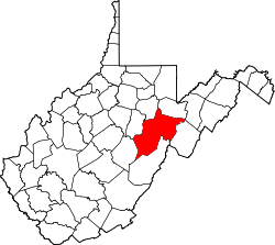 | |
| Towns | ||
| CDPs | ||
| Other communities |
| |
| Ghost towns | ||
| Footnotes | ‡This populated place also has portions in an adjacent county or counties | |
| International | |
|---|---|
| National | |
| Geographic | |
| Other | |
Randolph County, West Virginia
View on GrokipediaHistory
Formation and early settlement
Randolph County was formed on October 16, 1787, through an act of the Virginia General Assembly, derived from portions of Harrison County. The legislation reflected Virginia's efforts to organize its expansive western frontier amid post-Revolutionary land claims and administrative needs, with the new county encompassing rugged terrain suited for eventual agrarian settlement.[7] It was named for Edmund Jennings Randolph (1753–1813), a Virginia-born statesman who contributed to American independence as a delegate to the Continental Congress, the Constitutional Convention, and as the first U.S. attorney general under President Washington, later serving as governor of Virginia.[1][8] Prior to formal county organization, the area saw sporadic Native American habitation by groups including Shawnee and Delaware, whose presence involved hunting grounds and seasonal villages along rivers like the Tygart Valley.[4] European exploration began in the mid-18th century, but permanent settlement faced severe obstacles from intertribal conflicts and raids allied with French interests during the French and Indian War. The earliest recorded European families, those of Robert Files and David Tygart, arrived in 1753–1754 near Beverly and Dailey, drawn by fertile valleys and abundant game; however, Native American attacks resulted in the near-total massacre of the Files family and the prompt abandonment by the Tygarts, underscoring the defensive imperatives that prioritized fortified positions over dispersed homesteading.[4][9] Pioneer influx accelerated after 1760, motivated by cheap land patents issued under Virginia's 1779 land law, which incentivized improvements on unclaimed tracts amid population pressures from eastern Virginia.[7] Yet, intermittent Native American incursions—exacerbated by British alliances during the Revolution—stifled growth, with settlers clustering near natural defenses like river bottoms and constructing forts such as those at Beverly and Leading Creek by the 1770s. By 1772, claims covered most arable land along drainages, establishing patterns of linear settlement tied to water access and soil quality rather than expansive clears.[9][2] Post-1787, county governance commenced with the inaugural court session held in a settler's home near Beverly, where officials addressed land disputes and infrastructure like a courthouse on donated acreage from James Westfall.[10] Virginia land grants, averaging 400 acres per patent, fueled initial expansion, emphasizing self-reliant clearings over commercial ventures. The nascent economy centered on subsistence farming—cultivating corn, rye, and vegetables on floodplain soils—augmented by hunting, rudimentary livestock rearing, and limited barter of pelts and timber, as gristmills and markets were absent until later decades.[7][4] This agrarian base reflected causal drivers of isolation, resource scarcity, and security needs, with empirical records showing household production sustaining families without surplus until improved surveying and peace enabled broader claims.[2]Industrial development in the 19th and early 20th centuries
The dense hardwood forests covering much of Randolph County's rugged terrain in the Allegheny Mountains fueled the expansion of logging operations during the late 19th century, transitioning the local economy from subsistence agriculture toward commercial timber harvesting. Industrialists such as Henry Gassaway Davis and Stephen B. Elkins established logging enterprises that capitalized on the region's abundant white oak, hemlock, and other species, with sawmills proliferating to process logs for railroad ties, building materials, and export. This shift was enabled by the county's isolation, which preserved vast stands until transportation improvements allowed scalable extraction.[11][12] The arrival of railroads in the 1880s marked a pivotal infrastructural advance, with the West Virginia Central and Pittsburgh Railway—promoted by Davis—extending lines into the county and reaching the site of future Elkins by 1889, thereby connecting remote timberlands to eastern markets. These rail developments facilitated the efficient export of lumber and nascent coal resources, drawing laborers and capital that spurred population growth; Randolph County's residents increased from approximately 12,000 in 1880 to over 16,000 by 1900, reflecting influxes tied to rail construction and resource jobs. The railways reduced transport costs dramatically, making large-scale logging economically viable where wagon roads had previously limited output to local needs.[13][14][15] Elkins emerged in 1890 as a planned rail hub on former Leadsville land, laid out by Davis and Elkins to centralize depot yards, lumber processing, and administrative functions amid the boom. Incorporated that year, the town quickly outpaced Beverly in commercial vitality due to its strategic rail nexus, leading to the relocation of the county seat from Beverly to Elkins in 1899 following contentious local debates and votes that favored infrastructure-driven growth. This move underscored how rail-enabled industry centralized economic and governmental activity, with Elkins' yards handling timber shipments that propelled regional development into the early 20th century.[16][17][4]Mid-20th century resource extraction and population growth
During World War II, logging and coal mining activities in Randolph County accelerated to meet national demands for timber and fuel, mirroring broader trends in West Virginia where statewide timber production climbed to 578 million board feet amid wartime shortages of imported materials.[18] Local operations focused on hardwoods and bituminous coal seams, with extraction supporting military construction and energy needs, though county-specific output figures remain limited in records compared to southern coalfields. This surge provided steady employment, bolstering the local economy without significant diversification into manufacturing.[19] Postwar federal investments facilitated infrastructure enhancements tied to extractive industries, including expansions to access remote timber stands and coal tipples. In Elkins, the regional airport—initially constructed in the 1930s—saw operational growth in the 1940s to handle cargo and personnel linked to Appalachian resource transport, while state and federal road projects under the evolving Federal-Aid Highway program improved connectivity for logging trucks and mine supplies.[20][21] These developments, driven by lingering war-era priorities and postwar reconstruction, enabled efficient movement of raw materials from Randolph's rugged terrain. The resource boom correlated with demographic shifts, as the county's population rose from 26,349 in 1940 to 30,259 in 1950, reflecting influxes of workers to mining and forestry jobs.[22] By 1960, it stabilized at 30,259, sustained by consistent demand for coal and timber rather than industrial broadening, with Elkins as the primary hub for labor and services.[22] This plateau underscored reliance on extractives, as employment in these sectors absorbed rural migrants without prompting urban-style growth.[23]Late 20th and 21st century challenges and adaptations
Beginning in the 1970s, Randolph County's economy faced contraction in its traditional coal and timber sectors due to mechanization, increased regulatory oversight, and competition from other energy sources. Coal production peaked at 1,237,000 tons in 1980 before declining sharply, reaching negligible levels by 2004 as underground mining operations closed amid falling demand and stricter environmental standards.[4] Timber harvesting similarly diminished, with statewide industrial roundwood output falling 19 percent from 1965 to 1974, a trend exacerbated in forested counties like Randolph by federal land designations that curtailed logging on public acres.[24] These shifts contributed to broader employment losses, mirroring West Virginia's coal jobs dropping from over 55,000 in 1975 to under 21,000 by the 2010s.[25] The expansion of protections within the Monongahela National Forest, which encompasses over half of Randolph County's land, further limited extractive activities through wilderness designations and sustainable management policies enacted in the late 20th century.[26] These measures preserved biodiversity but constrained local timber and mineral access, prompting a pivot toward conservation-oriented land use while enabling ancillary economic activities like guided recreation, though without fully offsetting job losses. Population reflected these pressures, declining from 29,405 in 2010 to 27,932 in 2020, with continued outmigration to urban centers for opportunities.[6] Adaptations emerged post-2000, including targeted investments in small-scale manufacturing; for instance, the Randolph County Development Authority received federal POWER Initiative funding to expand hardwood cluster facilities, aiming to diversify beyond resources.[27] Statewide remote work incentives, such as the Ascend West Virginia program launched in 2019 and extended to the Greater Elkins area by 2025, have sought to attract digital nomads, leveraging the county's rural appeal and broadband improvements to bolster the labor force amid persistent extractive decline.[28] Employment edged up 2.01 percent from 2022 to 2023, reaching 10,800 workers, signaling modest stabilization through these non-traditional avenues.[29]Geography
Physical landscape and terrain
Randolph County covers 1,040 square miles of land, constituting the largest county by area in West Virginia.[4] The terrain predominantly occupies the Appalachian Plateau, featuring deeply dissected uplands with steep slopes and narrow valleys resulting from long-term fluvial erosion of Paleozoic sedimentary rocks, including sandstones and shales.[30] Elevations vary significantly, from roughly 900 feet in the lowest valley bottoms to exceeding 4,800 feet along the crests of the Allegheny Mountains, creating a rugged landscape that constrains accessibility and land suitability for development.[31] Over 88% of the county's land remains covered by natural forest as of 2020, reflecting the dominance of wooded highlands unsuitable for extensive cultivation due to thin soils on steep gradients and short growing seasons at higher altitudes.[32] This topography inherently limits flat, fertile expanses for agriculture, channeling historical land use toward timber harvesting where dense vegetative cover thrives amid the moderate precipitation and humidity supportive of deciduous forest ecosystems. The county experiences a humid continental climate, with cold winters averaging below freezing and moderate summers rarely exceeding the mid-70s°F, based on long-term observations from Elkins-Randolph County Airport. Annual precipitation totals around 40-45 inches, distributed relatively evenly, further shapes habitability by promoting forest density while restricting crop viability to sheltered valleys, as frost risks persist into late spring and resume early fall at elevations above 2,000 feet.[33] These climatic conditions, intertwined with the physiography, have directed settlement and resource utilization away from summits toward riverine corridors for millennia.Hydrology and rivers
The hydrology of Randolph County is dominated by the Tygart Valley River, which originates on Valley Mountain near the county's southern boundary with Pocahontas County and flows northward through the Allegheny Mountains, serving as the primary drainage for much of the area before joining the West Fork River to form the Monongahela River.[34] The river's headwaters in Randolph County drain steep, forested terrain, contributing to a watershed that totals approximately 1,420 square miles across multiple counties, with local tributaries such as Leading Creek—17.4 miles long and draining 61 square miles entirely within northern Randolph County—adding to the flow near Elkins.[35] [36] Other notable tributaries in the county include Mill Creek and smaller streams that enhance the Tygart's volume, facilitating sediment transport and erosion along narrow valleys carved by glacial and fluvial processes.[37] The steep gradients of the Tygart Valley River and its tributaries, often exceeding 100 feet per mile in upper reaches, render the county vulnerable to flash flooding, exacerbated by intense precipitation common to the Appalachian highlands.[38] The November 1985 floods, triggered by over 10 inches of rain in five days across the Mid-Atlantic, caused widespread inundation in the Tygart basin, including Randolph County, with peak discharges at Elkins gauging stations surpassing historical records and leading to channel scour and debris flows.[39] Similarly, the June 2016 event, characterized as a "thousand-year" downpour in parts of West Virginia, produced high-water marks documented by USGS surveys showing flood extents along Tygart tributaries, though impacts in Randolph were less severe than in downstream counties, highlighting ongoing risks from rapid runoff on impermeable slopes.[40] These events underscore the rivers' role in episodic geomorphic reshaping, with erosion rates elevated during high flows due to the basin's narrow, V-shaped valleys. Historically, the Tygart Valley River and its tributaries powered early industrial activities, particularly gristmills that processed local grain harvests. For instance, a two-story gristmill constructed in 1877 on the Dry Fork River near Harman utilized the stream's consistent flow for grinding, serving pioneer settlements amid the county's agricultural expansion.[41] By the late 19th century, water-powered mills along these waterways supported lumber and flour production, with sites like the Elkins Milling Company drawing from the Tygart system to mill produce across Randolph and adjacent counties, though operations relied on seasonal flows prone to low-water interruptions.[42] Initial efforts at hydroelectric generation emerged around 1900, harnessing river gradients for small-scale electricity in milling operations, predating larger dams and reflecting the waterways' foundational role in pre-industrial energy without extensive navigation due to rapids and falls.[43]Forests, mountains, and natural landmarks
Randolph County lies within the Allegheny Mountains, characterized by rugged ridges and high-elevation plateaus. Cheat Mountain extends the length of central Randolph County, reaching elevations up to approximately 4,848 feet, while Rich Mountain forms a prominent ridge with peaks exceeding 4,300 feet.[44][45] These features contribute to the county's dissected terrain, with steep slopes and narrow valleys shaped by Appalachian uplift and erosion.[46] Portions of the Monongahela National Forest cover significant areas of Randolph County, encompassing old-growth forests that represent remnants of pre-logging ecosystems. The Shavers Mountain Spruce-Hemlock Stand, a National Natural Landmark designated in 1974, spans 183 acres of uncut red spruce and eastern hemlock forest at high elevations, exemplifying mature Appalachian conifer habitats.[47] Similarly, Blister Run Swamp, another National Natural Landmark, features a high-altitude balsam fir swamp at the southern limit of its range, supporting specialized wetland flora adapted to acidic, saturated conditions.[48] These sites persist due to topographic isolation, which limited historical logging access compared to lower valleys, thereby preserving biodiversity hotspots amid widespread 19th- and early 20th-century timber harvest in the region.[46] Karst topography, formed by dissolution of Mississippian limestone formations like the Greenbrier Group, underlies parts of the county, manifesting in sinkholes, springs, and subterranean drainage.[49] While specific cave inventories are documented by speleological surveys, these features enhance hydrological connectivity and habitat for troglobitic species, with empirical mapping indicating karst potential across limestone outcrops in Randolph.[50] The interplay of forested uplands and karst influences local microclimates, fostering diverse understory communities resistant to past disturbances.[51]Transportation infrastructure
Randolph County's primary transportation arteries consist of state and U.S. highways engineered to navigate the Appalachian Mountains, supporting commerce in timber, manufacturing, and regional trade. U.S. Route 219 bisects the county on a north-south alignment, linking Interstate 68 in the north to Interstate 64 in the south and enabling efficient movement of goods through its rural corridors.[52] U.S. Route 33, incorporating segments of the interstate-grade Corridor H (co-designated with U.S. Route 48), connects westward to Interstate 79 near Elkins and extends eastward, with construction enhancements since the 1990s improving capacity for freight and passenger traffic amid the terrain.[53] [52] West Virginia Route 92 complements these by providing secondary access for local commerce, intersecting major routes to facilitate distribution from county hubs like Elkins.[52] Rail infrastructure includes the Durbin and Greenbrier Valley Railroad, a short-line operator that connects Randolph County facilities to the CSX Transportation mainline west of the county, offering freight services for inbound and outbound shipments to eastern U.S. markets, Canada, and ports.[54] [52] Historically, rail lines in the county, developed in the early 1900s by entities like the Chesapeake and Ohio Railway, transported timber and coal from remote sites, with remnants integrated into modern operations for resource-based logistics.[55] The Elkins-Randolph County Regional Airport, known as Jennings Randolph Field, functions as a general aviation hub with a 4,501-foot primary runway, accommodating business aviation, cargo and mail transport, flight instruction, and specialized flights for utility patrols and the wood products industry.[56] [57] These operations support regional commerce, including aerial inspections for power lines and gas infrastructure, though commercial passenger service has diminished in favor of private and utility-focused use.[56] The county's steep terrain elevates freight logistics costs compared to lowland areas, as highways and rails require extensive grading and bridging; ongoing Corridor H expansions address these by reducing travel times and enhancing reliability for truck and future interstate traffic.[53] [58]Adjacent counties and federal lands
Randolph County borders six other counties in West Virginia: Barbour County to the northwest, Upshur County to the west, Webster County to the southwest, Pocahontas County to the south, Pendleton County to the east, and Tucker County to the northeast.[59] These boundaries define the county's jurisdictional extent, with local governance limited to non-federal lands within them. A substantial portion of Randolph County's approximately 665,600 acres falls under federal jurisdiction as part of the Monongahela National Forest, managed by the U.S. Forest Service, which spans over 919,000 acres across 10 counties including Randolph.[60] This federal overlay, encompassing much of the county's eastern and southern areas, removes those lands from local property tax assessment, resulting in forgone county revenue that would otherwise support schools, roads, and public services. In lieu of taxes, the county receives formula-based Payments in Lieu of Taxes (PILT) from the federal government, which for counties hosting Monongahela National Forest lands compensate partially for untaxable federal property but often fall short of equivalent ad valorem tax yields.[61] Federal administration of these lands imposes uniform national regulations on use and development, overriding local zoning and permitting authority; restrictions include limits on commercial timber harvesting, mining, and subdivision beyond Forest Service approvals, reinforced by the National Forest Management Act of 1976 and prior expansions such as those in the mid-20th century that integrated additional acreage into protected status.[62] This structure curtails county autonomy in land-use decisions, channeling activities through federal processes that prioritize multi-use mandates over local economic preferences.Economy
Natural resource industries
Coal mining remains a significant natural resource industry in Randolph County, with production reaching 2,039,294 tons in 2021 from both surface and underground operations.[63] This output supported 170 direct employees in the county's mines that year, contributing to the state's overall coal sector despite broader national declines in employment and production volume.[63] Such figures highlight the sector's ongoing viability for energy supply, with local operations like the Hartridge Surface Mine actively extracting bituminous coal.[64] Timber harvesting constitutes another key extractive activity, regulated by the West Virginia Division of Forestry to promote sustainable yields through annual cutting limits and best management practices.[65] The county's extensive forested areas—part of West Virginia's 12 million acres of timberland—sustain logging operations that employ workers in harvesting, processing, and transportation, integrating with the state's wood products industry employing over 30,000 statewide.[65] These quotas ensure steady resource utilization without overexploitation, maintaining forestry as a reliable economic pillar amid fluctuating markets. Oil and natural gas extraction play a minor role, with county production limited to 68,464 thousand cubic feet of gas in recent annual data and negligible oil output.[66] Aggregate mining, including crushed stone, sand, and gravel, occurs on a small scale to support local construction, aligning with West Virginia's documented reserves of these materials as assessed by federal surveys.[67] USGS evaluations of areas like Cheat Mountain indicate low to moderate potential for additional hydrocarbons and minerals, underscoring the supplementary nature of these sectors relative to coal and timber.[68]Tourism and outdoor recreation
Tourism in Randolph County emphasizes outdoor recreation within the Monongahela National Forest, drawing visitors for hiking and angling at sites like the Seneca Creek Backcountry and Cheat Mountain. The Seneca Creek area features over 60 miles of trails winding through red spruce stands, open meadows, and streams, appealing to hikers, mountain bikers, and equestrians.[69] Cheat Mountain's scenic vistas and wildlife habitats further attract nature enthusiasts, supporting activities such as birdwatching and trout fishing.[70] The Elkins-Randolph County Convention and Visitors Bureau promotes the region via the "Authentic By Nature" branding, launched to highlight its unspoiled landscapes and rural heritage, with marketing efforts intensifying around 2020.[71][72] Scenic excursion trains operated by the Durbin & Greenbrier Valley Railroad, including the 10.5-mile Durbin Rocket route through forested valleys, generate seasonal visitor traffic from depots in Elkins and Durbin.[73][74] Events in Elkins, such as performances at the Gandy Dancer Theatre and outdoor festivals, supplement income during peak periods like fall and summer.[70][75] Lodging taxes fund CVB operations, with tourism contributing to local revenue amid statewide growth exceeding $9 billion in economic impact by 2023; however, in Randolph County, visitor spending trails behind natural resource extraction as a secondary economic driver.[76][77][78] Visitor attendance fluctuates seasonally, with elevated activity during foliage viewing and mild weather months, resulting in moderate overall accommodation occupancy and underutilization off-peak, which strains year-round infrastructure maintenance.[79][77]Employment and labor force characteristics
In 2023, the civilian labor force in Randolph County stood at approximately 11,400 persons, with 10,834 employed, reflecting a modest employment growth of 2.01% from the previous year.[29] [80] The unemployment rate averaged around 4.5% to 5% throughout 2023, consistently higher than the West Virginia state average of approximately 4%, attributable in part to fluctuations in natural resource sectors.[81] [82] [83] The median household income reached $55,057 in 2023, an increase of 7.56% from $51,186 in 2022, though this remains below the national median and reflects challenges in wage growth amid rural economic constraints.[29] Higher-wage positions persist in extractive industries like mining, quarrying, and oil and gas extraction, where median earnings were $79,154 in 2023, supporting a degree of reliance on these volatile sectors despite their smaller employment footprint.[29] Employment is dominated by service-oriented sectors, with health care and social assistance accounting for 2,274 jobs or 21% of total employment, followed by retail trade at 1,638 jobs (15.1%), and educational services at 1,061 jobs (9.8%) in 2023.[29] This distribution indicates a post-2010 shift toward stable service jobs, particularly in healthcare and retail, as traditional resource extraction faced market pressures, though manufacturing tied to logging continues to contribute to the workforce mix.[29] [4]Economic challenges and recent trends
Randolph County's population fell from 29,405 in 2010 to 27,932 in 2020, a 5.0% decline that has persisted, with estimates showing a further 2.7% drop by July 2024, largely tied to net out-migration amid shrinking opportunities in extractive sectors.[84] This depopulation correlates with job losses in coal mining and timber harvesting, where West Virginia's coal employment has plummeted over 50% since 2011 due to mechanization, substitution by cheaper natural gas for power generation, and fluctuating global timber demand, reducing local payrolls and tax bases without commensurate gains elsewhere.[85] County-level data indicate these sectors' contraction has contributed to labor force stagnation, as younger workers depart for urban centers offering diversified employment.[29] Unemployment in Randolph County averaged around 5.0% through mid-2025, exceeding the state rate of 3.7% and reflecting persistent underutilization of the workforce, exacerbated by the opioid crisis that has impaired productivity and increased absenteeism.[81][86] West Virginia's overdose deaths, predominantly fentanyl-related, declined 40% from early 2023 to late 2024, yet the legacy of addiction continues to hinder economic recovery by eroding the available labor pool and straining public resources.[87] Efforts to counter these challenges include infrastructure upgrades, such as $626,202 in federal funding awarded in June 2023 to the Elkins-Randolph County Regional Airport for runway obstruction removal, lighting, and marking to enhance accessibility and support limited aviation-related activity.[88] Small business formations showed modest growth, with a 13.5% increase in Randolph County registrations from July 2024 to September 2025, mirroring statewide microbusiness expansion of 13% since 2019, though overall employment rose only 2% from 2022 to 2023.[89][90] Despite these adaptations, diversification remains limited, as market-driven shifts in energy production and automation have outpaced policy responses or tourism offsets, leaving the county vulnerable to continued fiscal pressures without scalable new industries.[91]Demographics
Population history and trends
The population of Randolph County experienced substantial growth from the late 19th century through the mid-20th century, fueled by expansions in timber harvesting, rail transport, and related economic activities that drew settlers and laborers to the region.[4] In 1900, the county recorded 17,670 residents according to the U.S. decennial census.[92] This figure more than doubled over subsequent decades, reaching a historical peak of 30,558 in 1950 amid postwar economic stability in resource-dependent rural areas.[4] Post-1950, the population began a gradual decline, reflecting broader patterns of outmigration from Appalachian counties as mechanization reduced demand for manual labor in logging and coal sectors, prompting younger residents to seek opportunities elsewhere.[93] The 2010 census counted 29,360 inhabitants, a drop of about 4% from the 1950 high, followed by further reduction to 27,932 by 2020.[94] Recent annual estimates show continued erosion, with 27,782 residents in 2023.[95]| Census Year | Population |
|---|---|
| 1900 | 17,670 |
| 1950 | 30,558 |
| 2010 | 29,360 |
| 2020 | 27,932 |
2020 census composition
As of the 2020 United States Census, Randolph County, West Virginia, had a total population of 27,932 residents. The racial composition was overwhelmingly White, at 95.1 percent, with Black or African American individuals comprising 1.6 percent, American Indian and Alaska Native at 0.3 percent, Asian at 0.5 percent, Native Hawaiian and Other Pacific Islander at 0.0 percent, and individuals identifying with two or more races at 1.3 percent.[96] Persons of Hispanic or Latino origin, regardless of race, accounted for 1.2 percent of the population, while White alone, not Hispanic or Latino, constituted 94.7 percent.| Race/Ethnicity | Percentage |
|---|---|
| White alone | 95.1% |
| Black or African American alone | 1.6% |
| American Indian and Alaska Native alone | 0.3% |
| Asian alone | 0.5% |
| Native Hawaiian and Other Pacific Islander alone | 0.0% |
| Two or more races | 1.3% |
| Hispanic or Latino origin | 1.2% |
| White alone, not Hispanic or Latino | 94.7% |
Socioeconomic indicators
The median household income in Randolph County, West Virginia, stood at $55,057 based on the 2019–2023 American Community Survey estimates, reflecting modest economic conditions in a predominantly rural setting where resource extraction and service jobs predominate. Per capita income lagged further behind national averages, underscoring limited upward mobility amid geographic isolation and an aging population.[29] Poverty affected 16.6% of the county's residents in recent ACS data, exceeding the national rate of 12.4% but aligning closely with West Virginia's statewide figure, with elevated concentrations in remote magisterial districts due to sparse job opportunities and outmigration of younger workers.[95] This rate highlights persistent challenges in self-sufficiency, as federal data reveal higher dependency on transfer payments in areas with declining traditional livelihoods like logging and small-scale farming. Among adults aged 25 and older, 88% had attained at least a high school diploma or equivalent, a figure bolstered by local vocational emphases but trailing national benchmarks; however, only 19% held a bachelor's degree or higher, indicative of barriers to advanced education access in a region with limited higher learning institutions nearby.[95] These attainment levels contribute to income disparities, as empirical correlations in ACS datasets link lower college completion to reduced earning potential in non-extractive sectors. Homeownership remained robust at 77.75% of occupied housing units, facilitated by abundant rural land availability and lower property costs compared to urban areas, though aging housing stock and maintenance burdens in isolated locales temper long-term stability.[98] This high rate contrasts with renter-heavy national trends, reflecting cultural preferences for property ownership amid economic stagnation.Government and Politics
County government structure
Randolph County is governed by a county commission consisting of three members elected to staggered six-year terms, as established under West Virginia Code Chapter 7. Each commissioner must reside in a separate magisterial district to promote geographic representation across the county's administrative divisions, which include Dry Fork, Clover, Harper, Leadsville, and Middle Fork. The commission holds regular meetings on the first and third Thursdays of each month at 1:30 p.m. in the James F. Cain Annex Building in Elkins, the county seat since 1900 following relocation from Beverly.[99][2] The commission oversees core administrative functions, including budget preparation, road and bridge maintenance, and coordination of county services delivered through magisterial districts. Other key elected officials include the sheriff, responsible for law enforcement and jail operations; the assessor, who appraises property for taxation; the county clerk, handling recording and administrative records; the circuit clerk, managing court records; the prosecuting attorney; and the surveyor. These roles operate independently but under the commission's fiscal oversight, per state statutes defining their duties.[100] Fiscal operations center on an annual budget funded primarily by property taxes, federal grants, and other levies. For fiscal year 2024-2025, current-year property tax collections are projected at $6,504,880, comprising a major revenue source alongside prior-year recoveries and penalties. The county's median effective property tax rate stands at 0.40% of assessed value, with the commission setting the levy rate annually to cover expenditures while adhering to state caps on class-specific rates. This structure ensures jurisdiction over local services without direct state or federal administrative overlap.[101][102][103]Electoral history and voting patterns
In recent presidential elections, Randolph County has demonstrated a pronounced Republican preference, consistent with its rural, resource-extraction economy fostering conservative voting patterns. In the November 5, 2024, general election, Republican Donald Trump received 72.1% of the vote (approximately 20,200 votes), while Democrat Kamala Harris obtained 25.9% (approximately 7,250 votes), with the remainder going to minor candidates; total turnout reached 28,005 ballots from roughly 23,000 registered voters, yielding a participation rate exceeding 70%.[104] This yielded a 46.2 percentage point margin for Trump, surpassing his 2020 performance in the county where he also exceeded 70% amid 12,293 total votes cast from 19,400 registered voters (63% turnout).[105]| Year | Republican Candidate | % Vote | Democratic Candidate | % Vote | Total Votes | Turnout (% Registered) |
|---|---|---|---|---|---|---|
| 2024 | Donald Trump | 72.1 | Kamala Harris | 25.9 | 28,005 | ~70% |
| 2020 | Donald Trump | >70 | Joe Biden | <30 | 12,293 | 63% |
Policy issues and local governance
Local law enforcement in Randolph County has prioritized drug enforcement through targeted raids and asset forfeitures. In June 2025, the Mountain Region Drug & Violent Crimes Task Force executed search warrants at five tobacco and vape stores in Randolph and Upshur counties, seizing approximately 500 pounds of banned vaping products valued at $500,000, along with cash, following reports of illegal sales to minors and contraband distribution.[108][109] In July 2025, the Randolph County Grand Jury indicted six individuals connected to Elkins vape shops where illegal items and drugs were discovered during these operations.[110] Complementing these efforts, county officials seized and auctioned a notorious "drug house" property in July 2025 under West Virginia Code provisions for nuisance abatement, aiming to disrupt ongoing narcotics activities.[111][112] Fiscal constraints have shaped governance decisions, particularly in education funding. Randolph County Schools projected a $2.8 million shortfall for fiscal year 2025, driven by an enrollment decline of nearly 700 students since prior years, which reduced state aid under West Virginia's funding formula.[113][114] This necessitated personnel cuts and facility consolidations, culminating in the October 2025 closure of Harman K-12 School and North Elementary School to achieve cost savings.[115] The West Virginia Board of Education responded by declaring a state of emergency for the district in June 2025, citing operational and financial mismanagement tied to these enrollment-driven shortfalls.[116] Curriculum policy adjustments have addressed compliance with state directives on sensitive topics. In May 2025, the Randolph County Board of Education updated Policy 2240 on "Controversial Issues," initially phrasing it to bar teachers from addressing student questions on scientific theories of life's origins, in reference to West Virginia Code §18-5-41a enacted via Senate Bill 280 (2024), which explicitly permits such discussions.[117] Superintendent Shawn Dilly acknowledged the draft's inaccuracy, stating, "You are correct that the policy’s language is inaccurate. We will work with our policy provider to correct the language," and committed to realigning it with state law to avoid conflict.[117] This revision reflects efforts to harmonize local rules with broader statutory allowances while maintaining instructional focus.[118]Education
Public school system
The Randolph County School District, governed by the elected Randolph County Board of Education, operates 14 public schools spanning pre-kindergarten through grade 12, including elementary, middle, and high schools primarily located in Elkins and surrounding rural areas.[119] Enrollment has steadily declined due to the county's rural demographics and population loss, dropping from 4,040 students in the 2017-2018 school year to 3,488 in 2024-2025, with early 2025-2026 figures at 3,372.[120] [121] This trend exacerbates operational challenges in maintaining small, geographically dispersed schools, many with enrollments under 100 students, such as Harman K-12 (103 students prior to closure).[113] Per-pupil expenditures in the district averaged $13,468 for the most recent reported year, below the West Virginia statewide average of approximately $14,500, reflecting funding strains from declining attendance and fixed rural costs like transportation over vast forested terrain.[122] [123] Student performance metrics, based on the West Virginia General Summative Assessment, position the district as the lowest-ranked among the state's 55 counties for the 2024-2025 school year, with proficiency rates lagging in core subjects amid broader rural education hurdles like teacher retention and limited extracurricular resources.[124] [125] Ongoing debates over school viability have centered on consolidation to address low enrollments, culminating in the October 2025 Board vote to close Harman K-12 School and consolidate it with larger facilities in Elkins, while a proposed closure of Pickens K-12 was averted after its October 14 public hearing was canceled amid revised financial projections.[126] [127] These measures aim to optimize resources in a system where rural isolation contributes to higher per-student operational inefficiencies compared to urban districts.[128]Higher education and vocational programs
Davis & Elkins College, a private liberal arts institution founded in 1904, serves as the primary higher education provider in Randolph County, located in Elkins.[129] The college offers bachelor's degrees in fields such as nursing, education, biology, and business, alongside an associate degree in nursing and online RN-to-BSN programs tailored to workforce needs.[130] With an enrollment of approximately 644 undergraduates as of recent data, it emphasizes small class sizes and ties to local industries like healthcare and education.[131] Vocational training for adults is available through the Randolph Technical Center in Elkins, which provides career-technical education programs in areas including healthcare, welding, and automotive technology.[132] The center's SPOKES initiative specifically targets adult learners, offering training in job readiness, computer skills, and life skills to facilitate employment or further education.[133] These programs address regional demands in trades and services, supplementing secondary offerings with flexible adult schedules. West Virginia University Extension Service operates a Randolph County office in Elkins, delivering non-credit adult education focused on agriculture, natural resources management, and community development.[134] Programs include workshops for farmers, gardeners, and homeowners on sustainable practices, supporting rural workforce skills amid the county's forested economy.[135] Access to community colleges remains limited, with the nearest option, Pierpont Community and Technical College, located approximately 42 miles away in Fairmont.[136] This geographic constraint contributes to educational attainment gaps; as of 2021 American Community Survey estimates, only about 16% of Randolph County residents aged 25 and older hold a bachelor's degree or higher, below the West Virginia state average of 21.5% and the national figure of 33.7%.[137] In 2023, local institutions awarded 194 degrees, predominantly to women, highlighting persistent underutilization of post-secondary pathways.[29]Recent administrative and policy developments
In April 2025, the Randolph County Board of Education approved the termination of 33 positions—comprising 29 professional staff roles such as teachers and four service personnel positions—as a measure to mitigate ongoing budget shortfalls driven by declining enrollment and state funding formulas.[138][139] These reductions in force (RIFs) followed public hearings and were deemed necessary despite projections of a remaining $800,000 deficit even after implementation, highlighting persistent fiscal pressures in the district.[140] In May 2025, the board adopted revised policies to ensure compliance with West Virginia statutes, including restrictions on classroom discussions of sensitive topics such as scientific theories on the origin of life, where local administrators may prohibit teacher responses to student inquiries to align with state guidelines overriding broader interpretive allowances.[117] Superintendent Shawn Dilly emphasized that most updates were procedural housekeeping to synchronize with evolving state law, rather than substantive shifts, though they narrowed prior flexibilities influenced by federal precedents on instructional content.[117] These actions contributed to staff retention challenges, with the RIFs exacerbating turnover in a district already facing workforce declines amid rural depopulation, while curriculum adjustments enforced stricter topic boundaries to prioritize state-mandated empirical focus over exploratory debates.[141] In June 2025, the West Virginia Board of Education intervened by declaring a state of emergency for the district, citing $2.8 million in projected FY2025 shortfalls and inadequate prior consolidations, imposing probationary oversight.[120] By October 2025, the board voted to close Harman K-12 and North Elementary schools for the 2026-2027 year, further streamlining operations to avert insolvency while preserving core instructional standards.[115]Communities
Cities and towns
Elkins is the sole incorporated city in Randolph County and functions as the county seat, serving as the region's primary economic and administrative hub. With an estimated population of 6,643 in 2025, it supports commerce through retail, government services, and historical ties to railroad-facilitated timber and coal industries.[142][143][144] The county's six incorporated towns are smaller municipalities focused on local services, agriculture, and emerging tourism. Beverly, population 589, was the original county seat from 1787 until 1899 and retains regional historical and commercial significance.[10][145] Harman, with 92 residents, occupies a narrow mountain valley and emphasizes rural preservation.[146][147] Huttonsville (154 residents) provides suburban-rural community infrastructure.[148] Mill Creek, population 532, lies along the Tygart Valley River and hosts educational facilities contributing to local stability.[149][150] Montrose (136 residents) maintains a rural economic base.[151] Womelsdorf, commonly called Coalton and incorporated in 1895 during early coal operations, has 183 residents and supports small-scale resource-related activities.[152][153]Census-designated and unincorporated places
Randolph County includes eight census-designated places (CDPs), which are unincorporated communities recognized by the U.S. Census Bureau for statistical purposes, along with numerous smaller unincorporated hamlets and historical settlements primarily tied to the county's logging and railroad past. These places often feature sparse populations and rural economies centered on forestry, agriculture, and limited tourism, reflecting the region's isolation in the Allegheny Mountains.[154] The CDPs vary in size and origin, with populations drawn from the 2020 Census showing declines in many due to outmigration and economic shifts away from resource extraction. For instance:| CDP Name | 2020 Population | Notes |
|---|---|---|
| Bowden | 0 | A former logging site with historical ties to timber operations around 1910; located near the Tucker County line.[154][155] |
| Dailey | 106 | Situated along the Tygart Valley River, serving as a rural residential area.[154] |
| East Dailey | 85 | Adjacent to Dailey, focused on local agriculture and small-scale farming.[154] |
| Helvetia | 59 | Founded in 1869 by German-speaking Swiss immigrants seeking familiar hilly terrain; preserves cultural traditions through events and architecture listed on the National Register of Historic Places in 1978.[154][156][157] |
| Pickens | 26 | Established in the 1890s and named for James Pickens Jr.; known for the annual West Virginia Maple Syrup Festival highlighting local forestry products.[154][158] |
| Valley Bend | 92 | Near the county seat, with ties to valley agriculture.[154] |
| Valley Head | 207 | Positioned along U.S. Route 219, supporting regional travel and outdoor recreation.[154][159] |
| Whitmer | 94 | Developed as a lumbering town around 1895 by operations like Reitz and Whitmer Lumber Company, exemplifying boom-and-bust cycles in timber extraction.[154][160][161] |