

Community hub
Recent from talks
Contribute something
Nothing was collected or created yet.
54°54′N 8°20′E / 54.900°N 8.333°E
Sylt (German pronunciation: [zʏlt] ⓘ; Danish: Sild; Söl'ring North Frisian: Söl) is an island in northern Germany, part of Nordfriesland district, Schleswig-Holstein, with a distinctively shaped shoreline. It belongs to the North Frisian Islands and is the largest island in North Frisia. The northernmost island of Germany, it is known for its tourist resorts, notably Westerland, Kampen and Wenningstedt-Braderup, as well as for its 40-kilometre-long (25-mile) sandy beach. It is frequently covered by the media in connection with its exposed situation in the North Sea and its ongoing loss of land during storm tides. Since 1927, Sylt has been connected to the mainland by the Hindenburgdamm causeway. In later years, it has been a resort for the German jet set and tourists in search of occasional celebrity sightings.[citation needed]
Key Information


Geography
[edit]

With 99.14 square kilometres (38.28 square miles), Sylt is the fourth-largest German island and the largest German island in the North Sea. Sylt is located from 9 to 16 kilometres (6–10 miles) off the mainland, to which it is connected by the Hindenburgdamm. Southeast of Sylt are the islands of Föhr and Amrum, to the north lies the Danish island of Rømø. The island of Sylt extends for 38 kilometres (24 miles) in a north–south direction. At its northern point at Königshafen, it is only 320 metres (1,050 feet) wide. Its greatest width, from the town of Westerland in the west to the eastern Nössespitze near Morsum, measures 12.6 kilometres (7.8 miles). On the western and northwestern shore, there is a 40-kilometre-long (25-mile) sandy beach. To the east of Sylt, is the Wadden Sea, which belongs to the Schleswig-Holstein Wadden Sea National Park and mostly falls dry during low tide.
The island's shape has constantly shifted over time, a process which is still ongoing today. The northern and southern spits of Sylt are exclusively made up of infertile sand deposits, while the central part with the municipalities of Westerland, Wenningstedt-Braderup and Sylt-Ost consists of a geestland core, which becomes apparent in the form of the Red Cliff of Wenningstedt. The geestland facing the Wadden Sea gradually turns into fertile marshland around Sylt-Ost. Sylt has only been an island since the Grote Mandrenke flood of 1362.[1] The so-called Uwe-Düne (Uwe Dune) is the island's highest elevation with 52.5 metres (172.2 feet) above sea level.
The island in its current form has only existed for about 400 years. Like the mainland geestland, it was formed of moraines from the older ice ages, thus being made up of a till core, which is now apparent in the island's west and centre by the cliff, dunes and beach. This sandy core began to erode as it was exposed to a strong current along the island's steep basement when the sea level rose 8000 years ago. During the process, sediments were accumulated north and south of the island. The west coast, which was originally situated 10 kilometres (6 miles) off today's shore, was thus gradually moved eastward, while at the same time the island began to extend to the north and south. After the ice ages, marshland began to form around this geestland core.
In 1141, Sylt is recorded as an island, yet before the Grote Mandrenke flood it belonged to a landscape cut by tidal creeks and, at least during low tide, it could be reached on foot.[1] It is only since this flood that the creation of a spit from sediments began to form the current characteristic shape of Sylt. It is the northern and southern edges of Sylt which were, and still are, the subject of greatest change. For example, Listland was separated from the rest of the island in the 14th century and from the later 17th century onwards the Königshafen (King's Harbour) began to silt up as the "elbow" spit began to form.[2]
In addition to the constant loss of land, the inhabitants during the Little Ice Age were constrained by sand drift. Dunes shifting to the east threatened settlements and arable land and had to be stopped by the planting of marram grass in the 18th century. Consequently, though, material breaking off the island was increasingly washed away and the island's extent continued to decrease.
Records of the annual land loss exist since 1870. According to them, Sylt lost an annual 0.4 metres (16 inches) of land in the north and 0.7 metres (28 inches) in the south from 1870 to 1951. From 1951 to 1984, the rate increased to 0.9 and 1.4 metres (35 and 55 inches) respectively, while shorelines at the island's very edges at Hörnum and List are even more affected.[3]
Severe storm surges of the last decades have repeatedly endangered Sylt to the point of breaking in two, e.g. Hörnum was temporarily cut off from the island in 1962. Part of the island near Rantum which is only 500 metres (yards) wide is especially threatened.


Measures of protection against the continuous erosion date back to the early 19th century when groynes of wooden poles were constructed. Those were built at right angles into the sea from the coast line. Later they were replaced by metal and eventually by armoured concrete groynes. The constructions did not have the desired effect of stopping the erosion caused by crossways currents. "Leeward erosion", i.e. erosion on the downwind side of the groynes prevented sustainable accumulation of sand.
In the 1960s, breaking the power of the sea was attempted by installing tetrapods along the groyne bases or by putting them into the sea like groynes. The four-armed structures, built in France and many tons in weight, were too heavy for Sylt's beaches and were equally unable to prevent erosion. Therefore, they were removed from the Hörnum west beach in 2005.[5]
Since the early 1970s, the only effective means so far has been flushing sand onto the shore. Dredging vessels are used to pump a mixture of sand and water to a beach where it is spread by bulldozers. Thus storm floods would only erase the artificial accumulation of sand, while the shoreline proper remains intact and erosion is slowed down.[6] This procedure incurs considerable costs. The required budget of an annual €10 million is currently provided by federal German, Schleswig-Holstein state and EU funds. Since 1972, an estimated 35.5 million cubic metres (46.4 million cu. yd.) of sand have been flushed ashore and dumped on Sylt. The measures have so far cost more than €134 million in total, but according to scientific calculations they are sufficient to prevent further loss of land for at least three decades, so the benefits for the island's economic power and for the economically underdeveloped region in general would outweigh the costs.[7] In the 1995 study Klimafolgen für Mensch und Küste am Beispiel der Nordseeinsel Sylt (Climate impact for Man and Shores as seen on the North Sea island Sylt), it reads: "Hätte Sylt nicht das Image einer attraktiven Ferieninsel, gäbe es den Küstenschutz in der bestehenden Form gewiss nicht" (If Sylt did not have the image of an attractive holiday island, coastal management in its current form would certainly not exist).[8]
The enforcement of a natural reef off Sylt is being discussed as an alternative solution. A first experiment was conducted from 1996 to 2003.[9] A sand drainage as being successfully used on Danish islands is not likely to work on Sylt owing to the underwater slope here.[10]
In parallel to the ongoing sand flushing, the deliberate demolition of groynes has begun amid great effort at certain beach sections where they were proven largely ineffective. This measure also terminated the presumably most famous groyne of Sylt, Buhne 16 – the namesake of the local naturist beach.
A number of experts, however, fears that Sylt will still have to face considerable losses of land until the mid 21st century. The continuous global warming is thought to result in increasing storm activity, which would result in increased land loss and, as a first impact, might mean the end of property insurance. Measurements showed that, unlike in former times, the wave energy of the sea is no longer lost offshore, today it carries its destructive effects on to the beaches proper. This will result in an annual loss of sand of 1.1 million cubic metres (1.4 million cubic yards).[2] The dunes of the island constitute nature reserves and may only be traversed on marked tracks. So called "wild paths" promote erosion and are not to be followed. Where vegetation is tread upon, no roots are left to hold the sand and it will be removed by wind and water.
The Wadden Sea on the east side between Sylt and the mainland has been a nature reserve and bird sanctuary since 1935 and is part of the Schleswig-Holstein Wadden Sea National Park. The construction of breakwaters in this area will abate sedimentation and is used for land reclamation.
Also the grazing of sheep on the sea dikes and heaths of Sylt eventually serves coastal management, since the animals keep the vegetation short and compress the soil with their hooves. Thus they help create a denser dike surface, which in case of storm surges provides less area for the waves to impact.
Flora and fauna
[edit]
The flora of Sylt is shaped by the island's original sparseness. Until the mid 19th century, Sylt was an island almost completely devoid of trees except for small areas of forest and bush created by plantations. Today, one can still recognize the man-made origin of the Friedrichshain and Südwäldchen forests in Westerland where many of the trees stand in rank and file. Also, the now widespread rose Rosa rugosa, known as the "Sylt rose" on the island was imported to Sylt. It originates from the Kamchatka peninsula in Siberia. The undemanding rose met ideal conditions on Sylt and spread so quickly that it is now a common sight on the island. Its proliferation is viewed critically from a biological point of view, since it threatens to displace endangered local species, especially on the heaths.[11]
The ample heaths on the eastern side of the island provide habitats for many rare species of plants and animals which are adapted to the extreme conditions such as drought, warmth, wind. About 2,500 animal species and 150 species of plants have so far been recorded. 45% of those plants are on the IUCN Red List.[11] Especially notable are the 600 species of butterflies that live in the heaths, small tortoiseshell, brimstone, painted lady and peacock butterfly among them.[12]
With several thousand individuals in the dune belt of Sylt, the natterjack toad, endangered in Germany, has one of Germany's largest populations here. Their spawning places are wet dune slacks and shallow, short-lived pools. For a habitat they prefer sandy areas with vegetation, but the species has also been observed on the top of the Uwe Dune. The main threat for this species on Sylt is road traffic.[13]
The many water birds and other coastal avians that have their hatching grounds on Sylt or use the island for resting on their migrations constitute an ornithological feature. There are two notable hatching areas on Sylt, the Königshafen bay with the small island Uthörn in the north and the Rantum basin in the southeast. Birds that hatch on Sylt include black-headed gull, Arctic tern, pied avocet, common redshank, common gull, oystercatcher, northern lapwing, common shelduck and tufted duck. During the migration, Sylt is a resting spot for thousands of brent geese and shelducks, Eurasian wigeons and common eiders, as well as bar-tailed godwits, red knots, dunlins and Eurasian golden plovers. Ringed plover, common snipe, ruff and other species are less common visitors to the island.[14]
Regarding land mammals, there is no significant difference from the neighbouring areas of mainland Nordfriesland. Primarily European hare, rabbit and roe deer can be found and are also hunted as game on the island. When the island was connected to the mainland by the causeway, red fox and European badger also became common.
West of Sylt a breeding area of harbour porpoises is located. In addition, great numbers of harbour seals and grey seals, the latter being rather uncommon in German seas, can be found on sand banks off Sylt.
Numerous associations and societies that care for the exploration and the protection of endangered animals and plants have branches on Sylt. Among them are the Alfred-Wegener-Institute for Polar and Marine Research, Verein Jordsand and Wadden Sea Conservation Station. Also the Federal Office for the Environment operates a research station in the dunes at Westerland.
Climate
[edit]On Sylt, a marine climate influenced by the Gulf Stream is predominant. With an average of 2 °C (36 °F), winter months are slightly milder than on the mainland, summer months though, with a median of 17 °C (63 °F), are somewhat cooler, despite a longer sunshine period. The annual average sunshine period on Sylt is 4.4 hours per day. It is due to the low relief of the shoreline that Sylt had a total of 1,899 hours of sunshine in 2005, 180 hours above the German average.[15] Clouds cannot accumulate as quickly and are generally scattered by the constant westerly or northwesterly winds.
The annual mean temperature is 8.5 °C (47.3 °F). The annually averaged wind speed measures 6.7 m/s (15 mph), predominantly from western directions. The annual rainfall amounts to about 650 millimetres (25½").[16] Since 1937 weather data are collected at Deutscher Wetterdienst's northernmost station on a dune near List, which has meanwhile become automated. A number of commercial meteorological services like Meteomedia AG operate stations in List too.
Sylt features an oceanic climate that is influenced by the Gulf Stream. On average, the winter season is slightly warmer than in mainland Nordfriesland. The summer season, however, is cooler despite longer sunshine periods. The yearly average sunshine period is greater than 4.4 hours per day with some years exceeding the average sunshine for all of Germany. Also precipitation is lower than on the mainland. This is due to the low relief of Sylt's shoreline where clouds are not able to accumulate and rain off.[17]
| Climate data for List (1961–1990 averages) | |||||||||||||
|---|---|---|---|---|---|---|---|---|---|---|---|---|---|
| Month | Jan | Feb | Mar | Apr | May | Jun | Jul | Aug | Sep | Oct | Nov | Dec | Year |
| Daily mean °C (°F) | 1.0 (33.8) |
0.9 (33.6) |
2.7 (36.9) |
6.0 (42.8) |
10.8 (51.4) |
14.2 (57.6) |
15.7 (60.3) |
16.2 (61.2) |
13.9 (57.0) |
10.4 (50.7) |
6.1 (43.0) |
2.8 (37.0) |
8.4 (47.1) |
| Average precipitation mm (inches) | 57.3 (2.26) |
35.1 (1.38) |
44.9 (1.77) |
39.5 (1.56) |
41.5 (1.63) |
55.9 (2.20) |
62.1 (2.44) |
72.1 (2.84) |
82.5 (3.25) |
88.5 (3.48) |
94.3 (3.71) |
71.6 (2.82) |
745.3 (29.34) |
| Mean monthly sunshine hours | 46.7 | 75.3 | 120.1 | 179.3 | 243 | 246.5 | 230.7 | 228.1 | 147.8 | 98.3 | 55.6 | 42.6 | 1,714 |
| Source: German Meteorological Service[18] | |||||||||||||
| Climate data for List, (1990–2014 averages) | |||||||||||||
|---|---|---|---|---|---|---|---|---|---|---|---|---|---|
| Month | Jan | Feb | Mar | Apr | May | Jun | Jul | Aug | Sep | Oct | Nov | Dec | Year |
| Daily mean °C (°F) | 2.3 (36.1) |
2.2 (36.0) |
4.3 (39.7) |
8.2 (46.8) |
12.1 (53.8) |
14.8 (58.6) |
17.7 (63.9) |
18.0 (64.4) |
15.0 (59.0) |
10.8 (51.4) |
6.5 (43.7) |
3.3 (37.9) |
9.6 (49.3) |
| Average precipitation mm (inches) | 49.9 (1.96) |
38.4 (1.51) |
33.5 (1.32) |
31.1 (1.22) |
37.8 (1.49) |
47.6 (1.87) |
54.3 (2.14) |
84.8 (3.34) |
77.6 (3.06) |
85.1 (3.35) |
69.3 (2.73) |
61.8 (2.43) |
670.8 (26.41) |
| Mean monthly sunshine hours | 46.74 | 67.1 | 129.2 | 179.5 | 221.1 | 209.8 | 215.3 | 189.8 | 137.9 | 97.2 | 51.1 | 42.6 | 1,587.2 |
| Source: WeatherOnline.co.uk[19] | |||||||||||||
| Climate data for List, (2019-present averages) | |||||||||||||
|---|---|---|---|---|---|---|---|---|---|---|---|---|---|
| Month | Jan | Feb | Mar | Apr | May | Jun | Jul | Aug | Sep | Oct | Nov | Dec | Year |
| Daily mean °C (°F) | 6.3 (43.3) |
5.6 (42.1) |
5.6 (42.1) |
8.4 (47.1) |
10.6 (51.1) |
16.9 (62.4) |
15.8 (60.4) |
18.7 (65.7) |
14.9 (58.8) |
11.1 (52.0) |
6.4 (43.5) |
6.1 (43.0) |
10.5 (51.0) |
| Average precipitation mm (inches) | 62.9 (2.48) |
99.1 (3.90) |
25.9 (1.02) |
15.0 (0.59) |
14.0 (0.55) |
63.2 (2.49) |
79.7 (3.14) |
70.4 (2.77) |
151.9 (5.98) |
125.6 (4.94) |
124.8 (4.91) |
38.9 (1.53) |
871.4 (34.3) |
| Mean monthly sunshine hours | 33.6 | 52.6 | 194.3 | 239.2 | 268.0 | 277.1 | 187.1 | 250.6 | 153.3 | 101.7 | 30.0 | 38.1 | 1,825.6 |
| Source: WeatherOnline.co.uk[20] | |||||||||||||
| Climate data for Sylt | |||||||||||||
|---|---|---|---|---|---|---|---|---|---|---|---|---|---|
| Month | Jan | Feb | Mar | Apr | May | Jun | Jul | Aug | Sep | Oct | Nov | Dec | Year |
| Average sea temperature °C | 4.7 |
3.7 |
4.6 |
8.0 |
12.1 |
16.0 |
18.4 |
19.1 |
17.2 |
13.5 |
10.0 |
6.5 |
11.2 |
| Mean daily daylight hours | 8.0 | 10.0 | 12.0 | 14.0 | 16.0 | 17.0 | 16.0 | 15.0 | 13.0 | 11.0 | 9.0 | 8.0 | 12.4 |
| Average Ultraviolet index | 0 | 1 | 2 | 4 | 5 | 6 | 7 | 6 | 4 | 2 | 1 | 0 | 3 |
| Source: Weather Atlas[21] | |||||||||||||
Settlements
[edit].jpg)
.jpg)
Sylt is divided into two administrative bodies: the Amt Landschaft Sylt administers all municipalities on the island, save for the Gemeinde Sylt, which was established in 2009 from the formerly independent municipalities of Westerland, Rantum and Sylt-Ost. As of December 2007, Sylt had 21,190 inhabitants, 9,072 of whom living in Westerland.[22] These numbers do not include owners of summer residences.
A referendum held in May 2008 resulted in a merger of the Sylt-Ost municipality with the town of Westerland on 1 January 2009.[23] Various interest groups hope to merge every island municipality into one governing body.[24]
Settlements along the west coast
[edit]Six municipalities are situated along the west coast of Sylt. List in the very north of the island constitutes Germany's northernmost municipality; it retained a certain independence due to its remote location and its long-time adherence to the kingdom of Denmark. On its eastern shore, a harbour is located where, in addition to tourist ships, the "Sylt-Express" ferry-boat sails to Havneby on the Danish island of Rømø. Wenningstedt together with Braderup and Kampen used to form the Norddörfer (Northern Villages) municipality, an early intercommunal association, which partly remains today in form of a school union. While Kampen, mainly in the 1950s and 1960s, was famous in Germany for attracting celebrities, Wenningstedt has been known as a "family resort" for more than 100 years. Since 1855, the prominent black and white Kampen Lighthouse has been located between Kampen and Wenningstedt; it is the oldest one on the island. East of there, the Braderuper Heide nature reserve is situated. Right south of Wenningstedt are the town limits of the island's largest town, Westerland.
After the complete destruction of the village Eidum by a storm surge on 1 November 1436, the survivors founded a new village northeast of their old home: Westerland. The name was first recorded in 1462. In 1865, a seaside spa was founded and, 50 years later, Westerland was granted town privileges. In 1949, it was officially recognised as a health resort. In 2007, the town numbered 9,072 citizens.
South of Westerland, the island extends for about 15 km (9.3 mi) in the form of a spit, until it is cut by the Hörnumtief tidal creek that runs through the Wadden Sea mudflats east of Sylt. Here is the location of Rantum. This village, like no other on Sylt, had to fight sand drift during the past centuries. Many farmsteads and a church had to be abandoned because of shifting dunes moving eastward. Only the planting of marram grass stopped the dunes and put an end to this threat. To the east, there are a few scattered spots of marshland, but the area is mostly dominated by dunes.
Hörnum on the island's southern headland is the youngest village. It was founded shortly after 1900, although the uninhabited southern tip of Sylt was said to serve as refuge for pirates and fishermen. The name Budersand in the area emanates from that custom, marking a great dune where booths (German: Buden) stood in former times to serve as shelters.[25] This southern headland, called Odde, is marked by continuous loss of land. Each year great amounts of sand are washed away by storm floods and coastal management has not yet seen sustainable effects in the area, so that further losses have to be expected.
Sylt-Ost
[edit]Sylt-Ost (East Sylt) is a former municipality which was formed in 1970 out of several small villages on the Nössehalbinsel of Sylt. The population (as of 2000) was 5,500. The villages included Tinnum, Munkmarsch, Archsum, Morsum and Keitum. In 2009, Sylt-Ost merged with Westerland and Rantum to form Gemeinde Sylt.
History
[edit]Geographically, Sylt was originally part of Jutland (today Schleswig-Holstein and mainland Denmark), with evidence of human habitation going back to 3000 BC at Denghoog. The first settlements of Frisians appeared during the 8th century and 9th century. In 1386, Sylt was divided between the Duke of Schleswig and the King of Denmark; except for the village of List, Sylt became part of the Duchy of Schleswig in 1435.
During the 17th and 18th century, whaling, fishing and oyster breeding increased the wealth of the population. At this time, Keitum became the capital of the island, and a place for rich captains to settle down. In the 19th century, tourism began. Westerland replaced Keitum as the capital. During World War I, Sylt became a military outpost. On 25 March 1916, British seaplanes bombed the German[26][better source needed] airship sheds on Sylt. The main connection for tourists was boats from Højer. Since Højer was ceded to Denmark in 1920, a rail causeway to the mainland was built in 1927, the Hindenburgdamm, named after Paul von Hindenburg. During World War II, Sylt became a fortress, with concrete bunkers built below the dunes at the shore, some of which are still visible today. Lager Sylt, the concentration camp on Alderney was named after the island. Rudolf Höss hid on the island after Nazi Germany's defeat, but he was later captured and brought to trial in Poland.[27]

Today, Sylt is mainly a tourist destination, famous for its sandy beaches and healthy climate. The 40 km-long (25 mi) west beach has a number of surf schools and also a nude section. The PWA World Tour Windsurf World Cup Sylt, established in 1984, is annually held at Westerland's beach front.[28] Sylt is also popular for second home owners, and many German celebrities who own vacation homes on "the island".
The Freikörperkultur and nude bathing
[edit]At the beginning of the 20th century, the bathing beaches on Sylt were segregated by sex into "ladies' bath" (Damenbad) and "men's bath" (Herrenbad); one bathed in long bathing dresses of that time period. From the beginning of the 20th century - starting from the Free German Youth camp Klappholttal and the intellectuals and artists in the village of Kampen - a social movement developed that lived a beach life without clothing (part of the German Freikörperkultur - FKK and Lebensreform movement). The first official nude bathing beach in Germany was opened on Sylt in 1920.[29] Nude bathing and sunbathing (also erroneously referred to as "nudist" or "nudism") spread over the entire island. "Sylt" was associated with nude bathing and the ideal environment for supporters of the Freikörperkultur (FKK). Since the 1960s, there have been designated nudist beaches (marked FKK-Strand) with names such as "Abyssinia", "Samoa" or "Zanzibar" on the entire west beach. The most famous nudist beach on Sylt became the "Groyne 16" (Buhne 16) in Kampen through regular reports in the tabloid media. Today the boundaries between nude and textile beaches are becoming more and more blurred. While nude beaches have lost some of their popularity, it is no longer unusual or sensational to bathe or sunbathe on "normal" beaches with no clothes on.
Culture
[edit]Sylt is a part of the Frisian Islands. It has its own local dialect, Söl'ring, which is the indigenous speech of Sylt. Söl'ring is a dialect of insular North Frisian, with elements of Danish, Dutch and English. The island has a museum called Altfriesisches Haus (Sölring Museen, Altfriesisches Haus in Keitum).
Today, only a small fraction of the population still speak Söl'ring. A law to promote the language (Friesisch-Gesetz) was passed in 2004. The northernmost part of the island, Listland, was traditionally Danish-speaking.
As in many areas in Schleswig-Holstein on New Year's Eve, groups of children go masked from house to house, reciting poems. This is known as "Rummelpottlaufen", and as a reward, children receive sweets or money.
Sylt also features many Frisian-style houses with thatched roofs.
Since the mid-18th century, the vowel in the name of the island has been represented as "y" for unknown reasons, while older spellings are Sildt and Silt, allegedly derived from Danish sild "herring",[30] or maybe related to English silt.
Sylt is mentioned in a pangram, a sentence that uses every letter in the German alphabet, including every umlaut (ä, ö, ü) plus the ß: Victor jagt zwölf Boxkämpfer quer über den großen Sylter Deich ("Victor chases twelve boxers across the Great Levee of Sylt").
Sylt in painting
[edit]Among the first painters who discovered Sylt as a theme were Eugen Dücker and Eugen Bracht. Franz Korwan followed them. The painter Andreas Dirks was born in Tinnum on Sylt in 1865. He studied at the Düsseldorf Art Academy and in Weimar, lived in Düsseldorf since 1895, accepted a professorship there in 1916 and at the same time maintained a studio in Westerland. Ulrich Schulte-Wülwer described him as "... the strongest artistic talent that the island has produced". Carl Arp came to Sylt in 1903. Painters like Emil Nolde, Erich Heckel, Anita Rée and Albert Aereboe moved to Sylt. Contemporary artists include the painters and sculptors Rainer Fetting and Ingo Kühl, who live in Berlin and on Sylt.
-
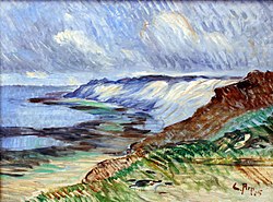
 Eugen Bracht Küste auf Sylt (Morsum-Kliff), 1897, Oil on canvas 61.5 cm × 50.5 cm (24+1⁄4 in × 20 in)
 -
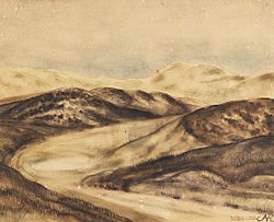
 Franz Korwan Winter auf Sylt, Oil on wood 24 cm × 38 cm (9+1⁄2 in × 15 in), without year
 -
 Carl Arp Küstenlandschaft auf Sylt (Morsumkliff) 1905, Oil on canvas 475 cm × 59.5 cm (187 in × 23+1⁄2 in), Museumsberg Flensburg
 -
 Wenzel Hablik Landschaft auf Sylt 1910, Oil on canvas, Museumsberg Flensburg
 -
 Andreas Dirks Munkmarschener Hafenansicht auf Sylt, 1922, Oil on canvas
 -
-
 Ingo Kühl Haus am Watt, 2015, Oil on canvas 150 cm × 200 cm (59 in × 78+3⁄4 in)


_anagoria.JPG)

.jpg)


Notable people
[edit]
- Dirk Meinerts Hahn (born 1804 in Westerland, Sylt – 1860) best known as the captain of the ship Zebra that he captained to South Australia
- Cornelius Jensen (1814 in Sylt – 1886) a Danish sea captain for 20 years; arriving in San Francisco in 1848, he became a rancher, a vintner and served as a California politician.
- Henriette Hirschfeld-Tiburtius (1834 in Sylt – 1911) the first female dentist in Germany
- Gustav Jenner (1865 in Keitum – 1920) a German composer, conductor and musical scholar and the only formal composition pupil of Johannes Brahms
- Hermann von der Lieth-Thomsen (1867–1942 in Sylt) a German military aviation pioneer, lived in Sylt from 1928
- Margarete Boie (1880 – 1946) a German author in the 1920s incorporating the history, landscape and people of Sylt
- Anita Rée (1885 – 1933) a German-Jewish painter, lived and worked here
- Heinz Reinefarth (1903 – 1979) a German SS commander during World War II and government official in West Germany after the war. During the Warsaw Uprising of August 1944 his troops committed numerous atrocities. After the war Reinefarth became the mayor of Westerland and member of the Schleswig-Holstein Landtag. The subject of the East German short documentary Holiday on Sylt (1959).
- Boy Lornsen (1922 in Keitum – 1995) a German sculptor and author of children's literature
- Dora Heldt (born Bärbel Schmidt, 1961 in Sylt) a German author
Transport
[edit]Sylt is connected to the German mainland by the Hindenburgdamm, a causeway with a railway line on top. The passenger trains connect Westerland (Sylt) to Niebüll or Klanxbüll, and the Deutsche Bahn's "Syltshuttle" as well as RDC's "Autozug Sylt", allow the transfer of cars and trucks between Westerland and Niebüll. There are also car ferry services to the nearby Danish island of Rømø, which offers a road connection to the mainland. Sylt Airport at Westerland serves the region.
In other media
[edit]The island was used during the filming of The Ghost Writer, as an alternate location for Martha's Vineyard, due to the film's director, Roman Polanski being unable to travel to the United States, due to an outstanding arrest warrant for rape. The ferry between the islands of Sylt and Rømø features prominently in the film.
See also
[edit]- Üüs Söl'ring Lön', insular anthem
- Heinz Reinefarth, a Nazi-German military officer. The "Butcher of Warsaw" became mayor of Westerland after World War II.
- St. Niels
- Uthlande
References
[edit]- ^ a b Kehl, H. "Entstehung der Insel Sylt im Laufe von 700 Jahren" (in German). Institute of Ecology, Technische Universität Berlin. Archived from the original on 28 December 2008. Retrieved 28 September 2008.
- ^ a b Thiede, J; K. Ahrendt (2000). "Klimaänderung und Küste – Fallstudie Sylt" (PDF) (in German). GEOMAR, University of Kiel. Archived from the original (PDF) on 6 October 2007. Retrieved 28 September 2008.
- ^ Landesamt für den Nationalpark Schleswig-Holsteinisches Wattenmeer, Umweltbundesamt, ed. (1998). Umweltatlas Wattenmeer (Wadden Sea environmental Atlas) (in German). Vol. I – Nordfriesisches und Dithmarscher Wattenmeer. Stuttgart. p. 38.
{{cite book}}: CS1 maint: location missing publisher (link) - ^ Müller, W. W.; Saathoff, F. (2015). "Geosynthetics in geoenvironmental engineering". Science and Technology of Advanced Materials. 16 (3) 034605. Bibcode:2015STAdM..16c4605M. doi:10.1088/1468-6996/16/3/034605. PMC 5099829. PMID 27877792.

- ^ Witte, J.-O.; Kohlhase, Sören, J. Radomski, P. Fröhle. "Fallstudie Sylt" (PDF) (in German). University of Rostock. Archived from the original on 10 August 2007.
{{cite web}}: CS1 maint: multiple names: authors list (link) - ^ Von Liebermann, Nicole. "Küstenschutz: Bisherige und zukünftige Maßnahmen" (PDF) (in German). Hamburg University of Technology. Archived from the original on 11 June 2007.
- ^ Daschkeit, Achim; Horst Sterr. "Küste, Ökologie und Mensch, Integriertes Küstenmanagement als Instrument nachhaltiger Entwicklung". In Bernhard Glaeser (ed.). Edition Humanökologie (PDF). Vol. 2. Deutsche Gesellschaft für Humanökologie. Archived from the original (PDF) on 27 November 2009. Retrieved 28 September 2008.
- ^ Daschkeit, Achim; Peter Schottes (2002). Klimafolgen für Mensch und Küste am Beispiel der Nordseeinsel Sylt (in German). Springer. ISBN 978-3-540-42569-4.
- ^ Bleck, Matthias. "Funktionale Bemessung künstlicher Riffe für aktiven und sanften Küstenschutz" (PDF). Stiftung deutscher Küstenschutz.[dead link]
- ^ Newig, J. "Sand auf Sylt" (PDF). University of Kiel. Archived from the original (PDF) on 5 July 2010. Retrieved 28 September 2008.
- ^ a b "Interessantes über die Braderuper Heide" (in German). Naturschutzgemeinschaft Sylt. Archived from the original on 17 February 2012.
- ^ "Morsum-Kliff" (in German). Naturschutzgemeinschaft Sylt. Archived from the original on 17 February 2012.
- ^ Klinge, Andreas (2003). "Die Amphibien und Reptilien Schleswig-Holsteins, Rote Liste" (PDF). 3rd version (in German). Schleswig-Holstein State Office for Nature and Environment. Archived (PDF) from the original on 19 July 2011. Retrieved 28 September 2008.
{{cite journal}}: Cite journal requires|journal=(help) - ^ Lohmann, M.; K. Haarmann (1989). Vogelparadiese (in German). Vol. 1 – Norddeutschland. Paul Parey. ISBN 3-490-16418-0.
- ^ "Tourimusstatistik 2005" (PDF) (in German). Town of Westerland. Archived from the original (PDF) on 15 August 2009. Retrieved 28 September 2008.
- ^ "List auf Sylt (climate chart)". Bernhard Mühr. 1 June 2007. Archived from the original on 11 October 2008. Retrieved 28 September 2008.
- ^ "Das Wetter auf Sylt: viel Sonne und eine frische Brise" [The Weather on Sylt: A lot of Sunshine and a fresh Breeze]. Zeit Reisen (in German). Retrieved 23 October 2012.
- ^ "Frei zugängliche Klimadaten" (in German). German Meteorological Service.
- ^ "CLimate Robot List/Sylt". WeatherOnline.co.uk. Archived from the original on 4 March 2016. Retrieved 17 September 2015.
- ^ "CLimate List/Sylt". dwd.de. Retrieved 13 August 2020.
- ^ "Sylt, Germany – Monthly weather forecast and Climate data". Weather Atlas. Retrieved 25 January 2019.[permanent dead link]
- ^ "Orte, Städte, Gemeinden im Landkreis Nordfriesland" (in German). Deutschland auf einen Blick. Archived from the original on 30 September 2008. Retrieved 29 September 2008.
- ^ "Westerland und Sylt-Ost fusionieren". Sylter Rundschau (in German). Schleswig-Holsteinischer Zeitungsverlag. 26 May 2008. Archived from the original on 16 February 2012.
- ^ "Der Fahrplan zur Teilfusion: So geht es jetzt weiter". Sylter Rundschau (in German). Schleswig-Holsteinischer Zeitungsverlag. 27 May 2008. Archived from the original on 16 February 2012.
- ^ Pahl, Max (1983). Hörnum. Heimat am Horn – Querschnitt und Streifzüge durch Geschichte, Leben und Landschaft des Nordseebades Hörnum auf Sylt (in German). Lunden: Verlagsdruckerei Schallhorn.
- ^ "First World War.com Day by day". First World War.com. Archived from the original on 25 March 2016. Retrieved 27 March 2016.
- ^ "Auschwitz: Inside the Nazi State. Auschwitz 1940–1945. Liberation & Revenge". PBS. Archived from the original on 27 August 2017. Retrieved 15 September 2017.
- ^ "PWA WORLD WINDSURFING TOUR: Detail".
- ^ Loxton, Richard (2019). "Why Germany's nudist culture remains refreshing". Bonn: Deutsche Welle. Retrieved 24 July 2021.
- ^ J. Booysen (1828), Beschreibung der insel Silt in geographischer, statistischer und historischer Rücksicht, pp. 5–6
External links
[edit]![]() Sylt travel guide from Wikivoyage
Sylt travel guide from Wikivoyage
| West Frisian Islands (Netherlands) |
|  | |||||
|---|---|---|---|---|---|---|---|
| East Frisian Islands (Germany) |
| ||||||
| Heligoland Bight (Germany) | |||||||
| North Frisian Islands (Germany) |
| ||||||
| Danish Wadden Sea Islands (Denmark) |
| ||||||
| International | |
|---|---|
| National | |
| Other | |
Geography
Location and physical characteristics
Sylt is the largest island among the North Frisian Islands, located in the Wadden Sea within Schleswig-Holstein, Germany, approximately 9 to 16 kilometers off the mainland coast.[9][2] The island spans 38 kilometers in a north-south orientation, with a total area of 99 square kilometers, and features a narrow, elongated profile varying from 0.4 to 8 kilometers in width.[2] It is connected to the mainland via the Hindenburgdamm, an 11-kilometer-long causeway that facilitates rail transport.[2] Geologically, Sylt formed as a Holocene barrier island from marine sands and glacial deposits, shaped by post-glacial sea-level rise and sediment dynamics in the Wadden Sea region.[10] Longshore drift and wave refraction contribute to its distinctive morphology, with the western coastline facing the North Sea characterized by approximately 40 kilometers of sandy beaches backed by dunes rising up to 30 meters in height.[11] Ongoing erosion on the exposed western shore and accretion on the sheltered eastern side into the Wadden Sea mudflats drive an eastward migration of the island at an average rate of 1-2 meters per year, as observed in long-term monitoring of barrier island systems.[12]Flora, fauna, and ecology
Sylt's dune ecosystems feature marram grass (Ammophila arenaria) as the primary stabilizer in foredunes, where its rhizomatous growth binds shifting sands against wind erosion.[13] In maturing grey dunes, marram coverage diminishes as acidic soils favor acid-tolerant successors like heather (Calluna vulgaris), reflecting successional dynamics observed in long-term dune surveys.[13] Adjacent salt marshes in the Wadden Sea, a UNESCO World Heritage site encompassing Sylt's tidal flats, support halophytic flora including sea lavender (Limonium vulgare) and glasswort (Salicornia spp.), which tolerate periodic inundation and high salinity.[14] These plant communities underpin over 2,300 flora and fauna species in the marshes alone.[15] Faunal diversity centers on marine mammals and avian migrants. Harbour seals (Phoca vitulina) and grey seals (Halichoerus grypus) haul out and breed along Sylt's western coasts, with aerial surveys in the adjacent Sylt Outer Reef documenting 50–150 harbour seals and established grey seal presence amid a regional population doubling from 2006 to 2017.[16] [17] The island hosts over 330 bird species annually, including migratory waterfowl staging in the Eastern German Bight, where the broader Wadden Sea supports 10–12 million individuals during peak seasons as a critical flyway hub.[18] Dune interiors shelter amphibians such as the natterjack toad (Epidalea calamita), which exploits temporary pools for breeding in this sandy matrix.[19] Ecological processes on Sylt balance dynamic tidal influences with anthropogenic pressures, including habitat fragmentation from infrastructure development. Conservation measures under the Schleswig-Holstein Wadden Sea National Park, established in 1985, prioritize habitat connectivity and monitoring to mitigate fragmentation effects, as evidenced by century-long datasets from the Alfred Wegener Institute's Wadden Sea Research Station in List. [19] These efforts reveal inherent resilience, such as dune remobilization aiding adaptation to sediment shifts, countering localized disruptions while preserving biodiversity hotspots.[20]Climate and environmental challenges
Sylt features a temperate maritime climate, with an annual mean temperature of approximately 9°C, ranging from 2°C in winter months to 18°C in summer. Precipitation averages 800-1000 mm annually, often accompanied by persistent cloud cover and fog due to the North Sea's influence. The island endures frequent strong winds, averaging 20-25 km/h, with storm gusts exceeding 100 km/h, as recorded at the List auf Sylt meteorological station.[21][22][23] Coastal erosion poses the primary environmental challenge, driven by tidal currents, wave refraction, and episodic storm surges that displace sediment volumes in the hundreds of thousands of cubic meters per event. The October 2023 storm surge, for example, eroded dunes and beaches, necessitating subsequent replenishment to restore profiles. These processes reflect the island's geological history as a dynamic barrier spit, formed through Holocene progradation interrupted by natural erosion phases, with the landform migrating eastward over millennia via longshore drift and overwash.[24][25][26] Such dynamics predate industrial-era CO2 emissions, as evidenced by medieval storm records causing comparable reshaping, underscoring tidal and meteorological forcings over anthropogenic attributions often amplified in academic narratives despite limited empirical linkage to global sea-level trends at this scale.[27][20] Adaptation relies on empirical, site-specific interventions like groynes, which interrupt longshore sediment transport to promote accretion, and beach nourishment, involving the annual deposition of up to two million cubic meters of dredged sand to counteract deficits. These measures have sustained shoreline stability since the 1980s, with nourishment volumes correlating directly to observed erosion rates rather than projected global model outputs, which frequently overestimate local hydrodynamic responses.[28][29][25] Localized monitoring and engineering thus prioritize causal tidal mechanics over broader, less verifiable climate projections.[30]History
Prehistoric and early settlement
The island of Sylt, formed from glacial moraine deposits following the retreat of the Weichselian ice sheet around 15,000 years ago, shows no definitive archaeological evidence of Mesolithic occupation specific to the site, though regional North Sea coastal hunter-gatherer activity, including potential shell midden exploitation, likely extended to nearby barrier islands by circa 6000 BCE as sea levels stabilized.[31][32] Human settlement intensified during the Neolithic period, with up to 77 megalithic graves documented across Sylt, Föhr, and Amrum, reflecting early farming communities that exploited fertile salt marshes for agriculture and pasturage amid post-glacial landscape stabilization.[32] These monuments, dating to approximately 3500–2500 BCE, indicate organized land use and ritual practices adapted to the emerging coastal ecology, where Neolithic migrants introduced domesticated crops and livestock to counter sporadic inundations.[32] In the late Neolithic to early Bronze Age (circa 2500–1700 BCE), Bell Beaker culture sites at Archsum reveal contemporaneous graves and domestic settlements, with burial proximity to living areas suggesting ancestral ties and resource management in a dynamic dune-and-marsh environment.[31] Approximately 1,000 Bronze Age barrows in the vicinity further attest to population expansion and territorial assertion through mound-building, leveraging elevated geest ridges for defense against rising tides.[32] By the Iron Age (circa 800 BCE–0 CE), proto-Frisian groups established permanent villages, constructing Warften—artificial earthen mounds akin to terps in adjacent Frisian regions—as causal responses to frequent storm surges and marsh flooding, elevating habitations above tidal reach for sustained agro-pastoralism.[33][34] These adaptations, verified through regional stratigraphic analyses, enabled exploitation of saline grasslands without diking, while North Sea proximity fostered early trade in amber along coastal routes linking Baltic sources to continental interiors.[35][33]Medieval to modern developments
Sylt, as part of the Duchy of Schleswig, fell under Danish rule from the medieval period, with the island's Frisian communities governed through feudal structures tied to the Danish crown and the County of Holstein. This arrangement persisted until the Second Schleswig War of 1864, when Prussian and Austrian forces defeated Denmark, leading to the occupation of Schleswig-Holstein; subsequent Prussian victory in the Austro-Prussian War of 1866 resulted in full annexation by Prussia, integrating Sylt into the Province of Schleswig-Holstein.[36][37] The post-World War I plebiscites of 1920, divided into northern and southern zones per the Treaty of Versailles, saw the southern zone—including Sylt—vote by a majority to remain German, with results confirming Prussian/German sovereignty over the area while the north rejoined Denmark.[38][39] Nineteenth-century engineering efforts focused on embankments and wooden groynes to combat relentless coastal erosion, enabling limited land reclamation and stabilization of the island's dunes and marshes against North Sea forces.[40][1] These measures addressed causal vulnerabilities from sediment dynamics and storm surges, preserving habitable areas amid ongoing morphological shifts. The Hindenburgdamm, constructed between 1923 and 1927 using over three million cubic meters of sand and clay, established an 11-kilometer rail causeway to the mainland, replacing ferry dependence and enabling reliable year-round access that transformed logistical chains.[41][42] World War II saw Sylt utilized for Luftwaffe airfields and defenses, yet the island sustained negligible structural damage from combat, owing to its peripheral strategic role. Post-1945, under Allied occupation transitioning to West German administration, infrastructural continuity supported rebound from wartime constraints, with the causeway facilitating material flows essential for stabilization.[43]Rise as a tourism destination
In the mid-19th century, tourism emerged on Sylt as Westerland developed into a seaside spa destination, promoted for its salubrious North Sea air and bathing facilities that appealed to affluent Germans seeking health cures.[44][45] A Hamburg physician is credited with popularizing the island's benefits, drawing initial visitors via steamer from the mainland to Westerland's nascent promenades and bathhouses, which catered to the emerging bourgeois and aristocratic classes following Prussia's annexation of Schleswig-Holstein in 1864.[44] By the 1890s, Westerland had supplanted Keitum as the island's primary resort hub, with villa constructions and improved amenities reflecting market demand from elite vacationers rather than state intervention. The completion of the Hindenburgdamm causeway in 1927 revolutionized access by linking Sylt directly to the mainland rail network, reducing travel time and costs compared to prior ferry dependencies, thereby accelerating tourist inflows and enabling Westerland's expansion as a year-round leisure center. This infrastructure, driven by private investment and engineering feasibility rather than subsidies, facilitated the construction of grand hotels and boarding houses, solidifying Sylt's reputation among Germany's upper echelons for relaxed seaside retreats amid dunes and beaches.[46] Following World War II, Sylt experienced a pronounced tourism surge during West Germany's economic recovery, with visitor numbers swelling as domestic affluence grew; by the late 1950s, the island attracted international attention when figures like playboy Gunter Sachs introduced it to the global jet set in the 1960s, prompting a wave of celebrity sightings and high-end developments.[47] This era saw proliferation of luxury villas, boutique hotels, and private estates in areas like Kampen, fueled by organic demand for Sylt's unspoiled natural assets—40 kilometers of fine white sands and tidal mudflats—without reliance on government incentives, as entrepreneurs capitalized on the island's exclusivity.[47] By 2000, annual overnight stays on Sylt approached 1.5 million, reflecting a peak in market-led growth that underscored the island's draw as a premium destination independent of broader subsidies, with tourism revenues sustained by its geographic isolation and scenic endowments.[48] This expansion prioritized private-sector innovations in hospitality, transforming Sylt from a niche spa outpost into a symbol of elite leisure.[48]Demographics and Society
Population composition and Frisian heritage
As of December 31, 2023, the municipality of Sylt had a permanent resident population of 13,679, reflecting a slight decline from prior years amid low natural growth.[49] The demographic profile features an aging population, with average ages of approximately 47 for males and 50 for females as of recent surveys, contributing to a median age around 48 and underscoring challenges from below-replacement fertility rates typical of rural German coastal areas.[50] This resident base expands significantly during peak tourist seasons, with visitor numbers often tripling the year-round figure through summer influxes that strain local infrastructure but bolster economic activity.[51] Sylt's ethnic composition remains predominantly German, with a small but historically rooted North Frisian minority preserving elements of indigenous heritage amid broader assimilation trends. North Frisians, native to the island and adjacent coastal regions, number fewer than 10,000 active speakers across their dialects island-wide, constituting under 10% of Sylt's populace.[52] The local Söl'ring dialect, specific to central and southern Sylt, is spoken fluently by only a few hundred individuals, primarily older generations, with daily use confined to familial and folkloric contexts rather than public life. Linguistic surveys indicate ongoing decline due to intergenerational transmission gaps, though cultural markers like traditional folklore, seafaring customs, and place names sustain Frisian identity without formal revival mandates.[53] Migration patterns favor inflows from mainland Germany, particularly affluent retirees and professionals seeking second homes, reinforcing ethnic and cultural homogeneity over diverse integration. Foreign-born residents remain minimal, with official data showing limited non-German origins compared to urban centers, as the island's high living costs and isolation deter broader settlement.[54] This continuity reflects voluntary demographic stability rather than policy-driven changes, preserving a cohesive Frisian-German core despite tourism's transient pressures.[55]Settlements and community structure
Sylt's settlements are distributed across multiple municipalities and villages, forming a single administrative entity under the broader Gemeinde Sylt umbrella, which encompasses the majority of the island's populated areas and serves as the central governing body.[5] Westerland functions as the administrative hub and largest settlement, accommodating a significant portion of the island's year-round population estimated at around 14,167 for the core municipality in 2024, with Westerland itself supporting commercial and residential density conducive to its role in local administration.[54] Kampen, situated nearby on the west coast, contrasts with clusters of luxury estates and upscale residences, reflecting targeted development for affluent seasonal use rather than dense year-round habitation.[5] Keitum, on the eastern side, preserves traditional Frisian architecture through clusters of thatched-roof farmhouses and captain's houses, maintaining a rural aesthetic amid protected zoning that limits modern expansion.[7] The west coast hosts tourism-oriented settlements like List at the northern tip, featuring a functional harbor that supports fishing and small-scale maritime activities, alongside beachfront infrastructure drawing seasonal visitors.[5] These areas exhibit higher development density, with zoning aligned to accommodate visitor facilities while buffering against erosion through engineered groynes and dunes. In empirical contrast, eastern settlements such as Tinnum, Archsum, Morsum, and Munkmarsch remain quieter, oriented toward low-impact agriculture and nature reserves, where land-use regulations enforce rural preservation to sustain ecological buffers against the Wadden Sea.[5] This coastal-inland divide—west facing the open North Sea versus east abutting tidal flats—drives distinct community patterns, with western zones prioritizing adaptive infrastructure for exposure to storms and tides, as evidenced by historical shoreline shifts of up to 13 km eastward over 7,000 years.[56] Community structure relies on localized governance through municipal councils within the Gemeinde Sylt framework, headquartered in Westerland's town hall, which handles island-wide services like address registration and lost property while delegating village-specific matters to sub-local bodies.[57] This setup fosters self-reliance, as councils manage zoning and maintenance independently of federal overreach, drawing on Frisian traditions of communal decision-making to balance tourism pressures with habitat protection in a UNESCO-recognized biosphere.[58] Elected officials, such as the independent mayor Nikolas Häckel for key areas, oversee operations emphasizing practical autonomy in an isolated setting prone to environmental autonomy.[59]Economy
Tourism as primary driver
Tourism serves as the dominant economic engine for Sylt, drawing affluent visitors primarily from Germany, Scandinavia, and other European nations to its coastal landscapes and luxury amenities. The island records approximately 4.8 million overnight stays annually, as evidenced by 2024 figures showing 4.79 million stays, a 0.6% increase from the prior year, underscoring sustained demand despite seasonal fluctuations.[60] This influx supports a vast array of over 1,000 registered accommodations, encompassing hotels, guesthouses, apartments, and private vacation rentals, which cater to varying budgets while emphasizing high-end exclusivity.[61]  portrays the eroding red cliffs at Morsum with vivid detail, highlighting geological features formed by tidal forces and wind erosion over millennia. Similarly, Carl Arp's 1905 painting Küstenlandschaft auf Sylt (Morsumkliff) depicts the same site, focusing on the interplay of sea, sky, and land to evoke isolation and elemental power, now housed in the Museumsberg Flensburg collection._anagoria.JPG) These early depictions, among the first by German painters like Eugen Dücker and Bracht, established Sylt as a motif for artistic exploration of northern European wilderness.[81] Subsequent artists extended this tradition into the 20th century, with Wenzel Hablik's 1910 Landschaft auf Sylt rendering dune vistas in Museumsberg Flensburg, and Anita Rée's 1932/33 watercolor Die Oase in Kampen illustrating the village's architectural integration with the landscape.[82] In literature, Sylt features as a backdrop for themes of affluence and detachment in works like Christian Kracht's 1995 novel Faserland, where the island symbolizes elite disconnection amid its protagonist's aimless travels.[83] Crime fiction series, such as the Mamma Carlotta books, exploit Sylt's scenic contrasts to underscore hidden social frictions beneath its tourist facade.[84] Film representations often utilize Sylt's isolated shores for atmospheric tension, as in F.W. Murnau's 1922 Nosferatu, which incorporated exterior shots from the island to evoke eerie northern desolation standing in for Transylvanian wilds.[85] Roman Polanski's 2010 The Ghost Writer employed Sylt's harbors for key scenes, enhancing the narrative's sense of seclusion and intrigue.[86] Such portrayals in media and art have empirically bolstered Sylt's allure as a cultural icon, driving tourism through branded imagery of preserved natural heritage while risking commodification that prioritizes aesthetic idealization over ecological realities.[87]Freikörperkultur and nude beach traditions
Freikörperkultur (FKK), or "free body culture," emerged in Germany during the late 19th century as a naturist movement emphasizing physical health, body acceptance, and communion with nature through non-sexual nudity. On Sylt, the practice gained prominence with the establishment of Germany's first official nude beach in 1920 near Kampen, marking a shift from segregated bathing norms at the century's start to designated zones promoting voluntary nudity.[88][89] This aligned with broader FKK ideals originating in the German Empire, where early proponents advocated nudity for hygienic and psychological benefits amid industrialization's stresses.[90] By the 1970s, legal tolerances expanded, with large portions of Sylt's 40-kilometer coastline—estimated at over 80% in practice through unmarked or designated FKK areas—permitting nudity without formal prohibition, reflecting Germany's decentralized approach where local authorities designate zones but rarely enforce against consensual adult exposure.[89] Post-World War II, FKK participation surged as a reaction to wartime repression, peaking in cultural acceptance during the mid-20th century; surveys indicate 8 to 12 million Germans still engage annually in summer, though representing roughly 10-15% of the population and declining among younger cohorts due to shifting social norms.[91] Proponents frame it as advancing personal liberty and body positivity, citing empirical links to improved vitamin D synthesis via skin exposure to UVB rays, which supports bone health, immune function, and reduced inflammation risks—causal effects verified in controlled studies showing serum 25(OH)D levels rising proportionally with safe sun exposure durations of 10-30 minutes several times weekly.[92][93] Critics, including some conservative voices and reports of youth disinterest, argue public nudity risks normalizing exposure in mixed settings, potentially eroding privacy norms, though data on conflicts remains sparse and indicates low incidence rates, with incidents often stemming from clothed interlopers rather than nudists themselves—such as rare harassment cases prompting targeted enforcement in places like Rostock but not broadly on Sylt.[94][95] Overall, Sylt's FKK tradition persists as a voluntary, low-conflict practice, sustained by cultural inertia despite membership drops in organized clubs from 100,000 in the 1980s to under 30,000 today.[96][91]Social norms and elite exclusivity
Sylt's social fabric reflects its status as a premium destination, where high household incomes— with a substantial share exceeding €5,000 monthly—draw entrepreneurs, celebrities, and affluent professionals seeking seclusion and refined leisure.[97] This economic profile fosters norms of discretion among the elite, prioritizing privacy over overt displays of wealth; for instance, visitors and part-time residents favor low-key luxury, such as private yachting or patronage of upscale yet unpretentious establishments in areas like Kampen, where average taxable incomes reach €243,000 annually per filer. [98] Such customs align with causal incentives for high earners to maintain exclusivity, as market-driven property prices—often surpassing €10,000 per square meter in prime locations—self-select for those able to afford the lifestyle without reliance on coercive policies. The island's housing stock underscores this exclusivity, with approximately 40% of units comprising second homes or vacation properties, largely owned by non-island residents who utilize them seasonally.[99] This pattern yields tangible benefits for permanent locals through tourism's economic multiplier effects, including job creation in hospitality and retail—where visitor spending sustains over 15,000 seasonal positions—and generates substantial tax revenue from second-home levies, totaling nearly €10 million in 2021 alone.[100] [98] Yet, the resultant high living costs exacerbate housing shortages for lower-wage islanders and fuel perceptions of exclusion among mainland underclasses, who view Sylt's barriers as emblematic of broader income disparities rather than outcomes of voluntary market signaling.[101] From a first-principles perspective, this segregation proves efficient, as affluent individuals' preferences for homogeneous environments minimize coordination costs and conflicts arising from divergent norms, evidenced by persistent demand despite alternatives; forced subsidization or integration would likely elevate opportunity costs for all parties without commensurate gains in social cohesion or economic output. Empirical data on sustained villa appreciation and tourism revenues affirm that such voluntary clustering enhances overall welfare by channeling resources to high-value uses, rather than diluting them through egalitarian mandates.[97][99]Controversies and Debates
Migration-related sentiments and public incidents
In May 2024, a video recorded at the Pony Club nightclub in Kampen on Sylt captured a group of affluent young Germans, estimated to be in their early 20s, chanting "Deutschland den Deutschen, Ausländer raus" ("Germany for the Germans, foreigners out") to the tune of Gigi D'Agostino's "L'Amour Toujours," while one participant raised an arm in a gesture resembling a Nazi salute.[102] [103] The clip, leaked anonymously and shared widely on social media platforms like TikTok and Instagram, depicted around 10-15 individuals from privileged backgrounds, including heirs to family fortunes, amid a setting of champagne consumption and luxury attire.[104] The incident triggered immediate national outrage, with Chancellor Olaf Scholz labeling the chants "disgusting" and a manifestation of right-wing extremism incompatible with democratic values.[103] Mainstream media outlets, including public broadcasters ARD and ZDF, portrayed the event as evidence of latent neo-Nazi sentiments infiltrating elite circles, drawing parallels to Alternative for Germany (AfD) rhetoric and historical Nazi slogans.[102] [104] Conservative commentators, however, contextualized the outburst as a raw expression of frustration disconnected from organized ideology, attributing it to the socioeconomic insulation of Sylt's vacationing youth from mainland Germany's migration pressures, such as overcrowded asylum facilities and localized spikes in violent incidents.[105] Police investigations by Schleswig-Holstein authorities identified nine suspects through facial recognition and witness statements, leading to initial charges of incitement to hatred and use of symbols of unconstitutional organizations.[106] By April 2025, however, prosecutors dropped charges against eight individuals, citing insufficient evidence of criminal intent or coordination with extremist groups, with only one 20-year-old man fined €7,800 for the Nazi salute gesture.[106] This outcome underscored the spontaneous nature of the chants rather than premeditated radicalism, amid broader empirical data on migration: Germany processed approximately 2.1 million first-time asylum applications from 2015 to 2023, predominantly from Syria, Afghanistan, and Iraq, straining integration systems.[107] [108] Federal Criminal Police Office (BKA) statistics reveal non-German nationals, representing about 15% of the population in 2023, comprised 41% of suspects in violent crimes, including a disproportionate involvement in knife attacks and sexual offenses, which has amplified public anxieties over causal links between unchecked inflows and urban insecurity.[109] [110] On Sylt, an island with minimal direct migrant presence due to its remote, high-cost profile, such sentiments highlight a perceptual disconnect: residents and visitors, buffered from continental hotspots like Berlin or Cologne where asylum-related incidents peaked (e.g., 2023 Solingen stabbing by a Syrian rejectee), occasionally erupt in unfiltered nationalism when national debates intrude on insular leisure.[109] While left-leaning analyses in outlets like Der Spiegel emphasized ideological toxicity, empirical reviews suggest these isolated vocalizations stem from data-driven realism about integration failures rather than inherent prejudice, with no subsequent organized incidents reported on the island.[104][106]Protests, class tensions, and political polarization
In July 2024, left-wing punks and activists from across Germany established a third consecutive summer protest encampment on Sylt, organized as "Aktion Sylt" to challenge perceived economic exclusion, far-right ideologies, and environmental neglect. The camp, comprising around 30 tents on a meadow in Tinnum near Westerland, operated from mid-July until September 1, drawing participants who decried the island's status as a playground for the wealthy amid broader critiques of capitalism and social inequality.[111][112][113] The action spotlighted class tensions, with encampment organizers arguing that Sylt's luxury pricing—such as hotel rooms frequently surpassing €500 per night in peak season—reinforces barriers that sideline lower-income groups, framing the island as a symbol of entrenched elitism.[114][115] Conservative respondents and local property advocates rebutted these claims by upholding market principles and private ownership, asserting that high costs stem from voluntary demand and supply dynamics rather than deliberate exclusion, and that no individual is entitled to subsidized access to private leisure spaces. Detractors further highlighted inconsistencies in the protesters' position, noting their initial mobilization via state-subsidized low-cost travel like the 2022 nine-euro public transport ticket, which enabled affordable access to the remote island for demonstrations against wealth concentration.[116] These confrontations amplified political polarization, aligning with national surges in support for the Alternative for Germany (AfD), which polled consistently above 20% in 2024 state elections and led national surveys by September 2025 on platforms emphasizing border enforcement and cultural preservation. While activists positioned their disruption as a bulwark against rising nationalism, the encampments evoked backlash from residents prioritizing legal order and economic self-determination, revealing fault lines between interventionist activism and preferences for controlled access that echo AfD critiques of unchecked openness in migration and social policy.[117][118]Infrastructure and Transport
Access via causeway, rail, and air
The Hindenburgdamm, an 11-kilometer rail causeway completed in 1927, provides the only fixed connection between Sylt and the mainland at Niebüll in Schleswig-Holstein, enabling both regional and long-distance passenger trains operated by Deutsche Bahn as well as the Autozug service for vehicle transport on flatcar shuttles. This infrastructure handles the majority of inbound traffic, with car shuttles accommodating up to 700 vehicles per train during peak periods, thereby restricting direct automotive access and contributing to controlled visitor volumes that support the island's exclusivity without expansive bridge developments.[119] Air access occurs primarily through Sylt Airport (GWT/EDXW), located near Westerland, which specializes in seasonal charter flights from hubs like Hamburg, Munich, and Düsseldorf, alongside private jet operations; the facility processed 119,763 passengers in its latest reported full-year statistics, reflecting a 17.4% increase from the prior period amid summer tourism surges.[120] The airport's short 2,000-meter runway limits scheduled commercial service to smaller aircraft, reinforcing reliance on charters that align with Sylt's premium profile while avoiding mass carrier influxes. A vehicle ferry alternative operates via the FRS Syltferry from Havneby on Denmark's Rømø island to List harbor at Sylt's northern end, with up to 32 daily crossings each way year-round, each lasting approximately 40-50 minutes and carrying cars, campers, and foot passengers for fares starting at €8 per person. This route, established in 1963, circumvents causeway bottlenecks—such as Autozug wait times exceeding hours in high season—offering flexibility amid occasional Wadden Sea weather disruptions, though it requires navigating Denmark's free Rømø causeway from the mainland.[121]Internal infrastructure and challenges
Sylt's internal transportation infrastructure features a sparse road network suited to its elongated, low-density geography spanning 99 km², with priority given to non-motorized mobility through an extensive 250 km cycling path system that links all island communities and promotes sustainable local travel.[122] Water utilities draw primarily from local groundwater aquifers, extracted and treated by the Energieversorgung Sylt GmbH (EVS) in collaboration with regional providers, delivering high-purity drinking water across the island's settlements without reliance on seawater desalination.[123][124] Electricity distribution connects via the Hindenburgdamm to the mainland grid, with supplementary input from proximate North Sea offshore wind installations like Butendiek (288 MW capacity, located 30 km west), though insularity exposes the system to storm-induced disruptions.[125] A full island-wide outage occurred in May 2014 due to technical failure, while severe weather events, such as the October 2024 storm with gusts reaching 170 km/h, have repeatedly threatened overhead lines and coastal substations.[126][127] Despite these vulnerabilities, the integrated German grid achieves exceptional reliability, with availability exceeding 99.999% annually, enabling consistent support for Sylt's high-end residential and tourism demands through redundant mainland ties and localized reinforcements.[128] Ongoing adaptations emphasize resilient coastal engineering, including groynes and dunes to mitigate erosion and flooding from North Sea surges, countering the erosive forces amplified by the island's exposed position.[129]Notable People
Long-term residents
Jürgen Gosch exemplifies self-made entrepreneurship among Sylt's long-term business figures, having launched his fish-selling venture on the island in 1967 after initial work as a crab peeler. By 1972, he established his first permanent stall in List harbor, expanding into a chain focused on fresh North Sea seafood that now includes multiple outlets and has shaped local gastronomy and tourism. Gosch, who continues to work at his Sylt locations into his 80s, built the operation from modest beginnings without inherited wealth, achieving millionaire status through direct engagement with the island's fishing traditions.[130][131][132] Multi-generational family businesses also anchor Sylt's economy, such as WEGST SYLT, founded in 1896 as a family enterprise specializing in jewelry, watches, souvenirs, and fashion. Now in its fourth generation, the firm maintains deep roots in the island's retail sector, adapting to tourism demands while preserving commercial continuity amid seasonal fluctuations.[133][134] The König family similarly contributes through their hospitality ventures, with Ole König leading the third-generation operation of König-Sylt properties as of recent years, emphasizing island-specific accommodations that support year-round economic stability.[135] Among cultural contributors, natives like writer Boy Lornsen (1922–1995), born in Keitum, drew on Sylt's environment for works including scripts for the German series Tatort, embedding local motifs in broader literature and media. Historical preservation efforts tie into long-term residency, as seen with families like the Jacobsens, traceable to the 18th century and involved in enduring island trades that sustain Frisian maritime and agrarian customs against modernization pressures.[136]Famous visitors and cultural figures
The Nobel Prize-winning author Thomas Mann visited Sylt in 1928, spending time in Kampen where the island's coastal landscapes inspired elements of his prose, including reflections on the North Sea's dynamic environment.[137] During this stay, Mann frequented locations like Haus Kliffende, using the seclusion for writing amid the dunes and cliffs.[138] His documented week-long vacation contributed to Sylt's early literary allure, drawing subsequent intellectuals without establishing permanent ties. In the late 1960s, wealthy industrialist and playboy Gunter Sachs arrived on Sylt, initiating a wave of high-profile tourism that elevated the island's status as a jet-set destination. Sachs's visits, often with his then-wife Brigitte Bardot, introduced extravagant nightlife and celebrity sightings, fostering Germany's first nude beach culture while amplifying media attention on Kampen's exclusivity.[47] This transient influx, including tennis star Boris Becker and actor Kevin Costner in later decades, generated soft power for local tourism through anecdotes and press coverage, though critics note it prioritized short-term hype over sustainable cultural depth.[139] Former German Chancellor Helmut Kohl made a public appearance on Sylt during the 1998 federal election campaign, visiting Westerland on July 29 to engage voters at the Kurpromenade and Weststrandhalle, where he sampled local crabs amid CDU events.[140] Such political visits underscored Sylt's role as a neutral, scenic backdrop for transient elite gatherings, enhancing its visibility without implying residency. Earlier 20th-century figures like actress Marlene Dietrich also vacationed there, reinforcing the island's pre-war appeal to international cultural icons seeking North Sea retreats.[141]References
- https://commons.wikimedia.org/wiki/Category:Sylt_in_art