

Community hub
Recent from talks
Contribute something
Nothing was collected or created yet.
Tingri County
View on Wikipedia
Key Information

.png)


| Tingri County | |||||||
|---|---|---|---|---|---|---|---|
| Chinese name | |||||||
| Simplified Chinese | 定日县 | ||||||
| Traditional Chinese | 定日縣 | ||||||
| |||||||
| Tibetan name | |||||||
| Tibetan | དིང་རི་རྫོང་། | ||||||
| |||||||
Tingri County (Tibetan: དིང་རི་རྫོང་།; simplified Chinese: 定日县; traditional Chinese: 定日縣; pinyin: Dìngrì Xiàn) is a county under the administration of the prefecture-level city of Shigatse in the Tibet Autonomous Region of China.[2]
The county comprises the upper valley of the Bum-chu or Arun River, with the valleys of its tributaries, the valleys of the Rongshar Tsangpo and the Lapchi Gang Tsangpo which flow south into Nepal. It is bordered on the south by the main range of the Himalayas, including Mount Everest (Tib. Jomolangma), Makalu and Cho Oyu. The present county administration is located at Shelkar, about 87 km (54 mi) east of Tingri (town).[3]
Tingri is one of the four counties (the other three being Dinjie, Nyalam, and Kyirong) that comprise the Qomolangma National Nature Preserve,[4] a protected area spanning 3.381 million hectares.
Toponymy
[edit]Tingri County is named after a nearby hill, which itself is reportedly named after the sound a falling stone made when it hit the hill.[5]
History
[edit]Shelkar Dzong was built in the area of the present-day county during the time of the Kashag.[5]
In 1960, Tingri County was established, and in June of that year, a local county government was established.[5] The county headquarters were originally established in Shelkar, but were moved to Gangga in August.[5] In July 1968, the local government moved back to Shelkar, where it remains today.[5]
In 1992, the county was added to the Qomolangma National Nature Preserve.[6]
On 7 January 2025 at 09:05 CST (UTC+8), an earthquake measuring Mw 7.1 or Ms 6.8 struck Tingri County. Several villages experienced near-total destruction and at least 126 people died and hundreds more were injured.[7]
Geography
[edit]Dingri County is a county under the jurisdiction of prefecture-level city of Shigatse. It is located in the southern part of the Tibet Autonomous Region and the south-central part of Shigatse.[6] It borders Dinggyê County and Sa'gya County to the east, Nyalam County to the west, Ngamring County to the north, Lhatse County to the northeast, and Nepal to the south.[6] It is 115 kilometres (71 mi) long from east to west and 152 kilometres (94 mi) wide from north to south, with a total area of about 14,000 square kilometres (5,400 sq mi).[6]
Tingri County is located at the northern foot of the middle section of the Himalayas, and at the northern foot of Mount Everest.[6] The county's landscape is extremely mountainous, with an average altitude of more than 5,000 metres (16,000 ft) above sea level, and the county seat situated at an altitude of 4,300 metres (14,100 ft) above sea level.[6] The world's highest peak, Mount Everest, and the world's sixth-highest mountain, Cho Oyu, are located in the county.[6]
The Arun River flows eastward out of the country.[6]
Climate
[edit]According to the Köppen Climate Classification Tingiri County's climate is a semi-arid climate (BSk) with large temperature differences between day and night, a high amount of sunshine hours, and little annual precipitation. On January 7, 1966, Tingri County recorded the lowest temperature ever recorded in Tibet at −46.4 °C (−51.5 °F).[6]
| Climate data for Tingri, elevation 4,300 m (14,100 ft), (1991–2020 normals, extremes 1981–2020) | |||||||||||||
|---|---|---|---|---|---|---|---|---|---|---|---|---|---|
| Month | Jan | Feb | Mar | Apr | May | Jun | Jul | Aug | Sep | Oct | Nov | Dec | Year |
| Record high °C (°F) | 14.7 (58.5) |
15.3 (59.5) |
18.7 (65.7) |
20.8 (69.4) |
23.8 (74.8) |
25.1 (77.2) |
25.8 (78.4) |
23.4 (74.1) |
22.9 (73.2) |
20.2 (68.4) |
17.3 (63.1) |
14.6 (58.3) |
25.8 (78.4) |
| Mean daily maximum °C (°F) | 3.7 (38.7) |
5.1 (41.2) |
8.3 (46.9) |
11.9 (53.4) |
16.1 (61.0) |
20.2 (68.4) |
19.5 (67.1) |
18.2 (64.8) |
17.5 (63.5) |
13.3 (55.9) |
8.8 (47.8) |
5.8 (42.4) |
12.4 (54.3) |
| Daily mean °C (°F) | −6.4 (20.5) |
−4.4 (24.1) |
−0.8 (30.6) |
3.1 (37.6) |
7.6 (45.7) |
12.1 (53.8) |
12.6 (54.7) |
11.6 (52.9) |
10.1 (50.2) |
4.0 (39.2) |
−1.6 (29.1) |
−5.2 (22.6) |
3.6 (38.4) |
| Mean daily minimum °C (°F) | −16.1 (3.0) |
−14.1 (6.6) |
−10.1 (13.8) |
−5.4 (22.3) |
−0.2 (31.6) |
5.2 (41.4) |
7.4 (45.3) |
6.9 (44.4) |
4.1 (39.4) |
−4.2 (24.4) |
−10.9 (12.4) |
−14.9 (5.2) |
−4.4 (24.1) |
| Record low °C (°F) | −46.4 (−51.5) |
−25.3 (−13.5) |
−19.0 (−2.2) |
−14.0 (6.8) |
−8.3 (17.1) |
−4.0 (24.8) |
1.4 (34.5) |
0.2 (32.4) |
−4.1 (24.6) |
−12.3 (9.9) |
−19.0 (−2.2) |
−32.6 (−26.7) |
−46.4 (−51.5) |
| Average precipitation mm (inches) | 1.0 (0.04) |
0.7 (0.03) |
0.6 (0.02) |
2.6 (0.10) |
9.1 (0.36) |
23.0 (0.91) |
108.4 (4.27) |
116.7 (4.59) |
27.1 (1.07) |
1.7 (0.07) |
0.9 (0.04) |
0.5 (0.02) |
292.3 (11.52) |
| Average precipitation days (≥ 0.1 mm) | 0.9 | 0.8 | 0.8 | 1.5 | 3.4 | 6.7 | 16.4 | 17.8 | 7.5 | 0.8 | 0.2 | 0.3 | 57.1 |
| Average snowy days | 1.3 | 1.7 | 2.7 | 4.6 | 4.3 | 0.3 | 0.1 | 0.2 | 0.4 | 1.0 | 0.4 | 0.6 | 17.6 |
| Average relative humidity (%) | 27 | 27 | 29 | 34 | 40 | 48 | 59 | 64 | 56 | 41 | 34 | 28 | 41 |
| Mean monthly sunshine hours | 281.1 | 262.5 | 300.2 | 300.2 | 327.7 | 289.6 | 222.0 | 220.0 | 261.6 | 310.2 | 292.9 | 286.5 | 3,354.5 |
| Percentage possible sunshine | 86 | 82 | 80 | 77 | 78 | 70 | 52 | 55 | 72 | 89 | 92 | 90 | 77 |
| Source: China Meteorological Administration[8][9] all-time extreme temperature[10]NOAA[11] | |||||||||||||
Administrative divisions
[edit]Tingri County is divided into 2 towns and 11 townships.
| Name | Chinese | Hanyu Pinyin | Tibetan | Wylie | ||
|---|---|---|---|---|---|---|
| Towns | ||||||
| Shelkar | 协格尔镇 | Xiégé'ěr zhèn | ཤེལ་དཀར་གྲོང་རྡལ། | shel dkar grong rdal | ||
| Gangga | 岗嘎镇 | Gǎnggā zhèn | སྒང་དགའ་གྲོང་རྡལ། | sgang dga' grong rdal | ||
| Townships | ||||||
| Tashi Dzom Township | 扎西宗乡 | Zhāxīzōng xiāng | བཀྲ་ཤིས་འཛོམས་ཤང་། | bkra shis 'dzoms shang | ||
| Ronxar Township | 绒辖乡 | Róngxiá xiāng | རོང་ཤར་ཤང་། | rong shar shang | ||
| Qutang Township | 曲当乡 | Qǔdāng xiāng | ཆུ་ཐང་ཤང་། | chu thang shang | ||
| Cogo Township | 措果乡 | Cuòguǒ xiāng | མཚོ་སྒོ་ཤང་། | mtsho sgo shang | ||
| Qulho Township | 曲洛乡 | Qǔluò xiāng | ཆུ་ལྷོ་ཤང་། | chu lho shang | ||
| Chamco Township | 长所乡 | Zhǎngsuǒ xiāng | གྲམ་མཚོ་ཤང་། | gram mtsho shang | ||
| Nyixar Township | 尼辖乡 | Níxiá xiāng | ཉི་ཤར་ཤང་། | nyi shar shang | ||
| Zagor Township | 扎果乡 | Zhāguǒ xiāng | རྩ་སྐོར་ཤང་། | rtsa skor shang | ||
| Kaimar Township | 克玛乡 | Kèmǎ xiāng | གད་དམར་ཤང་། | gad dmar shang | ||
| Pain'gyi Township | 盆吉乡 | Pénjí xiāng | ཕན་སྐྱིད་ཤང་། | phan skyid shang | ||
| Gyaco Township | 加措乡 | Jiācuò xiāng | བརྒྱ་ཚོ་ཤང་། | brgya mtsho shang | ||
Demographics
[edit]Per the 2020 Chinese Census, Tingri County has a population of 58,173,[1] up from the 50,818 recorded in the 2010 Chinese Census.[5] The 2000 Chinese Census recorded a population of 46,585.[5]
Economy
[edit]Agriculture and pastoralism are major sources of employment in Tingri County.[6]
Transport
[edit]Gallery
[edit]-
![Dampa Sangye, author of the Tingri One Hundred[12][13][14] and founder of Tingri Langkhor[15]](//upload.wikimedia.org/wikipedia/commons/thumb/9/94/Padampa_Sanggye.jpg/120px-Padampa_Sanggye.jpg)
-
![Machig Labdrön (1055–1149), student of Padampa Sanggye at Tingri Langkhor[16][15]](//upload.wikimedia.org/wikipedia/commons/thumb/1/19/Machik_Labdron.jpg/120px-Machik_Labdron.jpg)
-
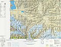
 Map including Tingri (labelled as TINGRI DZONG) (1954)
 -
 Map including Tingri (T'ing-jih) (DMA, 1981)
 -
![Zhangton Chobar, Lamdre practitioner, b. 1053 in Tingri County[17]](//upload.wikimedia.org/wikipedia/commons/thumb/b/b7/Zhangton_chobar.jpg/120px-Zhangton_chobar.jpg)
![Dampa Sangye, author of the Tingri One Hundred[12][13][14] and founder of Tingri Langkhor[15]](https://en.wikipedia.org/wiki/File:Padampa_Sanggye.jpg)
![Machig Labdrön (1055–1149), student of Padampa Sanggye at Tingri Langkhor[16][15]](https://en.wikipedia.org/wiki/File:Machik_Labdron.jpg)


![Zhangton Chobar, Lamdre practitioner, b. 1053 in Tingri County[17]](https://en.wikipedia.org/wiki/File:Zhangton_chobar.jpg)
References
[edit]- ^ a b "日喀则市第七次全国人口普查主要数据公报" (in Chinese). Government of Xigazê. 20 July 2021. Archived from the original on 26 October 2021. Retrieved 12 August 2023.
- ^ Croddy, E. (2022). China's Provinces and Populations: A Chronological and Geographical Survey. Springer International Publishing. p. 698. ISBN 978-3-031-09165-0. Retrieved 7 March 2024.
- ^ Footprint Tibet Handbook with Bhutan, p. 296. 2nd edition (1999). Gyume Dorje. Footprint Handbooks, Bath, England. ISBN 1-900949-33-4.
- ^ Department of Forestry, Government of the Tibet Autonomous Region, People's Republic of China, Report on Protected Lands in the Tibet Autonomous Region Lhasa: Tibet Autonomous Region Government Publishing House, 2006
- ^ a b c d e f g 定日县历史沿革 [Tingri County Organizational History]. xzqh.org (in Chinese). 24 February 2016. Archived from the original on 23 January 2022. Retrieved 9 January 2025.
- ^ a b c d e f g h i j 定日县概况地图 [Tingri County Overview Map]. xzqh.org (in Chinese). 24 February 2016. Archived from the original on 22 January 2022. Retrieved 9 January 2025.
- ^ Leplâtre, Simon (8 January 2025). "Tibet earthquake: 'In the worst-hit villages, 80-90% of houses have collapsed'". Le Monde. Retrieved 9 January 2025.
- ^ 中国气象数据网 – WeatherBk Data (in Simplified Chinese). China Meteorological Administration. Archived from the original on 5 September 2018. Retrieved 27 August 2023.
- ^ "Experience Template" 中国气象数据网 (in Simplified Chinese). China Meteorological Administration. Archived from the original on 4 April 2023. Retrieved 27 August 2023.
- ^ "Extreme Temperatures Around the World". Archived from the original on 22 June 2013. Retrieved 23 October 2024.
- ^ "Tingri Climate Normals 1991-2020". NOAA.
- ^ Sorensen, Michelle (2011). "Padampa Sanggye". The Treasury of Lives. Archived from the original on 12 August 2023. Retrieved 24 July 2017.
- ^ "The Tingri Hundred". Tibetological. Archived from the original on 28 May 2015. Retrieved 24 July 2017.
- ^ "ding ri glang 'khor". Rangjung Yeshe Wiki - Dharma Dictionary. 2005. Archived from the original on 11 September 2015. Retrieved 24 July 2017.
- ^ a b "Dingri Langkhor". The Treasury of Lives. Retrieved 24 July 2017.
- ^ Sorenson, Michelle (2010). "Machik Labdron". The Treasury of Lives. Archived from the original on 3 May 2016. Retrieved 24 July 2017.
- ^ Gardener, Alexander (2010). "Zhangton Chobar". The Treasury of Lives. Archived from the original on 29 October 2014. Retrieved 24 July 2017.
Further reading
[edit]- Annals of Tingri County (in Chinese)
Shigatse (Xigazê) | |||||||||||
|---|---|---|---|---|---|---|---|---|---|---|---|
| County-level divisions |
|  | |||||||||
| Settlements | |||||||||||
| Landmarks | |||||||||||
| Geography |
| ||||||||||
| Transport | |||||||||||
| Economy & Development | |||||||||||
| Hotels & Parks | |||||||||||
| Sciences | |||||||||||
| Cultures | |||||||||||
| International | |
|---|---|
| Other | |
Tingri County
View on GrokipediaPhysical Geography
Location and Topography
Tingri County, also known as Dingri County, is located in the southern part of the Tibet Autonomous Region, China, within the administrative jurisdiction of Xigazê City.[2] It lies at approximately 28.06° N latitude and 86.94° E longitude, positioning it near the border with Nepal.[3] The county occupies a strategic location at the northern foothills of the central Himalayas, serving as a gateway to Mount Everest from the north.[4] The topography of Tingri County features high-altitude plateaus and rugged mountain terrain, with an average elevation of 4,963 meters above sea level.[5] To the south, it is bordered by the principal range of the Himalayas, encompassing peaks such as Mount Everest (8,848 meters), Cho Oyu, and Makalu.[6] The county spans approximately 115 kilometers east to west and 152 kilometers from north to south, characterized by glacial valleys, arid plains, and steep ascents toward the Himalayan crest.[2] This varied elevation profile, ranging from broad intermontane basins to precipitous slopes, influences local hydrology and accessibility, with the Rongbuk River and other glacial meltwater streams draining northward into the Tibetan Plateau.[7]Climate and Natural Features
Tingri County exhibits a plateau temperate semi-arid monsoon climate, marked by cold temperatures, pronounced day-night fluctuations exceeding 20°C, low humidity, and intense solar radiation due to its high elevation. The annual average temperature ranges from 2.5°C to 3.9°C, with January means around -7.4°C and July peaks at 12°C; frost-free periods are brief, typically spanning May to September.[8][9][2] Annual precipitation averages 290–319 mm, concentrated in the summer monsoon season from June to October, which accounts for over 95% of totals, while winters remain exceptionally dry with minimal snowfall. The county's average elevation surpasses 5,000 meters, fostering alpine and steppe-like conditions with sparse vegetation, including hardy grasses and shrubs suited to permafrost and strong winds.[8][2] Natural features are defined by the Himalayan orogenic belt, featuring steep glacial valleys, high plateaus, and permanent snowfields on peaks such as Qomolangma (Mount Everest, 8,848.86 m) and Cho Oyu (8,188 m), which anchor the region's dramatic topography. The upper Arun River (Bum-chu) watershed dominates the hydrology, fed by glacial melt and seasonal runoff, supporting limited riparian zones amid otherwise barren, rocky terrain prone to erosion and seismic activity.[9][10][2]History
Etymology and Early Settlement
The name Tingri (Tibetan: དིང་རི་, Wylie: ding ri) derives from the Tibetan term for a specific hill in the region, literally translating to "Ding hill" or "Ting sound hill," where "ding" or "ting" evokes an onomatopoeic reference to a resonant sound.[11] Local legend attributes the name to a stone thrown by a lama from atop the hill, which reportedly produced a sharp "ting" upon impact, thus naming the feature and surrounding area.[2] This folk etymology underscores the hill's prominence in the landscape, though the precise linguistic origins trace to classical Tibetan topography denoting elevated, echoing terrains.[12] Early settlement in Tingri centered on religious and monastic foundations rather than large-scale agriculture, given the high-altitude, arid environment at approximately 4,300 meters elevation. In 1097, the Indian Buddhist adept Padampa Sangye (born c. 1055, died 1117) established Dingri Langkhor (Tibetan: དིང་རི་གླང་འཁོར་, "Dingri Oxen Circuit"), a key hermitage and teaching center west of present-day Tingri Dzong, which became a hub for his Shijé (Pacification) lineage of Tibetan Buddhism.[13] This site attracted disciples and marked one of the earliest documented permanent religious communities in the area, predating major dzong (fortress) constructions. Padampa's arrival, guided by visionary instructions linking the site to ancient Indian Buddhist prophecies, facilitated integration of tantric practices with local nomadic pastoralism.[14] Subsequent settlement expanded through trade networks, with Tingri emerging as a vital post on routes connecting Ü-Tsang province to Nepal by at least the medieval period, though exact pre-11th-century habitation remains archaeologically sparse due to the plateau's extreme conditions. Nomadic herders likely utilized the valleys seasonally for yak grazing prior to monastic anchors, but no verified evidence places organized villages before the 11th century.[13] Later fortifications like Shelkar Dzong, erected under the Kashag administration (established post-1720), reflect defensive consolidations amid regional power shifts, but these postdate initial spiritual settlements.[15] The area's enduring role as a frontier gateway underscores causal ties between spiritual migration, trade incentives, and topographic suitability over purely demographic pressures.Pre-1950s Tibetan Era
Tingri functioned as a strategic border district under the de facto independent Tibetan government centered in Lhasa during the Ganden Phodrang era, which consolidated authority over central and western Tibet following the Fifth Dalai Lama's ascension in 1642. Local governance occurred through a dzongpon, or district administrator, stationed at the central fortress known as Tingri Dzong, overseeing taxation, corvée labor, and border security in line with Tibet's feudal-theocratic system. The region's inhabitants, primarily ethnic Tibetans engaged in pastoral herding of yaks and sheep, contributed to Lhasa's treasury via wool and salt production. As a vital trading hub on the ancient route linking Ü-Tsang province to Nepal, Tingri facilitated barter exchanges where Tibetan merchants traded salt, wool, and livestock for Nepalese rice, grain, and iron tools, sustaining local economies and supporting pilgrimage networks toward sacred sites like Mount Kailash. This commerce peaked during fair seasons, drawing Sherpa traders across passes such as Nangpa La, and positioned Tingri as a economic linchpin amid the Himalayan frontier's isolation. Historical records note disruptions during interstate conflicts, including the Nepalese capture of Tingri in mid-August 1791 amid their invasion toward Shigatse during the Sino-Nepalese War. Religiously, the area anchored Tibetan Buddhism's monastic tradition, with Dingri Langkor hermitage established around 1097 by the South Indian master Padampa Sangye, who propagated the Zhije (Pacification) teachings emphasizing severance of ego-clinging and integration of Indian and Tibetan tantric practices. Nearby Shelkar Chode Monastery, originating in the 13th century under Kagyu auspices before aligning with the dominant Gelugpa sect by the 17th century, housed up to 400 monks and served as a spiritual center overlooking the Everest massif, reinforcing clerical influence over lay affairs. These institutions collected dues from herders and traders, embedding monastic estates within the socio-economic fabric while preserving scriptural lineages amid sparse arable land and harsh altitudes.[12]Post-1959 Integration and Modern Developments
Following the 1959 Tibetan uprising and the People's Republic of China's consolidation of authority in Tibet, the Tingri region underwent administrative reorganization as part of broader efforts to integrate Tibetan territories into the national framework. In 1959, the historical Shegar Zong, Tingri Zong, and 13 xiang were consolidated to form Tingri County, which was officially established the following year with its administrative seat initially placed in Shegar Township, later known locally as "New Tingri."[2] On June 27, 1960, the People's Government of Tingri County was formally instituted, marking the imposition of county-level governance under central directives.[16] These changes coincided with the rollout of "democratic reforms" across Tibet, which targeted the dissolution of the pre-existing theocratic-feudal system. Land holdings, monasteries, and estates previously controlled by aristocratic serf owners and religious institutions were expropriated and redistributed to former serfs and laborers, a process Chinese official narratives describe as emancipating over one million individuals from bondage and enabling socio-economic modernization.[17] [18] In Tingri, as in other Tibetan areas, this entailed the reconfiguration of pastoral land use and labor relations, transitioning from hereditary obligations to collective and state-managed production, though implementation involved the suppression of local resistance aligned with the broader uprising.[17] In the ensuing decades, Tingri benefited from targeted infrastructure expansions to enhance connectivity and economic viability. The China-Nepal Friendship Highway, upgraded progressively since the 1960s, traverses the county, serving as a vital artery for cross-border trade with Nepal and access to Mount Everest's northern base camp, thereby catalyzing limited tourism alongside traditional yak herding.[16] Administrative adjustments continued, with Tingri incorporated into Shigatse City in 2014 following the prefecture's dissolution, aligning it further with regional urban planning.[2] More recently, a magnitude 6.8 earthquake struck Tingri County on January 7, 2025, prompting rapid state-led reconstruction focused on seismic-resilient housing and infrastructure to mitigate vulnerabilities in the high-altitude plateau.[19] These efforts reflect ongoing central policies emphasizing poverty alleviation through road networks, electrification, and scenic area development around Qomolangma, though local outcomes remain shaped by geographic isolation and environmental constraints.[20]Administrative and Political Structure
Administrative Divisions
Tingri County administers two towns and eleven townships, as established under the administrative structure of Xigazê City in the Tibet Autonomous Region.[21] The county seat is situated in Shelkar Town (协格尔镇), which serves as the primary administrative center.[21] The towns are: The townships include:- Jiacuo Township (加措乡)
- Rongxia Township (绒辖乡)
- Nixia Township (尼辖乡)
- Penji Township (盆吉乡)
- Qudang Township (曲当乡)
- Zha'guo Township (扎果乡)
- Zhaxizong Township (扎西宗乡)
- Changsuo Township (长所乡)
- Quluo Township (曲洛乡)
- Cuoguo Township (措果乡)
- Kema Township (克玛乡)
Governance and Autonomy Status
Tingri County functions as a standard county-level administrative unit within China's hierarchical system, subordinate to Xigaze City, a prefecture-level division of the Tibet Autonomous Region (TAR). Local governance is exercised through a people's government, responsible for implementing national and regional policies on public services, infrastructure, and economic development, alongside a Communist Party of China (CPC) committee that directs political and ideological matters. The CPC secretary, who outranks the county magistrate in authority, ensures alignment with central directives, particularly in border regions like Tingri, where national security concerns amplify oversight from higher levels. The county seat, established in Shegar Town since 1968 after relocation from Gangga Township, houses these bodies.[13][9] As part of the TAR, established in 1965 as China's sole autonomous region for Tibetans, Tingri County benefits from nominal ethnic autonomy provisions under the PRC's Regional Ethnic Autonomy Law, allowing limited local input on cultural and economic affairs tailored to Tibetan customs. In practice, however, this autonomy is severely constrained by centralized CPC control, with Beijing exerting paramount influence over appointments, resource allocation, and sensitive domains such as religious management and border stability. Empirical analyses of leadership in Tibetan areas reveal persistent underrepresentation of ethnic Tibetans in pivotal roles—comprising only about 15% of prefectural-level and higher positions as of 2020—favoring appointees vetted for loyalty to the party over local ethnic ties, which undermines substantive self-governance.[22][23] Mandatory integration of CPC cadres into local institutions, including monasteries, further illustrates this dynamic, prioritizing political reliability amid historical tensions.[22]Demographics and Society
Population and Ethnic Composition
As of the Seventh National Population Census of the People's Republic of China conducted in 2020, Tingri County had a total constant resident population of 58,173.[24] This marked an increase from 50,818 residents recorded in the 2010 census, reflecting a growth rate of approximately 14.5% over the decade, driven largely by natural increase among the ethnic Tibetan majority in this rural high-altitude region.[24] The ethnic composition is overwhelmingly Tibetan, with small minorities of Han Chinese and others, consistent with patterns in remote Tibetan counties where Han settlement is limited to administrative, military, and infrastructure roles.[24] Specifically:| Ethnic Group | Population | Percentage |
|---|---|---|
| Tibetan | 56,301 | 96.8% |
| Han | 1,600 | 2.75% |
| Other minorities | 272 | 0.47% |
Cultural Practices and Religion
The inhabitants of Tingri County, predominantly ethnic Tibetans comprising 92% of the population as of 2013, adhere to Tibetan Buddhism as their primary religion, with the Gelug school holding particular prominence through institutions like Shelkar Chode Monastery.[2] Founded in 1385 by Lotsawa Loden Sherab, Shelkar Chode has served as a key center for Gelug practices since the 17th century, historically housing up to 400 monks before reductions due to 20th-century events including the Cultural Revolution.[27] Rongbuk Monastery, located in the county near Mount Everest, functions as a major pilgrimage destination, hosting annual Buddhist ceremonies that draw participants from Nepal and beyond, emphasizing rituals tied to the site's spiritual significance in the Himalayan landscape.[28] Cultural practices in Tingri are deeply intertwined with Buddhist observance and high-altitude pastoralism, including nomadic herding of yaks and dzos, which sustains traditional livelihoods and informs daily rituals of offerings and environmental reverence.[29] Festivals such as Losar, the Tibetan New Year, feature communal gatherings with song, dance, and butter lamp lighting, while Saga Dawa in June amplifies pilgrimages to sites like Rongbuk, where devotees circumambulate sacred spaces and engage in merit-generating activities.[1][30] These events reflect a broader Tibetan ethnic framework of polyandry in some herding families, folk arts like throat singing, and strict monastic disciplines, though contemporary restrictions on religious assembly have curtailed monastic populations and public expressions since the 1950s.[31] Smaller ethnic groups, including Han Chinese and Uyghurs, coexist but maintain distinct customs with limited integration into dominant Tibetan Buddhist norms.[29]Economy and Development
Traditional Sectors
The traditional economy of Tingri County relied predominantly on pastoral nomadism, with local herders raising yaks, sheep, and goats on the expansive high-altitude pastures of the Tibetan Plateau. Yaks, in particular, were indispensable for their roles in providing milk, meat, hides, and draught power for transport over rugged terrain, while also serving as currency in exchanges. Sheep and goats supplied wool and additional meat, supporting subsistence needs in an environment where arable land was scarce due to elevation exceeding 4,000 meters.[32][33] Subsidiary agriculture occurred in narrower river valleys, centered on hardy crops like barley, which tolerated the short growing seasons and frost-prone conditions. This cultivation complemented herding by yielding tsampa (roasted barley flour), a dietary staple, though yields remained low owing to soil limitations and climatic extremes. Herders often practiced transhumance, seasonally migrating livestock to optimize grazing and integrate limited farming where feasible.[34][35] Trade augmented self-sufficiency, with Tingri serving as a historic caravan hub along routes to Nepal, where pastoral products such as wool, salt, and live animals were exchanged for imported grains, rice, and iron tools unavailable locally. This barter system, predating modern infrastructure, sustained communities by bridging resource gaps in the isolated Himalayan frontier.[13]Tourism and Infrastructure Growth
Tingri County's tourism industry centers on its role as a gateway to the northern slopes of Mount Everest, particularly the Rongbuk Valley and Qomolangma Base Camp, attracting adventurers and sightseers to the world's highest peak. The Qomolangma Scenic Area, which includes key Everest access points in Tingri, recorded over 547,600 visitors in 2024, reflecting an 18% year-over-year increase and underscoring the region's rising appeal amid improved access.[36] This growth has been bolstered by post-2010s investments in visitor facilities, including homestays and guesthouses in Rongbuk, designed to handle seasonal influxes during peak climbing windows from May to October. Key infrastructure advancements have directly enabled this tourism surge. The Shigatse Tingri Airport (IATA: DDR), operational since 2023 and elevated at 4,163 meters, stands as the closest airfield to Everest Base Camp—only 52 kilometers distant—facilitating direct flights from hubs like Lhasa and reducing travel times for international trekkers.[37] Complementing this, Tibet's provincial highway network expanded by 51% from 7,840 km to 11,820 km between 2015 and 2020, with targeted upgrades in Tingri improving road reliability to remote valleys and mitigating seasonal disruptions like monsoons or snowfalls.[38] Accommodation and support services have scaled accordingly, with establishments like the Tingri Roof of the World Grand Hotel and Rongbuk Monastery Guesthouse offering elevated lodging options amid the plateau's harsh conditions.[39] Recent enhancements in Rongbuk include repaired access roads, upgraded telecommunications for real-time bookings, and expanded homestays to accommodate growing domestic and foreign footfall.[40] A January 2025 earthquake in Tingri prompted rapid reconstruction of affected roads and facilities, further solidifying infrastructure resilience to support sustained visitor growth.[41]Poverty Reduction and Economic Policies
In the context of China's targeted poverty alleviation campaign initiated in 2013, Tingri County benefited from centralized funding and infrastructure projects tailored to its high-altitude pastoral economy, where nomadic herding predominated amid extreme environmental constraints. Local initiatives included the establishment of cooperatives for yak and sheep husbandry, providing stable employment and income supplementation through government-subsidized salaries, as exemplified by villagers in Bangbug Village who accessed such programs by 2020.[42] Relocation efforts under the campaign moved impoverished households from remote grasslands to concentrated communities like Kangzhuang, offering 70-square-meter residences equipped with utilities and proximity to job opportunities in animal husbandry and services, thereby addressing housing deficits in traditional tent-based living.[42] Water infrastructure development formed a core component, with spring-fed systems delivering clean drinking water to at least 80 households in poverty-designated areas by August 2020, mitigating health risks from contaminated sources in arid, elevated terrains.[43] In Zhaxizom Township's Zangpu Village, families such as herdsman Zhaxi's transitioned from subsistence herding to enhanced operations supported by policy incentives, including vehicle access for transport and market integration, resulting in reported income growth and asset accumulation by April 2020.[44] These measures aligned with Tibet-wide allocations exceeding 75 billion RMB in alleviation funds since 2016, emphasizing relocation, industrial cooperatives, and ecological compensation for former nomads.[45] By the end of 2019, Tingri County, alongside Tibet's other 73 initially impoverished counties, was officially delisted from poverty rosters, with claims of eradicated absolute poverty verified through national standards of per capita income exceeding 4,000 RMB annually and access to essential services.[46] Post-2020 economic policies shifted toward rural revitalization, incorporating skill training for off-farm employment and integration with tourism-related sectors, though sustainability remains contingent on ongoing subsidies given the region's limited arable land and climate vulnerabilities. Official state media reports, while primary sources for implementation details, reflect government perspectives that prioritize measurable outputs like housing units built over qualitative assessments of cultural disruption from sedentarization.[47]Transportation and Connectivity
Road Networks
The primary artery of Tingri County's road network is the G318 National Highway, a major east-west trunk road that traverses the county as part of the Sino-Nepal Friendship Highway, connecting Lhasa approximately 450 km to the east with the Nepal border at Zhangmu via Nyalam to the southwest.[48][49] This 943 km segment from Lhasa through Tingri to the border supports overland trade, tourism, and regional connectivity, passing through high-altitude terrain including the Gucuo Basin near Tingri town.[50] The highway, paved and maintained for heavy vehicle traffic, reaches elevations over 5,000 meters and includes passes like Lalung La (5,050 m) west of Tingri.[51] A key branch road diverges north from the G318 at Tingri town, providing access to the Qomolangma (Mount Everest) National Nature Reserve and the North Everest Base Camp near Rongbuk Monastery, about 100 km away.[52] This route, paved since expansions in the 2000s, climbs to Gawu La Pass at 5,198 m before descending to the base camp at 5,200 m, enabling tourist vehicles and supply convoys despite seasonal closures due to snow or weather events, such as the October 2025 blizzard that blocked access and stranded nearly 1,000 people.[53][54] Local road development in Tingri County aligns with broader Tibetan infrastructure initiatives, including a 2019 target to connect all administrative villages via paved roads, enhancing access to remote herding communities and facilitating economic integration.[55] These secondary networks, totaling hundreds of kilometers, link townships like Chadrug and Zagar to the G318, though they remain vulnerable to landslides and require ongoing maintenance in the seismic-prone Himalayan foothills.[48]Access to Key Sites
Access to key sites in Tingri County, primarily the North Everest Base Camp and Rongbuk Monastery within Mount Qomolangma National Park, is regulated and requires specific permits for foreign visitors. All international travelers must obtain a Tibet Travel Permit and an Aliens' Travel Permit in addition to a Chinese visa, arranged through licensed Tibetan travel agencies, as independent travel is prohibited.[56][57] Private vehicles with drivers and guides are mandatory, with no public transportation available to these remote sites.[30][58] The primary route follows the G318 Friendship Highway, which passes through Tingri County en route from Lhasa to the Nepal border. From Tingri town, the drive to Everest Base Camp covers approximately 108 kilometers and takes 3.5 to 6 hours, depending on vehicle type, due to bumpy dirt sections and high-altitude terrain.[59] Visitors proceed to a parking lot at the park entrance, then transfer to electric shuttle buses to Rongbuk Monastery, about 30 minutes away, before accessing the base camp viewpoint.[60] Rongbuk Monastery, the highest in the world at 5,009 meters, serves as a staging point, with the base camp located roughly 6 kilometers south.[61] Since 2018, tourist access has been limited to areas near Rongbuk, excluding the advanced climbing base camp used by expeditions.[62] Alternative access includes a multi-day trek from Tingri to Everest Base Camp, spanning about 70 kilometers over 4 days, crossing two high passes and traversing alpine valleys with views of Mount Everest's north face.[63] This route passes through small Tibetan villages but requires acclimatization due to elevations exceeding 5,000 meters and is typically undertaken with guided groups. From Nepal, entry via the Resuo Bridge border crossing connects to Tingri along the same highway, though border operations and permit validity must align with Chinese regulations.[13] Road conditions improve seasonally, but travel remains challenging year-round, with closures possible during extreme weather.[64]Controversies and Challenges
Human Rights Incidents
In 2019, Chinese authorities raided Tengdro Monastery in Dingri (Tingri) County, arresting multiple monks after discovering a mobile phone belonging to Choegyal Wangpo containing contacts with overseas Tibetans and records of aid sent to a sister monastery in Nepal.[31] The raid, involving over 100 police officers, resulted in the detention of at least 20 monks, physical beatings during interrogations, and the suicide of one detained individual under unclear circumstances.[65] In secret trials held in 2020 without public access or legal representation, four monks—Choegyal Wangpo (sentenced to 20 years), Lobsang Jinpa (19 years), Norbu Dondrup (17 years), and Ngawang Yeshe (5 years)—were convicted of "inciting subversion of state power" based on unsubstantiated claims of political activities, including alleged foreign communications.[66][67] Earlier, on May 30, 2008, security forces conducted a night raid on Shelkar Chode Monastery in Dingri County, arresting 12 monks who had opposed a "patriotic re-education" campaign imposed by authorities.[68] The detainees, including senior figures, were held without formal charges or trial details disclosed, amid broader post-2008 protests across Tibetan areas.[68] Such campaigns typically require affirmations of loyalty to the Chinese Communist Party, with non-compliance leading to detentions justified under national security pretexts. Reports from organizations like Human Rights Watch and Radio Free Asia, drawing on witness accounts and leaked documents, highlight patterns of arbitrary arrests and restricted information flows in the region, though Chinese officials maintain these actions target separatism without elaborating on evidence.[31][65] These incidents reflect documented restrictions on monastic communications and religious expression in Dingri County, enforced through surveillance and rapid-response policing, as corroborated by U.S. State Department assessments of arbitrary detentions in Tibetan areas.[67] No independent verification from Chinese judicial records is available, as trials remain closed and appeals limited.Environmental Policies and Relocation Programs
In Tingri County, Chinese authorities have pursued environmental policies aimed at mitigating grassland degradation and preserving high-altitude ecosystems, particularly within the Qomolangma National Nature Reserve, which encompasses much of the county's territory. These efforts include the implementation of the "Incentive Mechanism for Grassland Ecological Protection," which compensates herders for reducing livestock grazing to allow pasture recovery, alongside the creation of community-based networks of grassland and wildlife monitors from local villages to enforce conservation rules.[69] From 2010 to 2018, livestock reductions in Tingri and adjacent counties—such as a 25.4% decrease in yaks and horses and an 11.3% drop in sheep and goats—were enforced to curb overgrazing, a primary driver of soil erosion and biodiversity loss in the region's fragile alpine meadows exacerbated by climate change.[70] Relocation programs form a core component of these policies, with nomads directed to abandon traditional seasonal grazing routes in favor of permanent settlements to lessen human and livestock pressure on grasslands. In Dingri County, authorities have compelled herders to relocate, often confiscating excess animals and dismantling tents, as part of broader Tibetan Plateau initiatives that have resettled over two million rural Tibetans since 2006 under the "New Socialist Countryside" framework, ostensibly to foster ecological restoration and poverty alleviation.[71][72] Official Chinese narratives frame these moves as successful, citing improved vegetation cover and reduced poverty rates through access to subsidized housing, education, and alternative livelihoods like farming or wage labor.[73] However, independent reports document significant challenges and coercion in Tingri's relocations, including inadequate prior consultation, insufficient compensation for lost herds—central to Tibetan pastoral economies—and subsequent unemployment rates exceeding 50% among resettled families, leading to dependency on government stipends that often prove temporary.[72][71] Critics, including human rights organizations, argue that while overgrazing empirically contributes to degradation, the programs prioritize state control over borderlands—evident in Tingri's proximity to Nepal and India—potentially under the ecological pretext, resulting in cultural disruption such as the erosion of nomadic knowledge systems that have sustained the plateau for millennia.[74] These accounts contrast with government data, highlighting discrepancies in outcomes where relocated households face health issues from dietary shifts and confinement, underscoring tensions between conservation imperatives and indigenous adaptive practices.[75][72]References
- https://en.wiktionary.org/wiki/Tingri