

Community hub
Recent from talks
Contribute something
Nothing was collected or created yet.
Amherst, Massachusetts
View on Wikipedia
Amherst (/ˈæmərst/ ⓘ)[4] is a city in Hampshire County, Massachusetts, United States, in the Connecticut River valley. Amherst has a council–manager form of government, and is considered a city under Massachusetts state law. Amherst is one of several Massachusetts municipalities that have city forms of government but retain "The Town of" in their official names.[5] At the 2020 census, the population was 39,263,[6] making it the highest populated municipality in Hampshire County (although the county seat is Northampton). The town is home to Amherst College, Hampshire College, and the University of Massachusetts Amherst, three of the Five Colleges.
Key Information


_-_IMG_6526.JPG)


Amherst has three census-designated places: Amherst Center, North Amherst, and South Amherst.
Amherst is part of the Springfield, Massachusetts Metropolitan Statistical Area. Lying 22 miles (35 km) north of the city of Springfield, Amherst is considered the northernmost town in the Hartford–Springfield Metropolitan Region, "The Knowledge Corridor". Amherst is also located in the Pioneer Valley, which encompasses Hampshire, Hampden and Franklin counties.
Name
[edit]The name of the town is pronounced without the h ("AM-erst") by natives and long-time residents, giving rise to the local saying, "only the 'h' is silent", in reference both to the pronunciation and to the town's politically active populace.[citation needed]
History
[edit]
The earliest known document of the lands now comprising Amherst is the deed of purchase dated December 1658 between John Pynchon of Springfield and three native inhabitants, referred to as Umpanchla, Quonquont, and Chickwalopp.[7] According to the deed, "ye Indians of Nolwotogg (Norwottuck) upon ye River of Quinecticott (Connecticut)" sold the entire area in exchange for "two Hundred fatham of Wampam & Twenty fatham, and one large Coate at Eight fatham wch Chickwollop set of, of trusts, besides severall small giftes" [sic].
Amherst was first visited by Europeans no later than 1665, when Nathaniel Dickinson surveyed the lands for its mother town Hadley. The first permanent English settlements arrived in 1727. It remained a part of Hadley, even when it gained precinct status in 1734, before becoming a township in 1759.
When it incorporated, the colonial governor assigned the town the name "Amherst" after Jeffery Amherst, 1st Baron Amherst. Many a colonial governor at the time scattered his name during the influx of new town applications, which is why several towns in the Northeast bear the name. Amherst was Commander-in-Chief of the forces of North America during the French and Indian War who, according to popular legend, singlehandedly won Canada for the British and banished France from North America. Popular belief has it that he supported the American side in the Revolutionary War and resigned his commission rather than fight for the British. Baron Amherst actually remained in the service of the Crown during the war—albeit in Great Britain rather than North America—where he organized the defense against the proposed Franco-Spanish Armada of 1779. Nonetheless, his previous service in the French and Indian War meant he remained popular in New England. Amherst is also infamous for recommending, in a letter to a subordinate, the use of smallpox-covered blankets in warfare against the Native Americans along with any "other method that can serve to Extirpate this Execrable Race".[8] For this reason, there have been occasional ad hoc movements to rename the town.[9]
Amherst celebrated its 250th anniversary in 2009. The Amherst 250th Anniversary Celebration Committee and Amherst Historical Society organized events, including a book published by the Historical Society and written by Elizabeth M. Sharpe, Amherst A to Z.
In 2021 the City Council voted to establish the Amherst African Heritage Reparation Assembly to study reparations for the town's black residents. In 2022, at the Assembly's suggestion, the City Council approved $2,000,000 of initial funding for reparations.
History of town government
[edit]The Town converted from an open town meeting to a representative town meeting form in 1938.[10] In 1953, Amherst voters passed the "Town Manager Act", which established the office of a town manager and reduced a number of elected positions.[10] In 1995, a charter commission was approved to study Amherst's government; the charter majority recommended a seven-person Council and a mayor, while also maintaining a reduced size representative Town Meeting (150).[11] This proposal failed in two successive votes.[10]
In 2001, the League of Women Voters Amherst made a number of recommendations that were adopted in 2001 in the form of a revised "Amherst Town Government Act".[12] An effort shortly thereafter to amend the charter to eliminate the town meeting, and establish an elected mayor and a nine-member Town Council,[13] was rejected by voters twice, first in spring 2003 by fourteen votes and again on March 29, 2005 by 252 votes.
In 2016, a charter commission was approved to study Amherst's government. A majority of commissioners proposed a charter that would establish a 13-member council with no mayor.[14][15] This proposal was voted on the March 27, 2018 local ballot,[16] and was passed by over 1,000 votes, a 58% majority.[17] The new town council was sworn in on December 2, 2018.[18]
Geography
[edit]
According to the United States Census Bureau, Amherst has a total area of 27.7 square miles (71.8 km2), of which 27.6 square miles (71.5 km2) are land and 0.12 square miles (0.3 km2), or 0.48%, are water.[19] The town is bordered by Hadley to the west, Sunderland and Leverett to the north, Shutesbury, Pelham, and Belchertown to the east, and Granby and South Hadley to the south. The highest point in the town is on the northern shoulder of Mount Norwottuck at the southern border of the town; the peak is in Granby but the town's high point is a few yards away and is about 1,100 feet (340 m). This point is located in the Mount Holyoke Range, which forms the so-called "Tofu Curtain". Amherst is nearly equidistant from Massachusetts' borders with Connecticut and Vermont.

Amherst's ZIP Code of 01002 is the second-lowest number in the continental United States after Agawam (not counting codes used for specific government buildings such as the IRS).
Climate
[edit]Amherst has a humid continental climate that under the Köppen system marginally falls into the warm-summer category (Dfb). It is interchangeable with the hot-summer subtype Dfa with July means hovering around 71.7 °F (22.1 °C). Winters are cold and snowy, albeit daytime temperatures often remain above freezing. Under the 2012 USDA Plant Hardiness Zone system, Amherst (ZIP Code 01002) is in zone 5b;[20] however, Amherst closely borders zone 6a, which penetrates into Massachusetts in the Connecticut River Valley, and climate change may be shifting those zones.[21]
| Climate data for Amherst, Massachusetts, 1991–2020 normals, extremes 1893–present | |||||||||||||
|---|---|---|---|---|---|---|---|---|---|---|---|---|---|
| Month | Jan | Feb | Mar | Apr | May | Jun | Jul | Aug | Sep | Oct | Nov | Dec | Year |
| Record high °F (°C) | 70 (21) |
78 (26) |
85 (29) |
93 (34) |
98 (37) |
101 (38) |
104 (40) |
100 (38) |
99 (37) |
90 (32) |
82 (28) |
72 (22) |
104 (40) |
| Mean maximum °F (°C) | 55.4 (13.0) |
57.1 (13.9) |
66.4 (19.1) |
80.6 (27.0) |
87.9 (31.1) |
94.6 (34.8) |
93.2 (34.0) |
91.2 (32.9) |
88.1 (31.2) |
78.3 (25.7) |
68.9 (20.5) |
58.5 (14.7) |
95.0 (35.0) |
| Mean daily maximum °F (°C) | 34.0 (1.1) |
37.0 (2.8) |
45.2 (7.3) |
58.2 (14.6) |
69.5 (20.8) |
78.0 (25.6) |
83.1 (28.4) |
81.5 (27.5) |
74.4 (23.6) |
64.9 (18.3) |
49.7 (9.8) |
39.2 (4.0) |
59.6 (15.3) |
| Daily mean °F (°C) | 23.9 (−4.5) |
26.2 (−3.2) |
34.7 (1.5) |
46.3 (7.9) |
57.5 (14.2) |
66.5 (19.2) |
71.7 (22.1) |
69.9 (21.1) |
62.3 (16.8) |
50.2 (10.1) |
39.4 (4.1) |
30.0 (−1.1) |
48.2 (9.0) |
| Mean daily minimum °F (°C) | 13.8 (−10.1) |
15.3 (−9.3) |
24.1 (−4.4) |
34.4 (1.3) |
45.4 (7.4) |
55.0 (12.8) |
60.2 (15.7) |
58.3 (14.6) |
50.3 (10.2) |
38.6 (3.7) |
29.1 (−1.6) |
20.8 (−6.2) |
37.1 (2.8) |
| Mean minimum °F (°C) | −5.7 (−20.9) |
−2.6 (−19.2) |
6.5 (−14.2) |
22.3 (−5.4) |
30.3 (−0.9) |
40.5 (4.7) |
49.5 (9.7) |
46.0 (7.8) |
35.5 (1.9) |
24.7 (−4.1) |
14.5 (−9.7) |
3.4 (−15.9) |
−8.4 (−22.4) |
| Record low °F (°C) | −30 (−34) |
−27 (−33) |
−17 (−27) |
8 (−13) |
24 (−4) |
29 (−2) |
39 (4) |
32 (0) |
25 (−4) |
12 (−11) |
−4 (−20) |
−22 (−30) |
−30 (−34) |
| Average precipitation inches (mm) | 3.36 (85) |
2.93 (74) |
3.47 (88) |
3.79 (96) |
3.71 (94) |
4.46 (113) |
4.12 (105) |
4.12 (105) |
4.62 (117) |
4.74 (120) |
3.38 (86) |
3.89 (99) |
46.59 (1,182) |
| Average snowfall inches (cm) | 8.1 (21) |
11.0 (28) |
7.3 (19) |
1.0 (2.5) |
0.0 (0.0) |
0.0 (0.0) |
0.0 (0.0) |
0.0 (0.0) |
0.0 (0.0) |
0.0 (0.0) |
1.6 (4.1) |
7.5 (19) |
36.5 (93.6) |
| Average extreme snow depth inches (cm) | 7.3 (19) |
8.9 (23) |
7.0 (18) |
0.9 (2.3) |
0.0 (0.0) |
0.0 (0.0) |
0.0 (0.0) |
0.0 (0.0) |
0.0 (0.0) |
0.3 (0.76) |
1.2 (3.0) |
5.7 (14) |
11.8 (30) |
| Average precipitation days (≥ 0.01 in) | 10.8 | 9.2 | 9.5 | 11.1 | 12.6 | 11.3 | 11.0 | 10.0 | 8.9 | 10.8 | 9.5 | 10.6 | 125.3 |
| Average snowy days (≥ 0.1 in) | 5.6 | 5.0 | 3.1 | 0.6 | 0.0 | 0.0 | 0.0 | 0.0 | 0.0 | 0.1 | 0.9 | 3.7 | 19.0 |
| Source 1: NOAA[22] | |||||||||||||
| Source 2: National Weather Service[23] | |||||||||||||
Demographics
[edit]| Year | Pop. | ±% |
|---|---|---|
| 1790 | 1,233 | — |
| 1800 | 1,258 | +2.0% |
| 1810 | 1,469 | +16.8% |
| 1820 | 1,917 | +30.5% |
| 1830 | 2,631 | +37.2% |
| 1840 | 2,550 | −3.1% |
| 1850 | 3,057 | +19.9% |
| 1860 | 3,206 | +4.9% |
| 1870 | 4,035 | +25.9% |
| 1880 | 4,298 | +6.5% |
| 1890 | 4,512 | +5.0% |
| 1900 | 5,028 | +11.4% |
| 1910 | 5,112 | +1.7% |
| 1920 | 5,550 | +8.6% |
| 1930 | 5,883 | +6.0% |
| 1940 | 6,410 | +9.0% |
| 1950 | 10,856 | +69.4% |
| 1960 | 13,718 | +26.4% |
| 1970 | 26,331 | +91.9% |
| 1980 | 33,229 | +26.2% |
| 1990 | 35,228 | +6.0% |
| 2000 | 34,874 | −1.0% |
| 2010 | 37,819 | +8.4% |
| 2020 | 39,263 | +3.8% |
| 2024* | 40,989 | +4.4% |
| * = population estimate[24] Source: United States census records and Population Estimates Program data.[25][26][27][28][29][30][31][32][33][34][35][36] | ||
As of the 2010 U.S. census, there were 37,819 people, 9,259 households, and 4,484 families residing in the town. There were 9,711 housing units. The racial makeup of the town was 76.9% White, 5.4% Black or African American, 0.2% Native American, 10.9% Asian, 0.03% Pacific Islander, 2.4% some other race, and 4.1% from two or more races. 7.3% of the population were Hispanic or Latino of any race.[37]
Of the 9,259 households in the town, 23.4% had children under the age of 18 living with them, 35.6% were headed by married couples living together, 16.3% had a female householder with no husband present, and 51.6% were non-families. Of all households, 27.3% were made up of individuals, and 9.7% were someone living alone who was 65 years of age or older. The average household size was 2.44 and the average family size was 2.88.[37]
In the town, 10.0% of the population were under the age of 18, 55.7% were from 18 to 24, 13.3% were from 25 to 44, 13.6% were from 45 to 64, and 7.4% were 65 years of age or older. The median age was 21.6 years. For every 100 females, there were 95.8 males. For every 100 females age 18 and over, there were 94.7 males.[37]
For the period 2011–2015, the estimated median annual income for a household in the town was $48,059, and the median income for a family was $96,005. Male full-time workers had a median income of $64,750 versus $39,278 for females. The per capita income for the town was $18,905. About 8.7% of families and 34.7% of the population were below the poverty line, including 18.2% of those under age 18 and 4.5% of those age 65 or over.[38]
Of residents 25 years old or older, 41.7% have a graduate or professional degree, and only 4.9% did not graduate from high school. The largest industry is education, health, and social services, in which 51.9% of employed persons work.
These statistics given above include some but not all of the large student population, roughly 30,000 in 2010, many of whom only reside in the town part of the year. Amherst is home to thousands of part-time and full-time residents associated with the University of Massachusetts Amherst, Amherst College, and Hampshire College.
Income
[edit]Data is from the 2009–2013 American Community Survey 5-Year Estimates.[39][40][41]
| Rank | ZIP Code (ZCTA) | Per capita income |
Median household income |
Median family income |
Population | Number of households |
|---|---|---|---|---|---|---|
| Massachusetts | $35,763 | $66,866 | $84,900 | 6,605,058 | 2,530,147 | |
| Hampshire County | $29,460 | $61,227 | $81,385 | 159,267 | 58,828 | |
| United States | $28,155 | $53,046 | $64,719 | 311,536,594 | 115,610,216 | |
| 1 | 01002 | $27,691 | $54,422 | $96,929 | 29,266 | 9,248 |
| Amherst | $19,796 | $53,191 | $96,733 | 38,651 | 8,583 | |
| 2 | 01003 (UMass Amherst Campus) | $3,531 | $N/A | $N/A | 11,032 | 16 |
Economy
[edit]Major employers in Amherst include University of Massachusetts Amherst, Amherst College, William D. Mullins Memorial Center, Hampshire College, and Amherst-Pelham Regional School District.[42]
Arts and culture
[edit]Points of interest
[edit]- Amherst Center Cultural District, formed in 2016.[43]
- Amherst Area Chamber of Commerce
- Amherst Cinema Arts Center: a local non-profit theater showing mostly arthouse and independent films[44]
- Amherst History Museum, which opened in 1916 and is governed by the Amherst Historical Society[45]
- Beneski Museum of Natural History, including the Hitchcock Ichnological Cabinet
- Emily Dickinson Museum, birthplace and lifelong residence of poet Emily Dickinson, now a museum.
- Eric Carle Museum of Picture Book Art
- Hitchcock Center for the Environment, an environmental education center on the grounds of Hampshire College
- Jones Library
- Mead Art Museum at Amherst College: 18,000 items with a particular strength in American art
- W. E. B. Du Bois Library at the University of Massachusetts Amherst: the tallest academic library in the United States
Sports
[edit]- Games were played in town during the 1996 World Junior Ice Hockey Championships.
- Amherst Regional High School's 1992–93 girls' basketball team inspired the book In These Girls, Hope is a Muscle by Madeleine Blais.[46]
- The University of Massachusetts Amherst's Ultimate Frisbee Team was ranked first in the Division 1 Men's Ultimate league for the 2017 season.[47][48]
- The Amherst Invitational, founded in 1992, is the oldest high school Ultimate Frisbee tournament in the United States.[49]
Government
[edit]
Amherst has a town council for its legislative branch and a town manager for its executive branch. The town manager is appointed by the town council.[50]
Amherst's town council consists of ten district councilors and three councilors-at-large. Two district councilors are elected from each of five districts in Amherst. The three councilors-at-large are elected by the whole town. Each councilor serves a two-year term, except for the first council, where each member will serve a three-year term.[50]
Amherst also has the following elected bodies:[50]
- A five-member School Committee with two-year terms.
- A six-member library board of trustees with two-year terms.
- A single Oliver Smith Will Elector with a two-year term.
Amherst also has a five-member housing authority in which three of the five members are elected by voters. Each member serves a two-year term.[50]
| Town Council Members[51] | |||
|---|---|---|---|
| Title | Name | District | First elected |
| Councilor-at-Large | Mandi Jo Hanneke | At-Large | 2018 |
| Councilor-at-Large | Ellisha Walker | At-Large | 2021 |
| Councilor-at-Large | Andrew Steinberg | At-Large | 2018 |
| District Councilor | Michele Miller | 1 | 2021 |
| District Councilor | Cathy Schoen | 1 | 2018 |
| District Councilor | Lynn Griesemer | 2 | 2018 |
| District Councilor | Patricia De Angelis | 2 | 2018 |
| District Councilor | Dorothy Pam | 3 | 2018 |
| District Councilor | Jennifer Taub | 3 | 2021 |
| District Councilor | Anika Lopes | 4 | 2021 |
| District Councilor | Pam Rooney | 4 | 2021 |
| District Councilor | Shalini Bahl-Milne | 5 | 2018 |
| District Councilor | Ana Devlin Gauthier | 5 | 2021 |
State and federal representation
[edit]In the Massachusetts Senate Amherst is in the "Hampshire, Franklin and Worcester" district,[52] represented by Democratic State Senator Jo Comerford since January 2019. In the Massachusetts House of Representatives Amherst is in the 3rd Hampshire district,[53] represented by Democratic State Representative Mindy Domb since January 2019. Amherst is part of the Eighth Massachusetts Governor's Council district and has been represented by Tara Jacobs since January 2023.[54]
Amherst is represented at the federal level by an all-Democratic delegation, including Senators Elizabeth Warren and Ed Markey, and by Representative Jim McGovern of the Second Congressional District of Massachusetts.
Voter registration
[edit]
Voter registration data is from the state election enrollment statistics.
| Registered Voters and Party Enrollment[56] | |||||||
|---|---|---|---|---|---|---|---|
| Year | Democratic | Republican | Unenrolled | Total | |||
| 2004 | 8,522 | 47.8% | 1,231 | 6.9% | 7,623 | 42.8% | 17,816 |
| 2006 | 8,350 | 49.2% | 1,076 | 6.3% | 7,228 | 42.6% | 16,980 |
| 2008 | 9,343 | 49.3% | 1,076 | 5.7% | 8,257 | 43.6% | 18,956 |
| 2010 | 8,675 | 49.6% | 948 | 5.4% | 7,661 | 43.8% | 17,501 |
| 2012 | 10,324 | 46% | 1,219 | 5.4% | 10,665 | 47.6% | 22,425 |
| 2014 | 9,645 | 45% | 1,156 | 5.4% | 10,454 | 48.8% | 21,431 |
| 2016 | 10,414 | 46.9% | 1,146 | 5.2% | 10,202 | 46% | 22,196 |
| 2018 | 10,249 | 46.6% | 1,025 | 4.7% | 10,331 | 47% | 21,993 |
| 2020 | 8,562 | 51.7% | 575 | 3.5% | 7,166 | 43.3% | 16,551 |
| 2022 | 7,222 | 51% | 414 | 3% | 6,441 | 45% | 14,243 |
Politics
[edit]Like many college towns, Amherst leans heavily Democratic. In each of the presidential elections from 2012 to 2020, more than 80% of Amherst's votes went to the Democratic candidate. The last Republican to win Amherst on the Presidential level was Richard Nixon in 1960.[57]
In the 2020 United States presidential election, Democrat Joe Biden received 90.3 percent of the vote to incumbent Republican Donald Trump's 7.4 percent.[58] In the 2000 United States presidential election, Amherst was one of a small number of places that delivered more votes for Green Party candidate Ralph Nader (who took 24% of the vote) than Republican candidate George W. Bush, who received just 13%.[59]
Education
[edit]

The town is part of the Amherst Regional School District along with Leverett, Pelham, and Shutesbury. Amherst has three elementary schools: Crocker Farm Elementary School, Fort River Elementary School, and Wildwood Elementary School serving K–6. Students in Amherst then attend Amherst Regional Middle School for grades 7–8. High school students then attend Amherst Regional High School.
There are three tertiary institutions located in the town: the public University of Massachusetts Amherst (the flagship of the UMass system), and two private liberal arts colleges—Amherst College and Hampshire College.
Infrastructure
[edit]Transportation
[edit]Bus
[edit]The Pioneer Valley Transit Authority, funded by local governments and the Five College Consortium, provides public transportation in the area, operated by University of Massachusetts Transportation Services. Service runs well into the early morning hours on weekends when school is in session. Students attending any colleges in the Five Colleges Consortium have a fee included in their tuition bills (service fee for UMass Amherst students and student activity fees for the other colleges) for each semester that prepays their bus fares for the semester. UMass Transit buses operate via a proof-of-payment system, in which there are random inspections of student identification cards and bus passes and transfers.
Peter Pan Bus Lines provides service between Amherst and Springfield, Boston, and other locations in New England.[60] Megabus provides service between New York City, Amherst, and Burlington, Vermont.[61]
Rail
[edit]Amtrak rail service is available in nearby Northampton on the Vermonter service between Washington, D.C., and St. Albans, Vermont. More frequent Amtrak service to New York City and Washington, D.C., is available from Union Station in Springfield.
Airports
[edit]The closest major domestic and limited international air service is available through Bradley International Airport (BDL) in Windsor Locks, Connecticut. Bradley is located approximately one hour's driving time from Amherst. Major international service is available through Logan International Airport (BOS) in Boston, 90 miles (140 km) away.
General aviation service is close by, at Northampton Airport, Westover Metropolitan Airport, and Turners Falls Airport.
Police report
[edit]Since 1997, the local newspaper, the Amherst Bulletin, has published a weekly log of phone calls received by the Amherst Police Department.[62] This police report, whose tone is deadpan and often unintentionally humorous, has been the subject of at least two books[63][64] and a 2002 article in Harper's Magazine, "Gone When Police Got There".[65] For example, an entry from the March 27, 2015 police report reads: "2:48 a.m.—An Ann Whalen Apartments resident awoke to find someone on her balcony looking into her bedroom. The woman later told police she thinks she may have been dreaming prior to calling 911."[66]
Notable people
[edit]Historical
[edit]- Chinua Achebe (1930–2013), was a professor at the University of Massachusetts from 1972 to 1976
- Osmyn Baker (1800–1875), born in Amherst, United States Congressman and lawyer[67]
- Ray Stannard Baker (1870–1946), newspaperman, biographer of Woodrow Wilson
- William S. Clark (1825–1886), Academician, politician, businessman; principal founder of the Massachusetts Agricultural College (now the University of Massachusetts Amherst), founder of the Sapporo Agricultural College (now the Hokkaido University)
- Mason Cook Darling (1801–1866), born in Amherst, United States Congressman from Wisconsin and first mayor of Fond du Lac, Wisconsin[67]
- Melvil Dewey (1851–1931), devised the Dewey Decimal System while an assistant librarian at Amherst College in 1876
- Edward Dickinson (1803–1874), born in Amherst, lawyer, United States Congressman, and father of Emily Dickinson[67]
- Emily Dickinson (1830–1886), born and lived in Amherst, one of the most prominent and celebrated American poets[67]
- Eugene Field (1850–1895), raised in Amherst by cousin, Mary Field French; poet and humorist who wrote children's poem Wynken, Blynken, and Nod
- Robert Francis (1901–1987), poet
- Robert Frost (1874–1963), Pulitzer prize-winning poet who taught at Amherst College and retired there
- Howard Roger Garis (1873–1962), children's author who wrote the Uncle Wiggily book series
- Lilian Garis (1873–1954), author of juvenile fiction who under the pseudonym Laura Lee Hope wrote early volumes in the Bobbsey Twins series
- Edward Hitchcock (1793–1864), educator, early geologist and a founder of the science of ichnology
- Helen Hunt Jackson (1830–1885), born in Amherst, noted author best known for A Century of Dishonor and her novel Ramona[67]
- Arthur Lithgow (1915–2004), lived and died in Amherst, noted actor, producer and director of Shakespeare plays, founder of the Great Lakes Shakespeare Festival in Ohio (today known as the Great Lakes Theatre Festival), former director of the McCarter Theatre in Princeton, NJ, father of actor John Lithgow
- Ebenezer Mattoon (1755–1843), born in North Amherst, Lieutenant in Continental Army during American Revolution, US Congressman (1801–1803).[68]
- Paul Nitze (1907–2004), born in Amherst, diplomat who helped shape defense policy over numerous presidential administrations
- Julius Hawley Seelye (1824–1895), Amherst college professor, united States Representative (1875–1877), 5th President of Amherst College
- Harlan Fiske Stone (1872–1946), attended public schools in Amherst and Amherst College; dean of the Columbia Law School, 52nd Attorney General of the United States, and Chief Justice of the United States
- Mabel Loomis Todd (1856–1932), world traveler, edited and published the first volume of Emily Dickinson's poetry
- Noah Webster (1758–1843), Author of An American Dictionary of the English Language
Born or raised in Amherst
[edit]- Annie Baker, playwright
- Thomas Bezucha, film & television director, writer, & producer
- Emily Dickinson, poet
- P. D. Eastman, children's author, illustrator, and screenwriter
- Helen Palmer Geisel, children's author and first wife of Dr. Seuss
- Michael Hixon, U.S. Olympic Athlete Rio 2016, men's individual 3 meter springboard; 3 meter springboard synchro
- James D. Hornfischer, military historian and author
- James Ihedigbo, Detroit Lions defensive back
- Martin Johnson, of rock band Boys like Girls
- John Leonard, ice hockey player
- Ryan Leonard, ice hockey player
- Amory Lovins, scientist and environmentalist
- Michael E. Mann, climatologist
- J Mascis, singer, guitarist and songwriter for alternative rock band Dinosaur Jr.
- Eric Mabius, star of ABC show Ugly Betty, attended Amherst schools
- Makaya McCraven, musician
- Julie McNiven, actress with recurring roles on Mad Men and Supernatural
- Ilan Mitchell-Smith, actor starring in 1985 film Weird Science, attended Amherst public schools
- Ebon Moss-Bachrach, actor with roles on The Bear and Girls, raised in Amherst and attended Amherst public schools
- Henry Addison Nelson (1820–1906), Presbyterian clergyman
- Eli Noyes, animator, film producer, director
- Gil Penchina, Former CEO of Wikia, Inc., attended the University of Massachusetts Amherst
- John Pettes, US Marshal for Vermont, born in Amherst[69]
- Steve Porter, music producer
- Allen St. Pierre, executive director of NORML, attended public schools in Amherst and graduated from the University of Massachusetts Amherst
- Matt Reid, head baseball coach at Army
- Timothy Tau, writer and filmmaker, attended public schools in Amherst including Amherst Regional Middle School and Crocker Farm Elementary School
- Uma Thurman, Oscar-nominated actress, whose father, Robert Thurman, taught at Amherst College
- Martin M. Wattenberg, artist and computer scientist
- Zoe Weizenbaum, child actress
- Jamila Wideman (born 1975), female left-handed point guard basketball player, lawyer and activist
- Elisha Yaffe, comedian, actor, and producer
- Kevin Ziomek, American professional baseball pitcher in the Detroit Tigers organization
Live/lived in Amherst
[edit]- Gavin Andresen, Bitcoin Foundation founder and former Bitcoin contributor
- Christian Appy, author of Patriots and Working-Class War, professor at University of Massachusetts Amherst
- Christopher Benfey, author of The Great Wave, professor at Mount Holyoke College
- Holly Black, author of Tithe, Valiant, Ironside, and co-author of the Spiderwick Chronicles
- Augusten Burroughs, author of Running with Scissors
- Michelle Chamuel, singer, songwriter, producer
- Cassandra Clare, author of The Mortal Instruments and The Infernal Devices
- Arda Collins, poet and winner of the Yale Series of Younger Poets Competition
- Tony DiTerlizzi, author of The Spider and the Fly and co-author/illustrator for Spiderwick Chronicles
- Peter Elbow, compositionist and professor emeritus at the University of Massachusetts Amherst
- Joseph Ellis, historian and author of Founding Brothers
- Martín Espada, poet, professor at the University of Massachusetts and author of the 2006 The Republic of Poetry, among others
- Black Francis, singer/guitarist of the alternative rock band the Pixies, attended UMass Amherst
- Rebecca Guay, artist specializing in watercolor painting and illustration
- Norton Juster, author of The Phantom Tollbooth
- John Katzenbach, author of The Madman's Tale
- Julius Lester, author and professor at the University of Massachusetts Amherst
- Michael Lesy, author of Wisconsin Death Trip, professor at Hampshire College
- Cale Makar, professional ice hockey player for the Colorado Avalanche and former University of Massachusetts defenseman.
- Charles C. Mann (born 1955), journalist and author of 1491: New Revelations of the Americas Before Columbus and 1493: Uncovering the New World Columbus Created
- Catherine Newman, memoirist and novelist
- John Olver, politician who served in the US House of Representatives
- John Elder Robison, author of Look Me in the Eye; older brother of Augusten Burroughs
- Joey Santiago, lead guitarist of the alternative rock band the Pixies, attended UMass Amherst
- Archie Shepp, jazz musician and professor emeritus at the University of Massachusetts Amherst
- Chris Smither, folk/blues singer, guitarist, and songwriter
- James Tate (born 1943), poet and professor at the University of Massachusetts Amherst
- Carl Vigeland, author of In Concert and many other books
- John Edgar Wideman, novelist and writer
- Dara Wier, poet and professor in the MFA Program for Poets & Writers at the University of Massachusetts Amherst
- Roman Yakub, composer
Sister cities
[edit]See also
[edit]References
[edit]- ^ Hollander, Paul (1981). Political Pilgrims: Western Intellectuals in Search of the Good Society. Piscataway, New Jersey: Transaction Publishers. p. xxv. ISBN 9781412831208. Retrieved April 7, 2013.
Brentlinger, a professor of philosophy at the University of Massachusetts at Amherst, was robustly and proudly alienated from American society and culture ... he has probably benefited from living amidst like-minded people in what has been jestingly called 'the people's republic of Amherst, Mass.'
- ^ Arkes, Hadley (1996). "Response to Fund". In Schaefer, David Lewis; Schaefer, Roberta Rubel (eds.). The future of cities. Lanham, Maryland: University Press of America. p. 9. ISBN 9780761802709. Retrieved April 7, 2013.
I come to you from one of those places that is in America, but not quite of it...In my case it is the People's Republic of Amherst
- ^ Sarat, Austin (2008). "Contested Terrain: Visions of Multiculturalism in an American Town". In Minow, Martha; Shweder, Richard A.; Markus, Hazel (eds.). Just Schools: Pursuing Equality in Societies of Difference. New York: Russell Sage Foundation. p. 102. ISBN 9781610447263. Retrieved April 7, 2013.
I live in a place whose liberal tendencies have earned it various nicknames. For example, it has been called 'The People's Republic of Amherst'
- ^ "Amherst". Dictionary.com. Retrieved November 9, 2014.
- ^ "CIS: Massachusetts City and Town Incorporation and Settlement Dates". www.sec.state.ma.us. Retrieved April 6, 2018.
- ^ "Census - Geography Profile: Amherst Town city, Massachusetts". U.S. Census Bureau. Retrieved September 25, 2021.
- ^ Carpenter, Edward Wilson; Charles Frederick Morehouse (1896). The History of the Town of Amherst, Massachusetts. Amherst, Mass.: Press of Carpenter & Morehouse. pp. 1–2. OCLC 11223569. Retrieved July 20, 2015.
- ^ d'Errico, Peter. "Jeffrey Amherst and Smallpox Blankets". Peter d'Errico's Law Page. Retrieved July 20, 2015.
- ^ Merzbach, Scott. "Belchertown man wants Amherst's town name banished". Daily Hampshire Gazette. Retrieved July 14, 2018.
- ^ a b c Amherst League of Women Voters, "Your Amherst Government" Archived March 5, 2018, at the Wayback Machine (2009).
- ^ 1996 Charter Commission Report Archived 2018-08-02 at the Wayback Machine.
- ^ League of Women Voters of Amherst 75th Anniversary Program" Archived March 4, 2018, at the Wayback Machine, p.11.
- ^ "2002 Charter Commission Report" (PDF). votenooncharter.org. Archived from the original (PDF) on August 2, 2018. Retrieved March 4, 2018.
- ^ Amherst League of Women Voters, "League of Women Voters Offers Evaluative Criteria".
- ^ Amherst Charter Commission, "Final Report and Home Rule Charter".
- ^ Amherst, Massachusetts, town website, "Charter Commission" (last visited March 4, 2018).
- ^ "Amherst voters approve charter change in historic election", Daily Hampshire Gazette (last visited August 18, 2018).
- ^ "Amherst Town Council Inauguration Celebration". Retrieved April 25, 2019.
- ^ "Geographic Identifiers: 2010 Census Summary File 1 (G001): Amherst town, Hampshire County, Massachusetts". American Factfinder. U.S. Census Bureau. Archived from the original on February 13, 2020. Retrieved August 7, 2017.
- ^ "USDA Plant Hardiness Zone Map". Archived from the original on May 2, 2021. Retrieved August 28, 2018.
- ^ Massachusetts Plant Hardiness Zone Map , USDA.
- ^ "U.S. Climate Normals Quick Access – Station: Amherst, MA". National Oceanic and Atmospheric Administration. Retrieved February 18, 2023.
- ^ "NOAA Online Weather Data – NWS Boston". National Weather Service. Retrieved February 18, 2023.
- ^ "Annual Estimates of the Resident Population: April 1, 2010 to July 1, 2017 (PEPANNRES): Massachusetts Minor Civil Divisions". American Factfinder. U.S. Census Bureau. Archived from the original on February 13, 2020. Retrieved August 7, 2017.
- ^ "Total Population (P1), 2010 Census Summary File 1". American FactFinder, All County Subdivisions within Massachusetts. United States Census Bureau. 2010.
- ^ "Massachusetts by Place and County Subdivision - GCT-T1. Population Estimates". United States Census Bureau. Retrieved July 12, 2011.
- ^ "1990 Census of Population, General Population Characteristics: Massachusetts" (PDF). US Census Bureau. December 1990. Table 76: General Characteristics of Persons, Households, and Families: 1990. 1990 CP-1-23. Retrieved July 12, 2011.
- ^ "1980 Census of the Population, Number of Inhabitants: Massachusetts" (PDF). US Census Bureau. December 1981. Table 4. Populations of County Subdivisions: 1960 to 1980. PC80-1-A23. Retrieved July 12, 2011.
- ^ "1950 Census of Population" (PDF). Bureau of the Census. 1952. Section 6, Pages 21-10 and 21-11, Massachusetts Table 6. Population of Counties by Minor Civil Divisions: 1930 to 1950. Retrieved July 12, 2011.
- ^ "1920 Census of Population" (PDF). Bureau of the Census. Number of Inhabitants, by Counties and Minor Civil Divisions. Pages 21-5 through 21-7. Massachusetts Table 2. Population of Counties by Minor Civil Divisions: 1920, 1910, and 1920. Retrieved July 12, 2011.
- ^ "1890 Census of the Population" (PDF). Department of the Interior, Census Office. Pages 179 through 182. Massachusetts Table 5. Population of States and Territories by Minor Civil Divisions: 1880 and 1890. Retrieved July 12, 2011.
- ^ "1870 Census of the Population" (PDF). Department of the Interior, Census Office. 1872. Pages 217 through 220. Table IX. Population of Minor Civil Divisions, &c. Massachusetts. Retrieved July 12, 2011.
- ^ "1860 Census" (PDF). Department of the Interior, Census Office. 1864. Pages 220 through 226. State of Massachusetts Table No. 3. Populations of Cities, Towns, &c. Retrieved July 12, 2011.
- ^ "1850 Census" (PDF). Department of the Interior, Census Office. 1854. Pages 338 through 393. Populations of Cities, Towns, &c. Retrieved July 12, 2011.
- ^ "amherstma.gov" (PDF). amherstma.gov. Archived from the original (PDF) on June 26, 2008. Retrieved December 8, 2006.
- ^ "City and Town Population Totals: 2020−2023". United States Census Bureau. Retrieved May 19, 2024.
- ^ a b c "Profile of General Population and Housing Characteristics: 2010 Census Summary File 1 (DP-1): Amherst town, Hampshire County, Massachusetts". American Factfinder. U.S. Census Bureau. Archived from the original on February 13, 2020. Retrieved August 7, 2017.
- ^ "Selected Economic Characteristics: 2011-2015 American Community Survey 5-Year Estimates (DP03): Amherst town, Hampshire County, Massachusetts". American Factfinder. U.S. Census Bureau. Archived from the original on February 13, 2020. Retrieved August 7, 2017.
- ^ "SELECTED ECONOMIC CHARACTERISTICS 2009-2013 American Community Survey 5-Year Estimates". U.S. Census Bureau. Archived from the original on January 17, 2015. Retrieved January 12, 2015.
- ^ "ACS DEMOGRAPHIC AND HOUSING ESTIMATES 2009-2013 American Community Survey 5-Year Estimates". U.S. Census Bureau. Archived from the original on January 5, 2015. Retrieved January 12, 2015.
- ^ "HOUSEHOLDS AND FAMILIES 2009-2013 American Community Survey 5-Year Estimates". U.S. Census Bureau. Archived from the original on February 12, 2020. Retrieved January 12, 2015.
- ^ Search Results – Amherst, Massachusetts- ReferenceUSA Current Businesses
- ^ "Amherst Center Cultural District - Amherst Downtown Business Improvement District". Amherst Downtown Business Improvement District. Archived from the original on December 26, 2018. Retrieved March 20, 2018.
- ^ "About Us". Amherst Cinema. Retrieved July 1, 2015.
- ^ "Amherst Historical Society | Connecting people to the town of Amherst, MA". Retrieved October 18, 2023.
- ^ "Review: In These Girls Hope is a Muscle". Kirkus Review. October 15, 1994. Retrieved December 19, 2022.
- ^ "College Rankings, Presented by NUTC". Ultiworld. Retrieved September 25, 2017.
- ^ "ZooDisc | UMass Ultimate Frisbee". blogs.umass.edu. Retrieved March 20, 2018.
- ^ "Amherst Invitational 2017: Tournament Preview". Ultiworld. May 11, 2017. Retrieved October 18, 2023.
- ^ a b c d Amherst Home Rule Charter (PDF), retrieved December 2, 2018
- ^ Town Election Unofficial Results (PDF), retrieved December 2, 2018
- ^ "Massachusetts Senatorial Districts". Retrieved March 21, 2014.
- ^ "Massachusetts Representative Districts".
- ^ Mass.gov. "Councillors". Retrieved September 13, 2023.
- ^ "Every election at your fingertips". Retrieved March 18, 2018.
- ^ "Registration Statistics". Retrieved March 17, 2018.
- ^ "Election statistics, the Commonwealth of Massachusetts".
- ^ Leip, Dave. "2020 Presidential General Election Results - Hampshire County, MA". Dave Leip's Atlas of U.S. Presidential Elections. Archived from the original on September 7, 2022.
- ^ Fujiwara, Daigo. "Map: How Your Mass. City Or Town Voted In Dozens Of Recent Elections". WBUR. WBUR. Retrieved December 17, 2022.
- ^ "Welcome". Peter Pan Bus Lines. Retrieved March 20, 2018.
- ^ megabus.com. "Bus from Burlington to Boston and from Boston to Burlington | megabus". us.megabus.com. Archived from the original on March 30, 2017. Retrieved March 20, 2018.
- ^ Grabbe, Nick (June 6, 2022). "Only-in-Amherst stories as two newspapers merge, 1988-2003". The Amherst Current. Retrieved December 23, 2022.
- ^ Ericson, Corwin (2013). Checked Out OK. Amherst, Massachusetts: Factory Hollow Books. ISBN 978-0-9795905-6-6.
- ^ Schuman, Aaron (2019). Slant. London, United Kingdom: Mack Books. ISBN 978-1-912339-38-9.
- ^ Ericson, Corwin (February 2002). "Gone when police got there". Harper's Magazine. Retrieved December 23, 2022.
- ^ Merzbach, Scott (March 27, 2015). "Arrests & summons". Amherst Bulletin. Retrieved January 4, 2023.
- ^ a b c d e Who Was Who in America, Historical Volume, 1607–1896. Marquis Who's Who. 1967.
- ^ "Mary Mattoon and her hero of the revolution" by Alice M. Walker, Carpenter and Morehouse, 1902
- ^ M. D. (April 11, 1868). "The Late Maj. John Pettes". Vermont Journal and Farmer. Windsor, VT. p. 4 – via Newspapers.com.
- ^ "Kanegasaki Sister City Committee". Archived from the original on May 28, 2010. Retrieved June 6, 2010.
- ^ "La Paz Centro Sister City Committee". Archived from the original on May 28, 2010. Retrieved June 6, 2010.
- ^ "Nyeri Sister City Committee". Archived from the original on May 28, 2010. Retrieved June 6, 2010.
External links
[edit]- Town of Amherst official website
 Geographic data related to Amherst, Massachusetts at OpenStreetMap
- Digital Amherst, an online repository of historic information about Amherst
- Town of Amherst Collection at the Amherst College Archives & Special Collections
Municipalities and communities of Hampshire County, Massachusetts, United States | ||
|---|---|---|
| Cities | 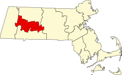 | |
| Towns | ||
| CDPs | ||
| Other villages | ||
| Footnotes | ‡This populated place also has portions in an adjacent county or counties | |
| International | |
|---|---|
| National | |
| Geographic | |
| Other | |
Amherst, Massachusetts
View on GrokipediaAmherst is a town in Hampshire County, western Massachusetts, United States, covering 27.7 square miles of land in the Pioneer Valley region.[1] Its population stood at 39,263 according to the 2020 United States census, rendering it the most populous municipality in the county, though Northampton functions as the county seat.[1][2]
The town operates under a council-manager form of government, with a 13-member town council overseeing a town manager.[1] Amherst is defined primarily as an educational hub, hosting Amherst College, founded in 1821 to educate indigent young men; the University of Massachusetts Amherst, established in 1863 as a land-grant agricultural college; and Hampshire College, opened in 1965 to provide alternative liberal arts instruction.[3] These institutions drive a daytime population estimated to more than double the residential count, fueling an economy centered on education, open space preservation, and agriculture.[2][3]
Settled in the 1730s by Congregationalist dissenters from Connecticut and formally separated from Hadley in 1759, Amherst maintains a historical emphasis on farming and learning, symbolized in its town seal by a plow and an open book.[3] It gained cultural distinction as the lifelong residence of poet Emily Dickinson, who was born there in 1830 and composed nearly all her work without departing the town after age 17.[4][3]
Name
Etymology and Historical Naming
The name Amherst derives from Jeffery Amherst, 1st Baron Amherst (1717–1797), a British Army officer who served as commander-in-chief of British forces in North America during the French and Indian War (1754–1763), leading successful campaigns that captured French strongholds at Louisbourg in 1758 and Quebec in 1759.[5] The town, originally part of Hadley and incorporated as a separate district in 1759 by the Massachusetts General Court, adopted the name as a tribute to his military achievements amid a wave of colonial place-naming honoring British victors in the conflict.[5] Full town incorporation followed on February 13, 1776, shortly after the Declaration of Independence, with early records dating to 1735 reflecting settlement patterns in the Pioneer Valley.[6] Amherst's legacy includes strategic acumen in conventional warfare but also controversy over his correspondence during Pontiac's War (1763–1766), where he endorsed proposals to deploy biological agents against Native American populations resistant to British control. In July 1763 letters to Colonel Henry Bouquet, Amherst approved Bouquet's suggestion to distribute smallpox-infected blankets and handkerchiefs from hospital stores to Delaware and Shawnee groups near Fort Pitt, stating, "You will do well to try to inoculate the Indians by means of Blanketts that may fall in their Hands, and take care not to get the disease yourself," and later adding that "any other method that can serve to Extirpate this Execreble Race" would be welcomed.[7] Primary documents, including Amherst's exchanges preserved in British military archives, confirm the intent, though the blankets distributed by Captain Simeon Ecuyer at Fort Pitt on June 24, 1763, coincided with an existing regional smallpox outbreak, rendering causal attribution to deliberate infection inconclusive based on epidemiological records.[8] No alterations to the town's name have occurred since its adoption, despite intermittent resident petitions and opinion campaigns since the 2010s citing Amherst's documented views on Native American subjugation as grounds for renaming to reflect contemporary ethical standards.[9] These efforts, often tied to broader reevaluations of colonial figures, have not advanced to formal ballot measures or legislative action, with town governance prioritizing historical continuity over reinterpretations lacking empirical basis for retroactive judgment.[10]History
Indigenous Presence and Early Colonial Settlement
The region of present-day Amherst, situated in the Connecticut River Valley, was long inhabited by the Nonotuck people, affiliated with the broader Pocumtuc confederacy of Algonquian-speaking groups. These indigenous communities practiced maize agriculture supplemented by beans, squash, and other crops on the valley's alluvial soils, alongside fishing in the river and participation in extensive trade networks for furs, wampum, and European goods introduced post-contact. Archaeological surveys have documented over 600 sites in the Massachusetts portion of the valley, evidencing Woodland-period settlements with evidence of farming tools, storage pits, and seasonal camps focused on resource gathering and riverine trade routes.[11][12][13] Adjacent Nipmuc bands also utilized lands near the Nonotuck territory for similar subsistence activities, including hunting, gathering, and diplomacy along the river corridor that facilitated inter-tribal exchange. King Philip's War (1675–1676), a conflict between English colonists and a Native alliance led by Metacom (King Philip), severely disrupted these communities in western Massachusetts, resulting in heavy Pocumtuc and Nipmuc casualties, displacement, and enslavement, which diminished indigenous control over the valley. The war's raids and destruction of frontier outposts in Hampshire County heightened colonial fears, stalling westward expansion for decades despite earlier explorations around 1665.[14][15][16] English settlement of the Amherst area began tentatively after the war's resolution, with lands granted by the Massachusetts General Court in 1703 as an extension of Hadley township, drawn by the valley's nutrient-rich floodplain soils ideal for tillage and its defensible position astride the Connecticut River for transport and military logistics. Permanent families arrived around 1730, clearing forests for homesteads and establishing about 18 households by that decade's end, prioritizing cattle rearing and grain production on granted lots typically ranging from 50 to 200 acres per settler. The precinct separated from Hadley in 1759 amid growing population pressures, achieving full town incorporation in 1775 with an estimated 1,200 residents by then, marking the consolidation of colonial agrarian patterns post-conflict.[17][3][18]Revolutionary and Early Republic Era
During the American Revolutionary War, Amherst residents exhibited divided loyalties between Patriot and Loyalist factions, reflecting broader tensions in western Massachusetts.[19] Local men enlisted in militia units and Continental Army regiments; for instance, Caesar Prutt of Amherst joined the Continental forces on May 8, 1775, following the Lexington Alarm.[20] The town's agricultural economy supported wartime efforts through provisions, though internal divisions, including Loyalist sympathies, strained community cohesion amid patriotic mobilization.[21] Postwar economic distress exacerbated by war debts and disrupted trade led to widespread agrarian hardship, culminating in Amherst's involvement in Shays' Rebellion of 1786–1787.[22] An estimated 113 townspeople joined the uprising against high taxes and debt collection, highlighting conflicts between small farmers and creditors that influenced calls for a stronger national government.[19] Recovery centered on agriculture, with farms producing livestock, dairy, and crops for emerging urban markets, alongside nascent industrial growth from water-powered mills on the Mill River.[23] By 1786, state legislation formalized Amherst as a town, stabilizing governance amid this transition.[24] The 1790 federal census recorded a population of 1,233, predominantly rural families reliant on self-sufficient farming.[25] Early republican institutions reinforced community structure, building on the First Congregational Church organized on November 7, 1739, as the foundational religious body in the Hadley Third Precinct.[26] Gristmills, such as those leveraging falls on the Mill River dating to mid-century permissions, expanded to process local grain, supporting agricultural output.[27] Lexicographer Noah Webster, relocating to Amherst in 1812, critiqued deficient local schooling and mobilized residents to establish the Amherst Academy, enhancing secondary education while serving in the Massachusetts General Court to advocate for governance reforms.[28][29] These developments fostered political alignment with federalist principles, prioritizing economic stability and civic education in the nascent republic.19th-Century Agricultural and Educational Foundations
During the early 19th century, agriculture formed the economic backbone of Amherst, with most residents engaged in farming on lands cleared from forested areas since the 1730s, employing methods that divided fields and grew nutrient-intensive crops.[3] Tobacco and onion production emerged as dominant specialties by mid-century, particularly suited to the Connecticut Valley's soils, enabling prosperity for farmers who adapted to these cash crops amid mixed grain and livestock operations.[18] [30] However, tobacco's heavy demands rapidly exhausted soil fertility, while volatile markets for field-grown varieties led to production declines and farmer discouragement by the late 1800s.[23] Complementing this agrarian base, educational institutions arose to address religious and utilitarian demands in a community shaped by Congregationalist values. Amherst College was established in 1821 by local clergy and residents, including lexicographer Noah Webster, explicitly to educate indigent youth—often for ministerial roles—drawing on Puritan-descended efforts to sustain moral instruction amid regional debates over relocating institutions like Williams College.[31] [32] Four decades later, the Massachusetts Agricultural College (predecessor to the University of Massachusetts Amherst) opened in 1863 under the federal Morrill Land-Grant Act, allocating 310 acres for practical training in farming techniques, directly responding to the era's agricultural challenges like soil management and crop innovation.[33] Abolitionist fervor, rooted in evangelical traditions, permeated these foundations without dominating them; by 1841, Amherst College students actively advocated political antislavery positions, while alumnus Henry Ward Beecher (class of 1834) emerged as a national figure in the cause.[34] [35] Local involvement in the Civil War included enlistments from Amherst's youth and Black residents, who participated in key Union actions such as the assault on Fort Wagner, reflecting pragmatic support for federal efforts rather than uniform ideological zeal, as evidenced by town records of recruitment and homefront contributions.[36] [37]20th-Century Industrial and Academic Expansion
In the early 20th century, Amherst's economy remained predominantly agricultural, with limited industrialization confined to remnants of 19th-century mills along the Mill River in North Amherst, such as grist and paper operations that largely declined by the 1910s and were supplanted by automotive-related services like gas stations.[38][39] Population growth was modest, increasing from 5,550 in 1920 to 6,410 in 1940, reflecting the town's rural character and reliance on farming alongside the nascent expansion of Massachusetts Agricultural College, which enrolled around 1,000 students by the 1920s but focused primarily on agricultural research rather than broad economic transformation.[25][40] The post-World War II era marked a pivotal shift, driven by the University of Massachusetts's rapid academic expansion, which became the town's primary economic engine. Renamed Massachusetts State College in 1931 and elevated to university status in 1947, UMass saw enrollment surge from approximately 4,000 students in 1954–1955 to 10,500 undergraduates by 1964, fueled by the GI Bill and Baby Boom demographics, alongside infrastructure developments like new dormitories and academic buildings.[33][41] This academic growth correlated with Amherst's population doubling to 10,856 by 1950, as faculty, staff, and students stimulated demand for housing and services, though manufacturing remained marginal, with the service sector—retail, dining, and campus-related enterprises—emerging as secondary drivers amid the town's persistent semi-rural landscape.[25][33] By the 1960s and 1970s, Cold War-era federal investments in higher education indirectly bolstered UMass's research profile, supporting expansions in sciences and engineering that attracted grants and personnel, though Amherst's planning emphasized suburban-style residential development to accommodate influxes rather than heavy industry.[33] Enrollment continued climbing, reaching over 23,000 by the late 1970s, prompting zoning adjustments for low-density housing and campus periphery growth, which preserved green spaces but strained infrastructure without fostering significant industrial diversification.[42][43] This academic-led trajectory contrasted with broader regional deindustrialization, positioning Amherst as an education-centric enclave rather than a manufacturing hub through 1980.[41]Post-2000 Developments and Challenges
The population of Amherst stabilized in the post-2000 period, reaching 39,263 residents according to the 2020 United States Census, up from 34,874 in 2000, with estimates placing it at approximately 40,989 in 2024 and around 41,049 by mid-2025.[1][44][45] This plateau reflects the town's heavy reliance on transient student populations from the University of Massachusetts Amherst (UMass Amherst) and Amherst College, which together account for over 25,000 enrollees annually, including about 23,920 undergraduates at UMass in fall 2024.[46] Municipal infrastructure projects advanced in the 2020s to accommodate growth and enhance public spaces, notably the North Common revitalization, which transformed the downtown park into a more accessible venue with improved landscaping, pathways, and amenities after construction phases spanning from 2013 to completion in October 2025.[47] Parallel zoning reforms sought to boost housing density amid rising costs and demand; amendments approved in recent years facilitated multi-family units in select districts like the Student Preservation Residential zone and reduced barriers for accessory dwelling units, aiming to expand affordable options while integrating year-round and student housing.[48] In 2025, citizen-initiated petitions further proposed caps on large student-oriented developments and a temporary moratorium on certain residential applications to prioritize family-friendly density.[49] The COVID-19 pandemic introduced enrollment volatility at local institutions, with UMass Amherst experiencing flat full-time student numbers around 30,460 by 2024 after initial disruptions, while broader undergraduate trends showed minimal recovery from pandemic-era dips influenced by deferred admissions and virtual alternatives.[50] Amherst College similarly navigated application surges but faced retention challenges tied to remote learning transitions in 2020-2021.[51] The shift to remote work, which elevated Massachusetts' remote employment rate among the nation's highest by 2023, strained Amherst's economy by reducing foot traffic in student-dependent retail and services, though town policies enabled municipal telework to sustain operations.[52][53]Geography
Physical Location and Terrain
Amherst occupies 27.7 square miles in Hampshire County, west-central Massachusetts, within the Pioneer Valley portion of the Connecticut River Valley.[1] Of this area, 27.6 square miles consists of land and 0.1 square miles of water, primarily small ponds and streams.[54] The town's position in the fertile alluvial plain of the valley facilitated early agricultural settlement, while its proximity to higher terrain limited expansive urban sprawl and supported a mixed economy of farming and later education.[1] The terrain features a low-lying valley floor with elevations averaging 295 feet above sea level, transitioning eastward to rolling hills and the eastern escarpment of the Holyoke Range.[55] This range, a 7-mile traprock ridge, includes peaks such as Mount Norwottuck at 1,106 feet and Long Mountain at 920 feet within or bordering Amherst, providing natural elevation gains of up to 800 feet from the valley base.[56][57] These uplands, composed of resistant basalt layers, have historically directed settlement toward the flatter, more arable valley lands, influencing patterns of land division and economic reliance on agriculture.[58] Hydrologically, the Connecticut River, located about 6 miles west of central Amherst, shapes regional drainage through its broad floodplain, which affects tributary streams like the Mill River flowing through the town.[59] Geologic features of the Connecticut Valley, including glacial deposits and permeable sands, moderate flood propagation, resulting in relatively low direct flood risks for Amherst compared to river-adjacent areas.[58][60] Land use reflects this topography, with 23% residential, 18% protected agricultural, and 18% conservation areas, preserving over half the town's land in open or undeveloped states that sustain ecological buffers and agrarian activities.[61]Climate and Environmental Features
Amherst experiences a humid continental climate characterized by cold, snowy winters and warm, humid summers. Average high temperatures range from 34°F in January to 83°F in July, with lows typically falling to 17°F in winter and 60°F in summer. Annual precipitation averages approximately 46 inches, distributed fairly evenly throughout the year, with June seeing the highest number of wet days at around 10.7 days with at least 0.04 inches of rain.[62][63] The region is particularly vulnerable to nor'easters, which bring heavy snowfall and strong winds, contributing to its winter weather patterns. For instance, a 2013 nor'easter deposited 16 inches of snow in Amherst, approaching the local record of 20 inches set in February 1898. These storms, common in the Northeast, underscore the area's exposure to intense winter precipitation events that can disrupt infrastructure and daily life.[64] Environmental features include extensive wetlands and conservation lands that support biodiversity amid ongoing development pressures. The town enforces a Wetlands Protection Bylaw covering freshwater wetlands, marshes, wet meadows, bogs, and swamps to preserve these resources. Conservation efforts protect areas such as Lawrence Swamp, the Mount Holyoke Range, local ponds, and rivers, balancing ecological integrity with urban expansion in the Pioneer Valley.[65][66]Demographics
Population Growth and Trends
The population of Amherst grew from 1,233 residents in the 1790 U.S. Census to 34,874 by 2000, reflecting gradual expansion tied to agricultural roots and early educational establishments.[25] A sharper increase occurred after 1960, coinciding with the expansion of the University of Massachusetts Amherst, rising from 13,718 in 1960 to 26,331 in 1970.[25] Decennial census figures illustrate this trajectory:| Year | Population |
|---|---|
| 1790 | 1,233 |
| 1800 | 1,358 |
| 1810 | 1,469 |
| 1820 | 1,917 |
| 1830 | 2,631 |
| 1840 | 2,550 |
| 1850 | 3,057 |
| 1860 | 3,206 |
| 1870 | 4,035 |
| 1880 | 4,298 |
| 1890 | 4,512 |
| 1900 | 5,028 |
| 1910 | 5,112 |
| 1920 | 5,550 |
| 1930 | 5,888 |
| 1940 | 6,410 |
| 1950 | 10,856 |
| 1960 | 13,718 |
| 1970 | 26,331 |
| 1980 | 33,229 |
| 1990 | 35,228 |
| 2000 | 34,874 |
Racial, Ethnic, and Religious Composition
According to the 2020 United States Census, Amherst's population of 39,201 was composed of 67.2% White alone (not Hispanic or Latino), 13.4% Asian alone, 5.1% Black or African American alone, 2 or more races 7.6%, and 7.3% Hispanic or Latino of any race.[71] The elevated proportion of Asian residents, exceeding the Massachusetts state average of 7.2%, stems primarily from international students and faculty at the University of Massachusetts Amherst and Amherst College, which draw significant numbers from East and South Asia. Black and Hispanic populations remain smaller, at levels below state medians of 9.0% and 12.6%, respectively, reflecting the town's academic orientation over broader urban migration patterns.[71]| Racial/Ethnic Group | Percentage (2020 Census) |
|---|---|
| White (Non-Hispanic) | 67.2% |
| Asian (Non-Hispanic) | 13.4% |
| Hispanic or Latino (any race) | 7.3% |
| Two or more races | 7.6% |
| Black or African American | 5.1% |
Socioeconomic Indicators
The median household income in Amherst was $65,938 in the 2019–2023 American Community Survey period, substantially lower than the Massachusetts state median of approximately $96,505, reflecting the influence of a large transient student population forming low- or zero-income households.[76] Per capita income, at $57,662, is moderated by this demographic but benefits from higher earnings among permanent residents such as university faculty and staff, who concentrate wealth in fewer households.[77] The poverty rate stood at 24.1% during the same period, more than double the state average and driven predominantly by undergraduate and graduate students classified as impoverished due to limited employment and dependence on financial aid or family support, rather than broader economic distress among working adults.[76] This contrasts with affluence in faculty-dominated segments, where family median incomes exceed $96,000, highlighting income polarization tied to the university's role.[76] Homeownership rates hover around 48%, with rentals comprising over half of occupied units, a pattern attributable to the proximity of the University of Massachusetts Amherst campus, which sustains high demand for affordable student housing and discourages long-term ownership among younger demographics.[78] This rental dominance exacerbates income disparities, as homeowner households report average annual incomes of $137,102 compared to $37,617 for renters.[79]Age, Education, and Household Structure
The median age in Amherst is 23 years, markedly younger than the Massachusetts state median of 40 years, primarily due to the large transient student population from institutions such as the University of Massachusetts Amherst, Amherst College, and Hampshire College. According to the 2019-2023 American Community Survey (ACS), approximately 5% of residents are under 15 years old, while 69.3% are aged 15 to 24, contributing to roughly 40% of the population being under 20 years old when including portions of the young adult cohort; in contrast, only about 10% are under 18 per 2020 Census benchmarks, underscoring the dominance of college-aged individuals over traditional youth demographics.[78] Educational attainment among adults aged 25 and older exceeds state and national averages, with 96% possessing at least a high school diploma or GED equivalent and 69% holding a bachelor's degree or higher as of recent ACS estimates. This elevated profile stems from the concentration of academic professionals, graduate students, and alumni in the community, rather than broad local workforce trends, as evidenced by the town's role as an educational hub; for comparison, Massachusetts statewide bachelor's attainment hovers around 46%. Literacy and advanced skill metrics align with these figures, though data on vocational or specialized training remains limited beyond degree proxies.[80][71] Household structures reflect the student-driven demographics, with non-family households—often comprising single occupants or roommates—outnumbering family units at approximately 55%, while family households constitute 44.8% of the total 4,664 households reported in recent surveys. Average household size is 2 persons, lower than the state average of 2.5, indicative of high single-occupancy rates among undergraduates and limited traditional nuclear families; married-couple families represent about 47% of family households, further highlighting deviations from non-college-town norms.[78][71]Government and Politics
Town Governance Structure
Amherst operates under a Home Rule Charter adopted by voters in 2017 and effective from July 1, 2018, which established a council-manager form of government replacing the prior open town meeting and select board structure.[81] The charter vests legislative powers in an elected Town Council of 13 members, including a mayor elected at-large, responsible for enacting bylaws, approving budgets, and setting policy.[82] The Town Manager, appointed by the Council and serving as chief executive officer, oversees daily administration, implements policies, manages departments, and prepares the annual budget.[83] The town's fiscal operations are governed by Massachusetts General Laws, including Proposition 2½ enacted in 1980, which limits annual property tax levy increases to 2.5% of the prior year's levy plus growth from new development, with overrides requiring two-thirds voter approval for permanent increases or debt exclusions for specific projects.[84] Amherst has historically complied with these caps through balanced budgeting and occasional voter-approved overrides or exclusions to fund infrastructure and services, avoiding chronic underrides that could strain operations.[85] Annual town budgets, typically approaching $100 million in operating expenditures, allocate over 50% to education, reflecting the significant share for public schools amid regional assessments and local K-8 operations.[86] For fiscal year 2025 (July 1, 2024–June 30, 2025), the Amherst Public Schools budget totaled $27.2 million for level services, supplemented by a $19.74 million assessment to the Amherst-Pelham Regional School District.[87][88] In 2025, municipal planning efforts included the Downtown Design Standards project, aimed at updating guidelines for streetscapes, building facades, and private properties to enhance downtown vitality while aligning with zoning bylaws.[89] This initiative, funded through the FY2025 capital improvement program, involves public workshops and consultant analysis to inform regulatory changes without expanding beyond core administrative functions.[90]State and Federal Representation
In the Massachusetts House of Representatives, Amherst falls within the 3rd Hampshire District, represented by Mindy Domb (D), who was re-elected to a fourth term on November 5, 2024.[91] Domb has sponsored petitions addressing education funding, including H.118 on charter school allocations and measures tied to public access to educational records for students with disabilities.[92] [93] The town is represented in the Massachusetts Senate by Joanne M. Comerford (D) of the Hampshire, Franklin, and Worcester District.[94] Comerford has supported budget amendments increasing allocations for educational initiatives, such as S.3 Amendment 855 for court-appointed special advocates in child welfare cases with educational overlaps, and testified in favor of reforms to charter school funding formulas in September 2025.[95] [96] Federally, Amherst lies in Massachusetts's 2nd Congressional District, served by Jim McGovern (D), who has held the seat since 1997 and prioritizes higher education funding in appropriations bills benefiting institutions like the University of Massachusetts Amherst.[97] The state's U.S. Senators are Elizabeth Warren (D) and Edward J. Markey (D), both in office as of October 2025. [98] Warren sponsored the Educational Equity Challenge Grant Act of 2024 (S.5372), allocating $100 billion over ten years for post-COVID recovery in K-12 and higher education equity programs, while Markey co-sponsored the College for All Act of 2023 to expand tuition-free access at public universities. [99] Amherst exerts policy influence primarily through the University of Massachusetts system's lobbying efforts, with UMass spending $830,000 on federal advocacy in 2023 and $460,000 in 2021 to secure appropriations for campus operations and research, indirectly bolstering town priorities like economic development tied to university funding.[100] [101]Electoral Patterns and Voter Demographics
In the 2020 presidential election, Democratic nominee Joe Biden received 10,718 votes (90.3% of valid votes), while Republican incumbent Donald Trump garnered 873 votes (7.4%), with minor candidates and write-ins accounting for the remainder among 11,871 valid ballots cast town-wide.[102] In the 2024 presidential election, Democratic nominee Kamala Harris secured 9,316 votes (86.7%), compared to 889 votes (8.3%) for Republican Donald Trump, amid 10,743 total ballots cast, including 384 votes for other candidates and 80 blanks.[103] These results demonstrate consistent Democratic dominance exceeding 85% in recent cycles, with Republican support remaining under 10%, reflecting limited variation from state trends where Massachusetts has not supported a Republican presidential candidate since 1984.| Year | Democratic Candidate | Votes | Percentage | Republican Candidate | Votes | Percentage |
|---|---|---|---|---|---|---|
| 2020 | Joe Biden | 10,718 | 90.3% | Donald Trump | 873 | 7.4% |
| 2024 | Kamala Harris | 9,316 | 86.7% | Donald Trump | 889 | 8.3% |