Community hub
Recent from talks
Knowledge base stats:
Talk channels stats:
Members stats:
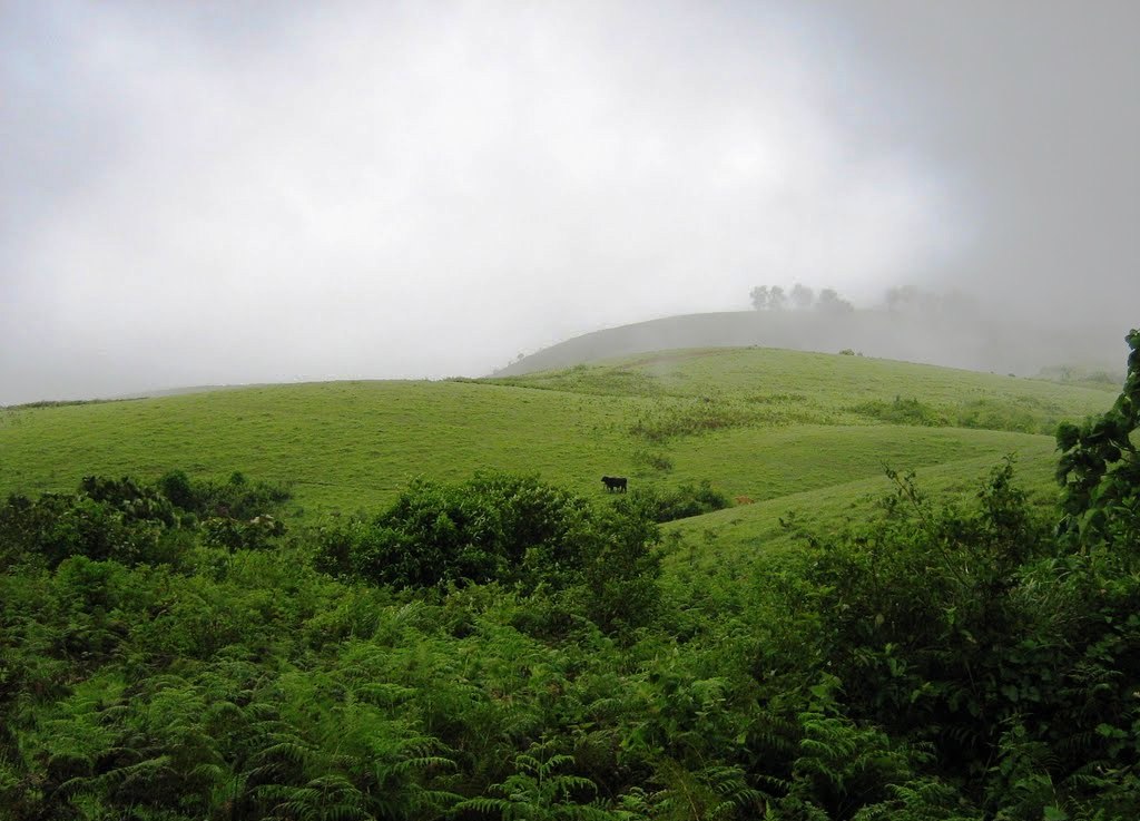
Vagamon
Vagamon (Malayalam: [ʋaːɡɐmɐɳ]) is an Indian hill station and a revenue village located in Peerumedu Taluk of Idukki district, and also Meenachil taluk and Kanjirappally taluk of Kottayam district in the state of Kerala, India. Located in the Western Ghats 25 kilometres (16 mi) east of Erattupetta on the border of Kottayam-Idukki districts, Vagamon is known for its natural environment. The Vagamon glass bridge is the longest cantilever glass bridge in India.
Vagamon remained largely unexplored for centuries. Though the British had plantations here, it was only in 1926, when Walter Duncan and Company started their tea plantations, that it became well known. In the 1930s, more tea plantations were set up in the area. After 1940, people from Travancore, and Madras (Tamil Nadu), migrated to Vagamon. Later, after the formation of Kerala State, people from various parts of Kerala migrated there.[citation needed]
In 1955, the Trappist monastery Kurisumala Ashram was founded in Vagamon.
In 1963,Dr. Elizabeth Baker and Architect Padma Shri Laurie Baker established a hospital and rural service centre at Kurishumala, Vagamon to serve tea-plantation workers and rural communities in the Idukki hills. Often referred to as the Mitraniketan, it is widely noted as Baker’s first project in Kerala and as an early exemplar of his cost-effective, climate-sensitive building approach using local materials.
Vagamon is located in the Western Ghats at 1,100 metres (3,600 ft) above sea level. It has a cool climate with summer temperatures reaching 10–23 °C (50–73 °F)10-23 °C at midday.
As of 2011 Census, Vagamon had a population of 14,641 with 7,212 males and 7,429 females. Vagamon village has an area of 78.3 km2 (30.2 sq mi) with 3,816 families residing in it. The average sex ratio was 1030 lower than the state average of 1084. In Vagamon, 9% of the population was under 6 years of age. Vagamon had an average literacy of 90.9%. higher than the national average of 74%, and lower than the state average of 94%.
The primary economy is ecotourism including hiking to explore the many waterfalls, rock climbing and paragliding. National Geographic Traveler has listed Vagamon in their directory of the "50 most attractive places to visit in India". In addition, many people work in as laborers in tea and coffee plantations.
Vagamon has two colleges: DC School of Management and Technology (DCSMAT) and DC School Of Architecture And Design, both promoted by DC Kizhakemuri Foundation and co-promoted by DC Books. One of the leading management colleges in Kerala, DCSMAT has an additional campus in Thiruvananthapuram. DCSMAT offer programs such as Master of Business Administration (MBA), Bachelor of Commerce (B.Com), Bachelor of Business Administrati (BBA), Certified Management Accountant (CMA) and Association of Chartered Certified Accountants (ACCA). DC School Of Architecture And Design provides courses such as Bachelor of Arts in Interior Design (BA Interior Design) and Bachelor of Architecture (BArch). The College of Dairy Sciences kolahalamedu Vagamon, offering courses for the B Tech Dairy Sciences, affiliated to Veterinary University.
Hub AI
Vagamon AI simulator
(@Vagamon_simulator)
Vagamon
Vagamon (Malayalam: [ʋaːɡɐmɐɳ]) is an Indian hill station and a revenue village located in Peerumedu Taluk of Idukki district, and also Meenachil taluk and Kanjirappally taluk of Kottayam district in the state of Kerala, India. Located in the Western Ghats 25 kilometres (16 mi) east of Erattupetta on the border of Kottayam-Idukki districts, Vagamon is known for its natural environment. The Vagamon glass bridge is the longest cantilever glass bridge in India.
Vagamon remained largely unexplored for centuries. Though the British had plantations here, it was only in 1926, when Walter Duncan and Company started their tea plantations, that it became well known. In the 1930s, more tea plantations were set up in the area. After 1940, people from Travancore, and Madras (Tamil Nadu), migrated to Vagamon. Later, after the formation of Kerala State, people from various parts of Kerala migrated there.[citation needed]
In 1955, the Trappist monastery Kurisumala Ashram was founded in Vagamon.
In 1963,Dr. Elizabeth Baker and Architect Padma Shri Laurie Baker established a hospital and rural service centre at Kurishumala, Vagamon to serve tea-plantation workers and rural communities in the Idukki hills. Often referred to as the Mitraniketan, it is widely noted as Baker’s first project in Kerala and as an early exemplar of his cost-effective, climate-sensitive building approach using local materials.
Vagamon is located in the Western Ghats at 1,100 metres (3,600 ft) above sea level. It has a cool climate with summer temperatures reaching 10–23 °C (50–73 °F)10-23 °C at midday.
As of 2011 Census, Vagamon had a population of 14,641 with 7,212 males and 7,429 females. Vagamon village has an area of 78.3 km2 (30.2 sq mi) with 3,816 families residing in it. The average sex ratio was 1030 lower than the state average of 1084. In Vagamon, 9% of the population was under 6 years of age. Vagamon had an average literacy of 90.9%. higher than the national average of 74%, and lower than the state average of 94%.
The primary economy is ecotourism including hiking to explore the many waterfalls, rock climbing and paragliding. National Geographic Traveler has listed Vagamon in their directory of the "50 most attractive places to visit in India". In addition, many people work in as laborers in tea and coffee plantations.
Vagamon has two colleges: DC School of Management and Technology (DCSMAT) and DC School Of Architecture And Design, both promoted by DC Kizhakemuri Foundation and co-promoted by DC Books. One of the leading management colleges in Kerala, DCSMAT has an additional campus in Thiruvananthapuram. DCSMAT offer programs such as Master of Business Administration (MBA), Bachelor of Commerce (B.Com), Bachelor of Business Administrati (BBA), Certified Management Accountant (CMA) and Association of Chartered Certified Accountants (ACCA). DC School Of Architecture And Design provides courses such as Bachelor of Arts in Interior Design (BA Interior Design) and Bachelor of Architecture (BArch). The College of Dairy Sciences kolahalamedu Vagamon, offering courses for the B Tech Dairy Sciences, affiliated to Veterinary University.