
Community hub
Recent from talks
Contribute something
Nothing was collected or created yet.
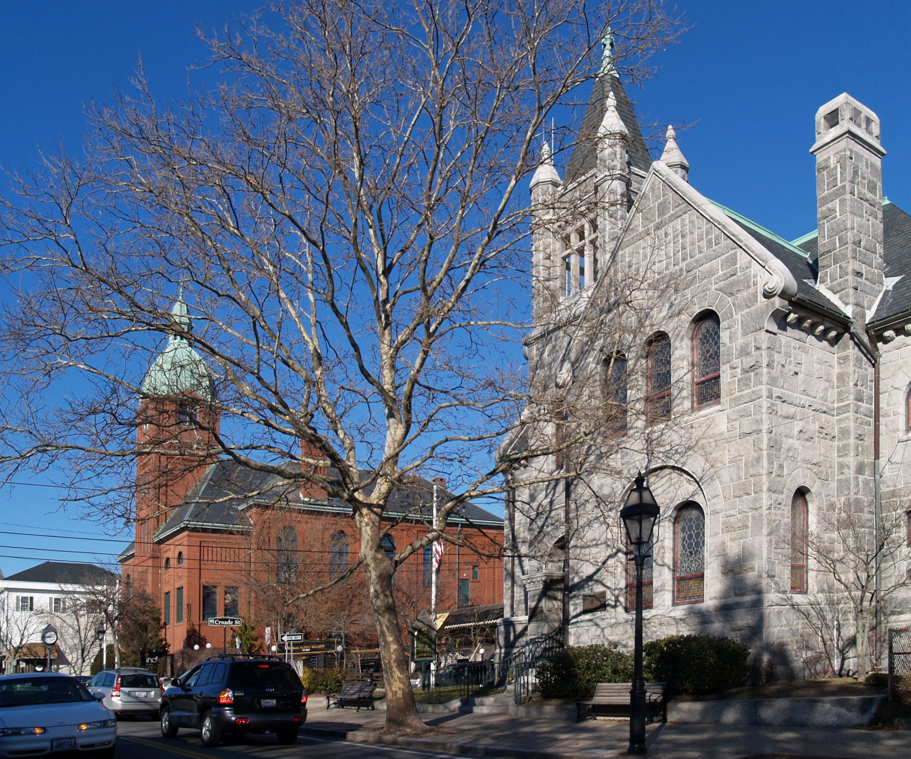
Warren, Rhode Island
View on Wikipedia
Warren is a town in Bristol County, Rhode Island, United States. The population was 11,147 at the 2020 census.
Key Information


History
[edit]
Warren was the site of the Pokanoket Indian settlement of Sowams located on a peninsula within the Pokanoket region. The region consisted of over 60 settlements under the authority of Chief Massasoit (sometimes called Osamequin) who controlled the land from Plymouth to the eastern shores of Narragansett Bay. English colonists Edward Winslow and Stephen Hopkins from Plymouth Colony first visited there in July, 1621.[2] Winslow and John Hampden saved Massasoit's life two years later and gained an important ally and lifelong friend. The colonists set up a trading post by 1632 on the banks of the Kickemuit River where they traded English goods for furs and other items. Roger Williams was banished from Salem, Massachusetts, in January, 1636, and fled to Sowams, becoming ill on the way. He was sheltered by Massasoit in Sowams until he recovered over the winter months; he later established Providence Plantations.
Permanent English settlement began east of the Indian village in 1653. Massasoit and his oldest son Wamsutta sold to Plymouth Colony settlers what is now Warren and parts of Barrington, Rhode Island, Swansea, Massachusetts, and Rehoboth, Massachusetts.[3] The land was part of the Massachusetts Bay Colony and was first incorporated as part of Swansea. After the death of Massasoit, however, relations became strained between the Indians and the settlers, leading to King Philip's War in 1675 when the Indians destroyed the settlement at Sowams. In 1668, the township was officially incorporated with the name Sowams; in 1691, the Plymouth Colony merged with the Massachusetts Bay Colony.
Warren was ceded to Rhode Island from Massachusetts in 1747 along with the Attleborough Gore (now Cumberland), Barrington, Bristol, Tiverton, and Little Compton, Rhode Island.[4] The town was named "Warren" after British naval hero Admiral Sir Peter Warren after a victory at Louisburg in 1745. Barrington was unified with Warren at the time, until it was separated again in 1770.
Warren was the original home of Brown University, founded in 1764 as the College in the English Colony of Rhode Island and Providence Plantations. The school registered its first students in 1765 and was the Baptist answer to Congregationalist Yale and Harvard, Presbyterian Princeton, and Episcopalian Penn and Columbia. It was the only one of these schools that welcomed students of all religious persuasions, following the example of Roger Williams, who founded Rhode Island in 1636 on the same principle.
In the mid-18th century, the town was well known as a whaling port, and ship building became an important industry. The American Revolutionary War seriously affected Warren's commercial prosperity, and the town was subject to British raids in 1778 along with the rest of the region. Commerce revived within the decade after the Revolution until the middle of the 19th century, and Warren was famous for the fine vessels launched from its yards. These vessels were largely commanded and operated by Warren crews, and they engaged in whaling, merchant service, and the West India trade. Three notable ships were built in Warren by Chase & Davis: the 1853 clipper Lookout, the 1853 clipper bark Gem of the Sea, and the 1854 clipper bark Mary Ogden.

With the decline of the whaling industry and related seafaring commerce toward the middle of the 19th century, business attention turned to textile manufacturing. Warren's first cotton mill was erected by the Warren Manufacturing Company in 1847. Further mills and factories developed during and after the Civil War, attracting an immigrant work force. Today, Warren is home to several waterfront businesses such as Blount Marine, Blount Seafood, and Dyer Boats.
Geography
[edit]According to the United States Census Bureau, the town has a total area of 8.6 square miles (22 km2), of which 6.2 square miles (16 km2) is land and 2.5 square miles (6.5 km2) (28.90%) is water. Warren is located on the east bank of the Warren River (opposite Barrington, Rhode Island). The weather in January is very low going at its highest of 38° and a low of 27°, as the months go the higher the weather gets as in July it gets a high of 79° and a low of 69°, then it starts to drop as the years go and then at the end of the month (December) it reaches a high of 43° and a low of 33°.
Demographics
[edit]


,_Rhode_Island.jpg)
| Census | Pop. | Note | %± |
|---|---|---|---|
| 1790 | 1,122 | — | |
| 1800 | 1,473 | 31.3% | |
| 1810 | 1,775 | 20.5% | |
| 1820 | 1,806 | 1.7% | |
| 1830 | 1,800 | −0.3% | |
| 1840 | 2,437 | 35.4% | |
| 1850 | 3,103 | 27.3% | |
| 1860 | 2,636 | −15.0% | |
| 1870 | 3,008 | 14.1% | |
| 1880 | 4,007 | 33.2% | |
| 1890 | 4,489 | 12.0% | |
| 1900 | 5,108 | 13.8% | |
| 1910 | 6,585 | 28.9% | |
| 1920 | 7,841 | 19.1% | |
| 1930 | 7,974 | 1.7% | |
| 1940 | 8,158 | 2.3% | |
| 1950 | 8,513 | 4.4% | |
| 1960 | 8,750 | 2.8% | |
| 1970 | 10,523 | 20.3% | |
| 1980 | 10,640 | 1.1% | |
| 1990 | 11,385 | 7.0% | |
| 2000 | 11,360 | −0.2% | |
| 2010 | 10,611 | −6.6% | |
| 2020 | 11,147 | 5.1% | |
| U.S. Decennial Census[5][6] | |||
As of the census of 2020, there were 11,147 people and 4,962 households in the town. The population density was 1,810.2 inhabitants per square mile (698.9/km2). There were 5,495 housing units in the town. The racial makeup of the town was 90.38% White, 1.66% African American, 0.26% Native American, 1.11% Asian, 0.00% Pacific Islander, 1.24% from other races, and 5.35% from two or more races. Hispanic or Latino of any race were 3.24% of the population.
There were 4,962 households, out of which 17.5% had children under the age of 18 living with them, 42.0% were married couples living together, 29.5% had a female householder with no spouse present, and 21.6% had a male householder with no spouse present. Of all households, 16.2% were made up of individuals, and 6.0% had someone living alone who was 65 years of age or older. The average household size was 2.20 and the average family size was 2.96.
In the town, the population was spread out, with 13.4% under the age of 18, 7.5% from 18 to 24, 25.8% from 25 to 44, 28.8% from 45 to 64, and 24.5% who were 65 years of age or older. The median age was 48.5 years.
The median income for a household in the town was $89,722, and the median income for a family was $122,807. The per capita income for the town was $50,745. About 9.2% of the population were below the poverty line, including 3.5% of those under age 18 and 14.4% of those age 65 or over.
Government
[edit]| Year | GOP | DEM | Others |
|---|---|---|---|
| 2016 | 39.33% 1,987 | 53.15% 2,685 | 7.52% 380 |
| 2012 | 34.78% 1,688 | 63.01% 3,058 | 2.20% 107 |
| 2008 | 34.54% 1,760 | 63.85% 3,254 | 1.61% 82 |
| 2004 | 38.17% 1,835 | 59.93% 2,881 | 1.89% 91 |
| 2000 | 31.02% 1,446 | 62.74% 2,925 | 6.24% 291 |
| 1996 | 25.95% 1,177 | 60.79% 2,757 | 13.25% 601 |
| 1992 | 29.27% 1,544 | 46.03% 2,428 | 24.70% 1,303 |
| 1988 | 45.57% 2,120 | 54.02% 2,513 | 0.41% 19 |
Warren is a part of the 10th District in the Rhode Island Senate and is currently represented by Democrat Walter Felag Jr. The town is a part of Rhode Island's 1st congressional district at the federal level and is presently represented by Democrat Gabe Amo. It is a reliably Democratic stronghold in presidential elections, as no Republican has carried the town in over four decades.
Notable places
[edit]Notable people
[edit]- Lou Abbruzzi, NFL football player
- Pat Abbruzzi, All-Star Canadian football player, RI football legend
- F. Nelson Blount, founder of the Blount Seafood Corporation and steam locomotive collector
- Luther Blount, started Blount Marine, American Canadian Caribbean Cruise Lines and Bay Queen Cruises
- Hezekiah Butterworth, an American writer of books for young people, and a poet
- Jo-Jo Morrissey, infielder for the Cincinnati Reds and Chicago White Sox
- Elizabeth "Lizzie" Murphy, "The Queen of Baseball"—the first woman to play professional baseball competing with male athletes
See also
[edit]References
[edit]- ^ "US Board on Geographic Names". United States Geological Survey. October 25, 2007. Retrieved January 31, 2008.
- ^ Baker, Virginia (1904). Massasoit's Town: Sowams in Pokanoket, Its History, Legends and Traditions. Warren, RI: By the author. pp. 9–11. ISBN 9789333322287.
{{cite book}}: ISBN / Date incompatibility (help) - ^ Bicknell, Thomas (1908). Sowams, with Ancient Records of Sowams and Parts Adjacent; Illustrated. London: Forgotten Books. p. 161. ISBN 978-1-333-57061-3.
{{cite book}}: ISBN / Date incompatibility (help) - ^ "Rhode Island History: Chapter 2". State of Rhode Island. Archived from the original on September 19, 2008. Retrieved June 17, 2016.
- ^ "Census of Population and Housing". Census.gov. Retrieved June 4, 2016.
- ^ Snow, Edwin M. (1867). Report upon the Census of Rhode Island 1865. Providence, RI: Providence Press Company.
- ^ "Archived copy". Archived from the original on August 14, 2018. Retrieved August 14, 2018.
{{cite web}}: CS1 maint: archived copy as title (link)
External links
[edit]- RI Preservation Survey – Warren (April 1975)
- Town Web Page
- Discover Warren
- Town of Warren Official GIS Maps and Property Information
- George Hail Free Library—the town library
Municipalities and communities of Bristol County, Rhode Island, United States | ||
|---|---|---|
| Towns |  | |
| International | |
|---|---|
| National | |
| Geographic | |
| Other | |
Warren, Rhode Island
View on GrokipediaHistory
Pre-Colonial and Early Settlement
The area now known as Warren, Rhode Island, formed part of Sowams, the core territory of the Pokanoket band of the Wampanoag people, who inhabited the region for millennia prior to European contact. Archaeological findings, including artifacts from sites in Warren and adjacent towns, confirm long-term indigenous presence, with Sowams valued for its fertile soils, abundant fisheries, and access to Narragansett Bay supporting semi-permanent villages and seasonal resource use. Under sachem Ousamequin (Massasoit), the Pokanoket maintained diplomatic relations with Plymouth Colony from the 1620s, securing a treaty in 1621 that ensured mutual peace and trade for over five decades, though underlying land pressures from expanding settlements persisted.[6][7] European acquisition of Sowams lands began in the 1640s through purchases by Plymouth Colony representatives from Wampanoag leaders, including a 1641 deed from Massasoit for Rehoboth township lands encompassing much of the future Warren area. By 1653, eleven Plymouth settlers formalized control over nearly all of Sowams via a £35 purchase from local sachems, integrating the territory into Rehoboth as agricultural outposts and trading sites, with initial habitation clustered near the Kickemuit River. These transactions, documented in colonial records, reflected Plymouth's preemptive claims under early alliances but sowed seeds of displacement amid growing settler numbers.[2] Under Massasoit's successor Metacomet (King Philip), grievances over encroachments escalated into King Philip's War (1675–1676), which inflicted per capita casualties exceeding any other American conflict, with approximately 9,000 total deaths including 3,000 Native Americans. The war ignited on June 20, 1675, with attacks by Pokanoket warriors on settler farms east of the Kickemuit River in Sowams, destroying isolated homesteads and prompting retaliatory campaigns that razed villages and reduced Wampanoag populations by over 40 percent in the region. Metacomet's forces operated from Sowams bases, but colonial militias, bolstered by Mohegan and Pequot allies, ultimately prevailed, leading to Metacomet's death on August 12, 1676, and widespread confiscation of surviving Native lands for redistribution to veterans.[6][8][9] Post-war, the depopulated Sowams area remained under Plymouth Colony administration as part of Rehoboth and later Swansea, but Plymouth's 1691 merger into Massachusetts Bay Colony triggered jurisdictional clashes with Rhode Island over eastern Narragansett Bay frontiers. Rhode Island invoked its 1663 royal charter asserting sovereignty south of a line from Pawcatuck River to Mount Hope (near Sowams), while Massachusetts countered with Plymouth's prior land grants; initial surveys and royal council reviews in the 1690s–1710s failed to fully resolve the ambiguities, setting the stage for prolonged arbitration that ceded the Warren precinct to Rhode Island by 1747.[2][10]Colonial Era and Revolutionary Period
Warren was incorporated as a separate town on July 14, 1747, when the Rhode Island General Assembly detached the area from Swansea, Massachusetts, and formally ceded it to Rhode Island jurisdiction, naming it in honor of British Admiral Sir Peter Warren for his command of the naval squadron that contributed to the capture of the French fortress at Louisbourg, Cape Breton Island, on June 26, 1745, during King George's War.[2][11] This naming reflected the era's strong ties to British imperial interests, as Warren's victory bolstered colonial defenses against French threats in North America. The new town encompassed approximately 20 square miles of land along the eastern shore of Narragansett Bay, with Kickemuit River providing additional access to tidal waters.[12] In the mid-18th century, Warren's economy began shifting from subsistence agriculture—focused on dairy farming, orchards, and grain production in outlying areas—to maritime commerce, leveraging its bayfront position for whaling, West Indies trade, and small-scale shipbuilding.[2][12] By the 1760s, local yards constructed sloops and brigs suited for coastal and transatlantic voyages, supporting a growing merchant class that exported lumber, fish, and rum distillates while importing molasses and European goods. This transition aligned with Rhode Island's broader colonial pattern of exploiting natural harbors for trade, though agricultural holdings persisted to supply foodstuffs for vessels and local mills.[12] The Gaspee Affair of June 9, 1772, when Rhode Island Sons of Liberty boarded and burned the grounded British schooner HMS Gaspee in shallow waters off Namquid Point near Warwick, exemplified escalating colonial resistance to customs enforcement in Narragansett Bay, with Warren's proximity placing its mariners in the regional network of defiance against perceived overreach.[13] During the Revolutionary War (1775–1783), Warren's strategic bay location facilitated privateering operations, as local owners fitted out armed vessels to capture British prizes, contributing to Rhode Island's issuance of commissions for over 65 privateers in 1776 alone; town shipwrights supported Continental supply efforts by building and repairing hulls for naval use, though specific vessel counts from Warren remain undocumented in surviving records.[14] British occupation of nearby Newport from 1776 prompted militia musters and supply disruptions, yet Warren avoided direct invasion, serving as a provisioning hub until the war's close.[15]Industrialization and 19th Century Growth
In the mid-19th century, Warren shifted from maritime trade and whaling to manufacturing, with textiles emerging as the primary industry. The Warren Manufacturing Company constructed the town's first cotton mill in 1847, establishing a foundation for industrial expansion.[16][17] This mill complex, later rebuilt after a 1895 fire, represented one of several large concerns that drove economic change.[18] Immigrant labor fueled this growth, as English and Irish workers arrived to operate the cotton mills starting in the 1840s. French-Canadian immigrants followed, staffing specialized textile facilities like handkerchief factories by the late 1800s.[19] These demographics contributed to rapid population increases, from 1,603 residents in the 1800 census to 7,306 by 1900, reflecting the demand for mill hands.[20] The arrival of rail infrastructure enhanced manufacturing viability. The Providence, Warren and Bristol Railroad, completed in 1855, connected Warren to Providence and Bristol, enabling efficient export of textiles and machinery components.[21] By the 1880s, state census data indicated significant female employment in Warren's mills, underscoring textiles' role in local labor markets.[22] This period marked Warren's peak industrial output before broader regional shifts in the early 20th century.20th Century Developments and Slave Trade Legacy
In the early decades of the 20th century, Warren's economy remained tied to its textile mills and maritime activities, with the Providence, Warren, and Bristol Railroad electrified around 1900 to facilitate hourly freight and passenger service, supporting industrial transport.[12] During World War II, the Warren Boat Yard, established in 1939, expanded operations to construct small wooden vessels and barges for the U.S. Navy, contributing to the national wartime shipbuilding effort amid labor shortages and material rationing.[23] Postwar economic shifts brought deindustrialization, as Rhode Island's textile sector, including Warren's cotton mills like the Warren Manufacturing Company, faced competition from Southern states with lower labor costs; mill closures accelerated from the 1950s through the 1970s, reducing manufacturing employment by over 50% statewide by 1980.[24] This led to suburbanization, with residents commuting to Providence-area jobs, stabilizing Warren's population at approximately 10,500–11,000 from the 1950 census onward, as evidenced by decennial figures showing minimal growth: 10,856 in 1950, 10,951 in 1960, and 11,473 in 1970.[20] Warren's historical role in the transatlantic slave trade, peaking from the 1760s to the 1807 U.S. ban, contributed to capital accumulation that funded 19th-century industrialization; Rhode Island merchants overall outfitted about 996 documented voyages, transporting roughly 106,000 enslaved Africans and comprising over 50% of all slave-trading departures from North American ports, per shipping manifests and port records analyzed in the Trans-Atlantic Slave Trade Database. Local Warren shipwrights built sloops and brigs for these voyages, with manifests listing vessels like those owned by Warren traders carrying captives primarily to the Caribbean for rum and molasses exchanges, while dozens of enslaved individuals resided in Warren households during this era, their labor supporting shipbuilding and rope-making industries.[25] Profits from these trades, documented in merchant ledgers, were reinvested in textiles and infrastructure, forming the economic base that persisted until mid-20th-century decline, underscoring Northern ports' empirical share—far exceeding Southern voyages—in the aggregate volume of 12,000+ transatlantic slaving expeditions.[26]Post-WWII to Present
Following World War II, Warren underwent modernization efforts amid economic stagnation, with many historic commercial structures demolished and replaced by contemporary buildings during the 1950s and 1960s.[12] Revitalization gained momentum in the 1970s through historic preservation initiatives, including the designation of the Warren Waterfront Historic District on the National Register of Historic Places in 1974, which encompassed over half the town's area and spurred community-focused restoration to preserve maritime heritage and architectural character.[27] These efforts emphasized coordinated policies to protect downtown and waterfront resources, countering postwar decline by integrating preservation with urban renewal strategies.[28] The town's population reached 11,147 according to the 2020 United States Census, marking a 5.1% increase from 10,611 in 2010.[29] Projections indicate modest growth to approximately 11,159 by 2025, at an annual rate of 0.15%, influenced by Warren's commuter access to Providence via Route 114 and its position in the East Bay suburbs.[30] In response to ongoing development pressures, Warren released a draft comprehensive community plan on August 7, 2024, outlining policies for land use, zoning reforms, increased density along corridors like Metacom Avenue, and resilience measures against sea level rise and flooding, while prioritizing historic preservation and affordable housing synergies.[31][32] Notable administrative challenges emerged from legal actions, including a 2018 incident where an infant suffered severe injuries in a car crash, with claims that delayed and inadequate emergency medical response by town personnel worsened the outcome, culminating in a $13 million settlement approved in 2024.[33] A preceding lawsuit settled for $8 million in December 2023, structured as an initial $5 million payment followed by three annual $1 million installments, prompting town officials to address fiscal oversight and emergency protocols amid broader budgetary strains.[34] These events led to internal reviews and policy adjustments by the town council, focusing on liability management without altering core service delivery frameworks.Geography
Location and Physical Features
Warren is situated in Bristol County, Rhode Island, along the eastern shoreline of Narragansett Bay, specifically on the banks of the Warren River, an arm of the bay.[35] The town encompasses 6.15 square miles of land area.[36] It shares boundaries with Barrington to the north and west, Bristol to the south, and Swansea, Massachusetts, to the east.[35] The topography is characterized by low-lying coastal terrain, with elevations ranging from sea level to approximately 50 feet and an average of around 20 feet.[37] The Kickemuit River traverses the town, contributing to a network of tidal creeks and coastal marshes that dominate the southern and eastern landscapes, including areas like Touisset Marsh.[38] These features create a mix of freshwater impoundments and salt marshes, with the river depth varying from 5 to 16 feet in tidal sections.[39] Due to its minimal elevation, particularly in the downtown area below 20 feet, Warren faces heightened vulnerability to sea-level rise. NOAA projections estimate an additional 10 to 12 inches of relative sea-level rise along the U.S. Northeast coastline by 2050 compared to 2000 levels, exacerbating risks of inundation in marsh and low-elevation zones.[40]Climate and Environmental Factors
Warren, Rhode Island, experiences a humid subtropical climate characterized by warm, humid summers and cool to cold winters, with temperatures moderated by its proximity to Narragansett Bay. Average high temperatures in July reach 82°F, while January lows average 21°F.[41][42] Annual precipitation totals approximately 48 inches, including about 33 inches of snowfall, distributed fairly evenly throughout the year with peaks in fall.[43][41] The town's coastal location exposes it to hurricane risks, as demonstrated by Hurricane Carol on August 31, 1954, which brought sustained winds of 80-100 mph across Rhode Island, causing widespread damage including downed power lines, flooded streets, and structural failures in the region.[44][45] Statewide extreme precipitation events have increased since 1950, with the highest frequency in recent decades, contributing to heightened flood risks in low-lying areas like Warren.[46] Environmental concerns stem primarily from legacy industrial pollution, particularly brownfields associated with 19th- and 20th-century textile and manufacturing mills along the Warren River. These sites often contain contaminants such as heavy metals and hydrocarbons from historical operations, necessitating remediation under state programs to address soil and groundwater impacts.[47] The Warren Town Landfill, while not designated a National Priorities List Superfund site, is monitored by the EPA for potential hazards.[48] No active NPL Superfund sites exist within Warren town limits.[49]Demographics
Population Dynamics
The population of Warren declined modestly from 11,385 in the 1990 census to 11,360 in 2000, reflecting a -0.22% change over the decade, before decreasing further to 10,611 in 2010, a -6.61% drop attributable to suburban outflows and aging demographics common in small Rhode Island towns during that period.[50][29] By the 2020 census, the population rebounded to 11,147, marking a +5.05% increase from 2010 driven by modest natural growth and intra-regional migration within the Providence metro area.[29]| Census Year | Population | Decennial % Change |
|---|---|---|
| 1990 | 11,385 | - |
| 2000 | 11,360 | -0.22% |
| 2010 | 10,611 | -6.61% |
| 2020 | 11,147 | +5.05% |
Ethnic and Racial Composition
As of the 2020 United States Census, Warren's population of 11,147 was 91.37% White alone, 1.40% Black or African American alone, 0.74% Asian alone, 1.72% some other race alone, and 4.77% two or more races.[54] Hispanic or Latino residents of any race comprised 3.7% of the total.[55] These figures reflect a stable demographic profile compared to the 2010 Census, where non-Hispanic Whites constituted over 92% of the population, with minimal shifts attributable to modest immigration and multiracial self-identification rather than large-scale demographic turnover.[30]| Racial/Ethnic Group | 2010 Percentage (approx.) | 2020 Percentage |
|---|---|---|
| White alone (non-Hispanic) | 92.5% | 89.9% |
| Hispanic or Latino (any race) | 2.5% | 3.7% |
| Black or African American alone | 1.0% | 1.4% |
| Asian alone | 0.5% | 0.7% |
| Two or more races | 2.0% | 4.0% |
Socioeconomic Profile
The median household income in Warren was $89,722 according to the latest American Community Survey data, surpassing Rhode Island's statewide median of $81,370. This figure reflects a modest increase from prior years, attributable in part to commuting patterns toward higher-wage opportunities in nearby Providence, though historical deindustrialization from shipbuilding and textile sectors has constrained local wage growth and contributed to income polarization.[60][61] The poverty rate stood at 9.2 percent, below the state average, with concentrations among households reliant on lower-skill service occupations amid the erosion of manufacturing employment since the mid-20th century. Educational attainment among residents aged 25 and older shows 36.0 percent holding a bachelor's degree or higher, aligning closely with state levels and facilitated by accessible higher education via regional commuting, though below national averages for professional economies.[30][62] Homeownership rates hover around 65 percent, comparable to Rhode Island's 65.8 percent in 2022, supporting community stability but exposing residents to property tax burdens of approximately 1.44 percent of assessed value under the town's mill rate structure. This fiscal load, while moderate, underscores reliance on residential taxation in a post-industrial context with limited commercial tax base expansion.[63]Economy
Historical Economic Foundations
Warren's early economy was rooted in maritime activities, including trade that encompassed the transatlantic slave trade, which provided initial capital accumulation for local merchants and industries. Rhode Island dominated the North American slave trade in the 18th century, with ports facilitating over 400 voyages between 1784 and 1807, and Warren specifically entered this commerce in 1789 when the ship Abigail departed, transporting 64 Africans across the Middle Passage, where 11 perished and 53 were sold into slavery.[64][65] Such voyages, alongside whaling and general shipping, generated wealth that seeded subsequent industrial development, particularly in textiles reliant on slave-produced cotton.[2][25] By the mid-19th century, textiles emerged as the dominant sector, with the Warren Manufacturing Company establishing the town's first cotton mill in 1847, producing goods like sheetings, shirtings, and jaconets.[16] This complex grew into one of Rhode Island's largest, fueling economic expansion through the late 1800s and into the early 20th century, as additional mills and factories proliferated post-Civil War.[12] The industry thrived on water-powered operations along local rivers, employing thousands and linking Warren to broader New England manufacturing networks until the mid-20th century.[28] Post-World War II, the textile sector faced sharp decline due to competition from Southern mills with lower labor costs and eventual offshoring, leading to factory closures in Warren and across Rhode Island.[19] By the late 20th century, manufacturing's share of local employment had dwindled below 10%, shifting the economic base away from heavy industry while leaving a legacy of mill buildings repurposed for other uses.[66] This transition marked the end of textiles as a cornerstone, with remnants of maritime and industrial capital influencing persistent patterns in property ownership and community structure.[67]Current Industries and Employment
The economy of Warren, Rhode Island, is characterized by a predominance of small businesses and service-oriented sectors, with 423 private establishments employing 3,420 individuals in 2022, representing the bulk of local private sector jobs. Manufacturing remains a significant employer, with 34 establishments providing 905 positions and generating $48.4 million in wages that year, though it constitutes a shrinking share relative to statewide trends. Healthcare and social assistance follows closely, with 47 units supporting 499 jobs and $22.5 million in wages, while accommodation and food services account for 48 establishments, 602 jobs, and $14.2 million in wages, bolstered by proximity to tourism draws like the historic waterfront and East Bay Bike Path.[31] Retail trade employs 328 workers across 55 units, yielding $11.1 million in wages, concentrated along Metacom Avenue and the Village Business District. Education, primarily through the Bristol Warren Regional School District, contributes to local employment but lacks granular private-sector breakdowns in available data; combined, healthcare, retail, and related services exceed 40% of private jobs. Tourism is an emerging growth area, leveraging historic sites and marine recreation to support food services and small retail, though its direct job impact remains modest compared to manufacturing's established footprint.[31][68]| Sector | Establishments | Jobs (2022) | Wages ($ millions, 2022) |
|---|---|---|---|
| Manufacturing | 34 | 905 | 48.4 |
| Accommodation & Food Services | 48 | 602 | 14.2 |
| Healthcare & Social Assistance | 47 | 499 | 22.5 |
| Retail Trade | 55 | 328 | 11.1 |