Wular Lake
Wular Lake
Main page
1920083

Wular Lake

logo
Community Hub0 subscribers
Read side by side
from Wikipedia

Key Information

Designations
Designated23 March 1990
Reference no.461[2]
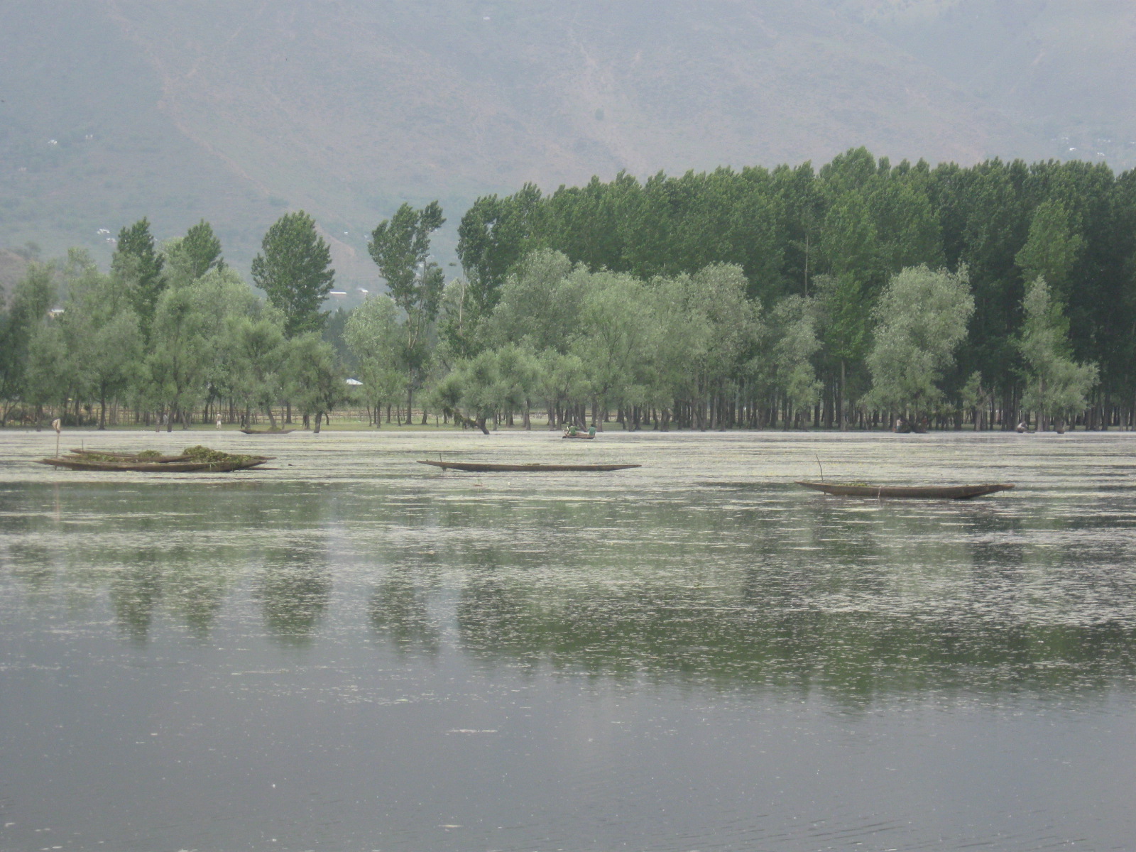
Wular Lake seen from Wular Vantage Park, Garoora.
A boat carrying aquatic plants extracted from the Wular Lake
Domesticated geese and cows on the bank of Wular Lake

Wular Lake (Urdu pronunciation: [ʋʊlər]), also known as Wolar (Kashmiri pronunciation: [ʋɔlar]) in Kashmiri, is one of the largest freshwater lakes in the Indian subcontinent.[3] It is located near Bandipora town in the Bandipora district of Jammu and Kashmir, India.[4] The lake basin was formed as a result of tectonic activity and is fed by the Jhelum River and the streams Madhumati and Arin.

The lake's size varies seasonally from 30 to 189 square kilometres. In addition, much of the lake has been drained as a result of willow plantations being built on the shore in the 1950s.

Background

[edit]

Etymology

[edit]

In ancient times, Wular Lake was also called Mahapadmasar (Sanskrit: महापद्मसरः). Nilamata Purana also mentions it as Mahapadmasaras. The lake, with its big dimensions and the extent of water, gives rise to high leaping waves in the afternoons, called Ullola in Sanskrit, meaning "stormy leaping, high rising waves". Therefore, it was also called Ullola. It is believed to have gotten corrupted over the centuries to Wulor or Wular.[5][6] The origin may also be attributed to a Kashmiri word 'Wul', which means a gap or a fissure, an appellation that must have come also during this period. The word Wul (gap or fissure) is also an indicator of its origin from a fissure or gap created.[7]

History

[edit]

The Kashmiri sultan Zain-ul-Abidin is reputed to have ordered the construction of the artificial island of Zaina Lank in the middle of the lake in 1444.[8]

According to the traditional beliefs in the vicinity of Wular Lake, there once stood a city whose king was Raja Sudrasen. By the reason of the enormity of his crimes, the waters of the lake rose and drowned him and his subjects. It was said that during the winter months, at low water, the ruins of the submerged idol temple might be seen rising from the lake. Zayn Ul Aabidin constructed a spacious barge which he sank in the lake and upon which he laid a foundation of bricks and stones till it rose high enough to be at level as the water. Upon this, he erected a Mosque and other buildings and gave the islet the name of Lanka. The expense of this work was defrayed by the fortunate discovery of two idols of solid gold, which had been brought up from the lake by divers.[9]

Ecology

[edit]

Fish

[edit]

Wular Lake is an important fish habitat, the main species being the common carp (Cyprinus carpio), rosy barb (Barbus conchonius), mosquitofish (Gambusia affinis), Nemacheilus species, Crossocheilus latius, and various snowtrout species in the genera Schizopyge and Schizothorax. Snowtrout species identified in the lake include the Sattar snowtrout (Schizopyge curvifrons), Chirruh snowtrout (Schizopyge esocinus), Schizothorax planifrons, Schizothorax macropogon, Schizothorax longipinus and Chush snowtrout (Schizopyge niger).[10]

Birds

[edit]

The lake sustains a rich population of birds. Terrestrial birds observed around the lake include the black-eared kite, Eurasian sparrowhawk, short-toed eagle, Himalayan golden eagle, Himalayan monal, chukar partridge, koklass pheasant, rock dove, common cuckoo, alpine swift, Indian roller, Himalayan woodpecker, hoopoe, barn swallow, golden oriole, and others.[10]

Economy

[edit]

Aquatic greens

[edit]

Many other families harvest the aquatic plants, such as the grass Phragmites and the waterlily-like Nymphoides, from the lake for human consumption and animal fodder.[10]

Fishing

[edit]

Fish from Wular Lake make up a significant part of the diet for many thousands of people living on its shores and elsewhere in the Kashmir Valley. More than eight thousand fishermen earn their livelihood from the lake, primarily fishing for the endemic Schizothorax species and the non-native carp. Their catch comprises about 60 percent of the total yield of fish in Kashmir. Hundreds of other local villagers are employed by cooperative societies that trade the fish catch..[10]

Tourism

[edit]

Boating, water sports, and water skiing have been launched by the Government of India Tourism in collaboration with Kerala Tourism and J&K Tourism. The contract for the operation of the site was awarded in September 2011.[11]

Issues

[edit]

Environmental threats

[edit]

The lake is one of the 80 Indian wetlands designated as a Ramsar site. However, it faces environmental threats including the conversion of large parts of the lake's catchment areas into agricultural land, pollution from fertilizers and animal wastes, hunting of waterfowl and migratory birds, and weed infestation in the lake itself.[10]

Lake degradation

[edit]

The shores of Wular Lake, one of the biggest freshwater lakes in South Asia, are now filled with trash.[12] Waste has piled up along the lake's edges and in the water, endangering the lake's fish and plants. Parts of the lake have become shallow, and areas that used to be wide open water are now covered in mud and garbage. This buildup of waste and mud has made the lake smaller and shallower.[13]

Conservation

[edit]

Recognition

[edit]

In recognition of its biological, hydrological, and socio-economic values, the lake was included in 1986 as a Wetland of National Importance under the Wetlands Programme of the Ministry of Environment and Forests, Government of India, for intensive conservation and management purposes. Subsequently, in 1990, it was designated as a Wetland of International Importance under the Ramsar Convention.[14][1] Against the Ramsar Convention, the lake area is being used for garbage dumping.[15]

Restoration

[edit]

Amongst other developments, two million trees will be cut to restore Wular Lake under the National Lake Conservation Programme.[16] The Environment Ministry of India approved Rs 4 billion for the restoration project for the lake that will take 5 to 10 years, and was, after long delays, scheduled to start in December 2011.[17] The partner organisation, South Asian Voluntary Association of Environmentalists (SAVE), is a joint initiative of individuals to protect the ecology and to conserve nature at Wular Lake.[18]

Tulbul Lock Project

[edit]

The Tulbul Lock Project (Tulbul Barrage), is an under-construction "river navigation lock-cum-water level control lock structure" at the mouth of Wular Lake[19] the barrage structure of which is designed to be 439 feet (134 m) long and 40 feet (12 m) wide with maximum storage capacity of 300,000 acre⋅ft (370×10^6 m3) of water.[20] The project aims to regulate the release of water from the natural storage in the lake to maintain a minimum draught of 4.5 feet (1.4 m) in the river up to Baramulla during the lean winter months.[21] The lean season water inflows into the Wular Lake are enhanced from the Kishanganga river by the Kishanganga Hydroelectric Plant after generating electricity.

Other lakes, such as Manasbal Lake, Anchar Lake, Dal Lake, etc., which are not located on the Jhelum Main river, can be used similarly to Wular Lake to impound flood waters for flood protection in downstream areas, hydro electricity generation, navigation throughout the year, irrigation, municipal and industrial uses.[22]

History

[edit]
1980: Conception
[edit]

The project was conceived in the early 1980s, and work began in 1984. The average annual inflows or outflows from the lake are nearly 7 billion cubic meters.[21]

1987-2025: Work stopped due to IWT dispute
[edit]

There was an ongoing dispute between India and Pakistan over the Tulbul Project between 1987 and 2025 (when India put the IWT in abeyance). In 1987, when Pakistan objected to the Tulbul construction project by stating that it violated the 1960 Indus Waters Treaty (IWT),[23][24] India stopped the construction work on the project that year, but has since attempted to restart construction. The Jhelum River passing through the Kashmir valley below Wular Lake, which is a connecting lake as per IWT, provides an important means of transport for goods and people. To sustain navigation throughout the year, a minimum depth of water is needed. India contends that the Tulbul Project is permissible per paragraphs 7 (c) and 9 of Annexure E, IWT, while Pakistan maintains that the project is a violation of the treaty if the storage is above 10,000 acre-feet (12×10^6 m3) for non-power generation purposes.[25] India hold the position that the suspension of work harmed the interests of the people of Jammu and Kashmir and also deprived irrigation and power benefits to the people of Pakistan that may accrue from regulated water releases.[26] In 2025, India put the IWT in abayance under which Pakistan was blocking the construction of Wular Barrage, thus paving the way for India to revive the Wular Barrage construction project.[23]

2025: Project revived
[edit]

In 2025, India suspended the IWT, and decided to expedite the work on the Tulbul project, construction of new CRBS (200 km long Chenab-Ravi-Beas-Sutlej Link Canal with 12 tunnels to link the Chenab, Ravi, Beas, and Sutlej rivers to bring their water to the Indira Gandhi Canal at Harike Barrage), work on increasing the capacity of major dams in Indus basin (such as Uri, Dulhasti, Salal, Baglihar, Nimu Bajgo, and Chutak) and the work on new major dams (Kishanganga, Ratle, and Pakal Dul.[27]

Details

[edit]

The lake storage capacity will be increased per IWT to 300,000 acre feet or more, up to 1580 m MSL, by considering it as a reservoir for a run-of-the-river (RoR) hydro power plant, by envisaging a low-head (nearly 8 meters rated head) power plant.[28] The available deepened river bed level at the toe of the dam will be below 1,570 m (5,151 ft) MSL for a 4,000 cusecs flow.[29]

Benefits

[edit]

The project offers several benefits.

Construction of a RoR power plant with sufficient sluice gates would also flush the sediment from the lake area to preserve the lake.[30]

The enlarged lake will also meet the downstream navigational requirements fully during the lean flow season.[31][32][33]

The regulated buffer/surcharge water storage in the Wular lake would substantially enhance the power generation from the downstream Lower Jhelum (105 MW), Uri (720 MW), proposed 1124 MW Kohala (in PaK), proposed 720 MW Azad Pattan (in PaK), 590-MW Mahl hydropower project (in PaK), and proposed 720 MW Karot (in PaKistan) RoR hydel projects, though its own power plant's generation is marginal.[31][32][33][34]

Current status

[edit]
  • 2025 Jun: In the context of India putting the IWT in abeyance, the revised DPR was being prepared by India for the construction of the Tulbul barrage.[23]

See also

[edit]

References

[edit]

Further reading

[edit]
Revisions and contributorsEdit on WikipediaRead on Wikipedia
from Grokipedia
Wular Lake is the largest freshwater lake in India, located in the Bandipora district of Jammu and Kashmir near the town of Sopore, approximately 34 kilometers northwest of Srinagar.[1][2] Formed by tectonic depression as a result of geological activity in the Kashmir Valley, the lake's basin receives inflows primarily from the Jhelum River and exhibits significant seasonal variation in surface area, ranging from about 30 square kilometers in the dry season to over 260 square kilometers during monsoons, with an average extent of around 189 square kilometers.[3][2][4] It functions as a vital hydrological regulator, absorbing floodwaters from the Jhelum catchment and mitigating inundation risks across much of the Kashmir Valley, while supporting diverse aquatic and avian biodiversity as a designated Ramsar wetland of international importance.[5][6] However, the lake faces ongoing degradation from siltation, encroachment, and land-use changes in its 1,600-square-kilometer watershed, resulting in progressive shrinkage of open water areas and reduced storage capacity over the past century, prompting conservation initiatives including dredging, watershed afforestation, and anti-encroachment measures.[7][8][9]

Geography and Physical Characteristics

Location and Morphology

Wular Lake is situated in the Bandipora district of Jammu and Kashmir, India, between the towns of Bandipora and Sopore, within the Kashmir Valley on the floodplains of the Jhelum River.[10][11] The lake lies at an elevation of approximately 1,580 meters above sea level and has central coordinates of 34°16′N 74°33′E.[12][11] The lake basin originated from tectonic activity, forming a depression that was subsequently filled by riverine inflows, primarily from the Jhelum River and tributaries such as Madhumati and Arin.[13] This tectonic origin contributes to its role as a natural flood absorption basin in the Jhelum hydrological system.[8] Morphologically, Wular Lake exhibits an elliptical shape, with a maximum length of 16 km and width of about 10 km.[14][15] Its surface area fluctuates seasonally between approximately 30 km² and 189 km², influenced by precipitation, snowmelt, and siltation, which has led to progressive shrinkage over time.[12][11] The lake is predominantly shallow, with a maximum depth of 5.8 meters in deeper western sections opposite the Baba Shakur Din hills, and extensive areas less than 1 meter deep due to sedimentation and turbidity.[15][16] This shallow profile supports high aquatic productivity but increases vulnerability to eutrophication and encroachment.[15]

Hydrology and Water Balance

Wular Lake receives its primary inflows from the Jhelum River, which contributes approximately 81% to 88% of the total annual inflow volume of 7,463.46 million cubic meters (Mm³), supplemented by the Madhumati Nallah (5%), Erin Nallah (3%), and minor contributions from other streams, springs, and direct precipitation (8%).[17][18] Inflow rates exhibit high seasonal variability, with 80% occurring during summer months due to snowmelt and monsoon precipitation, ranging from a minimum of 1,030 cubic feet per second (cusecs) to a maximum of 43,314 cusecs.[17][18] Outflows are dominated by the Jhelum River, accounting for 96.9% of the total annual volume of 8,139.09 Mm³, with lesser losses to irrigation (1.58%), evaporation (1.47%), and domestic water supply (0.09%); rates vary from 870 to 31,800 cusecs, peaking at 86% during summer.[17][18] The lake's water balance is maintained by subterranean spring discharge contributing an estimated 675.62 Mm³ annually, offsetting the discrepancy between measured inflows and outflows, alongside direct precipitation and negligible groundwater recharge.[18] Evaporation losses total 119.51 Mm³ per year, equivalent to 986 mm annually, influenced by regional meteorological conditions including wind velocity, solar radiation, and humidity.[18] Surface water levels fluctuate between winter lows and summer highs, supporting a storage variation of approximately 170 million cubic meters (Mcum) around a normal elevation of 1,576 meters, with maximum depths reaching 5.8 meters; this drives seasonal area expansion from 24 square kilometers in lean periods to 89 square kilometers during floods, averaging 54 square kilometers.[17] Sedimentation, primarily from catchment erosion, has reduced storage capacity by 91.56 Mcum over the past 30 years at an annual rate of 2,470 acre-feet, altering the hydrological regime such that the lake now retains more water in winter, diminishing its flood regulation function.[17]
ComponentAnnual Volume (Mm³)Percentage of Total
Inflow (total)7,463.46-
- Jhelum River6,596.7381-88%
Outflow (total)8,139.09-
- Jhelum River7,883.8396.9%
Evaporation119.511.47%
Groundwater/Springs675.62Balances discrepancy
[18][17]

Historical Context

Pre-Modern History

In ancient Kashmiri texts such as the Nilamata Purana (composed between the 6th and 8th centuries CE), Wular Lake is referenced as Mahapadmasaras or Mahapadma Lake, associated with the Naga deity Mahapadma as its tutelary guardian, underscoring its cultural and possibly spiritual significance in early Hindu traditions of the region. The lake is also regarded in traditional accounts as a remnant of Satisar, the vast primordial lake said to have once filled the entire Kashmir Valley before its mythological drainage by sage Kashyapa, though geological evidence attributes its basin formation primarily to tectonic subsidence rather than such legends.[19] During the early medieval period, under King Avantivarman of the Utpala dynasty (r. 855–883 CE), extensive hydraulic engineering transformed the lake's role in flood control and agriculture. Avantivarman's minister Suyya redirected the courses of the Jhelum River and its tributaries to converge near Srinagar and channel through Wular Lake, constructing stone embankments and canals to regulate water flow, mitigate chronic flooding, and reclaim inundated lands for cultivation.[20][19] Suyya founded the town of Sopore (originally Suyyapur) at the lake's outlet in circa 880 CE, establishing it as a hub for irrigation networks that extended to arid areas between Wular and the Pohru River, while implementing seasonal bans on fishing and waterfowl hunting to preserve avian populations during breeding.[21][22] These interventions, detailed in chronicles like Kalhana's Rajatarangini, boosted agricultural productivity and stabilized the regional economy amid frequent seismic and fluvial hazards.[19] In the later medieval era, during the Kashmir Sultanate (14th–16th centuries), Wular Lake served as a vital artery for inland trade, fisheries, and resource extraction, supporting the economic consolidation of rulers like Zain-ul-Abidin (r. 1420–1470 CE), who constructed the artificial island of Zaina Lank within the lake as a fortified retreat and symbolic emblem of authority.[23] Paleoenvironmental records from lake sediments indicate that by the 15th–16th centuries, human activities intensified nutrient loading, marking early eutrophication trends amid the Little Ice Age's climatic stresses, though the lake retained its hydrological primacy in the Jhelum basin.[24]

Colonial and Post-Independence Developments

In the early 1900s, under Dogra Maharaja Pratap Singh, water levels in Wular Lake were modified with the assistance of British engineers to control flooding in the Kashmir Valley, a measure that disrupted the lake's hydrological equilibrium and contributed to long-term ecological shifts without prior assessment of environmental impacts.[25] The lake's surface area stood at 217.8 square kilometers as documented in surveys from 1911, reflecting its pre-decline extent during late colonial oversight of the princely state.[25] After India's independence in 1947, the Jammu and Kashmir government initiated willow (Salix alba) plantation programs on the lake bed in the 1950s, encouraging local communities to cultivate trees for timber and fuelwood to address regional shortages, which resulted in the conversion of approximately 27.3 square kilometers of open water into forested land and accelerated silt trapping.[26][27] By the 1980s, these encroachments had reduced the lake's effective area to around 80 square kilometers, with only 24 square kilometers of open water remaining, exacerbating flood retention capacity while diminishing aquatic habitats.[25] To address navigational and irrigation challenges, the Tulbul Navigation Project was conceived in the early 1980s and construction commenced in 1984 at the lake's outlet into the Jhelum River, aiming to build a 440-foot-long gated control structure with a navigation lock to regulate winter flows and enable year-round boating, though work stalled in 1987 amid Pakistani objections interpreting it as a violation of the 1960 Indus Waters Treaty.[28][29] Subsequent conservation measures included the 2007 Comprehensive Management Action Plan, which identified socioeconomic drivers of degradation such as poverty-driven encroachments, and a 2008 Wetlands International proposal for an $82 million restoration initiative focused on dredging silt and rehabilitating hydrology, projecting economic returns through enhanced fisheries within 12 years.[30] The Wular Conservation and Management Authority, formed in 2012, has since pursued targeted interventions like removing invasive weeds and silt deposits, though progress has been limited by coordination issues among agencies.[25] By 2017, plans emerged to fell 2.1 million willow trees and extract 20 million cubic meters of silt to reclaim submerged areas.[27]

Ecological Profile

Aquatic Flora

The aquatic flora of Wular Lake is dominated by macrophytes, with approximately 25 species identified across 17 families and classified into four ecological groups: emergents, rooted with floating leaves, free-floating, and submerged.[31] Emergent species, which prevail in the marshy peripheral zones, include Typha angustata, Phragmites australis, Sagittaria sagittifolia, Sparganium ramosum, Alisma plantago-aquatica, Carex sp., Myriophyllum verticillatum, Nasturtium officinale, and Polygonum amphibium.[31][1] Rooted plants with floating leaves occupy shallower areas and encompass economically significant species such as Nelumbo nucifera (lotus), Trapa natans (water chestnut), Nymphaea alba, Nymphoides peltatum, Hydrocharis dubia, and Potamogeton natans.[31][1] These species contribute to primary production, with net annual rates ranging from 7.42 to 12.5 g m⁻² yr⁻¹, peaking in August.[31] Free-floating macrophytes, including Lemna minor, Lemna gibba, Salvinia natans, and the invasive Azolla pinnata, often form surface covers that can impede light penetration.[31][1] Submerged species, such as Ceratophyllum demersum, Potamogeton crispus, Hydrilla verticillata, Myriophyllum spicatum, Potamogeton lucens, and Potamogeton pusillus, inhabit deeper waters and support oxygenation and habitat provision.[31][32] Invasive aquatic plants have increasingly altered the native flora; Azolla cristata forms dense summer mats that senesce red in winter, while Alternanthera philoxeroides (alligator weed), first recorded in 2008, spreads rapidly via vegetative fragments.[33][34] These invasives reduce biodiversity by outcompeting natives and disrupting ecosystem services.[33] Restoration efforts have yielded positive results, with Nelumbo nucifera beds reappearing in 2025 after a three-decade absence, signaling improved conditions for native floating-leaved species.[35] The lake's macrophyte communities exhibit seasonal variations in biomass and pigment content, influenced by hydrological fluctuations and nutrient inputs.[36]

Fauna and Biodiversity

Wular Lake supports a diverse array of fauna, primarily consisting of fish and waterbirds, though populations of native species have declined due to siltation, pollution, and encroachment.[37] The lake's ichthyofauna includes at least 16 fish species across multiple families, with cyprinids dominating catches.[38] Common species encompass Cyprinus carpio var. communis (common carp), which constitutes approximately 39.5% of biomass and 34% of catch by number, alongside Schizothorax spp. (snow trout), Carassius auratus (goldfish), and Triplophysa spp.[39] Native Schizothorax populations have experienced drastic reductions attributed to anthropogenic pressures, contributing to shifts toward non-native carps.[37] Historical records indicate over 50 fish species once present, but current diversity reflects marked losses in endemic forms like Kashmir catfish, now endangered.[40] Avian biodiversity features prominently, with the lake serving as a key wintering ground for migratory waterbirds under the Central Asian Flyway.[1] Surveys document 25 waterbird species across six orders and seven families, including significant populations of Anas platyrhynchos (mallard), Anas strepera (gadwall), Anas crecca (common teal), and Spatula clypeata (northern shoveler).[41] Rare sightings include the near-threatened Ichthyophaga humilis (lesser fish-eagle) and the elusive Botaurus stellaris (great bittern), observed in 2024.[5] In September 2025, censuses recorded approximately 300,000 migratory birds, a surge including large flocks of northern pintail (Anas acuta), greylag goose (Anser anser), and ferruginous duck (Aythya nyroca), signaling improved habitat conditions amid ongoing threats.[42] Certain species, such as Baer's pochard (Aythya baeri) and white-bellied heron (Ardea insignis), face local extinction risks from habitat degradation.[43] Mammalian and reptilian records are sparse, with occasional reports of otters and amphibians tied to wetland margins, but comprehensive inventories remain limited. Overall biodiversity underscores the lake's Ramsar status, yet empirical data highlight vulnerabilities: native fish yields have dropped, while bird abundances fluctuate with conservation interventions versus pollution inputs.[1][44]

Ecosystem Services

Wular Lake provides essential regulating services, particularly flood control and water flow regulation, as an integral component of the Kashmir Valley's hydrological system. The lake absorbs excess waters from the Jhelum River and surrounding glacial melt during monsoon peaks (July to September), attenuating flood risks for local and downstream communities, while releasing stored water during lean winter periods to support water security.[45][18] Designated a Ramsar Wetland of International Importance in 1990, its capacity for these services has diminished due to historical shrinkage, reducing storage by approximately one-fifth between 1911 and 2008, which exacerbates both flood and drought vulnerabilities.[45] Restoration measures, including willow removal and dredging to increase holding capacity by 2.02 million cubic meters, could yield annual flood damage savings of ₹1.05 billion (US$17.5 million).[18] Supporting services encompass habitat provision for biodiversity, sustaining migratory waterfowl such as mallards and gadwalls, as well as diverse fish populations that underpin the local ecosystem.[18][46] The lake's high productivity fosters nutrient cycling and primary production through native macrophytes like Trapa natans and Hydrilla verticillata, though invasive species disrupt these processes.[46] Provisioning services include freshwater for community use, fisheries supporting over 2,500 fishers with annual yields exceeding 3,580 metric tons (as of 2012–2013), and harvestable aquatic vegetation generating seasonal revenues from water chestnuts alone estimated at ₹24.52–32.70 crore.[18][46] These services collectively contribute to regional livelihoods and ecological resilience, with potential post-restoration increases in fish production by 27 metric tons annually valued at ₹3.1 million.[18]

Economic Utilization

Fisheries and Aquaculture

Wular Lake sustains a vital capture fishery that contributes approximately 54% of the total fish yield from lakes in the Kashmir Valley, supporting the livelihoods of about 2,914 active fishers, primarily from the Hanji community.[44][47] The fishery provides employment to thousands of families across 37 villages surrounding the lake, with inland fisheries in Jammu and Kashmir relying heavily on such wetland resources.[48] Annual fish production reached 3,728 metric tons in 2017–2018, though earlier trends showed fluctuations, including a decline from 475 tons in 2003–2004 to 262 tons in 2007–2008 before partial recovery.[49][50] By 2021–2022, the total catch stood at 2,941.68 metric tons, with Jammu and Kashmir government data indicating consistent increases in subsequent years, refuting claims of deterioration-induced declines.[51] The ichthyofauna comprises at least 16 species, dominated by the introduced common carp (Cyprinus carpio var. communis), which constitutes 39.52% of biomass and 34.01% of catch composition across sampling sites.[39][38] Economically significant native species include Schizothorax spp., while fishing employs traditional gillnets, cast nets, and traps, operating seasonally with peaks in summer and reduced activity from November to March due to lower water levels and temperatures.[49] Women play a key role in processing and marketing, often comprising a substantial portion of the labor force in lean periods.[52] Aquaculture remains underdeveloped in Wular Lake, with the sector predominantly capture-based rather than involving intensive stocking or cage culture, constrained by ecological pressures like siltation and pollution that threaten sustainability.[53] Studies highlight the need for evidence-based interventions to prevent overexploitation and maintain yields amid environmental degradation.[54]

Tourism and Recreation

Wular Lake serves as an emerging destination for ecotourism in Jammu and Kashmir, drawing visitors for its expansive freshwater expanse and surrounding Himalayan vistas, though it remains less frequented compared to more prominent sites like Dal Lake.[2] Boating activities, including hiring houseboats, doongas, and sailing boats, are available at key mooring points such as Ningal Nullah, Kiuhnus Bay, and Ajus Spur on the southern shore.[55] These outings offer opportunities for scenic cruises and wildlife observation amid the lake's seasonal fluctuations in size and water levels.[56] Birdwatching constitutes a primary recreational draw, with the lake's wetlands hosting species like herons, kingfishers, and migratory ducks, particularly during spring and autumn migrations.[57] Visitors can engage in photography, nature walks, and trekking around adjacent lush forests and meadows, such as those at Watlab and Ningli Nallah.[58] Water-based pursuits extend to canoeing, kayaking, water skiing, and motor boating, enhancing the lake's appeal for adventure seekers despite its underdevelopment relative to Kashmir's tourism circuits.[59] Recent initiatives aim to bolster tourism infrastructure, including the development of Wullar Vantage Park as an eco-tourism spot overlooking the lake and the organization of events like the Wular Lake Marathon on October 12, 2025, which promotes community bonds and activities such as boating and fishing.[60][61] However, environmental challenges including siltation, pollution from untreated sewage, and encroachment limit the lake's full recreational potential, as untreated wastewater from nearby towns like Sopore and Bandipora continues to degrade water quality.[62][26] Despite these issues, the lake's serene setting supports sunset viewing and the annual Wular Sports Festival, fostering gradual growth in visitor interest.[56]

Harvesting of Aquatic Resources

Harvesting of aquatic vegetation in Wular Lake primarily involves water chestnuts (Trapa natans, locally known as singhara or goer) and lotus stems (Nelumbo nucifera, yielding nadru). These resources provide seasonal livelihoods for thousands of local residents, particularly from shoreline villages. Water chestnuts constitute approximately 90% of the valley's production, with official estimates indicating an annual yield of around 4 metric tons from the lake, though actual harvests have declined due to shrinking water areas and siltation.[63][64] Extraction of water chestnuts occurs twice yearly, mainly from June to September, using traditional methods such as hooked poles or diving in shallow waters. Individual harvesters typically collect 30 kilograms per day, generating daily earnings of 600-700 Indian rupees, supporting poorer communities dependent on the lake. Women play a significant role in processing and selling the nuts, which are traded across Kashmir for consumption as a nutrient-rich food source.[65][66][67] Lotus cultivation and harvesting had diminished for nearly three decades due to flooding and ecosystem degradation but revived in 2025 following desilting efforts by the Wular Lake Management Authority. The edible stems, a Kashmiri delicacy, were historically harvested by up to 5,000 people, with labor-intensive collection in shallow, cleared areas. Recent blooms signal potential economic recovery, as lotus requires specific water depths for growth, now facilitated by restoration projects.[68][69][70] Other vegetation, such as reeds (Phragmites spp.), is harvested for fodder, thatching, or sale, contributing to an estimated annual economic value of 5.6 million Indian rupees from sustainable aquatic plant use in feasibility studies. Community-based management is advocated to balance extraction with ecological sustainability, preventing overharvesting amid invasive species proliferation.[18][71][17]

Environmental Degradation

Primary Causes of Siltation

The primary geological sources of silt entering Wular Lake derive from the surrounding Panjal traps, limestones with intercalated shales, and Karewa formations in its catchment, which erode and drain sediments via tributaries and the Jhelum River.[72] These natural erosive processes have been ongoing, but their impact has intensified due to the lake's position in a tectonically active Himalayan basin prone to weathering.[73] Deforestation in the northern Kashmir hills and Wular's 1,600 km² catchment area has accelerated soil erosion, substantially increasing sediment influx during monsoons and floods.[74] [75] Extensive tree felling for timber, agriculture, and urbanization has removed vegetative cover, leading to higher runoff velocities that carry fine silts and clays into the lake basin.[25] This anthropogenic amplification is evidenced by geological surveys showing abnormal spatial and temporal siltation rates compared to pre-disturbance baselines.[72] Proliferation of invasive aquatic vegetation, particularly willow trees (Salix spp.), exacerbates siltation by trapping suspended sediments and contributing organic debris that settles and compacts on the lake bed.[76] An estimated 100,000 willow trees along the periphery and shallows mechanically retain silt loads from inflows, while their root systems stabilize and accumulate deposits, reducing water depth by up to 1-2 meters in affected zones.[77] This feedback loop is compounded by nutrient-rich runoff promoting weed growth, though primary silt originates upstream rather than from the plants themselves.[78]

Encroachment and Land Use Changes

Encroachment on Wular Lake primarily involves the illegal reclamation of lakebed and peripheral wetlands for agricultural fields, human settlements, and commercial plantations, significantly reducing the lake's surface area over the past century.[79][80][62] Historical records indicate the lake spanned 217 square kilometers in 1911, including 58 square kilometers of associated marshes, but encroachment-driven land use shifts have contracted it to approximately 86 square kilometers by the early 21st century.[79][80] This represents a roughly 45% loss in total area from 1911 to 2007, with open water specifically diminishing by about 25% between 2008 and 2019 due to expanding built-up areas and cultivated lands encroaching on former aquatic zones.[80][62] A key driver has been the widespread planting of willow trees (Salix spp.) since 1924, initially promoted for timber and fuelwood to meet local economic demands, which now cover 27.3 square kilometers of former lake margins.[80] These dense plantations act as sediment traps, exacerbating silt accumulation and hydrological alterations that favor terrestrial conversion over water retention, with the Wular Conservation and Management Authority (WUCMA) estimating a loss of one-fifth of the lake's water-holding capacity over the preceding three decades as of 2007.[80] Concurrently, population growth in surrounding districts like Bandipora and Baramulla has spurred unauthorized settlements and agricultural expansion directly onto lake fringes, converting wetlands into paddy fields and orchards; satellite analyses of land use/land cover changes from 1991 to 2018 confirm a net increase in cropland and built-up areas at the expense of water bodies and vegetation cover in the lake's catchment.[62][81] Recent assessments highlight ongoing issues, with Jammu and Kashmir High Court proceedings in 2021 documenting approximately 640 kanals (about 0.32 square kilometers) of lake land under active encroachment, prompting directives for removal timelines from WUCMA.[82][83] These encroachments, often involving hutments and informal infrastructure within the catchment, compound the lake's degradation by fragmenting its buffer zones and increasing runoff from converted lands, which carries sediments and nutrients into remaining waters.[84] Despite intermittent efforts like willow removal—targeting 2.1 million trees, with over 58,000 extracted by 2020—the causal linkage between unchecked land use intensification and areal contraction persists, as evidenced by the lake's failure to rebound without addressing root anthropogenic pressures.[80][62]

Pollution Sources

Untreated sewage and wastewater from surrounding urban and rural settlements constitute a primary pollution source for Wular Lake, discharging directly into the lake and its tributaries without adequate treatment facilities. This inflow introduces high levels of organic matter, pathogens, and nutrients, exacerbating eutrophication and degrading water quality, as evidenced by elevated biochemical oxygen demand and reduced dissolved oxygen levels observed in lake assessments.[62][85][40] Agricultural runoff, laden with fertilizers, pesticides, and horticultural wastes from the lake's catchment area, contributes significantly to nutrient pollution, leading to algal blooms and hypoxic conditions. Studies indicate that phosphorus and nitrogen inputs from these sources have intensified over decades, with sediment core analyses revealing accumulation rates tied to intensified farming practices in north Kashmir.[62][86][6] Industrial discharges, though limited in scale compared to domestic and agricultural inputs, introduce heavy metals such as cobalt, copper, iron, and others into lake sediments, resulting in moderate contamination levels as per ecological risk assessments. Spatial distribution patterns in surface sediments point to point-source pollution from nearby small-scale industries, compounded by atmospheric deposition, with enrichment factors exceeding background values in central lake zones.[6][87] Domestic sewage also carries trace elements and organic pollutants, correlating with higher electrical conductivity readings in lake water, reflective of anthropogenic waste disposal practices. While streams feeding the lake occasionally show acceptable water quality indices under low-flow conditions, seasonal monsoon flushing amplifies pollutant transport from these diffuse sources.[15][88]

Conservation Measures

Wular Lake was designated a wetland of international importance under the Ramsar Convention on March 23, 1990, as site number 461, covering an area of 18,900 hectares in Jammu and Kashmir, India.[11] This status obligates India to promote the conservation and wise use of the wetland, recognizing its role in flood control, biodiversity support, and as a habitat for migratory birds, though without a specific national legal designation at the time of listing.[11] At the national and state level, conservation efforts are guided by the Jammu and Kashmir Wetlands (Conservation and Management) Rules, 2021, which provide a regulatory framework for notified wetlands, including prohibitions on encroachment, pollution, and unsustainable resource extraction.[89] Under these rules, Wular Lake was formally scheduled as a protected wetland in 2022, enabling integrated management plans that address siltation, biodiversity loss, and watershed protection.[89] The Wular Conservation and Management Authority (WUCMA), established in 2012 by the Jammu and Kashmir government, oversees implementation, coordinating dredging, anti-encroachment drives, and community-based monitoring.[90] A Comprehensive Management Action Plan, developed by Wetlands International South Asia for the Jammu and Kashmir Department of Wildlife Protection, outlines strategies for ecological restoration, including willow removal, pollution control, and regulated tourism, aligned with Ramsar guidelines and state rules.[17] Enforcement remains challenged by local encroachments and upstream land use, but the framework supports ongoing projects funded by central and state governments, such as recent dredging initiatives under WUCMA supervision.[17]

Dredging and Restoration Projects

The Wular Conservation and Management Authority (WUCMA) initiated large-scale dredging operations in 2020 to address siltation, contracting Reach Dredging Limited for restoring 3.1 square kilometers of critically silted areas.[91] By July 2021, 2.6 square kilometers had been restored through the removal of 51 lakh cubic meters of silt, as part of a Rs 200 crore Wular Action Plan sanctioned by the Union Territory administration.[92] Efforts intensified in subsequent years, with dredging focused on unclogging channels and excavating accumulated sediments to revive water-holding capacity.[93] By March 2025, operations had restored 5 square kilometers by extracting 78.43 lakh cubic meters of silt, enhancing ecological functions and flood mitigation.[94] In July 2025, approximately 80 lakh cubic meters of silt had been dredged from targeted zones, contributing to the re-emergence of native lotus beds covering 4-5 square kilometers after a 30-year absence since the 1992 floods.[95] Complementary restoration measures included reintroducing native aquatic vegetation and halting encroachments, integrated with the 2007 Comprehensive Management Action Plan.[96] A Jammu and Kashmir high court directive in December 2022 further mandated accelerated restoration to combat decades of mismanagement, emphasizing sustainable dredging to preserve biodiversity without exacerbating downstream sedimentation.[97] These projects have yielded measurable ecological revival, such as improved water quality supporting lotus proliferation, though ongoing monitoring is required to sustain gains against recurrent silt inflows from tributaries.[93]

Monitoring and Community Involvement

Monitoring of Wular Lake encompasses water quality assessments, biodiversity surveys, and ecological risk evaluations conducted by research institutions and non-governmental organizations. In 2014, multivariate techniques including discriminant analysis and water quality index (WQI) were applied to data from five sites across the lake, revealing variations in parameters such as dissolved oxygen, nutrients, and heavy metals.[15] A 2022 study utilized Landsat 8 OLI satellite imagery to assess the lake's trophic state, classifying it as mesotrophic with indications of eutrophication risks due to nutrient enrichment.[98] More recently, spatial analysis of heavy metal distribution in sediments highlighted elevated levels of chromium and lead, informing ecological risk assessments for conservation priorities.[6] Organizations like Earth5R employ IoT sensors and satellite imaging for real-time tracking of water quality, biodiversity, and pollution hotspots.[40] Community involvement in Wular Lake conservation includes local participation in weed removal, sustainable resource harvesting, and restoration initiatives. In villages like Lankrishipora, women-led groups manually clear invasive aquatic weeds, which serve as cattle fodder, while harvesting water chestnuts for economic benefit, thereby aiding in biomass control as of 2022.[99] Non-governmental organizations provide training to fishermen on sustainable practices to mitigate overexploitation of fish stocks.[23] Broader efforts, such as the Indo-German Biodiversity Project, foster stakeholder workshops involving over 70 participants from government, NGOs, and locals to develop integrated wetland management plans, emphasizing community roles in flood buffering and biodiversity protection.[100] In March 2025, a knowledge exchange program under the Living Lakes initiative gathered lake managers and community representatives to share strategies on participatory conservation, aligning ecological restoration with local livelihoods.[101] The Jammu and Kashmir government integrates community input into its 2025 conservation plan, promoting eco-restoration projects that sustain fisheries and tourism while addressing siltation and pollution.[94]

Infrastructure Projects

Tulbul Navigation Lock Overview

The Tulbul Navigation Lock, officially designated as a navigation lock-cum-water level control structure, is situated at the outlet of Wular Lake where the Jhelum River begins its course southward, approximately 8 kilometers north of Sopore in Jammu and Kashmir, India.[102] The project aims to regulate water levels in the lake to enable consistent navigation depths of at least 6 feet year-round, addressing seasonal fluctuations that currently limit boat traffic to summer months when the lake's surface elevation naturally reaches around 1,580 meters (5,200 feet).[103] India maintains that the structure, spanning 439 feet in length and 40 feet in width, incorporates a lock for vessel passage without creating appreciable storage reservoirs, aligning with provisions for non-consumptive uses under the 1960 Indus Waters Treaty.[104] Construction commenced in 1984 under the Indian government's initiative to revive historical navigation routes on the Jhelum, which had supported trade and transport until siltation and low winter flows diminished viability post-1950s.[105] By 1987, after completing about 15% of the work—including initial embankment and foundation elements—the project was suspended indefinitely due to diplomatic protests from Pakistan, which reclassified it as the "Wular Barrage" and argued it would permit upstream storage of up to 0.3 million acre-feet, potentially enabling flow augmentation or depletion downstream in violation of the treaty's restrictions on India's use of western rivers like the Jhelum.[102] [106] Bilateral talks, including those mediated by the World Bank as treaty neutral expert, failed to resolve the impasse, with India insisting on its navigational intent and Pakistan demanding design disclosures to verify non-storage features.[107] As of June 2025, following India's suspension of the Indus Waters Treaty in April 2025 amid heightened cross-border tensions, the Indian government revived plans for the project, directing preparation of a detailed project report (DPR) expected to span one year and incorporate modern dredging integration to combat lake siltation.[108] [109] The revival aligns with broader efforts to optimize India's allocated 33% share of western river waters, currently underutilized at about 20%, while proponents cite potential socio-economic gains for Jammu and Kashmir, including enhanced tourism, fisheries access, and flood mitigation without altering downstream flows beyond natural variability.[103] Critics, including Pakistani officials, contend the timing exploits treaty abeyance to militarize water infrastructure, though Indian assessments emphasize empirical hydrological data showing minimal impact on treaty-compliant run-of-river operations.[110]

Engineering Details and Intended Functions

The Tulbul Navigation Project consists of a barrage structure measuring approximately 440 feet in length, equipped with a navigation lock designed to accommodate vessels transiting the Jhelum River at the outlet of Wular Lake near Sopore.[106][111] Alternative specifications describe it as a 439-foot-long and 40-foot-wide control structure with a limited storage capacity of 0.30 million acre-feet below the lake's full reservoir level, intended as a run-of-the-river facility without significant impoundment.[112] The lock itself spans about 440 feet, enabling passage for boats requiring a minimum flow of 4,000 cubic feet per second and a depth of 4 feet to ensure safe navigation.[104][111] Its primary engineering function is to regulate outflows from Wular Lake into the Jhelum River, maintaining a consistent water depth of at least 1.4 meters during lean periods from October to February, when natural flows diminish due to reduced precipitation and upstream abstractions.[113] This regulation prevents the river from becoming too shallow for commercial and passenger vessels, particularly along the 20-kilometer stretch between Sopore and Baramulla.[29][114] Secondary functions include channeling excess monsoon waters for temporary storage and controlled release to mitigate downstream flooding, while supporting potential enhancements in hydroelectric power generation through stabilized flows, though the project emphasizes non-consumptive uses compliant with the Indus Waters Treaty.[103][115][116] The structure employs gated spillways and the integrated lock to manage variable river regimes, with design features prioritizing minimal ecological disruption to Wular Lake's hydrology while enabling year-round inland water transport, historically vital for Kashmir's trade in timber, agricultural goods, and tourism-related passenger services.[104][103] Construction, initiated in 1984, incorporates concrete and steel reinforcements suited to the region's seismic and flood-prone conditions, though detailed material specifications remain limited in public records due to ongoing geopolitical sensitivities.[28]

Geopolitical Controversies and Status

The Tulbul Navigation Project, involving a barrage and lock at the Jhelum River's outlet from Wular Lake, was initiated by India in 1984 to facilitate year-round navigation, regulate floods, and manage siltation, but construction halted in 1987 following Pakistani diplomatic protests.[114][117] Pakistan objected on grounds that the structure, potentially capable of storing 0.3 million acre-feet of water, contravenes the 1960 Indus Waters Treaty, which restricts India to non-consumptive uses on the treaty's western rivers—including the Jhelum—while prohibiting reservoirs that could diminish downstream flows during dry periods.[118][119] India countered that the facility constitutes a run-of-the-river navigation aid without storage intent, aligning with treaty provisions for such infrastructure, though bilateral talks via the Permanent Indus Commission yielded no resolution, perpetuating the impasse for decades.[107][120] The controversy underscores broader Indo-Pakistani tensions over Kashmir's waters, with Pakistan viewing the project as a strategic threat to its agriculture-dependent economy, reliant on Jhelum flows for irrigation in Punjab province, amid fears of upstream diversion or withholding during conflicts.[121][122] India maintains the barrage addresses local needs, such as preventing winter freezing that halts navigation and exacerbates Wular's shrinkage, without impinging on treaty allocations, as verified in prior World Bank-mediated reviews that did not deem it a violation but urged design clarifications.[123][124] Critics in Pakistan, including official statements, have labeled it the "Wular Barrage" to emphasize perceived damming risks, while Indian proponents highlight stalled progress's costs, including lost hydropower potential estimated at 30-40 MW and hindered lake conservation.[125][116] In April 2025, India suspended the Indus Waters Treaty in response to a terrorist attack in Pahalgam, Jammu and Kashmir, citing Pakistan's alleged support for militancy and treaty non-compliance, thereby removing prior constraints on western river projects like Tulbul.[117][112] This prompted renewed momentum for resumption, with Jammu and Kashmir Chief Minister Omar Abdullah advocating revival in May 2025 for socio-economic gains, including enhanced connectivity and flood mitigation, despite opposition from figures like Mehbooba Mufti, who decried it as "weaponizing water" amid bilateral strains.[126][127] By June 2025, Indian government sources confirmed active planning to restart construction, framing it as a strategic response to treaty abeyance, though full implementation remains pending environmental and engineering assessments.[128][129] As of October 2025, the project's status reflects India's unilateral advancement post-suspension, escalating geopolitical frictions without formal Pakistani acquiescence or international arbitration revival.[130][131]

Recent Developments and Future Prospects

Ecological Revivals

In recent years, restoration efforts led by the Wular Conservation and Management Authority (WUCMA) have yielded measurable ecological improvements in Wular Lake, primarily through dredging and de-siltation operations initiated in 2020. These activities have removed approximately 7.9 million cubic meters of accumulated silt, restoring 4-5 square kilometers of lake bed and enhancing water depth, sunlight penetration, and overall water-holding capacity.[26][132][133] Complementary measures, including encroachment removal, pollution controls, and targeted reintroduction of native aquatic vegetation, have further supported habitat recovery over the past 3-4 years.[134][96] A prominent indicator of revival is the reappearance of lotus (Nelumbo nucifera) beds in July 2025, absent for nearly three decades following severe siltation and 1992 floods. Spanning about 3 square kilometers, the blooms resulted from improved water quality and a 2025 seed dispersal program, with 20-30% of growth aided by controlled sowing to revive dormant roots.[35][96] This resurgence has boosted aquatic flora diversity and signaled broader ecosystem stabilization, as lotus plants contribute to natural filtration and sediment binding.[35][96] Avian biodiversity has also surged, with the annual bird census recording a 293% increase from approximately 75,000 individuals in the prior year to 295,000 in September 2025. This includes migratory species such as ferruginous duck, northern pintail, greylag goose, Great Bittern, and Falcated Duck, attributed directly to stabilized water levels, reduced siltation, and habitat enhancements that deterred poaching and unsustainable practices.[134][35] These developments underscore a functional shift toward healthier wetland conditions, though sustained monitoring is required to address residual challenges like ongoing nutrient inflows.[134][35]

Policy and Research Advances

In 2020, the Wular Conservation and Management Authority (WUCMA) initiated a comprehensive revival plan for the lake, emphasizing dredging operations to remove accumulated silt, encroachment removal, and pollution control measures to address hydrological degradation and eutrophication.[135] These efforts have been supported by intensified siltation control and habitat restoration, contributing to observable ecological recoveries, such as a 293% increase in migratory bird populations from approximately 75,000 individuals in 2024 to 295,000 in 2025.[136] [137] Policy frameworks have increasingly incorporated community-based monitoring and strict land-use regulations, with recommendations for multi-stakeholder involvement to mitigate anthropogenic pressures like silt inflow from surrounding watersheds.[138] In February 2025, Jammu and Kashmir's Chief Secretary directed the development of a detailed action plan for lake rehabilitation, prioritizing Wular's conservation due to its status as Asia's largest freshwater lake and its role in regional water security.[139] Research advancements have focused on quantitative modeling and risk assessments to inform these policies. A 2024 study applied a multi-criteria decision-making (MCDM) model to prioritize restoration interventions, identifying siltation control and wetland rehabilitation as high-impact strategies based on ecological, economic, and social criteria.[140] Hydrological and trophic state analyses, including a 2022 assessment using the Trophic State Index for Freshwater Himalayan Lakes (TSIFHL), revealed the lake's shift toward mesotrophic conditions due to nutrient enrichment, underscoring the need for targeted nutrient load reductions to prevent further eutrophication.[16] Recent ecological risk evaluations in 2025 examined heavy metal contamination in sediments, employing geo-accumulation and potential ecological risk indices to map pollution hotspots linked to upstream agricultural runoff and urbanization, advocating for source-apportionment-based mitigation.[6] These studies, drawing on multivariate statistical methods and remote sensing data, have enhanced understanding of land-use impacts on water chemistry, supporting evidence-based policy adaptations.[141]

References

User Avatar
No comments yet.