

Community hub
Recent from talks
Contribute something
Nothing was collected or created yet.
Vidisha
View on Wikipedia
Vidisha (विदिशा, formerly known as Bhelsa and known as Besnagar and Bhaddilpur in ancient times) is a city in Indian state of Madhya Pradesh and the administrative headquarters of Vidisha district. It is located 62.5 km northeast of the state capital, Bhopal. The name "Vidisha" is derived from the nearby river "Bais", mentioned in the Puranas. "Vidisha" also finds its historic reference in ancient epic Ramayana, under the rule of Rama's youngest brother Shatrughna, later on under the rule of Shatrughna's younger son Shatrughati.[1]
Key Information


-vidisha-banner_(1).jpg)


The district was created as Bhilsa District in 1904 by joining the tehsils of Vidisha (also known as Bhilsa) and Basoda (but not Basoda State) which were then part of Gwalior state. After India's independence in 1947, the former princely state of Gwalior became part of Madhya Bharat state, which was formed in 1948.[2]
Vidishā was the administrative headquarters of Bhelsa, or Bhilsa, during the Medieval period. It was renamed Vidisha in 1956.[3] Vidisha is also amongst the 112 Aspirational District in the Aspirational District Programme launched by NITI Aayog in 2018.[4] Towards the seventh or eighth century, Bhadravati was raised from its ruins by a Bheel chieftain, who surrounded it with walls, and gave it the name of Bhilsa. When, in the year 1230, the Emperor Altamsh took possession of it, it was the seat of a Rajpoot prince of the Chohan clan. It was not, however, finally wrested from the Hindus until the year 1570, under Akbar.[5]
Demographics
[edit][needs update] As of the 2011 Census of India, Vidisha had a population of 155,959. Males constitute 53.21% of the population and females 46.79%. Vidisha has an average literacy rate of 86.88%, higher than the national average of 74.04%: male literacy is 92.29%, and female literacy is 80.98%. In Vidisha, 15% of the population is under 6 years of age.[6]
History
[edit]Besnagar
[edit]
The town is situated east of the Betwa River, in the fork of the Betwa and Bes rivers, 9 km from Sanchi. The town of Besnagar, 3 km from present-day Vidisha on the west side of the river, became an important trade centre in the 6th and 5th centuries BCE, under the Shungas, Nagas, Satavahanas, and Guptas, and was mentioned in the Pali scriptures. The Emperor Ashoka was the governor of Vidisha during his father's lifetime. His Buddhist Empress Vidisha Devi who was also his first wife, was brought up in Vidisha. It finds mention in Kalidasa's Meghaduta.[2]
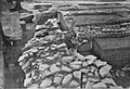
The ruins of Besnagar were inspected by Alexander Cunningham in 1874–1875.[7] Remains of a large defensive wall were found on the western side of the city.[7] Ancient Buddhist railings were also found just outside of the city, which had probably adorned a stupa.[7] Numerous coins were found, including nine coins of the Western Satraps.[7]
The Heliodorus Pillar is a stone column, which was constructed in about 150 BCE. This stone column was erected by the Greek ambassador of the Indo-Greek King Antialcidas, who came to the court of Bhagabhadra, a possible Sunga king. Dedicated to Lord Vāsudeva, this column was constructed in front of the temple of Vāsudeva. The pillar is situated about four kilometers away from the city on Vidisha-Ganj Basoda SH-14, located on the northern bank of the Vais River. It is a 20 feet and 7 inches tall stone pillar, commonly called Kham Baba.[7] The script used in the inscription is Brahmi but the language is Prakrit, recording that Heliodorus erected the pillar as a Garuda Stambha to pay homage to Lord Vasudeva, who was later integrated as a manifestation of Lord Vishnu.[8]
-
 Archaeological plan of the old city of Besnagar
 -
 Archaeological layers at Besnagar: the Temple of Vāsudeva in the forefront, and the Heliodorus pillar in the back
 -
 Besnagar pottery Period V
 -
 Besnagar silver punch-marked coins.
 -
 Besnagar Yakshini
 -
 Besnagar Kalpadruma
 -
 Besnagar Buddhist railings
 -
 Besnagar Buddhist railings
 -
 Besnagar pillar capitals
 -
 View of Heliodorus pillar
 -
 Besnagar Ganga statue


Emergence as Bhelsa
[edit]
Besnagar was known as Bhelsa during the medieval period.[citation needed] It became famous for the temple of Sun god Bhillasvamin.[9] It was ruled by the Later Gupta king Devagupta of Malwa and Rashtrakuta king Krishna III. The name is first noted in an inscription of 878 CE by a merchant Hatiaka of Paravada community.[10] The 12th-century Tri-shashthi-shalaka-purusha-charitra mentions an image of Bhillasvamin at Vidisa, along with a copy of Jivant Swami buried in the sand.[11] Minhajuddin's Tabaqat-i-Nusiri states that the temple was destroyed by Iltutmish in 1233–34 CE.[12]
In 1293, Alauddin Khalji of the Delhi Sultanate sacked the city as a general of Sultan Jalaluddin. The attack was illustrative of Vidisha's importance in the medieval era.[13] In 1532 Bhilsa was sacked by Bahadur Shah of Gujarat Sultanate. It then passed on to the Malwa Sultans, the Mughals and the Scindias.
Jainism in Vidisha
[edit]
Vidisha is considered to be Puranakshetras Jain tirtha. Vidisha is also believed to be the birthplace of Shitalanatha, the tenth tirthankar.[14] There are 14 temples in Vidisha, among which Bada Mandir, Bajramath Jain temple, Maladevi temple, Gadarmal temple and Pathari Jain temple, built between 9th-10th centuries CE, are the most prominent. These temples are rich in architecture.[15][16][17][18]
Climate
[edit]| Climate data for Vidisha (1981–2010, extremes 1970–2003) | |||||||||||||
|---|---|---|---|---|---|---|---|---|---|---|---|---|---|
| Month | Jan | Feb | Mar | Apr | May | Jun | Jul | Aug | Sep | Oct | Nov | Dec | Year |
| Record high °C (°F) | 35.0 (95.0) |
36.2 (97.2) |
42.1 (107.8) |
46.9 (116.4) |
49.1 (120.4) |
49.0 (120.2) |
43.3 (109.9) |
38.6 (101.5) |
39.0 (102.2) |
40.8 (105.4) |
38.0 (100.4) |
35.0 (95.0) |
49.1 (120.4) |
| Mean daily maximum °C (°F) | 26.2 (79.2) |
29.5 (85.1) |
34.7 (94.5) |
40.2 (104.4) |
42.8 (109.0) |
38.9 (102.0) |
32.3 (90.1) |
30.3 (86.5) |
32.2 (90.0) |
34.0 (93.2) |
31.4 (88.5) |
27.9 (82.2) |
33.4 (92.1) |
| Mean daily minimum °C (°F) | 8.3 (46.9) |
10.8 (51.4) |
15.3 (59.5) |
20.5 (68.9) |
26.1 (79.0) |
25.5 (77.9) |
23.4 (74.1) |
23.6 (74.5) |
21.5 (70.7) |
18.3 (64.9) |
13.0 (55.4) |
9.1 (48.4) |
17.9 (64.2) |
| Record low °C (°F) | 0.0 (32.0) |
2.5 (36.5) |
5.8 (42.4) |
13.1 (55.6) |
18.5 (65.3) |
16.3 (61.3) |
13.0 (55.4) |
10.0 (50.0) |
10.1 (50.2) |
11.0 (51.8) |
4.9 (40.8) |
3.1 (37.6) |
0.0 (32.0) |
| Average rainfall mm (inches) | 5.9 (0.23) |
12.2 (0.48) |
11.4 (0.45) |
3.8 (0.15) |
17.9 (0.70) |
116.7 (4.59) |
310.5 (12.22) |
332.0 (13.07) |
177.4 (6.98) |
48.3 (1.90) |
6.1 (0.24) |
5.4 (0.21) |
1,047.3 (41.23) |
| Average rainy days | 0.6 | 1.1 | 0.9 | 0.4 | 1.1 | 6.7 | 12.5 | 13.4 | 7.5 | 2.4 | 0.6 | 0.2 | 47.2 |
| Average relative humidity (%) (at 17:30 IST) | 51 | 42 | 32 | 27 | 26 | 49 | 73 | 81 | 71 | 50 | 46 | 47 | 50 |
| Source: India Meteorological Department[19][20] | |||||||||||||
Historic places and monuments
[edit]


.jpg)
Near the eastern edge of the old town are the remains of a large temple of the late Paramara period known as the Bijamaṇḍal. The building was probably started in the second half of the 11th century. That it was never finished is evidenced by the unfinished carved niches and architectural pieces found round the base of the temple plinth.[22] On top of the plinth is a small mosque made using pillars, one of which has an inscription dating probably from the time of king Naravarman (circa 1094–1134). It is a devotional inscription revering Carccikā (i.e. Cāmuṇḍā), of whom he was a devotee.[23] The miḥrāb suggests the mosque was constructed in the late 14th century. To one side of the Bijamaṇḍal is a store house of the Archaeological Survey of India containing many sculptures collected in the neighbourhood. A step-well of the 7th century is in the same campus and has, beside the entrance, two tall pillars with Kṛṣṇa scenes. These are the earliest Kṛṣṇa scenes in the art of central India. The dimensions of Bijamandal Temple at Vidisha are comparable to those of Konark in Orissa.
Lohangi Pir is a rock formation in Vidisha District that derives its name from Shaykh Jalal Chishti, a saint who was locally known as Lohangi Pir. This small domed building is a tomb, which has two Persian inscriptions on it. One of the inscriptions dates back to 1460 CE, while the other is from 1583 CE. The tank and a large bell-capital dating back to the 1st century BCE can be seen on the nearby hill. Near the tomb are the remains of a medieval temple that survived as a pillared crypt. These are dedicated to Goddess Annapurna. Lohangi is a large rock right in the heart of Vidisha, within walking distance of the railway station, is of religious and historical significance in the region.[24]
Udaygiri is less than 10 km from Vidisha town. It is a series of at least 20 caves, containing both Hindu and Jain sculptures from the Gupta Era, sometime between the 4th and 5th century CE. According to Jain texts, Tirthankara Sheetal Nath attained nirvana here. It is basically a small hill where intricate sculptures have been cut out of the rocks.
Maladevi temple is a grand Portal of ninth century CE, situated on the eastern slope of a hill and built on a huge platform cut out of the hillside and strengthened by a massive retaining wall, Maladevi temple's imposing structure provides a panoramic valley view, in Gyaraspur, about 40 km from Vidisha along NH-86.[25]
Hindola Torana - Hindola means a swing and Torana is an arched gate - is a magnificent artwork of the 9th century or medieval period, situated in Gyaraspur. It is a developed, ornamental and decorated arched gate made of sandstone. On both of its pillars, Lord Vishnu's ten incarnations are engraved. Near it, four carved and sculpted pillars and beams seem to be the ruins of Trimurthy temple set on one raised platform, as Lord Shiva, Lord Ganesha, Goddess Parvati and their servants are sculpted on these pillars and beams. The gate may be an entrance gate for a temple for Vishnu, Shiva or Thirumurthy.
Bajramath Temple is situated in Gyaraspur, on NH-146 behind the Sub-Judicial Magistrate and Tehsildar's Office. The temple faces the east, and was a Hindu temple later transformed into a Jain temple. It is just opposite the hill on which Maladevi temple is situated.[26]
Dashavtar Temple is situated on the north of the local lake, where ruins of a group of small Vaishnava shrines can be found. These small Vaishnava shrines are popularly known as Sadhavatara Temple. The temple comprises a large open pillared hall, in which the pillars are dedicated to the ten incarnations of Vishnu. These pillars date back from 8th to 10th century CE. Towards the western bank of the lake lie the ruins of sati pillars that date back to 9th or 10th century CE. One of these pillars is carved with four sculptured faces that depict a seated group of Hara-Gauri.
Girdhari Temple, which is known for its sculptures and fine carvings, is a popular attraction in Sironj. The ancient shrines of Jatashankar and Mahamaya are located close to this temple. Jatashankar Temple is situated 3 km towards the south-west of Sironj in the forest area. On the other hand, Mahamaya Temple is situated 5 km south-west of Sironj.
Udayeshwara Temple, located in Udaipur village of the Basoda Tehsil, is one of the most prominent Hindu shrines in the region. The inscriptions found in this temple suggest that the Udaipur Town was founded by the Parmara King Udayaditya during the 11th century CE. Other inscriptions found at the temple suggest that Parmara King Udayaditya dedicated it to Lord Shiva.
Vidisha District Museum
[edit]
Vidisha Museum or Vidisha District Museum is the main museum of the city of Vidisha.[27][28][29]
The museum has many sculptures, terracottas and coins, especially from the 9th to the 10th century CE, as well as Harrappan art.[28]
Notable people
[edit]Historic
[edit]- Maharani Devi (wife of Ashoka) – According to the Ceylonese chronicles, Ashoka's first wife was the daughter of a merchant of Vedisagiri (present-day Vidisha), Devi by name, whom Ashoka had married while he was Viceroy at Ujjain.[30][31]
Social works
[edit]- Kailash Satyarthi – Born as Kailash Sharma in the Vidisha district, he is an Indian social reformer.
- Atul Shah – He is a social worker and a key figure in multiple Non Governmental Organisations which includes Lions club Vidisha and Red cross Society Vidisha
Education
[edit]- Pritam Babu Sharma – Indian academic and Vice Chancellor of Amity University, Gurgaon and ex Vice Chancellor of Delhi Technological University.
Art and sports
[edit]- Surendra Malviya – Indian Cricketer.
- Aalok Shrivastav – Indian Writer, Lyricist.
Politicians
[edit]- Atal Vihari Vajpayee – India's 10th Prime Minister represented Vidisha Lok Sabha as an MP in 2nd, 5th, 6th and 7th Lok sabha.
- Mukesh Tandon – Politician, MLA of Madhya Pradesh legislative assembly from Vidisha 144 Constituency.
- Munvvar Saleem – Politician, MP of Rajya Sabha for Uttar Pradesh.
- Pratap Bhanu Sharma – Indian Politician, MP of 7th and 8th Lok Sabha from Vidisha Lok Sabha constituency.
- Raghavji – Indian Politician, MP of Lok Sabha and Rajya Sabha.
- Sushma Swaraj — won the Vidisha constituency in Madhya Pradesh for a second term In the 2014 Lok Sabha Election retaining her seat.
Transport
[edit]
Vidisha railway station is a railway station on the Delhi-Chennai, Delhi-Mumbai main line of the Central Railway, at a distance of 54 km from Bhopal, the capital of Madhya Pradesh. Sanchi on the Jhansi-Itarsi section of the West Central Railway and Bhopal to Bina triple electrified broad gauge lines, from Bina to Katni double electrified Lines, Vidisha 102 km from Bina, and Vidisha, 9 km from Sanchi, are more convenient. Vidisha is also well-connected by road.
Education
[edit]Vidisha has many primary and secondary schools affiliated with the Madhya Pradesh Board of Secondary Education. Some schools choose to be affiliated with Central Board of Secondary Education (CBSE).
There is a Grant-in-Aid Autonomous College called Samrat Ashok Technological Institute (SATI).
Atal Bihari Vajpayee Government Medical College, a medical college located in Vidisha.[32] It became functional in 2018 and received its first batch of students in the same year.[33] The number of students admitted in 2018 was 150 whereas in 2019 the intake was increased to 180. Students are admitted to the college through NEET-UG examination.
There are many more Schools and Colleges in Vidisha:
- Saraswati Shishu Mandir
- Magadham International School
- Vatsalya Senior Secondary School
- Jawahar Navodaya Vidyalaya
- Trinity Convent Senior Secondary School
- Kendriya Vidyalaya
- Nirmala Convent Higher Secondary School
- Government Lal Bahadur Shastri College
- Gurudev Vidya Sagar B.Ed College
- Saket MGM College
- Sanjay Gandhi College
- Grantham College of Education
- SGA Paramedical College
- Kushabhaou Thakre College
- Jawaharlal Nehru College
Economy
[edit]Agriculture
[edit]Agriculture is the primary economic activity, with most of the population engaged in farming.Major crops include wheat, soybean, maize, pulses, and oilseeds.[34]
Much of the district lies within the Betwa River basin, providing ample irrigation facilities. The majority of the population depends on agriculture.[35]
Industries
[edit]The economy includes industries related to agriculture, such as oilseeds processing, Dairy Products and flour mills.The region hosts small-scale industries producing soaps, detergents, chemicals, textiles and engineering (e.g., steel furniture, agricultural implements).[36]
References
[edit]- ^ Corpus Inscriptions Indicarum. Vol. II. Government Epigraphist for India, Ootacamund. 1963. p. 9.
- ^ a b Kulke, Hermann (2021). The History of India: An Introduction. Books Treasure. ISBN 9789384385637.
- ^ "Vidisha". Encyclopaedia Britannica. Encyclopædia Britannica, inc. Retrieved 20 April 2020.
- ^ "List of 112 Aspirational Districts" (PDF). niti.gov.in.
- ^ Rousselet, Louis (1882). India and Its Native Princes: Travels in Central India and in the Presidencies of Bombay and Bengal. By Louis Rousselet. Carefully revised and edited by Lieut.-Col. Buckle. With numerous illus. and maps. Bickers.
- ^ "Census of India 2001: Data from the 2001 Census, including cities, villages and towns (Provisional)". Census Commission of India. Archived from the original on 16 June 2004. Retrieved 1 November 2008.
- ^ a b c d e Report Of Tours In Bundelkhannd And Malwa Vol X 1874–75. 1880. pp. 36–46.
- ^ Paul, Pran Gopal (December 1989). "Brahmanical Imagery in the Kuṣāṇa Art of Mathurā: Tradition and Innovations". East and West. 39: 111–143.
- ^ Art & architecture of Daśārṇa (Malwa) Region, Rahman Ali, Sharada Pub. House, 2008, p. 14
- ^ (Malwa Through the Ages, from the Earliest Times to 1305 A.D, K.C. Jain, p. 485
- ^ Gleanings of Indian archaeology, history, and culture: R.N. Mehta commemoration volume, Volume 1, 2000, p. 263
- ^ Madhya Pradesh: District Gazetteers, Vol. 42, V. S. Krishnan, Government Central Press p. 30
- ^ [Studies in the Religious Life of Ancient and Medieval India, Dineschandra Sircar, Motilal Banarsidass Publ., 1971, p. 117]
- ^ Dainik Bhaskar & 108 feet temple.
- ^ ASI & Bajramath Temple.
- ^ ASI & Maladevi Temple.
- ^ ASI & Badoh Jain Temple.
- ^ ASI & Gadarmal Temple.
- ^ "Station: Vidisha Climatological Table 1981–2010" (PDF). Climatological Normals 1981–2010. India Meteorological Department. January 2015. pp. 791–792. Archived from the original (PDF) on 5 February 2020. Retrieved 29 December 2020.
- ^ "Extremes of Temperature & Rainfall for Indian Stations (Up to 2012)" (PDF). India Meteorological Department. December 2016. p. M134. Archived from the original (PDF) on 5 February 2020. Retrieved 29 December 2020.
- ^ The Past Before Us, Romila Thapar p. 361
- ^ O.P. Mishra, "Bijamaṇḍal and Carccikā: Tutelary Goddess of the Paramāra King Naravarman," Journal of the Royal Asiatic Society 22, 1 (2012), pp. 107–113.
- ^ H. V. Trivedi, Inscriptions of the Paramāras, Chandellas, Kachchhapaghātas and Two Minor Dynasties, Corpus Inscriptionum Indicarum, volume 7 in 2 parts (New Delhi, 1978–91) 2: 120–122.
- ^ "Home | the Travelling Slacker". 17 September 2020.
- ^ "Maladevi Temple | Maladevi Temple Photos | Vidisha Tourist Places". Archived from the original on 16 January 2013.
- ^ "Bajramath Temple, Vidisha | History, Timings, Reviews, Photos | HolidayIQ.com". www.holidayiq.com. Archived from the original on 9 October 2014.
- ^ "Famous Museums in Madhya Pradesh | MP Museums Guide". www.tourmyindia.com.
- ^ a b Hudson, Kenneth; Nicholls, Ann (1985). The Directory of Museums & Living Displays. Springer. ISBN 9781349070145.
- ^ Buddhist Circuit in Central India: Sanchi, Satdhara, Sonari, Andher, Travel Guide. Goodearth Publications. 2010. ISBN 9789380262055.
- ^ "Devi : Ashoka's first wife". by WikiEditPS.
- ^ "Vidisha: The land of Emperor's Love". by WikiEditPS.
- ^ "Atal Bihari Vajpayee Government Medical College, Vidisha". gmcvidisha.org. Retrieved 26 September 2019.
- ^ Pioneer, The. "CM: Medical College to start in Vidisha from August". The Pioneer. Retrieved 26 September 2019.
- ^ https://www.mptradeportal.org/vidisha#:~:text=MP%20Trade%20Portal,products%20and%20agro%2Dbased%20commodities.
- ^ "Dynamics of Food Grains Production in Vidisha District of Madhya Pradesh - Economicaffairs". economicaffairs.co.in.
- ^ https://www.indiastatdistricts.com/madhyapradesh/vidisha-district#:~:text=Agriculture%20is%20the%20backbone%20of,of%20several%20reputed%20educational%20institutions.
- "Vidisha, the country's first 108 feet elevated temple with all Tirthankars". Dainik Bhaskar. 17 April 2019. Retrieved 28 July 2019.
- "Maladevi Temple". Archaeological Survey of India.
- "Bajramath Temple". Archaeological Survey of India.
- "Gadarmal Temple". Archaeological Survey of India.
- "Badoh Jain Temple". Archaeological Survey of India.
- "Vidisha". Archaeological Survey of India.
- Jain, Kailash Chand (1972), Malwa Through The Ages, Motilal Banarsidass, ISBN 9788120808249
| International | |
|---|---|
| National | |
| Geographic | |
| Other | |
Vidisha
View on GrokipediaGeography
Location and Topography
Vidisha is situated in the central part of Madhya Pradesh, India, at geographical coordinates 23.53°N latitude and 77.82°E longitude.[9] The city lies approximately 57 kilometers northeast of the state capital Bhopal by road.[10] It is positioned east of the Betwa River, near its confluence with the Bes River.[11] The Vidisha district covers a total area of 7,371 square kilometers and occupies the Vindhyachal Plateau, extending off the main Vindhyachal Range with spurs projecting toward the north and northeast.[12] The plateau slopes gently from south to north and is drained by several rivers, including the Betwa, which influences local irrigation systems and periodic flooding patterns during heavy rainfall.[13] The terrain consists primarily of fertile alluvial plains in river valleys, interspersed with undulating plateaus, supporting agricultural activities through nutrient-rich sediments deposited by the Betwa.[14] Predominant soil types in the district include black cotton soils and alluvial soils, derived from the region's sedimentary and basaltic formations, which contribute to the fertility of the plains.[13] [14] The area also hosts natural resources such as limestone outcrops, which occur in isolated deposits suitable for extraction.[15] The average elevation of Vidisha city is 424 meters above sea level, reflecting the plateau's moderate topography.[9]Climate
Vidisha features a tropical savanna climate (Köppen Aw) with pronounced seasonal contrasts driven by the region's subtropical high-pressure systems and monsoon influences. Annual average temperatures hover around 26.5°C, with total precipitation averaging approximately 972 mm, predominantly concentrated in the monsoon period.[16][17] Summers from April to June are intensely hot and dry, with average daily highs exceeding 37°C and peaking in May, where temperatures can reach up to 45°C due to clear skies and continental heating. The monsoon season spans July to September, delivering 70-90% of annual rainfall, often exceeding 300 mm in August alone, though variability leads to uneven distribution. Winters from December to February remain mild and dry, with daytime highs of 25-30°C and nighttime lows dipping to 10-12°C, supported by retreating monsoon troughs and northerly winds.[17][18] Records from the Indian Meteorological Department (IMD) indicate recurrent drought risks during deficient monsoon years, exacerbated by erratic rainfall patterns, alongside flood events when the Betwa River surpasses danger levels above 1355 feet following intense downpours. For instance, heavy localized rains in July 2025 caused river swelling and inundation in low-lying areas.[19][20] Observational data over recent decades reveal gradual temperature increases of 0.2-0.5°C per decade alongside declining rainfall trends in central Madhya Pradesh, heightening drought frequency without corresponding rises in overall precipitation volume. These shifts, derived from IMD gridded datasets, reflect broader regional patterns of enhanced variability rather than uniform change.[21][20][22]History
Ancient and Classical Periods
The ancient settlement of Besnagar, corresponding to modern Vidisha, emerged as a significant urban center in central India by the 2nd century BCE, with archaeological evidence indicating continuous occupation linked to its strategic location at the confluence of the Bes and Betwa rivers. Excavations at Besnagar have uncovered punch-marked silver coins typical of the Mauryan period (circa 322–185 BCE), suggesting early trade and monetary use in the region, alongside pottery shards and structural remains that point to fortified settlements supporting commerce along northern trade routes. This positioning facilitated connections to nearby sites like Sanchi, where Buddhist stupas were constructed and expanded during the Mauryan era under Ashoka (r. 268–232 BCE), though direct Mauryan inscriptions at Besnagar remain absent.[23][24] A pivotal artifact from this era is the Heliodorus pillar, erected around 113 BCE by Heliodorus, a Greek ambassador from Taxila representing the Indo-Greek king Antialcidas, dedicated to the god Vasudeva (an early form of Vishnu). The pillar's Brahmi inscription explicitly states Heliodorus's devotion to Vasudeva as a path to salvation, evidencing cultural exchange between Indo-Greek elites and local Vedic traditions under the local ruler Bhagabhadra, likely a feudatory of the Shunga dynasty (185–73 BCE). This monument, standing 6.5 meters tall in sandstone, underscores Besnagar's role as a diplomatic and religious nexus, with the pillar originally serving as a garuda-dhvaja (eagle flagstaff) for a Vishnu temple, later confirmed by associated architectural fragments like pillar capitals and yakshini sculptures.[25][26] During the Gupta period (circa 320–550 CE), Besnagar, referred to as Vidisha in inscriptions, flourished as a commercial hub, evidenced by inscribed copper coins bearing symbols like the wheel and issued by local rulers, reflecting sustained economic activity in agriculture, trade, and craftsmanship. Numismatic finds from the Eran-Vidisha region include potin and copper issues linking to Gupta overlords, while Jain and Hindu image inscriptions from Vidisha mention figures like Ramagupta, indicating a diverse religious landscape accommodating Buddhism—via proximity to Sanchi—Jainism, and Hinduism without dominance by any single faith. Trade routes through Vidisha connected Gangetic plains to western ports, causal to its prosperity as a riverine crossroads, with artifacts such as Buddhist railings and Ganga statues attesting to syncretic practices grounded in empirical patronage rather than doctrinal uniformity.[23][3][27]Medieval Period
In 1293 CE, Alauddin Khalji, then governor of Kara under the Delhi Sultanate, conducted a military expedition against Bhilsa (contemporary name for Vidisha), a wealthy center in the Paramara kingdom of Malwa weakened by prior conflicts. The raid involved systematic plunder of treasures and the deliberate destruction of Hindu temples, yielding substantial booty that funded further campaigns and marked the initial subjugation of the region to Sultanate authority.[28][29] This event disrupted local economic networks reliant on temple patronage and trade, initiating a pattern of violent incursions that eroded prior urban cohesion. Following the Khalji raid, Bhilsa integrated into the Delhi Sultanate's Malwa province by the early 14th century, with administration fluctuating under succeeding dynasties including the Tughlaqs. The city faced further sacking in 1532 CE by Bahadur Shah of the Gujarat Sultanate, compounding material losses and population displacement. Archaeological remnants, such as the Bija Mandal—a massive raised platform from a demolished Paramara-era temple likely dedicated to Vishnu or a local deity—exemplify the physical toll, reduced to foundations amid these conquests and evidencing targeted iconoclasm rather than natural decay.[30][3] Under Mughal oversight from 1562 CE, after Akbar's conquest of Malwa, Vidisha (reverting to its ancient name sporadically) served as a peripheral district in the Subah of Malwa, with governance emphasizing revenue extraction over reconstruction. These transitions imposed iqta-based land grants and Islamic legal overlays, severing causal links to indigenous patronage systems and fostering settlement shifts away from vulnerable ancient cores toward fortified outskirts. The cumulative effect of invasions—characterized by looting, temple demolition, and coercive tribute—halted cultural transmission at sites like Bhilsa, prioritizing extractive control over continuity.[2][31]Colonial and Post-Independence Era
During the colonial period, Vidisha, then known as Bhilsa, functioned as an administrative center under British paramountcy within the Gwalior princely state. In 1904, the British formed Bhilsa District by combining the tehsils of Vidisha and Basoda, excluding the princely state of Basoda itself, to streamline governance and revenue collection in the Central India Agency territories.[2] This district structure persisted until India's independence, emphasizing agrarian taxation and local administration amid broader colonial economic policies that prioritized resource extraction over local development.[32] Vidisha contributed to the independence movement, notably as the starting point for the Quit India Movement in Madhya Pradesh in 1942, where local Congress activists mobilized protests against British rule, leading to arrests and suppression by colonial authorities.[33] The movement reflected widespread resistance in the region, aligning with national calls for immediate withdrawal of British forces, though specific documentation of arrests in Vidisha remains tied to broader provincial records of Congress-led agitations. Post-independence, Bhilsa District was renamed Vidisha and integrated into the newly formed Madhya Bharat in 1948 following the merger of princely states. In 1949, it expanded through the accession of the small princely state of Kurwai, enhancing its administrative footprint.[2] The district achieved its current configuration in 1956 under the States Reorganisation Act, incorporating Madhya Bharat, Bhopal State, and the Sironj tehsil from Rajasthan, while aligning with the enlarged Madhya Pradesh state.[32] Infrastructure developments, including railway expansions inherited from the colonial era, supported gradual connectivity, though the economy remained agrarian with persistent challenges in diversification until later reforms.[34]Demographics
Population Statistics
According to the 2011 Census of India, Vidisha district recorded a total population of 1,458,875, comprising 769,568 males and 689,307 females.[35] The district spans 7,371 square kilometers, yielding a population density of 198 persons per square kilometer.[35] [36] The urban population of Vidisha city stood at 155,951, with 81,488 males and 74,463 females.[37] The district's sex ratio was 896 females per 1,000 males, reflecting a slight improvement from prior censuses but remaining below the national average.[35] Literacy rates reached 70.53% overall, with 79.14% for males and 60.85% for females; urban areas reported higher rates at 81.5%, compared to 67.1% in rural zones.[38] The decadal population growth rate from 2001 to 2011 was 20.09%, driven primarily by natural increase and limited net migration linked to agricultural employment opportunities.[36] [39] Rural areas accounted for 76.72% of the population (1,119,257 persons), while urban areas comprised 23.28% (339,618 persons), underscoring Vidisha's predominantly agrarian demographic structure with urban centers concentrated around administrative and trade hubs.[38]| Demographic Indicator (2011 Census) | District Value | City Value |
|---|---|---|
| Total Population | 1,458,875 | 155,951 |
| Population Density (per sq km) | 198 | N/A |
| Sex Ratio (females/1,000 males) | 896 | 914 |
| Literacy Rate (%) | 70.53 | 85.16 |
| Decadal Growth Rate (2001-2011) (%) | 20.09 | N/A |
| Rural/Urban Split (%) | 76.72/23.28 | 100 urban |
Religious and Social Composition
According to the 2011 Census of India, Vidisha district's population is predominantly Hindu, with 1,287,391 individuals (88.25% of the total 1,458,875 residents) adhering to Hinduism.[38] Muslims constitute the second-largest group at 149,548 persons (10.25%), reflecting a notable minority presence concentrated in urban and peri-urban areas.[38] Jains number 18,490 (1.27%), a community with roots in the region's ancient mercantile history, though their proportion has declined relative to the overall population growth. Christians (1,313 or 0.09%) and Sikhs (914 or 0.06%) form negligible fractions, alongside smaller numbers of Buddhists and others.[38]| Religion | Population | Percentage |
|---|---|---|
| Hindu | 1,287,391 | 88.25% |
| Muslim | 149,548 | 10.25% |
| Jain | 18,490 | 1.27% |
| Christian | 1,313 | 0.09% |
| Sikh | 914 | 0.06% |
| Others | ~1,219 | ~0.08% |
Economy
Agriculture and Primary Sectors
Agriculture constitutes the economic foundation of Vidisha district in Madhya Pradesh, with crop cultivation serving as the primary livelihood for the majority of the rural population. The district's agrarian economy revolves around rainfed and irrigated farming, supported by fertile black cotton soils conducive to high-yield cereal and pulse production. Two distinct cropping seasons dominate: Kharif (monsoon, June-October) featuring soybean, paddy, and pulses like black gram and green gram; and Rabi (winter, November-April) dominated by wheat and gram (chickpea). Soybean, a high-value oilseed crop, ranks as the second-most produced commodity, offering farmers significant income due to its demand in food and industrial processing.[44][14] Crop yields reflect the interplay of soil quality, varietal improvements, and partial irrigation coverage. Average wheat productivity stands at 2,624 kg/ha, while soybean achieves 1,515 kg/ha, outcomes linked to the district's loamy soils retaining moisture and nutrients effectively for these staples. Gram production benefits from similar conditions, with the crop's nitrogen-fixing properties enhancing soil fertility for subsequent rotations. Paddy and pulse cultivation, though lower in scale, contributes to food security, with relative area expansions noted for green gram. These outputs are bolstered by central schemes like the National Food Security Mission, which promote hybrid seeds and balanced fertilization to mitigate yield gaps from erratic monsoons.[45][46] The Betwa River and its tributaries provide critical irrigation, supplemented by canal networks and projects such as the Samrat Ashok Sagar barrage, which commands areas in Vidisha and adjoining districts to sustain dry-season farming. These systems cover substantial arable land, though exact irrigated fractions vary by block, enabling higher cropping intensities compared to fully rainfed zones. Despite this, post-harvest practices pose environmental challenges; Vidisha led Madhya Pradesh in stubble burning incidents in 2025, recording 2,916 fires between April 1 and 20 alone, primarily from wheat residue disposal, exacerbating regional air quality degradation.[47][48][49]Industries and Emerging Developments
Vidisha's non-agricultural economy centers on small-scale manufacturing and processing, with 8,273 micro and small enterprises registered, involving an investment of ₹7,710.52 lakh and providing employment to 17,038 workers.[12] Dominant sectors include engineering and servicing (2,480 units), repair and maintenance services (1,820 units), and limited chemical and plastic production such as phenyl and cleaning powders.[12] Food processing units, including oilseed milling, flour mills, and dairy operations, form a key subset, alongside smaller textile and electronics assembly activities, though medium-scale units like dye and paper mills have largely closed.[12][15] Mineral extraction contributes to construction materials, with resources encompassing laterite, limestone outcrops, calcite, flagstone (95,540 cubic meters produced in 2010-11), dhoka stone (1,011,147 cubic meters), muram (678,882 cubic meters), and sand (631,565 cubic meters).[12][15] Stone quarrying, including metal stone from sites like Maliyakheda, supports local building demands but involves small operations with reported health risks from dust and unregulated practices in arid areas.[50][51] Three industrial areas—Vidisha (12.14 hectares, 80 units operational), Kurwai (1.75 hectares), and Kampana (52.3 hectares, 139 plots allotted)—facilitate these activities across 66.15 hectares total land, though underutilization persists due to inadequate water, electricity, finance, and marketing support.[12][52] Emerging growth is projected at 10-15% annually for processing-linked sectors, but large-scale industrialization remains limited, with total industrial employment averaging 19,783 daily workers amid broader district reliance on agriculture-derived income.[12] Heritage-linked tourism holds potential as a service driver, yet critiques point to persistent infrastructure gaps like poor connectivity constraining visitor economies despite proximity to sites like Besnagar.[53]Government and Politics
Administrative Structure
Vidisha district is administered by a District Collector, who serves as the chief executive officer responsible for revenue administration, law and order maintenance, and coordination of developmental schemes across the district. The Collector is supported by Additional Collectors and sub-divisional officers overseeing specific jurisdictions, with powers delineated under the Madhya Pradesh Land Revenue Code and other state statutes for land records, disaster management, and public welfare implementation.[8][12] Established in 1904 as Bhilsa District through the merger of Vidisha and Basoda tehsils from the princely state of Gwalior, the district underwent post-independence expansions in 1949 with the incorporation of territories from the former petty states of Kurwai, Sironj, and Patharia, aligning with the formation of Madhya Bharat. Further reorganizations occurred in 1956 upon the creation of the modern state of Madhya Pradesh, standardizing administrative boundaries to include rural and urban extensions. These historical delineations have shaped the district's hierarchical structure, emphasizing tehsil-level revenue functions and block-level panchayat coordination.[32][31] The district encompasses 12 tehsils, each headed by a Tehsildar tasked with land revenue assessment, mutation records, and magisterial duties, and 7 community development blocks focused on agricultural extension, rural infrastructure, and gram panchayat oversight for approximately 1,524 villages. The blocks are Vidisha, Basoda, Gyaraspur, Kurwai, Lateri, Nateran, and Sironj, serving a 2011 census population of 1,458,875 through decentralized governance mechanisms. Tehsils include Vidisha, Basoda, Gyaraspur, Kurwai, Lateri, Nateran, Sironj, Badoh-Patharia, and additional subdivisions for efficient sub-district administration.[54][8][13] Urban governance in Vidisha city falls under the Vidisha Municipal Council (Nagar Palika), which manages civic services such as water distribution, waste management, street lighting, and property taxation for the urban population, operating under the Madhya Pradesh Municipalities Act. In January 2025, the state government announced the elevation of this body to a Municipal Corporation status, aiming to expand its jurisdiction by integrating peri-urban areas and bolstering fiscal autonomy for infrastructure projects. This upgrade would delineate enhanced powers for urban planning and revenue generation, distinct from rural panchayat systems.[55][56][57]Electoral and Political Dynamics
Vidisha's Lok Sabha constituency, formed in 1967, witnessed early dominance by the Indian National Congress in the post-independence period, with the party securing victories through the 1970s amid its nationwide appeal to diverse rural and urban voters. This pattern shifted decisively toward the Bharatiya Janata Party (BJP) starting in the late 1980s, as the BJP leveraged organizational strength, developmental promises, and appeals to Hindu-majority sentiments in a region with growing OBC and upper-caste consolidation, leading to uninterrupted wins since 1989. The transition reflects causal factors like Congress's internal factionalism and failure to counter BJP's welfare delivery, evidenced by consistent high margins exceeding 2-3 lakh votes in most cycles post-1990s.[58] In the 2024 Lok Sabha elections, BJP candidate Shivraj Singh Chouhan won with 1,116,460 votes (approximately 72% share), defeating Congress's Pratap Bhanu Sharma by 821,408 votes, marking one of Madhya Pradesh's largest margins and underscoring BJP's entrenched base. Voter turnout reached 76.5%, driven by intensive rural campaigning on agricultural subsidies and infrastructure, with assembly segments like Vidisha (Congress win in 2023 by Shashank Bhargava with 80,332 votes) and Basoda showing BJP recoveries through defections, including Bhargava's switch to BJP in March 2024 amid Congress disarray. Similar trends prevail across Vidisha district's six assembly seats, where BJP captured four in 2023, buoyed by OBC voter loyalty to policies favoring Kirar and Lodhi communities, which form over 30% of the electorate and prioritize tangible benefits over ideological shifts.[59][60][61]| Election Year | Winner (Party) | Votes Secured | Margin | Turnout (%) |
|---|---|---|---|---|
| 2024 | Shivraj Singh Chouhan (BJP) | 1,116,460 | 821,408 | 76.5 |
| 2019 | Ramakant Bhargava (BJP) | ~850,000 | ~500,000 | ~75 |
| 2014 | Sushma Swaraj (BJP) | ~700,000 | ~400,000 | ~72 |