Hubbry Logo
TectonicsTectonicsMain
Open search
Tectonics
Community hub
Tectonics
logo
8 pages, 0 posts
0 subscribers
Be the first to start a discussion here.
Tectonics
Tectonics
from Wikipedia

Tectonics (from Ancient Greek τεκτονικός tektonikós 'pertaining to building' via Latin tectonicus)[1] are the processes that result in the structure and properties of Earth's crust and its evolution through time. The field of planetary tectonics extends the concept to other planets and moons.[2][3]

These processes include those of mountain-building, the growth and behavior of the strong, old cores of continents known as cratons, and the ways in which the relatively rigid plates that constitute Earth's outer shell interact with each other. Principles of tectonics also provide a framework for understanding the earthquake and volcanic belts that directly affect much of the global population.

Tectonic studies are important as guides for economic geologists searching for fossil fuels and ore deposits of metallic and nonmetallic resources. An understanding of tectonic principles can help geomorphologists to explain erosion patterns and other Earth-surface features.[4]

Main types of tectonic regime

[edit]

Extensional tectonics

[edit]

Extensional tectonics is associated with the stretching and thinning of the crust or the lithosphere. This type of tectonics is found at divergent plate boundaries, in continental rifts, during and after a period of continental collision caused by the lateral spreading of the thickened crust formed, at releasing bends in strike-slip faults, in back-arc basins, and on the continental end of passive margin sequences where a detachment layer is present.[5][6][7]

Thrust (contractional) tectonics

[edit]

Thrust tectonics is associated with the shortening and thickening of the crust, or the lithosphere. This type of tectonics is found at zones of continental collision, at restraining bends in strike-slip faults, and at the oceanward part of passive margin sequences where a detachment layer is present.[8]

Strike-slip tectonics

[edit]
San Andreas transform fault on the Carrizo Plain

Strike-slip tectonics is associated with the relative lateral movement of parts of the crust or the lithosphere. This type of tectonics is found along oceanic and continental transform faults which connect offset segments of mid-ocean ridges. Strike-slip tectonics also occurs at lateral offsets in extensional and thrust fault systems. In areas involved with plate collisions strike-slip deformation occurs in the over-riding plate in zones of oblique collision and accommodates deformation in the foreland to a collisional belt.[9]

Plate tectonics

[edit]
The Tectonic Network of Earth. Legend: Brown: Terrane (microplate) boundaries in the continents and Mobile Belts, Cyan: Terranes of the Oceanic Plates, Blue: Oceanic transform faults; Red and orange: Fault zones in the Continental and Mountain belt domain; Purple: Main subduction zones and suture zones; Green: Continental margins

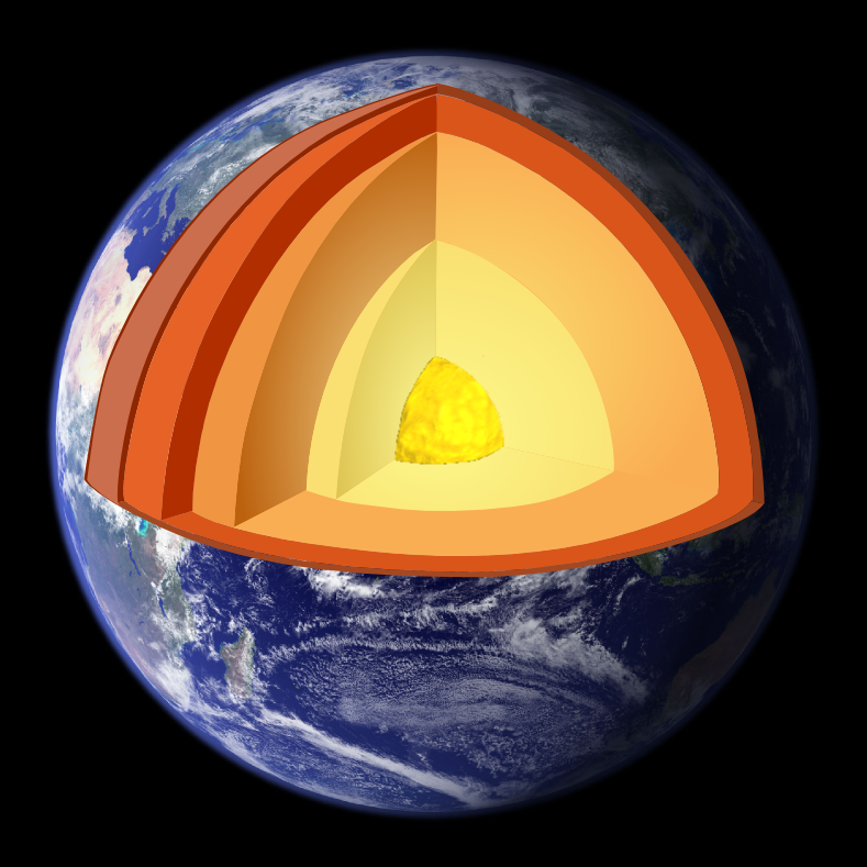
In plate tectonics, the outermost part of Earth known as the lithosphere (the crust and uppermost mantle) act as a single mechanical layer. The lithosphere is divided into separate "plates" that move relative to each other on the underlying, relatively weak asthenosphere in a process ultimately driven by the continuous loss of heat from Earth's interior. There are three main types of plate boundaries: divergent, where plates move apart from each other and new lithosphere is formed in the process of sea-floor spreading; transform, where plates slide past each other, and convergent, where plates converge and lithosphere is "consumed" by the process of subduction. Convergent and transform boundaries are responsible for most of the world's major (Mw > 7) earthquakes. Convergent and divergent boundaries are also the site of most of the world's volcanoes, such as around the Pacific Ring of Fire. Most of the deformation in the lithosphere is related to the interaction between plates at or near plate boundaries. The latest studies, based on the integration of available geological data, and satellite imagery and Gravimetric and magnetic anomaly datasets have shown that the crust of Earth is dissected by thousands of different types of tectonic elements which define the subdivision into numerous smaller microplates which have amalgamated into the larger Plates.[10]

Other fields of tectonic studies

[edit]

Salt tectonics

[edit]

Salt tectonics is concerned with the structural geometries and deformation processes associated with the presence of significant thicknesses of rock salt within a sequence of rocks. This is due both to the low density of salt, which does not increase with burial, and its low strength.[11]

Neotectonics

[edit]

Neotectonics is the study of the motions and deformations of Earth's crust (geological and geomorphological processes) that are current or recent in geological time. The term may also refer to the motions and deformations themselves. The corresponding time frame is referred to as the neotectonic period. Accordingly, the preceding time is referred to as palaeotectonic period.[12]

Tectonophysics

[edit]

Tectonophysics is the study of the physical processes associated with deformation of the crust and mantle from the scale of individual mineral grains up to that of tectonic plates.[13]

Seismotectonics

[edit]

Seismotectonics is the study of the relationship between earthquakes, active tectonics, and individual faults in a region. It seeks to understand which faults are responsible for seismic activity in an area by analysing a combination of regional tectonics, recent instrumentally recorded events, accounts of historical earthquakes, and geomorphological evidence. This information can then be used to quantify the seismic hazard of an area.[14]

Impact tectonics

[edit]

Impact tectonics is the study of modification of the lithosphere through high velocity impact cratering events.[15]

Planetary tectonics

[edit]

Techniques used in the analysis of tectonics on Earth have also been applied to the study of the planets and their moons, especially icy moons.[3]

See also

[edit]

References

[edit]

Further reading

[edit]
[edit]
Revisions and contributorsEdit on WikipediaRead on Wikipedia
from Grokipedia
Tectonics is a fundamental branch of that examines the deformation of the Earth's , focusing on the large-scale architecture of the crust, including the regional assembly of structural features such as folds, faults, and mountain belts, as well as their origins, mutual relations, and historical evolution. This discipline integrates principles from but operates on broader scales, from mineral fabrics to entire lithospheric plates, and over timescales ranging from rapid earthquake ruptures (minutes) to the slow formation of mountain ranges (tens of millions of years). At its core, tectonics investigates the forces and processes that shape the planet's surface, driven primarily by the movement of tectonic plates on the underlying . The modern understanding of tectonics is largely encapsulated by the theory of , which posits that the Earth's outermost rigid layer, the , is fragmented into a dozen or more large and small plates that float on the semi-fluid and move horizontally at rates of a few centimeters per year. These plates interact at boundaries—divergent, where new crust forms; convergent, where plates collide and one may subduct; and transform, where plates slide past each other—resulting in geological phenomena such as earthquakes, , and the creation of basins and continental margins. Plate tectonics provides a unifying framework for , explaining the distribution of fossils, rocks, and landforms across continents and oceans, and has profoundly influenced our comprehension of Earth's dynamic history since its formulation in the mid-20th century. Tectonic processes not only drive surface features but also interact with other Earth systems, influencing through the uplift of mountain ranges that alter , and contributing to natural hazards like tsunamis and landslides via active faulting. Research in tectonics employs diverse methods, including field mapping, seismic imaging, , and computer modeling, to reconstruct past plate configurations and predict future deformations. By elucidating how internal heat from and residual formation energy powers , tectonics reveals the interconnectedness of 's interior dynamics with surface evolution, underscoring the planet's ongoing geological activity.

Fundamentals

Definition and Scope

Tectonics is the scientific discipline that examines the architecture, origin, and deformation of the Earth's , encompassing processes such as folding, faulting, and ductile flow that shape crustal structures over geological time. This field interprets how deformational events influence the evolution of rock bodies at various scales, providing insights into the dynamic history of planetary surfaces. The term "tectonics" derives from the Greek word tektonikos, meaning "pertaining to building" or "constructive," reflecting its roots in analyzing how is "built" through deformational forces; it entered geological usage in the to describe mountain-building phenomena. The scope of tectonics spans regional to global scales of lithospheric deformation, distinguishing it from related fields like , which emphasizes local-scale analysis of rock fabrics and geometries, and , which primarily investigates underlying and driving forces. Within tectonics, subfields address deformation across a continuum: microtectonics focuses on grain- and crystal-scale mechanisms observable via , while larger-scale investigations—often termed regional or —examine continental and oceanic crustal evolution. This broad range enables tectonics to integrate observational data from field studies with theoretical models of crustal response to stress. Tectonics maintains strong interdisciplinary connections with , which provides seismic and gravitational data to map subsurface structures; , which analyzes rock compositions altered by deformation; and , which reconstructs temporal sequences of crustal layering and events to trace evolutionary histories. These linkages facilitate a holistic understanding of lithospheric development, from ancient orogenic belts to modern plate interactions. serves as the unifying paradigm, explaining large-scale crustal motions and deformations observed in the field.

Key Concepts in Deformation

In tectonic deformation, the lithosphere experiences various types of stress that lead to corresponding strains, fundamentally shaping geological structures. Stress is defined as force per unit area acting on a rock body, with three primary types relevant to tectonics: compressional stress, which shortens rocks by squeezing them together; tensional stress, which elongates rocks by pulling them apart; and shear stress, which causes rocks to slide past one another along parallel planes. Strain represents the resulting change in shape, size, or volume of the rock in response to stress, and it can be elastic, where the deformation is reversible upon removal of stress; ductile, involving permanent flow without fracturing; or brittle, characterized by sudden fracturing and permanent displacement. The transition to failure often follows the Mohr-Coulomb criterion, which predicts shear failure when the shear stress τ\tau on a plane exceeds cohesion cc plus the product of normal stress σ\sigma and the tangent of the friction angle ϕ\phi, expressed as: τ=c+σtanϕ\tau = c + \sigma \tan \phi This criterion is widely used to model fault initiation in the brittle upper lithosphere, where increasing differential stress overcomes rock strength. Deformation structures form as rocks respond to these stresses, with folds and faults being the most prominent. Folds develop primarily through ductile processes under compressional stress, where layered rocks buckle like a rug pushed against a wall, leading to anticlines—upward-arcing folds with older strata at the core—and synclines—downward-troughing folds with younger strata at the core. The buckling mechanism involves layer-parallel shortening, amplified by contrasts in rock competency, resulting in periodic undulations that accommodate strain without rupture. In contrast, faults arise from brittle failure when stress exceeds the rock's yield strength, creating discrete fracture planes. Faults are classified by slip direction: dip-slip faults, where movement is primarily along the fault's dip (normal faults feature downward hanging-wall motion under tension, while reverse faults show upward hanging-wall motion under compression); and strike-slip faults, involving horizontal motion parallel to the fault strike, driven by shear stress. Oblique-slip faults combine elements of both, but the primary categories highlight how stress orientation dictates rupture geometry. Rock rheology governs whether deformation is brittle or ductile, influenced by environmental factors within the . Brittle behavior predominates in the shallow crust at low temperatures (typically below 300–400°C), low confining pressures, and rapid strain rates (around 10^{-14} s^{-1} or higher), leading to fracture-dominated structures like faults. Ductile behavior emerges deeper, at higher temperatures (above 400–500°C), elevated pressures, and slower strain rates (10^{-14} to 10^{-12} s^{-1}), allowing viscous flow through mechanisms like dislocation creep or , which produce folds and . The brittle-ductile transition zone varies with rock type—quartz-rich rocks transition at lower temperatures than feldspar-dominated ones—and is critical for localizing above and aseismic flow below. further lowers the transition temperature by enhancing , promoting ductility in otherwise brittle regimes. Continuum mechanics provides the theoretical framework for modeling these processes at the lithospheric scale, treating rocks as viscous fluids under low conditions. The Navier-Stokes equations, which balance , viscous forces, and gradients, are simplified by neglecting to yield the Stokes equations for slow, : σ+ρg=0,σ=pI+2ηϵ˙\nabla \cdot \sigma + \rho \mathbf{g} = 0, \quad \sigma = -p \mathbf{I} + 2 \eta \dot{\epsilon} where σ\sigma is the stress tensor, ρg\rho \mathbf{g} body forces, pp , η\eta , and ϵ˙\dot{\epsilon} . This foundation enables numerical simulations of lithospheric deformation, incorporating rheological layering to predict flow patterns and stress distribution without deriving full inertial terms.

Historical Development

Pre-Plate Tectonics Theories

Early theories of Earth's crustal deformation emerged in the , attempting to explain mountain building and continental features without invoking large-scale horizontal movements. These ideas, developed primarily by American and European geologists, focused on vertical , thermal processes, and fixed landmasses, laying groundwork for later tectonic understandings but ultimately limited by incomplete mechanisms for observed geological features. The geosynclinal theory, one of the earliest comprehensive models, posited that vast sedimentary basins known as geosynclines formed through subsidence along continental margins, accumulating thick layers of sediment that later uplifted and folded into mountain ranges. James Hall first proposed the concept in the 1850s based on observations of extensive Paleozoic sedimentary sequences in the Appalachian Mountains, suggesting cycles of subsidence followed by orogenic uplift. James Dwight Dana formalized the idea in the 1870s, coining the term "geosyncline" in 1873 to describe a downwarping of the crust where sediments accumulated to depths of thousands of meters before compression and elevation produced fold mountains. For instance, the Appalachians were interpreted as the product of a miogeosyncline—a shallow marine trough—evolving into a folded belt through these processes. Émile Haug extended the theory to Europe around 1900, integrating it with Alpine stratigraphy and emphasizing geosynclines as precursors to orogenic belts. Parallel to geosynclinal ideas, the contraction theory gained prominence in the late 19th and early 20th centuries, attributing crustal deformation to the Earth's gradual cooling and volumetric shrinkage since its formation. This thermal contraction was thought to wrinkle the outer crust like the skin of a drying fruit, producing folds and thrust faults that built mountain chains. Proponents like Eduard Suess and Albert Heim applied the model to the , viewing them as radial wrinkles from global shrinkage, while Haug linked it to geosynclinal by suggesting cooling-induced contraction drove loading and subsequent compression. The theory drew from earlier work by Élie de Beaumont in the but was refined through geophysical estimates of Earth's thermal history, implying periodic orogenic pulses tied to cooling phases. However, by the early , discoveries of radioactive heat generation undermined the assumption of steady cooling, as it suggested ongoing internal heating that countered significant shrinkage. Alfred Wegener's continental drift hypothesis, introduced in 1912, challenged the fixity of continents inherent in prior models by proposing that landmasses had once formed a and subsequently drifted apart. Wegener compiled multidisciplinary evidence, including jigsaw-like fits of continental margins (e.g., and ), matching fossil distributions such as the Permian reptile across now-separated Atlantic shores, and paleoclimatic indicators like Carboniferous glacial deposits in equatorial regions of and . He argued these patterns required horizontal displacement over millions of years, with continents "floating" on a denser substratum. Despite support from some European geologists like Émile Argand, who integrated it with Alpine nappe structures in 1924, the hypothesis faced widespread rejection, particularly in , due to the absence of a plausible driving mechanism—Wegener's suggestion of tidal or polar forces was deemed insufficient to overcome continental inertia. These pre-plate tectonics theories shared key limitations, including their reliance on vertical tectonics and neglect of dynamics, such as the later-discovered , which invalidated assumptions of permanent continental margins. Hall and Dana's mountain-building cycles, for example, explained orogenic timing but failed to account for the immense lateral shortening in ranges like the , estimated at hundreds of kilometers. Contraction and geosynclinal models similarly overlooked evidence for continental mobility, paving the way for mid-20th-century syntheses.

Emergence of Plate Tectonics

In the mid-20th century, pivotal evidence from ocean floor studies revolutionized geological understanding, culminating in the hypothesis proposed by Harry Hess in 1962. Hess suggested that new forms at mid-ocean ridges through mantle material, which then spreads laterally, carrying continents and explaining the relative motion observed in earlier ideas. This hypothesis was directly supported by patterns of magnetic striping on the seafloor, where alternating bands of normal and reversed polarity in the basalt record the Earth's periodic reversals as the crust cooled and solidified. The seafloor spreading model gained empirical confirmation through the work of Frederick Vine, Drummond Matthews, and Lawrence Morley in 1963, who demonstrated that these magnetic anomalies were symmetric on either side of mid-ocean ridges, consistent with continuous crust formation and outward migration at rates of a few centimeters per year. Building on this, J. Tuzo Wilson introduced the concept of transform faults in 1965, identifying a new class of boundaries where plates slide past each other horizontally, offsetting ridges without creating or destroying crust, which resolved inconsistencies in earlier spreading models. Concurrently, Hugo Benioff's analysis of seismicity in the 1950s revealed inclined zones of deep earthquakes—now known as Wadati-Benioff zones—extending from ocean trenches into the mantle, providing evidence for oceanic crust descending back into the at zones. The paradigm shift accelerated in the late with formal mathematical models of rigid lithospheric plates by and Dan McKenzie. Morgan's 1967 presentation and 1968 publication outlined a global framework of about a dozen major plates moving relative to each other, driven by , while McKenzie and Robert Parker's 1967 work quantified plate motions on a using paleomagnetic and data. This synthesis, illustrated in the first comprehensive plate motion map published by Morgan in 1968, unified disparate observations into a cohesive theory accepted by the geological community through the , bolstered by focal mechanisms and paleomagnetic evidence. The theory's global impact lay in its elegant explanation of phenomena like and distributions along plate boundaries, as well as the jigsaw-like fit of continental margins, marking a departure from pre-plate tectonics explanations.

Plate Tectonics Framework

Theory and Evidence

The theory of plate tectonics posits that Earth's lithosphere is divided into several rigid plates that float on the underlying asthenosphere, a ductile layer of the upper mantle. These plates, which include both oceanic and continental crust, move relative to one another at rates of a few centimeters per year, driven primarily by gravitational forces such as slab pull—where dense subducting slabs pull plates toward the mantle—and ridge push, arising from the elevated topography at mid-ocean ridges. Mantle drag, the viscous resistance from underlying convection currents, also contributes to plate motion, particularly for continental plates. Empirical evidence supporting this theory includes , which reveals apparent paths—curves tracing the apparent movement of Earth's magnetic poles relative to continents over geologic time. These paths differ for each continent, indicating that the continents have drifted apart rather than the poles wandering independently; for instance, matching the paths of and requires reconstructing them into a former configuration. Fossil and rock correlations provide further substantiation, as identical assemblages of late flora and reptiles appear in now-separated southern continents like , , , and , consistent with their assembly in the before continental breakup. Hotspot tracks, such as the Hawaiian-Emperor seamount chain, offer additional proof: this linear chain of volcanoes formed as the Pacific Plate moved over a fixed , with ages progressing northwestward at rates matching plate velocities of about 8-10 cm/year. Plates exhibit compositional differences that influence their behavior: oceanic crust, averaging 5-10 km thick, consists mainly of dense basaltic rocks (density ~2.9 g/cm³), while continental crust, 30-50 km thick, comprises lighter granitic rocks (density ~2.7 g/cm³). These variations contribute to isostatic equilibrium, where the achieves buoyancy balance on the ; the Airy model explains this through varying crustal thickness (thicker roots under mountains), and the Pratt model through lateral density variations within the crust. Quantitatively, plate motions on Earth's spherical surface are described by , which states that the relative displacement between any two plates can be represented as a single about an axis through the Earth's center, specified by a rotation pole (defined by latitude and longitude) and a rotation angle (or angular velocity).

Plate Boundaries and Interactions

Plate boundaries represent the interfaces where Earth's lithospheric plates interact, driving the primary deformational processes in . These zones account for most geological activity, including , earthquakes, and mountain building, as plates either diverge, converge, or slide past one another. The nature of deformation at these boundaries depends on the relative motion vectors and the types of crust involved, with oceanic plates generally denser and more prone to than continental ones. Divergent boundaries form where two plates move apart, creating space that is filled by upwelling from the mantle, which solidifies to produce new oceanic or . This , known as , is most prominent at mid-ocean ridges, such as the , where the North American and Eurasian Plates separate at an average rate of 2.5 centimeters per year, generating a global network of submarine mountain chains. In continental settings, divergent boundaries manifest as rift zones, like the , where extensional forces thin the and may eventually lead to the formation of new basins through magma upwelling and faulting. Convergent boundaries occur where plates move toward each other, leading to the destruction of crust through or collision, often accompanied by intense and . Subduction zones develop when an oceanic plate descends beneath another plate, forming deep ocean trenches, volcanic arcs, and accretionary prisms where sediments are scraped off and piled against the overriding plate; a key example is the Peru-Chile Trench off the , where the Nazca Plate subducts under the South American Plate at rates up to 10 centimeters per year, fueling the Andean volcanic chain. In contrast, continental collision zones arise when two continental plates converge, as in the case of the Indian Plate indenting the Eurasian Plate to form the , resulting in crustal thickening, fold-thrust belts, and no due to the of continental . Transform boundaries are characterized by horizontal, shearing motion where plates slide laterally past each other, neither creating nor destroying crust but offsetting features like ridges or trenches. These boundaries are marked by prominent strike-slip faults and frequent shallow earthquakes; the exemplifies this, accommodating the northwestward motion of the Pacific Plate relative to the North American Plate at about 5 centimeters per year through right-lateral slip, with total offset exceeding 300 kilometers over millions of years. Relative motion rates at transform boundaries are determined using slip vectors derived from seismic focal mechanisms and geodetic measurements. Plate boundary interactions often involve complexities beyond simple pairwise motions, such as triple junctions where three plates meet and can migrate or evolve over time. For instance, the Afar Triple Junction in marks the divergence of the Nubian, Arabian, and Somalian Plates, linking the , , and . Oblique convergence, where plates approach at an angle to the boundary normal, results in partitioned deformation combining shortening and strike-slip components, as observed along the western margin of the Philippine Sea Plate interacting with the Sunda Plate. Diffuse plate boundaries, in contrast, lack sharp fault lines and instead feature broad zones of distributed deformation across weakened , such as the Indo-Australian Plate boundary where relative motion is accommodated over hundreds of kilometers through intraplate faulting and .

Primary Tectonic Regimes

Extensional Tectonics

Extensional tectonics refers to the deformation of the Earth's under tensile stresses, leading to crustal thinning and the formation of rift zones primarily at divergent plate boundaries. This process involves the stretching and rupture of continental or , resulting in and the development of sedimentary basins. Unlike other tectonic regimes, extension is characterized by vertical thinning and horizontal expansion of the , often accompanied by elevated heat flow due to from the . The primary mechanisms of include normal faulting, which accommodates brittle deformation in the upper crust through dip-slip motion on planar or curved faults dipping at 45–60 degrees. Basin formation occurs as these faults create depressed blocks that fill with sediments, while metamorphic core complexes emerge in areas of high strain where ductile lower crust is exhumed along low-angle detachment faults, exposing migmatitic gneisses and mylonites overlain by brittle upper crust. Listric faults, which flatten with depth concave-upward toward a décollement, facilitate this exhumation and produce rollover structures—anticlinal folds in the hanging wall due to differential displacement along the curving fault plane. Key processes driving extension involve pure-shear or simple-shear lithospheric stretching, where the brittle upper crust fractures while the ductile lower crust and mantle flow, reducing thickness from typical 30–50 km to as little as 10 km in highly extended regions. Asthenospheric upwelling follows, driven by convective thinning or edge-driven flow, supplying heat that promotes and . The exemplifies active extension, with lithospheric thinning of 50–100 km beneath the 3,500 km-long system, where normal faulting and volcanic activity reflect ongoing divergence at rates of 6–7 mm/year. Similarly, the in western demonstrates distributed extension since the , with crustal thinning up to 100% and block faulting creating a mosaic of ranges and basins over 500,000 km². Associated features include grabens—symmetric rift valleys bounded by paired normal faults—and asymmetric half-grabens tilted along a dominant border fault, both filling with syn-rift sediments up to 10 km thick. Volcanic activity is prominent, with bimodal basaltic-rhyolitic eruptions linked to decompression during , as seen in the East African Rift's 20–30 km³/km of erupted material. patterns are analyzed using the backstripping method, which removes sediment loads and decompacts layers to isolate tectonic subsidence curves, revealing initial rapid syn-rift deepening followed by slower thermal decay in post-rift phases. Economically, extensional settings host significant resources, with traps formed by rollover anticlines, fault blocks, and tilted strata in basins, such as the North Sea or East African systems, where source rocks in lacustrine shales mature due to elevated geothermal gradients.

Contractional Tectonics

Contractional tectonics encompasses the deformation processes driven by compressional forces, primarily at convergent plate boundaries, where the crust undergoes and thickening. This regime is characterized by the accumulation of strain through brittle and ductile mechanisms in the upper and lower crust, respectively, leading to the development of mountain belts and associated sedimentary basins. Key mechanisms in contractional tectonics include thrust faulting, where low-angle reverse faults propagate through the crust, accommodating horizontal shortening by displacing rock masses upward and over adjacent blocks. Folding often accompanies thrusting, with strata deforming into anticlines and synclines due to layer-parallel shortening, particularly in competent sedimentary sequences. Imbricate fans form as a series of overlapping thrust sheets that stack progressively, creating wedge-shaped structures that efficiently shorten the crust. These processes typically occur above detachment levels, such as weak horizons in evaporites or shales within sedimentary covers, which facilitate sliding and reduce frictional resistance during deformation. The primary processes involve the formation of orogenic belts through sustained crustal wedging, where incoming sedimentary prisms are accreted and imbricated against a foreland, resulting in progressive uplift and erosion. In the Zagros Fold-Thrust Belt, ongoing convergence between the Arabian and Eurasian plates has produced a classic example of such wedging, with to recent shortening estimated at over 100 km across a 200-km-wide belt. Similarly, the exemplify Laramide-style orogenesis, where flat-slab led to thick-skinned wedging and basement-involved thrusting during the to Eocene, elevating the North American craton interior. Associated features include nappes, which are large-scale sheets detached from their substratum and transported significant distances, often tens to hundreds of kilometers, as seen in Alpine-type orogens. Duplex structures arise when multiple imbricate s share common floor and roof s, forming horse-block arrays that amplify shortening without excessive surface uplift. Foreland basins develop adjacent to these belts as flexural depressions loaded by the advancing wedge, accumulating synorogenic sediments derived from of the rising orogen. Balanced cross-section reconstruction techniques are essential for quantifying these deformations, involving the restoration of faulted and folded sections to their pre-deformational state while conserving line lengths and areas, thereby validating kinematic models. Crustal thickening in contractional settings promotes regional metamorphism, particularly Barrovian sequences, where progressive burial and heating under moderate pressures (4-8 kbar) generate index minerals like chlorite, biotite, garnet, staurolite, and kyanite in pelitic rocks, reflecting increasing metamorphic grade with depth in the orogenic pile. This metamorphism is directly linked to the tectonic overthickening, as radiogenic heat and ductile flow in the mid- to lower crust sustain temperatures of 400-700°C during prolonged convergence.

Strike-Slip Tectonics

Strike-slip tectonics involves the horizontal shearing of crustal blocks along near-vertical faults, resulting in predominantly lateral displacements without significant vertical motion. This regime accommodates tangential plate motions, often at transform boundaries where plates slide past one another. The direction of relative motion defines two primary types: right-lateral (dextral), where the opposite block moves to the right when viewed along the fault , and left-lateral (sinistral), where it moves to the left. These motions generate characteristic subsidiary structures that reveal the of deformation. Key mechanisms in strike-slip systems include the formation of Riedel shears, which are synthetic and antithetic fractures oriented at acute angles to the main fault, typically 10-20° for synthetic shears indicating the shear sense. In right-lateral systems, left-stepping Riedel shears develop, while right-stepping ones form in left-lateral regimes. Flower structures emerge as en echelon arrays of faults that splay upward from a master fault, creating positive (restraining) or negative (releasing) geometries; positive flowers involve convergent splaying with components, as observed in analog models of restraining stepovers. These features arise from the interaction of oblique slip and fault jogs, promoting localized or transtension. Processes in often involve escape tectonics, where indented continental margins extrude laterally due to indentation by adjacent plates, leading to en echelon folds and fault arrays that accommodate the lateral flow. For instance, the in exemplifies a right-lateral strike-slip system, accommodating 65-75% of the relative motion between the Australian and Pacific plates at rates of about 30 mm/year, with cumulative displacement exceeding 400 km since the . Similarly, the Dead Sea Fault, a left-lateral transform, has accumulated around 100 km of slip over the past 15 million years at rates of 3.8-6.1 mm/year, linking the to the Taurus-Zagros collision. These examples illustrate how strike-slip faults facilitate plate boundary reorganization through lateral escape and segmentation. Associated features include pull-apart basins at releasing bends, where right-stepping jogs in left-lateral faults or vice versa create rhomb-shaped depressions filled with sediments, as seen in the region. Restraining bends, conversely, produce uplifted ranges bounded by thrusts, with fault strands merging downward into flower-like patterns. Offset measurements rely on piercing points—distinctive markers like stream channels or lithologic contacts that are displaced across the fault—to quantify lateral slip, enabling reconstruction of long-term . In ductile shear zones associated with , kinematic indicators such as S-C fabrics—where S-planes (schistosity) are deflected by C-planes (shear)—reveal shear sense, with the angle between them indicating non-coaxial flow. Asymmetric boudins, formed by necking and rotation of competent layers, further confirm directionality, showing tails or steps oriented with the shear. These microstructures, observed in mylonites, provide evidence of progressive simple shear in deeper crustal levels.

Specialized Tectonic Studies

Salt Tectonics

Salt tectonics refers to the deformation of sedimentary layers driven primarily by the mobility of evaporite deposits, such as , due to their low and viscous behavior compared to overlying sediments. These evaporites, often formed in ancient restricted basins, create density inversions that promote upward migration of salt through forces. This process decouples salt movement from underlying basement tectonics, leading to distinctive structures that influence basin evolution and resource distribution. The fundamental physics involves Rayleigh-Taylor instability, where a denser sinks into the less dense salt layer, initiating perturbations that amplify into larger structures. This instability arises from gravitational forces acting on the density contrast at the salt-sediment interface, fostering ductile flow of salt without requiring external tectonic stress. Seminal models from the mid-20th century emphasized this buoyant ascent as the dominant mechanism, shifting from earlier views of salt as a rigid layer. Key structures in include , diapirs, and welds. Salt form as initial, bulbous accumulations at the crest of a rising salt layer, preceding full penetration of the . Diapirs occur when salt pierces through sediments, often reaching several kilometers in height, while welds represent thinned or depleted zones where salt has been expelled, bringing rocks into contact with . These features evolve through interconnected processes of dissolution, flow, and . Salt structures develop in three primary modes: reactive, active, and passive. Reactive diapirism involves salt responding to extensional forces in the , where thinning sediments allow salt to rise into fault-related depressions. Active diapirism follows, with salt actively piercing and deforming the cover as it ascends due to . Passive diapirism occurs later, driven by differential loading or that removes , enabling continued upward growth without forceful penetration. Many natural diapirs exhibit hybrid characteristics, transitioning between these modes over geological time. In the , Jurassic Louann Salt exhibits pronounced upward migration, forming extensive salt domes that pierce up to 10 km of sediments. Density inversion here drives regional salt flow, with evacuation from source layers feeding canopy systems and allochthonous sheets, as mapped by sequential shelf-break contours. This has created complex weld networks and influenced basin subsidence patterns since the . Similarly, in the , Permian Zechstein evaporites demonstrate buoyancy-driven ascent at rates of 1-5 mm per year in extensional settings, producing diapirs spaced 23-58 km apart with radial fault patterns in the . Deformation occurs via pressure solution and dislocation creep, with grain sizes of 5-10 mm facilitating flow. Salt tectonics significantly interacts with hydrocarbon systems by creating migration pathways and traps. Salt layers act as impermeable seals, while faults and diapir flanks provide conduits for fluid ascent, enhancing charge to reservoirs. Withdrawal of salt forms minibasins—localized depocenters where sediments accumulate rapidly, often exceeding 5 km in thickness—which host prolific hydrocarbon accumulations due to rapid burial and maturation. In such basins, minibasins can initiate even before sediment density surpasses that of salt, through initial perturbations amplified by loading. Imaging salt bodies poses challenges due to their complex geometries and contrasts, but advanced seismic techniques have improved resolution. Reverse time migration (RTM), utilizing two-way wave equations, effectively handles steep flanks and turning waves, while wide-azimuth acquisitions enhance subsalt illumination. Anisotropic models, such as transversely isotropic with tilted axes (TTI), account for variations (3500-6500 m/s in evaporites), enabling accurate mapping of diapirs and welds critical for .

Neotectonics

Neotectonics is the study of the geometry, kinematics, and rates of crustal deformation during the Period, spanning the last 2.6 million years, which distinguishes it from investigations of older tectonic structures by emphasizing active processes that shape modern landscapes and influence seismic hazards. This field integrates geomorphic, geodetic, and geochronologic evidence to quantify ongoing tectonic activity, particularly at plate boundaries, where deformation rates can reach millimeters to centimeters per year. By focusing on recent time scales, neotectonics provides insights into the evolution of fault systems and their potential for future earthquakes, bridging geological records with contemporary monitoring. Key methods in neotectonics include the analysis of fault scarps—visible surface ruptures on deposits that record cumulative displacements from multiple earthquakes. Uplift rates are determined using cosmogenic nuclides, such as (^10Be), which accumulate in exposed rocks and allow calculation of long-term erosion and tectonic uplift over 10^4 to 10^5 years, with rates often in the range of 0.1–1 mm/year in active margins. (GPS) monitoring complements these by measuring present-day deformation at sub-millimeter precision, revealing strain accumulation across fault zones in real time. Ongoing deformation in neotectonics primarily occurs at plate boundaries, where extensional, contractional, and strike-slip regimes interact to produce active faulting. For instance, the in , , exemplifies normal faulting in an extensional setting, with slip rates of 1–2 mm/year derived from scarp profiling and GPS data, contributing to evolution. Similarly, the Anatolian Plate's westward escape, driven by the Arabia-Eurasia collision, involves lateral extrusion along strike-slip faults like the , with neotectonic rates of 20–25 mm/year accommodating regional shortening. Applications of neotectonics include paleoseismology, which excavates trenches across faults to date prehistoric earthquakes and estimate recurrence intervals, often 1,000–10,000 years for major events, aiding probabilistic hazard assessments. River terrace analysis further quantifies slip rates by measuring offsets in fluvial landforms, as seen in studies of offset strath terraces that reveal average displacements of several meters per event. These techniques link recent tectonics to hazard mitigation, informing in seismically active regions.

Tectonophysics

Tectonophysics applies principles of physics to quantitatively model the mechanical behavior and deformation of the Earth's and underlying mantle during tectonic processes. This interdisciplinary field integrates , , and to simulate stress distribution, strain accumulation, and material flow in geological settings. By combining theoretical frameworks with computational and experimental methods, tectonophysicists aim to predict how tectonic forces drive phenomena such as plate motion, faulting, and , providing insights into the lithosphere's response to internal and external loads. Key approaches in tectonophysics include numerical modeling of stress fields and finite element analysis (FEA) for simulating deformation. Numerical models solve partial differential equations governing , , and mass conservation to map stress orientations and magnitudes across tectonic regions, often incorporating boundary conditions derived from plate velocities or gravitational anomalies. For instance, three-dimensional geomechanical-numerical models have been used to reconstruct the intraplate stress field in , revealing how inherited structures influence contemporary stress patterns. FEA, in particular, discretizes the into elements to compute strain localization and failure under varying loads, enabling simulations of complex interactions like ridge-push forces or slab pull. These methods have advanced through , allowing for multi-scale resolutions from crustal faults to global . Central to these models are representations of lithospheric strength, such as strength envelopes that delineate the lithosphere's yield stress as a function of depth, temperature, and strain rate. The Goetze strength profile, a seminal concept, describes the transition from brittle frictional failure in the upper crust to ductile flow in the lower crust and mantle, with yield strength peaking at mid-lithospheric depths due to the balance of pressure and temperature effects. This profile has been validated against observations of flexural rigidity in oceanic lithosphere, where it predicts bending stresses during subduction initiation. Complementing this are viscoelastic flow laws that capture time-dependent deformation; a key example is the power-law creep equation for dislocation-dominated flow in rocks: ϵ˙=Aσnexp(QRT)\dot{\epsilon} = A \sigma^n \exp\left(-\frac{Q}{RT}\right) where ϵ˙\dot{\epsilon} is the strain rate, σ\sigma is differential stress, AA is a constant, nn is the stress exponent (typically 3–5 for mantle minerals), QQ is , RR is the , and TT is temperature. This formulation, derived from laboratory-derived rheologies for and , explains nonlinear viscous behavior in the and has been applied to model postseismic relaxation. Laboratory analogs provide controlled tests of these models, replicating tectonic processes at reduced scales. Sandbox experiments, using granular materials like quartz sand to simulate brittle upper crustal behavior, have illuminated fault evolution by demonstrating how initial localization leads to segment linkage and strain delocalization over time. These setups apply lateral compression or extension to mimic contractional or extensional regimes, revealing scaling relationships between fault length and displacement. Centrifuge modeling extends this to subduction dynamics by applying enhanced gravity (up to 100g) to viscous-siliciclastic layers, simulating the densification and sinking of oceanic lithosphere; experiments show that subduction initiates spontaneously when slab pull overcomes frictional resistance at weak zones. Such analogs validate numerical predictions and highlight rheological transitions critical for plate boundary formation. Recent advances in tectonophysics emphasize numerical models with geodynamic simulations to explore -lithosphere interactions. These integrated approaches incorporate convective flow in to drive lithospheric deformation, such as edge-driven beneath passive margins or plume-induced rifting. For example, models viscous flow with elastic lithospheric plates demonstrate how asthenospheric can thin the , facilitating extension and . This has refined understandings of long-term tectonics, linking deep-seated to surface observables like and patterns, and continues to evolve with improved datasets from and .

Seismotectonics

Seismotectonics is the interdisciplinary study that combines seismological observations with tectonic processes to elucidate the mechanics of faulting and the spatial-temporal distribution of . It examines how tectonic stresses accumulate and release along faults, providing insights into regional deformation patterns and seismic hazards. This field relies on seismic data to map active fault structures and infer slip behaviors, distinguishing it from broader tectonic analyses by its emphasis on earthquake source parameters. Central to seismotectonics are focal mechanisms, graphical representations known as "beach balls" that depict the orientation and type of fault slip during an . These diagrams illustrate the two possible fault planes and the direction of slip, indicating whether the motion is strike-slip, normal, or (reverse). Focal mechanisms are derived from the analysis of seismic waveforms, revealing the stress regime at depth. Seismic moment tensors extend this analysis by quantifying the fault slip in three dimensions, representing the earthquake source as a that decomposes into double-couple components for shear faulting and isotropic terms for volumetric changes. For tectonic earthquakes, the double-couple component dominates, corresponding to slip on a fault plane, with the tensor's defining the slip type—such as pure strike-slip or dip-slip. Moment tensors are inverted from long-period seismic waves, providing estimates of (M0) and fault geometry essential for modeling rupture dynamics. Coulomb stress transfer describes how an earthquake alters the stress field on surrounding faults, potentially triggering or inhibiting subsequent events by changing the failure stress (ΔCFS = Δτ + μΔσ_n, where Δτ is change, Δσ_n is normal stress change, and μ is coefficient). Positive ΔCFS promotes failure on receiver faults, explaining clustering and seismic sequences in tectonically active regions. This process has been quantified in models showing stress perturbations of 0.1–10 bars influencing over distances up to hundreds of kilometers. In subduction zones, Wadati-Benioff zones manifest as dipping planes of seismicity extending to depths of 700 km, tracing the descending oceanic slab where intermediate-depth earthquakes occur due to dehydration embrittlement and phase transitions. These zones delineate the subducting lithosphere, with earthquake depths correlating to slab geometry and thermal structure, as observed in the Pacific Ring of Fire. Intraplate seismicity, occurring away from plate boundaries, exhibits clustered and migratory patterns driven by inherited crustal weaknesses or mantle plumes, with lower strain rates than interplate settings leading to irregular recurrence. Examples include the New Madrid Seismic Zone in the central U.S., where events align with ancient rift structures, highlighting the role of far-field stresses in stable continental interiors. The (Mw 7.9) exemplifies strike-slip seismotectonics along the , a transform boundary where right-lateral slip of up to 6 meters ruptured over 470 km. Focal mechanisms confirmed dextral strike-slip motion, with the event releasing accumulated elastic strain from Pacific-North American plate interactions, influencing subsequent seismic gaps. In contrast, the 2011 Tohoku earthquake (Mw 9.1) involved megathrust mechanics in the subduction zone, with a low-angle (strike 195°, dip 10°, rake 85°) and maximum slip of 60 meters at shallow depths. The moment tensor revealed a pure double-couple source with M0 ≈ 5.3 × 10²² Nm, underscoring slab unlocking and generation from rapid shallow rupture. Seismic tomographic imaging reconstructs three-dimensional velocity models of fault zones using travel-time inversions of P- and S-waves from local earthquakes and controlled sources. This method reveals low-velocity damage zones, such as the 100–500 m wide structure along the San Jacinto Fault, aiding in delineating fault geometry and fluid content for hazard assessment. The Gutenberg-Richter law quantifies patterns through the relationship between magnitude (M) and (N), expressed as: log10N(M)=abM\log_{10} N( \geq M ) = a - b M where N is the cumulative number of s with magnitude greater than or equal to M, a reflects overall level, and b (typically 0.8–1.1 for tectonic regimes) indicates the relative proportion of small to large events. Lower b-values in high-stress fault zones signal increased likelihood of larger ruptures, as derived from on catalogs.

Extraterrestrial and Applied Tectonics

Impact Tectonics

Impact tectonics refers to the localized deformation of planetary crusts resulting from or impacts, driven by exogenic forces rather than internal endogenic processes like or plate movements. Unlike , which involves global-scale lithospheric dynamics without external projectiles, impact tectonics produces discrete structures through instantaneous energy release, with no ongoing plate boundary involvement. The primary processes begin with shock wave propagation during the contact and compression stage, inducing shock metamorphism that permanently alters minerals through high-pressure effects such as planar deformation features, shatter cones, and high-pressure polymorphs like stishovite. Pressures exceeding 5 GPa cause fracturing, , and near the impact site, decaying rapidly with distance. This excavates a transient cavity, a bowl-shaped depression up to 20 km deep for large events, which then collapses under , triggering central uplifts where deep-seated rocks rebound to form peaks or rings, and ring faults that facilitate inward slumping of the crater walls. The collapse redistributes material, filling the cavity with breccias and melt sheets while expanding the final diameter. Complex craters, typical for diameters greater than 4 km on , exhibit multi-ring morphologies with a central surrounded by faulted terraces and an outer rim. The , formed 66 million years ago by a ~10-15 km impact on the , exemplifies this with a 200 km diameter structure buried under sediments; its consists of uplifted granitic basement rocks from 8-10 km depth, fractured and shocked during formation, then altered by post-impact hydrothermal activity. Drilling during Expedition 364 confirmed the 's composition of low-velocity, porous rocks, highlighting the rapid uplift and outward flow mechanisms that shape such features. Mechanically, impacts at velocities of 11-72 km/s generate peak pressures up to hundreds of GPa at the interface, far surpassing endogenic tectonic stresses. blankets, comprising shocked debris, form continuous sheets near the rim—thickest at about one-fifth the depth—and thin outward following a power-law decay, with thickness δ(r)(R/r)3\delta(r) \propto (R/r)^3 where RR is the crater radius and rr the radial distance. dimensions scale with EE via DE1/3D \propto E^{1/3}, reflecting the cubic-root dependence in gravity-dominated regimes, which governs the transition from simple to complex morphologies.

Planetary Tectonics

Planetary tectonics encompasses the structural deformation and internal dynamics of solar system bodies beyond , driven by processes such as , tidal forces, and volatile interactions, often resulting in surface features distinct from Earth's . Unlike Earth's mobile lid regime, many planetary bodies exhibit a "stagnant " mode where the remains rigid, limiting widespread recycling of crust, as evidenced by mapping from missions like Magellan for and Viking for Mars. This regime dominates on and Mars, where episodic resurfacing through and plumes shapes the crust without sustained . On Venus, tectonic features like coronae—quasi-circular structures up to 1,000 km in diameter—and tesserae, elevated crustal plateaus, arise from mantle plume interactions with the lithosphere, causing radial fractures, annular rifts, and topographic uplifts. Coronae form through plume upwelling that thins and deforms the crust, often followed by gravitational collapse, as modeled in simulations integrating visco-plastic rheology. Tesserae, interpreted as thickened, buoyant crust from plume-induced melting and delamination, cover about 8% of Venus's surface and exhibit compressional folds and grabens. These features, mapped by the Magellan spacecraft, indicate a dynamic but non-plate-like interior lacking global subduction zones. Mars displays tectonic deformation linked to the bulge, a massive volcanic province that has flexed the , producing radial grabens and the canyon system. Valles Marineris, spanning over 4,000 km and up to 7 km deep, consists of interconnected grabens formed by extensional stresses from Tharsis uplift around 3.5 billion years ago, with later modification by landslides and aqueous erosion. The Tharsis region's loading caused circumferential compression and radial rifting, as seen in fossae like Claritas Fossae, without evidence of ongoing plate motion. These structures highlight Mars's transition to stagnant lid convection after an early active phase. In the outer solar system, tidal heating drives intense tectonics on Jovian and Saturnian moons. On Io, the innermost Galilean satellite, orbital resonances with Europa and Ganymede induce tidal flexing, generating extensional cracks and mountain blocks up to 18 km high, observed by and 2 in 1979. This , exceeding 100 terawatts, sustains a thin, brittle prone to fracturing over a ductile , with no stable plates due to constant resurfacing by . Cryovolcanism, involving the eruption of volatile-rich slurries like water-ammonia mixtures, shapes icy moons' surfaces. Europa's lineaments—long, double-ridged fractures crossing the globe—result from tidal stresses cracking the ice shell over a subsurface ocean, with cryovolcanic plumes potentially depositing low-albedo materials along these features, as inferred from Galileo spacecraft imagery. On Enceladus, tidal stresses from its eccentric orbit around Saturn open water-filled faults at the south pole, driving geyser-like eruptions observed by Cassini from 2005 to 2017, where diurnal tension modulates plume activity. These processes reflect coupled ice-ocean dynamics unique to volatile-dominated bodies. Volatiles play a pivotal role in outer solar system tectonics, lowering the melting point of ices and facilitating cryovolcanism and viscous relaxation on moons like Europa and , where and dissolved gases enhance mantle flow and fault propagation. Experimental studies show that even small volatile contents in ice can reduce by orders of magnitude, enabling tectonic resurfacing over billions of years. Impact s provide relative dating for these features via size-frequency distributions, calibrated against lunar chronologies, revealing resurfacing rates; for instance, low densities on Enceladus's tiger stripes indicate ages under 100 million years.

Applied Tectonics

Applied tectonics involves the practical use of tectonic principles to address real-world challenges in engineering, resource management, and hazard mitigation. Tectonic studies guide economic geologists in locating fossil fuels, metallic and nonmetallic ore deposits, and geothermal resources by identifying structurally favorable traps and basins formed by deformation. In engineering , understanding active faults and stress regimes is essential for in projects such as , tunnels, and pipelines, ensuring stability against seismic activity and ground deformation. Tectonic mapping helps assess risks for landslides and in . Tectonics also informs assessment by modeling fault behaviors and potential, aiding in the development of building codes and emergency preparedness. Additionally, it influences resource management, as tectonic structures control formation and flow paths. These applications underscore tectonics' role in and risk reduction.

References

Add your contribution
Related Hubs
User Avatar
No comments yet.