Hubbry Logo
logo
Maya architecture
Community hub

Maya architecture

logo
0 subscribers

Wikipedia

from Wikipedia

The Mayan architecture of the Maya civilization spans across several thousands of years, several eras of political change, and architectural innovation before the Spanish colonization of the Americas.[1] Often, the buildings most dramatic and easily recognizable as creations of the Maya peoples are the step pyramids of the Terminal Preclassic Maya period and beyond. Based in general Mesoamerican architectural traditions, the Maya utilized geometric proportions and intricate carving to build everything from simple houses to ornate temples.[2] This article focuses on the more well-known pre-classic and classic examples of Maya architecture. The temples like the ones at Palenque, Tikal, and Uxmal represent a zenith of Maya art and architecture. Through the observation of numerous elements and stylistic distinctions, remnants of Maya architecture have become an important key to understanding their religious beliefs and culture as a whole.[3][4]

Urban design

[edit]

As Maya cities spread throughout the varied geography of Mesoamerica, the extent of site planning appears to have been minimal, their cities having been built somewhat haphazardly as dictated by the topography of each independent location. Maya architecture tends to integrate a great degree of natural features. For instance, some cities existing on the flat limestone plains of the northern Yucatán grew into great sprawling municipalities, while others built in the hills of Usumacinta utilized the natural loft of the topography to raise their towers and temples to impressive heights. However, some semblance of order, as required by any large city, still prevailed. At the onset of large-scale construction, a predetermined axis was typically established in congruence with the cardinal directions. Depending upon the location and availability of natural resources such as fresh-water wells, or cenotes, the city grew by connecting great plazas with the numerous platforms that created the sub-structure for nearly all Maya buildings, by means of sacbeob causeways. As more structures were added and existing structures re-built or remodelled, the great Maya cities seemed to take on an almost random identity that contrasts sharply with other great Mesoamerican cities such as Teotihuacan and its rigid grid-like construction.

Archaeological site at Palenque, Chiapas, Mexico

At the heart of the Maya city existed the large plazas surrounded by their most valued governmental and religious buildings such as the royal acropolis, great pyramid temples, and occasionally ballcourts. Though city layouts evolved as nature dictated, careful attention was placed on the directional orientation of temples and observatories so that they were constructed in accordance with the Maya interpretation of the orbits of the stars. Immediately outside this ritual center were the structures of lesser nobles, smaller temples, and individual shrines: the less sacred and less important structures had a greater degree of privacy. Outside the constantly evolving urban core were the less permanent and more modest homes of the common people.

Classic Era Maya urban design could easily be described as the division of space by great monuments and causeways. In this case, the open public plazas were the gathering places for the people and the focus of the urban design, while interior space was entirely secondary. Only in the Late Post-Classic era did the great Maya cities develop into more fortress-like defensive structures that lacked, for the most part, the large and numerous plazas of the Classic. In the Postclassic in Peten, Guatemala, smaller protected settlements emerged in defensible locations, for example on peninsulas and islands in the Petén Basin. These sites had diminutive plazas, and smaller ceremonials structures and the canons of architectural design were modified from the previous Classic period but were recognizable designs shifts from the Classic patterning.[5]

Architectural styles

[edit]

Maya architecture can be identified, depending on the region and the corresponding period, into different styles. The regional architectural styles have unique characteristics, features and elements that show diverse social and political aspects of the different regions and history periods of the Maya civilization.

Puuc

[edit]

The Puuc style is the most complex and detailed, considered the pinnacle of Maya architecture, implementing architectural, constructive and highly elaborated decorative aspects. It is the distinctive architectural style of the Puuc region of northern Yucatan that developed during the Postclassic period. The buildings are mostly great pyramids, temples and palaces richly decorated in the upper façades with intricate stone mosaics, alternating repeated geometric figures with more elaborate sculptures. A common feature found in its ornamentation are columns with god Chaak masks, usually placed in the corners. the Puuc style also represented a major architectural advance of the Maya civilization, the Puuc style used coated concrete on walls and vaults, and these were covered with stones of finely carved edges replacing the use of large stones set on top of one another using mud mortar for structural support of earlier Classic period Maya styles.[6] Example: Uxmal, Kabah, Sayil, Labna

Petén

[edit]

It was one of the main styles of the major sites of the central and southern Maya Lowlands it developed since the late Preclassic period of Mesoamerica until the end of the Classic period with the collapse of the Maya civilization that caused the abandonment of the major sites in this region. One of its most recognizable features are enormous buildings and tall pyramids with long staircases and temples at the top some of which have flat roof combs. The temples and facades of the structures in this style are flat and lack of decorations. The Petén style was highly influenced by Teotihuacán architecture in features such as the use of the talud-tablero and stepped platforms.[7] Example: Calakmul, Tikal, Naranjo, Dzibanche, Ichkabal

Palencan

[edit]

It was developed by Palenque and its the distinctive unique style of the city, it was also imposed in the subordinated sites of the kingdom of Palenque. The buildings and temples are on pyramidal bases with elegant sculptures in stucco and carved stone. The buildings have vaulted rooms and high Maya arches, as well as staircases with alfardas. The temples have facades with 3 or 5 wide entrances which gives clarity and light to the interior of the rooms. At the top of the buildings there are large double-walled roof combs with rectangular openings and decorative sculptures.[8] Example: Palenque, Xupa, Chancalá.

Megalithic

[edit]

Developed in the great city of Izamal and diffused in near sites, the style is characterized by buildings, temples and pyramids of great size and height built with huge flat blocks and slabs of finely carved stone. The buildings include wide attached staircases, inclined slopes and stepped vaults.It is also found in the Yalahau region.[9] Example: Izamal, Ake, X'baatún.

Pixa'an

[edit]

It is a style unique and characteristic of the city of Kohunlich, the structures have smooth stone walls, niches in the facades, stylized rounded jambs at the entrances and embedded columns, also characterized by using dry stone without mortar for the buildings.[10] Example: Kohunlich

Chiapas Highlands

[edit]

Pyramid shaped buildings of different levels in a quadrangular shape with stairs flanked by alfardas and altars built on natural elevations, also characterized by the use of stonemasonry walls in the buildings.[11] Example: Chinkultic, Tenam Puente.

Gulf Coast

[edit]

The constructions in this style are made from dirt and clay with stucco-covered bricks due to the natural features of the region, the buildings are mainly stepped pyramids with front stairs, sloping walls and platforms decorated with sculptures and masks alluding to mythological events, aquatic animals and rulers. The funerary enclosures are formed by pyramidal bases.[12] Example: Comalcalco.

Pacific Coast

[edit]

Small platforms and low-rise flat pyramidal bases with features influenced by major sites of central Mexico, characterized by the simplicity of the constructions as well as the lack of decoration and very low detail in the structures. Considered the simplest architectural style it developed in the middle and late Postclassic period.[7] Example: Iximche, Mixco Viejo, Gumarcaj.

Building process

[edit]

All evidence suggests that most stone buildings existed on top of a platform that varied in height from less than a meter to 45 meters depending on the importance of the building. A flight of stone steps often split the large platforms on one side, contributing to the common bi-symmetrical appearance of Maya architecture. Depending on the prevalent stylistic tendencies of an area, these platforms most often were built of stucco and cut stone exteriors filled with densely packed gravel. As is the case with many other Maya reliefs, those on the platforms often were related to the intended purpose of the residing structure. Thus, as the sub-structural platforms were completed, the grand residences and temples of the Maya were constructed on the solid foundations of the platforms. As all structures were built, little attention seems to have been given to their utilitarian functionality and much to external aesthetics; however, a certain repeated aspect, the corbelled arch, was often utilized to mimic the appearance and feel of the simple Maya hut.[citation needed]

Temple of the Cross, Palenque

Though not an effective tool to increase interior space, as it required thick stone walls to support the high ceiling, some temples utilized repeated arches, or a corbelled vault, to construct what the Maya referred to as pibnal, or sweatbath, such as those in the Temple of the Cross at Palenque. As structures were completed, typically extensive relief work was added to the layer of stucco. However, many lintel carvings have been discovered, as well as actual stone carvings used as a facade. Commonly, these would continue uninterrupted around an entire structure and contain a variety of artwork pertaining to the inhabitants or purpose of a building. Though not the case in all Maya locations, broad use of painted stucco has been discovered as well.[citation needed]

Though the Maya did not use a specific measuring unit, their buildings were still proportioned according to the golden mean. For their homes, the Maya would begin with a square then use a cord or vine to measure the square corner to corner. Then by arcing the cord down, a new base length could be established based on the previous square. The new rectangle's length would be the square root of two, which is a proportion found in nature. Since the Maya had religious connotations for which proportions they used and when their form of measurement is called sacred geometry. It was also practiced by the Egyptians. The Maya played with different proportions in their temples and homes to yield symmetrical and harmonious designs all without the use of actual units.[13]

It has been suggested that, in conjunction with the Maya Long Count Calendar, every fifty-two years, or cycle, temples and pyramids were remodelled and rebuilt. It appears now that the rebuilding process was often instigated by a new ruler or for political matters, as opposed to matching the calendar cycle. However, the process of rebuilding on top of old structures is indeed a common one. Most notably, the North Acropolis at Tikal seems to be the sum total of 1,500 years of architectural modifications.[citation needed]

Building materials

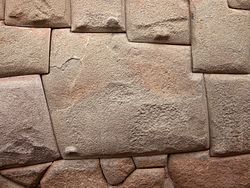
The Maya civilization used very simple tools for building their structures. The most common tools use were made of stone found in surrounding areas. Limestone was a huge part of the Maya tool making, as limestone was geographically very abundant in most settlements. Locations of the Maya cities were chosen with the access to necessary stones in mind. This allowed most quarries to be right outside the city for easy access to blocks needed for construction.[14] Top limestone quarries used were Palenque and Tikal. Though limestone was the most important material, they still collected sandstone from Quiriguá and volcanic tuff from Copan.

The Maya people had taken advantage of mortar on most structural projects. The Mayas used a very difficult process of limestone under large amounts of heat to create their mortar.[15] The mortar was so widely used, the Mayas even used it for sculptures, facades, and floor layers. Their mortar was very effective on a large building lifetime, but humid climates can have a negative effect on the mortar.

For more important construction projects the Mayas would cover the entire structures exterior with stucco, followed by bright paintings, prioritizing red, yellow, green, and blue.[16]

Notable constructions

[edit]

Ceremonial platforms

[edit]

These were commonly limestone platforms of typically less than four meters in height where public ceremonies and religious rites were performed. Constructed in the fashion of a typical foundation platform, these were often accented by carved figures, altars and perhaps tzompantli, a stake used to display the heads to the victims or defeated Mesoamerican ballgame opponents. The Mayans often depicted Flora and Fauna in their architecture. Some examples of this are statues and depictions of corn in Mayan architecture.

Palaces

[edit]
Remains of the Palace of Sayil, Yucatán

Large and often highly decorated, the palaces usually sat close to the center of a city and housed the population's elite. Every exceedingly large royal palace, or one consisting of many chambers on different levels might be referred to as an acropolis. However, often these were one-story and consisted of small chambers and typically at least one interior courtyard; these structures appear to take into account the needed functionality required of a residence, as well as the decoration required for their inhabitants stature. Archaeologists seem to agree that many palaces are home to various tombs.

At Copán (one of the most powerful and important cities), beneath over four-hundred years of later remodeling, a tomb for one of the ancient rulers has been discovered and the North Acropolis at Tikal appears to have been the site of numerous burials during the Terminal Pre-classic and Early Classic periods.[17]

E-groups

[edit]

"E-Group" is a classification given by Mayanists to certain structure complexes present at a number of Maya sites located in the central and southern Maya lowlands (e.g., the Petén region). Complexes of this type consist of a stepped pyramid main structure, situated on the western side of a quadrilateral plaza or platform. A raised but rather elongated structure appears along the eastern side of the plaza, running north–south; a variation has three smaller temple mounds on top of or replacing this platform, the middle of these substructures placed directly opposite the main structure. Often, two other subsidiary structures appear on the north and south sides of the plaza, respectively. The main western structure is typically terraced (i.e. has several levels), with inset stairways on each of its four sides, with only the eastern stairway, leading from the plaza, providing access to the summit. The stairways have large balustrades which protrude from the pyramid, which were decorated with large stucco masks and panels of architectural art. In other examples, believed to be of a later date, this quadripartite stairway configuration is lacking.

E-group complexes are named after their prototypical example, Structure E-VII-sub at the site of Uaxactun. They were first identified as a meaningful complex by archaeologist Frans Blom in 1924, who excavated the site under the auspices of the Carnegie Institution of Washington.

It has been theorized that these E-groups are observatories, because the eponymous group at Uaxactun contains alignments corresponding approximately to sunrises on the solstices and equinoxes. However, the architectural sequence documented in excavation reports reveals that these alignments connect elements from different periods and thus could have never been observationally functional.[18] Besides, all other E-groups have different orientations, which pertain to widespread groups of astronomical alignments that are also embedded in a number of buildings of other types.[19] Therefore, and considering that their primary uses were ritual and funerary, there are no grounds to designate E Groups as observatories.[20] Other ideas seem to stem from the possible creation story told by the relief and artwork that adorns these structures.

Triadic Groups

[edit]

They consist of an elevated platform (either an extensive acropolis or a steep pyramid) with a monumental stairway, with a central building facing the stairs, and two lateral structures facing each other on both sides of the platform. This formal complex has been attributed to the earthly re-creation of the Celestial Hearth (modern-day constellation of Orion), or a stage for enthronement rituals.[21] Most recently Triadic Groups have been interpreted as sanctuaries commemorating Maize God's resurrection upon the Flowery Mountain.[22] Such complexes appear during the Late Preclassic times and gradually decrease in number until their disappearance in the Early Postclassic.

Pyramids and temples

[edit]
Tikal, temple pyramid with prominent roof comb

Often the most important sanctuaries sat atop towering Maya pyramids, some of over two hundred feet, such as that at El Mirador. The sanctuary on top commonly was heightened by a crest or roof comb. While recent discoveries point toward the extensive use of pyramids as tombs, the temples themselves seem to rarely, if ever, contain burials. Maya pyramids had flat tops and were similar to the Aztec pyramids, though The Aztecs were the individuals who built their pyramids indistinguishable.

At Chichén Itzá there is a pyramid called El Castillo ('the castle'). With four stairways, each with 91 steps (with the upper platform they sum up to 365), and having other architectural elements appearing in astronomically significant numbers, it is a good example of Maya myth and astronomical cycles joined in architecture. Ancient Egyptian civilizations believed there were powers in the sky that brought the rain and even kept hurricanes away. In order to get close enough for the powers to hear them, they built pyramids. The Mesopotamians built ziggurats that were similar to pyramids with steps. Additionally, the Mayas and many of the other Mesoamericans built their pyramids high above the surrounding forests to see the heavens. Besides honoring the gods on high, Maya pyramids also served as observatories for solar events. The Maya pyramids even aligned well with cardinal directions, or north, east, west, and south, so that they were used like a compass Also referred to as the Pyramid of Kukulcán, the structure provides a remarkable display, observed by thousands of modern visitors at the equinoxes. The setting sun's rays are projected on the northern balustrade, creating the illusion of a snake winding its way down the steps of the pyramid. The snake is composed of several triangle shapes giving it the appearance of a diamondback snake. At the base of the northern stairway, there are massive snake head sculptures, making this effect even more persuasive. While it is a widespread belief that this light-and-shadow effect was achieved on purpose to record the equinoxes,[23][24] the idea is highly unlikely: it has been shown that the phenomenon can be observed, without major changes, during several weeks around the equinoxes, making impossible to determine any date by observing this effect alone.[25]

Maya architecture is vastly different from the others in Meso-American cultures. The blend of mythology and astronomical events can be found in nearly all Maya palaces or pyramid structures. One will also notice the heavy influence of the Toltecs in the architecture at Chichén Itzá. The Toltecs invaded the Maya and merged their cultural traditions around the year 1000.[26]

Observatories

[edit]
El Caracol, the Observatory, Chichen Itza, Mexico

The Maya were keen astronomers and had mapped out the phases of celestial objects, especially the Sun, Venus and the Moon. Many temples have doorways and other features aligning to celestial events. Round temples, often dedicated to Kukulcan, are perhaps those most often described as "observatories" by modern ruin tour-guides. It is now known, however, that many buildings of different types and uses were oriented on astronomical grounds, mostly to sunrises and sunsets on specific dates.[27][28] The dates recorded are concentrated in four agriculturally significant seasons and tend to be separated by multiples of elementary periods of the calendrical system (13 and 20 days), suggesting that the orientations allowed the use of observational calendars intended to facilitate a proper scheduling of agricultural and associated ceremonial activities.[29] Although most of the important Maya buildings were oriented on the basis of astronomical criteria, their primary functions were religious, residential or administrative; the label "observatory" applied to any structural type is thus hardly warranted.

Religion

[edit]

Mayan religion is polytheistic and was an important part of their daily lives. The gods they worship included Itzam Na, the creator god, Kinich Ahau, the sun god, Ah Puch, a death god, and Buluc Chabtan, the war god. The Maya believed that all things, including inanimate objects, had a soul and could influence the world and believe in an afterlife called Xibalba, where the soul is tormented by underworld gods until it passes to heaven.[30]

Ballcourts

[edit]
Great Ballcourt at Chichen Itza

As an integral aspect of the Mesoamerican lifestyle, the courts for their ritual ballgame were constructed throughout the Maya realm, often on a grand scale. The playing alleys of ballcourts were defined by two long walls. Courts built earlier in Maya history (as at Cobá) had sloped sides, while ones built later (as at Chichén Itzá) had vertical sides. Frequently, the ends were enclosed so as to create an -shaped court when viewed from above.

When the Maya played games in the Ballcourts, the ball was made of solid rubber and was sometimes as much as a foot in diameter. It was passed between teams ranged on opposite ends of the court. The players could hit it only with their knees or hips, much like football or soccer today. Points could be scored when the opponents failed to return the ball correctly. In central Mexico, and in late times in Yucatán, rings of stone were set high up in the side walls of the court. It was considered a particular triumph for a player to knock the ball through the ring.[31]

Cave sites

[edit]

There are also cave sites that are important to the Maya. Maya cave sites include Jolja Cave, the cave site at Naj Tunich, the Candelaria Caves, and the Cave of the Witch. There are also cave creation myths among the Maya. Some cave sites are still used by the modern Maya in the Chiapas highlands in Mexico. Some of these caves were completely or partially artificial.[32]

See also

[edit]

References

[edit]
[edit]

Grokipedia

from Grokipedia
Maya architecture encompasses the diverse building traditions of the ancient Maya civilization across Mesoamerica, spanning from the Preclassic period around 1000 BCE to the Postclassic period ending with the Spanish conquest in the 16th century CE, and is renowned for its monumental stone pyramids, multi-roomed palaces, and ceremonial complexes that integrated religious symbolism, astronomical alignments, and political power. In English-language scholarship, these structures are commonly referred to as "Maya temples," "Maya pyramids," and "Maya architecture," with "Maya" serving as the preferred adjectival form for the civilization, its people, culture, and architectural heritage (e.g., Maya ruins, Maya temples); the variant "Mayan temples" is widespread but less precise, as "Mayan" is typically reserved for the languages spoken by the Maya.[1][2][3][4] Developed by independent city-states in regions including modern-day Mexico, Guatemala, Belize, and Honduras, Maya architecture evolved through three main periods: the Preclassic (c. 1000 BCE–250 CE), marked by the emergence of early ceremonial centers and platform mounds; the Classic (250–900 CE), the height of monumental construction with soaring temple-pyramids and ornate urban layouts; and the Postclassic (900–1521 CE), featuring more militaristic influences and sites like Chichén Itzá.[3][5][6] Key characteristics include the use of corbelled arches to create vaulted roofs, limestone or volcanic stone masonry bonded with lime mortar, and surfaces adorned with stucco reliefs, carved glyphs, and symbolic motifs such as serpent masks representing deities.[4][7] Structures like the pyramids at Tikal and Palenque symbolized sacred mountains and cosmic layers, often aligned with solar events, while palaces served as elite residences and administrative hubs, and ballcourts hosted ritual games tied to fertility and warfare myths.[3][4] Regional styles added variety, with the Southern Lowlands (Peten region) favoring tall, steep-sided pyramids and plain facades, the Puuc region in northern Yucatán emphasizing geometric mosaics and colonnaded facades as seen at Uxmal, and the Northern Lowlands incorporating Chenes and Rio Bec influences with building masks and false temples.[4][7] Overall, Maya architecture not only demonstrated advanced engineering without metal tools but also encoded the civilization's cosmology, history, and social hierarchy through public inscriptions and iconography.[3][4]

Historical Development

Preclassic Period

The Preclassic Period (c. 1000 BCE–250 CE) marks the foundational phase of Maya architecture, characterized by the transition from simple sedentary villages to early monumental constructions that laid the groundwork for later urban developments. Around 1000 BCE, sites like Cuello in Belize emerged as early sedentary communities, spanning approximately 1.62 square kilometers, with initial monumental architecture consisting of earthen platforms supporting thatched-roof structures for communal and ritual purposes. Similarly, at Nakbe in the Petén region of Guatemala, Middle Preclassic settlements (1000–350 BCE) featured residential wattle-and-daub houses evolving into low vertical wall platforms, built with roughly hewn stones and crude plaster, signaling the onset of organized labor for public works. Highland sites like Kaminaljuyú also developed early monumental architecture, influencing broader Maya traditions.[8] These developments reflect broader Mesoamerican precedents, including early Olmec influences evident at sites like La Venta, where massive earthen platforms and symbolic layouts inspired Maya experimentation with scale and ritual space.[9] By 500 BCE, architectural forms advanced significantly, with earthen platforms transitioning to stone-faced pyramids that served as elevated ritual centers. At Nakbe, platforms incorporated large, finely cut stone blocks, apron moldings, and advanced stucco technology, culminating in the construction of triadic pyramid complexes like Structure 1 by 300–200 BCE, which included monumental masks and multiple construction phases.[10] The site of El Mirador exemplifies this evolution, featuring massive Preclassic pyramids such as La Danta, a triadic complex with a volume of approximately 2.8 million cubic meters, making it one of the largest ancient structures by mass and highlighting the era's engineering ambition.[11] Experimental corbel arches, first appearing in Middle Preclassic tombs influenced by Olmec techniques at sites like La Venta and Guerrero, began to span interior spaces in these pyramids, allowing for vaulted chambers while stucco decorations—crafted from lime-based plasters—adorned facades and floors with modeled motifs, enhancing the symbolic potency of these buildings.[12] These architectural innovations carried profound social implications, as monumental constructions at emerging centers like Cuello, Nakbe, and El Mirador reflected the consolidation of chiefdoms and the centralization of ritual authority. The labor-intensive erection of platforms and pyramids fostered social cohesion among diverse groups, integrating communities through shared ceremonial activities and signaling the rise of elite leaders who orchestrated these projects to legitimize power. By the Late Preclassic (400 BCE–250 CE), such structures formed the core of ritual centers, paving the way for the more complex urbanism of the Classic Period.

Classic Period

The Classic Period (c. 250–900 CE) marked the zenith of Maya architectural innovation, characterized by the expansion of independent city-states that constructed elaborate ceremonial centers with multi-leveled acropolises integrating temples, palaces, and plazas. Prominent examples include Tikal in Guatemala, where the North Acropolis featured layered platforms supporting successive temple constructions over centuries; Palenque in Mexico, renowned for its terraced Palace complex overlooking the Otolum River; and Copán in Honduras, with its hieroglyphic stairway ascending a multi-tiered acropolis adorned with sculpted figures.[13] These urban cores symbolized political and religious authority, often encompassing ballcourts and causeways that linked elite residences to monumental structures. Building upon Preclassic precursors such as the massive platforms at El Mirador, Classic architects achieved greater verticality and spatial complexity.[7] A key advancement was the refinement of corbel vaulting, which employed stepped stone corbels to form inward-leaning arches that supported roofs without true keystones, enabling the construction of taller, more stable buildings than earlier periods. This technique, typical of the 'V'-shaped vault profile, allowed for multi-roomed palaces and soaring pyramid-temples, such as Tikal's Temple I, rising 47 meters with vaulted chambers housing royal tombs.[14][13] Hieroglyphic inscriptions proliferated on building facades, lintels, and stairways, recording dynastic histories, astronomical alignments, and ritual events, as seen in Palenque's Temple of the Inscriptions, where carved texts detail the life and deification of Ruler Pakal.[15] Stelae—tall, carved stone monuments—were strategically placed in plazas and along processional paths to convey iconographic narratives of rulers, depicting them in ritual poses with captives or deities to legitimize power and commemorate accessions, military victories, or period endings in the Long Count calendar.[16][17] In the Late Classic (c. 600–900 CE), architectural patterns reflected increasing societal pressures, including overcrowding in urban centers and signs of impending collapse, with sites like Tikal supporting populations estimated at 60,000 to 90,000 inhabitants through dense settlement and agricultural intensification.[13] Massive construction projects, such as pyramid enlargements and causeway networks, demanded organized labor from a largely agrarian populace, where approximately 80–90% of individuals were food producers mobilized in domestic production units for surplus generation to support elite initiatives. Evidence of conflict emerged in defensive modifications, notably at Aguateca, where hasty stone walls and palisades were erected around the late eighth century in response to warfare, yet the site was attacked and rapidly abandoned around 810 CE, leaving artifacts scattered in elite residences.[18] These patterns underscore a shift toward fortified layouts amid environmental stress and political instability, contributing to the widespread abandonment of southern lowland centers by 900 CE.[13]

Postclassic Period

Following the collapse of many Classic Period centers in the southern lowlands around 900 CE, Maya architecture in the Postclassic Period (c. 900–1500 CE) shifted northward to the Yucatán Peninsula, where sites like Chichén Itzá and Mayapán emerged as major hubs of political and cultural activity.[19] This era saw a resurgence characterized by open plazas designed for large gatherings and colonnaded halls that facilitated communal and ritual functions, reflecting a more decentralized social structure compared to the earlier monumental complexes. Chichén Itzá, in particular, exemplified this transition with its expansive Great Plaza, surrounded by structures like the Temple of the Warriors, which incorporated long rows of columns echoing Mesoamerican trade networks.[20] A hallmark of Postclassic architecture was the integration of external influences, notably from central Mexico's Toltecs, evident in the adoption of Atlantean figures and serpent balustrades at sites like Chichén Itzá. Atlantean columns, depicting warriors or deities supporting temple roofs, appeared in structures such as the Temple of the Warriors and the House of the Eagles, symbolizing strength and cosmic support while blending with local Maya motifs like jade adornments and ritual fans.[20] Serpent balustrades, often feathered and intertwined along stairways, flanked entrances to key temples like El Castillo, representing the plumed serpent deity Kukulkan (Quetzalcoatl equivalent) and evoking journeys of solar and divine passage, a motif intensified through Toltec-Maya interactions around 900–1100 CE.[21] These hybrid elements underscored cultural exchanges via trade routes, rather than outright conquest.[22] Political fragmentation during this period contributed to defensive architectural adaptations, including extensive city walls and a general reduction in monumentality, as resources shifted toward protection amid rival city-states. Mayapán, the late Postclassic political capital (c. 1200–1450 CE), was enclosed by a 9.1 km-long limestone wall with strategically baffled gates to deter invaders, enclosing over 4,000 structures in a compact urban core that prioritized defensibility over grandeur.[23] Similarly, coastal trade centers like Tulum featured perimeter walls atop 12-meter cliffs overlooking the Caribbean, with clifftop temples such as El Castillo serving dual roles in surveillance and ritual oversight of maritime commerce.[24] Uxmal's late phases, extending into the early Postclassic (c. 900–1050 CE), showed this trend through modest additions like the Round Structure, a circular temple with Puuc-style masonry but simplified forms, incorporating feathered serpent motifs amid declining elite patronage.[25] Ballcourts persisted as central features, maintaining continuity with earlier traditions but evolving in symbolism to emphasize sacrifice and political alliances in a fragmented landscape. At Chichén Itzá, the Great Ballcourt's massive scale (168 m by 70 m) featured reliefs depicting decapitation rituals, linking the game to underworld renewal and elite competition under Toltec-influenced iconography.[26][21] Mayapán's ballcourts, though smaller and more numerous, incorporated modified markers symbolizing fertility and conflict resolution, adapting the game's role to support the site's role as a league capital.[23] These elements highlighted a pragmatic evolution, blending ritual continuity with the era's geopolitical realities.

Regional and Stylistic Variations

Petén Style

The Petén style of Maya architecture, predominant in the central lowlands of the Petén Basin in present-day Guatemala and southern Mexico, flourished primarily during the Classic period (AD 250–900), with roots extending to the Preclassic period (c. 1000 BC–AD 250).[27] This style is exemplified at major sites such as Tikal, Calakmul, and Uaxactún, where structures integrated seamlessly with the dense rainforest environment, emphasizing verticality and ritual function over ornate surface decoration.[28] At Uaxactún, Preclassic foundations include early temple pyramids like Structure E-VII-B, a flat-topped platform with four-sided stairways dating to around 600 BC, adorned with large stucco masks depicting mythological deities associated with astronomical events.[29] A hallmark of the Petén style is the construction of tall, slender pyramids serving as temple platforms, often reaching heights of up to 60 meters, as seen in Tikal's Temple I (the Temple of the Great Jaguar) and Temple IV, built in the 8th century AD to house royal tombs and facilitate sky observations.[30][27] These pyramids feature multiple superimposed temples, with steep slopes and corbelled vaults supporting massive roofcombs—perforated stone lattices used for symbolic displays of rulers and deities—necessitating thick outer walls that exceed the width of interior chambers for structural support.[27] At Calakmul, similar monumental pyramids, such as Structure II, rise to 45 meters and incorporate multi-tiered bases connected by broad stairways, reflecting the style's emphasis on hierarchical and ceremonial elevation within the landscape.[28] Construction relied on plain masonry of roughly cut limestone blocks set in lime mortar, often coated with smooth stucco to create a uniform surface, which was then embellished with modeled masks and friezes, particularly on temple facades like those at Tikal's Temple II (Temple of the Masks).[27] Interconnecting radial causeways, known as sacbeob, linked key structures and plazas, as evidenced in Tikal's Great Plaza and North Acropolis, facilitating processions and urban cohesion across the site's expansive layout.[27] Adaptations to the humid, flood-prone terrain of the Petén lowlands included the widespread use of elevated platforms, which raised civic and residential structures above seasonal inundations; for instance, at Nakum, architectural complexes featured channeled drainage systems to divert excess rainwater and prevent flooding during the rainy season.[31] Multi-room palaces, such as those in Tikal's Central Acropolis, comprised linear range-type buildings with vaulted interiors for elite residences and administration, while upper levels or ancillary structures often incorporated thatch roofs over wooden beams for lighter, more flexible construction in the tropical climate.[27] This contrasts with the more horizontally oriented and faceted Puuc style of the northern Yucatán.[27]

Puuc Style

The Puuc style emerged in the Puuc hills of Yucatán during the Late Classic to Terminal Classic periods, roughly 750–1000 CE, representing a peak of decorative sophistication in Maya architecture.[32] This regional variant is distinguished by its emphasis on geometric ornamentation and adaptation to the karstic landscape, where buildings were constructed atop low hills and integrated with the undulating topography to maximize views and defensive positioning.[33] Key sites such as Uxmal, Kabah, and Sayil exemplify these traits, featuring multi-room palaces and temples aligned along sacbeob (raised causeways) that connected civic centers.[32] A hallmark of Puuc architecture is the colonnaded facade, with lower walls often lined by rows of stylized, faux columns or colonnettes carved from limestone veneer, creating a rhythmic, repetitive pattern above smooth basal platforms.[32] Upper zones are dominated by extensive friezes filled with intricate motifs, including the gaping-mouthed masks of Chaac, the rain deity, arranged in stacked sequences to evoke cascading water; lattice or step-fret patterns symbolizing woven mats or serpentine forms; and geometric mosaics of serpents, sun disks, and abstract elements, all executed in precisely cut stone tiles.[32][34] These decorative veneers overlay a core of rubble-filled masonry, enhancing the horizontal profile of low-rise structures that prioritize broad, elongated forms over vertical height.[32] Water scarcity in the Puuc region necessitated innovative engineering solutions, prominently including chultunes—bell-shaped underground cisterns excavated into bedrock and plastered to store rainwater runoff from roofs and plazas.[33][35] At sites like Sayil, thousands of these chultunes supported dense populations, with some complexes yielding capacities sufficient for seasonal needs.[33] Construction relied on finely hewn limestone blocks for the veneer, cut with such precision using stone tools that they interlocked tightly, often without additional mortar in the decorative layers, while the structural core employed lime-based plaster for stability.[32][36] This technique allowed for the creation of expansive, low-profile edifices that blended into the hilly terrain, such as the elongated palaces at Uxmal and the mask-adorned Codz Poop at Kabah.[34] Elements of the Puuc style, particularly its mosaic friezes and Chaac iconography, exerted a lasting influence on Postclassic architecture at Mayapán, where revival motifs appear in temple facades.[37]

Chenes and Palenque Styles

The Chenes style, prominent in the western Yucatán Peninsula during the Late Classic period (ca. 600–900 CE), is distinguished by its elaborate, facade-encompassing anthropomorphic motifs that transform entire building exteriors into representations of cosmic entities. Structures in this style, such as those at Hochob and Dzibilnocac, feature massive stone mosaic masks of the earth monster, often identified as Itzamná, the creator deity, with open-jawed entrances symbolizing portals to the underworld. At Hochob, the Main Palace (Estructura II) exemplifies this through a central facade dominated by a zoomorphic mask, where the doorway forms the monster's gaping maw with prominent fangs and intertwined serpentine elements, creating a sense of architectural immersion in mythology.[38] Similarly, Dzibilnocac's towers and temples incorporate Chenes elements like soaring roof combs and trunk-like appendages, blending regional influences while emphasizing monumental scale.[39] These facades carry profound cosmological symbolism, portraying the earth monster as a liminal gateway to Xibalba, the Maya underworld, thereby linking human-built spaces to the earth's devouring aspect and the cycle of creation and destruction. The imagery ties directly to Maya beliefs in earth deities as foundational forces, with the monster's form—combining reptilian, shark-like, and divine traits—evoking fertility, rain, and subterranean realms essential to agricultural cosmology.[40] In Chenes architecture, such representations extend across the building's width, unlike more modular styles, underscoring a holistic integration of form and myth that reinforced ritual access to divine powers.[38] In contrast, the Palenque style from the Chiapas highlands represents a unique Classic Period (ca. 250–900 CE) variant, emphasizing refined engineering, landscape integration, and dynastic narrative through architecture. The Palace complex, constructed in multiple phases atop an artificial platform, includes a distinctive four-story tower—possibly for astronomical observation or ceremonial signaling—and an advanced aqueduct system that diverts the Otolum River via a vaulted channel beneath the main plaza, demonstrating sophisticated water management unprecedented in Maya sites.[41][42] This engineering allowed for expansive, multi-chambered interiors while harmonizing with the site's hilly terrain, reflecting Palenque's emphasis on elite control over natural and cosmic orders. The Temple of the Inscriptions epitomizes Palenque's innovations, a nine-stepped pyramid-temple built ca. 675 CE under ruler K'inich Janaab' Pakal, with his tomb crypt seamlessly integrated into the substructure via a hidden internal stairway. Interior walls bear 617 hieroglyphs across stucco tablets, chronicling Palenque's dynastic history and mythological foundations, while sculpted piers—painted in vibrant red, blue, and yellow—divide the vaulted chambers into smaller bays for enhanced structural stability.[43][44] These piers, depicting guardian figures and deities like GII (an infant form of the god K'awiil), support multi-level corbel vaulting that reduces wall thickness and expands interior space, countering the inherent outward thrust of Maya vaults through compartmentalization. Symbolically, the temple's design fuses funerary and temple functions, portraying Pakal's sarcophagus lid as his rebirth as the maize god emerging from the underworld, thus embedding rulership within broader cosmological narratives of renewal and divine ancestry.[41] Both styles share corbel vault techniques for spanning interiors but diverge in their expressive fusion of form, engineering, and myth.

Other Regional Styles

In the Chiapas Highlands, Maya architecture adapted to rugged terrain through terraced constructions integrated into foothills, as exemplified at Toniná, a Late Classic site (600–900 CE) featuring steep pyramids and elaborate narrative carvings. These pyramids, such as the multi-tiered acropolis with its grand stairway, were engineered with dramatic terraces rising up to 72 meters, incorporating brown sandstone sculptures less than 1 meter tall that depict rulers, rituals, and conquests, like Monument 28 honoring K’inich Bahlam Chapaat. Highland adaptations included modifying mountainsides for stability and ritual elevation, with structures like the sarcophagus in a third-tier temple carved from a single large stone, emphasizing verticality and symbolic ascent in a landscape of limited flat land.[45][46] On the Gulf Coast, sites like Comalcalco demonstrate innovative responses to resource scarcity, relying on adobe bricks and fired clay instead of limestone, with buildings elevated on earthen mound platforms for flood protection and stability. Constructed from molded, sun-dried adobe bricks—sometimes fired for durability—and coated in stucco, these platforms supported vaulted-roof temples and palaces, such as the 125-foot-high Great Acropolis spanning 11.8 acres with Temple I and Temple II featuring brick cladding and oyster-shell lime mortar. This material choice, driven by the alluvial Tabasco region's lack of stone, resulted in a distinct style with polychrome cresting and stucco decorations, as seen in the Temple of the Stuccos, highlighting adaptive engineering in humid lowlands.[47][48] Along the Pacific Coast, Izapa's architecture reflects early Formative influences (circa 750 BCE–300 CE) with earthen pyramids coated in stucco, shaped by coastal trade networks that facilitated material exchange and cultural synthesis. Monumental platforms like Mound 30a, reaching 16 meters high by the Frontera phase, were built with earth fill, white clay surfaces, and stucco facades, expanded in the Terminal Formative with stone staircases and ramps totaling 22,500 cubic meters. The site's E-Group complex (Mounds 72 and 73), augmented during the Guillén phase (300–100 BCE), incorporated stucco masks and plazas aligned for astronomical observation, underscoring trade-driven prosperity from salt production and inter-regional contacts in Chiapas' estuarine environment.[49][50] Megalithic elements in southern Maya sites, particularly during the late Preclassic (400 BCE–250 CE), involved large stone blocks for durable platforms and tombs, as at Izapa and highland variants like the Pixa'an style, which employed basalt and finely cut megaliths. At sites such as Tenam Puente in the Chiapas Highlands, Early Classic structures feature gradual ascents of huge, flat stone slabs forming retaining walls and platforms integrated into hills, contrasting steeper lowland pyramids and adapting to defensive highland needs. The Pixa'an style, evident in southern contexts, uses large basalt blocks with mortarless walls, rounded corners, and recessed panels framed by horizontal stones, reflecting potential early highland influences with ties to Chenes and Río Bec elaboration. These overlaps with Preclassic developments highlight resource-driven innovations in basalt-rich southern zones.[51][52][53]

Construction Techniques and Materials

Materials and Sourcing

Limestone served as the dominant building material in ancient Maya architecture, particularly in the lowlands where it was abundantly available in the bedrock. Quarried locally using manual techniques such as pit and ledge methods with stone tools like hammerstones and bifaces, it was extracted in forms ranging from hard blocks for facades to softer varieties for fill.[54] In regions like the Puuc and Petén, quarries were often situated near construction sites, with examples such as the 22 quarries at Xultun covering over 10,000 square meters, reflecting organized labor and resource management.[54] The stone's initial softness (around 3 on the Mohs scale) allowed for easy cutting, hardening upon exposure to air, which facilitated its use in block masonry. Limestone was also burned in kilns to produce lime, essential for stucco coatings that smoothed rough stone surfaces and enabled intricate sculptures and decorative motifs. Stucco, mixed with organic additives like plant extracts in some cases, provided durability against tropical weathering, as seen in plasters from Copán that have endured over 1,200 years.[55] Complementary materials included sascab, a white to reddish compacted powder derived from unconsolidated limestone pockets in Yucatán formations, which acted as an aggregate in mortars and plasters, substituting for sand.[56] Wood, primarily durable species like Manilkara zapota (sapodilla) and Haematoxylum campechianum (logwood), was sourced from nearby forests for lintels spanning doorways and beams supporting vaults and roofs.[57] In limestone-scarce areas of the Gulf Coast, such as Comalcalco, fired adobe bricks supplemented or replaced stone.[58] Extensive trade networks for non-local resources like obsidian from Guatemalan highlands and jade from the Motagua River valley shaped site locations, positioning major centers like Tikal and Quiriguá along riverine and coastal routes to optimize access and economic integration.[59] In the Puuc region, superior water-slaked lime, derived from high-purity local limestone and processed in efficient annular kilns, enhanced structural longevity amid the area's seasonal aridity.[55] Sustainability practices emerged notably in the Postclassic period, with evidence from sites like Ucanal showing systematic reuse of Terminal Classic stones in new constructions, driven by both practical abundance and social meanings rather than scarcity.[60] However, lime production's reliance on wood fuel—requiring ratios up to 8.5:1 in open pyres—contributed to deforestation, as seen in Puuc hinterlands where fuel sourcing from hilly slopes denuded forests and altered landscapes during peak construction phases around 650–950 CE.[61]

Building Methods and Engineering

Maya builders utilized the corbel arch, a structural technique involving successive courses of stones leaning inward from opposite walls to form a false vault, which relied on compression rather than true keystone arches for support.[12] This method limited room spans to approximately 3-4 meters due to the inward thrust generated, necessitating thick walls and reinforcement with rubble fill between the vault faces to distribute weight and enhance stability.[12][58] The vaults were constructed in two self-supporting halves meeting at a capstone, often requiring temporary formwork during assembly to hold the stones in place until mortar set.[62] Construction relied on basic lithic tools, including chert hammers for quarrying and shaping limestone blocks, obsidian blades for precise cutting, and wooden levers for maneuvering stones, as the Maya lacked metal implements and the wheel.[63] Ramps constructed from earth and stone facilitated the transport and elevation of materials to building sites, allowing workers to haul heavy blocks using ropes and human labor without draft animals.[64] These techniques enabled the erection of multi-story structures despite technological constraints, with evidence of planned layouts marked by incised lines on plaza floors to guide alignment.[65] Labor for monumental projects was mobilized through corvée systems, where rulers conscripted commoners for seasonal work, often during agricultural off-periods, fostering community-wide participation under elite oversight.[66] Estimates suggest that major undertakings at sites like Tikal required large workforces, coordinated in divisions for tasks such as quarrying, hauling, and masonry, with total efforts measured in tens of thousands of person-days per structure.[67] This system supported the rapid construction of complexes, reflecting centralized authority and social organization. Among engineering innovations, the Maya developed sophisticated water management at Palenque, including subterranean aqueducts like the Piedras Bolas system, which channeled spring water through narrowing stone conduits to generate pressurized flow—capable of propelling water up to 20 feet—for flood control and potential fountains.[68] Additionally, layered construction in pyramids and vaults, with each successive level slightly inset and filled for flexibility, contributed to earthquake resistance, allowing structures to withstand seismic activity through distributed stress rather than rigid monolithic forms.[69]

Urban Planning and Site Layout

Civic-Ceremonial Centers

Civic-ceremonial centers formed the core of ancient Maya urban complexes, serving as focal points for political authority, religious rituals, and communal gatherings. These centers typically consisted of elevated acropolises—large raised platforms—that supported clusters of monumental structures arranged around expansive open plazas, creating a hierarchical spatial organization that emphasized verticality and centrality. The layout often followed a predominant north-south axis, with structures aligned to capture significant astronomical events such as solstices, integrating cosmology into the urban fabric to symbolize cosmic order on earth.[70][71] Connecting these centers were sacbeob, elevated limestone causeways that facilitated movement between sites and reinforced political and economic networks across the landscape. The most extensive example is the Coba-Yaxuna sacbe, stretching approximately 100 kilometers through the Yucatan Peninsula, linking the cities of Coba and Yaxuna and demonstrating the scale of Maya infrastructure investment. These roads, often 3 to 10 meters wide and surfaced with white stucco, not only enabled trade and pilgrimage but also projected elite dominance over distant territories.[72][73] In terms of scale, major centers like Tikal encompassed a dense core of about 16 square kilometers, incorporating plazas, reservoirs for water management, and potential market areas to sustain large populations during peak ceremonial periods. This integration of utilitarian features within ritual spaces underscored the multifunctional nature of these hubs, balancing sacred activities with practical urban needs. Ballcourts were occasionally incorporated into these layouts to host ritual games tied to elite sponsorship.[74] Socially, civic-ceremonial centers embodied elite control, with restricted access to upper levels of acropolises reserved for rulers and nobility, while lower plazas accommodated public ceremonies that reinforced hierarchical bonds between leaders and commoners. These open spaces hosted large-scale rituals, including offerings and performances, that legitimized authority and fostered community cohesion under elite oversight.[75][76]

Residential and Defensive Structures

In Maya urban design, residential structures for commoners typically consisted of simple pole-and-thatch houses constructed on low earthen platforms, often clustered in groups known as house mounds that formed the periphery of settlements. These platforms, usually 0.5 to 1 meter high, provided elevation against flooding and facilitated household activities, with superstructures supported by wooden posts filled with wattle-and-daub walls and topped by thatched roofs made from palm or grass. House mounds, remnants of these platforms after organic materials decayed, reveal clustered arrangements around shared patios or plazas, reflecting communal living patterns among non-elite families engaged in agriculture and craft production.[77][58] Elite suburbs extended beyond the civic cores, featuring more durable multi-room stone houses arranged around enclosed patios, which served as administrative and residential complexes for secondary nobility and officials. These structures, built with limestone blocks and sometimes vaulted roofs, included benches for seating and storage areas, indicating higher status through access to specialized labor and resources. At Tikal, peripheral groups such as those in the outer zones exemplified this suburban elite housing, with multi-building compounds connected by low walls and offering views of the surrounding landscape.[78][79] Defensive structures in Maya sites emphasized protection for growing populations, with moats, walls, and natural features like cenotes (chichén in Yucatec Maya, meaning "well") integrated into Postclassic urban planning, while Classic period examples focused on earthen barriers. At Becan in Campeche, a Classic site, a massive dry moat—up to 16 meters wide and 5 meters deep—encircled the core, flanked by earthen embankments creating a 12-meter-high barrier pierced by seven causeways, likely constructed around 100-250 CE to deter invasions amid regional conflicts. In the Postclassic, sites like Mayapán featured extensive limestone walls approximately 9 kilometers long enclosing 4.2 square kilometers, with formal gates and watchtowers, reflecting heightened warfare and political fragmentation. These defenses often linked residential areas to ceremonial centers via raised sacbeob pathways.[80][81] During the Late Classic (600-900 CE), suburban expansion accelerated at major centers like Tikal and Copán, with populations swelling to tens of thousands as house mounds proliferated in peripheral zones, straining local resources through intensified deforestation for construction and agriculture. Pollen records and soil analyses from Tikal indicate widespread clearing of hardwood forests for timber in elite and commoner buildings, leading to erosion and reduced fuel availability by the 8th century CE, as evidenced by progressively narrower temple beams sourced from diminishing local supplies. This growth, while fostering economic specialization, contributed to environmental degradation and vulnerability to droughts, exacerbating social tensions in sprawling suburbs.[82][83]

Major Architectural Forms

Pyramids and Temples

Maya pyramids and temples served as the pinnacle of sacred architecture in ancient Maya society, functioning primarily as elevated platforms for ritual performance and divine interaction. These structures typically consisted of multi-tiered, stepped bases constructed from a core of earth, rubble, and large stones, faced with cut limestone blocks and often coated in stucco for a smooth finish.[58] Atop these bases rose small temple buildings, usually comprising one to four interconnected rooms designed to house images or effigies of deities, where priests conducted ceremonies away from public view.[58] Broad stairways, often steep at angles of 45° to 60° and sometimes inscribed with hieroglyphs on the risers, ascended the pyramid faces, providing ritual access to the summit and symbolizing the arduous journey to the divine realm.[58] The primary functions of these pyramids and temples revolved around ancestor veneration and bloodletting rites, which reinforced the ruler's divine authority and maintained cosmic balance. Rulers and elites performed autosacrifice, such as piercing their bodies with stingray spines or obsidian blades, on temple summits to draw blood as a life-giving offering to gods and deified ancestors, ensuring fertility, rain, and prosperity.[84] Temples also served as funerary monuments; for instance, Temple I at Tikal, standing approximately 47 meters tall, was dedicated as the burial pyramid for the ruler Jasaw Chan K'awiil I (r. AD 682–734), housing his tomb and facilitating ongoing rituals to honor his lineage.[84][58] Architectural variations in pyramids and temples reflected regional styles and environmental adaptations across the Maya lowlands. In the Petén region, such as at Tikal, pyramids were tall and steeply sided with prominent roof combs, emphasizing verticality to pierce the sky and connect with celestial forces.[58] In contrast, Puuc-style structures, exemplified by the Pyramid of the Soothsayer at Uxmal (about 32 meters high), featured lower, wider platforms with intricate stone mosaic facades, prioritizing horizontal expanse and decorative elaboration over height.[85] Royal tombs further diversified these forms; the Temple of the Inscriptions at Palenque, built in the 7th century CE during the reign of K'inich Janaab' Pakal I (r. 615–683 CE), concealed the sarcophagus of Pakal deep within its nine-tiered base, accessed via a hidden stairway, and contained jade artifacts symbolizing his rebirth as the maize god.[43][58] Temple roofs often employed corbel vaults, a Maya innovation using inward-leaning stones to span interiors without true arches.[30] Symbolically, Maya pyramids embodied the "world mountain," a sacred axis mundi linking the earthly realm to the heavens and underworld, with their stepped tiers representing layers of the cosmos.[58] Many incorporated nine levels to evoke Xibalba, the Maya underworld of nine strata inhabited by death lords and ancestors, as seen in the Temple of the Inscriptions, where the structure's design mirrored Pakal's journey through these realms etched on his sarcophagus lid.[85][84] This tiered symbolism underscored the pyramids' role in rituals that navigated the multi-layered universe, affirming the Maya's cyclical view of time and renewal.[58]

Palaces and Elite Residences

Maya palaces and elite residences were characterized by multi-room complexes arranged around central courtyards, featuring vaulted galleries and low platforms that emphasized horizontal sprawl rather than vertical elevation. These structures often incorporated corbel vaults supported by piers that divided interior spaces, allowing for improved ventilation and light penetration in the tropical climate. A prime example is the Palace at Palenque, a sprawling complex built in stages from the 7th to 8th centuries CE, comprising multiple courtyards, elongated galleries, and a distinctive four-story tower that may have served observational purposes.[86] These buildings functioned primarily as administrative hubs and royal residences, housing rulers, nobles, and their retinues while facilitating governance, diplomacy, and elite rituals. Specific rooms included throne areas for audiences and decision-making, as well as attached steam baths known as sweat houses, which were used for purification rites and therapeutic practices integral to elite life. At sites like Tikal and Copán, palaces integrated into acropolises served as seats of political power, underscoring their role in maintaining social hierarchies.[86][87][88] Over time, Maya palace architecture evolved from the expansive, agglutinative forms of the Classic period (ca. 250–900 CE), which reflected centralized political authority and growing elite populations, to more compact and fortified designs in the Postclassic period (ca. 900–1500 CE), possibly in response to regional instability and shifting power dynamics. This transition is evident in sites like Chichén Itzá, where palaces became denser with fewer but more multifunctional rooms, prioritizing defensibility over elaboration. Pier divisions and ventilation features persisted but adapted to smaller scales in later constructions.[86][89] Archaeological evidence from palace contexts includes elite burials and dedicatory caches that highlight the high status of occupants, such as jade ornaments, ceramic vessels, and obsidian artifacts interred beneath floors or in room corners to mark sacred spaces. At Aguateca, for instance, royal tombs within palace structures contained regalia symbolizing divine kingship, while caches at Caracol revealed ritual deposits tied to elite ceremonies. These finds underscore the palaces' role in perpetuating ancestral veneration and political legitimacy.[86][90]

Ballcourts and Ritual Spaces

Ballcourts were essential architectural features in Maya cities, serving as venues for the Mesoamerican ballgame, a ritualistic sport that blended athletic competition with religious ceremony. These structures typically consisted of an I-shaped playing alley formed by two parallel walls or earthen mounds, with open-ended zones at each extremity to accommodate players and spectators. The alleys varied in size but often measured around 30-50 meters in length and 5-10 meters in width, allowing the heavy rubber ball to be struck using hips, knees, or elbows while protected by padded yokes and belts.[91][92] The walls flanking the alley were usually vertical or slightly sloping, rising to heights of up to 8 meters in prominent examples, constructed from stone masonry coated in stucco and sometimes painted. End markers, often carved stone rings or sculpted panels, were positioned at mid-alley height on the walls or at the alley's extremities to define boundaries and score points when the ball passed through them. This design facilitated the game's symbolic reenactment of cosmic struggles, with the enclosed space evoking a controlled ritual arena.[91][93] Over 2,300 ballcourts have been identified across Mesoamerica, with a significant portion attributed to Maya sites, reflecting the game's widespread cultural importance from the Preclassic to Postclassic periods.[94] Prominent Maya examples include the well-preserved ballcourt at Copán in Honduras, featuring intricate scarlet macaw-themed markers and integration into the site's acropolis, and those at Yaxchilán and Caracol in the southern lowlands, where multiple courts indicate evolving elite sponsorship. While ballcourts at non-Maya sites like El Tajín exhibit unique sculptural elements, Maya courts like Copán's emphasized sculptural detail over sheer scale. The largest known ballcourt is at Chichén Itzá, measuring 168 by 70 meters with 8-meter-high walls.[95][96][97][98] Symbolically, ballcourts represented portals to the underworld, with the alley symbolizing a passage through the earth's layers—upper world, middle world, and Xibalba—mirroring the ball's trajectory as a metaphor for celestial movements and renewal. The rubber ball itself embodied the sun or fertility emblems, such as the Maize God, whose death and rebirth in mythic contests paralleled agricultural cycles and the game's ritual outcomes, often culminating in human sacrifice to ensure cosmic balance. This underworld association is evident in iconography depicting serpentine or cave-like motifs around the courts.[96][98][92] Ritual spaces adjacent to ballcourts enhanced their ceremonial role, including marker stones inscribed with hieroglyphs recording victories, players, or divine patrons, and nearby temples dedicated to ballgame-related sacrifices. At Copán, for instance, the ballcourt's markers feature glyphs honoring rulers and gods, while structures like the "Motmot" temple nearby hosted post-game offerings. These elements positioned ballcourts within civic-ceremonial centers, underscoring their function in political and religious pageantry.[99][98][93]

Astronomical and Calendrical Structures

Maya astronomical and calendrical structures were specialized architectural complexes designed to observe celestial events and maintain the sophisticated timekeeping systems integral to Maya society. E-groups, one of the earliest forms of monumental architecture dating to the Preclassic period (ca. 1000 BCE–250 CE), typically consisted of a western pyramidal platform and an eastern triadic structure aligned on an east-west axis to facilitate solar observations. These complexes allowed observers to track the sun's position at key points in its annual cycle, particularly the solstices, by sighting the sunrise or sunset over the eastern buildings from the western platform. The Group E at Uaxactún, Guatemala, serves as the prototypical example, where the layout enabled precise marking of summer and winter solstices, supporting the synchronization of ritual and agricultural activities.[100] In the Postclassic period (ca. 900–1500 CE), more advanced observatories emerged, such as the circular tower known as El Caracol at Chichén Itzá, Yucatán, Mexico, which featured narrow windows and alignments oriented toward significant astronomical phenomena. The structure's upper windows aligned with the setting positions of Venus, a planet central to Maya cosmology and warfare planning, while one lower window approximated the solar equinox sunrise. These alignments, with deviations typically under 2 degrees, permitted the tracking of Venus's 584-day synodic cycle, which influenced military campaigns and elite rituals. El Caracol's design integrated multiple sightlines, demonstrating the Maya's engineering prowess in combining circular architecture with precise celestial targeting.[101] These structures played a crucial role in integrating the Maya calendrical systems, particularly the 260-day tzolkin ritual cycle, with observable celestial events to guide agriculture and societal timing. At sites like Chichén Itzá, equinox sunlight created dramatic shadow effects on the Pyramid of Kukulkan (El Castillo), where shadows formed the illusion of a descending feathered serpent along the northern balustrade, symbolizing the god Kukulkan's arrival and marking the transition to the rainy season for planting. Such phenomena, accurate to within 1 degree of alignment, reinforced the tzolkin's synchronization with solar and agricultural cycles, ensuring communal activities like harvests aligned with environmental cues. This calendrical precision also informed warfare strategies, as Venus observations from structures like El Caracol predicted favorable periods for conquests based on the planet's "warrior" phases.[102][103]

Symbolic and Cultural Integration

Religious Symbolism in Design

Maya architecture deeply embedded religious symbolism, reflecting the ancient Maya cosmovision where buildings served as conduits between the earthly realm and the supernatural. Structures were designed to embody cosmological principles, with elements like stepped pyramids symbolizing sacred mountains that connected the human world to the divine. These motifs drew from a worldview that viewed mountains as abodes of gods and ancestors, facilitating rituals that reinforced social and spiritual hierarchies.[104][84] Stepped forms in pyramids and temples evoked the sacred mountain, a central motif representing the axis mundi or world center where creation and renewal occurred. For instance, at Copán's Temple 22, the pyramid's terraced design mimicked a mountain linked to royal legitimacy and cosmic order, as evidenced by its dedication by King Waxaklajuun Ubaah K'awiil in the 8th century CE. Doorways were often sculpted to resemble cave mouths, portals to the underworld that symbolized emergence and rebirth, aligning with Maya beliefs in caves as generative spaces tied to fertility and the ancestors.[104][105] Deities were integrated into architectural facades and layouts to invoke protection and cosmic harmony. The rain god Chaac, crucial in the arid Maya lowlands, appeared prominently in masks on building exteriors, such as at Uxmal's Governor's Palace, where his snarling visage with lightning-axe nose symbolized storm-bringing power and agricultural abundance. Layouts often incorporated world tree axes, vertical and horizontal alignments representing the ceiba tree that pierced the three-layered universe, as seen in the central orientations of complexes like those at Palenque, which structured space to mirror the tree's role in sustaining cosmic balance.[106][7][107] Rituals further imbued architecture with symbolism through dedicatory and termination practices. Dedicatory caches, consisting of jade, ceramics, and eccentric flints buried within structures, sanctified buildings as sacred loci during construction, as exemplified by the elaborate offerings in Copán's Rosalila temple that invoked underworld deities for divine endorsement. Termination rites, involving the burning, dismantling, or covering of old buildings with white marl, "killed" the structure's spirit to prevent misuse, a practice documented at sites like Tamarindito where non-elite contexts revealed similar ritual defacement to honor decommissioning.[108][109] The tripartite universeheaven, earth, and underworld—was architecturally manifested in triadic pyramids, where a central elevated temple flanked by two smaller ones on a platform symbolized the layered cosmos and the Maize God's resurrection. At Tikal's Lost World complex, this form reflected the division into upper (celestial), middle (terrestrial), and lower (Xibalba) realms, reinforcing rituals of renewal and kingship. Such designs underscored the Maya's view of architecture as a microcosm of the universe, with the ballgame's underworld ties occasionally echoed in ritual spaces adjacent to these forms.[4]

Integration with Landscape and Environment

Maya architects strategically selected sites that leveraged natural features for sustainability and security. In the northern lowlands, such as the Yucatán Peninsula, settlements were often situated in karst landscapes characterized by porous limestone bedrock, which facilitated access to subsurface water sources like cenotes—natural sinkholes providing reliable freshwater in an otherwise arid region.[110] High settlement densities in areas like the Northwest Karst Plain reflect this adaptation, where cenotes supported population growth and urban development.[110] In contrast, sites like Copán in the southeastern lowlands were established in fertile river valleys, chosen for their alluvial soils ideal for intensive agriculture and strategic positioning amid surrounding hills that offered natural defensive advantages against incursions.[111] Water management systems were integral to architectural planning, transforming challenging environments into habitable urban centers. In the Puuc region, where surface water is scarce due to the lack of rivers or lakes, the Maya constructed reservoirs and chultunes—bell-shaped underground cisterns with capacities ranging from 7 to 95 cubic meters—to capture and store rainwater, enabling year-round habitation at sites like Uxmal and Labná.[112] These features, often integrated into plazas and building bases, directed runoff from roofs and pavements into sealed storage, supporting populations through seasonal dry periods.[112] At Edzná in the western lowlands, an extensive canal network, including the 12-kilometer-long Great Canal, channeled water from the Río Candelaria for irrigation, reservoirs, and even fish farming, demonstrating advanced hydraulic engineering from the Late Preclassic period onward.[112][113] The Maya modified their landscapes profoundly, balancing exploitation with some sustainable practices amid growing ecological pressures. Deforestation for slash-and-burn agriculture and lime production—essential for plastering buildings and creating stucco—reduced forest cover by up to 90% in the Central Maya Lowlands by the Late Classic period, leading to soil erosion, nutrient depletion, and increased sedimentation in water bodies.[114] Lime production alone required vast amounts of firewood, exacerbating biofuel shortages and prompting substitutions like inferior clays at sites such as Palenque.[114] In the highlands, terracing on slopes mitigated erosion and supported intensive farming, a practice that began in the Early Classic and enhanced agricultural productivity in rugged terrains.[114] Following the Classic period collapse around 800–1000 CE, abandoned urban centers experienced rapid ecological recovery as human activity waned. Forests regenerated within 80–260 years, with old-growth species dominating after 120–280 years, though the landscape retained altered compositions, such as persistent stands of ramón trees adapted to disturbed soils.[114] This reclamation by jungle over structures like pyramids and reservoirs underscores the resilience of the tropical environment, transforming once-thriving cities into overgrown ruins.[114]

Special and Underground Sites

Modified Caves and Cenotes

The ancient Maya modified natural caves to create ritual spaces, incorporating architectural elements such as platforms, altars, and stelae to facilitate ceremonies. In Actun Balam, located in the Vaca Plateau of Belize, excavators documented constructed altars and other modifications to the cave's chambers, including the placement of stelae and polychrome vessels used in rituals.[115][116] These features indicate deliberate engineering to designate sacred areas within the subterranean environment, transforming raw karst formations into structured venues for offerings and invocations.[117] Caves like Naj Tunich in Guatemala's Petén region served as major pilgrimage destinations, drawing elites and priests along established routes for ritual performances. Archaeological evidence from Naj Tunich reveals over 500 hieroglyphic inscriptions, 44 figural drawings, and nearly 100 paintings, many depicting processions and deities, underscoring its role as a hub for long-distance travel and communal rites from the Late Preclassic through Late Classic periods (ca. 300 BCE–900 CE).[118] Pilgrims navigated narrow passages to reach inner chambers, where artifacts such as incense burners and ceramic vessels were deposited, reinforcing the site's status as a liminal space connecting the living to the underworld.[119] Cenotes, natural sinkholes formed by collapsed limestone caves, held profound sacred significance as portals to Xibalba, the Maya underworld, and were often architecturally integrated with surface temples to enhance their ritual prominence. At Chichén Itzá, the Sacred Cenote, a deep well measuring approximately 60 meters in diameter and 20 meters deep, was positioned adjacent to major structures like the Temple of the Warriors, with surrounding platforms and access paths framing it as a focal point for ceremonies.[120] This spatial arrangement allowed processions from aboveground temples to converge at the cenote's edge, blending subterranean and monumental architecture.[121] Ritual functions in these modified caves and cenotes centered on rainmaking ceremonies, burials, and votive offerings to appease deities like Chaak, the rain god. In cenotes such as Chichén Itzá's Sacred Cenote, priests conducted Cha Chaak rites involving the deposition of jade beads, ceramic vessels, gold ornaments, and human remains—often children or captives—to invoke rainfall during droughts, with over 4,000 artifacts recovered attesting to centuries of use from the Terminal Classic to Postclassic periods (ca. 800–1500 CE).[122][123] Similarly, caves hosted burials and artifact caches, including jade masks, ceramic incense burners, and skeletal remains interred with grave goods, as seen in Actun Balam and Naj Tunich, where such deposits symbolized transitions to the afterlife and appeals for agricultural fertility.[124] These practices tied into broader Maya water management strategies by ritually securing precipitation essential for sustenance.[125] The stable microclimate of caves and cenotes, characterized by consistent high humidity and temperatures around 22–25°C, has aided the long-term preservation of paintings, inscriptions, and organic artifacts. At Naj Tunich, for instance, the damp, enclosed environment protected vivid pictographs and codex-style texts from erosion, allowing their survival for over 1,200 years until modern discovery.[119] This natural conservation contrasts with exposed surface sites, where fluctuating conditions accelerate decay.[126]

Recent Discoveries and LIDAR Findings

In the mid-2010s, large-scale LIDAR surveys transformed understandings of Maya architectural extent, with the 2018 PACUNAM LiDAR Initiative scanning over 2,100 square kilometers in Guatemala's Petén region and identifying more than 60,000 previously unknown structures, including pyramids, palaces, terraces, and fortifications. [127] These findings, conducted by a consortium of archaeologists and institutions, revealed a far denser network of settlements than previously mapped through ground surveys, highlighting the limitations of traditional excavation in jungle environments. Subsequent LIDAR efforts from 2019 to 2023 expanded coverage, particularly in the Mirador-Calakmul Karst Basin of northern Guatemala, where scans uncovered approximately 417 urban centers connected by an extensive system of elevated causeways—dubbed "superhighways"—spanning about 110 miles (177 km) and up to 130 feet (40 meters) wide. [128] [129] These Preclassic-era roadways, linking sites like El Mirador, facilitated trade and political integration across the lowlands. [130] These discoveries have reshaped views of Maya urbanism, demonstrating unprecedented settlement density in the southern lowlands, with integrated features like raised agricultural fields, irrigation canals, and defensive walls indicating sophisticated landscape modification for habitation and sustenance. [131] Previously undocumented causeways and terraced fields suggest a more interconnected and agriculturally intensive society than earlier models assumed. [132] The implications extend to demographic revisions, with analyses of LIDAR data now estimating peak Late Classic populations (A.D. 600–900) at 10–16 million across the Maya lowlands—roughly double prior figures—based on the scale of residential platforms and support infrastructure, as confirmed by 2025 studies. [133] [132] [134] This density underscores intensified agricultural integration, where architecture blended with modified wetlands and hillsides to sustain large communities. [134] Ongoing work in the 2020s incorporates drone-based LIDAR and AI-enhanced data processing; for instance, reanalysis of 2013 scans in Campeche, Mexico, in 2024 revealed the Valeriana site, encompassing over 6,500 structures including monumental pyramids and plazas across 6.4 square miles. [135] [136] In 2025, additional discoveries include the tomb of Caracol's first king (July), a painted altar at Tikal shedding light on 1,600-year-old political tensions (April), and a 3,000-year-old cosmic map at an ancient Maya site (November), further illuminating ritual and astronomical architecture through LIDAR and excavations.[137][138][139] However, climate change poses escalating threats to preservation, with increased rainfall, erosion, and extreme weather accelerating deterioration at exposed sites like Tikal, prompting calls for enhanced monitoring and protective measures. [140] [141]

References

User Avatar
No comments yet.