Hubbry Logo
search
logo
1395694

The Inquiry

logo
Community Hub0 Subscribers
Read side by side
from Wikipedia
1919 group photo of Inquiry members at the Paris Peace Conference, sitting left to right: Charles Homer Haskins, Western Europe; Isaiah Bowman, Chief of Territorial Intelligence; Sidney Edward Mezes, Director; James Brown Scott, International Law; David Hunter Miller, International Law; standing Charles Seymour, Austria-Hungary; R. H. Lord, Poland; William Linn Westermann, Western Asia; Mark Jefferson, Cartography; Edward M. House; George Louis Beer, Colonies; D.W. Johnson, Geography; Clive Day, Balkans; W. E. Lunt, Italy; James T. Shotwell, History; Allyn Abbott Young, Economics

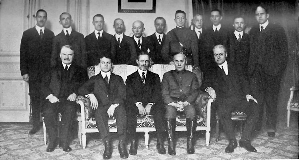
The Inquiry was a study group established in September 1917 by Woodrow Wilson to prepare materials for the peace negotiations following World War I. The group, composed of around 150 academics, was directed by the presidential adviser Edward House and supervised directly by the philosopher Sidney Mezes. The Heads of Research were Walter Lippmann and his successor Isaiah Bowman. The group first worked out of the New York Public Library but later worked from the offices of the American Geographical Society of New York once Bowman had joined the group.[1]

Mezes's senior colleagues were the geographer Isaiah Bowman, the historian and librarian Archibald Cary Coolidge, the historian James Shotwell, and the lawyer David Hunter Miller.[1] Progressive confidants who were consulted on staffing but did not contribute directly to the administration or reports of the group included James Truslow Adams, Louis Brandeis, Abbott Lawrence Lowell, and Walter Weyl.

Twenty-one members of The Inquiry, later integrated into the larger American Commission to Negotiate Peace, traveled to the Paris Peace Conference in January 1919[2] and accompanied Wilson aboard USS George Washington to France.

Also included in the group were such academics as Paul Monroe, a professor of history at Columbia University and a key member of the Research Division who drew on his experience in the Philippines to assess the educational needs of developing areas such as Albania, Turkey, and Central Africa,[3] and Frank A. Golder, a history professor from Washington State University, who specialized in the diplomatic history of Russia and wrote papers on Ukraine, Lithuania, Poland, and Russia.[4]

Recommendations

[edit]

The Inquiry provided various recommendations for the countries which it surveyed. Specifically, the recommendations discussed the ideal borders for various countries as well as various other conditions that were felt necessary to achieve a lasting peace free of tensions.

France, Belgium, Luxembourg, and Denmark

[edit]

The Inquiry recommended that Alsace–Lorraine be returned to France, that parts of Saarland that France had controlled before 1815 be returned to that country, and that the Rhineland be demilitarized.[5] It was recommended that Belgium's neutral status be abolished and that Belgium be allowed to annex territory in the Maastricht region for strategic reasons and in the Malmedy region for ethnic reasons.[6] It was recommended that Luxembourg either be annexed to Belgium or be restored to independence.[7] Meanwhile, the Inquiry recommended that there be a plebiscite in northern Schleswig, with the area transferred from Germany to Denmark if the region's people preferred.[8]

Russia, Poland, and the former Russian Empire

[edit]

The Inquiry suggested that if it was possible for Russia to become a genuine federal and democratic state, the Baltic states (with the possible exception of Lithuania) and Ukraine should be encouraged to reunify with Russia because of the belief that it would best serve the economic interests of everyone involved.[9] Meanwhile, if the Bolsheviks maintained their control of Russia, the Inquiry suggested that the independence of the Baltic states and Ukraine be recognized, with a referendum on reunion with Russia at some future better time.[9] The borders that the Inquiry proposed for Ukraine, Latvia, and Estonia were very similar to their 1991 borders. Indeed, the Inquiry even suggested that Crimea be given to Ukraine.[10]

The Inquiry expressed support for Finnish independence and also expressed a desire, never realized, that Åland be transferred from Finland to Sweden.[11] It was recommended that an independent Poland be created, encompassing all indisputably Polish areas, that Poland and Lithuania unite if possible, and that Poland "be given secure and unhampered access to the Baltic [Sea]" through a Polish Corridor.[12] While acknowledging that it would be unfortunate to separate East Prussia, with its 1,600,000 Germans, from the rest of Germany, the Inquiry considered that to be better than denying Poland, a nation of 20,000,000 people, access to the sea. In addition, the Inquiry expressed confidence that Germany could easily be assured railroad transit across the Polish Corridor.[12] As for Poland's eastern borders, the Inquiry kept the door open to Polish annexation of eastern Galicia and Belarusian-majority territories to its north.[12]

In the Caucasus, the Inquiry suggested an independent Armenia in the borders contemplated for Wilsonian Armenia, and provisional independence for both Georgia and Azerbaijan.[13] In addition, the idea of a future union of Armenia, Georgia, and Azerbaijan (in the form of a Transcaucasian Federation) was discussed and viewed favorably by the Inquiry.[13]

Czechoslovakia, Romania, Yugoslavia, and Italy

[edit]

It was suggested that Czechoslovakia be created out of the Czech-majority and Slovak-majority areas of the former Austria-Hungary.[14] In addition, it was suggested that Czechoslovakia include the Sudetenland, Subcarpathian Ruthenia, and more than 500,000 Hungarians (Magyars) south of Slovakia.[14]

The Inquiry advised that Romania be allowed to annex all of Bessarabia, the Romanian-majority part of Bukovina, all of Transylvania, the Romanian-majority areas in Hungary proper, and about two thirds of the Banat.[15] In addition, the Inquiry suggested having Romania cede Southern Dobruja to Bulgaria, which ultimately occurred in 1940.[15] Meanwhile, it was suggested that an "independent federated Yugo-Slav state" be created out of Serbia, Montenegro, and the Serbian, Croatian, and Slovenian territories of the former Austria-Hungary.[16]

The Inquiry acknowledged that the Brenner Pass, which had been promised to Italy in the 1915 Treaty of London, would give Italy the best strategic frontier, but it recommended a line somewhat further south, to reduce the number of ethnic Germans in Italy while still giving Italy a frontier more defensible than the prewar border.[17] In addition, it was suggested that Italy be allowed to annex Istria, with its many ethnic Italians, but not Italian-majority Fiume, given that city's importance to Yugoslavia.[18] The Inquiry also advised that Italy end its occupation of Rhodes and the Dodecanese Islands and give the islands to Greece, in accordance with the wishes of their inhabitants, something that was not done until 1947, after World War II.[18] The Inquiry recommended that Italian Libya "be given a hinterland adequate for access to the Sudan and its trade."[18]

German Austria and Hungary

[edit]

It was recommended that German Austria, later renamed the Republic of Austria, be established as an independent state and be given an outlet for trade at Trieste, Fiume, or both cities.[19] Meanwhile, it was suggested that Hungary be given independence with borders similar to those it ultimately received by the Treaty of Trianon and that it to be given an outlet for trade at either Trieste or Fiume as well as "rights of unrestricted commerce on the lower Danube."[20] The Inquiry advised that the German-majority Burgenland remain part of Hungary to avoid "disturb[ing] long-established institutions," at least until it became clear that the people there indeed desired union with Austria.[21]

Albania, Constantinople, the Straits, and the Middle East

[edit]

No specific recommendations were given for Albania, given the extremely complex nature of the situation there.[22]

The Inquiry suggested that Constantinople become an internationalized state and that the Bosporus, the Sea of Marmara, and the Dardanelles be permanently open to ships and commercial vessels of all countries, with international guarantees to uphold that status.[23] Meanwhile, it was advised that an independent Turkish Anatolian state be created, to be superintended by one of the Great Powers under a League of Nations mandate.[24]

Also, the Inquiry suggested that independent Mesopotamian and Syrian states be created under a League of Nations mandate, with the mandates awarded to powers to be named later.[25] The proposed Syrian state would consist of territories that are now part of Lebanon, northern Jordan, and western Syria. Meanwhile, the proposed Mesopotamian state would consist of territories now part of Iraq and northeastern Syria.[25] In addition, it was advised that the option to create an Arab confederation, to include Mesopotamia and Syria, be kept open.[25]

As for Palestine, it was advised that an independent state under a British mandate be created.[26] Jews would be invited to settle in Palestine if the protection of the personal, religious, and property rights of the non-Jewish population were assured, with the state's holy sites under the protection of the League of Nations.[26] The League was to recognize Palestine as a Jewish state as soon as it was in fact.[26]

As for Arabia, it was suggested that the King of Hejaz not be given assistance to impose his rule over unwilling Arab tribes.[27]

Legacy

[edit]

Some of the members later established the Council on Foreign Relations, which is independent of the government.[28]

The Inquiry's papers are currently stored at the National Archives, though some of their papers (in many cases, duplicates) are stored at the Yale Archives.[29]

References

[edit]
Revisions and contributorsEdit on WikipediaRead on Wikipedia
from Grokipedia
The Inquiry was a confidential research organization formed in September 1917 by Colonel Edward M. House, Woodrow Wilson's chief advisor, at the president's direction to compile data and recommendations for the postwar settlement after World War I.[1] Assembled primarily from American academics, geographers, economists, and historians, the group operated out of New York City and the American Geographical Society, producing over two thousand reports on territorial boundaries, ethnic distributions, economic resources, and political aspirations across Europe, the Middle East, and beyond.[2] Numbering around 150 specialists under the direction of historian Sidney E. Mezes, The Inquiry aimed to provide empirical foundations for a just peace grounded in self-determination and national aspirations, influencing Wilson's Fourteen Points speech in January 1918.[3][4] The group's work transitioned into the American Commission to Negotiate Peace, which accompanied U.S. delegates to the Paris Peace Conference in 1919, where Inquiry experts served as advisors and supplied maps, memoranda, and statistical analyses to support American proposals.[5] Despite its comprehensive preparations, many of The Inquiry's recommendations—favoring ethnic-based redrawings of maps and minimal punitive measures—were overridden by Allied demands for reparations and territorial gains, contributing to the Treaty of Versailles's punitive character and the ultimate rejection of the League of Nations by the U.S. Senate.[6] The Inquiry represented an early effort in American foreign policy to apply scholarly expertise to international diplomacy, though its idealistic, data-driven approach clashed with the geopolitical realities of power balancing among victors.[7]

Formation and Organization

Establishment and Context

The Inquiry was established in September 1917 by President Woodrow Wilson as a confidential study group tasked with preparing factual data and analytical reports to inform United States positions in post-World War I peace negotiations.[8] This initiative emerged amid the U.S. entry into the war in April 1917, reflecting Wilson's emphasis on a rational, evidence-based approach to diplomacy over reliance on Allied secret treaties or vengeful reparations.[9] The group operated under the direction of Colonel Edward M. House, Wilson's closest advisor, with philosopher Sidney E. Mezes serving as its executive head, leveraging expertise from academics to map global territorial, ethnic, and economic realities.[9][10] Headquartered at the American Geographical Society in New York City, The Inquiry assembled around 150 specialists, including historians, geographers, economists, and political scientists, predominantly from Ivy League institutions and other leading universities.[6] These experts produced over 2,000 detailed studies covering topics such as boundary delineations, population distributions, and resource assessments across Europe, the Middle East, and beyond, aiming to support Wilson's ideals of national self-determination and equitable settlements.[6] The effort was shrouded in secrecy to avoid influencing ongoing military operations or provoking diplomatic tensions, with participants sworn to confidentiality.[10] In the broader context of 1917, The Inquiry represented an unprecedented mobilization of scholarly resources for foreign policy, contrasting with European powers' reliance on military and colonial imperatives.[11] Wilson's administration viewed it as essential for countering what he perceived as outdated imperial bargaining, instead prioritizing empirical foundations for a new world order, though the group's outputs later faced criticism for academic idealism detached from geopolitical pragmatism.[12] By the Armistice in November 1918, The Inquiry's preparatory work had positioned a contingent of its members to accompany the U.S. delegation to the Paris Peace Conference, where their maps and memoranda directly informed negotiation strategies.[6]

Leadership and Key Personnel

The Inquiry was directed by Sidney E. Mezes, a philosopher and former president of the City College of New York, who coordinated the group's research efforts from its inception in September 1917 until its integration into the American Commission to Negotiate Peace.[13] Mezes reported to Edward M. House, Woodrow Wilson's close advisor, who initiated the assembly of experts at the president's request to prepare data for potential peace negotiations.[2] The organization comprised approximately 150 specialists, primarily academics in fields such as geography, history, economics, and international law, drawn from institutions like Harvard, Columbia, and the American Geographical Society.[4] Initial heads of research included journalist and political analyst Walter Lippmann, who oversaw divisions on politics, government, and international cooperation in late 1917.[14] Lippmann was succeeded by geographer Isaiah Bowman, who assumed leadership and served as chief of territorial intelligence, playing a pivotal role in mapping territorial recommendations and boundary studies.[15] Other key figures encompassed historian Charles Homer Haskins, focused on Western European affairs; international lawyer David Hunter Miller; and economist Clive Day, contributing to economic and regional analyses.[16] These personnel produced over 2,000 reports, emphasizing empirical data on ethnic distributions, resources, and strategic interests to inform U.S. positions.[3]

Objectives and Methods

Research Focus and Scope

The Inquiry's research primarily targeted the compilation of empirical data on territorial, economic, political, and ethnographic conditions across Europe, the disintegrating Austro-Hungarian, Ottoman, and Russian empires, and other global regions affected by the war, with the explicit goal of informing U.S. negotiating positions at the anticipated peace conference. This scope extended to assessments of potential boundary adjustments, ethnic distributions, resource endowments, and administrative feasibilities, prioritizing objective analyses to evaluate claims of self-determination and economic viability for emergent states.[17][18] Studies encompassed specific issues such as disarmament frameworks, post-war reconstruction needs, colonial redistributions in Africa and Asia, and the political stability of regions like the Balkans, Anatolia, and the Adriatic.[17] Geographical and strategic dimensions received particular emphasis, including the production of detailed maps and reports on natural barriers, transportation networks, and military frontiers to underpin "scientific" approaches to redrawing borders and allocating mandates. Economic inquiries scrutinized trade dependencies, industrial capacities, and reparative potentials, particularly for Central Powers territories, while political research examined governance structures, minority protections, and international law applications to avoid punitive settlements that could foster future instability.[19] The breadth covered virtually all continents, from Latin American border disputes like Tacna-Arica to Scandinavian neutrality implications, though the core focus remained on Eurasian theaters where Allied war aims intersected with Wilsonian ideals of open diplomacy and equitable adjustments.[17][18] This comprehensive mandate, directed by a central research committee, generated thousands of memoranda, statistical appendices, and alternative settlement scenarios, ensuring negotiators had access to synthesized intelligence rather than unverified assertions from belligerent parties.[17] While the effort innovated expert-driven foreign policy preparation, its outputs reflected the academic backgrounds of participants, often favoring geographic determinism and ethnographic mappings over purely legalistic precedents.[19]

Data Collection and Analytical Approach

The Inquiry employed an interdisciplinary team of approximately 150 experts, primarily academics from institutions such as Harvard, Yale, and Princeton, along with specialists in geography, economics, history, and international law, to systematically gather and synthesize information on global territories and postwar issues.[20] Data collection began in late 1917 under the direction of Sidney E. Mezes and involved compiling materials from U.S. government bureaus including the Census Bureau, Department of Agriculture, War Trade Board, and Tariff Commission, as well as from official archives, newspapers, treaties, and historical records.[20] Experts focused on 12 territorial regions, producing reports that incorporated ethnographic, economic, political, and legal data, supplemented by maps from the U.S. Geological Survey and statistical analyses.[2][20] Analytical efforts emphasized synthetic research, where subject-matter specialists critiqued and revised draft reports through iterative reviews to assess feasibility of boundary adjustments, resource distributions, and self-governance structures.[20] Under geographer Isaiah Bowman, the group generated over 25 sets of millionth-scale maps and accompanying graphs to visualize ethnic distributions, economic interdependencies, and strategic considerations, drawing on both existing surveys and newly processed data.[20] This approach extended to 29 specialized research sections covering topics like diplomatic history, international law, and regional politics, with outputs including abstracts, precis, and bibliographies that prioritized empirical evidence over speculative ideals.[2][20] To support these activities, the Inquiry established a dedicated library and reference collection, planned by Andrew Keogh, which aggregated printed materials, despatches, and intelligence summaries for cross-verification.[20] The process, funded at around $240,000, relied on both salaried staff and volunteers, with clerical and mapping personnel trained for rapid dissemination of findings to policymakers.[21] While the methodology favored compilation from verifiable sources, it reflected the academic backgrounds of participants, potentially emphasizing Wilsonian principles like national self-determination in interpretations, though reports were structured to allow for evidentiary-based revisions.[20] By May 1918, initial outputs forecasted completion within 6 to 12 months, enabling preparatory briefs for the Paris Peace Conference.[20]

Influence on US Policy

Contribution to the Fourteen Points

The Inquiry, established in September 1917 under the direction of Colonel Edward M. House and philosopher Sidney E. Mezes, assembled approximately 150 experts from American universities and institutions to conduct detailed studies on postwar territorial, economic, and political arrangements.[3] In December 1917, President Woodrow Wilson tasked the group with preparing specific recommendations for a comprehensive peace settlement, drawing on their ongoing research into European ethnology, geography, and international law.[3] This work provided the empirical foundation and analytical refinements that shaped Wilson's address to Congress on January 8, 1918, where he outlined the Fourteen Points as a blueprint for enduring peace.[22] The Inquiry's contributions were particularly evident in the points advocating self-determination for national groups, adjustments to colonial claims based on populations' interests, and the redrawing of European frontiers along recognizable lines of nationality. For instance, reports from geographers like Isaiah Bowman and historians such as Robert Lansing analyzed ethnic distributions and historical claims, informing Points IX through XIII, which addressed specific regions like Italy, the Austro-Hungarian Empire, the Balkans, and Poland.[3] These recommendations emphasized factual assessments over punitive measures, aligning with Wilson's vision of a settlement grounded in justice rather than vengeance, though the group's secrecy limited public awareness of their direct input at the time.[22] While the Fourteen Points' general principles—such as open diplomacy (Point I), freedom of the seas (Point II), and a League of Nations (Point XIV)—stemmed primarily from Wilson's prior ideological commitments, the Inquiry supplied the detailed, data-driven substantiation that lent credibility and specificity to the program.[3] This preparatory role helped Wilson position the points as a counter to Allied demands for harsh reparations, influencing Germany's armistice request in November 1918 by promising a negotiated peace based on these terms.[22] However, the Inquiry's influence waned as the Paris Peace Conference progressed, with many of its territorial proposals modified amid political compromises.[3]

Preparation for the Paris Peace Conference

In the months leading up to the Armistice of November 11, 1918, The Inquiry, directed by Sidney E. Mezes under the oversight of Colonel Edward M. House, focused on synthesizing extensive research into concise briefs, boundary studies, and policy recommendations tailored for U.S. negotiators at the impending peace conference.[7] This preparation involved prioritizing data on disputed territories, including ethnographic distributions, resource assessments, and potential economic interdependencies, drawn from over 120 experts across academic disciplines such as geography, history, and economics.[5] By early 1919, the group had generated over 2,000 reports and approximately 1,200 maps, many produced under geographer Isaiah Bowman, to support evidence-based claims on self-determination and border adjustments.[23] Selection of personnel for direct involvement accelerated in late November 1918, with President Wilson approving a contingent of Inquiry experts to accompany the American delegation. Of the more than 120 original members, 23 key specialists— including Bowman, historian Charles Seymour, and economist Allyn A. Young—sailed aboard the USS George Washington on December 4, 1918, arriving in Paris on December 13.[24] These individuals carried dossiers of summarized findings, enabling rapid briefings on complex issues like the dissolution of the Austro-Hungarian and Ottoman Empires, while additional materials were shipped separately for on-site reference.[7] The effort emphasized factual groundwork over partisan advocacy, though internal debates highlighted tensions between idealistic principles and pragmatic territorial realities. This preparatory phase transitioned The Inquiry into the American Commission to Negotiate Peace upon the delegation's arrival, with its outputs forming the core informational arsenal for U.S. positions.[1] Funded through informal allocations totaling around $240,000 from government departments, the work underscored a reliance on empirical analysis from universities like Yale and Columbia, minimizing reliance on Allied intelligence to maintain American independence in deliberations.[21] Despite its scope, the materials' utility was constrained by the conference's political dynamics, where European powers often prioritized strategic gains over the Inquiry's data-driven proposals.[7]

Territorial Recommendations

Western Europe and Scandinavia

The Inquiry's territorial studies on Western Europe emphasized rectification of borders disrupted by German aggression, prioritizing restoration of pre-war sovereignties and French security interests while incorporating elements of self-determination where feasible. Research focused on the western front, encompassing Belgium, Luxembourg, Alsace-Lorraine, and adjacent regions up to the Swiss border, with reports prepared by specialists such as Dean Charles H. Haskins on Belgian political issues and Professor W. H. Hobbs on Alsace-Lorraine boundaries and resources.[20] These efforts produced detailed analyses of economic ties, public opinion, language distributions, and mineral resources, informing Wilson's advocacy for evacuating and restoring invaded territories.[20] Regarding Alsace-Lorraine, annexed by Germany in 1871, the Inquiry generated at least 16 reports advocating its return to France to address the longstanding grievance that had destabilized European peace, consistent with the Eighth Point of Wilson's Fourteen Points program delivered on January 8, 1918.[25] Studies by experts including Professor E. B. Krehbiel on plebiscites, Professor Wallace Notestein on governance and attitudes since 1914, and Professor E. C. Armstrong on linguistic composition supported integration into France without extensive plebiscites, emphasizing historical French claims and local sentiments favoring reunion, though some analyses noted complexities in ethnic distributions.[20] This position aligned with empirical assessments of the region's pre-1871 status and post-war instability under German rule. For the Saar Basin, adjacent to Alsace-Lorraine and rich in coal resources vital to French industry, the Inquiry endorsed French claims to administrative control and economic exploitation, viewing it as compensation for war damages and a buffer against future German revanchism, rather than outright annexation.[26] Recommendations included temporary French oversight, with a eventual plebiscite after 15 years, reflecting data on the area's industrial output—producing over 17 million tons of coal annually by 1913—and its strategic linkage to Lorraine's iron fields, though internal debates weighed self-determination against Allied reparations needs.[26] Belgium's restoration was a core focus, with studies by Haskins and Professor Clive Day examining political and economic dependencies on Germany and France, recommending full evacuation, reparations for devastation—including the destruction of over 6,000 square kilometers of territory and 1 million buildings—and reinstatement of sovereignty without territorial concessions, directly supporting Wilson's Seventh Point.[20] Luxembourg received targeted analysis by Dr. L. D. Steefel, proposing either independence under guarantees or economic and possible political union with Belgium to neutralize its strategic position between France and Germany, given its 1915 customs union with Germany and vulnerability to influence.[20] Scandinavian matters received preliminary attention as part of broader neutral states research under Day, with limited depth compared to continental hotspots; no comprehensive territorial redrawing was proposed for Norway, Sweden, or Denmark proper, reflecting their non-belligerent status.[20] For Schleswig, divided between Denmark and Germany since 1864, the Inquiry noted the border dispute and advocated plebiscites in northern zones to ascertain local preferences, aligning with self-determination principles amid Denmark's claims based on ethnic Danish majorities in areas like North Schleswig, where approximately 75% spoke Danish per pre-war censuses.[27] The Åland Islands, claimed by Sweden due to Swedish-speaking populations but held by Finland, were referenced in terms of prior Russo-Finnish understandings, with recommendations deferring to Finnish sovereignty absent strong evidence overriding post-independence realities.[27] These Nordic assessments, initiated late in 1917, underscored caution against disrupting stable neutrals absent direct war impacts.[20]

Eastern Europe and the Former Russian Empire

The Inquiry's experts systematically examined the fragmentation of the former Russian Empire after the Bolshevik Revolution and Treaty of Brest-Litovsk in 1918, producing reports on ethnic distributions, economic interdependencies, and viable boundaries for self-governing entities. Directed initially by Archibald C. Coolidge and later Robert H. Lord, the work prioritized ethnographic data and provisional political assessments, with ongoing revisions to account for wartime developments such as German occupations and local independence declarations.[20] Key regions analyzed included Poland, the Baltic provinces, Finland, Ukraine, White Russia, the Don Cossacks, Siberia, and the Caucasus (Transcaucasia).[20] For Poland, Robert H. Lord's team completed detailed territorial mappings of "indisputably Polish" areas across the former partitions, covering about 80% of core ethnographic zones by May 1918, with economic analyses at 40% completion. These informed recommendations for a unified, independent Poland with ethnographic borders extending into German and Austro-Hungarian territories, aligned with Wilson's Fourteenth Point advocating "free and secure access to the sea."[20] [20] Similar principles guided proposals for the Baltic states—Lithuania, Courland (Latvia), and Esthonia (Estonia)—where Frank A. Golder's provisional reports, supplemented by specialists like Mr. Speek for Estonia, supported separation from Russia and Germany based on distinct national identities and historical claims to autonomy.[20] Finland's case, addressed in Samuel E. Morison's forthcoming report expected by June 1918, reinforced U.S. backing for its December 1917 declaration of independence, viewing it as a stable application of self-rule amid the empire's dissolution. In contrast, analyses of Ukraine, White Russia, and Transcaucasia by Golder and A. I. Andrews highlighted fragmented national aspirations—such as Ukrainian autonomy efforts and emerging republics in Georgia, Armenia, and Azerbaijan—but noted severe obstacles from civil war, Bolshevik incursions, and lacking centralized authority, leading to cautious, non-committal territorial outlines rather than firm statehood endorsements. Siberia and Don Cossack regions received parallel scrutiny for potential self-governance, though provisional findings required updates due to fluid alliances and interventions.[20] [20] Detailed 1:1,000,000-scale maps and block diagrams accompanied these reports, enabling data-driven boundary suggestions that prioritized contiguity and resource access over strategic buffers against Germany or Bolshevism. While influencing U.S. advocacy for plebiscites and minority protections at Paris, the Inquiry's Eastern European proposals often clashed with Allied realpolitik, resulting in partial realizations like Polish and Baltic independences by 1920, but deferrals for unstable areas like Ukraine.[20][20]

Central Europe and the Balkans

The Inquiry's sectional studies on Central Europe emphasized the dissolution of the Austro-Hungarian Empire along ethnic lines to enable national self-determination, recommending the creation of independent Czechoslovakia from the Bohemian Crown lands, Moravia, and Slovakia, while assigning the predominantly German-speaking Sudetenland to a residual Austrian state but acknowledging potential plebiscites for disputed areas.[21] These reports, drawing on ethnographic data and maps prepared by experts like Isaiah Bowman, projected Czechoslovakia's borders to encompass approximately 3.7 million Czechs and Slovaks, though they noted the ethnic complexity of regions like Teschen Silesia, where Polish, Czech, and German populations overlapped, leading to proposals for arbitration rather than rigid division.[2] For Hungary, the Inquiry advocated significant territorial reductions to its ethnic Magyar core, estimating a population of about 8 million after cessions of Transylvania to Romania, Slovakia to Czechoslovakia, and Croatia-Slavonia to a prospective South Slav state, based on linguistic and historical analyses that prioritized majority ethnicities over economic viability or pre-war administrative units.[28] Austria was envisioned as a compact German-speaking republic centered on Vienna, with its viability questioned due to the loss of industrial and agricultural hinterlands, prompting some Inquiry memoranda to suggest economic unions or plebiscites in mixed areas like southern Styria.[10] In the Balkans, the Inquiry supported the unification of South Slav territories into a Kingdom of Serbs, Croats, and Slovenes (later Yugoslavia), incorporating Slovenia, Croatia, Bosnia-Herzegovina, and Dalmatia from Austria-Hungary with Serbia and Montenegro, while recommending federal structures to accommodate Croat and Slovene autonomies and protect minorities comprising up to 30% of the projected population.[29] Reports urged Serbia's access to the Adriatic via Dalmatia, rejecting Italian claims to Fiume and northern Albania, and proposed adjustments for Romania's incorporation of Transylvania and Bukovina, Bulgaria's retention of core Thrace but loss of Dobruja, and Albania's independence with Italian influence limited to economic spheres.[20] These recommendations, informed by pre-war Balkan War outcomes and refugee testimonies, aimed to stabilize the region through autonomous relations among states but underestimated irredentist tensions, as evidenced by the Inquiry's limited fieldwork and reliance on émigré sources.[30]

Middle East and Adriatic Issues

The Inquiry's analyses of Adriatic territories emphasized ethnic self-determination over strategic or historical claims, particularly in response to Italian demands for the eastern Adriatic coast after the collapse of Austria-Hungary. Experts, including geographers and ethnologists, compiled ethnographic maps and demographic data showing a Slavic majority in Dalmatia and around Fiume (Rijeka), recommending that Italy receive Trieste and northern Istria—areas with significant Italian populations—but that southern Dalmatia and islands like Lussin (Lošinj) integrate into a South Slav state to align with Woodrow Wilson's principle of national self-determination outlined in his [Fourteen Points](/page/Fourteen Points).[31][32] For Fiume, a multi-ethnic port city with an Italian plurality but Yugoslav hinterland ties, the group proposed internationalization as a free city under League of Nations oversight, potentially with a plebiscite to determine affiliation, rejecting full Italian sovereignty to avoid denying Slavic access to the sea.[33] These recommendations, detailed in the Inquiry's "black book" of territorial proposals and supported by naval and economic assessments, aimed to balance Italian contributions to the Allied victory with equitable boundary adjustments, but clashed with the secret 1915 Treaty of London promising Italy extensive Adriatic gains. At the Paris Peace Conference, Wilson invoked Inquiry data to oppose Orlando's maximalist claims, insisting on ethnographic boundaries and open diplomacy over prewar pacts, though Italian walkouts and domestic pressures led to partial concessions; Dalmatia ultimately went to the Kingdom of Serbs, Croats, and Slovenes in 1919, while Fiume remained unresolved until the 1920 Treaty of Rapallo awarded it to Italy amid Gabriele D'Annunzio's occupation.[33][34] In the Middle East, the Inquiry focused on partitioning the Ottoman Empire's non-Turkish provinces, advocating autonomy or independence for Arab, Armenian, and Kurdish populations under the Twelfth Point's call for "absolutely unmolested opportunity of autonomous development" while ensuring Turkish core areas' sovereignty. Reports by political scientists and regional specialists proposed boundaries for an independent Armenia encompassing historic areas in eastern Anatolia with Armenian majorities, provisional autonomy for Kurdistan, and Arab states in Mesopotamia (Iraq) and Syria free from colonial partition, drawing on missionary accounts, Ottoman census data, and wartime promises like the Hussein-McMahon correspondence to prioritize local aspirations over European spheres of influence.[35][11] However, the Inquiry's boundary drafts, including maps delineating Syria-Lebanon and Palestine as potential mandates with self-governing trajectories, underestimated Anglo-French commitments under Sykes-Picot (1916) and overestimated U.S. leverage; Wilson initially endorsed the group's anti-colonial leanings but deferred to Allied mandates at San Remo (1920), where Britain received Iraq and Palestine, France Syria and Lebanon, sidelining Armenian independence after Turkish resistance and the 1920 Treaty of Sèvres' revisions.[35] The King-Crane Commission's 1919 field survey, involving some Inquiry alumni, echoed these findings by opposing Zionism's full territorial claims in Palestine and favoring U.S. or international administration, but its report—suppressed until 1922—had minimal impact amid European realpolitik.[36] This divergence highlighted tensions between the Inquiry's academic idealism and conference pragmatism, contributing to long-term instability in mandate territories.

Role in Negotiations

Advisory Functions at the Conference

Twenty-one members of The Inquiry accompanied the American delegation to Paris in January 1919, integrating into the American Commission to Negotiate Peace, which operated from January 18 to December 9.[8] These experts served as technical advisors, staffing commissions and subcommittees established by the conference to address territorial, economic, and political issues.[5] Their primary function was to furnish data, maps, and analytical reports derived from pre-conference research, enabling U.S. negotiators to evaluate proposals and formulate positions grounded in empirical assessments rather than solely diplomatic concessions.[7] Under Director Sidney E. Mezes, the group organized into specialized sections, such as territorial and intelligence, where they provided on-site expertise during deliberations.[7] Geographer Isaiah Bowman, for instance, headed territorial efforts, advising on boundary delineations in Europe and the Middle East by applying geographic and ethnographic data to proposed settlements.[37] Other members, including historians and economists, contributed to commissions on reparations, mandates, and the League of Nations, drafting memoranda that informed President Wilson's advocacy for self-determination and open covenants.[5] This advisory capacity extended to countering Allied claims with U.S.-centric analyses, though the experts' influence was advisory, with ultimate authority residing with principals like Wilson and Secretary of State Robert Lansing.[7] The Inquiry's presence marked an unprecedented mobilization of academic and scientific expertise in diplomacy, shifting from traditional statecraft to data-driven policymaking.[5] However, their roles were often sidelined amid the "Big Four" negotiations, with specialists occasionally expressing frustration over limited access to decision-making cores.[18] Despite this, their preparatory work and real-time consultations shaped American inputs on key treaties, including Versailles, Saint-Germain, and Trianon, by emphasizing factual bases over punitive measures.[7]

Specific Contributions and Rejections

Members of The Inquiry served as technical advisors in specialized commissions at the Paris Peace Conference, supplying empirical data on ethnography, geography, and economics to inform U.S. positions on territorial adjustments and political settlements. Isaiah Bowman, appointed Chief Territorial Specialist, drew on Inquiry maps and reports to advocate for boundaries aligned with natural features and population distributions, influencing the treaty's provisions for plebiscites in contested areas such as Schleswig-Holstein, where a 1920 vote favored Danish incorporation, and the Allenstein-Marienwerder districts, assigned to Poland following local preferences.[37][11] In Eastern Europe, Charles Seymour's October 1918 boundary proposal for the successor states of Austria-Hungary, which reduced Hungary to approximately 112,000 square kilometers with an 80% ethnic Hungarian population, was incorporated into the American "Black Book" of tentative recommendations finalized in January 1919, serving as the basis for U.S. advocacy in negotiations. This included ceding Transylvania to Romania and Slovak territories to Czechoslovakia, reflecting Inquiry emphasis on ethnic self-determination. However, earlier federalist schemes, such as Seymour's May 1918 suggestion for a confederation of six states within a reformed Habsburg framework, were rejected as President Wilson pivoted to support full dismemberment of the Dual Monarchy by mid-1918.[21] Sidney Mezes, directing territorial intelligence, contributed memos favoring international mandates over outright annexation for former Ottoman territories, a concept partially adopted in the League of Nations mandate system established by the Treaty of Versailles, which assigned regions like Syria and Palestine to British and French administration under supervisory oversight rather than direct sovereignty. Economic analyses, such as Clive Day's reports on Central European trade dependencies, informed U.S. pushes for open markets but were disregarded in final reparations clauses, which imposed uncapped indemnity demands on Germany exceeding Inquiry projections for sustainable reconstruction.[21][38] Rejections often stemmed from Allied strategic priorities overriding Inquiry data; for instance, ethnographic evidence against extensive Italian claims in the Adriatic, highlighted by Bowman and others, supported Wilson's opposition to Fiume’s annexation, yet secret wartime pacts led to compromises favoring Italy, with the city initially excluded from Yugoslavia but later seized amid unresolved disputes. In the Middle East, while mandate principles were accepted, specific Inquiry recommendations for Armenian independence were sidelined due to geopolitical realities, resulting in no sovereign state and ongoing Turkish control over eastern territories. These divergences underscored the limits of academic expertise amid great-power bargaining, with U.S. delegates frequently conceding to French and British demands despite Inquiry-backed alternatives.[37][21]

Criticisms and Controversies

Idealism Versus Realist Critiques

The Inquiry's recommendations, drawing on extensive ethnographic, economic, and geographic data compiled by experts like Isaiah Bowman and Sidney Mezes, embodied Wilsonian idealism by prioritizing principles such as national self-determination and border adjustments based on ethnic majorities rather than strategic or historical claims. These plans, outlined in reports like the "Preliminary Draft of the Plan of the Territorial Settlement" presented in February 1919, sought to foster stable democracies through rational, scientific reconfiguration of Europe and the former empires, assuming that transparent diplomacy and collective security via the League of Nations could supplant balance-of-power politics.[26][39] Realist critics, including European statesmen like Georges Clemenceau and British diplomats, dismissed these proposals as impractically utopian, arguing they disregarded the imperatives of national security and retribution after four years of devastating war; for instance, French demands for Rhineland annexation and heavy reparations directly contradicted the Inquiry's advocacy for minimal punitive measures to avoid economic instability.[40][41] In the United States, figures such as Senator Henry Cabot Lodge and military advisors critiqued the Inquiry's academic detachment, contending that its data-driven ethnology overlooked the anarchic realities of power competition and the infeasibility of carving homogeneous states from heterogeneous empires, as evidenced by the rejection of over 70% of its territorial suggestions at the conference.[42] Later realist theorists like E.H. Carr reinforced this view, portraying Wilsonian efforts—including the Inquiry's groundwork—as "utopian" illusions that failed to account for states' pursuit of self-interest, contributing to the treaty's harshness and subsequent instability.[43] Some contemporary analyses, however, attribute partial realism to Wilson himself, noting his concessions on mandates and secret treaties as pragmatic adjustments, though these did not mitigate broader indictments of the Inquiry for fostering overconfidence in expertise over geopolitical exigencies; internal tensions, such as State Department resistance to the group's influence, underscored early skepticism about its insulated, professorial methodology.[44][45] This idealism-realism divide highlighted systemic challenges in translating scholarly ideals into enforceable peace, with realists warning that ignoring power dynamics invited revanchism, a prophecy borne out by interwar Europe's volatility.[46]

Implementation Failures and Long-Term Consequences

The Inquiry's recommendations, which advocated for borders drawn along ethnographic lines and the principle of self-determination to minimize ethnic conflicts, were largely undermined during the Paris Peace Conference by competing Allied priorities, particularly France's demands for security guarantees against Germany. For instance, while the Inquiry proposed adjustments in Eastern Europe that would have granted more homogeneous territories to emerging states like Poland and Czechoslovakia, the final Treaty of Versailles, signed on June 28, 1919, incorporated compromises such as the Polish Corridor, which separated East Prussia from Germany and left substantial German minorities under Polish control, numbering approximately 800,000 in the corridor and surrounding areas. These deviations arose as President Wilson traded territorial concessions for support of the League of Nations Covenant, sidelining many of the Inquiry's detailed maps and reports prepared under Colonel Edward House.[47] Implementation failures extended to the Middle East, where the Inquiry's emphasis on stable mandates clashed with secret wartime agreements like Sykes-Picot, resulting in artificial boundaries that ignored ethnic and sectarian realities, such as the division of Ottoman territories into mandates that sowed seeds of instability in Iraq and Syria. Critics, including realists like British diplomat Harold Nicolson, argued that the Inquiry's data-driven idealism overlooked power balances and economic imperatives, leading to treaties that failed to enforce plebiscites or minority protections effectively; for example, only limited plebiscites were held in Schleswig and Upper Silesia, while broader self-determination claims in Anatolia were rejected in favor of Greek territorial ambitions that collapsed by 1922.[40] Long-term consequences included heightened ethnic tensions that destabilized interwar Europe, as mismatched borders fueled irredentist movements; the 3 million German speakers in Czechoslovakia's Sudetenland, a legacy of unheeded Inquiry warnings on minority integration, became a pretext for Nazi annexation in 1938. In the Balkans and Central Europe, the treaties' failure to align fully with the Inquiry's proposed adjustments contributed to fragmented states prone to internal strife, exacerbating economic woes and authoritarian rises, with hyperinflation in Germany reaching 4.2 trillion marks per dollar by November 1923 partly attributable to reparations tied to territorial losses. These outcomes validated realist critiques that the Inquiry's "scientific" approach naively prioritized abstract principles over enforceable security, ultimately undermining the Versailles system's durability and paving pathways to World War II through unresolved grievances.[48][49]

Dissolution and Legacy

Organizational End and Integration

The Inquiry concluded its independent operations following the armistice of November 11, 1918, as its preparatory research transitioned into active advisory roles at the Paris Peace Conference.[5] Established in September 1917 under the direction of Sidney E. Mezes, the group produced over 2,000 reports and maps by early 1919, but with the conference convening on January 18, 1919, its structure was reorganized to align with diplomatic proceedings.[20] In January 1919, The Inquiry was absorbed into the American Commission to Negotiate Peace, ceasing to function as an autonomous entity.[5] Twenty-one key members, including territorial specialists and economic experts, integrated directly into the Commission's divisions, such as the Division of Territorial, Economic, and Political Studies, to provide on-site expertise during negotiations.[8] This merger facilitated seamless incorporation of The Inquiry's materials into treaty drafting, with Mezes serving as a commissioner until the body's dissolution. The American Commission itself operated until December 9, 1919, after which remaining personnel dispersed, marking the effective end of organized Inquiry activities.[8] Post-integration, surviving records and personnel from The Inquiry contributed to archival preservation efforts, with documents transferred to U.S. government repositories for historical analysis.[5] This absorption reflected pragmatic adaptation to wartime-to-peacetime transitions, prioritizing utility over prolonged independent existence, though it limited the group's potential for broader institutionalization beyond the conference.[5]

Influence on Future Policy and Institutions

The Inquiry's interdisciplinary approach to foreign policy preparation, involving over 150 experts from academia and government, established a precedent for enlisting scholarly resources in high-level diplomatic planning, a practice that subsequent U.S. administrations adopted for structured policy analysis. This model influenced the creation of dedicated policy research entities, as evidenced by the direct involvement of Inquiry alumni in founding postwar institutions focused on international affairs.[50] A primary institutional legacy was the Council on Foreign Relations (CFR), established in 1921 by key Inquiry participants including Elihu Root and members of the American delegation to the Paris Peace Conference, explicitly positioning itself as a continuation of the Inquiry's deliberative framework to inform U.S. foreign policy amid isolationist debates. The CFR's founding documents and early activities emphasized nonpartisan study groups akin to the Inquiry's sectional committees, producing reports on global issues that shaped executive and legislative discussions through the interwar period and beyond.[51][52] The Inquiry's outputs, including ethnographic studies and territorial recommendations that underpinned Wilson's Fourteen Points announced on January 8, 1918, promoted principles like national self-determination, which, despite partial rejection at Versailles, informed later multilateral frameworks such as the Atlantic Charter of 1941 and the United Nations Charter's emphasis on peoples' rights to self-government. These ideas gained traction in decolonization efforts post-1945, as evidenced by their invocation in U.S. policy toward European mandates and Asian territories during the Wilson era's immediate aftermath.[22] Critics of the Inquiry's idealism noted its limited direct impact on enforceable institutions due to Senate rejection of the Versailles Treaty on November 19, 1919, yet its methodological innovations endured, fostering the growth of think tanks like the Brookings Institution and influencing the U.S. State Department's Policy Planning Staff created in 1947 to integrate expert input into Cold War strategy.[53][54]

References

User Avatar
No comments yet.