

Community hub
Recent from talks
Contribute something
Nothing was collected or created yet.
Davis, California
View on Wikipedia
Davis is the most populous city in Yolo County, California, United States. Located in the Sacramento Valley region of Northern California, the city had a population of 66,850 in 2020,[10] not including the on-campus population of the University of California, Davis, which was over 9,400 (not including students' families) in 2016.[11] As of 2023,[update] there were 40,850 students enrolled at the university, and is known as the biking capital of America.[12]
Key Information

.JPG)
.JPG)


History
[edit]Davis sits on land that was historically inhabited by Indigenous people associated with the Clovis culture. The Patwin, a southern branch of Wintun people, eventually displaced existing Indigenous tribes. The Patwin were subsequently displaced by the American and Mexican government in the 1830s as part of the California genocide.[13][14][15] Patwin burial grounds have been found across Davis, including on the site of the UC Davis Mondavi Center.[16] Territory that eventually became Davis emerged from ranchos, Laguna de Santos Callé.[17] Jerome C. Davis, a prominent farmer and one of the early claimants to land in Laguna de Santos Callé, lobbied to the United States Congress to retain the land that eventually became Davis.[17][18] Davis became a depot on the Southern Pacific Railroad in 1868, when it was named Davisville after Jerome C. Davis.[19] The post office at Davisville shortened the town name to "Davis" in 1907. The name stuck, and the city of Davis was incorporated on March 28, 1917.[citation needed]
From its inception as a farming community, Davis is known primarily for its contributions to agricultural policy along with veterinary care and animal husbandry. Following the passage of the University Farm Bill in 1905 by the California State Legislature, Governor George Pardee selected Davis out of 50 other sites as the future home to the University of California's University Farm, officially opening to students in 1908.[20] The farm, later renamed the Northern Branch of the College of Agriculture in 1922, was upgraded to become the seventh UC general campus, the University of California, Davis, in 1959.
Geography and environment
[edit]Location
[edit]Davis is located in Yolo County, California, 11 mi (18 km) west of Sacramento, 70 mi (113 km) northeast of San Francisco, 385 mi (619 km) north of Los Angeles, at the intersection of Interstate 80 and State Route 113. Neighboring towns include Dixon, Winters, Woodland, and West Sacramento.
Davis lies in the Sacramento Valley, the northern portion of the Central Valley, in Northern California, at an elevation of about 52 feet (16 m) above sea level.
According to the United States Census Bureau, the city has a total area of 10.0 square miles (26 km2). 10.0 square miles (26 km2) of it is land and 0.03 square miles (0.078 km2) of it, or 0.35%, is water.[5]
The topography is flat, which has helped Davis to become known as a haven for bicyclists.[21]
Climate
[edit]The Davis climate resembles that of nearby Sacramento and is typical of California's Central Valley Mediterranean climate region: warm and dry in the spring, summer and autumn, and cool and wet in the winter. It is classified as a Köppen Csa climate. Summer days are hot, ranging from 85 to 105 °F (29 to 41 °C), but the nights turn pleasantly cool, almost always dropping below 70 °F (21 °C). The Delta Breeze, a flow of cool marine air originating from the Pacific Ocean via San Francisco Bay and the Sacramento–San Joaquin River Delta, frequently provides relief in the evening. Winter temperatures generally reach between 45 and 65 °F (7 and 18 °C) in the afternoon; nights average at about 35 to 40 °F (2 to 4 °C), but occasionally fall below freezing.
Average temperatures range from 46 °F (8 °C) in December and January to 75 °F (24 °C) in July and August. Thick ground fog called tule fog settles into Davis during late fall and winter. This fog can be dense, with near zero visibility. As in other areas of Northern California, the tule fog is a leading cause of road accidents in the winter season.
Mean rainfall per annum is about 20 inches (510 mm). The bulk of the rainfall occurs between about mid-November to mid-March, with typically no precipitation falling from mid-June to mid-September.[22]
Record temperatures range from a high of 116 °F (47 °C) on July 17, 1925, to a low of 12 °F (−11 °C) on December 11, 1932.[23]
| Climate data for Davis, California, 1991–2020 normals, extremes 1893–present | |||||||||||||
|---|---|---|---|---|---|---|---|---|---|---|---|---|---|
| Month | Jan | Feb | Mar | Apr | May | Jun | Jul | Aug | Sep | Oct | Nov | Dec | Year |
| Record high °F (°C) | 88 (31) |
90 (32) |
92 (33) |
98 (37) |
108 (42) |
115 (46) |
116 (47) |
114 (46) |
116 (47) |
105 (41) |
90 (32) |
88 (31) |
116 (47) |
| Mean maximum °F (°C) | 65.4 (18.6) |
71.4 (21.9) |
79.3 (26.3) |
88.2 (31.2) |
96.1 (35.6) |
103.1 (39.5) |
105.3 (40.7) |
104.8 (40.4) |
102.2 (39.0) |
93.8 (34.3) |
79.2 (26.2) |
66.0 (18.9) |
107.2 (41.8) |
| Mean daily maximum °F (°C) | 55.5 (13.1) |
60.7 (15.9) |
66.3 (19.1) |
72.5 (22.5) |
81.1 (27.3) |
88.6 (31.4) |
93.3 (34.1) |
92.8 (33.8) |
89.8 (32.1) |
79.9 (26.6) |
65.4 (18.6) |
56.0 (13.3) |
75.2 (24.0) |
| Daily mean °F (°C) | 46.9 (8.3) |
50.9 (10.5) |
55.1 (12.8) |
59.6 (15.3) |
66.3 (19.1) |
72.2 (22.3) |
75.3 (24.1) |
74.6 (23.7) |
72.3 (22.4) |
64.7 (18.2) |
54.0 (12.2) |
47.0 (8.3) |
61.6 (16.4) |
| Mean daily minimum °F (°C) | 38.4 (3.6) |
41.0 (5.0) |
43.9 (6.6) |
46.6 (8.1) |
51.6 (10.9) |
55.8 (13.2) |
57.3 (14.1) |
56.3 (13.5) |
54.8 (12.7) |
49.6 (9.8) |
42.5 (5.8) |
37.9 (3.3) |
48.0 (8.9) |
| Mean minimum °F (°C) | 29.2 (−1.6) |
31.6 (−0.2) |
34.5 (1.4) |
36.9 (2.7) |
43.0 (6.1) |
47.5 (8.6) |
50.8 (10.4) |
50.1 (10.1) |
46.6 (8.1) |
40.2 (4.6) |
31.9 (−0.1) |
28.2 (−2.1) |
26.4 (−3.1) |
| Record low °F (°C) | 16 (−9) |
21 (−6) |
26 (−3) |
25 (−4) |
32 (0) |
34 (1) |
37 (3) |
37 (3) |
35 (2) |
26 (−3) |
20 (−7) |
12 (−11) |
12 (−11) |
| Average precipitation inches (mm) | 4.02 (102) |
3.90 (99) |
2.70 (69) |
1.15 (29) |
0.73 (19) |
0.25 (6.4) |
0.01 (0.25) |
0.04 (1.0) |
0.09 (2.3) |
0.75 (19) |
1.78 (45) |
3.74 (95) |
19.16 (486.95) |
| Average precipitation days (≥ 0.01 in) | 12.3 | 10.4 | 8.8 | 5.0 | 3.3 | 1.3 | 0.1 | 0.1 | 0.8 | 3.0 | 6.9 | 11.2 | 63.2 |
| Source 1: NOAA[24] | |||||||||||||
| Source 2: National Weather Service[25] | |||||||||||||
Neighborhoods
[edit]This section needs additional citations for verification. (May 2024) |
Davis is internally divided by two freeways (Interstate 80 and State Route 113), a north–south railroad (California Northern), an east–west mainline (Union Pacific) and several major streets. The city is unofficially divided into six main districts made up of smaller neighborhoods (often originally named as housing subdivisions):

- Central Davis, north of Fifth Street and Russell Boulevard, south of Covell Blvd., east of SR 113, and west of the railroad tracks running along G Street. Within these boundaries is the officially denoted neighborhood of Old North Davis, which is sometimes also considered part of Downtown.[citation needed]
- Downtown Davis, roughly the numbered-and-lettered grid north of I-80, south of Fifth Street, east of A Street, and west of the railroad tracks, including the Aggie Village and Olive Drive areas.[26]
- East Davis, north of I-80, south of Covell Blvd., and east of the railroad tracks. It includes the older, 'inner' East Davis of lettered streets and neighborhoods such as Davis Manor, Chestnut, and Rancho Yolo, as well as more distinctly identified (in some cases walled-in) subdivisions such as Mace Ranch, Lake Alhambra Estates, and Wildhorse.[citation needed]
- North Davis, north of Covell Blvd. North Davis includes Covell Park, Senda Nueva, Northstar, and North Davis Farms.
- South Davis, south of I-80, and includes Willowbank. El Macero, California, although outside the city limits, is sometimes considered part of South Davis; El Macero is part of the Davis Joint Unified School District, and El Macero children who attend public schools attend Davis's public schools.[citation needed]
- West Davis, north of I-80 and west of SR 113. West Davis includes Westwood, Evergreen, Aspen, Stonegate (west of Lake Boulevard and including Stonegate Lake and the Stonegate Country Club) and the eco-friendly Village Homes development, known for its solar-powered houses.
The University of California, Davis is located south of Russell Boulevard and west of A Street and then south of 1st Street. The land occupied by the university is not incorporated within the boundaries of the city of Davis and lies within both Yolo and Solano Counties.
Environment
[edit]Local energy planning began in Davis after the energy crisis of 1973. A new building code promoted energy efficiency. Energy use in buildings decreased dramatically and in 1981 Davis citizens won a $100,000 prize from utility PG&E, for cutting electricity use during the summer peak.[27]
On November 14, 1984, the Davis City Council declared the city to be a nuclear-free zone.[citation needed] In 1998, the City passed a "Dark Skies" ordinance in an effort to reduce light pollution in the night sky.[28]
In 2013, Davis became part of the state Cool Roof Initiative with the "CoolDavis" campaign, requiring all new roofing projects to meet Cool Roof Rating Council (CRRC) requirements, including the installation of light-colored roofs. The aim is to reflect more sunlight back into space via the albedo effect, and reduce the amount of heat absorbed in hopes of limiting climate change.[29]
Demographics
[edit]| Census | Pop. | Note | %± |
|---|---|---|---|
| 1880 | 441 | — | |
| 1890 | 547 | 24.0% | |
| 1920 | 939 | — | |
| 1930 | 1,243 | 32.4% | |
| 1940 | 1,672 | 34.5% | |
| 1950 | 3,554 | 112.6% | |
| 1960 | 8,910 | 150.7% | |
| 1970 | 23,488 | 163.6% | |
| 1980 | 36,640 | 56.0% | |
| 1990 | 46,209 | 26.1% | |
| 2000 | 60,308 | 30.5% | |
| 2010 | 65,622 | 8.8% | |
| 2020 | 66,850 | 1.9% | |
| 2024 (est.) | 65,054 | [30] | −2.7% |
| U.S. Decennial Census[31] | |||
Davis is part of the Sacramento metropolitan area.
2020
[edit]The 2020 United States census reported that Davis had a population of 66,850. The population density was 6,703.8 inhabitants per square mile (2,588.4/km2). The racial makeup was 54.7% White, 2.5% African American, 0.7% Native American, 22.1% Asian, 0.2% Pacific Islander, 7.3% from other races, and 12.6% from two or more races. Hispanic or Latino of any race were 17.0% of the population.[32]
The census reported that 96.7% of the population lived in households, 2.8% lived in non-institutionalized group quarters, and 0.6% were institutionalized.[32]
There were 25,667 households, out of which 24.5% included children under the age of 18, 38.7% were married-couple households, 6.6% were cohabiting couple households, 32.9% had a female householder with no partner present, and 21.8% had a male householder with no partner present. 25.2% of households were one person, and 9.1% were one person aged 65 or older. The average household size was 2.52.[32] There were 13,229 families (51.5% of all households).[33]
The age distribution was 16.0% under the age of 18, 27.8% aged 18 to 24, 24.0% aged 25 to 44, 18.2% aged 45 to 64, and 13.9% who were 65 years of age or older. The median age was 28.1 years. For every 100 females, there were 89.0 males.[32]
There were 27,066 housing units at an average density of 2,714.2 units per square mile (1,048.0 units/km2), of which 25,667 (94.8%) were occupied. Of these, 43.5% were owner-occupied, and 56.5% were occupied by renters.[32]
In 2023, the US Census Bureau estimated that the median household income was $87,421, and the per capita income was $50,060. About 5.3% of families and 25.1% of the population were below the poverty line.[34]
2010
[edit]The 2010 United States census[35] reported that Davis had a population of 65,622. The population density was 6,615.8 inhabitants per square mile (2,554.4/km2). The racial makeup of Davis was 42,571 (64.9%) White, 1,528 (2.3%) African American, 339 (0.5%) Native American, 14,355 (21.9%) Asian, 136 (0.2%) Pacific Islander, 3,121 (4.8%) from other races, and 3,572 (5.4%) from two or more races. Hispanic or Latino of any race were 8,172 persons (12.5%).
Davis's Asian population of 14,355 was apportioned among 1,631 Indian Americans, 6,395 Chinese Americans, 1,560 Korean Americans, 1,185 Vietnamese Americans, 1,033 Filipino Americans, 953 Japanese Americans, and 1,598 other Asian Americans.[36]
Davis's Hispanic and Latino population of 8,172 was apportioned among 5,618 Mexican American, 221 Puerto Rican American, 80 Cuban American, and 2,253 other Hispanic and Latino.[36]
| Davis, California population reported at 2010 United States census[37][38] | |||
|---|---|---|---|
Total Population |
|||
White
|
42,571 | 38,641 | 3,930 |
| 1,528 | 1,415 | 113 | |
| 339 | 166 | 173 | |
| 14,355 | 14,213 | 142 | |
| 136 | 120 | 16 | |
| 3,121 | 181 | 2,940 | |
two or
more races |
3,572 | 2,714 | 858 |
The census reported that 63,522 people (96.8% of the population) lived in households, 1,823 (2.8%) lived in non-institutionalized group quarters, and 277 (0.4%) were institutionalized.
There were 24,873 households, of which 6,119 (24.6%) had children under the age of 18 living in them, 9,343 (37.6%) were opposite-sex married couples living together, 1,880 (7.6%) had a female householder with no husband present, and 702 (2.8%) had a male householder with no wife present. There were 1,295 (5.2%) unmarried opposite-sex partnerships, and 210 (0.8%) same-sex married couples or partnerships. 5,952 households (23.9%) were made up of individuals, and 1,665 (6.7%) had someone living alone who was 65 years of age or older. The average household size was 2.55. There were 11,925 families (47.9% of all households); the average family size was 2.97.
The population age and sex distribution was 10,760 people (16.4%) under the age of 18, 21,757 people (33.2%) aged 18 to 24, 14,823 people (22.6%) aged 25 to 44, 12,685 people (19.3%) aged 45 to 64, and 5,597 people (8.5%) who were 65 years of age or older. The median age was 25.2 years. For every 100 females, there were 90.5 males. For every 100 females age 18 and over, there were 88.0 males.
There were 25,869 housing units, with an average density of 2,608.0 per square mile (1,007.0/km2), of which 10,699 (43.0%) were owner-occupied, and 14,174 (57.0%) were occupied by renters. The homeowner vacancy rate was 0.9%; the rental vacancy rate was 3.5%. 27,594 people (42.0% of the population) lived in owner-occupied housing units and 35,928 people (54.7%) lived in rental housing units.
This city of approximately 65,000 people abuts a university campus of 32,000 students. Although the university's land is not incorporated within the city, many students live off-campus in the city.
Economy
[edit].jpg)
Top employers
[edit]According to the city's 2020 Comprehensive Annual Financial Report,[39] the top employers in the city are:
| # | Employer | # of Employees |
|---|---|---|
| 1 | University of California, Davis | 25,227 |
| 2 | Davis Joint Unified School District | 1,120 |
| 3 | Sutter Health | 505 |
| 4 | City of Davis | 341 (FTEs) |
| 5 | Nugget Markets | 265 |
| 6 | Unitrans | 260 |
| 7 | Safeway | 188 |
| 8 | Courtyard Healthcare Center | 162 |
| 9 | University Retirement Community | 160 |
| 10 | Davis Food Co-op | 117 |
Davis Dollars
[edit]A community currency scheme was in use in Davis, called Davis Dollars.[40]
Bicycling
[edit]

Bicycling has been one of the most popular modes of transportation in Davis for decades, particularly among school-age children and UC Davis students. In 2010, Davis became the new home of the United States Bicycling Hall of Fame.
Bicycle infrastructure became a political issue in the 1960s, culminating in the election of a pro-bicycle majority to the City Council in 1966.[41] By the early 1970s, Davis had become a pioneer in the implementation of cycling facilities. As the city expands, new facilities are usually mandated. As a result, Davis residents today enjoy an extensive network of bike lanes, bike paths, and grade-separated bicycle crossings.[citation needed] The flat terrain and temperate climate are also conducive to bicycling.[42]

In 2005, the Bicycle-Friendly Community program of the League of American Bicyclists recognized Davis as the first Platinum Level city in the US.[43][44] Bicycling appears to be declining among Davis residents: from 1990 to 2000, the US Census Bureau reported a decline in the fraction of commuters traveling by bicycle, from 22 percent to 15 percent.[45] This resulted in the reestablishment of the city's Bicycle Advisory Commission and creation of advocate groups such as "Davis Bicycles!". In 2016, Fifth Street, a main road in Davis, was converted from four lanes to two lanes to allow for bicycle lanes and encourage more bicycling.
In 1996, 2001, 2006, and 2009, the UC Davis "Cal Aggie Cycling" Team won the national road cycling competition.[46] The team also competes off-road and on the track, and has competed in the national competitions of these disciplines. In 2007, UC Davis also organized a record-breaking bicycle parade numbering 822 bicycles.[citation needed]
Sights and culture
[edit]Whole Earth Festival
[edit]A continuous stream of bands, speakers and various workshops occurs throughout Mother's Day weekend on each of Whole Earth Festival's (WEF) three stages and other specialty areas. The WEF is organized entirely by UC Davis students, in association with the Associated Students of UC Davis and the university.
Celebrate Davis
[edit]Celebrate Davis is the annual free festival held by the Davis Chamber of Commerce. It features booths by Davis businesses, live music, food vendors, live animals, activities like rock climbing and zip-lining. It concludes with fireworks after dark. Parking is problematic, so most people ride their bikes and use the free valet parking.
Picnic Day
[edit]Picnic Day is an annual event at the University of California, Davis and is always held on the third Saturday in April. It is the largest student-run event in the US. Picnic Day starts off with a parade, which features the UC Davis California Aggie Marching Band-uh!, and runs through campus and around downtown Davis and ends with the Battle of the Bands, which lasts until the last band stops playing (sometimes until 2 am). There are over 150 free events and over 50,000 attend every year. Other highlights include: the Dachshund races, a.k.a. the Doxie Derby, held in the Pavilion; the Davis Rock Challenge, the Chemistry Magic Show, and the sheep dog trials. Many departments have exhibits and demonstrations, such as the Cole Facility, which until recently showed a fistulated cow (a cow that has been fitted with a plastic portal (a "fistula") into its digestive system to observe digestion processes). Its name was "Hole-y Cow".
Davis Transmedia Art Walk
[edit]The Davis Transmedia Art Walk is a free—self-guided—public art tour includes 23 public murals, 16 sculptures, and 15 galleries and museums all in downtown Davis and the University of Davis campus. A free Davis Art Walk map serves as a detailed guide to the entire collection. The art pieces are all within walking distance of each other. The walk is a roughly circuitous path that can be completed within an hour or two. Every piece of art on the Art Walk has been embedded with an RFID chip. Using a cellphone that supports this technology, you access multimedia files that relate to each work. You can even leave a comment or "burn your own message" for other visitors to see. Artist hosted tours are held on the weekend by appointment only. To pick up a copy of the Davis Art Walk map, visit the Yolo County Visitors Bureau (132 E St., Suite 200; (530) 297–1900) or the John Natsoulas Center for the Arts (521 1st St.; (530) 756–3938).
Manetti Shrem Museum of Art
[edit]The Manetti Shrem Museum of Art, located on the UC Davis campus, opened on November 13, 2016, and carries on the legacy of the university's world-renowned first generation art faculty, which contributed to innovations in conceptual, performance and video art in the 1960s and 70s. The museum has generated nationwide attention with exhibits by artists such as Wayne Thiebaud, Bruce Nauman, John Cage, and Robert Arneson as well as its striking architecture, featuring a 50,000 square-foot "Grand Canopy" of perforated aluminum triangular beams, supported by 40 steel columns. Every year the museum exhibits works by graduating art students. The museum is free and hosts lecture series and events throughout the year, as well as weekend art studio activities for all ages.
Mondavi Center
[edit]The Mondavi Center, located on the UC Davis campus, is one of the biggest non-seasonal attractions in Davis. The Mondavi Center is a theater which hosts many world-class touring acts, including star performers such as Yo-Yo Ma, Yitzhak Perlman and Wynton Marsalis, and draws a large audience from Sacramento.
UC Davis Arboretum
[edit]The UC Davis Arboretum is an arboretum and botanical garden. Plants from all over the world grow in different sections of the park. There are notable oak and native plant collections and a small redwood grove. A small waterway spans the arboretum along the bed of the old North Fork of Putah Creek. Occasionally herons[which?], kingfishers[which?], and cormorants[which?] can be seen around the waterways, as well as the ever-present ducks. Tours of the arboretum led by volunteer naturalists are often held for grade-school children.
The Domes
[edit]The Domes (AKA Baggins End Innovative Housing) is an on-campus cooperative housing community designed by project manager Ron Swenson and future student-residents in 1972. Consisting of 14 polyurethane foam-insulated fiberglass domes and located in the Sustainable Research Area at the western end of Orchard Road, it is governed by its 26 UCD student residents. It is one of the few student co-housing cooperative communities in the US, and is an early example of the modern-day growing tiny house movement. The community has successfully resisted several threats to its continuation over the years.
Farmers Market
[edit]The Davis Farmers Market[47] is held every Wednesday evening and Saturday morning. Participants sell a range of fruits and vegetables, baked goods, dairy and meat products (often from certified organic farms), crafts, and plants and flowers. From May through September, the market hosts Picnic in the Park, with musical events and food sold from restaurant stands.[48][49]
Media
[edit]Davis has one newspaper, The Davis Enterprise, a thrice-weekly[50] newspaper founded in 1897. UC Davis also has a weekly newspaper called The California Aggie that covers campus, local and national news. Davis Media Access, a community media center, is the umbrella organization of television station DCTV.[citation needed] There are also numerous commercial stations broadcasting from nearby Sacramento. Davis has two community radio stations: KDVS 90.3 FM, on the University of California campus, and KDRT 95.7 FM, a subsidiary of Davis Media Access and one of the first low-power FM radio stations in the United States. Davis has the world's largest English-language local wiki, DavisWiki. In 2006, The People's Vanguard of Davis began news reporting about the city of Davis, the Davis Joint Unified School District, the county of Yolo, and the Sacramento area.[51]
Toad Tunnel
[edit]
Davis's Toad Tunnel is a wildlife crossing that was constructed in 1995 and has drawn much attention over the years, including a mention on The Daily Show. Due to the construction of an overpass, animal lovers worried about toads being killed by cars commuting from South Davis to North Davis, since the toads traveled from one side of a dirt lot (which the overpass replaced) to the reservoir at the other end. After much controversy, a decision was made to build a toad tunnel, which runs beneath the Pole Line Road overpass which crosses Interstate 80. The project cost $14,000, equivalent to $29,000 in 2024.[52] The tunnel is 21 inches (53 cm) wide and 18 inches (46 cm) high.
Education
[edit]University of California
[edit]The University of California, Davis, or UC Davis, a campus of the University of California, had a 2019 Fall enrollment of 38,369 students.[53] UC Davis has a dominant influence on the social and cultural life of the town.
Other colleges
[edit]An off-campus branch of Sacramento City College is located in Davis. The satellite is located in West Village, an area built by UC Davis to house students and others affiliated with the university.
Public schools
[edit]Davis's public school system is administrated by the Davis Joint Unified School District.
The city has nine public elementary schools (North Davis, Birch Lane, Pioneer Elementary, Patwin, Cesar Chavez, Robert E. Willett, Marguerite Montgomery, Fred T. Korematsu at Mace Ranch, and Fairfield Elementary (which is outside the city limits but opened in 1866 and is Davis Joint Unified School District's oldest public school)). Davis has one school for independent study (Davis School for Independent Study), four public junior high schools (Ralph Waldo Emerson, Oliver Wendell Holmes, Frances Harper, and Leonardo da Vinci Junior High), one main high school (Davis Senior High School), one alternative high school (Martin Luther King High School), and a small project based high school (Leonardo da Vinci High School). Cesar Chavez is a Spanish immersion school, with no English integration until the third grade. The junior high schools contain grades 7 through 9. Due to a decline in the school-age population in Davis, two of the elementary schools in south Davis may have their district boundaries changed, or magnet programs may be moved to equalize enrollment. Valley Oak was closed after the 2007–08 school year, and their campus was granted to Da Vinci High (which had formerly been located in the back of Davis Senior High's campus) and a special-ed preschool. On average, class size is about 25 students for every teacher.[54]
At one time, Chavez and Willett were incorporated together to provide elementary education K–6 to both English-speaking and Spanish immersion students in West Davis. César Chávez served grades K–3 and was called West Davis Elementary, and Robert E. Willett (named for a long-time teacher at the school, now deceased) served grades 4–6 and was known as West Davis Intermediate. Willett now serves K–6 English-speaking students, and Chavez supports the Spanish immersion program for K–6.
Private schools
[edit]- Davis Waldorf School (Pre-K–8)
- Peregrine School (Pre-K–6)
- Merryhill School (Infants–Pre-K)[55]
Notable people
[edit]This section needs additional citations for verification. (February 2021) |
These are some notable Davis residents, other than UC Davis faculty who were not previously from Davis.
- Jalil Anibaba, soccer player and club ambassador for Nashville SC[56]
- Karin Argoud, actress
- David Breaux[57]
- Samuel G. Armistead, anthropologist and linguist
- Ruth Asmundson, former mayor of Davis
- Peter S. Beagle, author, The Last Unicorn
- Eric Beavers, American football quarterback
- Robert F. Berkhofer, historian
- Nate Boyden, soccer player[58]
- William G. Burrill, Episcopal bishop
- Cathy Carr, American Olympic swimmer
- Robert Todd Carroll (born 1945), publisher of The Skeptic's Dictionary and fellow for Committee for Skeptical Inquiry
- Alexandra Chalupa, American pro-Ukrainian activist
- Connie Chan, San Francisco politician
- Joseph Ballinger Chiles, trail blazer and early pioneer
- Tony Cline Jr., NFL tight end
- Antoinette Clinton, aka Butterscotch, musician
- Kim Conley, 2012 Olympian, track and field
- Ross Cordy, archaeologist
- Joe Craven, musician
- Denise Curry, basketball player
- Jerome C. Davis, state figure and pioneer, and namesake of Davis
- Malachi Davis, sprinter, Olympian
- Josh Davis, aka DJ Shadow, famous for his critically acclaimed sample based instrumental hip-hop
- Cecilia Dean, fashion model and entrepreneur
- Theodosius Dobzhansky, Russian-American geneticist and evolutionary biologist
- Delaine Eastin, former California State Superintendent of Public Instruction
- Tony Fields, actor, dancer; Davis High School alumnus. Fields is best known in his tenure as a Solid Gold Dancer (1979–1984) and his film roles of Alan DeLuca in the 1985 movie version of A Chorus Line and Sammi Curr in the 1986 cult horror film Trick Or Treat.
- Jason Fisk, former NFL defensive tackle
- Karen Joy Fowler, author
- Rebecca Fransway, author and poet
- Michael Franti, musician
- Nick Frentz, politician, member of the Minnesota Senate
- Todd Gogulski, former professional bicycle road racer and TV commentator for Universal Sports
- John Lawrence Goheen, American missionary, educator and administrator, agriculturist, social worker, and writer
- Carol Greider, molecular biologist and Nobel Laureate (at Johns Hopkins), raised in Davis
- Myril Hoag, MLB outfielder, three-time World Series champion
- Rita Hosking, musician
- Winnifred Hudson, painter
- Nyjah Huston, professional skateboarder
- Katie Kitamura, author
- John Lescroart, author
- John Lieswyn, American racing cyclist
- Ladule Lako LoSarah is an American-born South Sudanese international[59] footballer currently with FC Inter Leipzig of the German NOFV-Oberliga.[60]
- Deborah Madison, chef, author
- Mike May, entrepreneur and athlete, regained sight after decades of complete blindness
- Jonna Mazet, epidemiologist
- Barry Melton, musician
- Gina Miles, 2008 Beijing Olympic silver medalist, equestrian
- Scott Miller, pop musician
- Hasan Minhaj, comedian
- Jennifer Moffitt, politician
- Paul Moller, engineer and developer of the Moller Skycar
- Rachel Moore, president and CEO of the Los Angeles Music Center
- Freddie Muller, Major League Baseball infielder
- Dave Nachmanoff, musician
- Gabe Newell, co-founder of Valve
- Iyabo Obasanjo, Nigerian politician
- Fiona O'Keeffe, long-distance runner and marathon runner in the 2024 Paris Olympics
- Thretton Palamo, American rugby union player
- Ning Pan, engineer
- Dickie Peterson, musician
- Orange Phelps, Oregon businessman and politician
- Kim Stanley Robinson, science-fiction author; famous works include Mars trilogy.
- Stephen Robinson, astronaut (received bachelor's degree from UC Davis, 1978)
- Beth Rodden, professional rock climber
- Halsey Rodman, artist
- Ray Rohwer, Major League Baseball outfielder
- Ed Ross, tintype photographer and lawyer
- Paul Scheuring, screenwriter (Prison Break, A Man Apart)
- Dave Scott, triathlete, six-time Ironman Triathlon world champion
- Jonathan Segel, American composer and multi-instrumentalist
- Meredith Small, anthropologist
- Peter Siebold, member of the Scaled Composites astronaut team
- Colby Slater, American rugby union player, Olympic gold-medal winner
- Sean Stewart, author
- Charles Tart, parapsychologist
- Donnette Thayer, vocalist, guitarist and songwriter
- Helen Thomson, state and county politician
- Alexandria Villaseñor, climate activist
- Nick Watney, PGA Tour professional golfer
- Zach Weiner, web comic author and illustrator
- Andrew Weir, author of The Martian
- Paul Whaley, drummer for the band Blue Cheer
- Craig Wilson, water polo player and Olympian
- Mike Wise, NFL defensive end
- Lois Wolk, state politician
- Paul Wulff, former Washington State football head coach
- Steve Wynn, musician, leader of the band The Dream Syndicate
- Mariko Yamada, state politician
- Martin Yan, cooking show host
- Sophia Yin, veterinarian, animal trainer and author
- Gary Lee Yoder, musician, part of several 1960s psychedelic rock bands
- Malcolm Clemens Young, Episcopal priest, dean of Grace Cathedral, San Francisco
- Robert Zirkin, Maryland politician
Sister cities
[edit]Davis's sister cities are:[61]
 Huishan (Wuxi), China
 Inuyama, Japan
 Los Baños, Philippines
- Muñoz, Philippines
- Qufu, China
 Rutilio Grande, El Salvador
 Sangju, South Korea
 Uman, Ukraine
See also
[edit]- Davis Community Church, 1800s structure, congregation
- Lake Davis, California
References
[edit]- ^ "The Davis Song". City of Davis. Retrieved July 30, 2021.
- ^ "California Cities by Incorporation Date". California Association of Local Agency Formation Commissions. Archived from the original (Word) on November 3, 2014. Retrieved August 25, 2014.
- ^ "City Council – Who's Who". City of Davis. Archived from the original on August 14, 2025. Retrieved August 14, 2025.
- ^ a b "Final Maps | California Citizens Redistricting Commission". Retrieved August 8, 2025.
- ^ a b "2020 U.S. Gazetteer Files". United States Census Bureau. Retrieved August 14, 2025.
- ^ "Davis". Geographic Names Information System. United States Geological Survey, United States Department of the Interior. Retrieved October 14, 2014.
- ^ "Growing Pains: Thirty Years in the History of Davis | City of Davis, CA". City of Davis. Retrieved June 15, 2025.
- ^ "ZIP Code(tm) Lookup". United States Postal Service. Archived from the original on November 16, 2014. Retrieved December 4, 2014.
- ^ "Golden Lupine". City of Davis. Retrieved July 30, 2021.
- ^ "American FactFinder – Results". factfinder2.census.gov. United States Census Bureau. Archived from the original on March 11, 2015. Retrieved April 28, 2018.
- ^ "Campus Tomorrow". campustomorrow.ucdavis.edu. Archived from the original on September 26, 2017. Retrieved April 28, 2018.
- ^ "Student Population Summary". ucdavis.edu. Retrieved June 6, 2024.
- ^ "Wintun | people". Encyclopedia Britannica. Retrieved July 30, 2020.
- ^ "California Indian History – California Native American Heritage Commission". nahc.ca.gov. Retrieved July 30, 2020.
- ^ Vaught, David (2002). "Putah Creek: Water, Land, Wheat, and Community in the Sacramento Valley in the 1850s". Agricultural History. 76 (2): 326–337. doi:10.1525/ah.2002.76.2.326. ISSN 0002-1482. JSTOR 3745007. S2CID 162189246.
- ^ "Second Patwin burial site found". UC Davis. June 16, 2000. Retrieved July 30, 2020.
- ^ a b Vaught, David (2004). "A Tale of Three Land Grants on the Northern California Borderlands". Agricultural History. 78 (2): 140–154. doi:10.1525/ah.2004.78.2.140. ISSN 0002-1482. JSTOR 3744897. S2CID 143254378.
- ^ Spanger, George C., ed. (July 2, 1864). "The Statutes at Large, Treaties, and Proclamations of the United States of America, December 1863 to December 1865, Vol. 13" (PDF). Library of Congress. Retrieved July 30, 2020.
- ^ "Davis | California, United States". Encyclopedia Britannica. Retrieved July 30, 2020.
- ^ Davis: Historical Overview Archived February 14, 2009, at the Wayback Machine University of California History Retrieved on 02-17-08
- ^ Reid, Carlton (August 3, 2015). "Davis, California – the American city which fell in love with the bicycle". The Guardian. Archived from the original on July 1, 2017. Retrieved April 28, 2018.
- ^ "Average Weather in Davis California, United States". Cedar Lake Ventures, Inc. Retrieved February 15, 2019.
- ^ "DAVIS 1 WSW, CALIFORNIA – Climate Summary". Wrcc.dri.edu. Archived from the original on August 11, 2014. Retrieved June 19, 2013.
- ^ "U.S. Climate Normals Quick Access – Station: Davis 2 WSW EXP Farm, CA". National Oceanic and Atmospheric Administration. Retrieved May 7, 2023.
- ^ "NOAA Online Weather Data – NWS Sacramento". National Weather Service. Retrieved May 7, 2023.
- ^ "El Macero - Welcome to El Macero". www.elmacerohoa.com. Retrieved September 2, 2023.
- ^ Lovins on the Soft Path: A Guide to the Film, RMI, 1985.
- ^ McCarthy, E."'Dark skies' law casts new light on buildings" Archived February 19, 2014, at the Wayback Machine Sacramento Business Journal, January 31, 1999.
- ^ "Energy Archives – Cool Davis". Cool Davis. Archived from the original on July 12, 2018. Retrieved July 12, 2018.
- ^ "E-5 Population and Housing Estimates for Cities, Counties, and the State, 2020-2024". State of California Department of Finance. May 2024. Archived from the original on May 15, 2024. Retrieved May 25, 2024.
- ^ "Census of Population and Housing". Census.gov. Retrieved June 4, 2015.
- ^ a b c d e "Davis city, California; DP1: Profile of General Population and Housing Characteristics - 2020 Census of Population and Housing". US Census Bureau. Retrieved August 12, 2025.
- ^ "Davis city, California; P16: Household Type - 2020 Census of Population and Housing". US Census Bureau. Retrieved August 12, 2025.
- ^ "Davis city, California; DP03: Selected Economic Characteristics - 2023 ACS 5-Year Estimates Comparison Profiles". US Census Bureau. Retrieved August 12, 2025.
- ^ "2010 Census Interactive Population Search: CA – Davis city". U.S. Census Bureau. Retrieved July 12, 2014.
- ^ a b "Census 2010: Table 3 – Total Population by Race, including Detailed Asian Race". California Department of Finance. Archived from the original (Excel) on September 28, 2011. Retrieved May 31, 2010.
- ^ "American FactFinder – Results". Archived from the original on March 11, 2015. Retrieved August 4, 2011. US Census Bureau
- ^ "Census 2010: Table 3A – Total Population by Race (Hispanic exclusive) and Hispanic or Latino: 2010". California Department of Finance. Archived from the original (Excel) on December 3, 2013. Retrieved May 31, 2010.
- ^ "City of Davis Comprehensive Annual Financial Report, Fiscal Year Ended June 30, 2020". Retrieved November 18, 2022.
- ^ Davis Dollars (n.d.). "Davis Dollars". unknown. Archived from the original on October 4, 2016. Retrieved December 6, 2016.
- ^ "City of Davis Comprehensive Bicycle Plan" (PDF). Archived from the original (PDF) on June 14, 2007. Retrieved May 15, 2007.
- ^ Carpenter, Andrew (June 8, 2016). "What makes Davis, California, a "biking capital?"". Mobility Lab. Retrieved January 9, 2022.
- ^ "League of American Bicyclists Bicycle Friendly Community Campaign". League of American Bicyclists. Archived from the original on October 11, 2010. Retrieved September 27, 2010.
- ^ Bike League press release Archived December 29, 2010, at the Wayback Machine, citing Davis as first platinum community
- ^ http://factfinder.census.gov/servlet/DatasetMainPageServlet?_program=DEC&_submenuId=datasets_0&_lang=en Archived April 3, 2009, at the Library of Congress Web Archives Factfinder.census.gov Retrieved on May 15, 2007
- ^ "Cal Aggie Cycling". ucdavis.edu. Archived from the original on December 30, 2006. Retrieved April 28, 2018.
- ^ "At The Market! — Davis Farmers' Market". davisfarmersmarket.org. Archived from the original on March 10, 2018. Retrieved April 28, 2018.
- ^ "Entertainment Schedule". Davis Farmers Market. Retrieved October 27, 2025.
- ^ Marketing, DFMA (April 30, 2024). "Picnic in the Park returns: May through September". Davis Farmers Market. Retrieved October 27, 2025.
- ^ "Davis Enterprise". Davis Enterprise. Retrieved April 28, 2018.
- ^ The People's Vanguard of Davis. "Guiding Principles". Davis Vanguard. Retrieved February 17, 2022.
- ^ 1634–1699: McCusker, J. J. (1997). How Much Is That in Real Money? A Historical Price Index for Use as a Deflator of Money Values in the Economy of the United States: Addenda et Corrigenda (PDF). American Antiquarian Society. 1700–1799: McCusker, J. J. (1992). How Much Is That in Real Money? A Historical Price Index for Use as a Deflator of Money Values in the Economy of the United States (PDF). American Antiquarian Society. 1800–present: Federal Reserve Bank of Minneapolis. "Consumer Price Index (estimate) 1800–". Retrieved February 29, 2024.
- ^ "Fall enrollment at a glance". universityofcalifornia.edu. December 20, 2017. Archived from the original on March 20, 2018. Retrieved April 28, 2018.
- ^ "EdData – District Profile – Davis Joint Unified". ed-data.org. Archived from the original on July 12, 2018. Retrieved July 12, 2018.
- ^ "Our Preschool | Merryhill School of Davis". Merryhill School. Retrieved July 18, 2025.
- ^ "Jalil Anibaba | Columbus Crew". Columbus Crew. Retrieved December 23, 2024.
- ^ Knoll, Corina (June 5, 2023). "He Devoted His Life to Compassion. His Killer Showed None". The New York Times. ISSN 0362-4331. Retrieved July 10, 2023.
- ^ Hamilton, Howard (June 20, 2012). "Soccermetrics Interview #2: Nathaniel Boyden". Soccermetrics Research. Retrieved February 9, 2025.
- ^ Rifhan, Khalis. "Maldives club Maziya sign South Sudanese player Ladule Lako LoSarah". Goal.com. Retrieved April 12, 2013.
- ^ Sportbuzzer.de retrieved August 25, 2014 Archived October 19, 2014, at the Wayback Machine
- ^ "Sister Cities". City of Davis. Retrieved January 7, 2021.
External links
[edit]Municipalities and communities of Yolo County, California, United States | ||
|---|---|---|
| Cities | 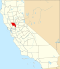 | |
| CDPs | ||
| Unincorporated communities | ||
| Ghost towns | ||
| International | |
|---|---|
| National | |
| Geographic | |
| Other | |
Davis, California
View on GrokipediaHistory
Founding and early settlement
The territory encompassing modern Davis was originally inhabited by the Patwin, a Southern Wintun-speaking people who occupied villages along Putah Creek and subsisted through acorn gathering, hunting, and trade for millennia prior to European contact.[8] [9] European exploration and settlement began in the mid-19th century following California's annexation from Mexico in 1848, with land grants issued under Mexican rule enabling initial ranching operations; notable among early grantees was William Wolfskill, who received a large tract in the 1840s that included portions of the future city site.[5] Davisville, the precursor to Davis, originated in 1868 with the establishment of a railroad station by the California Pacific Railroad on land formerly part of Jerome C. Davis's ranch, which the railroad had acquired in the 1860s amid Davis's financial difficulties.[5] [10] Jerome C. Davis, a farmer who had settled in the area after marrying into the Chiles family in 1850 and purchasing ranchland, lent his name to the new depot and burgeoning town, reflecting the railroad's pivotal role in catalyzing settlement by connecting the Sacramento Valley to broader markets for agricultural goods.[11] By late 1868, Davisville spanned 119 acres, boasted a voting population of approximately 400, featured around 200 houses, and exhibited boom-town characteristics including rapid construction and commercial activity tied to rail transport.[10] Early Davisville developed as a rail-dependent agricultural hub, with settlers drawn by fertile soils and proximity to transportation; the town's layout centered on the depot, fostering inns, stores, and saloons amid a landscape of wheat farming and stock raising, though challenges like flooding from Putah Creek periodically disrupted growth.[5] The post office shortened the name to Davis in 1907 to streamline operations, marking a transition from informal settlement to more structured community amid ongoing ranching expansion.[11]Establishment of the university
In 1905, the California State Legislature authorized the establishment of the University Farm, an agricultural branch of the University of California, to provide practical instruction in farming and related sciences as a complement to the more theoretical programs at the Berkeley campus.[12] On March 18, Governor George Pardee signed the enabling legislation, which appropriated funds for site selection and land acquisition amid competition from multiple Central Valley towns vying to host the facility.[13] The initial appropriation included $10,000 for investigating agricultural production, particularly wheat quality, underscoring the farm's focus on applied research and education to advance California's agrarian economy.[14] A state commission, chaired by figures including Sacramento judge Peter J. Shields, selected a 779-acre tract known as the Sparks-Devlin-Hamel property near Davisville (present-day Davis) as the site, purchasing it in 1906 for $104,250 with an additional $150,000 legislative allocation for development.[15] This location was chosen for its fertile soil, access to water from the Sacramento River, and proximity to experimental agricultural needs, marking the transition from planning to physical establishment.[13] Construction of initial facilities, such as barns and a creamery, began shortly thereafter under the oversight of UC Berkeley's College of Agriculture. The University Farm formally opened in 1908 as an extension for hands-on training, initially enrolling a small cohort of students transferred from Berkeley for specialized coursework in animal husbandry, crop management, and soil science.[16] The first graduating class emerged in 1911, validating the institution's early role in bridging academic theory with empirical farming practices.[12] This foundational phase positioned the farm as a key driver of regional agricultural innovation, though it remained administratively tied to Berkeley until later expansions.Mid-20th century expansion
Following World War II, Davis experienced accelerated population growth, rising from 3,557 residents in 1950 to 8,910 by 1960 and reaching 23,469 by 1970, a more than sixfold increase over two decades primarily fueled by the expansion of the University of California, Davis.[17][18] This surge reflected broader California trends in higher education enrollment post-war, including the effects of the G.I. Bill, which increased demand for agricultural and related programs at the institution then known as the University Farm.[19] The city's 1958 General Plan anticipated this trajectory, projecting population tripling every decade to accommodate university-related influxes of students, faculty, and staff.[20] The University of California, Davis, transitioned from a specialized agricultural extension of UC Berkeley to a comprehensive campus, with total enrollment growing from 1,121 students in 1940 (1,054 undergraduates and 67 graduates) to 7,723 by 1965 (5,901 undergraduates and 1,822 graduates).[18] Key milestones included the 1946 establishment of the School of Veterinary Medicine, which admitted its first class in 1948, and the 1951 creation of the College of Letters and Science, broadening offerings beyond agriculture.[18] In 1959, the UC Regents designated Davis a general campus, enabling diverse majors and graduate expansion, followed by the 1961 founding of the College of Engineering.[18] These developments, aligned with California's 1960 Master Plan for Higher Education, directly spurred housing demand, leading to post-1945 tract developments characteristic of California's suburban boom.[21] Municipal responses included annexations and infrastructure to support residential expansion, such as mid-1960s subdivisions like Covell Park in North Davis, which incorporated greenbelts amid rapid build-out.[22] By the late 1960s, Davis had surpassed Woodland as Yolo County's largest city, accounting for over 60% of county population growth, though this pace raised early concerns about preserving community character amid unchecked development.[23] Enrollment continued climbing to 18,370 by 1980 (13,262 undergraduates and 5,108 graduates), solidifying the university's role as the city's economic anchor.[18]Late 20th and early 21st century developments
During the late 20th century, Davis grappled with rapid population growth, expanding by 74.3% from 1970 to 1986, surpassing the pace of Yolo County overall.[24] This surge, driven largely by the expanding University of California, Davis, prompted resident surveys in 1971 revealing a preference for capping population below 40,000 by 1990, though actual growth exceeded such limits amid debates over sprawl.[25] In response, the city adopted policies emphasizing compact development, including the creation of greenbelts, open-space corridors, and trails to preserve agricultural land and mitigate urban expansion.[22] A landmark initiative was Measure J, enacted in the early 1990s, which mandated voter approval for any general plan amendments extending the urban growth boundary onto peripheral farmland, aiming to enforce slow-growth principles and protect the city's rural-urban interface.[26] This measure reflected broader community resistance to unchecked development, as evidenced by rejections of large peripheral housing projects in the 1990s. Concurrently, the Village Homes subdivision, developed between 1975 and 1983, exemplified early sustainable urban design with energy-efficient housing, shared green spaces, and pedestrian-oriented layouts, influencing subsequent local planning.[27] Bicycle infrastructure advanced significantly, building on the nation's first striped bike lanes installed in 1967; by the 1970s and 1980s, Davis expanded its network with dedicated paths, underpasses, and overpasses, fostering a modal share where bicycles outnumbered cars on many streets.[28] The city's finances shifted around 1990 from expansion-fueled surpluses to fiscal constraints, tying economic vitality more closely to university-related research, agriculture, and small-scale innovation rather than broad commercial booms.[23] Into the early 21st century, adherence to Measure J constrained housing supply amid rising university enrollment, while environmental commitments led to acquisitions of open space and the extension of greenway systems. UC Davis's growth in biotechnology and veterinary programs bolstered the local economy, though dependency on state funding exposed vulnerabilities during California's early 2000s budget crises.[29] These developments solidified Davis's identity as a university town prioritizing sustainability and quality of life over rapid urbanization.[22]Recent growth challenges (post-2010)
Davis experienced sluggish population growth post-2010, increasing by just 2% from 2010 to 2020, largely due to escalating home prices and curtailed new housing construction amid the city's entrenched slow-growth framework.[30] This stagnation contrasted with UC Davis enrollment expansions, which averaged 1.2% annually over the subsequent decade, intensifying demand for off-campus housing and straining local infrastructure.[31] The university's projected addition of nearly 11,000 students by 2030 further amplified these pressures, prompting city concerns over unmitigated spillover effects on municipal services and traffic.[32] Measure J, first enacted in 2000 and renewed by voters in 2020 with 83% approval, mandates public referenda for developments exceeding certain thresholds outside urban limits, effectively limiting peripheral expansion to preserve agricultural land and contain sprawl.[33] While intended to promote infill and sustainability, the policy has bottlenecked housing supply, exacerbating affordability issues and prompting reform debates, including potential amendments to expedite affordable projects amid state housing mandates.[34] Controversial initiatives like the Nishi Gateway project, approved by voters in June 2018 via Measure J (52% in favor), added over 2,000 residential units near campus but faced opposition over traffic, environmental impacts, and fidelity to growth controls.[35][36] To address university-driven demand, Davis and UC Davis forged a 2018 Memorandum of Understanding, obligating the university to accommodate 100% of net new enrollment growth with on-campus beds, a commitment met through accelerated construction exceeding initial timelines.[37][38] Between 2017 and 2023, combined city and campus efforts delivered housing for nearly 7,000 residents, including six university projects slated to add 2,800 beds by 2030.[39] These measures contributed to falling student apartment vacancy rates, reaching levels indicative of easing shortages by fall 2024, though broader affordability challenges for non-students persist due to historical underbuilding.[40]Geography
Location and physical setting
Davis is situated in Yolo County, within the Central Valley of northern California, approximately 11 miles (18 km) west of Sacramento, 72 miles (116 km) northeast of San Francisco, and 385 miles (620 km) north of Los Angeles. The city occupies the eastern portion of the Putah Creek Plain, a major feature of the southwestern Sacramento River Valley, encompassing 9.91 square miles of land. This setting places Davis amid the flat alluvial expanses of the Sacramento Valley, a region renowned for its fertile soils and agricultural productivity.[41] The topography is predominantly level, with a gentle slope of less than 1 percent, facilitating efficient drainage but posing risks of shallow sheet flooding from stormwater runoff, which is managed through three diversion channels and three detention basins. Elevations average 51 feet (16 m) above sea level, ranging from 60 feet (18 m) in western areas to 25 feet (8 m) in eastern sections, reflecting the subtle undulations of the valley floor formed by sedimentary deposits from ancient river systems. No active earthquake faults traverse the city, classifying it in Seismic Activity Intensity Zone II, indicative of low to moderate seismic hazard.[41] Surrounding the urban core are vast expanses of prime agricultural land, supporting crops such as rice, tomatoes, and almonds, while natural features include Putah Creek to the south and the Yolo Bypass Wildlife Area—a 2,500-acre floodplain habitat—to the east, part of the broader Sacramento River watershed. To the east rise the Sacramento and American Rivers, transitioning to the Sierra Nevada foothills and Lake Tahoe; westward extend the Coast Ranges toward the San Francisco Bay Area and Pacific Ocean; southward lies the Sacramento-San Joaquin Delta. Davis's position along the Pacific Flyway influences local ecology, drawing migratory waterfowl and supporting wetland conservation efforts amid the valley's engineered flood control infrastructure.[41][41]Climate and weather patterns
Davis, California, has a hot-summer Mediterranean climate classified as Köppen Csa, marked by warm to hot, dry summers and cool, wet winters with low seasonal temperature variation overall.[42][43] The city's position in the Sacramento Valley contributes to this pattern, with marine influences from the Pacific Ocean moderated by the Sierra Nevada, resulting in limited summer fog but occasional winter tule fog in the broader valley.[44] Summer temperatures from June to September typically reach average highs of 92–93°F in July, the peak month, with lows around 57–59°F; daytime highs occasionally exceed 100°F during heat waves, though nights cool sufficiently for relief.[45][46] Winters from December to February feature average highs of 55–60°F and lows near 37–40°F, with freezing temperatures occurring on only a few nights annually due to mild air masses.[44] Spring and fall serve as transition periods, with April and October averages bridging the extremes at highs of 70–75°F.[45] Precipitation averages 20 inches annually, concentrated in the rainy season from late October to early April, often as frontal systems bringing 2–4 inches monthly in peak winter months like December and January.[47] Summers are arid with negligible rainfall, less than 0.1 inches per month on average, fostering drought-prone conditions exacerbated by year-to-year variability influenced by Pacific oscillations.[44] Snowfall is rare, totaling under 1 inch yearly and typically melting quickly.[47] Extreme events include summer heat exceeding 105°F, as recorded in historical data from nearby stations, and winter storms capable of heavy downpours leading to localized flooding in the flat valley terrain.[48] Annual temperature ranges from record lows near 15°F to highs over 110°F, reflecting the region's exposure to both cold snaps and prolonged dry heat.[49] Climate records from the UC Davis/NOAA station indicate increasing variability in precipitation, with multi-year droughts followed by wet periods, consistent with broader California patterns.[50]Environmental and ecological features
Davis lies on a flat alluvial plain in the Sacramento Valley, characterized by low-relief topography typical of the Central Valley's agricultural landscape. This setting, formed by sediment deposition from the Sacramento River system, supports expansive grasslands and riparian zones but has undergone significant alteration due to farming and urbanization.[41] The region's hydrology features Putah Creek, which flows through the city and forms a critical riparian corridor. The UC Davis Putah Creek Riparian Reserve encompasses 640 acres of restored natural riparian and grassland ecosystems along the creek's southern edge, hosting valley oaks, northern California black walnut, arroyo willow, and narrow-leaf willow in its canopy. Restoration efforts since the 1990s have revived the creek from a degraded state, enabling the return of native species including juvenile Chinook salmon that migrate to the ocean and spawn as adults after 2-4 years. Wildlife monitoring over two decades has documented diverse fish and terrestrial species, underscoring the creek's role in local biodiversity.[51][52][53][54] Adjacent to Davis, the Yolo Bypass serves dual purposes as a flood control structure and wetland habitat, encompassing the 16,000-acre Yolo Bypass Wildlife Area with managed wetlands, uplands, and restored lands. This area, part of one of California's largest public-private restoration projects, provides essential stopover habitat for waterfowl along the Pacific Flyway, supporting migratory birds amid seasonal flooding. The city-operated Davis Wetlands, a 110-acre managed freshwater emergent wetland adjacent to the Bypass, includes oak riparian woodlands and native grasslands, enhancing regional ecosystem services like waterfowl habitat and stormwater management.[55][56][57] The UC Davis Arboretum and Public Garden spans over 5,300 acres, integrating demonstration gardens with native plantings and habitat enhancement practices such as weed control and ecological restoration. Adapted to the Mediterranean climate of hot, dry summers and mild, wet winters, the arboretum features collections of trees and plants that promote biodiversity and sustainable landscaping, including efforts to combat invasive species and foster resilient ecosystems. These initiatives, informed by university research, demonstrate models for integrating urban development with native habitats in an agriculturally dominated valley.[58][59][60]Demographics
Population growth and trends
The population of Davis, California, has exhibited steady but moderated growth since the mid-20th century, primarily driven by the expansion of the University of California, Davis, which attracts a large transient student population comprising a significant portion of residents.[61] As of the 2020 United States Census, Davis recorded 66,850 residents, reflecting a population density of approximately 6,704 inhabitants per square mile. U.S. Census Bureau estimates indicate a slight increase to 67,125 by July 1, 2024, representing a 0.4% growth from the 2020 base of 66,861.[62] Historical census data illustrate a pattern of incremental expansion tied to educational and agricultural economic anchors, with the population rising from 60,308 in 2000 to 65,622 in 2010—an 8.8% decade-over-decade increase—before slowing to 1.9% growth in the subsequent decade amid broader California housing constraints.[63] This deceleration aligns with state-level trends of net domestic out-migration due to elevated living costs, though Davis has outperformed many peers through university-related influxes.[64]| Year | Population | Percent Change from Prior Decade |
|---|---|---|
| 2000 | 60,308 | — |
| 2010 | 65,622 | +8.8% |
| 2020 | 66,850 | +1.9% |
Racial, ethnic, and socioeconomic composition
As of the 2022 American Community Survey (ACS) estimates, the racial composition of Davis includes 50.9% White (non-Hispanic), 23.9% Asian, 2.4% Black or African American, 0.9% American Indian and Alaska Native, 0.4% Native Hawaiian and Other Pacific Islander, 5.6% two or more races, and 3.7% some other race.[69] [61] The ethnic breakdown shows 15.2% of residents identifying as Hispanic or Latino of any race, with the remainder non-Hispanic.[69] This distribution reflects the demographic imprint of the University of California, Davis, which draws a disproportionate share of Asian students and faculty, particularly from East and South Asia, elevating the Asian population above state averages.[61] Socioeconomic composition in Davis exhibits bimodal characteristics driven by its university-centric economy: a core of highly educated professionals juxtaposed against a transient student population. Educational attainment is exceptionally high, with 72.5% of residents aged 25 and older holding a bachelor's degree or higher as of 2022 ACS data, far exceeding California's 36.0% statewide figure.[61] Median household income stood at $87,421 in 2023, with per capita income at $67,458, though the average household income reaches $127,802, indicating skewness from high-earning households among faculty and agribusiness executives.[68] [70] Poverty affects 25.1% of the population, a rate elevated relative to California's 12.2% average, primarily due to low-income students classified under federal thresholds despite access to scholarships, parental support, or part-time work; non-student households experience lower poverty around 10-15%.[68] Income inequality, measured by Gini coefficient, aligns with state norms at approximately 0.45, but the city's affluence concentrates in non-student segments, fostering a professional class dominant in tech, academia, and agriculture while minimizing traditional working-class presence.[61] Foreign-born residents comprise about 20%, correlating with higher education levels but variable income outcomes tied to visa statuses in university roles.[70]Income, education, and housing metrics
The median household income in Davis was $87,976 for the 2022-2023 period, while per capita income stood at $43,700 over the same timeframe. The poverty rate was 27.1%, elevated relative to national averages primarily due to the large transient student population at the University of California, Davis, which includes many individuals with minimal current earnings. Average persons per household numbered 2.45. Educational attainment among residents aged 25 and older is notably high, with 96.0% having graduated high school or attained a higher level of education, and 77.0% holding a bachelor's degree or above. This elevated profile aligns with the city's role as home to a major research university, attracting faculty, researchers, and graduates who contribute to professional and academic sectors. Housing metrics reflect a tight market influenced by limited supply and demand from university-affiliated residents. The median value of owner-occupied housing units was $786,200 in 2022-2023, with median gross rent at $1,897. The homeownership rate was 35.8%, compared to 64.2% renter-occupied units, underscoring the prevalence of rentals suited to students and short-term professionals.| Metric | Value (2022-2023) |
|---|---|
| Median Household Income | $87,976 |
| Per Capita Income | $43,700 |
| Poverty Rate | 27.1% |
| High School Graduate or Higher (25+) | 96.0% |
| Bachelor's Degree or Higher (25+) | 77.0% |
| Median Home Value (Owner-Occupied) | $786,200 |
| Median Gross Rent | $1,897 |
| Homeownership Rate | 35.8% |
Government and politics
Municipal government structure
The City of Davis employs a council-manager form of government, in which the elected city council sets policy and appoints a professional city manager to oversee administrative operations.[71] The city council consists of five members, each representing one of five geographic districts established for the 2020 elections to ensure district-based representation.[72][71] Council members serve staggered four-year terms, with elections held every two years in odd-numbered years for either two or three seats.[73][71] The council annually designates one of its members as mayor, who presides over meetings, performs ceremonial duties as the official head of the city, and represents the municipality in public capacities, but holds no additional administrative powers beyond those of other council members.[74] The council also selects a vice mayor to assume the mayor's duties in their absence.[74] As the legislative body, the council establishes goals, approves budgets, enacts ordinances, and provides oversight to city departments.[75] The city manager, appointed by and serving at the pleasure of the council, functions as the chief executive officer, directing all city departments, implementing council policies, managing the budget, and handling daily governance without direct election by voters.[76][77] This structure, adopted following the city's incorporation in 1917, aligns with general law provisions under California Government Code for council-manager municipalities.Electoral politics and voter leanings
Davis, California, consistently demonstrates strong Democratic leanings in electoral outcomes, reflecting the influence of its large population affiliated with the University of California, Davis, where faculty and staff political contributions heavily favor Democratic candidates and causes. In the 2020 presidential election, Yolo County voters, which includes Davis as its largest city, cast 69.5% of ballots for the Democratic nominee, compared to 28.1% for the Republican and 2.5% for others, continuing a pattern of Democratic victories in every presidential contest in the county since 2000.[78] Local elections for the Davis City Council are officially non-partisan, with five members elected by district to staggered four-year terms, but candidates frequently receive endorsements from the Yolo County Democratic Party and align with progressive policy priorities such as environmental protection and increased public spending. For instance, in the November 5, 2024, general municipal election, challenger Linda Deos, endorsed by the Yolo County Democratic Party, Sacramento Central Labor Council, and local firefighters, defeated incumbent Gloria Partida to win the District 2 seat with approximately 52% of the vote after all ballots were counted.[79][80] Voter support for tax measures further underscores these tendencies; Measure Q, proposing a 1% sales tax increase to fund public services including road maintenance and affordable housing, passed with 62.5% approval in the same 2024 election, while Measure T, extending a prior tax for similar purposes, also succeeded.[81][80] Individual campaign contributions from the Davis area between 2018 and 2021 reveal a stark partisan imbalance, with 29,675 donations totaling $2,357,521 directed to Democratic or liberal recipients (averaging $79 per contribution), versus 1,531 donations totaling $337,623 to Republicans or conservatives (averaging $221 per contribution), indicating broader community preferences skewed toward left-leaning causes despite the presence of agricultural interests in surrounding Yolo County that occasionally support Republican positions.[78] This pattern aligns with statewide trends among University of California employees, where donations during the 2018 cycle favored Democratic congressional candidates by a margin of $3,437,446 to $78,727.[82]Key policies and their outcomes
One of the defining policies in Davis is Measure J, adopted by voters in March 2000 and renewed in 2020 with approximately 83% approval, which requires public referenda for General Plan amendments expanding the urban boundary onto agricultural land for residential, commercial, or industrial development exceeding specified annual limits. This policy aims to preserve farmland and control sprawl but has constrained housing supply, contributing to Davis's median home price exceeding $800,000 as of 2023 and a persistent shortage of units relative to population growth driven by UC Davis enrollment. Amendments are under discussion as of October 2025 to exempt affordable housing projects or environmental mitigation efforts, amid state pressures to address California's housing crisis, though proponents argue it maintains community character while critics, including local analyses, contend it inflates costs without proportionally protecting open space given infill development alternatives.[83][33][84] Davis's bicycle transportation policies, originating with the 1963 Bicycle Transportation Plan—the first in the United States—and reinforced by ongoing Bike Master Plans, prioritize extensive bike lanes, paths, and low-stress networks to reduce car dependency. These have fostered a culture where bicycling accounts for about 20% of work commutes as of recent data, with Davis ranking among the safest U.S. cities for cyclists due to infrastructure separating bikes from high-speed traffic. However, mode share has declined from a peak of 28% in 1980, attributed to rising e-bike and scooter use straining mixed-use paths, increased pedestrian conflicts, and competition from ride-sharing, prompting evaluations for enhanced enforcement and separated facilities.[85][86][87] The city's 2020 Climate Action and Adaptation Plan (CAAP) sets targets for carbon neutrality by 2040 through measures like electrifying fleets, expanding renewables, and zero-waste initiatives, building on earlier sustainability efforts tied to UC Davis's influence. Implementation has yielded mixed results: municipal greenhouse gas emissions assessments show progress toward reduction goals, with waste diversion rates reaching 65-72% in aligned university operations by 2022, but city-wide data indicate challenges in scaling building retrofits and transportation electrification amid budget constraints. A 2019 climate emergency declaration spurred mobilization, yet evaluations highlight reliance on grants and partnerships rather than standalone fiscal commitments, with adaptation for heat and drought events still in early phases as of 2025.[88][89][90] ![Bicyclists in Davis, illustrating policy impacts on transportation][float-right] Davisbikes.jpg Partnerships with UC Davis under a 2018 memorandum of understanding have addressed student housing demands, resulting in construction covering 100% of enrollment growth since then and exceeding timeline targets for on-campus units. This has alleviated some pressure on local rentals but underscores broader policy tensions, as peripheral development remains voter-gated, limiting supply responses to market signals.[38]Economy
Economic overview and drivers
The economy of Davis, California, is predominantly driven by the University of California, Davis (UC Davis), which employs over 25,000 people and generates an annual economic impact exceeding $13 billion statewide, with approximately $9.57 billion benefiting the Sacramento metropolitan area including Davis.[91] This impact stems from university operations, research expenditures totaling $961 million in external funding for fiscal year 2024-25, student spending, and construction activities that supported 9,043 jobs and $1.54 billion in induced economic activity.[92][93] Secondary drivers include agriculture and agribusiness in Yolo County, where Davis is located, with the region featuring heavy concentrations in food and beverage manufacturing that process local commodities like rice, tomatoes, and wine grapes into value-added products.[94] Local employment reflects these anchors, with UC Davis as the top employer, followed by the Davis Joint Unified School District (over 1,100 employees), Sutter Davis Hospital (around 500), and municipal government operations.[95] The service sector, bolstered by a transient student population of roughly 40,000, sustains retail, hospitality, and professional services, though the city's Measure J growth limits have constrained commercial expansion and diversified job creation. In 2023, the median household income stood at $87,421, reflecting a mix of high-earning university-affiliated professionals and lower-income student households, while the unemployment rate hovered around 5.2% amid seasonal fluctuations tied to academic cycles.[61][96] Emerging economic activity includes biotechnology and innovation spin-offs from UC Davis research, contributing to the university's role in fostering startups and patents, though these remain subordinate to core educational and agricultural influences. Yolo County's agricultural output, valued at billions regionally, indirectly bolsters Davis through supply chains and farm-related services, but urban land use policies prioritize preservation over industrial scaling, limiting agribusiness intensification within city limits.[4] Overall, Davis exhibits low volatility in economic metrics due to the stabilizing presence of public institutions, with growth tied more to enrollment trends and state funding than private sector dynamism.[97]Role of UC Davis
The University of California, Davis (UC Davis), established in 1905 as a public land-grant institution focused on agricultural and environmental sciences, dominates the economy of Davis as its largest employer and central driver of growth. The campus hosts approximately 41,239 students in fall 2024, with 32,273 undergraduates, generating sustained demand for local housing, retail, dining, and transportation services through student expenditures estimated in the hundreds of millions annually as part of broader university-induced activity.[98][99] UC Davis directly employs thousands of faculty, staff, and administrators on its Davis campus, contributing to a regional economic footprint that includes Davis within the Sacramento metro area, where university operations support $9.57 billion in annual impact and 61,700 jobs.[91] Research activities at UC Davis further bolster the local economy, with $961 million in external funding awards for fiscal year 2025 fueling advancements in agriculture, veterinary medicine, and biotechnology—fields that align closely with Yolo County's agribusiness sector. This funding sustains nearly 10,000 research-related jobs statewide and generates $2 billion in associated economic activity, much of which cascades to Davis through procurement, collaborations, and innovation spillovers benefiting nearby farms and startups.[92] As a land-grant university, UC Davis provides extension services that deliver practical research to local producers, enhancing crop yields, pest management, and sustainable practices critical to the region's $3.7 billion annual agricultural output.[100] Campus construction and development, such as the $836 million in Davis-specific spending, create additional short-term boosts, yielding $1.54 billion in impact and 9,043 jobs through multiplier effects on suppliers and labor. Overall, UC Davis accounts for a disproportionate share of Davis's economic vitality, with institutional spending and visitor activity prompting expansions in service-oriented businesses while tying the city's prosperity to fluctuations in enrollment, funding, and state budgets.[99][101]