Hubbry Logo
MapunMapunMain
Open search
Mapun
Community hub
Mapun
logo
8 pages, 0 posts
0 subscribers
Be the first to start a discussion here.
Mapun
Mapun
from Wikipedia

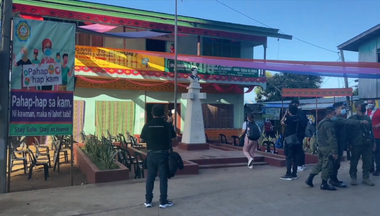
Mapun, officially the Municipality of Mapun (Tagalog: Bayan ng Mapun), is a municipality in the province of Tawi-Tawi, Philippines. According to the 2020 census, it has a population of 30,038 people.[6]

Key Information

It was formerly known as Cagayan de Sulu until 1984, then as Cagayan de Tawi-Tawi until 1988.

Mapun is an island municipality in the Sulu Sea[7] on the south-western extreme of the Philippines, located very close to Sabah, Malaysia as well as to Palawan. The people inhabiting the island are known as Jama Mapun or "people of Mapun". Their local language is Pullun Mapun, which means "Mapun language".

Due to an administrative error in the Treaty of Paris, while the remainder of the Philippines was ceded to the United States, Sibutu and Cagayan de Sulu were retained under Spanish Sovereignty until they were formally ceded to the United States upon the ratification of the Treaty of Washington on March 23, 1901. In 1946, the Philippines became an independent country, including Mapun island as part of it.

History

[edit]

Colonial period

[edit]

Cagayan de Sulu was among the islands in the Sulu Archipelago being occupied by the Samal people (Sama-Bajau) in the late 18th and early 19th century. The island likewise had a smaller Tausug population than Palawan.[8]

Sulu Sultanate at the growing external trade (Late 1700s–early 1800s)

[edit]

In 1783, an East India Company ship, the Antelope, spent a month trading among Cagayan de Sulu and the Tapian Tana islands.[8]

Internal trade

[edit]

Cagayan de Sulu was among the traditional sources of rice and sago. In the 1790s, rice was extensively cultivated for export. The products once supplied the Tausugs in Sulu.[8]

Challenges in the external trade and its aftermath

[edit]

In 1872, as Spanish authorities began conquering Jolo, they issued a regulation aiming to destroy all Tausug shipping, in a move to reduce their trading activities to a mere submission. Despite this, a usual number of prahus (trading boats) from southern Palawan and Cagayan de Sulu continued to go to the British settlement.[8]

Haji Mansur, a powerful aristocrat, was one of the leading traders bringing precious cargoes to Labuan. He was later attacked by the Spanish. He had returned to Labuan from a pilgrimage in Mecca in July 1875, and left for Cagayan de Sulu. While their prahus were on its way from southern Palawan to Zamboanga, they had an encounter with Spanish vessel Santa Lucia; after which, he was the only one at least (or amomg the few) in his family who survived.[8]

The Tausugs in Sulu were affected by the blockade which severed their access to Cagayan de Sulu, resulting in their insufficient rice supply, despite reports that peace was later maintained in the Sulu Archipelago and people turned to labor and agriculture.[8]

American colonial period

[edit]

Following the 1898 Treaty of Paris, the first treaty between the United States and Spain, the former later adjusted the borders of the Philippine territory.[9][10] Later, it was reportedly discovered that some islands were outside the defined boundary.[10] The second treaty on November 7, 1900,[10] included the outlying islands of Cagayan de Sulu and Sibutu and their dependencies, in the territory,[9] situated in the southwest, both of the archipelago[10] and of the Sulu Sea.[11]

American documents stated that what was then called the Cagayan Sulu group was a dependency of the Sultan of Sulu and included the island of Cagayan Sulu, the two Muligi islands to the south, and seven others to the north. Cagayan Sulu, the largest, is bounded by a coral reef except at the steep northwest and southeast parts. There are ranges of hills on the east side. It was then only inhabited and thinly populated. While the soil and climate are favorable to vegetation and the cultivation of tobacco, hemp palm, and various crops, fruits, and vegetables; the natives depended mainly for the abundance of fishes and rice imported from Palawan, being exchanged with coconuts and its oil. Meanwhile, the smaller ones were for turtle catching and other temporary uses.[11]

Throughout American-rule in the Philippines, Cagayan de Sulu was never organized as a regular municipality of the Moro Province's Sulu District despite having authorization by the legislative council, thus it once had its own tribal ward government. At the time, it had the villages of Jurata and Imus.[12]

The first American resident governor of Cagayan de Sulu was Guy Stratton, a former American army officer from Kansas. He lived on the island for nearly two decades, during which he brought the three districts and allied villages under a single municipal authority. He later established an administrative center at the present-day poblacion, Lupa Pula, at a new anchorage. With a new municipal administrative structure, Datu Amilhanja was appointed mayor (1911–1914), directly under a resident deputy governor.[13]

Japanese occupation

[edit]

During the Japanese period, Salip Hatari of Awang was the de facto ruler (1943–1945) of the island with the help of the Japanese from Borneo, as part of revenge against Stratton, who had been subduing the salip in the early phase of the American pacification.[13]

Contemporary

[edit]

In the final decades as part of Sulu

[edit]

By virtue of Executive Order No. 355, signed by President Carlos P. Garcia on August 26, 1959, Cagayan de Sulu was among the twenty of 21 remaining municipal districts of then-undivided Sulu which were converted into municipalities effective July 1, 1958.[14] The first election was held in 1959 where Lim Eng, a part-Chinese commoner, won as mayor. First appointed in 1954, he served until 1967.[13]

At that time, Cagayan de Sulu, being called Tana Mapun in the Pelun Mapun language, had been inhabited by Jama Mapun (literally, "People of Mapun") which are Muslim Filipinos like the Tausugs and Samals. It was in June 1963 when lunsay, their popular pre-Islamic traditional community dance, was documented following a performance in Barrio Duhul Batu.[15]

As part of Tawi-Tawi and later developments

[edit]

After the municipality became part of Tawi-Tawi, its name was further changed twice; from Cagayan de Sulu to Cagayan de Tawi-Tawi through Batas Pambansa Blg. 647 on March 7, 1984;[16] and eventually to its present name, Mapun, through Republic Act No. 6672 on September 5, 1988.[17]

Mapun Island, located near the Philippine–Malaysian border, is inside the Sandakan Basin which is said to be rich in oil and natural gas. On the Philippine side, there have been joint explorations since as early as 2004 off the island, resulting in the discovery of oil within a decade. The waters alone, reportedly, have an estimated reserve of about 500 billion barrels of oil.[18][19]

Mapun, along with the Turtle Islands—both now among the three main island groups in the province—serve as places of interest for traders bound for northern Borneo, particularly Sabah, and Labuan.[20]

Geography

[edit]

Mapun Tawi-Tawi is surrounded by several islets such as:

  • Manda
  • Boan
  • Kinapusan
  • Pamilikan
  • Lapun-Lapun
  • Bintuut
  • Muligi

Most of these are located at Barangay Umus Mataha.

Barangays

[edit]

Mapun is politically subdivided into 15 barangays. Each barangay consists of puroks while some have sitios.

  • Boki
  • Duhul Batu
  • Guppah
  • Iruk-Iruk
  • Kompang
  • Liyubud (Poblacion)
  • Lubbak Parang
  • Lupa Pula
  • Mahalu
  • Pawan
  • Sapah
  • Sikub
  • Tabulian
  • Tanduan
  • Umus Mataha

Climate

[edit]
Climate data for Mapun, Tawi-Tawi
Month Jan Feb Mar Apr May Jun Jul Aug Sep Oct Nov Dec Year
Mean daily maximum °C (°F) 28
(82)
28
(82)
29
(84)
31
(88)
31
(88)
31
(88)
30
(86)
31
(88)
30
(86)
30
(86)
29
(84)
28
(82)
30
(85)
Mean daily minimum °C (°F) 24
(75)
23
(73)
23
(73)
24
(75)
24
(75)
25
(77)
24
(75)
25
(77)
24
(75)
24
(75)
24
(75)
24
(75)
24
(75)
Average precipitation mm (inches) 123
(4.8)
81
(3.2)
79
(3.1)
48
(1.9)
65
(2.6)
65
(2.6)
68
(2.7)
64
(2.5)
66
(2.6)
100
(3.9)
101
(4.0)
134
(5.3)
994
(39.2)
Average rainy days 17.7 14.5 16.1 14.9 22.7 24.3 25.7 25.4 23.8 25.7 22.9 20.8 254.5
Source: Meteoblue[21]

Demographics

[edit]
Population census of Mapun
YearPop.±% p.a.
1903 2,000—    
1918 6,090+7.71%
1939 6,851+0.56%
1948 8,824+2.85%
1960 10,789+1.69%
1970 12,577+1.54%
1975 15,892+4.80%
1980 19,607+4.29%
1990 19,372−0.12%
1995 20,716+1.26%
2000 22,011+1.31%
2007 29,801+4.27%
2010 24,168−7.34%
2015 26,597+1.84%
2020 30,038+2.59%
2024 29,218−0.66%
Source: Philippine Statistics Authority[22][23][24][25][26]

Education

[edit]
The Jama Mapun people's indigenous cosmology is extremely vast. Examples of figures in their cosmology are Niyu-niyu (coconut palm), Lumba-lumba (dolphin), and Anak Datu (two sons of a datu spearing another figure, Bunta - a blowfish).[27]
Elementary
  • Lupa Pula Pilot School (formerly Lupa Pula Central School) - elementary pupils are primarily from Lupa Pula, Liyubud, and Mahalu.
  • Mahalu Elementary School
  • Duhul Batu Elementary School
  • Sikub Elementary School
  • Surong Baiddin Memorial Elementary School
  • Sapah Elementary School
  • Boki Elementary School
  • Kompang Elementary School
  • Tanduan Elementary School
  • Pawan Elementary School
  • Guppah Elementary School
  • Iruk-Iruk Elementary School
  • Umus Mataha Elementary School
  • Lubbak Parang Elementary School
  • Imam Saat Elementary School
Secondary
  • Notre Dame of Cagayan (NDC) - a private school located in the border of Barangay Lupa Pula and Barangay Mahalu.
  • Mindanao State University (MSU) - a public school located in Mahalu
  • Tawi-Tawi Academy (TTA) - a private school located in Barangay Guppah
  • Mapun SHS
Tertiary

Mindanao State University Extension - a public school and the only college institution in Mapun. MSU-Extension offers two-year courses.

Majority of those who graduate from high school pursue their studies in other places, most notably Zamboanga City, Palawan, and Bongao. On the other hand, most of the graduates from elementary and high school are forced to stop their studies due to poverty lack of scholarships from the government. Most of them have found a job in neighboring country like Malaysia. Tend to work as a construction workers and fisherman.

Culture

[edit]

Mapun Day

[edit]

Mapun Foundation Day is celebrated by the Jama Mapun every September 5. This week-long celebration starts on September 1, with a parade and then a short program held in Lupa Pula Central School.

Various competitions are held during Mapun Day, which includes singing competitions (in English, Tausug, and Pullun Mapun), dance showdowns (modern dance, folk dance, pangalay, which is a native dance, and lunsay, which is a dance performed during weddings), Azaan competition, Tarasul iban Daman (Mapun's version of declamation and oration), and Leleng, to name a few.

Each Barangay has their own representatives in the various events. However, the most popular is the "Budjang Mapun", which is a beauty contest. Each barangay has its own contestant in this event. The winner of the search for "Budjang Mapun" is usually sent to Bongao as Mapun's representative in Budjang Tawi-Tawi, a similar beauty search held in Bongao every Province Day. Every municipality in Tawi-Tawi has its own contestant.

Economy

[edit]

Poverty Incidence of Mapun

10
20
30
40
50
60
70
2000
61.00
2003
48.92
2006
46.20
2009
35.19
2012
30.57
2015
27.63
2018
18.81
2021
38.18

Source: Philippine Statistics Authority[28][29][30][31][32][33][34][35]

Main source of income from this province are farming and fishing. In a bid to advance competitiveness of Tawi-Tawi in farming industry, this province supplies large companies when it comes on coconut plantation mainly "COPRA". 80% of the land consist of coconut trees, quarterly harvested and to be traded and refined in other places, like Palawan and Zamboanga City.

Rice fields are not known in this area due to lack of water irrigation projects, rice is imported locally from Palawan and Zamboanga City and mostly from Malaysia. Most of the locals use cassava as base on their daily meal.

See also

[edit]

References

[edit]
[edit]
Revisions and contributorsEdit on WikipediaRead on Wikipedia
from Grokipedia

Mapun, officially the , is a coastal island municipality in the province of within the Autonomous Region in Muslim Mindanao, .
Located on de Sulu Island in the at approximately 6°59′N 118°31′E, it is positioned near the maritime boundary with , , to the south and the Peninsula to the northwest, making it one of the province's most remote municipalities.
As of the 2020 , Mapun has a of 30,038 people across 15 barangays, with a land area of 181.29 square kilometers yielding a density of about 170 persons per square kilometer.
The inhabitants, known as the Jama Mapun—a subgroup of the Sama ethnolinguistic family—derive the municipality's name from local dialect terms connoting forgiveness, reflecting cultural ties to the historical Sultanate.
Originally part of the Sulu Sultanate and later designated Cagayan de Sulu, it was renamed Cagayan de Tawi-Tawi in 1973 and restored to Mapun via Republic Act No. 6672 in 1988, emphasizing its indigenous identity.
The economy centers on and , supported by its surroundings and coastal geography, while the area holds historical significance as a site linked to early European explorations in the region.

History

Pre-colonial and Sulu Sultanate era

The island of Mapun, located in the , was inhabited by related groups, known locally as Jama Mapun, who established settlements leveraging its marine environment for fishing, boat-building, and early exchange networks. These maritime-oriented peoples, part of the broader Samal ethnolinguistic cluster, occupied the low-lying island and surrounding reefs, utilizing coral lagoons for resource extraction and as bases for seasonal voyages across the . Linguistic evidence, including the Mapun language's classification within the Sama-Bajaw branch, indicates roots traceable to proto-Malayo-Polynesian migrations, with cultural adaptations to sea nomadism predating formalized polities. Mapun's position along ancient intra-Asian sea lanes positioned it as a node in pre-sultanate , where local groups bartered marine goods like pearls, mother-of-pearl shells, and dried cucumbers (trepang) with Bornean and Mindanaon intermediaries, fostering economic interdependence without centralized authority. Archaeological surveys in , encompassing Mapun's vicinity, reveal artifacts such as earthenware pottery and iron tools suggestive of sustained coastal commerce from at least the 10th-14th centuries, aligning with oral traditions of ancestral seafaring clans. This era featured fluid social structures dominated by kinship-based datus, who coordinated raids and exchanges, though hierarchies were pragmatic responses to ecological pressures rather than expansive empires. By the late 18th century, Mapun integrated more firmly into the Sulu Sultanate's domain, established circa 1450 and extending over principalities by 1465, where it contributed to the sultanate's expanded maritime economy amid rising Chinese demand for luxury marine products. Sultanate oversight involved tribute extraction and protection rackets, with Mapun's fisheries supplying pearls—harvested via free-diving—and trepang, processed through drying techniques yielding high-value exports to markets in China and . intensified post-1768, as captives from Visayan and coastal incursions provided labor for these industries, comprising up to 20-30% of the sultanate's population by the early and underpinning volumes that peaked with annual pearl bank yields exceeding thousands of carats. This , documented in sultanate records and European observations, reflected causal dependencies on coerced labor for scalability, without evidence of equitable distribution.

Colonial period

The Spanish colonial administration maintained nominal oversight of Mapun, known as Cagayan de Sulu, as an extension of the province within the from the onward. Effective governance was constrained by the Sulu Sultanate's autonomy and persistent Moro resistance, which included raids and piracy that challenged Spanish maritime trade routes in the . Following the Spanish-American War, the 1898 Treaty of Paris transferred Philippine sovereignty, including the , to the , though the 1899 Kiram-Bates Treaty initially affirmed the Sulu Sultan's authority over core territories. A clarifying agreement on November 7, 1900, explicitly incorporated outlying islands such as Cagayan de Sulu and Sibutu under direct U.S. control, resolving prior ambiguities and enabling formal administration within the Department of Mindanao and Sulu (later in 1903). American policies prioritized eradicating Moro piracy through naval patrols and military expeditions, alongside infrastructure initiatives like roads and constabulary outposts to enforce taxation and integrate local economies into colonial networks. Japanese Imperial forces occupied , encompassing Mapun, from early 1942 as part of their southern campaign, leveraging the islands' strategic position for naval anchorages near oil fields and resource extraction to fuel the war machine. Local resistance manifested through guerrilla units organized under figures like Sultan Jainal Abirin, involving sabotage and intelligence efforts that disrupted Japanese operations amid widespread destruction of settlements and agriculture. U.S. forces, including elements of the 41st Infantry Division, liberated the area by , securing Tawi-Tawi islands like Sanga Sanga in coordinated assaults.

Post-independence integration and conflicts

The administrative renaming of the reflected broader Philippine efforts to integrate peripheral Muslim-majority areas into the national polity following in 1946, amid persistent Moro resistance to centralized rule. Originally designated Cagayan de Sulu under Sulu province, it was renamed Cagayan de Tawi-Tawi through Batas Pambansa Blg. 647, enacted on March 7, 1984, coinciding with the formal separation of province to streamline governance and address local administrative needs. This change aligned with post-martial law attempts, though it initially retained a colonial-era . In 1988, Act No. 6672, approved on September 5, further renamed it Mapun, reverting to the indigenous Jama Mapun term for the island and signaling nominal acknowledgment of ethnolinguistic identity within the structure. These shifts occurred against a backdrop of national integration policies, including land reforms and infrastructure pushes, which often clashed with local sultanate legacies and customary laws. Mapun's post-independence trajectory intertwined with the (MNLF) insurgency, launched in 1972 to demand or for territories, drawing in despite its relative geographic isolation. MNLF forces, active across the , conducted raids and ambushes spilling over from province, with government counteroperations under (1972–1981) escalating tensions; by the mid-1970s, over 10,000 combatants clashed in the region, displacing communities and disrupting trade routes critical to Mapun's fishing economy. The (MILF), formed as an MNLF splinter in 1977 over ideological disputes regarding the secular Tripoli Agreement of 1976, extended operations to , fostering low-level guerrilla activities and clan-based vigilantism that compounded insecurity. Violence metrics from the era indicate recorded fewer direct engagements than or mainland —approximately 200–300 conflict-related incidents province-wide between 1972 and 1986—but spillover effects included kidnappings and extortion, eroding trust in Manila's claims. Autonomy concessions, such as the 1976 Tripoli Accord's promise of regional self-rule, yielded partial implementation via the 1987 Constitution's provisions for an (ARMM, established 1989), yet empirical outcomes revealed governance shortfalls: per capita income in lagged national averages by over 50% through the , with separatist factions critiquing unfulfilled resource control as perpetuating marginalization. Analysts attribute exacerbated underdevelopment not merely to state neglect but to insurgent ideologies prioritizing armed struggle, which diverted and aid—estimated at millions in lost —toward conflict sustainment rather than economic diversification, as rido (clan feuds) intertwined with ideological warfare. This dynamic underscored causal links between failed integration and instability, where promises of clashed with realities of fragmented authority, hindering Mapun's alignment with Philippine developmental frameworks.

Contemporary developments

In the late 20th century, Mapun, formerly known as de Sulu, underwent administrative renaming and stabilization within the newly formed province, established on September 11, 1973, via Presidential Decree No. 302, which separated it from province. The municipality's name evolved to Cagayan de in 1984 and finally to Mapun in 1988, reflecting efforts to assert distinct local identity amid broader regional autonomy pushes. These changes coincided with post-martial law efforts to integrate remote island communities, though persistent geographic isolation—Mapun lies approximately 40 kilometers from , , closer to than to 's capital —continued to hinder connectivity and economic integration. The establishment of the Autonomous Region in Muslim Mindanao (BARMM) in 2019 incorporated , including Mapun, into a framework aimed at enhanced and development funding. figures reflect modest growth, reaching 30,038 residents in the 2020 , up from prior decades but constrained by and limited opportunities. Infrastructure initiatives under BARMM have included road constructions, such as the 1-kilometer Tabulian-Kompang Road completed in 2023 at a cost of PHP 30 million and the Tong Pawan road in Barangay Iruk-Iruk in 2024, alongside allocations for 50 resettlement housing units in Mapun to address displacement from natural hazards. However, cross-border proximity to exacerbates challenges like illegal migration and , complicating enforcement and straining local resources without proportional federal investment. BARMM's impact on stability and in areas like Mapun remains limited, with high poverty incidence persisting due to entrenched , factional politics, and underinvestment in remote locales, as evidenced by the region's inheritance of (ARMM) governance failures that diverted funds from essential services. Official data indicate BARMM's overall poverty rate hovered around 60% in recent assessments, with facing exacerbated vulnerabilities from events like the 2024 El Niño drought, underscoring inadequate adaptive infrastructure despite autonomy promises. These factors have yielded measurable underdevelopment, including delayed healthcare access and stalled economic diversification, prioritizing over broad-based gains.

Geography

Location and physical features

Mapun is an island municipality situated in the southwestern portion of province within the Bangsamoro Autonomous Region in Muslim Mindanao, , positioned in the at the western extremity of the peninsula. Its municipal center lies on Cagayan de Sulu Island at coordinates approximately 6°59′N 118°31′E, with an estimated elevation of 6.7 meters above mean . The encompasses a land area of 181.29 square kilometers, constituting about 5% of Tawi-Tawi's total land area, and features predominantly coastal terrain characteristic of low-lying islands in the region. Surrounded by the , Mapun borders marine environments that include fringing coral reefs, supporting diverse ecosystems but exposing the area to environmental stresses from maritime activities. Geographically isolated from mainland , Mapun maintains close proximity to , , to its south—facilitating cross-border trade while complicating security due to the short sea distances involved in potential smuggling and incursions—and to in the northwest. This strategic position in the heightens vulnerability to maritime threats, including historically prevalent in the area, given the limited natural barriers beyond its coastal and reef features. Adjacent marine zones link to the Turtle Islands Wildlife Sanctuary, emphasizing the interconnected coastal and reef systems that define the locality's physical landscape.

Administrative divisions

Mapun is administratively subdivided into 15 barangays, the smallest units in the , which handle basic services such as public safety, , and community dispute resolution. These divisions facilitate decentralized governance within the Autonomous Region in Muslim Mindanao (BARMM), enabling localized management of resources like fisheries in coastal barangays, though oversight remains under the municipal mayor and provincial authorities. The 2020 recorded a total of 30,038 across these , with densities varying due to the island's terrain and settlement patterns concentrated near shorelines. Lupa Pula and Liyubud emerged as the most populous, reflecting central economic hubs, while others like Tabulian and Tanduan support smaller, more remote communities.
BarangayPopulation (2020)
Boki2,262
Duhul Batu1,634
Erok-erok2,149
Guppah2,253
Kompang1,206
Liyubud3,362
Lubbak Parang1,208
Lupa Pula3,394
2,517
Pawan1,514
Sapa1,812
Sikub1,542
Tabulian1,219
Tanduan1,348
Umus Mataha2,618

Climate and natural environment

Mapun features a tropical monsoon climate (Köppen classification Am), with consistently high temperatures averaging 26–32°C throughout the year and relative humidity often exceeding 80%. Rainfall is seasonal, driven by southwest monsoon winds from May to October, delivering the bulk of annual precipitation estimated at approximately 1,500–2,000 mm, while drier conditions prevail from November to April under northeast trades. The region lies outside the primary Philippine typhoon belt, experiencing infrequent direct hits but occasional indirect effects from distant storms, such as enhanced rainfall or storm surges. The island's natural environment consists of low-lying terrain, encompassing 67 square km of land surrounded by coral reefs, 13 islets, and coastal lagoons like Jurata Bay, a saltwater supporting diverse aquatic habitats. Marine biodiversity is notable, with ecosystems hosting reef fish, seagrasses, and mangroves, though empirical assessments highlight vulnerabilities from climate variability, including erratic rainfall patterns that exacerbate on thin, limestone-derived soils. These conditions constrain dry-rice cultivation, limiting yields to rain-fed systems with productivity below 2 tons per hectare due to prolonged dry spells and nutrient-poor substrates, thereby restricting agricultural diversification and perpetuating economic dependence on coconut and fisheries. Sustainability challenges include threats from sea-level rise, projected to inundate low-elevation coastal zones at rates of 3–7 mm annually in the region, compounding habitat loss in mangroves and reefs. Illegal, unreported, and unregulated (IUU) fishing further depletes stocks, with studies in adjacent areas documenting persistent use of destructive methods like , reducing fish by up to 50% in unprotected zones and undermining local livelihoods tied to . These pressures causally limit economic resilience, as overexploited fisheries and climate-induced agricultural shortfalls hinder income stability without adaptive interventions like enforced marine protected areas.

Demographics

Population statistics

According to the 2020 of Population and Housing conducted by the , Mapun had a total of 30,038 persons. This figure represented a 12.9% increase from the 26,597 residents recorded in the 2015 census, reflecting an average annual growth rate of approximately 2.5%. The stood at 170 persons per square kilometer, based on the municipality's land area of roughly 177 square kilometers. The demographic profile indicates sustained growth driven by high fertility, with the 2015 census reporting an average household size of 6.01 persons across 4,426 households. Population distribution favors coastal barangays, where settlements cluster due to geographic constraints, with earlier data suggesting over 80% of households in rural areas outside the poblacion center. Applying the recent growth rate, projections estimate the population reaching around 34,000 by 2025, though official updates remain pending.

Ethnic composition and language

The ethnic composition of Mapun is overwhelmingly dominated by the Jama Mapun, a subgroup of the broader peoples indigenous to the island and recognized as its native inhabitants. These Sama-speaking people form the core population, with smaller numbers of other groups such as Sama-Badjao, Tausug from , Yakan from , and limited migrants from and . This homogeneity stems from the island's remote maritime location, which has historically limited external influx and fostered endogamous practices within the Jama Mapun community, preserving distinct social boundaries despite partial integration into Philippine national structures. The primary is Pullun Mapun (also known as Mapun), an Austronesian within the Sama-Bajaw , spoken as a by approximately 53,000 individuals, primarily the Jama Mapun ethnic community. It exhibits with other Sama dialects, such as those spoken in nearby and areas, facilitating regional communication among related maritime groups. However, the lacks widespread and is not formally taught in schools, which constrains rates and educational access for native speakers, reinforcing linguistic insularity alongside the group's cultural practices.

Religion and social structure

The Jama Mapun of Mapun municipality predominantly adhere to , with adherence rates approaching universality in this isolated enclave, where non-Muslim populations are negligible. This faith, integrated since the Sulu Sultanate era (circa 15th-19th centuries), emphasizes orthodox practices reinforced by ties to the sultanate's prestige system, including the emergence of hadjis (pilgrims to ) as a modern status marker alongside traditional . Folk-Islamic persists in rituals, blending pre-Islamic animist elements with Qur'anic tenets, yet core —evident in prohibitions on interfaith unions and emphasis on communal piety—maintains social boundaries amid external pressures like American colonial reforms post-1900. Social organization centers on patrilineal , stratified into nobles (datus and salip, comprising about 10% of the ), commoners (tao marayao), and formerly enslaved ata (abolished after 1900). Datus, as heads, historically directed district-level alliances and mediated inter- disputes, with patrilineal ensuring noble titles passed through male lines, often via endogamous marriages between datu and salip lineages to preserve sacred descent from the Prophet Muhammad. These structures foster tight-knit loyalties, shaping through networks rather than state mechanisms, as seen in persistent rido (clan feuds) that erupt over resources or honor, drawing in extended families and complicating pacification efforts, such as U.S. interventions in the early . Intermarriage rates with non-Muslims remain exceedingly low, constrained by Islamic jurisprudence prohibiting such unions for Muslim women and discouraging them for men without conversion, thereby reinforcing ethnic-religious endogamy in a region where Moro groups exhibit high odds ratios against out-marriage (e.g., over 5,000:1 in broader Muslim Mindanao contexts). This insularity, coupled with clan-centric governance, sustains separatism; while external influences like municipal elections (post-1911) have diluted datu authority—shifting mayoral roles from nobles (7 of 14 pre-1971) to commoners—kin-based feuding and conservative Islamic norms prioritize parochial ties, hindering broader economic diversification and national integration by perpetuating cycles of localized conflict over meritocratic or institutional advancement.

Government and administration

Local governance structure

Mapun operates under the framework of the Local Government Code of 1991 (Republic Act No. 7160), which establishes a municipal government headed by an elected serving as the chief executive responsible for policy implementation, budget execution, and administrative oversight. The legislative body, the , consists of eight elected councilors plus the vice mayor as presiding officer, tasked with enacting ordinances, approving budgets, and supervising local operations. As a sixth-class , Mapun's structure emphasizes streamlined operations suited to its limited resources and remote island setting, with the municipal center located in Barangay Liyubud. The is subdivided into 15 , the smallest administrative units, each led by an elected and a seven-member council (kagawads). captains mediate local disputes, maintain peace and order, and deliver basic services such as and , often serving as the primary interface between residents and higher municipal authorities. This layer handles routine but faces constraints from limited fiscal autonomy, relying on barangay-level collections supplemented by municipal allocations. Municipal finances exhibit high dependency on national (IRA) transfers, which constitute the bulk of revenues for sixth-class units like Mapun, with local sources such as taxes and fees providing marginal contributions. In the , this centralized funding model has underscored operational inefficiencies, including delays in project execution due to bottlenecks and remoteness from Manila-based oversight, as evidenced by the need for a P30 million allocation in 2023 for a new municipal building to address dilapidated . Such dependencies highlight tensions between local decision-making aspirations under the Code's provisions and the practical realities of fiscal control from national and regional entities, limiting agile responses to community needs like maintenance and .

Integration into national and regional frameworks

Mapun municipality, situated in province, became part of the Bangsamoro Autonomous Region in Muslim Mindanao (BARMM) upon the ratification of the (Republic Act No. 11054) through plebiscites held in 2019, with voters approving inclusion on January 21 of that year. The law established BARMM as an autonomous political entity with powers over governance, justice, revenue, and resources, intended to address historical grievances and promote stability in Muslim-majority areas by integrating principles alongside national laws. However, implementation has yielded mixed outcomes, as BARMM's expanded authority over internal affairs, including shared control of natural resources and taxation, has faced delays in transitioning to elected institutions, with parliamentary elections postponed multiple times beyond the original 2022 target. Jurisdictional tensions persist between national legal frameworks and BARMM's Sharia-based systems, particularly in justice administration, where Sharia courts operate under the Supreme Court but handle personal status laws for Muslims, creating overlaps with secular courts in family, inheritance, and civil matters. These ambiguities have complicated enforcement, as national laws retain supremacy in criminal and public domains, yet regional application of tribal and Islamic norms often leads to inconsistent rulings and disputes over authority. In Tawi-Tawi, including Mapun, such dual systems have not resolved underlying conflicts, with reports indicating ongoing skirmishes tied to land disputes and clan rivalries rather than diminished insurgency. Empirical indicators reveal BARMM's failure to deliver promised reductions in poverty and violence since 2019, attributable in part to and entrenched patronage networks that perpetuate illicit economies and inefficiencies. rates in the region remain among the highest in the , with limited progress in service delivery despite grants, as transitional bodies prioritize political consolidation over structural reforms. Violence has flared intermittently, including transition-induced conflicts from institutional shifts, undermining stability in peripheral areas like , where operations continue alongside regional efforts. assessments highlight persistent and weak accountability, contrasting with the Organic Law's pledges and contributing to uneven integration of municipalities like Mapun into effective regional frameworks.

Economy

Primary economic activities

The primary economic activities in Mapun revolve around and , which sustain the majority of the Jama Mapun population. Dry-rice farming, practiced on limited , provides security, while copra production from plantations—covering roughly 80% of the municipality's land area—serves as a key , with harvests occurring quarterly for drying and export to processing centers elsewhere. Fishing predominates in the smaller islands and islets, where households rely on nearshore , including captured via traditional pole-and-line techniques that emphasize but yield modest volumes constrained by basic equipment. Seaweed cultivation, integral to 's coastal economy, supplements incomes in Mapun through family-based operations harvesting varieties for drying and sale, though outputs in the 2020s remain limited by manual propagation methods and variable sea conditions. Small-scale gathering of pearls and other marine products, such as , provides intermittent supplementary earnings, historically tied to diving practices but now curtailed by depleted stocks and lack of modern extraction tools. These activities underscore a predominantly engaged in low-mechanization pursuits, with high rates reflecting their subsistence orientation.

Trade dynamics and challenges

Mapun's proximity to , , has historically supported external trade routes exchanging local products like dried seaweeds and pearls for imported essentials such as rice and sugar from and Indonesian sources. These routes, integral to the Sulu Archipelago's economy, shifted to informal channels following the establishment of post-colonial borders and the application of tariffs, which rendered formal trade cumbersome and costly. Informal barter dominates, with an estimated 10,000 to 18,000 sacks of smuggled monthly through transit points including Mapun, evading duties via private ports and corrupt facilitation fees ranging from 615,000 to 635,000 per major shipment. This fosters black markets that undermine revenues, contributing to national losses exceeding 250 billion annually in foregone government income. Local interceptions, such as 15 million in seized off in September 2023, underscore the scale and persistence of these activities. Regulatory challenges compound the issues, as strict import controls and enforcement gaps drive traders underground, while piracy in adjacent waters— with multiple incidents reported in areas in 2024—imposes additional risks and costs on even informal operators. Far from benign, inflates local commodity prices, as seen in a 50% rice price surge during 2016 trade restrictions, and sustains dependency on illicit networks that extract rents without building formal . This informality perpetuates poverty cycles by diverting toward evasion tactics rather than legal enterprise development, limiting integration into broader Philippine and regional markets despite Tawi-Tawi's relatively high household incomes from such trades.

Culture and society

Jama Mapun identity and traditions

The Jama Mapun, a Sama-speaking ethnic group native to Mapun Island in , , derive their core identity from a seafaring heritage shaped by centuries of maritime trade and mobility across the . Historical accounts emphasize their ancestors' reliance on sea travel for economic exchange, fostering a cultural emphasis on adaptability to oceanic environments and inter-island networks that influenced regional interactions. Central to this identity are practical skills in boat-building and , with men traditionally serving as constructors of vessels suited for inter-island and , using local timber and techniques passed down through generations. These abilities enabled sustained livelihoods in and , distinguishing the group from more land-based Moro subgroups. Observable traditions include mat-weaving from pandan leaves, a integral to daily utility and economic activity, often produced by women and symbolizing continuity amid environmental reliance. Musical practices draw from regional ensembles, though documentation specific to Jama Mapun highlights performative elements tied to communal gatherings rather than formalized kulintangan sets. Modern influences, including motorized kumpit boats introduced post-World War II, have shifted trade from barter-based systems to cash economies, reducing dependence on traditional navigation while eroding apprenticeship in boat craftsmanship. Youth out-migration to urban centers like Zamboanga or for wage labor—driven by limited local opportunities—has accelerated the decline of these skills, with fewer inheriting maritime knowledge amid assimilation pressures.

Language and oral heritage

Pullun Mapun, the language of the Jama Mapun people, is a Sama-Bajaw language within the Austronesian family, spoken by approximately 43,000 individuals primarily on Mapun Island in Tawi-Tawi province, Philippines. As a dialect closely related to other Sama varieties, it features influences from Islam, including Arabic loanwords for religious concepts such as those related to prayer and faith, reflecting the community's adherence to Sunni Islam since at least the 15th century. The language employs a Latin-based orthography with 20 consonants and five vowels, where stress typically falls on the penultimate syllable, and glottal stops are indicated by 'h'. Grammatically, Pullun Mapun relies on focus systems in —distinguishing , , or object focus—along with affixes like n- for and time-aspect particles such as bay (completed) and lay (incomplete) to convey tense and mood, rather than strict conjugations. draws from Austronesian roots but incorporates Malay and elements due to historical and Islamic propagation in the , with examples in kinship, maritime activities, and religious terminology. The oral heritage of the Jama Mapun centers on kana-kanahan ni uruhan, a storytelling tradition featuring uruhan (legends) that narrate origins of places, such as the of "Mapun" itself, and impart moral lessons on themes like , , and transgression of beliefs. These narratives, transmitted intergenerationally during communal gatherings, preserve historical migrations, pre-Islamic customs, and cultural values, often employing linguistic devices like and affixation for emphasis. Proverbs and shorter oral forms complement these legends, reinforcing social norms in a historically reliant on spoken transmission due to maritime nomadism. Preservation efforts face barriers, including limited formal literacy resources beyond a SIL-produced dictionary with over 5,000 entries and basic Bible translations, which prioritize missionary goals over comprehensive documentation. Dominance of Filipino and English in national education systems, coupled with low documentation of oral forms, heightens vulnerability to extinction, as elders' storytelling declines amid modernization and youth migration; recent academic collections, spurred by 1970s Philippine folklore initiatives, underscore the urgency of transcription to sustain this heritage.

Festivals and communal practices

Mapun Foundation Day, observed annually on September 5, commemorates the municipality's establishment in 1988 from the former Cagayan de Tawi-Tawi, serving as a key event for the Jama Mapun to affirm their historical ties to the local sultanate legacy through cultural performances and communal gatherings. Celebrations typically feature traditional dances such as the lunsay, a participatory form of and rhythmic movement that involves the entire , alongside feasts and displays of woven mats and attire, fostering ethnic cohesion amid the island's isolation. These activities reinforce Jama Mapun identity but can accentuate insularity, as participation remains predominantly local with limited external integration due to geographic remoteness. The Jama Mapun also engage in provincial festivals like the Kamahardikaan sin , held to mark regional unity, where Mapun delegations showcase cultural elements including lunsay dances, music, and traditional dress during street parades and competitions. Similarly, the Agal-Agal Festival, centered on Tawi-Tawi's seaweed harvest, draws municipal groups for vibrant displays that highlight Sama and Jama Mapun customs, though Mapun's contributions emphasize preservation of heritage over economic promotion. Such events promote inter-municipal ties within the province, yet their focus on ethnic-specific traditions may limit broader national cohesion. Islamic holidays, particularly and , dominate communal practices, with large-scale prayers at mosques followed by shared feasts that strengthen familial and village bonds among the predominantly Muslim population. These observances, aligned with the —such as on March 31, 2025, in the region—integrate lunsay performances and reinforce religious solidarity, but their exclusivity to the faith community can perpetuate social insularity in a diverse national context.

Education and infrastructure

Educational system

The educational system in Mapun primarily comprises public elementary and secondary schools under the Department of Education, alongside madrasas focused on Islamic instruction. Key institutions include the Lupa Pula Pilot School, serving elementary students from nearby barangays such as Lupa Pula, Liyubud, and Mahalu, and Mapun Junior High School, which has received support for ICT integration from Mindanao State University-Tawi-Tawi College of Technology and Oceanography to enhance digital literacy as of May 2025. Madrasas, such as the one in Barangay Sikub, emphasize Quranic memorization and Arabic literacy, reflecting the Jama Mapun's Muslim cultural priorities, though they often operate with limited formal integration into the national curriculum. Secondary school completion rates in Tawi-Tawi, encompassing Mapun, remain low, with only about 24% of the population aged five and over having completed high school based on 2000 census data, indicative of persistent dropout trends linked to economic pressures and security disruptions from regional insurgency. More recent provincial indicators show functional illiteracy affecting 67% of Tawi-Tawi's population, or roughly 218,000 individuals, underscoring deficits in foundational skills that hinder progression beyond basic education. These challenges are exacerbated by teacher shortages and inadequate assessment literacy among educators, as elementary and secondary teachers in Tawi-Tawi exhibit relatively low proficiency in evaluating student outcomes, contributing to suboptimal instructional quality. Language mismatches further impede access, with public schools delivering instruction in Filipino and English despite the prevalence of the among students, leading to comprehension barriers in indigenous communities. Cultural factors, including a preference for madrasa-based over secular schooling, and ongoing conflict-related disruptions from groups like in , result in irregular attendance and infrastructure vulnerabilities, perpetuating cycles of low enrollment and completion.

Health, transportation, and utilities

Mapun's healthcare consists primarily of a single unit and several health stations, which provide basic services such as , , and minor treatments but lack capacity for specialized interventions like or advanced diagnostics. Residents requiring referral care must travel by boat for 14 to 30 hours to facilities in or , contributing to delayed treatment and elevated risks of morbidity and preventable mortality, with studies identifying geographic isolation and transport barriers as key factors exacerbating these outcomes. These limitations correlate with broader provincial challenges in , where child service readiness scores rank among the lowest in the , reflecting underinvestment in facilities and personnel. Transportation in Mapun relies heavily on sea routes, with pump boats serving as the primary means to connect the island municipality to , the provincial capital, approximately 100 kilometers away, often taking several hours depending on weather conditions. Internal mobility is constrained by rudimentary networks, with many accessible only by dirt paths unsuitable for vehicles during rainy seasons; however, recent BARMM-funded projects include the construction of the Boki-Batu-Batu and boulevard roads in Lupah Pula, completed or underway as of 2023-2024, aimed at improving local connectivity though coverage remains limited to select areas. Inter-island ferries and informal water transport dominate trade and passenger movement, but the absence of an airport or reliable paved highways perpetuates isolation, with ongoing discussions for airport and port upgrades in as of October 2025. Utilities in Mapun face chronic unreliability, with electricity supplied by the Electric Cooperative (TAWELCO) through diesel-powered systems under the Utilities Group, serving most households but prone to frequent outages—such as those reported in May 2025 affecting polling precincts—and blackouts lasting hours or days. Electrification efforts have progressed, with 3,033 households in Lupa Pula gaining access for the first time in 2021 via hybrid solar-diesel setups, yet overall coverage lags due to high fuel dependency and maintenance issues. depends on communal wells, , and limited piped systems, with intermittent availability tied to seasonal droughts and inadequate ; provincial assessments highlight Tawi-Tawi's reliance on development, but Mapun-specific upgrades remain minimal post-BARMM formation in 2019, resulting in persistent shortages that compound risks in a high- context where Tawi-Tawi's family poverty incidence exceeded 50% in earlier surveys before regional reductions to around 30% by 2021. BARMM allocations for and since 2022, totaling over P1.8 billion regionally, have supported minor facility enhancements but have not fully resolved utility gaps in remote areas like Mapun.

Security and regional challenges

Insurgency and terrorism impacts

Mapun, situated in province adjacent to where the Group (ASG) maintains strongholds, has faced spillover effects from the organization's insurgent activities, including kidnappings for that undermined local stability during the and . A notable incident occurred on February 20, 2014, when ASG militants under Alhabsi Misaya abducted businesswoman Dianne Esperanza Buenviaje from her store in Mapun, holding her in jungle captivity until her release on May 28, 2014, reportedly after a payment. This event exemplifies how ASG operations targeted economic assets, deterring and commerce in remote island communities like Mapun. Philippine government countermeasures, including sustained military deployments under Tawi-Tawi and the establishment of Tactical Operations Squadron Mapun by the , have diminished ASG capabilities through targeted operations and intelligence-driven pursuits since the early 2000s. These efforts, bolstered by U.S. support from 2002 onward, contributed to fewer high-profile attacks by the mid-2010s, with ASG membership in the Sulu-Tawi-Tawi area contracting due to neutralizations and surrenders. However, residual threats persist, as evidenced by occasional ASG recruit surrenders in Tawi-Tawi and cross-island movements. The ASG's persistence stems primarily from an Islamist ideology advocating violence to establish an autonomous Islamic state in Mindanao and surrounding islands, rather than socioeconomic grievances alone like poverty, which, while prevalent, do not causally explain the group's targeted recruitment of ideologically aligned militants. This doctrinal commitment, rooted in an extremist interpretation of Islam justifying civilian-targeted actions such as kidnappings and bombings, sustains operational resilience despite military pressures. In Mapun's context, such ideology facilitates infiltration from Sulu bases, perpetuating insecurity despite local Jama Mapun communities' general rejection of extremism.

Cross-border security issues

Mapun's proximity to , —separated by approximately 25 kilometers of maritime border in the —presents significant security challenges due to the archipelago's porous nature, characterized by over 100 small islands and extensive shallow reefs that hinder effective surveillance. This geography enables networks to transport undocumented goods, including , , and consumer items, across the border, as evidenced by the September 17, 2025, interception of a vessel in waters carrying 10,000 sacks of , 4,722 bags of , and other without proper documentation. Such illicit undermines enforcement and contributes to economic distortions in the region. Arms smuggling exacerbates these vulnerabilities, with Tawi-Tawi's border areas, including those adjacent to Mapun, identified as transit routes for weapons trafficked by transnational criminal elements exploiting the lax maritime controls. Philippine naval assessments highlight how small, fast-moving vessels navigate these waters to ferry firearms and explosives, often originating from or destined for Southeast Asian black markets. To counter this, Philippine and Malaysian forces conduct coordinated patrols under bilateral agreements, supplemented by the Trilateral Cooperative Arrangement (TCA) with established in 2016, which has facilitated joint operations in the Sulu-Celebes Seas targeting routes. While these patrols have yielded successes, such as vessel seizures and arrests of , persistent enforcement gaps remain due to limited naval assets, vast patrol areas exceeding 1 million square kilometers, and coordination challenges across jurisdictions. Malaysian reports note ongoing arms inflows via eastern routes near Mapun, underscoring the need for enhanced intelligence sharing and technology deployment to address these deficiencies.

Human trafficking and smuggling concerns

In August 2025, authorities rescued 17 potential victims of in Mapun, an island municipality in province situated mere kilometers from , . The individuals, intercepted during a joint operation, lacked proper travel documents and were en route via small boats, highlighting the exploitation of porous sea routes by organized networks for cross-border movement. This case followed a separate of eight potential victims, including four minors, in the same locality just days earlier, with victims admitting to under deceptive pretenses of overseas work. Mapun's geographic isolation and socioeconomic vulnerabilities exacerbate risks, as endemic drives residents—predominantly women and children—toward traffickers promising economic opportunities in . These factors facilitate operations that often transition into trafficking, with victims facing forced labor or sexual exploitation upon arrival. Empirical data from regional operations indicate at least 105 thwarted attempts across in 2025 alone, many involving undocumented boat crossings near Mapun. Enforcement breakdowns stem from inconsistent inter-agency coordination and localized autonomy in the Autonomous Region, which dilutes national anti-trafficking efforts and allows facilitators to evade detection. Official complicity and resource gaps in remote outposts further undermine prosecutions, as evidenced by low conviction rates despite frequent rescues. Such systemic lapses perpetuate the cycle, with routes serving dual purposes for human and transport.

References

Add your contribution
Related Hubs
User Avatar
No comments yet.