
Community hub
Recent from talks
Contribute something
Nothing was collected or created yet.
Robertsganj
View on Wikipedia
Sonbhadra (Hindi: sōnbhadra), formerly known as Robertsganj (Hindi: rŏbartsganj), is a city and a municipal board in Sonbhadra district in the Indian state of Uttar Pradesh.
Key Information


Robertsganj is located in the south-eastern corner of the state. Robertsganj is the administrative headquarter of Sonbhadra District. The district Sonbhadra and Robertsganj as its district headquarter were created by carving off the southern part of the Mirzapur district on 4 March 1989. Son, Karmnasa, Chandra Prabha, Rihand, Kanhar, Renu, Ghagar and Belan Rivers drain this area. The city is named after Frederick Roberts, 1st Earl Roberts.
Located between Vindhyan Range and Kaimur Range, this area had been the centre of activities of pre-historic man which is evident from the rock paintings (pre-historic cave art) found in abundance in this region.
Geography
[edit]Robertsganj is located at 24°42′N 83°04′E / 24.7°N 83.07°E.[2] It has an average elevation of 330 metres (1080 feet) from sea level. Robertsganj is located in the south-eastern ranges of the Vindhyachal mountain.
It lies between Kaimur range and Chota Nagpur Plateau region. A river flows on the southern side of the city named Son river in the Chopan town located nearly 25 km south of Robertsganj. Salkhan Fossils Park is situated 16 km from Robertsganj.
History
[edit]Robertsganj is named after the Kanpur-born Field Marshall Frederick Roberts, 1st Earl Roberts, Commander-in-Chief of the British Indian Army in 1885–93. The Robertsganj railway station was renamed Sonbhadra in 2018.[3]
Transport
[edit]Air Flight
[edit]Robertsganj is located about 82 km from the city of Varanasi, which has also the nearest airport. Flights are available to all major Indian cities including Delhi, Mumbai, Kolkata, Lucknow, Agra, Bangalore, Chennai, Patna, Khajuraho, Bhubaneswar, Hyderabad, Gaya etc. International connections are Bangkok, Colombo, Hong Kong, Mecca and Kathmandu.
Rail
[edit]The Sonbhadra Railway Station connects Delhi, Jammu, Prayagraj, Ranchi, Tatanagar, Lucknow, Bareilly, Varanasi and Kanpur by rail. Some notable trains passing through the town are
- Muri Express (Jammu Tawi - Delhi - Tata Nagar),
- Jharkhand Swarna Jayanti Express/12873(Hatia - Kanpur - Delhi)
- Triveni Express (Bareilly - Lucknow - Shaktinagar),
- Intercity Express (Singrauli - Varanasi).
Road
[edit]Robertsganj is well connected to Lucknow, Allahabad, Varanasi and Mirzapur by road. Buses are available at all hours of the day from Varanasi, and it normally takes 2+1⁄2 hours to cover the distance. SH 5A a 6 lane highway built by UPSHA runs through the city from Varansi To Hathinala where it merges with national highway 75E.
The highway connecting Varanasi and Waidhan passes through the city. Though this is not a national highway it is a very busy road because of the towns Dalla, Renukoot, Anpara, Shaktinagar which are sufficiently commercialized areas. National Thermal Power Corporation is in Shaktinagar and also National Coalfield different projects like Singrauli, Khadia, Jayant, Dudhichua, Amlori, Kakri, etc. These areas have several major coal mines which cater to a big part of the coal need of the state. Churk a nearby town is situated around 10 km, where Jaypee Group is establishing a thermal power project.
Climate
[edit]Robertsganj has a relatively subtropical climate with high variation between summer and winter temperatures. The average temperature is 32 °C–42 °C in the summer and 2 °C–15 °C in the winter. The weather is pleasant in the rainy season from July to October.
Demographics
[edit]As of 2011[update] India census,[4] Robertsganj is a Nagar Palika Parishad in the district of Sonbhadra, Uttar Pradesh. The Sonbhadra city is divided into 25 wards for which elections are held every 5 years. The Sonbhadra Nagar Palika Parishad (Robertsganj) has a population of 36,689, of which 19,294 are males while 17,395 are females as per a report released by Census India 2011.
Sex ratio and child population
[edit]In Sonbhadra Nagar Palika Parishad, the female sex ratio is of 902 against the state average of 912. Moreover, the child sex ratio in Sonbhadra is around 867, compared to the Uttar Pradesh state average of 902. The Population of children with the age of 0-6 is 4678, which is 12.75% of a total population of Sonbhadra (NPP).
Literacy rate
[edit]The Literacy rate of Robertsganj (Sonbhadra city) is 84%, higher than the state average of 67.68%. In Sonbhadra, male literacy is around 89.32% while the female literacy rate is 78.1%.
Households and administration
[edit]Sonbhadra Nagar Palika Parishad has total administration of over 6, 196 houses to which it supplies basic amenities like water and sewerage. Water supplies from the Dhandhraul Dam in the Robertsganj City. It is also authorized to build roads within Nagar Palika Parishad limits and impose taxes on properties coming under its jurisdiction.
Caste factor
[edit]Scheduled Castes constitute 13.72% while Scheduled Tribe were 0.50% of the total population in Sonbhadra city.
Work profile
[edit]Out of the total population, 10,339 were engaged in work or business activity. Of this 8,362 were males while 1,977 were females. In a census survey, worker is defined as a person who does business, job, service, and cultivator and labor activity. Of the total 10339 working population, 80.55% were engaged in main work while 19.45% of total workers were engaged in marginal work.
Place of interest
[edit]Historical places
[edit]
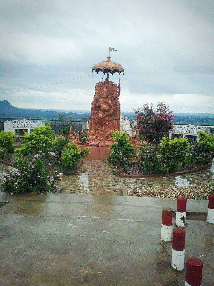
- Vijaygarh Fort, Sonbhadra: It is located about 30 km from Robertsganj in south-east direction in Mau Kalan village on Robertsganj-Churk road, in the Sonbhadra District. Built in the 5th century, at a height of 400 feet from the ground level by Kol Kings, the fort is known for its rock inscriptions, cave paintings, many statues and its perennial ponds. There are four ponds inside the premises of the fort which never dry up.
- Sodharigarh Durg, Sonbhadra
- Veer Lorik Stone
- Agori Fort in Chopan.
Natural places
[edit]Other nearby
[edit]Media
[edit]Gaon Girav & Kaimoor Times are among the few Hindi newspapers published from this district.
Chandrakanta, a popular Hindi novel by Devaki Nandan Khatri is related to Vijaygarh Fort. The princess Chandrakanta of Vijaygarh and the prince Virendra Singh of Naugarh. Krur Singh, a member of the Vijaygarh king's court who dreams of marrying Chandrakanta and taking over the throne. When Krur Singh fails in his endeavor, he flees the kingdom and befriends Shivdutt, the powerful neighboring king of Chunargarh fort in Chunar that inspired Khatri to write the novel. Vijaygarh Fort is in Sonbhadra City.
See also
[edit]External links
[edit]- (24°41′11″N 83°03′56″E / 24.686426°N 83.065664°E[5]) Geo links for Robertsganj
References
[edit]- ^ "2023 UP Municipal Election results". ECI Uttar Pradesh. Retrieved 22 May 2023.
- ^ Falling Rain Genomics, Inc - Robertsganj
- ^ "British-Era Robertsganj Railway Station In UP Renamed Sonbhadra". NDTV. 21 March 2018. Retrieved 5 January 2026.
- ^ "Sonbhadra Nagar Palika Parishad City Population Census 2011-2022 | Uttar Pradesh".
- ^ robertsganj satellite image
Robertsganj
View on GrokipediaRobertsganj is a town serving as the administrative headquarters of Sonbhadra district in the southeastern corner of Uttar Pradesh, India.[1] Located in the valley of the Son River south of the Kaimur Range and between the Vindhya and Kaimur hill ranges, it functions as the primary urban center for a region rich in mineral deposits such as coal, bauxite, limestone, and granite.[1] The town's economy is driven by heavy industries including thermal power plants, coal mining operations, and cement factories, positioning Sonbhadra as one of India's key industrial districts.[1] The name Robertsganj originates from the British colonial period, associated with Field Marshal Frederick Roberts, 1st Earl Roberts, a prominent commander in the East India Company army.[2] Historically part of the Mirzapur district, Robertsganj tehsil encompassed numerous villages and was integrated into the newly formed Sonbhadra district in 1989 following administrative reorganization.[3] According to the 2011 Indian census, the urban population of Robertsganj stood at 36,689, while the tehsil population reached 901,830, reflecting growth tied to industrial development and resource extraction.[4][5]
Geography and Environment
Location and Topography
Robertsganj is situated at approximately 24.70°N 83.07°E, with an average elevation of 330 meters above sea level, in the southeastern region of Uttar Pradesh, India.[6] As the administrative headquarters of Sonbhadra district, it occupies a strategic position near the state's borders with Madhya Pradesh to the south and Bihar to the east.[1] The local topography consists of undulating hills and plateaus formed by the Vindhyan supergroup sedimentary rocks, which dominate the geological structure of the area.[7] The Son River flows through the district, demarcating two primary topographic divisions: relatively flatter alluvial zones to the north and more rugged, elevated terrains to the south that form the northern fringe of the Chota Nagpur Plateau.[8] [1] The Rihand River, a significant tributary of the Son, originates in the vicinity and enhances the region's riverine features, contributing to a landscape characterized by hilly forested expanses and plateau escarpments.[8] This configuration underscores Sonbhadra's position within the transitional zone between the Gangetic plains and peninsular highlands.[8]Natural Resources and Geology
The geology of the Robertsganj area, situated in Sonbhadra district, is dominated by Precambrian formations, including sedimentary sequences of the Vindhyan Supergroup, which represent one of the most extensive Proterozoic successions in India. These rocks, exposed in regions like the Son Valley and Salkhan areas, comprise thick layers of shale, sandstone, and limestone from the Semri and Kaimur groups, dating to the Mesoproterozoic era (approximately 1.6 to 1.0 billion years ago).[9][10] The underlying basement includes older elements such as the Mahakoshal Group and Dudhi granitoid complex, contributing to a structurally stable platform that hosts mineral-bearing horizons verified through systematic mapping by the Geological Survey of India.[11] Sonbhadra's geological framework supports rich deposits of key minerals, notably coal within the Gondwana-age Singrauli coalfield extending into the district, alongside substantial reserves of limestone and dolomite suitable for industrial applications. Bauxite occurrences are present in areas like the Bagru Hills, while lesser-known traces of gold are associated with banded iron formations of the Agori Formation and bismuth-telluride mineralisation in sites such as Parsoi and Goindari.[12][13][14] These resources, embedded in the Vindhyan and associated Precambrian lithologies, underpin India's coal inventory, with the district's coalfields forming part of the northern reserves critical for thermal power generation and national energy supply.[15][16]Climate and Seasonal Variations
Robertsganj exhibits a humid subtropical climate marked by pronounced seasonal temperature swings and monsoon-driven precipitation patterns. Average annual temperatures hover around 25.6°C, with extremes ranging from a low of approximately 6°C to highs exceeding 43°C.[17][18] Summer months from March to June bring intense heat, with May recording average highs near 39°C and occasional peaks up to 43°C, accompanied by low humidity that exacerbates dry conditions. Winters from November to February remain relatively mild, featuring average January lows of about 9°C and highs around 24°C, though dense fog often persists during mornings, reducing visibility to under 50 meters on multiple days and complicating regional transport logistics.[18][19][20] The southwest monsoon dominates from June to September, delivering roughly 80% of the region's annual rainfall total of 1,012 mm, with July alone contributing over 216 mm amid high humidity levels frequently surpassing 80%. This seasonal deluge introduces variability through intense downpours that can lead to localized flooding, while post-monsoon October transitions feature moderating temperatures averaging 28-32°C with diminishing precipitation. Such patterns influence industrial activities, as summer heat strains power generation and mining equipment, and monsoon variability disrupts open-pit operations via waterlogging.[17][18][18]| Month | Avg High (°C) | Avg Low (°C) | Rainfall (mm) |
|---|---|---|---|
| January | 24 | 9 | 20 |
| May | 39 | 26 | 15 |
| July | 32 | 25 | 216 |
| December | 23 | 10 | 10 |
Historical Development
Ancient and Medieval Periods
Archaeological surveys in Sonbhadra district, encompassing Robertsganj, reveal Paleolithic occupation evidenced by stone tools, including microliths fabricated from chert and quartzite, concentrated south of the Son River in areas like the Kone block.[23][24] These artifacts indicate early hunter-gatherer adaptations to the region's sandstone formations and rock shelters, with tool technologies reflecting local raw material exploitation rather than widespread trade networks.[24] Nearby Salkhan Fossil Park preserves stromatolite structures dating to approximately 1.4 billion years ago, representing ancient microbial life in the Proterozoic era but unrelated to human activity.[9] Prehistoric rock art in sites such as Lakhania Rock Shelter, located about 22 km from Robertsganj, features paintings estimated at 4,000 years old, depicting fauna and human figures that correlate with Mesolithic or early Neolithic cultural phases amid a forested, riverine environment.[25] These shelters served as seasonal habitations for indigenous groups, with artistic motifs suggesting ritual or subsistence practices tied to resource competition in the Kaimur ranges.[23] Verifiable evidence of larger settlements or administrative structures remains scarce, pointing to dispersed, kin-based communities focused on foraging and rudimentary agriculture. In the medieval period, local control rested with tribal groups such as the Kol, who constructed defensive forts like Vijaygarh around the 5th century CE to safeguard territories amid inter-group rivalries over forests and minerals.[26] The Chero, another indigenous polity with presence in the region, maintained similar hilltop strongholds, emphasizing autonomy through fortified economies reliant on tribute from agrarian and extractive activities rather than integration into expansive empires like the Guptas or early Delhi Sultanate.[24] Scant inscriptions or chronicles link Sonbhadra directly to pan-Indian polities, underscoring self-reliant local dynamics punctuated by conflicts over scarce arable land and trade routes along the Son River.[3] Later renovations to structures like Vijaygarh by Rajput branches, such as the Chandels of Agori-Barhar, reflect defensive adaptations against incursions but preserved underlying tribal administrative patterns.[26]Colonial Foundations and Naming
Robertsganj developed as an administrative tehsil within the British-controlled Mirzapur district during the 19th century, serving as a outpost for overseeing the resource-rich eastern Son Valley amid the Vindhyan hills.[3] The town's name honors Field Marshal Frederick Sleigh Roberts, 1st Earl Roberts (1832–1914), a key East India Company commander noted for campaigns including the Indian Rebellion of 1857 and Afghan conflicts, reflecting pragmatic British naming conventions for strategic locales tied to military figures.[26] Its location facilitated initial resource assessments in an area abundant with coal, limestone, and bauxite deposits, as identified through early colonial geological explorations.[3] The Geological Survey of India, established in 1851, conducted 19th-century mappings that documented coal seams in the Son Valley's Gondwana formations near Robertsganj, informing potential extraction despite rudimentary infrastructure like basic quarries for local stone and timber.[27] These efforts preceded formal railways, with the East Indian Railway's extensions reaching Mirzapur by the 1880s but not fully penetrating Robertsganj until later, prioritizing export routes from mineral prospects. Population records from the 1901 census indicate low density, with the tehsil encompassing 1,222 villages and a total of 221,717 residents, predominantly tribal groups such as Gonds and Kol, whose customary land use complicated formal surveys.[3][28] Archival notes on Survey of India operations highlight occasional resistance from tribal communities to boundary demarcations in forested tracts, underscoring the challenges of asserting administrative control over sparsely settled, indigenous-held territories without widespread displacement at the time.Post-Independence Industrialization
Following India's independence in 1947, Robertsganj and the surrounding Sonbhadra district experienced state-directed industrialization primarily through public sector investments in mining and energy infrastructure to address national energy shortages. Coal mine nationalization under the Coal Mines (Nationalisation) Act of 1973 transferred private operations in Sonbhadra to public entities like Coal India Limited's Northern Coalfields Limited, enabling centralized extraction to fuel thermal power expansion and linking resource policy directly to industrial output growth.[29] Key milestones included the Rihand Dam's construction from 1954 to 1962 at Pipri, which generated initial hydropower capacity and supported downstream thermal projects by stabilizing water supply for cooling and coal slurry transport.[3] This was followed by the Obra Thermal Power Station's initiation in 1967 and the Anpara Thermal Power Plant's commissioning in 1980, both under state electricity boards, contributing to a cumulative installed capacity exceeding 4,000 MW from NTPC-linked facilities like Rihand Super Thermal (3,000 MW) and Singrauli Super Thermal (2,000 MW) by the late 20th century.[3][30] These developments stemmed from five-year plans prioritizing heavy industry and power self-sufficiency, with coal abundance in Sonbhadra driving site selection over alternative fuels. By the 1980s, integrated energy corridors emerged in the region, amplifying Uttar Pradesh's industrial base as public investments correlated with output surges; Sonbhadra's per capita income reached Rs. 1,44,758 in 2023, surpassing the state average of Rs. 93,422, reflecting mining and power's disproportionate economic pull despite uneven local distribution.[31] This policy-driven trajectory underscored causal dependencies on state monopolies for resource mobilization, yielding measurable capacity gains but tying growth to centralized planning rather than private diversification.[1]Economy and Industrial Base
Mining Operations and Mineral Wealth
Northern Coalfields Limited (NCL), a subsidiary of Coal India Limited, conducts major coal mining operations in the Singrauli Coalfield, which extends into Sonbhadra district including areas around Robertsganj.[32][33] Key active mines such as Kakri, operated by NCL, employ open-cast methods to extract non-coking coal reserves, facilitating high-volume production through mechanized excavation and overburden removal.[33] These operations primarily supply coal for thermal power generation, cement manufacturing, and steel production, supporting downstream industries reliant on affordable domestic fuel sources.[34] In 2023, Uttar Pradesh's coal production, predominantly from Sonbhadra district's mines, reached 20.54 million tonnes, marking an increase from 18.073 million tonnes in 2022, with NCL contributing significantly through its regional projects.[35] NCL's overall output for FY 2023-24 totaled 136.15 million tonnes across its operational areas, underscoring the district's integral role in national coal supply chains.[36] Limestone extraction, another key activity, draws from the Kajrahat belt south of the Son River, yielding cement-grade reserves estimated at 175 million tonnes, processed via quarrying for use in construction materials.[13] Bauxite deposits in Sonbhadra support aluminum production, though output volumes remain secondary to coal and limestone, with open-pit methods dominating due to shallow ore depths and economic viability.[13] These mining activities bolster India's resource self-sufficiency by reducing import dependence on energy minerals, generating substantial revenue—NCL alone contributed ₹15,000 crore to the government exchequer in FY 2023-24—and sustaining direct employment for thousands, including over 3,300 contract workers in Robertsganj constituency mines as of 2025.[36][37] The sector's expansion, including capacity enhancements at mines like Jayant, targets increased output to meet industrial demand through 2026-27.[38]Power Generation Infrastructure
The power generation infrastructure in the Robertsganj area of Sonbhadra district primarily consists of large-scale coal-fired thermal power stations, which provide base-load electricity to Uttar Pradesh and the northern grid. The NTPC Rihand Super Thermal Power Station, located near Robertsganj, has an installed capacity of 3,000 MW across six units, with the first 500 MW unit commissioned in 1988 and subsequent units added through the early 2010s.[39] These supercritical units utilize locally sourced coal and achieve plant load factors (PLF) typically in the 70-85% range, as reported in NTPC operational data, enabling reliable output that integrates directly into the Power Grid Corporation of India (PGCIL) transmission network to support peak demands exceeding 20,000 MW in Uttar Pradesh.[40] The Anpara Thermal Power Station, operated by Uttar Pradesh Rajya Vidyut Utpadan Nigam Limited (UPRVUNL), contributes an additional installed capacity of approximately 3,850 MW across nine coal-based units, with initial units commissioned in the late 1970s and expansions through the 2010s.[41] Obra Thermal Power Station, also under UPRVUNL management and situated proximate to Robertsganj, adds 1,288 MW of thermal generation capacity from older units dating to the 1970s, supplemented by a small 99 MW hydro facility for auxiliary power.[42] Collectively, these facilities in Sonbhadra district generate over 8,000 MW, accounting for more than 10% of Uttar Pradesh's total thermal power output and playing a key role in maintaining grid stability by averting shortages during high-demand periods, as evidenced by state energy balance reports showing minimal energy deficits under 0.3% in recent years.[43] Efficiency improvements, including retrofits for higher supercritical parameters, have elevated average capacity factors to 70-80% across these plants, per Central Electricity Authority (CEA) generation performance metrics, reducing reliance on imported power and supporting industrial loads in the region.[44] Grid integration via 765 kV lines ensures seamless evacuation, with Rihand and Anpara units often operating at full throttle to counter seasonal variability in hydro-dependent supplies elsewhere in the state.[45]Employment Impacts and Local Businesses
The mining and power generation sectors in Sonbhadra district, centered around Robertsganj, have generated substantial direct employment, with large and medium industries employing approximately 17,896 workers as of the early 2010s, primarily in thermal power plants such as NTPC Rihand and Obra, alongside mining operations for limestone and dolomite.[46] Small-scale industries, often ancillary to these resource-based activities, support an estimated average of 18,343 daily workers, contributing to a combined industrial workforce that underscores the district's shift toward non-agricultural labor amid land constraints from extraction activities.[46] Local surveys indicate high dependency on mining-related jobs, with 65-78% of respondents in affected areas relying on such livelihoods, including 22% as wage laborers and 18% in transport roles tied to mineral haulage.[47] This has spurred growth in small enterprises, evidenced by 5,863 registered MSME units up to 2011, many in processing, trade, and logistics linked to the resource boom, though expansion has been uneven due to environmental regulations and mechanization reducing manual labor needs.[46] Inflows of migrant labor from outside the district, attracted by these opportunities, have bolstered local consumption through wages spent on goods and services, with family incomes in mining zones averaging ₹9,000-15,000 monthly, yet disparities persist as landless households—predominantly SC/ST groups—face greater vulnerability to job instability and health risks from dust exposure.[47][47]Infrastructure and Connectivity
Road and Highway Networks
The road network in Robertsganj, as the headquarters of Sonbhadra district, primarily facilitates the transport of minerals and industrial goods from mining operations to regional hubs, leveraging state highways and segments of national highways for logistics efficiency. State Highway 5A (SH-5A), a key artery spanning the district, connects Robertsganj directly to Varanasi approximately 74 kilometers away, enabling swift movement of freight such as coal and limestone extracted from local mines.[48] This highway has been widened to six lanes in sections through state public works initiatives, reducing congestion and supporting higher volumes of heavy vehicle traffic essential for the district's extractive economy.[49] National Highway 39 (NH-39) traverses portions of Sonbhadra, linking the area to broader networks toward Prayagraj (around 170 kilometers distant) and facilitating inter-state connectivity for industrial shipments.[49] Post-2017 infrastructure enhancements under the Bharatmala Pariyojana have prioritized upgrades to such corridors in Uttar Pradesh, including four-laning and strengthening to handle increased freight loads from mining activities, though specific Sonbhadra segments reflect ongoing state-level execution rather than fully completed national projects.[50] Feeder roads branching from SH-5A and district roads provide access to major mining sites like those in Chopan and Renukoot, with dedicated corridors developed to bypass populated areas and minimize disruptions from overloaded trucks.[51] These networks underscore logistical gains, with improved pavement quality post-upgrades correlating to lower maintenance costs for mining firms reliant on road haulage for overland coal transport before rail handoff. Road density in Uttar Pradesh, at approximately 907 kilometers per 1,000 square kilometers as of recent Ministry of Road Transport and Highways (MoRTH) assessments, supports Sonbhadra's dispersed mining clusters, though district-specific figures remain integrated into state totals without granular breakdowns. Enhanced connectivity has streamlined freight evacuation, reducing transit times to Varanasi and Prayagraj by up to 20-30% in upgraded stretches, bolstering the district's role in regional supply chains.[48]Rail and Water Transport
The primary rail infrastructure supporting Robertsganj's resource-based economy consists of the East Central Railway's lines connecting Chopan station to the Singrauli coalfields in Madhya Pradesh, enabling efficient freight evacuation of coal and minerals. Chopan serves as the key junction for handling coal trains destined for power plants and industrial users across northern India, with the 167-kilometer Chunar-Chopan section acting as the shortest route for rakes originating from Singrauli mines.[52] This corridor integrates into Indian Railways' broader coal logistics network, which transported an average of 297.7 coal rakes daily to the power sector in March 2024, underscoring the line's role in national energy supply chains despite capacity constraints on single tracks.[53] Efforts to augment freight throughput include the 2023 sanctioning of track doubling along the Chunar-Chopan route, aimed at reducing detention times for coal rakes and accommodating increased volumes from the Singrauli belt, where annual coal production exceeds 100 million tonnes.[52] While exact local rake dispatches vary seasonally, the infrastructure prioritizes bulk cargo over passenger services, with coal comprising the dominant freight category; national data indicate Indian Railways allocated over 86% of open wagons to coal in peak demand periods like 2022.[54] Robertsganj's own station (RBGJ) supplements this with limited connectivity under the Prayagraj division, but freight operations remain centered at Chopan to minimize logistical bottlenecks for mineral exports. Water transport via the Rihand Reservoir and associated river systems holds untapped potential for barge-based freight, particularly for bulk commodities like coal, given the reservoir's proximity to mining hubs and capacity to support navigation over 300 square kilometers of water surface. However, commercial utilization remains negligible, with no established barge terminals or regular operations reported, as infrastructure development has prioritized hydropower and irrigation over inland waterways. The reservoir, formed by the Rihand Dam completed in 1962, primarily serves thermal power cooling and flood control, limiting navigational feasibility due to seasonal water levels and absence of dredging or lock systems, thereby confining resource evacuation to rail and road modes.[55]Air and Emerging Urban Facilities
Robertsganj lacks a dedicated airport or airstrip, relying on Lal Bahadur Shastri International Airport in Varanasi as the nearest facility, approximately 100 km away by road with travel times of about 1.5 to 2 hours depending on conditions.[56] [57] Flights from Varanasi connect to major Indian cities including Delhi and Mumbai, supporting limited air access for the region. In Sonbhadra district, the Muirpur airstrip is undergoing upgrades to become a functional airport, aimed at serving industrial hubs like Northern Coalfields Limited operations and enhancing connectivity for mining and power sectors.[58] Uttar Pradesh Chief Minister Yogi Adityanath announced this conversion in September 2020, with development tied to the UDAN scheme for regional aviation.[58] The facility, located roughly 70-80 km from Robertsganj, is projected to include an apron, lounge, and boundary wall, though progress remains ongoing without a firm operational date as of 2023.[59] Emerging urban facilities in Robertsganj include basic electrification nearing full coverage, bolstered by the district's extensive power infrastructure such as NTPC plants, contributing to Uttar Pradesh's low energy shortages of 0.1% in 2024.[45] Broadband services are available through providers like Airtel Xstream Fiber, offering plans up to 40 Mbps, though district-specific penetration data lags behind national averages of around 62% internet subscribers.[60] [61] No dedicated smart city designation applies, but municipal upgrades under schemes like AMRUT since 2015 target water supply and sewerage, addressing gaps in urban amenities amid industrial growth.[62]Demographics and Social Fabric
Population Dynamics and Urban-Rural Divide
The population of Sonbhadra district, administrative headquarters at Robertsganj, totaled 1,862,559 as recorded in the 2011 Census of India, marking a decadal growth of 27.27% from the 1,463,519 residents enumerated in 2001.[63] Robertsganj town itself had an estimated population of approximately 38,000 during this census, serving as a modest urban nucleus amid the district's expansive rural landscape.[64] Projections based on sustained growth trends place the district's 2025 population at around 2.16 million, reflecting an annualized rate declining from the 2011 decadal average toward 1.5-2%.[65] Rural areas dominated with 83.12% of the population (1,548,217 persons), while urban centers accounted for 16.88% (314,342 persons), underscoring a pronounced urban-rural divide characteristic of resource-extraction regions where industrial hubs like mining and power plants attract limited inflows but fail to offset broader agrarian dependencies.[66] This urbanization level, though rising from prior decades due to employment in extractive industries, remains subdued compared to Uttar Pradesh's statewide average, with rural-to-urban migration patterns evidenced in household surveys linking industrial opportunities to selective townward shifts. The district's sex ratio was 918 females per 1,000 males, with a child (0-6 years) sex ratio of 925, indicative of demographic imbalances influenced by socioeconomic factors prevalent in rural-heavy districts.[63] Children under 6 comprised about 15.5% of the total population, concentrated disproportionately in rural sub-districts where access to services lags urban equivalents.[67] These dynamics highlight persistent rural outmigration pressures toward Robertsganj and adjacent industrial townships, though overall urban expansion proceeds incrementally amid infrastructural constraints.Literacy, Education, and Human Capital
According to the 2011 Census, the literacy rate in Sonbhadra district stood at 64.03%, with males at 74.92% and females at 52.14%, reflecting a gender disparity of 22.78 percentage points.[63] Rural literacy lagged at 59.60%, while urban areas, encompassing Robertsganj, achieved 84.31%.[67] These figures underscore foundational human capital constraints, particularly in rural and female cohorts, where economic demands in mining and agriculture often prioritize immediate labor over sustained education.[68] Enrollment in government schools remains high, exceeding 95% at elementary levels per statewide ASER assessments, though district-specific infrastructure gaps—such as inadequate facilities in Sonbhadra's primary schools—persist despite expansions.[69] Dropout rates, influenced more by familial economic pulls toward informal sector jobs in local industries than institutional shortcomings, have declined in Uttar Pradesh overall, from 12.7% at secondary level in 2022-23 to 5.9% in 2023-24; analogous pressures in Sonbhadra elevate risks among tribal and low-income groups.[70][71] Post-1990s institutional growth has targeted technical human capital for the district's mineral and power economy, including the Government Degree College in Robertsganj (established 2008), Government ITI Robertsganj offering vocational trades like electrician and welder, and Government Polytechnic Sonbhadra focusing on engineering diplomas.[72][73][74] These facilities, numbering over a dozen colleges and polytechnics by the 2010s, emphasize skills in mechanical and electrical fields to align with mining operations and power plants, fostering workforce readiness amid industrial expansion.[75] ASER data indicate improving foundational arithmetic and reading competencies in Uttar Pradesh government schools since 2018, with Std III proficiency tripling, suggesting gradual enhancements in cognitive capital applicable to Sonbhadra's context.[76]Workforce Participation and Occupational Profiles
In Sonbhadra district, encompassing Robertsganj as its administrative center, the workforce participation rate was 39.2% according to the 2011 Census, with males at 47.7% and females at 29.9%.[77] This reflects a labor force dominated by rural and semi-urban activities, though recent estimates for 2023-24 indicate a rise to 65.79% overall labor force participation rate (LFPR), driven by industrial expansion.[78] Female LFPR lags, aligning with Uttar Pradesh trends where it increased from 14.2% in 2017-18 to 32.1% in 2022-23, but remains below 30% in district-specific assessments due to limited non-agricultural opportunities for women.[79] Sectoral distribution among main workers (730,399 in 2011) shows agriculture employing roughly 34%, with 13.9% as cultivators (101,592 individuals) and 20.2% as agricultural laborers (147,315 individuals).[66] The balance, approximately 46% as other workers, centers on mining, manufacturing, and allied industries, consistent with the district's mineral-rich profile where coal, bauxite, and limestone extraction supports around 40% of industrial employment per economic surveys from 2011-2021.[46] Power generation and related infrastructure further bolster waged labor in these sectors, shifting workers from subsistence farming—evidenced by NSSO data showing income multiples of 2-3 times higher in mining versus agriculture.[80] Underemployment persists, particularly in agriculture and marginal work, with over 50% of rural laborers reporting seasonal idle time in district studies, though market-driven industrial growth has reduced this by channeling labor into formal mining roles since the early 2010s.[81] Occupational profiles emphasize skilled trades in extraction and energy, with unskilled manual labor comprising the majority, fostering gradual upskilling via on-site training in public sector units.[46]Ethnic and Caste Composition
The population of Sonbhadra district, with Robertsganj as its headquarters, exhibits a diverse ethnic and caste structure dominated by Scheduled Tribes (STs) and Scheduled Castes (SCs), as enumerated in the 2011 Census. STs comprise 20.67% of the district's total population of 1,862,559, totaling 385,018 individuals, primarily residing in rural and forested areas across the seven tehsils including Robertsganj, Dudhi, and Obra.[66] Major ST communities include the Gond (the largest subgroup), Chero, Baiga, Parahiya, Kol, Agariya, Patari, and Pankha-Panika, who traditionally inhabit the Vindhya and Kaimur hill ranges and engage in subsistence agriculture, forest-based livelihoods, and seasonal migration.[82] SCs form 22.64% of the population, numbering 421,661, with concentrations in both rural blocks and urban Robertsganj, where they participate in reserved quotas for education and public sector employment that integrate them into local administration and services.[66] The remaining population, exceeding 56%, consists predominantly of Other Backward Classes (OBCs) such as Yadavs, Kurmis, and other intermediate castes, who hold sway in agrarian economies and village-level politics, supplemented by smaller proportions of forward castes like Brahmins and Rajputs overrepresented in bureaucratic and professional roles due to historical access to education and land ownership.[83] This composition influences socioeconomic patterns, with ST households averaging smaller sizes and higher self-employment rates in informal sectors compared to urban OBC and general caste groups reliant on formal wage labor.[84]Governance and Political Landscape
Administrative Functions as District Headquarters
Robertsganj serves as the administrative headquarters of Sonbhadra district, overseeing the coordination of governance across its four tehsils: Robertsganj, Ghorawal, Dudhi, and Obra.[85] The district magistrate (DM), stationed in Robertsganj, holds primary responsibility for revenue collection, land administration, and developmental schemes, while the superintendent of police (SP) manages law and order from the same location.[86] This centralization facilitates efficient oversight of sub-divisional operations, including the issuance and regulation of mining leases, given Sonbhadra's status as a mineral-rich area with resources like coal, bauxite, and iron ore contributing significantly to district revenue—recent auctions alone projecting approximately ₹6,000 crore in government earnings.[87] Key bureaucratic functions include the administration of district courts in Robertsganj, which handle civil, criminal, and revenue-related litigation for the entire district, supported by a mining officer dedicated to lease approvals, compliance monitoring, and royalty collections that fund local infrastructure and welfare programs.[88] Revenue from mineral resources directly bolsters the district budget, enabling allocations for public services without heavy reliance on state transfers, though administrative efficiency varies due to the district's remote terrain. E-governance adoption has enhanced service delivery, with the district portal integrating tools like e-office for file tracking and online applications for certificates, aligning with Uttar Pradesh's broader Digital India framework to reduce processing times.[89] Empirical metrics underscore improved bureaucratic responsiveness; for instance, public distribution system (PDS) reforms in Sonbhadra, managed from Robertsganj, have incorporated SMS-based monitoring and Aadhaar-linked authentication to curb leakages, as analyzed in district-specific implementation studies showing higher transparency in ration distribution across tehsils.[90] These measures, including digitized beneficiary verification, have streamlined access to subsidized food grains for over 80% of eligible below-poverty-line households, reflecting quantifiable gains in service coverage and accountability under the district's centralized command.[89]Electoral Outcomes and Representation
In the 2024 Lok Sabha elections, held on June 1 with results declared on June 4-5, Samajwadi Party candidate Chhotelal Gangwar secured victory in the Robertsganj (SC) constituency with 465,848 votes (46.14%), defeating Rinki Singh of Apna Dal (Soneylal), who received 336,614 votes (33.34%), by a margin of 129,234 votes.[91] Voter turnout stood at 56.51%.[92] This marked a shift from the previous two elections, where the National Democratic Alliance (NDA) held the seat; outcomes reflected mobilization among Scheduled Caste and tribal voter blocs, including the Kol community, amid debates on welfare schemes versus infrastructure development.[93] The constituency had been won by NDA allies in 2019, with Pakauri Lal Kol of Apna Dal (Soneylal) polling 447,914 votes (45.3%) against Samajwadi Party's Bhai Lal's 393,578 votes (39.8%), yielding a margin of 54,336 votes.[94] Similarly, in 2014, Bharatiya Janata Party's Chhotelal prevailed, consolidating upper caste and OBC support alongside Scheduled Caste voters in the resource-rich but underdeveloped region.[95] Historical patterns show turnout fluctuating between 55% and 65%, influenced by tribal (ST) populations exceeding 20% in Sonbhadra district and caste dynamics, with Election Commission data indicating consistent participation from marginalized groups.[96] At the state level, the five assembly segments under Robertsganj—Ghorawal, Robertsganj, Obra, Duddhi (ST), and Chopan—predominantly returned Bharatiya Janata Party candidates in the 2022 Uttar Pradesh Legislative Assembly elections, with the party securing three seats district-wide on a 42.9% vote share.[97] In Robertsganj assembly, BJP's Bhupesh Choubey won by 5,621 votes over Samajwadi Party's Avinash Kushwaha.[98] This local NDA dominance contrasts the 2024 parliamentary upset, highlighting fragmented alliances and localized tribal-OBC voting preferences per constituency-wise Election Commission records.[99]| Election Year | Lok Sabha Winner | Party | Votes (%) | Margin (Votes) |
|---|---|---|---|---|
| 2024 | Chhotelal Gangwar | SP | 465,848 (46.14%) | 129,234 |
| 2019 | Pakauri Lal Kol | AD(S) | 447,914 (45.3%) | 54,336 |
| 2014 | Chhotelal | BJP | N/A | N/A |