


Community hub
Eastern Washington
View on Wikipedia
 | This article needs additional citations for verification. (December 2010) |
Eastern Washington is the region of the U.S. state of Washington located east of the Cascade Range. It contains the city of Spokane (the second largest city in the state), the Tri-Cities, the Columbia River and the Grand Coulee Dam, the Hanford Nuclear Reservation and the fertile farmlands of the Yakima Valley and the Palouse. Unlike in Western Washington, the climate is dry, including some desert environments.
Key Information


Geography
[edit]Nomenclature
[edit]Other terms used for Eastern Washington or large parts of it include:
- Columbia Basin
- Eastside or east side of the state[1][2][3]
- Inland Empire/Inland Northwest (also includes the Idaho Panhandle)
- "The 509" (in reference to the local area code)
Cities
[edit]
Notable cities and towns in Eastern Washington include:
Protected areas
[edit]
- Hanford Reach National Monument
- Lake Roosevelt National Recreation Area
- Juniper Dunes Wilderness
- Salmo-Priest Wilderness
- Wenaha-Tucannon Wilderness (partial)
- Colville National Forest
- Idaho Panhandle National Forest (partial)
- Kaniksu National Forest (partial)
- Okanogan–Wenatchee National Forest
- Umatilla National Forest (partial)
- Columbia National Wildlife Refuge
- Conboy Lake National Wildlife Refuge
- Little Pend Oreille National Wildlife Refuge
- McNary National Wildlife Refuge
- Saddle Mountain National Wildlife Refuge
- Toppenish National Wildlife Refuge
- Turnbull National Wildlife Refuge
- Umatilla National Wildlife Refuge (partial)
- Crawford State Park
Counties
[edit]Eastern Washington is composed of:[4]
Some definitions also include part of Skamania County that lies east of the ridge line of the Cascade Mountains.
Climate
[edit]
A significant difference between Eastern Washington and the western half of the state is its climate. While the west half of the state is located in a rainy oceanic climate, the eastern half receives little rainfall due to the rainshadow created by the Cascade Mountains. Also, due to being farther from the sea, the east side has both hotter summers and colder winters than the west. Most communities in Eastern Washington, for example, have significant yearly snowfall, while in the west snowfall is minimal and not seen every year. The east and west do still have some climatic traits in common, though: more rainfall in winter than summer, a lack of severe storms, and milder temperature ranges than more inland locations.
There is some variation in both temperature and rainfall throughout Eastern Washington. Generally, lower elevations are both hotter and drier than higher elevations. This is easily seen in the comparison between low-elevation Richland with higher elevation Spokane.
| Climate data for Tri-Cities, Washington (combined average of 3 cities) | |||||||||||||
|---|---|---|---|---|---|---|---|---|---|---|---|---|---|
| Month | Jan | Feb | Mar | Apr | May | Jun | Jul | Aug | Sep | Oct | Nov | Dec | Year |
| Record high °F (°C) | 74 (23) |
74 (23) |
87 (31) |
95 (35) |
105 (41) |
111 (44) |
115 (46) |
115 (46) |
106 (41) |
89 (32) |
79 (26) |
71 (22) |
115 (46) |
| Mean maximum °F (°C) | 58.3 (14.6) |
62.6 (17.0) |
72.7 (22.6) |
83.4 (28.6) |
93.0 (33.9) |
99.7 (37.6) |
105.7 (40.9) |
102.7 (39.3) |
93.8 (34.3) |
80.8 (27.1) |
68.3 (20.2) |
59.6 (15.3) |
106.4 (41.3) |
| Mean daily maximum °F (°C) | 41.1 (5.1) |
48.8 (9.3) |
58.5 (14.7) |
66.5 (19.2) |
75.2 (24.0) |
82.4 (28.0) |
91.0 (32.8) |
89.7 (32.1) |
80.3 (26.8) |
66.4 (19.1) |
50.5 (10.3) |
41.2 (5.1) |
66.1 (18.9) |
| Mean daily minimum °F (°C) | 27.7 (−2.4) |
30.2 (−1.0) |
35.1 (1.7) |
40.0 (4.4) |
47.8 (8.8) |
54.4 (12.4) |
59.4 (15.2) |
58.4 (14.7) |
49.9 (9.9) |
40.6 (4.8) |
33.6 (0.9) |
28.1 (−2.2) |
42.2 (5.7) |
| Mean minimum °F (°C) | 8.5 (−13.1) |
14.4 (−9.8) |
21.5 (−5.8) |
25.7 (−3.5) |
32.2 (0.1) |
41.8 (5.4) |
47.0 (8.3) |
45.5 (7.5) |
35.2 (1.8) |
24.0 (−4.4) |
16.6 (−8.6) |
9.3 (−12.6) |
3.4 (−15.9) |
| Record low °F (°C) | −27 (−33) |
−23 (−31) |
10 (−12) |
18 (−8) |
26 (−3) |
35 (2) |
38 (3) |
37 (3) |
21 (−6) |
9 (−13) |
−12 (−24) |
−22 (−30) |
−27 (−33) |
| Average precipitation inches (mm) | 1.00 (25) |
0.66 (17) |
0.63 (16) |
0.48 (12) |
0.63 (16) |
0.57 (14) |
0.17 (4.3) |
0.22 (5.6) |
0.31 (7.9) |
0.56 (14) |
0.90 (23) |
1.08 (27) |
7.24 (184) |
| Average snowfall inches (cm) | 3.2 (8.1) |
1.6 (4.1) |
0.2 (0.51) |
trace | 0.0 (0.0) |
0.0 (0.0) |
0.0 (0.0) |
0.0 (0.0) |
0.0 (0.0) |
trace | 1.5 (3.8) |
2.2 (5.6) |
8.5 (22) |
| Source 1: WRCC[5][6] | |||||||||||||
| Source 2: NOAA[7] | |||||||||||||
| Climate data for Spokane (combined average of 3 stations) | |||||||||||||
|---|---|---|---|---|---|---|---|---|---|---|---|---|---|
| Month | Jan | Feb | Mar | Apr | May | Jun | Jul | Aug | Sep | Oct | Nov | Dec | Year |
| Record high °F (°C) | 62 (17) |
64 (18) |
75 (24) |
90 (32) |
97 (36) |
108 (42) |
112 (44) |
112 (44) |
102 (39) |
87 (31) |
70 (21) |
63 (17) |
112 (44) |
| Mean maximum °F (°C) | 51.5 (10.8) |
54.3 (12.4) |
64.9 (18.3) |
76.2 (24.6) |
86.6 (30.3) |
93.5 (34.2) |
100.3 (37.9) |
99.2 (37.3) |
90.6 (32.6) |
76.6 (24.8) |
59.6 (15.3) |
51.6 (10.9) |
101.9 (38.8) |
| Mean daily maximum °F (°C) | 35.3 (1.8) |
41.5 (5.3) |
49.8 (9.9) |
58.5 (14.7) |
67.9 (19.9) |
75.3 (24.1) |
85.4 (29.7) |
84.3 (29.1) |
74.3 (23.5) |
59.5 (15.3) |
43.5 (6.4) |
35.3 (1.8) |
59.2 (15.1) |
| Mean daily minimum °F (°C) | 24.9 (−3.9) |
27.5 (−2.5) |
31.5 (−0.3) |
36.6 (2.6) |
43.8 (6.6) |
50.6 (10.3) |
56.2 (13.4) |
55.1 (12.8) |
47.1 (8.4) |
37.8 (3.2) |
30.6 (−0.8) |
25.1 (−3.8) |
38.9 (3.8) |
| Mean minimum °F (°C) | 0.7 (−17.4) |
7.0 (−13.9) |
17.8 (−7.9) |
26.8 (−2.9) |
32.0 (0.0) |
40.2 (4.6) |
45.5 (7.5) |
44.2 (6.8) |
34.5 (1.4) |
25.3 (−3.7) |
15.1 (−9.4) |
5.82 (−14.54) |
−6.4 (−21.3) |
| Record low °F (°C) | −30 (−34) |
−24 (−31) |
−10 (−23) |
14 (−10) |
24 (−4) |
33 (1) |
37 (3) |
30 (−1) |
22 (−6) |
7 (−14) |
−13 (−25) |
−25 (−32) |
−30 (−34) |
| Average precipitation inches (mm) | 1.98 (50) |
1.37 (35) |
1.69 (43) |
1.25 (32) |
1.55 (39) |
1.41 (36) |
0.53 (13) |
0.63 (16) |
0.71 (18) |
1.14 (29) |
2.13 (54) |
2.40 (61) |
16.81 (427) |
| Average snowfall inches (cm) | 9.9 (25) |
4.1 (10) |
1.8 (4.6) |
0.5 (1.3) |
trace | trace | trace | 0.0 (0.0) |
trace | 0.1 (0.25) |
4.2 (11) |
12.7 (32) |
33.2 (84) |
| Source 1: WRCC[8][9] | |||||||||||||
| Source 2: NOAA[10] | |||||||||||||
Population
[edit]Compared to Western Washington, Eastern Washington has roughly twice the land area and one-fourth the population. As of the 2020 census, Eastern Washington was home to 1,667,593 of the state's total 7,705,281 residents, making its population comparable to that of West Virginia.[11] The population growth rate between the two is roughly the same. Of Washington's ten Congressional districts, Eastern Washington exactly encompasses two (the 4th and 5th), aside from a small portion of the 8th in Chelan, Douglas, and Kittitas Counties.[12]
Education
[edit]
Eastern Washington hosts a number of universities including three of the state's five public universities.
Public institutions
[edit]- Central Washington University
- Eastern Washington University
- Washington State University
- A number of local community colleges including:
Private institutions
[edit]- Gonzaga University
- Heritage University
- Pacific Northwest University of Health Sciences
- Walla Walla University
- Whitman College
- Whitworth University
Research institutions
[edit]- Pacific Northwest National Laboratory
- Chimpanzee and Human Communication Institute at Central Washington University
Proposed statehood
[edit]
There have been sporadic movements to create a 51st state out of Eastern Washington by splitting the current state down the Cascades, but proposals have rarely progressed out of the state legislature's committees. Bills in the Washington State Legislature which would have requested the United States Congress to take up the question were proposed in 1996, 1999, 2005, and 2017.[13] Proposed names for the new state have included Lincoln, Columbia, Liberty,[14] or simply Eastern Washington. Many of these proposals would include the Idaho Panhandle as part of the proposed state of Lincoln.
Eastern Washington tends to vote Republican, whereas Western Washington usually votes Democratic. Even Spokane, the proposed capital and largest city, is in a fairly reliably Republican county despite tending to have a higher democratic vote than other Eastern Washington cities. The only fairly consistently Democratic county is the college town dominated Whitman County, which even then is far less Democratic than Western Washington.
Images
[edit]-
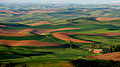 The Palouse Hills of southeastern Washington
 -
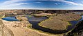 Dry Falls in the semi-desert Channeled Scablands that dominate much of eastern Washington.
 -
 Truck transport going east on Highway 2, near Waterville
 -
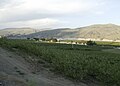 Apple orchards in Azwell, Washington surrounding a community of pickers' cabins


References
[edit]- ^ WSP Eastside Recruiter Returns to Face Recruitment Challenge, Washington State Patrol Government and Media Relations, September 8, 2010, archived from the original on November 3, 2010, retrieved December 27, 2010
- ^ "Eastside steelheading enters last month". Bellingham Herald. March 4, 2010. Retrieved December 27, 2010.[permanent dead link]
- ^ "Eastside Earthquakes Get Attention At Conference In Yakima". Oregon Public Broadcasting. October 17, 2007. Archived from the original on March 14, 2012. Retrieved December 27, 2010.
- ^ "WAC 222-16-010". Washington Administrative Code. Washington State Legislature. Retrieved August 10, 2025.
- ^ "RICHLAND, WASHINGTON (457015)". Western Regional Climate Center. Retrieved March 11, 2018.
- ^ "KENNEWICK, WASHINGTON (454154)". Western Regional Climate Center. Retrieved March 11, 2018.
- ^ "NowData – NOAA Online Weather Data". National Oceanic and Atmospheric Administration. Archived from the original on April 18, 2019. Retrieved March 11, 2018.
- ^ "SPOKANE INTL AP, WASHINGTON (457938)". Western Regional Climate Center. Retrieved March 11, 2018.
- ^ "SPOKANE, WASHINGTON (457933)". Western Regional Climate Center. Retrieved March 11, 2018.
- ^ "NOWData – NOAA Online Weather Data". NOAA. Archived from the original on September 21, 2016. Retrieved March 11, 2018.
- ^ "Census QuickFacts: Washington". Retrieved August 15, 2021.
- ^ https://www.king5.com/article/news/politics/state-politics/washington-state-proposed-congressional-district-changes/281-4a4268ab-a0f8-4951-88d7-3abf0d6ab0a1
- ^ "Lawmakers want to make eastern Wash. its own state". USA TODAY. Retrieved January 10, 2017.
- ^ Hallenberg, Pia (February 12, 2017). "A 51st state, called Liberty, would have political clout and an ag-based economy". Spokesman-Review. Retrieved April 23, 2018.


| National | |
|---|---|
| Other | |

Eastern Washington
View on GrokipediaGeography
Nomenclature and Boundaries
Eastern Washington denotes the eastern portion of Washington state, geographically separated from the western part by the Cascade Range, which forms a natural boundary along the crest line running roughly northwest to southeast through the state.[6] This division, often referred to as the "Cascade Curtain," creates distinct environmental and cultural differences, with Eastern Washington characterized by drier, continental climates east of the rain shadow effect produced by the mountains.[7] The region's boundaries extend from the Cascade crest eastward to the Idaho state line, northward to the Canadian border, and southward to the Oregon border, encompassing approximately 41,960 square miles.[8] While not a formally designated administrative region by state law, Eastern Washington aligns closely with the jurisdiction of the U.S. District Court for the Eastern District of Washington, which includes the entirety of 20 counties situated east of the Cascade crest: Adams, Asotin, Benton, Chelan, Columbia, Douglas, Ferry, Franklin, Garfield, Grant, Kittitas, Klickitat, Lincoln, Okanogan, Pend Oreille, Spokane, Stevens, Walla Walla, Whitman, and Yakima.[9] These counties represent the core of the region, though some, such as Chelan, Kittitas, and Yakima, include territories on both sides of the Cascade divide, with the eastern portions falling within the Eastern Washington's drier steppe and basin landscapes.[1] The boundary follows the mountain crest rather than county lines, emphasizing the topographic and hydrologic separation over political subdivisions.[8] The nomenclature "Eastern Washington" emerged as a practical descriptor to differentiate the area from the more populous, wetter Western Washington, with usage dating to at least the mid-20th century in official and popular contexts.[6] Alternative terms include "Eastside" or "east side of the state" for informal reference, "Columbia Basin" for the central and southern lowlands, and "Inland Empire" or "Inland Northwest" for the northern agricultural and urban areas extending into adjacent Idaho.[10] These synonyms reflect subregional identities tied to geography and economy, but "Eastern Washington" remains the predominant term in demographic, economic, and cultural discussions.[11]Topography and Hydrology
Eastern Washington's topography is dominated by the Columbia Plateau, a broad expanse of Miocene flood basalts covering approximately 63,000 square miles across the Pacific Northwest, with the eastern Washington portion forming an arid lowland between the Okanogan Highlands to the north, the Cascade Range to the west, and the Blue Mountains to the southeast.[12] Elevations generally range from 500 to 2,000 feet above sea level on the plateau, interrupted by the stark, eroded landscapes of the Channeled Scablands, which span about 15,000 square miles of east-central and southeastern Washington.[13] These scablands feature a network of deeply incised channels, coulees, and cataracts carved into the resistant Columbia River basalt by cataclysmic Pleistocene floods from Glacial Lake Missoula, including the 50-mile-long Grand Coulee and Dry Falls, a 3.5-mile-wide cataract dropping 400 feet.[13] In contrast, the Palouse region in southeastern Washington consists of steep, rolling hills formed by wind-deposited loess up to 500 feet thick overlying basalt, creating fertile agricultural terrain with elevations rising to around 3,000 feet at Steptoe Butte.[14] The northeastern Okanogan Highlands exhibit more rugged terrain, with pre-Tertiary metamorphic and granitic rocks folded into north-south trending ranges reaching elevations over 7,000 feet, including the Selkirk Mountains.[15] The southeastern Blue Mountains, an extension of the Rocky Mountains, feature dissected uplands of granitic and volcanic rocks with peaks up to 9,000 feet at Rock Creek Butte.[15] Hydrologically, the region is defined by the Columbia River, which traverses eastern Washington for about 300 miles, forming much of the southern and western boundaries while draining over 250,000 square miles of watershed, with major eastern tributaries including the Snake River (from Idaho and southeast Washington) and the Spokane River (111 miles long, originating at Lake Coeur d'Alene in Idaho).[16][17] Other significant rivers such as the Yakima, Okanogan, and Wenatchee originate in the Cascades or north and flow into the Columbia, supporting extensive irrigation networks in this semi-arid area where annual precipitation averages less than 12 inches.[16] The scablands contain numerous shallow pothole lakes and rock basins, remnants of flood erosion, while large reservoirs like Franklin D. Roosevelt Lake (behind Grand Coulee Dam) and Banks Lake store water for hydropower generation and agriculture, altering natural flow regimes with over 60 major dams on the Columbia system.[13][16]Cities and Urban Centers
Spokane, the largest city in Eastern Washington, had an estimated population of 229,608 in 2025 and functions as the economic, healthcare, and educational hub for the Inland Northwest.[18] [19] Adjacent Spokane Valley, with approximately 109,000 residents as of 2024, serves as a suburban extension supporting retail, logistics, and residential growth.[20] The Tri-Cities metropolitan area, encompassing Kennewick (86,470 residents in 2023), Pasco (81,280), and Richland (64,190), collectively housed over 314,000 people in 2023, bolstered by the Hanford Site's nuclear legacy, federal employment, and agriculture.[21] [22] [23] Yakima, an agricultural powerhouse centered on fruit, hops, and wine production, reported 97,390 residents in 2024.[24] Smaller urban centers include Pullman (33,543), anchored by Washington State University and research activities; Walla Walla (33,901), known for viticulture and higher education at Whitman College; and Moses Lake (26,933), facilitating manufacturing and irrigated farming.[25] [26]| City/Area | Population Estimate | Primary Economic Drivers |
|---|---|---|
| Spokane | 229,608 (2025) | Healthcare, education, manufacturing |
| Tri-Cities MSA | 314,253 (2023) | Nuclear energy, agriculture, government |
| Yakima | 97,390 (2024) | Agriculture (fruits, hops) |
| Pullman | 33,543 (2025) | University research, education |
| Walla Walla | 33,901 (2025) | Wine industry, education |
Counties and Administrative Divisions
Eastern Washington comprises 20 counties that serve as the primary administrative divisions, handling functions such as property assessment, public health, and infrastructure maintenance under Washington state law. These counties generally align with the geographical region east of the Cascade Range crest, though boundaries for Chelan, Kittitas, and Klickitat counties extend partially westward. The counties are Adams, Asotin, Benton, Chelan, Columbia, Douglas, Ferry, Franklin, Garfield, Grant, Kittitas, Klickitat, Lincoln, Okanogan, Pend Oreille, Spokane, Stevens, Walla Walla, Whitman, and Yakima.[8] Spokane County is the most populous, with a 2023 estimated population of 552,359 and its seat in Spokane, the region's largest city.[27] Yakima County follows with 257,731 residents and its seat in Yakima, supporting extensive agriculture.[27] Benton County, seat Prosser, has 206,958 inhabitants and includes parts of the Tri-Cities metropolitan area.[27] Smaller counties like Garfield (2,266 residents, seat Pomeroy) and Ferry (7,151 residents, seat Republic) feature sparse populations and rural economies.[27]| County | County Seat | 2023 Population Estimate | Land Area (sq mi) |
|---|---|---|---|
| Adams | Ritzville | 19,499 | 1,925 |
| Asotin | Asotin | 22,285 | 638 |
| Benton | Prosser | 206,958 | 1,703 |
| Chelan | Wenatchee | 80,582 | 2,921 |
| Columbia | Dayton | 3,979 | 857 |
| Douglas | Waterville | 44,329 | 1,847 |
| Ferry | Republic | 7,151 | 2,204 |
| Franklin | Pasco | 98,678 | 1,242 |
| Garfield | Pomeroy | 2,266 | 712 |
| Grant | Ephrata | 101,851 | 2,680 |
| Kittitas | Ellensburg | 48,077 | 2,297 |
| Klickitat | Goldendale | 23,271 | 1,870 |
| Lincoln | Davenport | 10,988 | 2,311 |
| Okanogan | Okanogan | 43,169 | 5,268 |
| Pend Oreille | Newport | 14,462 | 1,401 |
| Spokane | Spokane | 552,359 | 1,774 |
| Stevens | Colville | 48,283 | 2,481 |
| Walla Walla | Walla Walla | 62,470 | 1,270 |
| Whitman | Colfax | 47,973 | 2,159 |
| Yakima | Yakima | 257,731 | 4,295 |
Protected Areas and Natural Resources
Eastern Washington encompasses significant federal protected lands, including the Colville National Forest, which covers 1.1 million acres in the northeastern part of the state and features diverse ecosystems shaped by Ice Age glaciers.[32] Portions of the Okanogan-Wenatchee National Forest extend into the region's eastern Cascade slopes, spanning over 3.8 million acres total and providing habitat for wildlife amid varied terrain.[33] The Hanford Reach National Monument preserves approximately 195,000 acres along the free-flowing Hanford Reach of the Columbia River, established in 2000 to protect ecological and cultural resources adjacent to the Hanford Site.[34] Lake Roosevelt National Recreation Area, formed by Grand Coulee Dam, offers 100 miles of shoreline for recreation within the boundaries of eastern Washington.[35] State-managed protected areas include numerous parks and natural areas focused on shrub-steppe habitats, grasslands, and unique geological features.[36] Key examples are Riverside State Park near Spokane, encompassing over 7,000 acres of Spokane River canyon landscapes, and Mount Spokane State Park, which protects 13,919 acres including the namesake peak rising to 5,883 feet.[37] Palouse Falls State Park safeguards the dramatic 198-foot waterfall and surrounding canyon, representing the Channeled Scablands formed by ancient megafloods.[37] The region's natural resources center on water, forests, and hydropower. Abundant precipitation in mountainous areas supports timber harvesting from eastside forests, with the forest industry serving as a major biomass and renewable energy provider.[38] The Columbia River and its tributaries host extensive dam systems, generating hydroelectric power that accounts for about 60% of Washington's electricity and positions the state as the nation's leading producer.[39] Mineral resources, historically significant with gold rushes in the northeast and coal mining peaking in 2003, include metallic minerals like magnesium and limestone, though current production is limited.[40] Water from these systems also enables irrigation for agriculture, underscoring its versatility as the state's most valuable resource.[41]Climate
Regional Climate Patterns
Eastern Washington's climate is predominantly semi-arid to continental, shaped by its position in the rain shadow of the Cascade Mountains, which block moist Pacific air masses, leading to low precipitation across much of the region. Annual precipitation varies significantly, ranging from under 8 inches (200 mm) in the arid Columbia Basin to 12-18 inches (300-450 mm) in the central plateau areas, and exceeding 30 inches (760 mm) in the northeastern highlands like the Selkirk and Kettle Mountains.[42] Precipitation patterns feature a winter maximum, with most rainfall and snowfall occurring from October to May, while summers remain dry and often rainless, contributing to frequent drought conditions in lower elevations.[42] According to the Köppen-Geiger classification, the majority of the region falls under cold semi-arid (BSk) in the basin and steppe areas, transitioning to humid continental (Dfb or Dwb) in higher, wetter northern and eastern zones influenced by continental air masses.[43] Eastern Washington is significantly sunnier than Western Washington due to the rain shadow of the Cascade Range, which blocks moist Pacific air and results in clearer skies much of the year. While tourism and promotional sources often claim over 300 sunny days annually for areas like the Tri-Cities or Yakima, this figure relies on very permissive definitions (e.g., any glimpse of sun). Standard climatological measures (clear days with ≤30% cloud cover plus partly sunny) yield averages of approximately 170-200 days across the region (e.g., ~174 for Spokane, ~201 for Yakima including partly sunny). This still represents substantially more sunshine than western Washington's ~164 days, particularly in summer, contributing to the region's arid conditions and agricultural viability. Temperature regimes exhibit pronounced continental characteristics, with hot, dry summers and cold winters featuring large diurnal ranges. In the Columbia Basin, summer highs frequently surpass 90°F (32°C), as seen in locations like Yakima where July averages reach 88°F (31°C), while winter lows dip below 20°F (-7°C), with January averages around 25°F (-4°C).[44] The Palouse region and Okanogan Highlands experience slightly moderated extremes due to higher elevation and terrain, but still record annual temperature swings of over 50°F (28°C).[42] Northeastern mountainous areas, such as around Colville, see cooler summers (highs around 80°F or 27°C) and heavier snowfall, accumulating 40-60 inches (100-150 cm) annually, driven by orographic lift from prevailing westerly winds.[45] These patterns result in diverse microclimates: the channeled scablands and basin support steppe vegetation adapted to aridity, while the wetter northeast sustains coniferous forests. Evapotranspiration often exceeds precipitation in lowland areas, exacerbating water scarcity, particularly during prolonged dry spells influenced by high-pressure systems over the Pacific.[42]Environmental Impacts and Adaptations
Eastern Washington's semi-arid climate, characterized by low annual precipitation averaging 7-20 inches in much of the region, results in chronic water scarcity that profoundly impacts agriculture, the dominant land use.[46] Rising temperatures and declining snowpack from climate change have reduced streamflows, exacerbating drought stress on irrigated crops such as apples, cherries, and wheat, which rely on Columbia River basin water.[47] [48] In recent decades, warmer summers have increased evaporative demand, leading to higher irrigation needs and occasional crop yield reductions during prolonged dry spells.[49] Wildfires pose another significant environmental impact, fueled by hot, dry conditions and exacerbated by climate-driven extensions in fire season length and intensity.[50] In Washington state, wildfires burned 251,840 acres as of October 10, 2025, with eastern regions like Yakima and Okanogan counties frequently experiencing large incidents, such as the 71,694-acre Boylston Fire in 2018.[51] [52] These fires degrade soil, release stored carbon, and threaten forested ecosystems, while smoke affects air quality and public health across the inland Northwest.[53] Drought conditions preceding fires amplify tree mortality and vegetation loss, creating feedback loops that hinder forest recovery.[54] Adaptations to these impacts include extensive irrigation infrastructure, notably the Columbia Basin Project initiated in the 1940s with Grand Coulee Dam, which diverts river water to reclaim arid lands for farming, supporting over 670,000 acres of irrigated agriculture.[55] Farmers employ precision technologies like drip irrigation and soil moisture monitoring to optimize water use amid scarcity, reducing waste by up to 30% in some systems.[56] In non-irrigated areas like the Palouse, dryland farming techniques, including no-till practices and drought-resistant wheat varieties, sustain productivity despite erratic rainfall.[57] Wildfire mitigation involves prescribed burns, fuel reduction, and enhanced early detection, though challenges persist due to expanding wildland-urban interfaces.[50]History
Indigenous Peoples and Pre-Columbian Era
Archaeological investigations have uncovered evidence of human presence in Eastern Washington dating to the late Pleistocene-early Holocene transition, with stone tools attributed to Paleo-Indian cultures found at multiple sites, indicating occupation as early as 11,500 years ago.[58] The Lind Coulee site in Grant County, excavated in the early 1950s, yielded a cultural layer radiocarbon-dated to approximately 8,700 years before present, containing 186 stone artifacts including projectile points, scrapers, choppers, and grinding tools, alongside bone implements and faunal remains of bison, beaver, and waterfowl, consistent with small nomadic bands exploiting lake-margin resources in a semi-arid landscape during the Anathermal period.[59] Excavations in the Spokane River valley, beginning in 2005, revealed stratified artifacts such as stemmed points and manos from layers dated to over 8,000 years ago, marking one of the longest records of continuous human activity in the state and pointing to persistent hunting-gathering adaptations.[60][61] By the late prehistoric period, indigenous populations in Eastern Washington formed part of the broader Northwest Plateau cultural complex, encompassing Interior Salish-speaking groups like the Spokane, Coeur d'Alene, and Colville bands (including Nespelem, Sanpoil, and Lakes), as well as Sahaptin-speaking peoples such as the Yakama, Palouse, Wanapum, and portions of the Nez Perce whose territories extended into the region.[62][63] These societies organized into semi-autonomous bands or villages, with social structures emphasizing kinship, resource stewardship, and intertribal alliances rather than centralized hierarchies.[64] Subsistence centered on a diverse, seasonal foraging economy without reliance on agriculture or domesticated animals prior to European introduction. Winter villages consisted of semi-subterranean pit houses clustered near rivers for access to overwintering salmon stocks, which were harvested en masse using weirs, traps, and spears once spring spawning occurred.[64] Summer and fall involved dispersed family groups conducting rounds to dig camas bulbs, gather huckleberries and bitterroot, and hunt deer, elk, and small mammals with bows, arrows, and snares, yielding a calorie-dense diet adapted to the intermontane basin's variable climate and topography.[64] Interregional trade supplemented local resources, exchanging dried salmon and roots inland for coastal shells, dentalium, and eulachon oil, fostering economic interdependence across the Columbia Plateau.[64] This adaptive strategy supported stable band sizes, though pre-contact population estimates for specific groups like the Spokane ranged from 1,400 to 2,500 individuals, reflecting ecological carrying capacity limits.[63]European Exploration and Early Settlement
The Lewis and Clark Expedition conducted the first recorded overland traversal of southeastern Washington in October 1805, following established Native American trails from the vicinity of present-day Wallula Gap northward along the Snake and Columbia rivers before turning west toward the Pacific.[65] The expedition's party of about 33 members, including Sacagawea and her infant, encountered Cayuse, Walla Walla, and other Plateau tribes, trading for food and horses amid challenging terrain and weather, with no permanent European presence established.[65] Their route skirted the edges of the Columbia Plateau but provided early Euro-American descriptions of the region's hydrology and indigenous populations.[66] Canadian explorer and North West Company surveyor David Thompson pioneered northern routes into the Inland Northwest, scouting the Pend Oreille River from Lake Pend Oreille in present-day Idaho northward into eastern Washington between September 27 and October 6, 1809.[67] Thompson's work, driven by fur trade interests, included mapping over 1.5 million square miles of territory and descending the full length of the Columbia River to its mouth in July 1811, facilitating commercial navigation claims.[68] His expeditions, often with small trapping parties, interacted with Salish and Kootenai groups, establishing trade relations without founding lasting outposts in the immediate eastern Washington interior at that time.[69] The fur trade intensified European activity on the Columbia Plateau from the early 1800s, with the North West Company erecting Spokane House near present-day Spokane Falls in 1810 as the first trading post in the inland Northwest, accommodating up to 100 traders and attracting regional tribes for beaver pelts and goods exchange.[70] After the 1821 merger forming the Hudson's Bay Company, operations consolidated; Fort Okanogan was built in 1824 near the Columbia River's confluence with the Okanogan, and Fort Colville followed in 1825 farther east, serving as a key depot for trapping brigades until the 1840s amid declining beaver populations.[71] These posts, manned by British, Canadian, and Métis personnel numbering in the dozens, represented transient semi-permanent footholds rather than agricultural settlements, reliant on indigenous labor and supplies.[72] Catholic missionaries, led by Belgian Jesuit Pierre-Jean De Smet, arrived in the 1840s to evangelize Plateau tribes, establishing St. Ignatius Mission among the Kalispel near present-day Cusick in 1844 and influencing Coeur d'Alene conversions eastward.[73] De Smet's 1838-1840 travels through the Bitterroot Valley and Columbia drainage, often with tribal guides, promoted peace councils but yielded limited permanent European residency, as missions emphasized itinerant preaching over colonization.[74] Protestant efforts, such as the 1836 Whitman mission at Walla Walla (southwestern edge), faced setbacks from the 1847 measles epidemic, deterring broader inland settlement until U.S. territorial organization post-1846 Oregon Treaty opened land claims.[75] By 1850, non-indigenous population in eastern Washington remained under 200, confined to traders and clergy, with no sizable farming communities due to aridity and tribal land use.[70]Territorial Development and State Formation
The region comprising Eastern Washington formed part of the Oregon Country under joint British-American occupancy until the Oregon Treaty of 1846 established the 49th parallel as the boundary, incorporating it into the United States.[76] In 1848, Congress organized the Oregon Territory, which included the area north of the Columbia River up to the 49th parallel and extending eastward to the Rocky Mountains, though settlement east of the Cascades remained negligible due to distance and terrain.[77] By the early 1850s, Puget Sound settlers, facing governance challenges from distant Oregon authorities, petitioned for a separate territory; Congress responded by creating the Washington Territory on March 2, 1853, carving it from Oregon Territory's northern half, with boundaries initially spanning from the Pacific Ocean to the continental divide and including present-day Idaho and western Montana.[78] [77] Eastern Washington's territorial development lagged behind the western portion, with early European presence limited to fur trading posts like Fort Okanogan (established 1811) and missionary outposts such as the Whitman mission near Walla Walla (founded 1836), disrupted by the 1847 Whitman massacre.[79] The first county in the east, Walla Walla County, was organized in 1854, followed by sparse governance amid Native American conflicts, including the Yakima War (1855–1858), which delayed broader settlement.[77] Gold discoveries in the Colville region from 1855 spurred migration to the northeast, but population centers remained west of the Cascades until the 1860s. On March 3, 1863, Congress established the Idaho Territory, detaching Washington Territory's lands east of the Columbia River basin's eastern ridges—primarily the Idaho Panhandle and areas into Montana—reducing Washington Territory to its modern boundaries and concentrating administrative focus on the remaining eastern expanse, including the Palouse and Spokane regions.[78] [80] This division addressed eastern mining booms' logistical strains but heightened sectional divides, as eastern legislators in Olympia sought greater influence amid fears of capital relocation.[80] By the 1870s, eastern population growth accelerated with agricultural expansion in the fertile Palouse and county formations like Spokane County (1879) and Whitman County (1871), fueled by wheat farming and rail spurs.[77] The Northern Pacific Railway's completion across the territory by 1887 bridged east-west divides, boosting eastern exports and unifying economic interests despite ongoing rural-urban tensions.[81] Statehood advocacy intensified in the 1880s; a constitutional convention convened in Olympia from July 4 to August 29, 1889, with 75 delegates, including 22 from eastern counties, debating proportional representation, water rights, and prohibition—issues where eastern agrarian voices countered western timber and shipping priorities.[81] [82] Voters ratified the constitution on October 1, 1889, by a 2-to-1 margin, with strong eastern support; President Benjamin Harrison proclaimed Washington the 42nd state on November 11, 1889, preserving territorial unity over proposals for eastern separation into a "Lincoln" territory.[83] [82] This formation embedded Eastern Washington's distinct topography and economy within the state framework, shaping subsequent political dynamics.[79]Industrialization and 20th-Century Growth
The mechanization of agriculture in Eastern Washington during the early 20th century transformed the region's economy, enabling large-scale wheat production in areas like the Palouse through the adoption of gasoline and diesel tractors, combines, and improved crop management techniques, which reduced labor needs and expanded farm sizes.[84][85] By 1905, the Columbia Plateau had become the leading wheat-producing district on the Pacific Slope, surpassing California, with rail networks facilitating exports and supporting Spokane's role as a commercial and processing hub for grains, fruits, and lumber.[86] Logging and sawmills, established since the 1870s, also contributed to industrial output, though agriculture increasingly dominated as mining declined.[87] The construction of major hydroelectric dams on the Columbia River, beginning in the 1930s under New Deal programs, marked a pivotal phase of industrialization by providing abundant, low-cost electricity and irrigation infrastructure that expanded arable land and powered emerging manufacturing. Grand Coulee Dam, initiated in 1933 and completed in 1942, generated approximately 8,800 construction jobs and triggered an economic boom in surrounding communities, irrigating over a million acres and increasing the number of farms in the Columbia Basin from 650 in 1949 to 2,600 by 1972, alongside a population surge from 22,500 to 66,300.[88][89] This hydropower infrastructure supported agricultural processing, food packing, and light industry in Spokane and the Yakima Valley, with annual economic contributions from dam-supported agriculture exceeding $1 billion by the late 20th century.[90] World War II accelerated growth through the establishment of the Hanford Site in 1943 as part of the Manhattan Project, which produced plutonium and became the dominant employer in the Tri-Cities (Richland, Kennewick, and Pasco), driving exceptional population and economic expansion that persisted post-war as the site shifted to ongoing nuclear operations and research.[91] Hanford's payrolls and procurements sustained thousands of jobs, with total employment in the area experiencing rapid increases through the 1970s before stabilizing, diversifying the regional economy beyond primary agriculture into energy-related services and manufacturing.[92] By the late 20th century, these developments had solidified Eastern Washington's transition from resource extraction to a mixed economy anchored in agribusiness, hydropower, and federal projects, though challenges like fluctuating commodity prices and environmental remediation costs at Hanford influenced sustained growth.[93]Post-2000 Developments and Challenges
Since 2000, Eastern Washington's economy has seen notable expansion in the wine industry, with the number of wineries increasing from approximately 74 to over 1,000 by the 2020s, driven primarily by favorable growing conditions in the region's arid eastern slopes and Columbia Valley appellations.[94][95] This growth contributed to an estimated $9.51 billion in statewide economic impact by 2022, including tourism and related jobs, though the sector's concentration in Eastern Washington counties like Yakima and Walla Walla amplified local benefits.[96] Urban centers like the Spokane metropolitan area also experienced population increases, with Spokane County adding residents at rates up to 3.6% annually in recent years, supporting diversification into health IT, pharmaceuticals, and services amid a gross metropolitan product reaching $25.5 billion by 2017.[97][98] However, persistent environmental pressures have intensified, including recurrent wildfires that burned over 1.1 million acres of eastern forests since 1995, with one-third of that acreage lost in 2006 alone due to fuel accumulation from decades of fire suppression policies combined with dry conditions.[99] In 2024, wildfires scorched 117,400 forested acres in Eastern Washington, highlighting ongoing risks from unmanaged fuels and expanding wildland-urban interfaces.[100] Groundwater depletion has accelerated, with levels in the Odessa aquifer and Yakima Basin dropping 2 to 3 feet annually, straining irrigation-dependent agriculture and prompting debates over water rights amid historical over-allocation.[101] Agricultural challenges persist due to labor shortages, as the sector relies heavily on immigrant workers—many undocumented—leading to vulnerabilities exposed by enforcement policies and deportation fears, with Washington's $12.8 billion farming economy at risk of disruption.[102][103] Manufacturing employment in Washington declined 17.4% statewide from 2000 to 2024, reflecting broader shifts to automation and offshoring that hit Eastern Washington's traditional sectors like aerospace and metals, despite localized resilience in Spokane's diversified base.[104] These issues underscore tensions between regulatory constraints, such as environmental mandates exacerbating fuel loads, and the need for practical reforms in labor and resource management to sustain growth.[105]Demographics
Population Trends and Distribution
The population of Eastern Washington, comprising the 20 counties east of the Cascade Mountains, reached an estimated 1,183,400 residents as of April 1, 2024, reflecting a 1.0% increase from the prior year.[106] This growth rate lagged slightly behind Western Washington's 1.1% for the same period, consistent with longer-term patterns where Eastern Washington's expansion has averaged under 1% annually since 2020 amid statewide deceleration from peak migration gains in the 2010s.[106] From April 1, 2020, to 2024, the region's population rose by approximately 4.3% overall, driven more by net domestic migration (40,488 persons) than natural increase (7,298 persons, from 62,614 births minus 55,316 deaths).[106] [107] Key drivers of growth include inflows from higher-cost Western states and intrastate moves seeking affordable housing and lower density, though fertility rates below replacement levels (around 1.6 births per woman regionally) limit organic expansion.[108] U.S. Census Bureau data indicate that between 2010 and 2022, Eastern counties like Spokane experienced a 16.4% rise, from 472,102 to 549,690, fueled by such migration amid national trends of deconcentration from coastal metros.[97] Slower-growing rural counties, such as Lincoln (3.9% in 2024) and Garfield, highlight variability, with some nonmetropolitan areas rebounding post-2020 via remote work-enabled relocations.[106] Distribution remains heavily skewed toward urban centers, with 71% of residents in metropolitan areas per Rural-Urban Commuting Area classifications, underscoring the region's sparse overall density (fewer than 10 people per square mile across its expanse).[109] The Spokane-Spokane Valley Metropolitan Statistical Area anchors over half the population at 604,962 in 2024, followed by Yakima County (around 250,000) and the Tri-Cities (Benton and Franklin counties combined exceeding 300,000).[110] Rural expanse dominates, encompassing agricultural Palouse farmlands and channeled scablands, where populations in counties like Ferry and Pend Oreille stagnate below 10,000, reflecting outmigration of youth and reliance on seasonal labor.[106] This urban-rural divide amplifies challenges like aging demographics in hinterlands, with 65+ populations comprising up to 25% in some eastern counties versus under 15% in growing metros.[97]| Major Eastern Washington Metropolitan Areas | 2024 Population Estimate | Share of Regional Total |
|---|---|---|
| Spokane-Spokane Valley MSA | 604,962 | ~51% |
| Yakima MSA | ~250,000 | ~21% |
| Kennewick-Pasco-Richland MSA (Tri-Cities) | ~300,000 | ~25% |
Ethnic and Cultural Composition
Eastern Washington's ethnic composition is characterized by a majority non-Hispanic white population, with notable concentrations of Hispanic or Latino residents in agricultural valleys and American Indian or Alaska Native individuals associated with tribal reservations. In Spokane County, the region's most populous area with over 500,000 residents, non-Hispanic whites comprised 81.6% of the population in 2023 data derived from the American Community Survey, followed by Hispanic or Latino individuals at 6.9% and persons of two or more races at 5.6%.[111] This contrasts with southern counties like Yakima, where Hispanic or Latino residents exceeded 50% of the approximately 257,000 population in 2020 Census figures, driven by seasonal and permanent farm labor in fruit and hop production.[112] [113] Across the region, Asian Americans and Black or African Americans each represent under 3% in most counties, reflecting limited urban diversity compared to western Washington. American Indian and Alaska Native populations, while comprising only 1.9% statewide in 2020, are elevated in eastern counties due to federally recognized tribes including the Confederated Tribes of the Colville Reservation, Spokane Tribe of Indians, and Yakama Nation, whose reservations span significant land areas and influence local demographics. [62] Enrollment in these tribes totals thousands, with cultural continuity maintained through sovereignty, traditional practices like salmon ceremonies, and economic activities such as gaming enterprises, though intermarriage and off-reservation living dilute on-reservation percentages.[62] Culturally, the region embodies rural Anglo-American heritage from 19th- and 20th-century settlers, primarily of British, German, and Scandinavian descent, who established wheat farming, ranching, and small-town institutions emphasizing self-reliance and community events like county fairs.[114] Hispanic cultural elements, introduced via Mexican migrant workers since the Bracero Program era (1942–1964), manifest in bilingual signage, festivals such as Cinco de Mayo celebrations, and contributions to local cuisine through taquerias and markets in areas like the Yakima Valley.[115] Native influences persist in place names (e.g., Spokane River), basketry arts, and environmental stewardship practices, with tribes exerting governance over resources like fisheries, fostering a layered cultural fabric amid ongoing demographic shifts from agricultural labor migration.[63] [62]Socioeconomic Indicators
In 2023, median household income across Eastern Washington counties ranged from approximately $67,000 in agricultural hubs like Yakima County to $73,500 in Spokane County, the region's economic core, compared to the state median of $94,952.[116][111][117] These figures reflect structural economic differences, including dependence on cyclical farming, food processing, and lower-wage services rather than high-value tech or professional sectors concentrated west of the Cascades. Rural counties such as Adams and Grant often report medians below $60,000, exacerbating regional gaps driven by limited job diversification and outmigration of skilled workers.[118] Poverty rates in Eastern Washington exceed state and national averages, with Spokane County's 2023 rate at 12.2% versus Washington's approximately 9.9% (based on 2018–2022 ACS benchmarks adjusted for recent trends).[111][119] In Yakima County, rates hover around 18–20%, linked to seasonal agricultural labor and higher proportions of Hispanic farmworkers facing wage instability.[120] Nine of Washington's eleven counties with above-average poverty are east of the Cascades, underscoring geographic isolation and underinvestment in non-agricultural infrastructure as causal factors over narrative-driven explanations like policy alone.[118] Unemployment in the Spokane Metropolitan Statistical Area averaged 4.2% in 2023, aligning closely with state lows of around 3.6–4.5% but masking rural volatility from harvest cycles and manufacturing slowdowns.[121][122] Educational attainment among adults aged 25 and older lags, with roughly 30–35% holding a bachelor's degree or higher in Spokane County versus over 40% statewide, particularly in King County.[123][124] Rural Eastern counties average under 25%, correlating with lower incomes as higher education drives wage premiums in knowledge-based economies absent locally.[125]| Key Indicator (2023) | Eastern WA Example (Spokane County) | Washington State |
|---|---|---|
| Median Household Income | $73,513[111] | $94,952[117] |
| Poverty Rate | 12.2%[111] | ~9.9%[119] |
| Unemployment Rate (Avg.) | 4.2%[121] | ~4.0%[122] |
| Bachelor's or Higher (25+) | ~33%[123] | ~36–40%[124] |
Economy
Agricultural Sector
Eastern Washington's agricultural sector dominates the state's production of grains, potatoes, and tree fruits, leveraging dryland farming in the Palouse region and federally subsidized irrigation in the Columbia Basin. The area's semi-arid climate necessitates reliance on winter precipitation for non-irrigated crops and massive water diversions from the Columbia River for others, with agriculture contributing substantially to the $13.95 billion statewide farm cash receipts in 2023.[126] Dryland wheat farming prevails east of the Cascades due to the region's loess soils and annual rainfall patterns averaging 15-20 inches, enabling efficient no-till practices that preserve soil structure.[127] The Palouse, spanning southeastern counties like Whitman and Garfield, yields primarily soft white and hard red winter wheat, with Washington harvesting 1.75 million acres of winter wheat in 2023, the majority from this eastern zone.[128] Statewide wheat production reached 150.4 million bushels that year, underscoring Eastern Washington's role in export-oriented grain output, though yields fluctuate with variable precipitation and occasional droughts.[129] Irrigated agriculture thrives in the Columbia Basin Project, authorized in 1948 and operational since the 1950s via Grand Coulee Dam, which supplies water to over 670,000 acres through canals serving districts like the East Columbia Basin Irrigation District managing 472,000 acres.[130][131] This infrastructure supports high-value row crops including potatoes—Washington ranked second nationally with 6.3 billion pounds harvested in 2023—and onions, beans, and corn, transforming former scablands into productive fields dependent on subsidized federal water rates.[128][130] North-central areas such as the Wenatchee Valley specialize in tree fruits, with Washington producing 64% of U.S. apples in 2023, totaling 5.6 billion pounds valued at $2.2 billion, nearly all from eastern orchards benefiting from cold winters and controlled irrigation.[127] Additional crops like hops, mint, and dry beans diversify output, but the sector faces pressures from water allocation disputes and rising input costs, with irrigation withdrawals comprising a significant portion of Columbia River flows.[132]| Major Crops in Eastern Washington | 2023 Statewide Production Highlights | Primary Eastern Regions |
|---|---|---|
| Winter Wheat | 1.75 million acres harvested | Palouse |
| Potatoes | 6.3 billion pounds | Columbia Basin |
| Apples | 5.6 billion pounds | Wenatchee/Yakima Valleys |
Natural Resources and Energy Production
Eastern Washington's natural resources include timber from drier upland forests and scattered mineral deposits, though commercial extraction of both has declined relative to historical levels. Forests in the northeastern counties, such as those in the Selkirk and Kettle mountain ranges, consist mainly of ponderosa pine, Douglas-fir, and larch, covering millions of acres including national forests like Colville and state trust lands. The Washington Department of Natural Resources manages approximately 680,000 acres of eastern forest lands, calculating sustainable harvest volumes to guide timber scheduling for the 2025-2034 decade, emphasizing even-aged management to balance growth and yield.[133] Statewide timber harvest reached 2.5 million thousand board feet in 2023, with eastern contributions from public lands supporting local mills despite environmental regulations limiting access.[134] Mineral resources feature historical lode gold and silver deposits in the northeast, particularly the Republic Mining District in Ferry County, where veins in Precambrian rocks yielded significant output during the late 19th and early 20th centuries. Accessory metals like copper, lead, and zinc occur alongside, but metallic mining has been dormant since the 1950s due to low grades, regulatory costs, and market shifts.[40] [135] Current nonfuel mineral activity focuses on industrial materials, including basalt aggregates from the Columbia Basin's Channeled Scablands and sand/gravel quarries, contributing to Washington's overall nonfuel production valued at hundreds of millions annually, though specific eastern output remains modest.[136] Coal seams exist in central-eastern counties like Kittitas, but production ended statewide in 2006 with the closure of the last underground mine.[40] Energy production relies heavily on hydroelectric facilities along the Columbia River, harnessing the river's steep gradient and high flow for baseload power. The Grand Coulee Dam in Grant County, completed in 1942, boasts a nameplate capacity of 6,809 megawatts, making it the largest hydropower plant in North America and supplying about 21 billion kilowatt-hours annually.[137] Adjacent dams like Chief Joseph (2,620 MW capacity, Douglas County) and Priest Rapids (further downstream) amplify regional output, with eastern facilities accounting for the bulk of Washington's hydroelectric generation, which comprised 59% of state electricity in 2024 and 25% of U.S. total utility-scale hydro.[138] These federal projects, managed by the U.S. Bureau of Reclamation and Bonneville Power Administration, provide irrigation benefits alongside power but face challenges from seasonal water variability and fish passage requirements under the Endangered Species Act. Wind energy supplements hydro in arid eastern counties, with farms like those in Benton and Franklin generating several hundred megawatts amid steady winds, though solar remains negligible due to diffuse insolation.[137] No active coal-fired plants operate in the region, following the phase-out of fossil fuels in Washington's grid.[139]Manufacturing, Services, and Emerging Industries
Manufacturing in Eastern Washington centers on Spokane and its suburbs, encompassing advanced manufacturing subsectors such as aerospace components, engineered wood products, aluminum fabrication, wind turbine parts, and medical devices.[140] In Spokane Valley, the sector employed 7,478 workers as of recent data, with average annual earnings of $73,043—43% above the national average—and experienced 8.6% employment growth from 2014 to 2021.[140] Prominent firms include Honeywell for aerospace and industrial products, Kaiser Aluminum and Wagstaff for metal processing, Mercer Mass Timber for cross-laminated timber, and MacKay Manufacturing for precision medical components.[140] The services sector forms the backbone of Eastern Washington's economy, particularly in Spokane, where it includes healthcare, education, retail and wholesale trade, finance, insurance, real estate, government administration, and professional services.[141] Healthcare and social assistance, alongside retail trade and government, rank among the largest employers in Spokane Valley, reflecting urban service-oriented growth amid the region's rural expanse.[142] Education and research services benefit from institutions like Washington State University Spokane and Gonzaga University, contributing to a diversified service base that supports the area's population of over 500,000 in Spokane County.[143] Emerging industries in Eastern Washington emphasize clean technology, life sciences, and advanced materials, with budding sectors in green energy, hydrogen production, and related manufacturing innovations.[144] Utilities like Avista are expanding renewable energy initiatives, while hydrogen technologies gain traction as part of sustainable energy transitions in the 2020s.[144] Life sciences and professional services are prioritized for development, leveraging Spokane's research ecosystem and logistics advantages to attract investment and foster job creation in high-tech applications.[145]Economic Challenges and Policy Critiques
Eastern Washington's economy grapples with structural vulnerabilities tied to its agricultural dominance, including exposure to volatile commodity prices, trade barriers, and escalating production costs. The region lost farms at a rate mirroring the state's overall decline of 3,717 operations between 2017 and 2022, equivalent to two closures daily, as smaller dryland wheat and irrigated fruit producers face consolidation pressures from high input expenses like fuel, fertilizer, and labor.[146] Poverty rates exceed state averages in eastern rural counties, with income inadequacy affecting up to 28% of working-age households statewide but concentrated higher in areas like the Columbia Basin due to limited non-farm job growth and youth outmigration.[147][148] State-level regulations have drawn sharp critiques for imposing urban-centric environmental and labor standards that hinder rural competitiveness. Policies curbing water diversions, pesticide use, and greenhouse gas emissions—often driven by Puget Sound priorities—elevate compliance costs, prompting farm exits and acreage shifts to larger corporate entities better equipped to absorb burdens.[146][149] Republican legislators and agricultural advocates contend these measures reflect a disconnect from eastern realities, where such rules exacerbate economic erosion without commensurate benefits, as evidenced by stagnating producer numbers amid rising operational mandates.[150] Emerging land-use conflicts from renewable energy expansions compound these issues, with solar and wind projects encroaching on arable farmland in counties like Grant and Franklin, displacing crops and disrupting irrigation infrastructure critical to the region's $10 billion annual ag output.[151] Farmers report economic turmoil from lease pressures and fragmented parcels, critiquing incentives that prioritize green transitions over food production stability despite federal and state subsidies favoring renewables.[152] Trade vulnerabilities persist, as tariffs and retaliatory duties from partners like China—imposed amid 2025 escalations—threaten exports of key staples such as apples and soft white wheat, which constitute over 50% of U.S. production in the area, underscoring calls for more tailored federal protections.[153][154]Politics and Governance
Political Culture and Voter Behavior
Eastern Washington's political culture is marked by a strong conservative orientation, shaped by its rural, agricultural character and emphasis on individual self-reliance, property rights, and limited government intervention. Residents exhibit skepticism toward expansive state policies often driven by urban centers in Western Washington, prioritizing issues such as Second Amendment protections, low taxation, and deregulation of farming and resource extraction. A 2021 survey placed Eastern Washington at a conservatism score of -1.41 on an ideology index, with 43% of residents identifying as very conservative, reflecting a philosophical divide from the state's liberal-leaning west where urban areas score positively on liberalism.[155] This culture fosters a sense of alienation from Olympia-based governance, as rural voters report lower optimism about the future and feeling underrepresented in state decision-making.[155] Voter behavior demonstrates consistent Republican dominance in local and federal races, serving as a counterweight to Democratic control statewide. Washington lacks partisan voter registration, but election outcomes reveal patterns: in the 2020 presidential election, Donald Trump secured victories in most Eastern counties, capturing over 60% of the vote in rural strongholds like Benton County (63.3% Trump vs. 34.7% Biden) and Franklin County (72.5% Trump vs. 25.1% Biden).[156] Spokane County, the region's largest, narrowly favored Trump at 50.1% to Biden's 47.8%, while Yakima County went 58.9% for Trump.[156] This trend persisted and intensified in 2024, with Trump improving margins across the region amid national shifts, winning counties like Benton (approximately 65%) and maintaining leads in over 90% of Eastern precincts despite Harris carrying the state overall 57%-40%.[157] High voter turnout characterizes general elections, though rural Eastern areas saw a dip in 2022 midterms (around 5-10% below statewide averages), attributed partly to conservative disillusionment with competitive Western races boosting Democratic participation.[158] Key influences on this behavior include economic ties to agriculture and energy, where voters favor candidates opposing environmental regulations perceived as burdensome, alongside cultural resistance to urban-imposed social policies. Support for ballot initiatives on tax limits and gun rights routinely exceeds 60% in Eastern counties, underscoring causal links between local livelihoods and electoral choices rather than abstract ideology.[159] Rural optimism lags, with only 48% viewing the future positively compared to urban majorities, reinforcing turnout driven by perceived threats to regional autonomy.[155]| Selected Eastern WA Counties | 2020 Trump % | 2020 Biden % | Notes |
|---|---|---|---|
| Benton | 63.3 | 34.7 | Strong Republican base[156] |
| Franklin | 72.5 | 25.1 | Highest Trump margins[156] |
| Spokane | 50.1 | 47.8 | Urban-rural mix, narrow win[156] |
| Yakima | 58.9 | 38.2 | Agricultural influence[156] |
Representation in State and Federal Government
Eastern Washington is represented in the United States Senate by the state's two Democratic senators, Patty Murray and Maria Cantwell, who were elected in statewide contests and thus serve the entire population despite the region's predominantly Republican voting patterns in federal elections.[160] Murray has held her seat since 1993, winning re-election in 2022 with 57% of the vote, while Cantwell has served since 2001, securing re-election in 2018 with 60%. These outcomes reflect the demographic weight of western Washington's urban centers, where Democratic support consistently outweighs eastern contributions in statewide races. In the U.S. House of Representatives, eastern Washington falls primarily within the Republican-leaning 4th and 5th congressional districts. The 4th District, encompassing counties such as Yakima, Benton, Franklin, and Grant, is represented by Dan Newhouse, a Republican serving since 2015 after winning re-election in 2024 with 62% of the vote.[161][162] The 5th District, covering Spokane and surrounding rural counties like Whitman and Stevens, is held by Michael Baumgartner, a Republican who won the seat in the November 2024 election and was sworn in on January 3, 2025, defeating Democrat Carmela Conley with approximately 59% of the vote.[163][164] These districts, redrawn after the 2020 census, align closely with eastern Washington's conservative electorate, enabling sustained Republican control amid national partisan realignments favoring rural areas. At the state level, eastern Washington spans multiple legislative districts (primarily 3 through 9 and 12 through 17), which predominantly elect Republicans to the bicameral Washington State Legislature, contrasting with Democratic majorities statewide.[165] In the Senate, eastern districts feature Republican incumbents such as Mark Schoesler (District 9, re-elected 2024), Mike Padden (District 4), and Jeff Holy (District 6), contributing to the GOP's bloc of about 20 senators overall against a Democratic majority of 29 as of January 2025.[166][167] The House sees similar patterns, with Republicans holding both seats in districts like 8 (Tri-Cities area, represented by Joseph McEntire and Stephanie Vanderwerf) and 15 (Yakima, Jeremie Dufault and Bruce Chandler), yielding around 40 GOP members region-wide amid a 58-40 Democratic edge driven by Puget Sound districts.[168] This district-level Republican dominance stems from eastern Washington's rural demographics and agricultural interests, which prioritize limited government and resource-based policies, though gerrymandering claims in recent redistricting litigation have alleged maps favor Democrats by packing eastern conservatives.[169]Federal Land Management and Local Grievances
The U.S. Forest Service and Bureau of Land Management oversee the majority of federal lands in Eastern Washington, encompassing national forests and rangelands vital for grazing, timber harvesting, and resource extraction. The Colville National Forest spans 1.5 million acres across northeastern counties, while the Okanogan-Wenatchee National Forest includes 3.8 million acres along the eastern Cascade slopes, with substantial portions in central and eastern areas.[170][171] The BLM manages roughly 437,000 acres statewide, predominantly east of the Cascades in the Columbia Basin and northeastern highlands.[172][173] These holdings represent a significant share of rural county land bases, where private ownership is limited by topography and aridity. Local ranchers and timber interests have long contested federal grazing and forestry policies, viewing them as overly restrictive and economically detrimental. Grazing permits on BLM and Forest Service allotments face frequent challenges from environmental groups citing habitat degradation and species protections, leading to reduced animal units and heightened enforcement.[174] In June 2023, the Ninth Circuit Court of Appeals upheld grazing rights for the Diamond M Ranch in the Okanogan-Wenatchee National Forest, rejecting claims by conservation organizations that cattle harmed riparian areas and endangered fish.[175] Similar disputes persist, as seen in a 2025 lawsuit by environmental coalitions against Colville National Forest grazing leases for failing to mitigate wolf-livestock conflicts and watershed damage. Ranchers argue these regulations, amplified by litigation, undermine viable operations in arid rangelands where grazing historically maintained grasslands against invasive species and fire fuels. Wildfire management draws particular ire, with critics attributing catastrophic blazes to federal underinvestment in fuel reduction amid regulatory delays from environmental reviews and endangered species consultations. In 2023, federal lands hosted 45% of the 13,500 acres of forested burns in Eastern Washington, highlighting vulnerabilities in multi-agency jurisdictions.[176] Policies favoring fire suppression over proactive thinning and prescribed burns have allowed dense stands to accumulate, as local lawmakers like Representative Baumgartner contend, prompting bipartisan pushes for reforms such as the Fix Our Forests Act to expedite treatments near communities.[177] These grievances reflect broader tensions over centralized decision-making in Washington, D.C., which locals perceive as prioritizing ecological preservation—often swayed by activist suits—over practical resource stewardship informed by regional conditions.[178]Secession Proposals and Debates
Proposals to divide Washington state along the Cascade Mountains, creating a separate state from Eastern Washington, date back to 1896, just seven years after statehood, driven by perceptions of cultural and economic disparities between the rural, agrarian east and the urban west.[179] These efforts have recurred periodically, often tied to frustrations over legislative dominance by Western Washington's population centers, particularly Seattle, which impose policies on taxation, gun rights, and land use that conflict with Eastern interests in agriculture and resource extraction.[180] In 2005, State Representative Don McCaslin introduced a bill to establish Eastern Washington as a new state, though it failed to advance.[181] The movement gained renewed attention in the 2010s amid widening partisan divides, with Eastern Washington counties consistently delivering over 60% Republican votes in presidential elections since 2000, contrasting sharply with Western majorities exceeding 55% Democratic.[182] In 2015, Tri-Cities legislators including Brad and Judy McCaslin sponsored similar legislation for secession, citing inadequate representation and policy mismatches on water rights and environmental regulations.[181] By 2019, Representatives Matt Shea and Bob McCaslin proposed House Bill 1509 to form the "State of Liberty" from counties east of the Cascades, encompassing about 20% of the state's population but vast agricultural and energy resources; the bill died in committee without a vote.[182] A 2021 iteration, House Bill 1239, reiterated the Liberty proposal but similarly stalled, reflecting limited legislative traction despite grassroots support in Eastern counties.[183] Parallel efforts have explored alternatives to full statehood, including petitions since the mid-1990s for Eastern counties to secede and join Idaho, motivated by alignments in conservative governance on taxes and Second Amendment protections.[184] A 2024 survey indicated 25% of Washingtonians favored secession in some form, with higher support in the east linked to grievances over state-level overrides of local control on federal lands comprising over 30% of Eastern Washington's area.[185] In 2025, facing repeated failures of secession bills, Representative Rob Chase shifted focus to internal restructuring via the "Win-Win Act," proposing two autonomous regions—Columbia in the east and Puget Sound in the west—retaining unified federal status but granting regional self-governance on taxes, education, and laws.[186] Introduced on April 24, this measure aims to address divides without constitutional hurdles, though critics from Western interests argue it undermines statewide cohesion on infrastructure and environment.[187] No proposal has progressed beyond introduction, constrained by Article IV, Section 3 of the U.S. Constitution requiring congressional approval for new states from existing ones.[188]Culture and Society
Rural Values and Lifestyle
Rural communities in Eastern Washington are deeply rooted in multi-generational family farming, where operations often span decades or centuries on the same land, instilling values of stewardship, perseverance, and intergenerational continuity. For instance, wheat and fruit farms in areas like the Palouse and Horse Heaven Hills are frequently passed down through families, with operations like Mercer Ranches maintaining a five-generation legacy of sustainable practices amid the region's semi-arid conditions, which receive only about 30 inches of annual precipitation on average.[189][190] This agricultural foundation promotes a work ethic tied to seasonal cycles—plowing in spring, harvesting in fall—and fosters tight-knit social bonds, as neighboring families collaborate on equipment sharing, labor during peak times, and community events such as county fairs and rodeos.[190] Core values emphasize self-reliance and resilience, honed by the practical necessities of managing vast open spaces with limited water resources and harsh winters, where residents often handle their own repairs, animal husbandry, and food preservation without frequent urban intervention. This lifestyle contrasts with Washington's urban west, prioritizing practical skills over consumerism; for example, many households engage in hunting, fishing, and foraging to supplement diets, reflecting a causal link between environmental constraints and adaptive independence.[191] Community life revolves around small towns like those in the 16% of the state's population living on 96% rural land, where mutual aid—such as barn-raisings or volunteer fire departments—underpins social cohesion, though challenges like higher unemployment in remote areas test these networks.[192][193] Daily routines blend agrarian labor with outdoor recreation, valuing the aesthetic and functional harmony of landscapes like rolling wheat fields and channeled scablands, which encourage a deliberate pace unhurried by metropolitan density. Families prioritize local education and church involvement, contributing to relatively stable household structures compared to state averages, though empirical data shows variability; Washington's overall divorce rate stood at 2.7 per 1,000 in recent years, with rural eastern counties often exhibiting stronger marital persistence linked to economic interdependence in farming.[194] This ethos of grounded realism—prioritizing tangible outcomes over abstract ideologies—defines a lifestyle resilient to economic fluctuations in agriculture, where over 63% of farm value derives from family-operated units.[195]Cultural Institutions and Media
The primary cultural institutions in Eastern Washington are centered in Spokane, the region's urban hub, with the Northwest Museum of Arts and Culture (MAC) serving as the largest organization in the Inland Northwest.[196] Founded in 1916 as the Eastern Washington State Historical Society, the MAC attracts over 100,000 visitors annually through its galleries focused on regional art, history, and anthropology, including exhibits on Native American artifacts and Pacific Northwest heritage.[196] Complementing this are smaller specialized museums such as the Campbell House, a preserved Victorian mansion offering insights into early 20th-century Spokane life, and the Mobius Discovery Center, which emphasizes interactive science education for families.[197] In rural areas like Spokane Valley, institutions such as the Spokane Valley Heritage Museum preserve local pioneer history through artifacts and events.[198] Performing arts thrive primarily in Spokane, with the Spokane Symphony providing classical music performances since 1947, drawing audiences to venues like the Martin Woldson Theater at The Fox.[199] The Myrtle Woldson Performing Arts Center at Gonzaga University hosts year-round music, theater, and dance events, fostering community engagement across the region.[200] Community theaters, including the Summer Theatre in Spokane Valley, offer seasonal productions emphasizing local talent and regional stories.[198] These outlets reflect Eastern Washington's blend of urban professional ensembles and grassroots efforts, though funding challenges persist due to the area's sparse population outside Spokane.[201] Media in Eastern Washington is dominated by Spokane-based outlets that cover the broader inland region, including agriculture, local politics, and outdoor recreation. The Spokesman-Review, established in 1883, remains the primary daily newspaper, providing print and digital coverage of news, sports, and business with a circulation serving multiple counties.[202] Broadcast television includes NBC affiliate KHQ-TV (channel 6), which has operated since 1958 and delivers local news, weather, and programming to eastern Washington and northern Idaho.[203] Competing stations like KXLY (ABC, channel 4) and KREM (CBS, channel 2) focus on breaking news and regional issues, with FOX 28 (KAYU-TV) adding syndicated content.[204] [205] Radio options include Spokane Public Radio, a NPR member station offering public affairs and classical music since 1979.[206] Alternative weeklies like The Inlander provide investigative reporting and cultural commentary, often critiquing state-level policies affecting rural Eastern Washington.[207] Local media generally prioritize factual regional reporting over national narratives, though audience fragmentation via digital platforms has reduced traditional ad revenue since the early 2010s.[208]Recreation, Sports, and Outdoor Activities
Eastern Washington's varied terrain, from the arid Channeled Scablands to the forested Selkirk Mountains, supports extensive outdoor recreation including hiking, skiing, fishing, hunting, and water sports. State parks like Riverside, at 7,063 acres, provide 80 miles of trails for hiking, biking, and equestrian activities, alongside rock climbing at the Bowl and Pitcher area and boating on the Spokane River.[209][210] Mount Spokane State Park, Washington's largest at over 13,900 acres, features more than 100 miles of multi-use trails and 37 miles of groomed Nordic ski paths, attracting users year-round.[211] Winter sports thrive at Mount Spokane Ski and Snowboard Park, a nonprofit facility within the park offering 53 runs across 1,700 skiable acres and a 2,000-foot vertical drop serviced by six chairlifts.[212][213] Fishing draws anglers to the Columbia River for Chinook salmon and steelhead, with daily limits of three adults in certain sections, while the Washington Department of Fish and Wildlife stocks Eastern lakes like Omak with trout, supporting record catches such as an 18-pound Lahontan cutthroat.[214][215] Hunting focuses on mule deer and Rocky Mountain elk in areas like Yakima County and national forests, with general seasons managed by permit quotas to sustain populations.[216][217] Organized sports center in Spokane, home to the Western Hockey League's Spokane Chiefs, who compete at Spokane Arena and recorded a season-opening win in September 2024. Gonzaga University's Bulldogs basketball team competes in NCAA Division I, fostering strong community engagement through high-profile games. Local recreation programs by Spokane Parks and Recreation include youth and adult leagues for softball, flag football, and volleyball, promoting participation across age groups.[218][219][220]Education
Primary and Secondary Education
Primary and secondary education in Eastern Washington is administered by over 90 public school districts across the region's eastern counties, serving primarily rural and small urban populations with a focus on basic academic instruction supplemented by career and technical education (CTE) programs aligned with local industries such as agriculture and manufacturing. Spokane Public Schools, the largest district, enrolls approximately 28,700 students in grades K-12 across 68 schools, representing a significant portion of the area's total K-12 population estimated at around 250,000 students based on county-level trends.[221] Smaller districts, such as those in Whitman and Walla Walla counties, typically serve fewer than 5,000 students each and contend with geographic isolation affecting resource allocation.[222] The state's funding model, which provides per-pupil allocations via the Office of Superintendent of Public Instruction (OSPI), is supplemented by local enrichment levies, though Eastern Washington's lower property values in rural areas limit levy capacity compared to western urban districts, contributing to per-pupil spending disparities. For the 2024-25 school year, Spokane Public Schools projects a full-time equivalent enrollment of 28,609 amid ongoing budget pressures from stagnant state revenues and enrollment declines post-pandemic. Districts face staffing challenges, including teacher shortages acute in rural settings where attrition rates exceed twice the national average due to competitive salaries in urban areas and isolation factors.[223][224][225] Graduation rates, measured by the adjusted four-year cohort method, average 86% statewide for the Class of 2023, with Eastern districts like those in Spokane County aligning closely but showing variability; for instance, some rural high schools report rates above 90% tied to community involvement, while others lag due to socioeconomic barriers and limited advanced coursework access. Proficiency on state assessments remains below pre-2020 levels, with 50.9% of students meeting English language arts standards and 40.7% in mathematics as of 2025, patterns consistent across Eastern regions where rural mobility issues and family economic pressures exacerbate learning gaps. CTE enrollment is higher than statewide averages in Eastern districts, emphasizing vocational tracks in farming, welding, and healthcare to match regional job markets, though overall postsecondary readiness trails urban peers.[226][227][228]Higher Education Institutions
Eastern Washington is home to several key higher education institutions, including public universities focused on research and teaching, private liberal arts colleges, and community colleges offering vocational and transfer programs. These institutions primarily cluster in the Spokane metropolitan area and Pullman, supporting regional economic development through agriculture, health sciences, and education training. Enrollment trends reflect demographic shifts and state funding challenges, with public universities experiencing recent declines amid broader national patterns in higher education participation.[229] Washington State University (WSU), the flagship public land-grant institution, maintains its primary campus in Pullman with an emphasis on agricultural sciences, veterinary medicine, and engineering. Established in 1890, the Pullman campus reported 16,248 students enrolled in fall 2025, down from 20,976 in fall 2019 due to factors including demographic declines and competition from other states.[230][229] WSU also operates a health sciences campus in Spokane, contributing to regional medical training.[231] Eastern Washington University (EWU), a public comprehensive university in Cheney near Spokane, specializes in polytechnic fields, teacher preparation, and business programs. Fall 2025 enrollment reached 10,491 students, with 32% identifying as first-generation college attendees and a student-faculty ratio of 20:1.[232] EWU's proximity to Spokane facilitates partnerships with local industries for applied learning.[233] Private institutions in Spokane include Gonzaga University, a Jesuit Catholic university offering undergraduate and graduate degrees in liberal arts, law, and business, with total enrollment of 7,470 students as of recent data.[234] Whitworth University, affiliated with the Presbyterian Church, provides over 100 programs in a liberal arts framework and enrolls approximately 2,500 students across undergraduate and graduate levels.[235] Community and technical colleges supplement four-year options, with the Spokane Colleges district—comprising Spokane Community College and Spokane Falls Community College—serving over 20,000 students annually through associate degrees, certificates, and workforce training in fields like healthcare and manufacturing.[236] Other notable community colleges include Walla Walla Community College and Big Bend Community College, focusing on agriculture and technical skills aligned with Eastern Washington's rural economy.[237][238]| Institution | Location | Type | Founded | Enrollment (Fall 2025 or latest) |
|---|---|---|---|---|
| Washington State University | Pullman | Public research | 1890 | 16,248 (Pullman campus) |
| Eastern Washington University | Cheney | Public comprehensive | 1882 | 10,491 |
| Gonzaga University | Spokane | Private Jesuit | 1887 | 7,470 (total) |
| Whitworth University | Spokane | Private liberal arts | 1890 | ~2,500 (total) |