
Community hub
Recent from talks
Contribute something
Nothing was collected or created yet.
Falmouth, Massachusetts
View on Wikipedia
Falmouth (/ˈfælməθ/ FAL-məth) is a town on Cape Cod in Massachusetts. The population was 32,517 at the 2020 census,[1] making Falmouth the second-largest municipality on Cape Cod after Barnstable. The terminal for the Steamship Authority ferries to Martha's Vineyard is located in the village of Woods Hole in Falmouth. Woods Hole also contains several scientific organizations such as the Woods Hole Oceanographic Institution (WHOI), the Marine Biological Laboratory (MBL), the Woodwell Climate Research Center, NOAA's Woods Hole Science Aquarium, and the scientific institutions' various museums.
Key Information


For geographic and demographic information on specific parts of the town of Falmouth, please see the articles on East Falmouth, Falmouth Village, North Falmouth, Teaticket, West Falmouth, and Woods Hole. Falmouth also encompasses the villages of Hatchville and Waquoit, which are not census-designated places and fall within the village of East Falmouth based on postal service.
History
[edit]Falmouth was first settled by English colonists in 1660 and was officially incorporated in 1686. Bartholomew Gosnold named the settlement after Falmouth, Cornwall, England,[2] his home port. Early principal activities were farming, salt works, shipping, whaling, and sheep husbandry, which was very popular due to the introduction of Merino sheep and the beginnings of water-powered mills that could process the wool. In 1837, Falmouth averaged about 50 sheep per square mile.
Falmouth saw brief action in the War of 1812, when the area around Falmouth Heights, on its southern coast, was bombarded by several British frigates and ships of the line, and Massachusetts militia hastily entrenched themselves on the beaches to repulse a possible British landing which never came. By 1872, the train had come to Falmouth and Woods Hole, and some of the first summer homes were established. By the late 19th century, cranberries were being cultivated and strawberries were being raised for the Boston market. Large-scale dairying was tried in the early 20th century in interior regions. After the improvement in highways, and due in part to the heavy use of neighboring Camp Edwards (now part of Joint Base Cape Cod) during World War II, population growth increased significantly. Large homebuilding booms occurred in the 1970s, followed by others in the 1980s and 1990s.
In the late 1800s, after railroad service was established between Boston and Cape Cod, James Madison Beebe bought over 700 acres (280 ha) and built Highfield Hall, which is now a museum, and much of the land is preserved as Beebe Woods. In 1965, Robert Manry sailed from Falmouth aboard his 13.5-foot (4.1 m) sailboat and reached Falmouth, Great Britain, 78 days later.
Historic districts
[edit]The town of Falmouth has seven historic districts, including four on the National Register of Historic Places:
The other three historic districts are in Woods Hole, Davisville, and Quissett.
In addition to the historic districts, Falmouth has ten individual sites on the National Register:
- Central Fire Station
- Crowell-Bourne Farm
- Elnathan Nye House
- Falmouth Pumping Station
- Josiah Tobey House
- Lawrence Academy
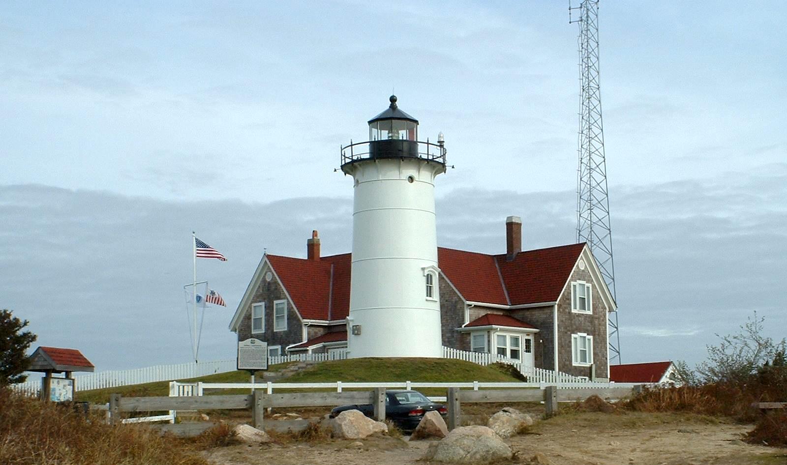
- Nobska Light
- Poor House and Methodist Cemetery
- Teaticket School
- Woods Hole School[4]
Offshore Falmouth in Buzzards Bay, Cleveland East Ledge Light is listed with the National Register.
Geography
[edit]
According to the United States Census Bureau, the town has a total area of 54.4 square miles (141.0 km2), of which 44.1 square miles (114.1 km2) is land and 10.3 square miles (26.8 km2), or 19.04%, is water.[5] Most of Falmouth, like the rest of Cape Cod, sits on glacial sands composed of glacial outwash deposits. However, the soil in the southwestern part of the town, consisting of moraine deposits, is more rocky and dense, like the rest of New England, and many glacial erratics are scattered about, having been dropped by the retreating glaciers. The climate is temperate marine. There is no exposed bedrock. Rainfall is evenly distributed throughout the year and averages 2 to 3 in (51 to 76 mm) per month.
Falmouth lies on the southwestern tip of Cape Cod. It is bordered by Bourne and Sandwich to the north, Mashpee to the east, Vineyard Sound to the south, and Buzzards Bay to the west. At its closest point, Falmouth is approximately 560 yards (510 m) from Nonamesset Island, the easternmost island of the town of Gosnold and the Elizabeth Islands. It is approximately 3+1⁄3 miles (5.4 km) north-northwest of Martha's Vineyard, the closest land to the island. Falmouth is approximately 14 miles (23 km) south of the Bourne Bridge, 22 miles (35 km) west of Barnstable, and 77 miles (124 km) south-southeast of Boston.
Falmouth's topography is similar to the rest of Cape Cod's, with many small ponds, creeks, and inlets surrounded by the pines and oaks of the Cape and often rocky beachfront. Falmouth's southern shore is notable for a series of ponds and rivers spaced very closely together, all of which travel some distance into the town. These include, from west to east, Falmouth Inner Harbor, Little Pond, Great Pond (which leads to the Dexter and Coonamesset rivers), Green Pond, Bourne's Pond, Eel Pond (which leads to the Childs River), and Waquoit Bay, which lies along the Mashpee town line. The Buzzards Bay side of the town is primarily bays divided by necks, peninsulas connected to land by isthmi. The largest inlet is Megansett Cove along the Bourne town line. The Buzzards Bay shore of Falmouth is punctuated by a number of hamlets, including, from north to south, Megansett, New Silver Beach, Old Silver, Chappaquoit, Sippewisset, Quissett, and Woods Hole.
The highest point in Falmouth is Telegraph Hill, also called Falmouth Hill, at an elevation of 157 feet.
Climate
[edit]According to the Köppen climate classification system, Falmouth, Massachusetts has a warm-summer, wet year round, humid continental climate (Dfb). Dfb climates are characterized by at least one month having an average mean temperature ≤ 32.0 °F (≤ 0.0 °C), at least four months with an average mean temperature ≥ 50.0 °F (≥ 10.0 °C), all months with an average mean temperature ≤ 71.6 °F (≤ 22.0 °C), and no significant precipitation difference between seasons. The average seasonal (Nov–Apr) snowfall total is approximately 30 inches (76 cm). The average snowiest month is February, which corresponds with the annual peak in nor'easter activity. According to the United States Department of Agriculture, the plant hardiness zone is 7a, with an average annual extreme minimum air temperature of 1.3 °F (−17.1 °C).[6]
| Climate data for Falmouth, Barnstable County, Massachusetts (1981–2010 averages) | |||||||||||||
|---|---|---|---|---|---|---|---|---|---|---|---|---|---|
| Month | Jan | Feb | Mar | Apr | May | Jun | Jul | Aug | Sep | Oct | Nov | Dec | Year |
| Mean daily maximum °F (°C) | 38.1 (3.4) |
39.8 (4.3) |
45.2 (7.3) |
54.2 (12.3) |
63.4 (17.4) |
72.6 (22.6) |
78.5 (25.8) |
78.1 (25.6) |
72.0 (22.2) |
62.3 (16.8) |
53.4 (11.9) |
43.7 (6.5) |
58.5 (14.7) |
| Daily mean °F (°C) | 30.5 (−0.8) |
32.2 (0.1) |
37.7 (3.2) |
46.3 (7.9) |
55.5 (13.1) |
65.1 (18.4) |
71.2 (21.8) |
70.7 (21.5) |
64.1 (17.8) |
54.2 (12.3) |
45.7 (7.6) |
36.2 (2.3) |
50.9 (10.5) |
| Mean daily minimum °F (°C) | 21.0 (−6.1) |
22.9 (−5.1) |
28.9 (−1.7) |
37.7 (3.2) |
47.0 (8.3) |
57.0 (13.9) |
63.4 (17.4) |
62.6 (17.0) |
55.3 (12.9) |
44.7 (7.1) |
36.2 (2.3) |
26.8 (−2.9) |
42.1 (5.6) |
| Average precipitation inches (mm) | 4.11 (104) |
3.57 (91) |
5.20 (132) |
4.50 (114) |
3.52 (89) |
3.78 (96) |
3.35 (85) |
3.92 (100) |
3.91 (99) |
4.23 (107) |
4.53 (115) |
4.52 (115) |
49.14 (1,248) |
| Average relative humidity (%) | 68.6 | 67.9 | 66.4 | 66.9 | 70.3 | 73.7 | 75.6 | 75.6 | 75.2 | 71.8 | 69.8 | 69.5 | 71.0 |
| Average dew point °F (°C) | 21.4 (−5.9) |
22.8 (−5.1) |
27.5 (−2.5) |
35.9 (2.2) |
46.0 (7.8) |
56.5 (13.6) |
63.1 (17.3) |
62.6 (17.0) |
56.1 (13.4) |
45.3 (7.4) |
36.4 (2.4) |
27.2 (−2.7) |
41.8 (5.4) |
| Source: PRISM Climate Group[7] | |||||||||||||
Ecology
[edit]According to the A. W. Kuchler U.S. Potential natural vegetation Types, Falmouth, Massachusetts would primarily contain a Northeastern Oak/Pine (110) vegetation type with a Southern Mixed Forest (26) vegetation form.[8]
Transportation
[edit]
Falmouth's main road is Massachusetts Route 28, which runs south from Bourne as a divided highway, then becomes a surface road and heads east through downtown as Main Street, then turns northeast through East Falmouth before crossing into Mashpee. As one of two major east–west routes on the Cape, Route 28 is regularly congested, and there is minimal room for widening opportunities. Route 151 runs east–west through the northern section of the town, connecting North Falmouth and Hatchville with Mashpee.[citation needed]
Falmouth is home to The Woods Hole, Martha's Vineyard and Nantucket Steamship Authority. Daily ferry service brings tourists, residents and supplies from Woods Hole to Nantucket and Martha's Vineyard. It is the main ferry line between the Vineyard and the mainland (as Nantucket is further east, its main line leaves Hyannis). A seasonal ferry, the Island Queen, runs from Falmouth Harbor to Martha's Vineyard.[9]
The Massachusetts Coastal Railroad provides rail freight service to North Falmouth, where a spur runs into Otis Air Base to serve a trash transfer station. The nearest inter-city (Amtrak) passenger rail stations are Providence and Boston's South Station. The nearest MBTA Commuter Rail stations are Middleborough and Kingston.
There is a private air park in East Falmouth,[10] and the nearest national and international air service is at Logan International Airport in Boston and T. F. Green Airport near Providence, both being about equidistant from Falmouth. There is a regional airport in nearby Hyannis.[11]
Falmouth is also served by the Cape Cod Regional Transit Authority bus routes.[12]
Demographics
[edit]| Year | Pop. | ±% |
|---|---|---|
| 1850 | 2,621 | — |
| 1860 | 2,456 | −6.3% |
| 1870 | 2,237 | −8.9% |
| 1880 | 2,422 | +8.3% |
| 1890 | 2,567 | +6.0% |
| 1900 | 3,500 | +36.3% |
| 1910 | 3,144 | −10.2% |
| 1920 | 3,500 | +11.3% |
| 1930 | 4,821 | +37.7% |
| 1940 | 6,878 | +42.7% |
| 1950 | 8,662 | +25.9% |
| 1960 | 13,037 | +50.5% |
| 1970 | 15,942 | +22.3% |
| 1980 | 23,640 | +48.3% |
| 1990 | 27,960 | +18.3% |
| 2000 | 32,660 | +16.8% |
| 2010 | 31,531 | −3.5% |
| 2020 | 32,517 | +3.1% |
| 2023* | 33,069 | +1.7% |
| * = population estimate. Source: United States census records and Population Estimates Program data.[13][14][15][16][17][18][19][20][21][22][23] | ||
As of the census[24] of 2000, there were 32,660 people, 13,859 households, and 8,980 families residing in the town. The population density was 738.2 inhabitants per square mile (285.0/km2). There were 20,055 housing units at an average density of 453.3 per square mile (175.0/km2). The racial makeup of the town was 93.39% White, 1.82% Black or African American, 0.51% Native American, 0.92% Asian, 0.02% Pacific Islander, 1.44% from other races, and 1.91% from two or more races. Hispanic or Latino of any race were 1.28% of the population.
There were 13,859 households, out of which 24.2% had children under the age of 18 living with them, 52.0% were married couples living together, 10.1% had a female householder with no husband present, and 35.2% were non-families. 29.8% of all households were made up of individuals, and 14.0% had someone living alone who was 65 years of age or older. The average household size was 2.30 and the average family size was 2.84.
In the town, the population was spread out, with 20.7% under the age of 18, 4.8% from 18 to 24, 24.5% from 25 to 44, 27.5% from 45 to 64, and 22.5% who were 65 years of age or older. The median age was 45 years. For every 100 females, there were 87.6 males. For every 100 females age 18 and over, there were 83.9 males.
The median income for a household in the town was $68,191, and the median income for a family was $97,422. Males had a median income of $61,797 versus $38,867 for females. The per capita income for the town was $42,548. About 4.5% of families and 6.9% of the population were below the poverty line, including 8.8% of those under age 18 and 6.2% of those age 65 or over.
Government and politics
[edit]Falmouth is represented in the Massachusetts House of Representatives as a part of two districts, the Third Barnstable (which also includes portions of Barnstable, Bourne and Mashpee), and the Barnstable, Dukes and Nantucket District, which includes all of Martha's Vineyard, Nantucket and Gosnold. The town is represented in the Massachusetts Senate as a part of the Plymouth and Barnstable district, which includes Bourne, Kingston, Pembroke, Plymouth, and Sandwich.[25] The town is patrolled by the Seventh (Bourne) Barracks of Troop D of the Massachusetts State Police.[26]
On the national level, Falmouth is a part of Massachusetts's 9th congressional district, and is currently represented by Bill Keating.[27]
Since 1937, Falmouth has been governed by a representative town meeting and led by a five-member Select Board serving rotating three-year terms. Twenty-seven town meeting members are elected to three-year terms from nine precincts. The state senator and state representatives who both reside in the town and represent districts that overlap with town serve as town meeting members at large. Prior to 1937, the town was governed by an open town meeting and Select Board.[28][29][30] The town operates its own police and fire departments, with a central police station and five fire stations. The fire department also operates the town's ambulance service with four-ambulances staffed 24/7. The town's central library is located downtown. There are branches in North and East Falmouth, and private libraries in West Falmouth and Woods Hole which are open to the public. There are seven post offices in town for the six ZIP codes, although several overlap and the main office handles the majority of the work. Falmouth is also the site of Falmouth Hospital, which serves the Upper Cape region.[31]
Falmouth has a reputation of being a town that's heavily liberal. Since the 1960s, Falmouth has only been won by republicans Richard Nixon in 1972, and Ronald Reagan in 1980 and 1984. Since 1988, the town has given wide margins to the democratic candidates.
| Year | Democratic | Republican | Third parties | Total Votes | Difference |
|---|---|---|---|---|---|
| 2020 | 64.57% 14,134 | 33.44% 7,319 | 2.00% 437 | 21,890 | 31.13% |
| 2016 | 58.37% 11,467 | 36.47% 7,165 | 5.17% 1,015 | 19,647 | 21.90% |
| 2012 | 56.80% 11,127 | 41.67% 8,163 | 1.53% 299 | 19,589 | 15.13% |
| 2008 | 59.82% 11,725 | 38.28% 7,503 | 1.89% 371 | 19,599 | 21.54% |
| 2004 | 58.32% 11,274 | 40.38% 7,807 | 1.30% 251 | 19,332 | 17.93% |
| 2000 | 55.78% 9,835 | 36.38% 6,414 | 7.84% 1,382 | 17,631 | 19.40% |
| 1996 | 58.92% 9,460 | 31.42% 5,044 | 9.66% 1,551 | 16,055 | 27.51% |
| 1992 | 47.92% 7,622 | 28.38% 4,514 | 23.71% 3,771 | 15,907 | 19.54% |
| 1988 | 53.31% 7,893 | 45.60% 6,751 | 1.09% 162 | 14,806 | 7.71% |
| 1984 | 47.25% 6,403 | 52.40% 7,100 | 0.35% 47 | 13,550 | 5.14% |
| 1980 | 35.35% 4,412 | 44.73% 5,582 | 19.92% 2,486 | 12,480 | 9.38% |
| 1976 | 50.00% 5,657 | 46.37% 5,246 | 3.62% 410 | 11,313 | 3.63% |
| 1972 | 44.98% 4,117 | 54.51% 4,989 | 0.50% 46 | 9,152 | 9.53% |
| 1968 | 49.25% 3,433 | 47.47% 3,309 | 3.29% 229 | 6,971 | 1.78% |
| 1964 | 66.27% 3,994 | 33.33% 2,009 | 0.40% 24 | 6,027 | 32.94% |
| 1960 | 49.25% 2,841 | 50.63% 2,921 | 0.12% 7 | 5,769 | 1.39% |
| 1956 | 24.83% 1,175 | 75.03% 3,551 | 0.15% 7 | 4,733 | 50.20% |
| 1952 | 30.83% 1,297 | 69.15% 2,909 | 0.02% 1 | 4,207 | 38.32% |
| 1948 | 31.41% 1,006 | 67.75% 2,170 | 0.84% 27 | 3,203 | 36.34% |
| 1944 | 39.34% 1,053 | 60.59% 1,622 | 0.07% 2 | 2,677 | 21.26% |
| 1940 | 39.49% 1,065 | 60.18% 1,623 | 0.33% 9 | 2,697 | 20.69% |
Education
[edit]Falmouth's public school system serves about 4,500 students yearly. There are four schools, East Falmouth, Mullen-Hall, North Falmouth, and Teaticket, which serve the elementary school population, from pre-kindergarten to fourth grade. The Morse Pond Middle School serves grades five and six, while the Lawrence Junior High School serves grades seven and eight. Falmouth High School covers grades 9–12. (Prior to 1974 the 9–12 grades were in the Lawrence building and known as Lawrence High School.) FHS's athletics teams are nicknamed the Clippers, and their colors are maroon and white. They compete in the Atlantic Coast League, having moved recently from the Old Colony League. Their chief rival is nearby Barnstable High School. The public schools are supported in part by the Volunteers in Public Schools (VIPS), various PTO associations, the Falmouth Scholarship Association, the Falmouth Education Foundation (FEF), the Falmouth STEM Boosters and the Woods Hole Science Technology Partnership.
Falmouth is also the home of a private school, Falmouth Academy, serving grades 7 through 12. Falmouth high school students may also choose to attend the Upper Cape Cod Regional Technical High School in Bourne free of charge. Resident students can also attend Sturgis Charter Public School in Hyannis also free of charge, pending acceptance through a lottery.
Sports and recreation
[edit]
Falmouth is home to the Falmouth Commodores, an amateur collegiate summer baseball team in the Cape Cod Baseball League. The team plays at Arnie Allen Diamond at Guv Fuller Field, and has featured dozens of players who went on to careers in Major League Baseball, such as Tino Martinez,[33] Darin Erstad,[34] and Jacoby Ellsbury.[35]
Falmouth is the home of its namesake Falmouth Road Race, an annual race started in 1973 that draws over 10,000 runners from all over the world. The race runs 7 miles (11 km) from the village of Woods Hole to Falmouth Heights Beach in downtown Falmouth.
Arts and entertainment
[edit]Falmouth is home to a vibrant theatre community. The College Light Opera Company has performed at the Highfield Theatre every summer since 1969. Other institutions include the Falmouth Theatre Guild and the Cape Cod Theatre Project.
In addition to theatre, there is the Cape Cod Conservatory[36] and the Falmouth Arts Guild.[37]
Falmouth holds a yearly Christmas parade in the month of December that runs along Main Street in downtown Falmouth.
At the end of July, the Woods Hole Film Festival showcases local and international films in a week long event. Established in 1991, it is the oldest independent film festival on Cape Cod.[38]
Notable people
[edit]- Peter Abrahams, author
- Ben Affleck, actor
- Casey Affleck, actor
- Katharine Lee Bates, writer of "America the Beautiful"
- Steve Cishek, relief pitcher for the Chicago Cubs
- Colleen Coyne, 1998 Olympic gold medalist on the U.S. women's ice hockey team
- Jason Cullinane, distance runner, coach, and Army officer
- Wesley Dennis, illustrator of children's books
- Pete Doherty "The Duke of Dorchester"
- Jessica Dubroff, seven-year-old pilot trainee who died in a plane crash
- Jacob Sloat Fassett, U.S. congressman from Elmira, New York; Fassett's Point in West Falmouth and the town of Fassett, Quebec, are named after him
- Melissa Febos, writer
- Paul Harney, former professional PGA golfer, resided in Falmouth and owned the Paul Harney Golf Club in Hatchville
- Edward Hopkins Jenkins (1850–1931), agricultural chemist; director of the Connecticut Agricultural Experiment Station (1900–1923); born in Falmouth
- Mark Lachs, physician, scientist, and popular author
- Julia Marden, Wampanoag artist
- John Muse, professional hockey player
- Frederick E. Olmsted, WPA muralist and sculptor then later scientist
- Julia O'Malley-Keyes, fine artist
- Joseph Rago, journalist
- Charles Bennett Ray Abolitionist journalist
- Greg Dean Schmitz, online film journalist (Yahoo! Movies, Rotten Tomatoes)
- Sunita Williams, astronaut and United States Navy officer
Military installations
[edit]Camp Edwards, formerly named Camp Falmouth,[citation needed] is a US military training camp in western Barnstable County. It is the largest part of Joint Base Cape Cod, formerly named Massachusetts Military Reservation. The installation is of economic and environmental importance.
Groundwater pollution
[edit]During the 1970s and 1980s, it was discovered that the groundwater in some areas of Falmouth had been contaminated by toxic chemicals linked to the disposal of jet fuel, solvents, industrial chemicals, and other substances on the Massachusetts Military Reservation, now known as Joint Base Cape Cod. Plumes of groundwater pollution that reached into Falmouth contaminated household well water in some neighborhoods and forced the town to shut down a public well in 1975 that accounted for 25% of the town's public water supply. A major report was released on the contamination in 1986. In 1996, the Air Force Center for Environmental Excellence (now known as the Air Force Center for Engineering and the Environment) assumed responsibility for the cleanup, treating soils at several sites and installing pumping wells in an effort to contain the plumes of groundwater contamination.[39]
In 2010, the Silent Spring Institute tested about 20 public water supplies, 40 percent of which had detectable levels of perfluorinated compounds (PFCs).[40] In 2015, the Air Force started testing private wells in the Currier Road area after water treatment plant samples showed elevated levels of 1,4-dioxane.[40] Since May 2016, four houses in the Currier Road neighborhood have been receiving bottled water for elevated levels of PFCs after the U.S. Environmental Protection Agency established a national standard for PFCs, such as PFOS and PFOAs.[40]
In popular culture
[edit]References
[edit]- ^ "Census - Geography Profile: Falmouth town, Barnstable County, Massachusetts". U.S. Census Bureau. Retrieved October 6, 2021.
- ^ Gannett, Henry (1905). The Origin of Certain Place Names in the United States. Govt. Print. Off. pp. 123.
- ^ "Town of Falmouth, Historical Commission" (PDF). Archived from the original (PDF) on August 2, 2014. Retrieved September 24, 2012.
- ^ "Town of Falmouth, Historic Districts Commission". Archived from the original on January 16, 2012. Retrieved September 24, 2012.
- ^ "Geographic Identifiers: 2010 Demographic Profile Data (G001): Falmouth town, Barnstable County, Massachusetts". U.S. Census Bureau, American Factfinder. Archived from the original on February 12, 2020. Retrieved December 4, 2013.
- ^ "USDA Interactive Plant Hardiness Map". United States Department of Agriculture. Archived from the original on July 4, 2019. Retrieved June 28, 2019.
- ^ "PRISM Climate Group, Oregon State U". www.prism.oregonstate.edu. Retrieved June 26, 2019.
- ^ "U.S. Potential Natural Vegetation, Original Kuchler Types, v2.0 (Spatially Adjusted to Correct Geometric Distortions)". Data Basin. Retrieved July 30, 2019.
- ^ "The Island Queen Ferry to Martha's Vineyard". Island Queen. Retrieved October 15, 2021.
- ^ "AirNav: 5B6 - Falmouth Airpark". www.airnav.com. Retrieved March 6, 2023.
- ^ "Home". FlyHYA | Cape Cod Gateway Airport. Retrieved March 6, 2023.
- ^ "Fixed Routes".
- ^ "Total Population (P1), 2010 Census Summary File 1". American FactFinder, All County Subdivisions within Massachusetts. United States Census Bureau. 2010.
- ^ "Massachusetts by Place and County Subdivision - GCT-T1. Population Estimates". United States Census Bureau. Retrieved July 12, 2011.
- ^ "1990 Census of Population, General Population Characteristics: Massachusetts" (PDF). US Census Bureau. December 1990. Table 76: General Characteristics of Persons, Households, and Families: 1990. 1990 CP-1-23. Retrieved July 12, 2011.
- ^ "1980 Census of the Population, Number of Inhabitants: Massachusetts" (PDF). US Census Bureau. December 1981. Table 4. Populations of County Subdivisions: 1960 to 1980. PC80-1-A23. Retrieved July 12, 2011.
- ^ "1950 Census of Population" (PDF). Bureau of the Census. 1952. Section 6, Pages 21-10 and 21-11, Massachusetts Table 6. Population of Counties by Minor Civil Divisions: 1930 to 1950. Retrieved July 12, 2011.
- ^ "1920 Census of Population" (PDF). Bureau of the Census. Number of Inhabitants, by Counties and Minor Civil Divisions. Pages 21-5 through 21-7. Massachusetts Table 2. Population of Counties by Minor Civil Divisions: 1920, 1910, and 1920. Retrieved July 12, 2011.
- ^ "1890 Census of the Population" (PDF). Department of the Interior, Census Office. Pages 179 through 182. Massachusetts Table 5. Population of States and Territories by Minor Civil Divisions: 1880 and 1890. Retrieved July 12, 2011.
- ^ "1870 Census of the Population" (PDF). Department of the Interior, Census Office. 1872. Pages 217 through 220. Table IX. Population of Minor Civil Divisions, &c. Massachusetts. Retrieved July 12, 2011.
- ^ "1860 Census" (PDF). Department of the Interior, Census Office. 1864. Pages 220 through 226. State of Massachusetts Table No. 3. Populations of Cities, Towns, &c. Retrieved July 12, 2011.
- ^ "1850 Census" (PDF). Department of the Interior, Census Office. 1854. Pages 338 through 393. Populations of Cities, Towns, &c. Retrieved July 12, 2011.
- ^ "City and Town Population Totals: 2020−2023". United States Census Bureau. Retrieved May 19, 2024.
- ^ "American FactFinder". United States Census Bureau. Archived from the original on February 12, 2020. Retrieved January 31, 2008.
- ^ "Index of Legislative Representation by City and Town, from Mass.gov". Archived from the original on September 29, 2007. Retrieved February 22, 2007.
- ^ "Mass.gov". www.mass.gov. Retrieved March 6, 2023.
- ^ "Our District". December 4, 2012.
- ^ "Town of Falmouth, Massachusetts". mma.org. Massachusetts Municipal Association. Retrieved February 5, 2024.
- ^ "Town Meeting Members". falmouthma.gov. Town of Falmouth, Massachusetts. Retrieved February 5, 2024.
- ^ Falmouth Town Report 1936. Falmouth, Massachusetts: Falmouth Publishing Co., Inc. 1937. p. 36. Retrieved February 5, 2024.
- ^ Falmouth Hospital
- ^ "Election Results".
- ^ "Cape League Wrapup". Barnstable Patriot. Barnstable, MA. July 3, 1986. p. 10. Archived from the original on June 10, 2020. Retrieved June 10, 2020.
- ^ Judd, Grant (January 31, 2002). "Cape League honors its own". Yarmouth Register. Yarmouth, MA. p. 8. Archived from the original on June 10, 2020. Retrieved June 10, 2020.
- ^ Murphy, Sarah (November 1, 2007). "A mother knows: Host mom was early witness to Ellsbury's greatness". Yarmouth Register. Yarmouth, MA. p. 16. Archived from the original on June 10, 2020. Retrieved June 10, 2020.
- ^ "Cape Cod Live Orchestra Music | Cape Symphony Orchestra". Cape Symphony. Retrieved March 6, 2023.
- ^ "Home". Falmouth Art Center. Retrieved March 6, 2023.
- ^ "About Us : FESTIVAL 2024: JULY 27 - AUGUST 3".
- ^ "The Massachusetts Military Reservation - An Environmental Dilemma". United States Geological Survey. November 30, 2016.
{{cite web}}: Missing or empty|url=(help) - ^ a b c George Brennan (May 20, 2016). "Air Force reacts to contaminated Falmouth water wells". Cape Cod Times. Falmouth, MA. Local Media Group, Inc. Retrieved May 25, 2016.
- ^ Myers, K. C. "Heroin's impact, right here at home". Cape Cod Times. Retrieved March 19, 2025.
- ^ Torres, Eric. "Allie X: Cape God". Pitchfork. Retrieved March 19, 2025.
External links
[edit]- Town of Falmouth Official Website
- Falmouth Historical Society
- Falmouth Chamber of Commerce Tourist Information

Boston (capital) | |
| Topics | |
| Society | |
| Regions | |
| Counties | |
| Cities |
|
| International | |
|---|---|
| National | |
| Geographic | |
| Other | |
Falmouth, Massachusetts
View on GrokipediaHistory
Early Settlement and Colonial Period
The area now known as Falmouth was originally inhabited by the Wampanoag people, who referred to it as Suckanesset, meaning "place near the flowing salt water" or a site associated with black wampum production from quahog shells.[8] European exploration of Cape Cod began with Bartholomew Gosnold's 1602 voyage, but permanent settlement awaited later colonial expansion from Plymouth Colony.[9] English colonists first settled Falmouth in 1660, with Jonathan Hatch arriving that year or in 1661 as one of the earliest permanent residents; he established a homestead near Salt Pond after navigating local waters.[10] Many initial settlers were from Barnstable and Sandwich, drawn by fertile lands and coastal access, and included individuals sympathetic to Quakers who sought relative tolerance amid persecution elsewhere in the colonies.[11] The settlement grew slowly amid challenges like isolation and interactions with indigenous groups, focusing on subsistence agriculture such as corn, hay, and livestock rearing, supplemented by fishing in Vineyard Sound.[12] Falmouth received its official charter and incorporation on June 15, 1686, under the name derived from the English port town, as part of the Province of Massachusetts Bay following the 1691 merger of Plymouth and Massachusetts Bay colonies.[13] Early governance involved proprietors dividing common lands for farming and pasturage, with records indicating modest population growth to around 200 families by the early 18th century.[14] The colonial economy emphasized self-sufficiency through mixed farming, coastal fishing for cod and shellfish, and limited trade, though vulnerabilities to Native American conflicts like King Philip's War (1675–1676) prompted fortifications and temporary abandonments in nearby areas.[1] By the mid-18th century, salt production from seawater evaporation supported fishing preservation, laying groundwork for later maritime expansion.[12]Economic and Social Development (19th-20th Centuries)
In the early 19th century, Falmouth's economy centered on agriculture, which engaged approximately two-thirds of its families, supplemented by fishing, coastal trading, and salt production from seawater evaporation in coastal works.[15][12] Sheep farming and wool production also contributed, as documented in local records of livestock inventories and textile outputs.[16] Maritime activities expanded with whaling, which peaked between 1820 and 1860; Falmouth served as home port for 13 whaling vessels that undertook 52 voyages, primarily to the Pacific, with six ships built locally and 65 town residents captaining such expeditions.[17][18] Shipbuilding at sites like Bar Neck Wharf in Woods Hole supported this sector, though the industry's decline by the 1870s—due to overexploitation and competition from petroleum—prompted economic diversification.[19] By mid-century, tourism emerged as a growth driver, transforming Falmouth into a summer resort destination leveraging its 67 miles of sheltered coastline for boating and bathing.[20] The completion of a railroad spur to Woods Hole in 1872 enhanced accessibility from Boston, spurring developments like Falmouth Heights (1871), an initial speculative venture for moderate-income visitors with hotels and Central Park, followed by upscale areas such as Chapoquoit Beach (1890) and Penzance Point (1892) for affluent professionals including congressmen and businessmen.[20][12] This influx stimulated local commerce, with town valuation rising from $1.232 million (average 1826–1876) to $6.5 million by 1896 and tax revenues increasing from $2,800 to $41,000 annually, funded partly by four wealthy families paying half the taxes; new infrastructure included 150 miles of roads and shops along Main Street, creating jobs for carpenters and merchants.[20] Socially, these changes shifted Falmouth from a primarily agrarian and maritime community to one blending year-round residents with seasonal elites seeking health and leisure, evident in the rise of modern cottages amid colonial architecture.[20] The establishment of the U.S. Fish Commission laboratory in Woods Hole in 1871 laid groundwork for scientific pursuits, fostering a research-oriented social fabric.[12] In the 20th century, tourism solidified as a pillar, with automobile bridges to Cape Cod in 1935 enabling broader access and year-round population growth alongside seasonal tripling.[21][12] The founding of the Woods Hole Oceanographic Institution in 1930 as the first independent nonprofit ocean research entity integrated Falmouth into a burgeoning scientific economy, attracting federal funding and expertise to the village's established marine community, eventually making it the town's largest employer after healthcare.[22][23] Socially, this diversified the populace with researchers and educators, complementing resort life while sustaining economic resilience beyond seasonal visitors.[12]Post-World War II Growth and Suburbanization
Following World War II, Falmouth underwent substantial population expansion, with the town's residents growing by 51% from 1950 to 1960, marking the most rapid increase in its modern history.[24] This surge reflected broader national trends of postwar economic prosperity, the baby boom, and enhanced accessibility via improved highways connecting Cape Cod to Boston and other urban centers.[25] Proximity to Otis Air National Guard Base, which saw heavy utilization during and after the war, further spurred residential influx as military personnel and related workers settled in the area.[25] By the 1970s, Falmouth's population had climbed to over 15,000, driven increasingly by retirees and seasonal residents converting summer properties to year-round use amid rising tourism demand.[24] Suburbanization accelerated through scattered residential development along north-south and east-west coastal routes, transforming former farmland and woodland into neighborhoods of single-family homes.[21] Homebuilding booms in the 1970s and especially the 1980s capitalized on Cape Cod's overall construction surge, with thousands of new units approved regionally between 1980 and 1985, many in Falmouth to accommodate commuters, vacationers, and those drawn to the Woods Hole Oceanographic Institution's research economy.[26] Tourism, bolstered by ferry services to Martha's Vineyard and the town's beaches, intertwined with housing growth, as second-home ownership fueled seasonal population swells exceeding 50,000 in peak summer months by the late 20th century.[12] This pattern shifted Falmouth from a seasonal enclave toward a suburban commuter and retirement hub, though it strained infrastructure and prompted later conservation measures.[21]Historic Districts and Preservation Efforts
Falmouth, Massachusetts, encompasses seven local historic districts designated under state law to safeguard structures and landscapes reflecting the town's architectural heritage from the 18th to early 20th centuries. These include the Davisville Historic District, Falmouth Village Historic District, North Falmouth Historic District, Waquoit Historic District, West Falmouth Historic District, Woods Hole Historic District, and Quissett Historic District.[27] [28] The districts feature concentrations of Federal, Greek Revival, and Victorian-era buildings, with boundaries mapped by the town to encompass key village centers and rural hamlets.[29] Four of these—Falmouth Village, North Falmouth, Waquoit, and West Falmouth—are also listed on the National Register of Historic Places, recognizing their significance in American history, architecture, and maritime culture.[30] The Falmouth Village district centers on the historic green established in 1756, preserving late Colonial and Federal structures amid threats from modern development. North Falmouth focuses on 19th-century rural village architecture at key crossroads.[31] Preservation efforts are overseen by the Falmouth Historical Commission, which maintains an inventory of over 100 significant buildings, landscapes, and monuments town-wide and enforces design review guidelines through the Historic District Commission to prevent incompatible alterations.[28] [32] Since adopting the Community Preservation Act in 2002, the town has allocated approximately $8.8 million from the Community Preservation Fund to 19 projects by June 2024, including $1.108 million for Highfield Hall's exterior restoration in 2023, $267,600 for Davis House rehabilitation in 2010, and $154,970 for Bay View Cemetery repairs in 2020.[33] Additional initiatives involve digitizing historical records like Falmouth Enterprise articles from 1896–1962 and restoring public monuments such as the World War I Memorial.[12] In March 2024, the town initiated plans to install official markers for the districts to enhance public awareness and protection.[27]Geography
Physical Location and Terrain
Falmouth occupies the southwestern tip of Cape Cod in Barnstable County, southeastern Massachusetts, extending along the shores of Vineyard Sound to the south and Buzzards Bay to the west. The town spans 54.4 square miles, comprising 44.1 square miles of land and 10.3 square miles of inland water bodies and coastal waters.[7] Its position on the peninsula places it approximately 70 miles southeast of Boston and adjacent to the Elizabeth Islands, with ferry connections to Martha's Vineyard.[34] The terrain of Falmouth reflects the glacial origins of Cape Cod, formed by deposits from the retreating Laurentide Ice Sheet during the late Pleistocene, approximately 18,000 to 12,000 years ago. Bedrock lies buried under 200 to 600 feet of glacial drift, including till, sand, and gravel, with local depths reaching 307 feet of unconsolidated sediments in borehole samples—100 feet of sand and gravel overlying finer till.[35] [36] Prominent features include the Falmouth Moraine, a ridge of glacial debris marking the ice sheet's southern advance, which creates low rolling hills rising to elevations of 50 to 100 feet, interspersed with kettle ponds formed by melting ice blocks.[37] Coastal areas feature sandy beaches, dunes, and salt marshes, while inland sections consist of outwash plains with pine-oak woodlands on sandy, nutrient-poor soils. Average elevation across the town is about 23 feet, with minimal relief characteristic of Cape Cod's post-glacial landscape.[38]Climate Data and Patterns
Falmouth exhibits a humid subtropical climate (Köppen Cfa), transitional to oceanic due to its peninsula location, with warm, humid summers and cool, occasionally snowy winters moderated by the Atlantic Ocean's proximity and the Gulf Stream's influence.[39][40] This results in milder extremes compared to inland Massachusetts areas, where continental effects amplify temperature swings. Annual average temperature is 51.4°F, with diurnal ranges typically 10–15°F.[40] Precipitation totals approximately 49 inches annually, distributed fairly evenly but with a slight autumn peak from nor'easters and tropical systems; July is the driest month at around 2.5 inches, while November sees up to 3.8 inches.[41][42] Snowfall averages 27 inches per year, concentrated from December to March, though coastal positioning reduces accumulation relative to northern New England; the snowy period spans about 4 months with measurable snow (≥1 inch in 31-day sliding average) primarily in January and February.[43][41]| Month | Avg. High (°F) | Avg. Low (°F) | Avg. Precip. (in) | Avg. Snow (in) |
|---|---|---|---|---|
| January | 38 | 27 | 3.8 | 8.0 |
| February | 40 | 28 | 3.5 | 7.5 |
| March | 45 | 33 | 4.0 | 4.5 |
| April | 55 | 42 | 3.6 | 0.5 |
| May | 65 | 51 | 3.2 | 0 |
| June | 74 | 60 | 3.0 | 0 |
| July | 80 | 66 | 2.5 | 0 |
| August | 79 | 65 | 3.0 | 0 |
| September | 73 | 59 | 3.3 | 0 |
| October | 64 | 50 | 3.7 | 0 |
| November | 53 | 41 | 3.8 | 1.0 |
| December | 43 | 32 | 4.0 | 5.5 |
Environment
Ecological Features and Conservation Lands
Falmouth encompasses diverse coastal ecosystems influenced by glacial moraines deposited around 12,000 years ago, featuring barrier beaches, salt marshes, tidal flats, freshwater ponds, and upland woodlands that support varied flora and fauna.[45][46] These habitats include expansive salt marshes like Great Sippewissett Marsh, which provide critical intertidal zones for bird species and marine life along Buzzards Bay.[47] Wetlands, bogs, and rivers such as the Childs River and Moonakis River host native plant communities and wildlife, though stormwater pollutants threaten pond ecosystems and downstream coastal embayments.[48][49] Conservation initiatives prioritize wetland protection and open space preservation to maintain ecological integrity. The Falmouth Conservation Commission regulates activities impacting wetlands under state and local bylaws, managing town-owned lands to safeguard dependent plants, animals, and natural communities.[50] The nonprofit 300 Committee Land Trust has conserved over 2,500 acres since its founding, including key parcels like Ashumet Holly Wildlife Sanctuary, known for rare holly species and pollinator habitats; Crane Wildlife Management Area; Allietta Field; and Florence Sylvia Woodland, with restrictions ensuring perpetual protection for biodiversity and water resources.[51][52] Federal and state designations enhance these efforts, notably the Waquoit Bay National Estuarine Research Reserve, covering 2,700 acres of open waters, barrier beaches, marshes, and uplands in the town, which serves as a model for shallow estuarine systems and supports research on habitat dynamics.[46] Additional protected sites include the 9.6-acre Little Pond Conservation Area for passive recreation and watershed protection, Quaker Marsh Conservation Area along Wild Harbor River for tidal access and marsh observation, and Salt Pond sanctuaries focused on avian habitats.[53][54][55] Community-driven biodiversity monitoring, such as iNaturalist surveys on these lands, documents species occurrences to inform ongoing management amid invasive species pressures like multiflora rose and Japanese barberry.[56][57]Groundwater Contamination Sources and Extent
Groundwater contamination in Falmouth primarily stems from historical military operations at the adjacent Joint Base Cape Cod (JBCC), encompassing the former Otis Air National Guard Base (ANGB) and Camp Edwards, designated a Superfund site in 1989.[58] Key sources include chemical and fuel spills, aqueous film-forming foam (AFFF) used in fire training, landfills, drainage structures, munitions training, and unexploded ordnance disposal.[58] These activities released volatile organic compounds (VOCs), per- and polyfluoroalkyl substances (PFAS such as PFOA and PFOS), 1,4-dioxane, RDX (an explosive), and perchlorate into the soil and aquifer.[58] The Cape Cod aquifer, a sole-source drinking water supply for Falmouth, is highly vulnerable due to its sandy composition and rapid groundwater flow rates of 1-2 feet per day, facilitating contaminant migration downgradient from JBCC toward coastal towns including Falmouth.[59] Contamination manifests in at least 11 identified plumes from Otis ANGB and 9 from Camp Edwards sites, with PFAS plumes originating from fire training areas (e.g., Ashumet Valley/FTA-1) and incidents like tanker truck rollovers extending off-base.[58][59] The extent includes detections exceeding regulatory thresholds in monitoring wells and private wells in Falmouth, particularly from PFAS migration, prompting mitigation measures such as bottled water provision, in-home treatment systems, and connections to public water supplies since 2014.[58] While plume containment strategies have prevented widespread impacts to public drinking water supplies to date, over 80 contaminant source areas have been assessed across the 22,000-acre site, with ongoing treatment extracting approximately 5.4 million gallons per day from Otis plumes and 3.0 million from Camp Edwards as of 2025.[58][59] Secondary local sources, such as percolation from municipal landfills and septic systems, contribute lesser nitrate and pathogen loads but are overshadowed by military-derived persistent chemicals in the aquifer.[60]Remediation Efforts and Military Base Impacts
The Joint Base Cape Cod (JBCC), encompassing the former Otis Air National Guard Base and Camp Edwards, has been subject to extensive environmental remediation under the U.S. Environmental Protection Agency's Superfund program since its listing on the National Priorities List in 1989.[61] The Installation Restoration Program (IRP) addresses contamination from solvents, fuels, and other chemicals at source areas and plumes, while the Impact Area Groundwater Study Program (IAGWSP) targets explosives-related impacts in the Camp Edwards training area. As of April 2025, remediation efforts treat approximately 5.4 million gallons per day of contaminated groundwater across four major plumes through extraction wells, on-site treatment via air stripping and carbon adsorption, and reinjection into the aquifer to contain migration.[61] In Falmouth, the CS-10 plume, contaminated primarily with chlorinated solvents from historical base operations, prompted the installation of a permeable reactive barrier (PRB) system by the University of Waterloo in collaboration with federal agencies; this in-situ technology uses zero-valent iron to degrade contaminants as groundwater flows through it, demonstrating effectiveness in pilot-scale tests for plume containment.[62] Broader IRP measures have included wellhead treatment systems at the Falmouth public water supply well, completed by the Air Force Civil Engineer Center (AFCEC), to remove volatile organic compounds before distribution. Off-base, over 1,300 homes in affected areas, including portions of Falmouth, have been connected to municipal water lines or provided granular activated carbon filtration to replace impacted private wells. Military base activities have resulted in multiple plumes migrating southward from JBCC toward Falmouth's North Falmouth and Waquoit areas, with groundwater flow carrying contaminants like trichloroethylene, perchloroethylene, and per- and polyfluoroalkyl substances (PFAS) at concentrations exceeding drinking water standards.[63] PFAS from Aqueous Film-Forming Foam (AFFF) used in fire training has persisted in the aquifer, with modeling indicating leaching could continue for centuries without full source removal, as evidenced by detections in private wells near the base as recently as 2023.[64] These impacts have necessitated land-use controls restricting groundwater extraction in plume paths and ongoing monitoring, though partial deletions of 61 source areas from the Superfund list in 2007 reflect progress in remediating less mobile contaminants.[65] Despite advancements, challenges remain due to the aquifer's high permeability, which accelerates plume transport over distances exceeding 4 miles from sources, complicating full restoration; federal reports emphasize reliance on pump-and-treat systems supplemented by natural attenuation where verified, but critics, including local advocacy groups, argue for accelerated PFAS source excavation to prevent further off-base spread.[66][67] Treatment efficacy is tracked via quarterly sampling, with plume footprints reduced by an estimated 20-30% in solvent-dominated areas since the 1990s, though PFAS plumes continue to expand slowly toward Falmouth's drinking water sources.[68]Demographics
Population Trends and Projections
The population of Falmouth grew steadily from 27,960 residents in the 1990 U.S. Census to 29,508 in 2000, 31,531 in 2010, and 32,517 in 2020, reflecting an average decennial increase of approximately 1.6% over this period.[69][70] This growth aligns with broader post-World War II suburbanization trends on Cape Cod, driven by retirees and second-home owners attracted to the area's coastal appeal, though constrained by environmental regulations and limited developable land. The decade from 2010 to 2020 saw a modest 3.1% rise, slower than the state average, amid rising housing costs and an aging demographic profile.[70]| Census Year | Population | Percent Change from Prior Decade |
|---|---|---|
| 1990 | 27,960 | +16.6% (from 1980: 23,640) |
| 2000 | 29,508 | +5.5% |
| 2010 | 31,531 | +6.9% |
| 2020 | 32,517 | +3.1% |
Socioeconomic and Household Characteristics
The median household income in Falmouth was $88,125 in 2022 dollars, based on the 2018–2022 American Community Survey (ACS) 5-year estimates.[74] Per capita income stood at $51,297 over the same period, reflecting a community with substantial individual earnings, often bolstered by retirement savings and property assets in this coastal area.[74] The poverty rate was 7.0%, lower than the Massachusetts state average of approximately 9.4% during comparable periods, indicating relative economic stability despite seasonal tourism influences.[74] Educational attainment among residents aged 25 and older is notably high, with 97.5% having graduated high school or attained a higher degree, surpassing the national average of about 89%.[74] Additionally, 52.8% hold a bachelor's degree or higher, compared to roughly 35% nationally, a figure attributable to the influx of educated professionals and retirees drawn to the region's quality of life and proximity to institutions like Woods Hole Oceanographic Institution.[74] Households in Falmouth average 2.14 persons, smaller than the U.S. average of 2.5, consistent with an older demographic and prevalence of empty-nester or single-occupant units among retirees.[74] Homeownership is prevalent, with an 81.2% owner-occupied housing unit rate, exceeding the national figure of 65.7%; the median value of such units was $586,800, underscoring the town's appeal as a high-value residential market constrained by coastal geography and zoning.[74]Racial, Ethnic, and Age Demographics
As of the 2020 United States Census, Falmouth's population of 32,517 was racially homogeneous, with White residents comprising the vast majority. The following table summarizes the racial and ethnic composition based on self-reported data:| Race/Ethnicity | Percentage |
|---|---|
| White alone | 85.5% |
| Black or African American alone | 1.2% |
| American Indian and Alaska Native alone | 0.3% |
| Asian alone | 2.7% |
| Native Hawaiian and Other Pacific Islander alone | 0.0% |
| Two or More Races | 6.8% |
| Hispanic or Latino (of any race) | 3.3% |
| White alone, not Hispanic or Latino | 82.9% |
Government and Politics
Town Governance Structure
Falmouth operates under a home rule charter adopted by voters and effective January 1, 1991, which establishes a representative town meeting as the legislative body, a five-member select board as the primary executive authority, and a professionally appointed town manager as the chief administrative officer.[75][76] This structure replaced the traditional open town meeting format while retaining core elements of Massachusetts town governance, emphasizing elected oversight with professional administration to handle the town's growing population and seasonal demands.[77] The representative town meeting consists of approximately 240 elected members, known as town meeting members, who serve staggered three-year terms and convene twice annually—once in spring after April 1 and once in fall, with dates set by bylaw or the select board.[78][79] This body holds exclusive authority to enact bylaws, approve budgets exceeding $10,000, appropriate funds, and act on warrant articles submitted by the select board or citizen petition requiring 100 signatures.[76] A town moderator, elected for one-year terms, presides over meetings to ensure orderly debate and voting, often by voice or division rather than full ballot unless required.[80] The select board, formerly known as the board of selectmen, comprises five members elected to overlapping three-year terms, with the chair selected annually by peers.[81] As the town's chief elected executive, it appoints the town manager, oversees policy implementation, issues licenses, and manages non-administrative functions like emergency declarations; meetings occur biweekly on Mondays at 6:30 p.m. in town hall.[81][82] Board members receive modest stipends, reflecting their part-time role in a town where administrative duties are delegated to maintain efficiency amid a population of over 30,000 residents and significant tourism.[77] The town manager, appointed by and serving at the pleasure of the select board, directs all town departments, prepares budgets for town meeting approval, coordinates interdepartmental operations, and executes policies without direct policymaking power.[83] This position, filled since the charter's adoption to professionalize management, reports directly to the board and handles day-to-day governance for services including public works, finance, and community development, insulating elected officials from routine administration.[84] The structure aligns with Massachusetts General Laws Chapter 43B, allowing home rule flexibility while preserving town meeting sovereignty.[76]Electoral Outcomes and Voter Registration Data
As of October 26, 2024, Falmouth had 28,849 registered voters, including 6,731 Democrats (23.3 percent), 3,010 Republicans (10.4 percent), 74 Libertarians (0.3 percent), and 18,896 unenrolled voters (65.5 percent).[85] This distribution aligns with broader Massachusetts patterns, where unenrolled voters constitute the majority and often participate as independents without formal party affiliation.[85] Earlier data from August 2024 showed similar proportions among 28,440 registered voters: 6,613 Democrats (23.3 percent) and 2,970 Republicans (10.4 percent).[86]| Party Affiliation | Number of Voters | Percentage of Total |
|---|---|---|
| Democrat | 6,731 | 23.3% |
| Republican | 3,010 | 10.4% |
| Libertarian | 74 | 0.3% |
| Unenrolled | 18,896 | 65.5% |
| Total | 28,849 | 100% |
Economy
Core Industries and Employment
The economy of Falmouth centers on scientific research and education, healthcare, maritime transportation, and tourism-related services, with the Woods Hole Oceanographic Institution (WHOI) serving as the town's largest employer, employing between 1,000 and 4,999 staff across its facilities in the Woods Hole village.[91] Other key institutions include the Marine Biological Laboratory, with 250-499 employees focused on biological research.[91] Healthcare employs hundreds through Falmouth Hospital (500-999 staff) and facilities like JML Care Center and Visiting Nurse Association (each 250-499).[91] The Steamship Authority, operating ferry services to Martha's Vineyard and Nantucket, maintains 500-999 employees at its Woods Hole terminals.[91]| Employer | Industry | Employee Range |
|---|---|---|
| Woods Hole Oceanographic Institution | Scientific Research | 1,000-4,999 |
| Falmouth Hospital | Healthcare | 500-999 |
| Steamship Authority | Maritime Transportation | 500-999 |
| Marine Biological Laboratory | Scientific Research | 250-499 |
| JML Care Center / Visiting Nurse Association | Healthcare | 250-499 each |