
Community hub
Shimoga
View on Wikipedia
Shimoga, officially Shivamogga[4] (Kannada: [ʃiʋɐmoɡːɐ]), is a city and the district headquarters of Shimoga district in the Karnataka state of India. The city lies on the banks of the Tunga River. Being the gateway for the hilly region of the Western Ghats, the city is popularly nicknamed the "Gateway of Malnad".[5] The population of Shimoga city is 322,650 as per 2011 census.[2] The city has been selected for the Smart Cities Mission standing in the fourth position in the state and 25th in the country as of November 2020.[6]
Key Information
.jpg)


The city is 569 m above sea level and is surrounded by lush green paddy fields, arecanut and coconut groves. It is located 267 km from the state capital Bangalore and 195 km from the port city Mangalore.[7]
History
[edit]The name of the city is derived from the term "shivmoga". A version of the etymology is the story that Shiva drank the Tunga River hence the name "Shiva-Mukha" which means the "face of Shiva". Another version of the etymology is that the name is derived from the term Sihi-Mogge, meaning "sweet pot".[8]
The district formed the southern tip of the Emperor Ashoka's Mauryan Empire in the third century BC.[citation needed] It was ruled during later centuries by the Kadambas (4th century), Chalukyas (6th century), Western Ganga, Rashtrakutas (8th century), Hoysalas (11th century), and the Vijayanagara rulers (15th century). Nayakas of Keladi, also known as Nayakas of Bednore and Ikkeri Nayakas, were an Indian dynasty based in Keladi in present-day Shimoga district of Karnataka, India. They were an important ruling dynasty in the late medieval and early modern Karnataka. They initially ruled as a vassal of the famous Vijayanagar Empire. After the fall of the empire in 1565, they gained independence and ruled significant parts of Malnad region of the Western Ghats in present-day Karnataka, most areas in the coastal regions of Karnataka, and parts of northern Kerala, Malabar and the central plains along the Tungabhadra River. . In 1763 AD, with their defeat to Hyder Ali, they were absorbed into the Kingdom of Mysore.[9]
During the Satyagraha movement, Mahatma Gandhi also visited the place to instigate the fight for national freedom.[7] After the independence of India in 1947, the Mysore state merged into the Republic of India.
On 1 November 2006, the government of Karnataka announced the renaming of Shimoga to "Shivamogga", along with nine other cities in the state. The central government approved (12 cities) the request in the October 2014 and the city was renamed on 1 November 2014.[10][11][12][13]
Geography
[edit]According to the Shimoga City Municipal Corporation,[14] the city has a total area of about 50 square kilometres (19 sq mi). As per the Smart City Proposal, of the total city area (around 70.01km2), 11.28% area is under OS & green belts while 7% is under water cover.[15] Most/all these hills are part of the Western Ghats, a region known for plentiful rainfall and lush greenery and declared during 2012 as a World Heritage site. Tunga River flows through Shimoga. The river is the major source of drinking water in the city and the city gets its drinking water through the Tunga dam (also known as Gajanuru dam).[16]
Climate
[edit]The climate is tropical wet and dry (Köppen climate classification) summer average temperature 20–35 °C (68–95 °F). This means that the winter and the early part of summer are typically dry periods. The majority of the rainfall occurs between June and early October. Shimoga is a part of a region known as Malnad (land of hills) in Karnataka. The average annual rainfall of the city is 731.1mm.[17] January and February are the driest months, July the wettest, and April is the warmest month with an average high temperature of 35.5 degrees Celsius (95.9 degrees F). Coldest months of Shimoga are July, August, November and December with average high temperature of 27 degrees Celsius (80.6 degrees F).[17] In summer (April–May), temperature crosses 36 °C at Shimoga.[18]
| Climate data for Shimoga (1991–2020, extremes 1950–2020) | |||||||||||||
|---|---|---|---|---|---|---|---|---|---|---|---|---|---|
| Month | Jan | Feb | Mar | Apr | May | Jun | Jul | Aug | Sep | Oct | Nov | Dec | Year |
| Record high °C (°F) | 36.4 (97.5) |
38.8 (101.8) |
41.4 (106.5) |
41.2 (106.2) |
44.0 (111.2) |
40.0 (104.0) |
35.4 (95.7) |
35.0 (95.0) |
38.0 (100.4) |
35.0 (95.0) |
34.4 (93.9) |
34.0 (93.2) |
44.0 (111.2) |
| Mean daily maximum °C (°F) | 31.7 (89.1) |
33.7 (92.7) |
36.3 (97.3) |
36.8 (98.2) |
35.3 (95.5) |
30.9 (87.6) |
28.6 (83.5) |
28.3 (82.9) |
30.0 (86.0) |
30.7 (87.3) |
30.6 (87.1) |
30.4 (86.7) |
32.0 (89.6) |
| Mean daily minimum °C (°F) | 15.6 (60.1) |
17.0 (62.6) |
19.7 (67.5) |
21.8 (71.2) |
22.3 (72.1) |
21.7 (71.1) |
21.0 (69.8) |
20.6 (69.1) |
20.9 (69.6) |
20.3 (68.5) |
18.4 (65.1) |
16.2 (61.2) |
19.6 (67.3) |
| Record low °C (°F) | 6.5 (43.7) |
9.0 (48.2) |
11.7 (53.1) |
11.5 (52.7) |
15.0 (59.0) |
16.0 (60.8) |
15.7 (60.3) |
13.0 (55.4) |
11.5 (52.7) |
11.7 (53.1) |
8.0 (46.4) |
6.0 (42.8) |
6.0 (42.8) |
| Average rainfall mm (inches) | 0.2 (0.01) |
0.4 (0.02) |
5.9 (0.23) |
39.6 (1.56) |
60.9 (2.40) |
129.8 (5.11) |
183.1 (7.21) |
161.4 (6.35) |
98.6 (3.88) |
169.5 (6.67) |
24.1 (0.95) |
8.7 (0.34) |
882.3 (34.74) |
| Average rainy days | 0.0 | 0.1 | 0.4 | 2.6 | 3.9 | 9.9 | 14.3 | 12.9 | 7.0 | 7.3 | 1.7 | 0.6 | 60.7 |
| Average relative humidity (%) (at 17:30 IST) | 40 | 39 | 34 | 45 | 53 | 74 | 80 | 80 | 76 | 70 | 59 | 50 | 57 |
| Source: Met Department | |||||||||||||
Demographics
[edit]As of 2011 Indian Census, Shimoga had a total population of 322,650, of which 162,018 were males and 160,632 were females. Population within the age group of 0 to 6 years was 32,691. The total number of literates in Shimoga was 254,531, which constituted 78.9% of the population with male literacy of 81.4% and female literacy of 76.3%. The effective literacy rate of 7+ population of Shimoga was 87.8%, of which male literacy rate was 90.8% and female literacy rate was 84.8%. The Scheduled Castes and Scheduled Tribes population was 40,737 and 9,192 respectively. Shimoga had 76,009 households in 2011.[2]
Kannada is the most widely spoken language in Shimoga. 72.76% of people are Hindus and 23.93% are Muslims, with rest being Buddhists, Christians and others.[22]
Kannada is the majority language, spoken by 53.47% of the population. Urdu is the second-largest language, while Tamil, Telugu, Hindi, Marathi and Konkani are also spoken.[23]
Government and politics
[edit]Civic administration
[edit]This section needs to be updated. The reason given is: Apparently this section needs updating. Updates require current references, not edited existing.. (August 2022) |
Shimoga is governed by a Municipal Corporation called the Shivamogga City Corporation. The total area under it is 70.01 km2 (27.03 sq mi), with a population of 322,650 (Census 2011).[24] Shimoga has been selected under the Smart Cities Mission of the Indian Government under Round 2 of selections.[25] Shimoga was upgraded to a Municipal Corporation from a Municipal Council in 2013.[26]
Economy
[edit]APMC of Shimoga is main marketing point of areca nut (betel nut), the major commercial crop grown in the district and well as in neighbouring districts like Uttara Kannada. Shimoga has the biggest areca nut market, and known for procuring high quality areca nuts. Other agricultural produces like rice, Maize, chili, coconut etc. are also marketed in APMC.
Shimoga IT Park is an information technology hub built just outside Shimoga near the Shimoga Airport. The IT Park consists of a 100000 sq ft office building with 24/7 electrical capacity, diesel backup generators, and high speed T1 data connections for use by IT industries such as data centres, call centres, aerospace, robotics, etc.[27]
Transportation
[edit]Road
[edit]Shimoga is well connected by road to major cities like Bangalore, Mysore, Mangalore, Hubli, Davangere, Ballari. Two major National Highways pass through the city: NH69 and NH169.
Rail
[edit]The city has two railway stations, main one being Shivamogga Town Railway Station, and there are trains that run to and from Bangalore, Mysore, Tirupati and Chennai.
Air
[edit]Shimoga Airport is situated near Sogane, 13 km south of Shimoga. This is the first airport which is being operated by Karnataka State Industrial & Infrastructure Development Corporation Limited as a wholly owned and undertaking of Government of Karnataka and not handed over to Airport Authority of India.[28][29] The nearest international airports are Kempegowda International Airport and Mangalore International Airport.
Education
[edit]This section needs to be updated. The reason given is: Apparently this section needs updating. Updates require current references. (December 2023) |
Shimoga is one of the important centers for the high school and the pre-university education in Karnataka. Notable institutes in Shimoga for high school is Jnanadeepa school and for pre-university (PU) education include: Sri Aurobindo PU College and PACE PU College and PES college in outskirts of city.
The village of Gajanur hosts a Jawahar Navodaya Vidyalaya (central school) which is a boarding school. Kuvempu University is located in Shankarghatta, at a distance of 20 km from Shimoga.
Shimoga Institute of Medical Sciences is the medical sciences college at Shimoga and managed by Government Departments. Subbaiah Institute of Medical Sciences is located at Purale.[30] It also has two engineering colleges, Jawaharlal Nehru National College of Engineering and PES Institute of Technology and Management.Also Rastriya Raksha University, Shivamogga Campus is opened in Ragigudda near Navule
Notable people
[edit]- U. R. Ananthamurthy, Jnanapeetha awardee
- Sarekoppa Bangarappa, former Chief Minister of Karnataka
- K. S. Eshwarappa, a politician and former Deputy Chief Minister of Karnataka
- Adarsh Iyengar a singer and musician
- Nikhil Kamath co-founder, Zerodha
- Mathur Krishnamurthy, Kannada language writer
- Kuvempu, a National poet, Jnanapeetha winner
- P Lankesh
- Kadidal Manjappa, 3rd Chief Minister of Karnataka
- Shekhar Naik, a former captain of the Indian blind cricket team
- D. H. Shankaramurthy, Former Chairman of the Karnataka Legislative Assembly
- Khadi Shankarappa, a freedom fighter
- Abhilash Shetty, a film director in Kannada film industry
- Shimoga Subbanna, a playback singer
- Sudeep, an actor and director in Indian cinema
- Archana Udupa, Indian playback singer
- B. S. Yediyurappa, 19th Chief Minister of Karnataka
See also
[edit]References
[edit]- ^ "About Our District - Shivamogga". District Urban Development Cell, Shivamogga - Official Website of Directorate of Municipal Administration. Retrieved 24 November 2023.
- ^ a b c d "Census of India: Shimoga". www.censusindia.gov.in. Retrieved 5 December 2019.
- ^ "50th Report of the Commissioner for Linguistic Minorities in India (July 2012 to June 2013)" (PDF). Archived from the original (PDF) on 8 July 2016. Retrieved 14 January 2015.
- ^ "Bangalore becomes 'Bengaluru'; 11 other cities renamed". The Economic Times. PTI. 1 November 2014. Retrieved 18 July 2018.
- ^ "85 per cent unused funds leaves Shivamogga scruffy". The New Indian Express. 6 May 2018. Retrieved 23 February 2021.
- ^ "Push to complete Smart City project works on time". The Hindu. 24 November 2020. Retrieved 12 February 2021.
- ^ a b "Shimoga | Shivamogga | Sightseeing Shimoga | Wildlife Shimoga". Karnataka.com. 18 August 2016. Retrieved 10 April 2020.
- ^ "History of Shivamogga". Shivamogga District. National Informatics Centre, Ministry of Electronics & Information Technology, Government of India. Archived from the original on 4 August 2020. Retrieved 8 December 2020.
- ^ Buchanan, Francis; Hamilton, Francis (1988). A journey from Madras through the ... – Google Books. Asian Educational Services. ISBN 9788120603868. Retrieved 17 September 2011.
- ^ "Bangalore, Mysore, Other Karnataka Cities to be Renamed on 1 November". International Business Times. 18 October 2014. Retrieved 18 July 2018.
- ^ K. Jeevan Chinnappa (18 October 2014). "Centre nod for Karnataka's proposal on renaming cities". The Hindu. Retrieved 18 July 2018.
- ^ "It's Bengaluru for Pranab". The Times of India. 7 July 2009. Retrieved 18 July 2018.
- ^ Nagesh Prabhu. "New name for cities". The Hindu. Retrieved 18 July 2018.
- ^ "Shimoga Municipal corporation". Retrieved 18 July 2018.
- ^ City, Smart (28 February 2023). "SmartCityProposal_KA-03-SMG" (PDF). Smartnet. Retrieved 28 February 2023.
- ^ Chronicle, Deccan (2 July 2019). "Inflow of Tunga river in Karnataka rises after heavy rainfall in Western Ghats". Deccan Chronicle. Retrieved 28 February 2023.
- ^ a b "Shimoga, India - Detailed climate information and monthly weather forecast". Weather Atlas. Retrieved 10 April 2020.
- ^ "Shimoga weather". World Weather Online. Retrieved 18 July 2018.
- ^ "Climatological Tables of Observatories in India 1991-2020" (PDF). India Meteorological Department. Retrieved 8 April 2024.
- ^ "Station: Shimoga Climatological Table 1981–2010" (PDF). Climatological Normals 1981–2010. India Meteorological Department. January 2015. pp. 705–706. Archived from the original (PDF) on 5 February 2020. Retrieved 19 April 2020.
- ^ "Extremes of Temperature & Rainfall for Indian Stations (Up to 2012)" (PDF). India Meteorological Department. December 2016. p. M103. Archived from the original (PDF) on 5 February 2020. Retrieved 19 April 2020.
- ^ a b "Table C-01 Population by Religion: Karnataka". censusindia.gov.in. Registrar General and Census Commissioner of India. 2011.
- ^ a b "Table C-16 Population by Mother Tongue (Town): Karnataka". www.censusindia.gov.in. Registrar General and Census Commissioner of India.
- ^ "Shivamogga City Corporation". shivamoggacitycorp.org. Retrieved 10 April 2020.
- ^ "City Wise Projects under Smart Cities Mission :: SMART CITIES MISSION, Government of India". smartcities.gov.in. Retrieved 10 April 2020.
- ^ "Tumkur, Shimoga and Bijapur cities to be upgraded as Municipal Corporations". The Hindu. 2 September 2013. Retrieved 10 April 2020.
- ^ Veerendra, P. M. (26 May 2014). "Two years on, Shimoga Information Technology Park awaits entrepreneurs". The Hindu. ISSN 0971-751X.
- ^ "Shivamogga on aviation map as PM to inaugurate airport today". The New Indian Express. 27 February 2023. Retrieved 28 February 2023.
- ^ "Airport at Shimoga likely to come up at Sogane". The Hindu. 8 April 2006. ISSN 0971-751X.
- ^ "Contact Us". Subbaiah Institute of Medical Science. Retrieved 18 July 2018.
External links
[edit]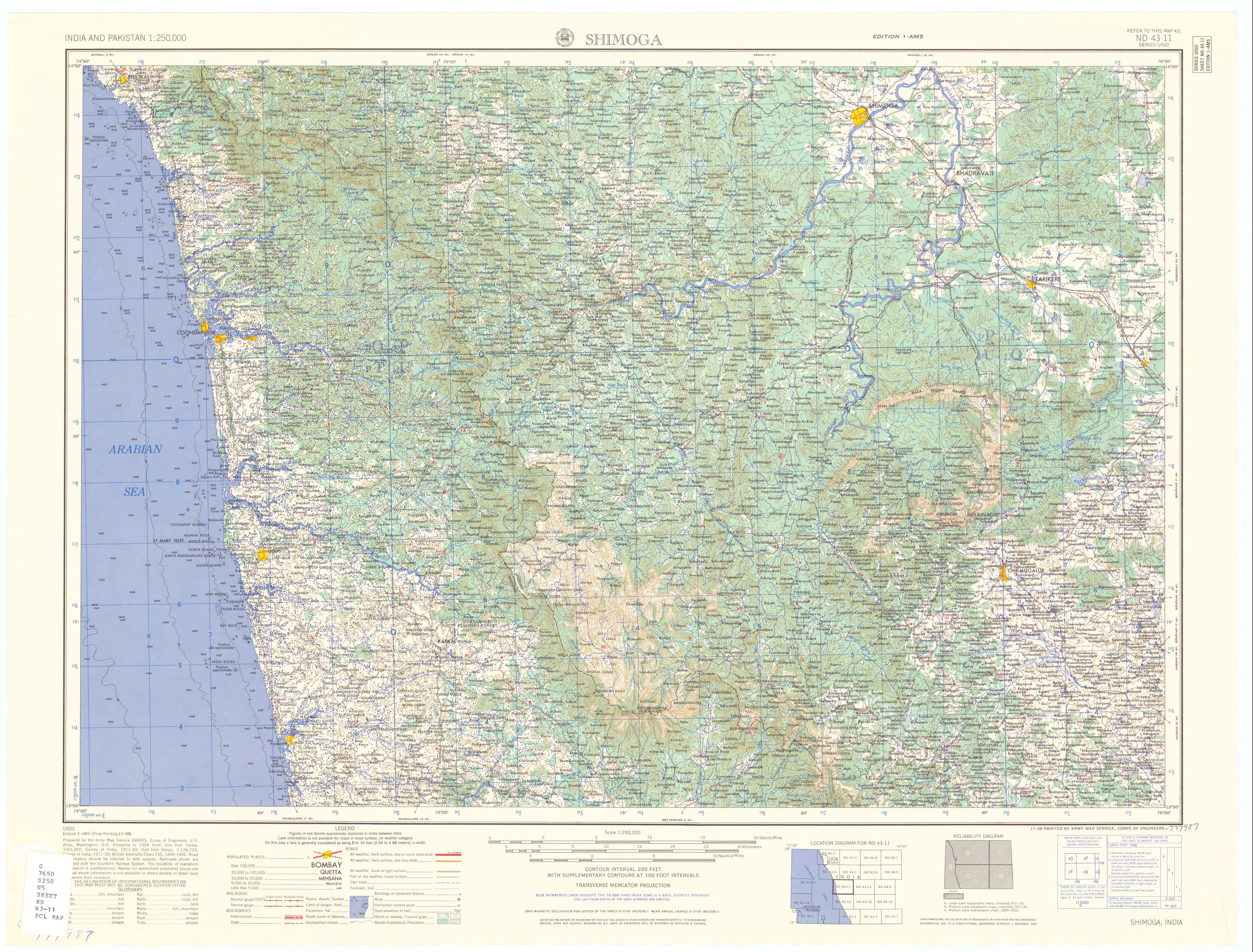
Shimoga
View on GrokipediaHistory
Etymology and naming
The name Shivamogga, the official Kannada designation for the city historically anglicized as Shimoga, derives primarily from terms linked to the Hindu deity Shiva. Traditional interpretations include "Shiva-Mukha," signifying "face of Shiva"; "Shivana-Mogu," meaning "nose of Shiva"; and "Shivana-Mogge," referring to buds or flowers offered to Shiva.[1] An alternative legend attributes the origin to "Sihi-Moge," translating to "sweet pot," based on the ashram of sage Durvasa in the region. According to this account, Durvasa's disciples boiled local herbs in an earthen pot to create a sweet beverage; nearby cowherds tasted the residue and exclaimed its sweetness, naming the site Sihi-Moge, which linguistically evolved into Shivamogga over time.[4] During British colonial administration and into the post-independence era, the anglicized spelling "Shimoga" prevailed in English-language records and usage. On November 1, 2006, the Government of Karnataka announced the reversion to "Shivamogga" to align with native Kannada phonetics and script, a change approved by the central government and reflecting broader efforts to standardize regional nomenclature.[6]Ancient and prehistoric periods
The prehistoric period in Shivamogga district is marked by evidence of early human activity dating back to the Paleolithic era, with stone tools discovered at sites such as Nyamathi, Lingadahalli, and Kadur by archaeologist Robert Bruce Foote.[7] Additional Paleolithic artifacts, including hand axes and choppers, have been found in the Bhadra river backwater areas, indicating hunting and food-gathering societies in the region's forested terrain.[8] These findings align with broader Paleolithic distributions in the Deccan plateau, where quartzite tools were prevalent due to local geology. Neolithic evidence emerges from rock shelters and engravings across approximately 27 sites in the district, with formations dated to 2500–1800 BCE, suggesting settled communities engaged in early agriculture and tool-making.[9] More recent excavations by the Archaeological Survey of India (ASI) uncovered polished stone tools used for farming, further evidencing a transition to agro-pastoral economies thousands of years ago in Shivamogga's hilly landscapes.[10] The Iron Age is prominently represented by megalithic burial sites, characteristic of funerary practices involving dolmens, cairns, and cist burials, with three distinct clusters documented at Nilaskal in Hosanagar taluk and near Shivamogga city.[1] These sites, often accompanied by black-and-red ware pottery, extend into taluks like Sagar (e.g., Mumbaru and Araga Gate), pointing to a dense population and iron-working technology by around 1000–300 BCE.[11] Excavations at Bhadravathi have reinforced this megalithic continuum, yielding urns and grave goods that link to South Indian Iron Age networks.[12] Archaeological inscriptions from the district, including those at Talagunda near Balligavi, attest to organized settlements by the early centuries CE, with epigraphs in proto-Kannada script pushing linguistic evidence to circa 380 CE—predating previously known records by decades.[13][14] These artifacts suggest continuity from prehistoric phases into the ancient period, under emerging polities like the Kadambas, though direct control remains inferred from regional patterns rather than site-specific governance records.[15]Medieval and colonial eras
The region of present-day Shimoga fell under the control of the Keladi Nayakas in the early 16th century, after they displaced the Hoysalas, establishing a dynasty that ruled from 1500 to 1763.[6] Originating as feudatories of the Vijayanagara Empire around 1499, the Nayakas expanded their domain across Shimoga district, with Keladi serving as a key base alongside Ikkeri and Bednore.[16] Shivappa Nayaka (r. 1645–1663) emerged as the dynasty's most expansionist ruler, consolidating power amid the Vijayanagara Empire's collapse and launching campaigns against the Bijapur Sultanate, the Wodeyar kings of Mysore, and Portuguese coastal enclaves.[17] His reign saw administrative reforms, including revenue systems and fortifications, alongside cultural patronage evident in structures like the Shivappa Nayaka Palace in Shimoga and temples at Keladi and Ikkeri.[18] The dynasty maintained relative autonomy until 1763, when Hyder Ali of Mysore annexed the territory following internal succession disputes.[15] Hyder Ali's conquest integrated Shimoga into the expanding Mysore Sultanate, which his son Tipu Sultan defended against British incursions until the Fourth Anglo-Mysore War.[15] British victory in 1799 restored Wodeyar rule over Mysore under a subsidiary alliance, placing Shimoga indirectly under colonial paramountcy as part of the princely state, with British Residents overseeing foreign policy and military matters.[15] Direct administration intensified after the 1831 Nagar peasant rebellion, prompting British imposition of Commissioner rule on Mysore from 1831 to 1881 to enforce revenue collection and suppress unrest.[19] Throughout the British era, Shimoga remained a forested, agrarian hinterland with limited infrastructure focus, though forest resources drew colonial timber interests.[15] Local resistance peaked in 1942, when Issuru village in the district declared independence from British rule—predating widespread Quit India adherence—establishing a short-lived parallel administration before suppression.[20]Modern and post-independence developments
Following India's independence on August 15, 1947, the princely state of Mysore, which included Shimoga, acceded to the Union of India, integrating the region into the post-colonial administrative framework. The area retained its district status within the expanded Mysore State after the linguistic reorganization under the States Reorganisation Act, effective November 1, 1956. In 1973, the state was renamed Karnataka, with Shimoga continuing as a key administrative and economic hub in the Malnad region. A significant post-independence event was the Kagodu Satyagraha in March 1951, where thousands of tenant farmers from villages near Sagar in Shimoga district protested against exploitative landlords, demanding tenancy rights and land redistribution; this movement influenced subsequent land reform legislation in Karnataka. Between the 1950s and 1980s, the district emerged as a center for progressive social campaigns, including efforts to abolish manual scavenging and promote equitable resource access, reflecting grassroots activism amid rapid rural transformation. Economically, Shimoga experienced modest industrial expansion post-1947, building on pre-existing units like the Visvesvaraya Iron and Steel Works in nearby Bhadravati, with growth in small-scale manufacturing focused on agro-processing, such as areca nut and forest products, alongside paper and sugar mills that contributed to regional employment. Education advanced notably with the establishment of Kuvempu University in 1987 at Shankaraghatta, an affiliating state institution named after Kannada poet K.V. Puttappa, which expanded higher education access in arts, sciences, and professional courses across the district. Administrative nomenclature evolved when the Government of Karnataka notified the official renaming of Shimoga to Shivamogga, effective November 1, 2014, aligning with efforts to standardize Kannada-derived spellings for 12 cities. This period also saw infrastructure improvements, including enhanced road connectivity via Karnataka State Road Transport Corporation hubs and urban commercial growth evidenced by modern retail centers.Geography and Environment
Location and topography
Shivamogga, commonly referred to as Shimoga, is located in the central-western part of Karnataka state, southern India, serving as the administrative headquarters of Shivamogga district.[2] The city occupies coordinates of approximately 13°55′ N latitude and 75°34′ E longitude, positioning it about 270 kilometers northwest of Bengaluru, the state capital.[21][2] It lies within the broader Malnad region, often described as the gateway to the hilly tracts of the Western Ghats.[22] The urban center sits at an average elevation of 640 meters above mean sea level, with the surrounding district exhibiting variations from 300 to over 1,300 meters in its hill ranges.[23] Shivamogga is situated on the banks of the Tunga River, a tributary of the Tungabhadra, which originates nearby in the Varahi hills and provides a key drainage feature amid the undulating terrain.[24] Topographically, the city features a mix of flat plains and intermittent low hills, supporting semi-deciduous forests and agricultural expanses of paddy fields, areca nut groves, and coconut plantations.[23] This landscape reflects the transitional character of the Malnad zone, with gentle slopes rising toward steeper ghats to the west, influencing local microclimates and soil fertility derived from lateritic and red loamy types.[22] The district encompasses an area of 8,465 square kilometers, bounded by latitudes 13°27′ to 14°39′ N and longitudes 74°38′ to 76°04′ E, underscoring the region's diverse relief from valleys to elevated plateaus.[25]Climate and weather patterns
Shimoga features a tropical savanna climate (Köppen Aw), marked by a pronounced wet season driven by the southwest monsoon and a drier period influenced by its inland position in Karnataka's Malnad region, which moderates extremes compared to coastal areas. Annual precipitation averages 1,114 mm, with over 80% concentrated in the June–September monsoon period, when southwest winds from the Arabian Sea bring consistent heavy rains, often exceeding 200 mm monthly. Pre-monsoon thunderstorms in April and May contribute sporadic showers, while post-monsoon months see declining totals, and winter remains largely dry with minimal rainfall under 20 mm per month.[23] Temperatures remain moderate throughout the year, ranging from 20°C to 35°C on average, with April as the peak of heat, recording highs up to 37°C and lows around 21°C amid low humidity before monsoon onset. The coolest period spans December to February, with daily highs near 29°C and lows dipping to 17°C, accompanied by clear skies and comfortable conditions. Diurnal variations are modest due to elevation around 550–600 meters, but summer heat indices can feel oppressive from residual winter dryness transitioning to humid buildup.[26][27] Seasonal patterns reflect broader peninsular Indian dynamics, with the southwest monsoon dominating hydrological cycles and supporting agriculture, though interannual variability—tied to phenomena like El Niño—has led to occasional deficits or excesses, as seen in Karnataka's state-wide normal of 1,153 mm where Shivamogga district contributes variably higher due to orographic lift from nearby Western Ghats slopes. High monsoon humidity (often 80–90%) fosters lush vegetation but also fog and mist in transitional months, while dry-season winds average 5–10 km/h, rarely intensifying to disrupt patterns.[28]Natural resources and biodiversity
Shimoga district, located in the Malnad region of Karnataka, possesses significant mineral deposits including white quartz, limestone, kaolin, manganese, and kyanite, which support local extraction activities.[29][23] Fossil fuels and oil reserves are minimal in the area.[29] The district's water resources are bolstered by major rivers such as the Tunga and Bhadra, which converge at Koodli to form the Tungabhadra, alongside the Sharavathi and Varada rivers originating or flowing through the region. Forests cover substantial portions of Shimoga, comprising evergreen, semi-evergreen, and deciduous types, contributing to the area's ecological richness and timber resources like teak and sandalwood, though regulated under forest conservation laws.[30] The Forest Survey of India reports a volumetric growing stock of approximately 3.16 to 27.611 cubic meters per hectare in inventoried forest areas, with about 75% lacking established regeneration, indicating challenges in sustainable forest management. Biodiversity in Shimoga is notable due to its position in the Western Ghats, hosting protected areas like Bhadra Wildlife Sanctuary and Tiger Reserve, Sharavathi Wildlife Sanctuary, and Shettihalli Wildlife Sanctuary, which harbor species such as tigers, elephants, gaurs, sloth bears, leopards, sambars, spotted deer, and diverse birdlife including peacocks and partridges.[31][32] The Tyavarekoppa Tiger and Lion Safari within the district facilitates observation of lions, tigers, and deer, aiding conservation awareness.[33] Over 120 floral species are documented in Bhadra alone, underscoring the region's floral diversity amid ongoing habitat pressures from human activity.[31]Demographics
Population statistics and trends
As of the 2011 Indian census, Shimoga city had a total population of 322,650, comprising 162,018 males and 160,632 females, yielding a sex ratio of 991 females per 1,000 males.[34] The child population (aged 0-6 years) numbered 29,976, representing 9.29% of the total, with a child sex ratio of 953.[34] These figures reflect the municipal corporation boundaries, excluding adjacent rural areas. The city's population grew from 274,352 in the 2001 census to 322,650 in 2011, registering a decadal growth rate of 17.6%, or an average annual rate of approximately 1.6%.[35] This urban growth outpaced the district's overall decadal increase of 6.7% (from 1,649,582 to 1,752,753), attributable to rural-to-urban migration driven by employment in administration, education, and small-scale industries.[36] Post-2011 trends indicate moderated expansion amid Karnataka's statewide deceleration in population growth, influenced by declining fertility rates and out-migration to larger metros like Bengaluru. Unofficial projections estimate the city population at around 411,000 in 2025, assuming sustained annual growth of 2.0-2.1%, though the absence of a 2021 census—delayed due to the COVID-19 pandemic—precludes verified updates.[37] District-level estimates similarly project 1.96-2.0 million by 2025, but urban concentration in Shimoga city continues to rise relative to rural areas.[38]| Census Year | City Population | Decadal Growth Rate (%) |
|---|---|---|
| 2001 | 274,352 | — |
| 2011 | 322,650 | 17.6 |
Religious and ethnic composition
According to the 2011 census, Hinduism is the predominant religion in Shimoga city, comprising 72.76% of the population (234,755 individuals out of 322,650 total residents).[39] Islam represents the largest minority faith at 23.93% (77,224 people), followed by Christianity at 2.17% (7,013).[39] Other religions, including Jainism, Sikhism, Buddhism, and unspecified groups, account for the remaining 1.14%.[39] These figures reflect urban demographic patterns, with a higher proportion of Muslims compared to the surrounding Shivamogga district's 13.39% Muslim share.[40]| Religion | Population | Percentage |
|---|---|---|
| Hinduism | 234,755 | 72.76% |
| Islam | 77,224 | 23.93% |
| Christianity | 7,013 | 2.17% |
| Others | 3,658 | 1.14% |