Hubbry Logo
Gandaki RiverGandaki RiverMain
Open search
Gandaki River
Community hub
Gandaki River
logo
8 pages, 0 posts
0 subscribers
Be the first to start a discussion here.
Gandaki River
Gandaki River
from Wikipedia

Gandaki River
Narayani
From top: Narayani River in Chitwan, Gandak River in Hajipur, Gandak River in Nepal, Anoma River in Buddhist Era
Map showing the Ghaghara and Gandaki tributaries of the Ganges
Location
CountryNepal, India
CitiesLo Manthang, Jomsom, Beni, Baglung, Kusma, Pokhara, Gorkha, Ridi, Devghat, Narayangarh, Valmikinagar, Triveni, Nepal, Hajipur, Sonpur, Muzaffarpur, Bagaha
Physical characteristics
SourceNhubine Himal Glacier
 • locationMustang District, Nepal
 • coordinates25°39′9″N 85°11′4″E / 25.65250°N 85.18444°E / 25.65250; 85.18444
 • elevation6,268 m (20,564 ft)
MouthGanges
 • location
Sonpur, India
 • coordinates
25°39′9″N 85°11′4″E / 25.65250°N 85.18444°E / 25.65250; 85.18444
 • elevation
44 m (144 ft)
Length814 km (506 mi)
Basin size46,300 km2 (17,900 sq mi)
Discharge 
 • average2,025 m3/s (71,500 cu ft/s)
 • minimum500 m3/s (18,000 cu ft/s)
 • maximum30,000 m3/s (1,100,000 cu ft/s)
Basin features
Tributaries 
 • leftTrishuli
 • rightKali Gandaki

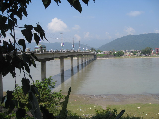
The Gandaki River, also known as the Narayani and Gandak, is one of the major rivers in Nepal and a left-bank tributary of the Ganges in India. Its total catchment area is 46,300 km2 (17,900 sq mi), most of it in Nepal. In the Nepal Himalayas, the Gandaki is notable for its deep canyon. The basin also contains three mountains over 8,000 m (26,000 ft), namely Dhaulagiri, Manaslu and Annapurna Massif. Dhaulagiri is the highest point of the Gandaki basin. In its upper reaches, the river is known as Kali Gandaki (or Gandaki) as it flows through the Mustang District and the famous Kali Gandaki Gorge in Nepal. When the river reaches the Terai plains of Nepal, it is referred to as the Narayani River. This name change typically occurs near the confluence with the Trishuli River at Devghat in Chitwan. Upon entering India, the river is known as the Gandak River.

River course

[edit]

Nepal

[edit]
Panorama of the Kali Gandaki gorge in Upper Mustang
River Gandaki in Kagbeni, Nepal

The Kali Gandaki river source is at the border with Tibet at an elevation of 6,268 m (20,564 ft) at the Nhubine Himal Glacier in the Mustang region of Nepal.[1][2]

The headwaters stream on some maps is named the Chhuama Khola and then, nearing Lo Manthang, the Nhichung Khola or Choro Khola. The Kali Gandaki then flows southwest (with the name of Mustang Khola on old, outdated maps) through a sheer-sided, deep canyon before widening at the steel footbridge at Chele, where part of its flow funnels through a rock tunnel, and from this point the now wide river is called the Kali Gandaki on all maps. In Kagbeni a major tributary named Johng Khola, Kak Khola or Krishnaa descends from Muktinath.

The river then flows southward through a steep gorge known as the Kali Gandaki Gorge, or Andha Galchi, between the mountains Dhaulagiri, elevation 8,167 m (26,795 ft) to the west and Annapurna, elevation 8,091 m (26,545 ft) to the east. If one measures the depth of a canyon by the difference between the river height and the heights of the highest peaks on either side, this gorge is the world's second deepest after the Yarlung Tsangpo Grand Canyon (ca. 6000 m). The portion of the river directly between Dhaulagiri and Annapurna I, 7 km (4.3 mi) downstream from Tukuche), is at an elevation of 2,520 m (8,270 ft), which is 5,571 m (18,278 ft) lower than Annapurna I. The river is older than the Himalayas. As tectonic activity forces the mountains higher, the river has cut through the uplift. South of the gorge, the river is joined by Rahughat Khola at Galeshwor, Myagdi Khola at Beni, Modi Khola near Kushma and Badigaad at Rudrabeni above Ridi Bazaar. The river then turns east to run along the northern edge of the Mahabharat Range. One of the largest hydroelectricity project in Nepal is located along this stretch of the river. Turning south again and breaking through the Mahabharats, Kali Gandaki is then joined by a major tributary, the Trishuli, at Devghat, which is larger than the Kali Gandaki. Gandaki is then joined by the East Rapti River draining the Inner Terai valley known as Chitwan. The Gandaki then crosses the Sivalik Hills into the Terai plains of Nepal. From Devghat, the river flows southwest of Gaindakot town. The river later curves back towards the southeast as it enters India where it is called the Gandak.

Below Gaindakot the river is known as the Narayani or Sapt Gandaki (Seven Gandakis), for seven tributaries rising in the Himalaya or further north along the main Ganges-Brahmaputra divide. These are the Kali Gandaki, the Trishuli River, and the five main tributaries of the Trishuli known as the Daraudi, Seti, Madi, Marsyandi and Budhi Gandaki.

India

[edit]

The entry point of the river at the Indo–Nepal border is also the confluence called Triveni with the rivers Pachnad and Sonha descending from Nepal. Pandai river flows into Bihar from Nepal in the eastern end of the Valmiki Sanctuary and meets Masan. The Gandak enters India at first in Maharajganj District of Uttar Pradesh for around 25 km (16 mi); it also passes through Kushinagar District before entering Bihar. The Gandak flows southeast 300 km (190 mi) across the Gangetic plain of Bihar state through West Champaran, Gopalganj, East Champaran, Saran, Muzaffarpur and Vaishali districts.[3]

From its exit from the outermost Siwaliks foothills to the Ganga, the Gandak has built an immense megafan comprising Eastern Uttar Pradesh and North Western Bihar in the Middle Gangetic Plains.[4]

Glaciers, glacial lakes and glacial lake outburst floods

[edit]

Glacier lakes, among the most hazardous features of high mountains, are usually formed behind dams of moraine debris left behind by retreating glaciers, a trend that is observed all over the world. Even though glacial lake outburst flood (GLOF) events have been occurring in Nepal for many decades, the Dig Tsho glacier outburst, which took place in 1985, has triggered detailed study of this phenomenon. In 1996, the Water and Energy Commission Secretariat (WECS) of Nepal reported that five lakes were potentially dangerous, namely, Dig Tsho, Imja, Lower Barun, Tsho Rolpa, and Thulagi, all lying above 4,100 m (13,500 ft). A recent study done by ICIMOD and UNEP (UNEP, 2001) reported 27 potentially dangerous lakes in Nepal. In ten of them GLOF events have occurred in the past few years and some have been regenerating after the event.[citation needed]

The Thulagi glacier, located in the Upper Marsyangdi River basin, is one out of the two moraine-dammed lakes that was identified as a potentially dangerous lake as it may outburst.[5]

Important towns

[edit]
Kali Gandaki River near Ghasa, between Annapurna and Dhaulagiri

The important towns in the Indian part of the Gandak river are Valmikinagar (Bhainsalotan) - location of Gandak Barrage, Bagaha, Bettiah (district headquarters & field directorate of Valmiki Tiger Project), Harinagar (Ramnagar), Hajipur (across the Ganges 10  km from Patna) and Sonepur (also Known as Harihar Kshetra), near Patna.[citation needed]

National Parks

[edit]

Chitwan National Park of Nepal and Valmiki National Park of India are adjacent to each other in the vicinity of Valmikinagar around the Gandak Barrage.

Chitwan National Park

[edit]

Chitwan National Park covers an area of 932 square kilometres (360 sq mi). Established in 1973, it is the oldest national park of Nepal. It was granted the status of a World Heritage Site in 1984. It is located in Chitwan, one of the Inner Terai Valleys of Nepal. The park is rich in flora and fauna, including Bengal Tigers and one of the last populations of single-horned Indian rhinoceros (Rhinoceros unicornis). The area used to be known as the Chitwan Valley. It was a place for big game hunting and until 1951 it was a hunting reserve. At the park there is canoeing, elephant rides, and guided jungle walks.

Key Information

Valmiki National Park

[edit]

Valmiki Sanctuary covers about 800 square kilometres (310 sq mi) of forest and was the 18th tiger reserve established in India.[6] It is ranked fourth in terms density of tiger population. Valmikinagar is located nearly 100 kilometres (62 mi) from Bettiah in the northernmost part of the West Champaran district, Bihar, bordering Nepal. Valmikinagar is a small town with scattered habitation, mostly within the forest area and has a railroad station in the district of West Champaran, close to the railhead of Bagaha. It has diverse landscapes, sheltering rich wildlife habitats and floral and faunal composition with the prime protected carnivores and was included in the National Conservation Programme of the Project Tiger in the year 1994. According to a 1998 report by the Zoological Survey of India, the sanctuary has 53 mammals, 145 birds, 26 reptile and 13 amphibians[7] and a Tiger Reserve.[8]

The notable species of wild fauna include: tiger, leopard, wild dog, wild boar, bison, bear, peacock, partridge, hornbill, hill mynah, woolly-necked stork, python, crocodile, deer, sambar, blue bull, barking deer, hog deer.

As per the Botanical Survey of India report of 1998 there are seven types of vegetation consisting of seven classes of forests; home to 84 species of trees (subtropical trees such as sal, sagwan, bamboo, and cane), 32 shrubs and climbers and 81 herbs and grasses.

Religious significance

[edit]
Muktinath Vaishnava temple idols, Nepal

Between the Dhaulagiri and Annapurna mountain ranges, the Gandaki River flows through the village of Muktinath and by the Ashram of Pulaha. In ancient times, the mountain range surrounding Pulaha was called Salagiris due to the vast forests of sal trees. The stones found in this region are therefore called Saligrama – Silas. It has great significance to Hindus, particularly to Brahmins. Smarthas uses this as the replica of lord Narayana. Srivaisnavas, and Madhvacharya sects who consider the place where one can find saligrama silas in the river bed of the Gandaki River, and the Mukthinath temple as one of the 108 Divyakshetrams.[9]

Places of archaeological significance

[edit]
Gandaki River in Marpha, Mustang District, Nepal

Archaeologically important places around Valmikinagar are Lauriya-Nandangarh and Someshwar Fort.[citation needed] In Lauria block,[10] about 1 km east of Nandan Garh, a lion pillar of Ashoka, made out of a single block of polished sandstone, measuring 35 feet (11 m) in height with a diameter of 35" at the base and 22" at the top, which is believed to be over 2,300 years old, is in an excellent condition. Its massiveness and exquisite finish furnish striking proof of the skill and resources of the masons of Ashokan age. Two more such pillars with their capitals removed have been discovered in Rampurwa village, close to Gandhi's Bhitiharawa Ashram in Gaunaha block. One of their capitals, the bull is now in the National Museum at New Delhi and the other, the lion, is at Calcutta Museum.[citation needed]

At Nandan Garh there are also Baudh (Buddha) stupas made out of bricks and about 80 feet (24 m) high which according to the authoritative source are Ashoka Stupas, in which ashes of Lord Buddha's funeral pyre are enshrined.[citation needed]

Someshwar Fort is situated in Narkatiaganj sub-division, near Nepal border, on top of Someshwar Hill at 2,884 ft (879 m) elevation. It is in a ruined state but its remains are well defined.[citation needed]

The Bhitiharawa Ashram[10] of Mahatma Gandhi near Gaunaha in the eastern end of the Valmiki reserve. It is a village in Gaunaha block in Bihar from where Gandhiji started his freedom movement that came to be known as 'Champaran Satyagraha' in India history. The village houses the hut which is called Ashram and has become a place of Gandhian pilgrimage.[citation needed]

Mustang Caves

[edit]
Gandaki Valley near Jomsom Nepal in October 1966

Mustang caves are a collection of some 10,000 human-made caves dug into the sides of valleys in the Mustang District of Nepal. The caves lie on the steep valley walls near the Kali Gandaki River in Upper Mustang. Several groups of archaeologists and researchers have explored these stacked caves and found partially mummified human bodies and skeletons that are at least 2,000-3,000 years old. Explorations of these caves by conservators and archaeologists have also led to the discovery of valuable religious paintings, sculptures, manuscripts and numerous artifacts belonging to the 12th to 14th century.[11]

Development scenario

[edit]

Hydropower development

[edit]

Nepal

[edit]

In Nepal, Sapta Gandaki alone has a huge hydropower potential of 20,650 MW (economic exploitable potential is 5,270 MW) out of a total estimated potential of 83,290 MW (economically exploitable potential is 42,140 MW). The country has so far been able to generate only around 600 MW of hydropower[12] out of which the Gandak basin projects contribute more than 266 MW, about 44%. The hydropower projects built are the Trisuli at Nuwakot (21 MW), Devighat at Nuwakot (14 MW), Pokhra (1 MW) and Western Gandak HEP, at Nawalparasi (15 MW), Marsyangdi at Tanahu (69 MW), Kali Gandaki at Syanja (144 MW), and Syange (2 MW). Middle Marsyangdi HE Project (70 MW) at Lamjung is under final stage of construction. Several major projects are on the anvil for implementation in the near future. With Government of Nepal now according priority to private-sector participation in a multi-pronged approach, the pace of hydropower development will get accelerated.[citation needed]

A major Indian firm has entered into a share purchase and joint venture agreement with a Nepalese firm to acquire 80 per cent stake of Nepalese Company for development of the Upper Marsyangdi HEP (250MW). Achieving the economically exploitable potential need would no more be a mirage.[13]

Reportedly there are several other major projects being pursued by the Government of Nepal for private sector participation on IPP basis.[citation needed]

Irrigation

[edit]

The Gandak Project at Valmikinagar (Bhainsaloton) intercepts water of a catchment area of 37,410 km (23,250 mi), which is mostly in Nepal and partly in India. An agreement was signed on 4 December 1959 between the governments of Nepal and of India on the Gandak Irrigation and Power Project. It encompassed the construction of a barrage, canal head regulators and other appurtenant works about 33 m (108 ft) below the existing Triveni Canal Head Regulator.[14] The agreement was modified in 1964 for the protection of Nepal's riparian rights. Basically there is an agreed share of water for ‘western canal system including a power station in Nepal and eastern canal system. As a part of this bilateral agreement, the Gandak Barrage, a part of Gandak Project, was built in 1968–69 over the Gandak river for providing irrigation to Nepal, Uttar Pradesh and Bihar.[15] The irrigation potential of this project is 11,510 km2 (4,440 sq mi), spread in the district of West Champaran, East Champaran, Muzaffarpur, Samastipur, Saran, Siwan and Gopalganj. The Eastern Gandak Canal Project was taken up in 1960 and Main Canal system was completed in 1975 for flow irrigation in Nepal for the gross commanded area estimated to be 103,500 acres (419 km2).[16]

A Gandak Hydropower Station with an installed capacity of 15 MW has also been constructed and commissioned on the bypass to Eastern Gandak Canal.[17]

Flood management

[edit]

Flood management does not aim at total elimination or control of floods or providing total immunity from the effects of all magnitudes of floods, which is neither practicable from economic considerations nor even necessary, keeping in view other realities that are faced in the Indian context. Thus, a multi-pronged strategy ranging from modifying the floods by means of structural measures to learning to live with the floods by means of other non-structural measures is the goal of flood management. Measures for protection against extreme floods of low frequency are seldom economically feasible. The term "flood management" refers to the provision of a reasonable degree of protection against floods by measures to mitigate the recurring havoc caused by floods. This is what is being done in flood plains of Gandak River in Bihar and Uttar Pradesh which are affected by floods.[18]

[edit]

Nepal has carried out studies on the feasibility of having navigational use of the Gandaki river. Studies indicate that (a) it is feasible only in the lower reaches, (b) link it with India's number 1 highway from Allahabad to Haldia, and (c) cognizance has to be taken of the adverse situation which could arise due to increased irrigation use in dry seasons which could restrict the river level for maintaining possible navigation.[citation needed]

[edit]
The Gandaki river divides Syangja District and Palpa District in Ramghat

The Gandaki river is mentioned in the ancient Sanskrit epic Mahabharata. Its evolution is described in Shiva Purana, Kumarakhand, in the chapter of the killing of Shankhachuda.[citation needed] A part of episode 1 of the documentary series "The Living Planet" was filmed in the Kali Gandaki Gorge.[19]

See also

[edit]

References

[edit]
[edit]
Revisions and contributorsEdit on WikipediaRead on Wikipedia
from Grokipedia
The Gandaki River, also referred to as the Narayani within and the Gandak in , is a major system originating near the Nepal-Tibet border in the Mustang region of the and flowing southward through central before crossing into northern to join the near in as its third-largest tributary by volume. Draining a basin of approximately 46,300 square kilometers—predominantly within —the river features a dramatic descent from high-altitude glacial sources, carving the , which separates the and massifs and ranks among the world's deepest canyons due to its incision through younger Himalayan rock layers. The Gandaki supports vital ecological, economic, and cultural roles, including via the 144 MW Kali Gandaki A run-of-the-river plant, Nepal's largest such facility, which harnesses the river's steep gradient and high sediment load; agriculture through irrigation in the plains; and religious significance as the primary source of stones, ammonite fossils revered in for their association with .

Etymology and Names

Linguistic Origins and Regional Variations

The name Gandaki derives from the term Gaṇḍakī (गण्डकी), denoting a sacred river originating from the Himalayan ranges, as referenced in ancient Hindu scriptures including the Varāhapurāṇa. This nomenclature reflects the river's longstanding cultural and religious significance in South Asian traditions, with mentions in texts like the Mahābhārata and Śiva Purāṇa underscoring its mythological role in . In the upper reaches through Nepal's and , the river bears the prefix Kali, from kālī meaning "black" or "dark," attributed to its sediment-laden, darker waters compared to neighboring rivers. This descriptor also evokes associations with the Hindu Kālī, symbolizing destructive natural forces, though the primary linguistic root ties to the river's visual characteristics. Downstream in central and southern Nepal, particularly after confluence with the Trisuli River, it is designated Narayani, the feminine form of Nārāyaṇa (an epithet for ), linked to the abundance of ammonite fossils () in its bed, which are venerated as divine manifestations of the deity in Vaishnava traditions. These fossils, embedded in from ancient marine deposits, reinforce the river's sanctity and inform the name's devotional connotation. Upon crossing into India at the Indo-Nepal border near Tribeni, the river reverts to Gandak, a phonetic simplification in regional Indo-Aryan dialects, emphasizing continuity while adapting to local linguistic norms in and . These variations—Kali Gandaki, Narayani, and Gandak—highlight the river's transboundary path and the influence of Sanskrit-derived nomenclature evolving through Nepali, , and Bhojpuri usage.

Geography

Basin Characteristics

The Gandaki River basin spans a total drainage area of 46,300 km², distributed as approximately 72% in (about 33,300 km²), 18% in , and 10% in , including portions of Tibet's Xiagze . The basin extends across latitudes 27.63°N to 29.87°N and longitudes covering central and adjacent regions, draining into the system. Topographically, the basin exhibits extreme variability, with elevations ranging from 529 m above mean in the southern plains to 8,143 m in the high , encompassing rapid altitudinal gradients and complex . It traverses all major agro-ecological zones of , from Trans-Himalayan arid plateaus through mid-mountain forests and subtropical valleys to alluvial floodplains, featuring the world's deepest river gorge between the and massifs. Three peaks over 8,000 m—, , and —dominate the upper catchment, contributing to pronounced orographic precipitation and glacial melt influences. Glaciologically, the basin hosts 1,025 glaciers covering 2,030 km² and 338 associated lakes, which serve as critical amid seasonal monsoon-driven flows. Land cover is dominated by mountainous terrain with sparse vegetation in the transitioning to dense forests and terraced in hills, and intensive cropping in the lowlands; upstream areas feature predominantly rainfed farming, with about 80% of agricultural land in districts like Rasuwa unirrigated. These characteristics underpin the basin's high yields and vulnerability to erosional processes due to tectonic activity and steep slopes.

River Course

The Gandaki River originates as the near Damodar Kunda in the District of , close to the Tibetan border, at an exceeding 3,700 meters. It flows southward through the rain-shadowed region, carving the —the world's deepest known gorge—between the and massifs, with depths reaching up to 5,500 meters relative to surrounding peaks. The upper course passes arid landscapes and settlements like Kagbeni, , Marpha, and Tukuche, where the river's gradient steepens amid narrow valleys and fossil-rich beds. Further south, the Kali Gandaki joins the Trishuli River near the town of Narayangarh (also known as Gaindakot), forming the Narayani River, which marks the transition to a broader, sediment-laden flow through Nepal's central hills and Siwalik ranges. The Narayani continues southeastward across the plains, traversing the Chitwan Valley and , where it supports floodplain ecosystems before reaching the Indo-Nepal border at Tribeni. The total length of the Gandaki system approximates 630 kilometers, with roughly 300 kilometers in Nepal.

Through Nepal

In Nepal, the river's path spans from high-altitude fringes to subtropical lowlands, descending over 3,000 meters in elevation. The upper Kali Gandaki segment, approximately 100 kilometers long, features a braided channel in before entering the constricted gorge near Lete, where turbulent flows erode and . Mid-course, after the gorge, the river widens near Beni and Kusma, receiving tributaries like the Modi and Seti that augment its discharge during monsoons. The Narayani phase, post-Trishuli confluence, shifts to meandering patterns in the Gangetic foreland, depositing coarse gravels and sands that form bars and islands, with the channel width expanding to over 1 kilometer in the . Key infrastructure includes the paralleling parts of the mid-course and the Narayani Bridge at Gaindakot, facilitating cross-border trade.

Into India

Upon crossing into at Brahmapuri (near ), the river assumes the name Gandak and traverses Bihar's West Champaran and Gopalganj districts over about 250 kilometers, maintaining a south-southeasterly through alluvial plains. It flows parallel to the Burhi Gandak (an older abandoned channel) eastward, passing through Valmiki Tiger Reserve and depositing fertile silts that support agriculture, though prone to seasonal flooding due to its steep Himalayan gradient. The Gandak joins the as a left-bank at (near Sonepur and ) after winding through braided deltas, contributing significant sediment load—estimated at 1,000 million tons annually—to the Ganges system. The lower Indian course features embankments like the Gandak Barrage at Tribeni (built 1978 under Indo-Nepal treaty) for and flood control, channeling water into canals serving over 43,000 square kilometers.

Through Nepal

The Kali Gandaki River originates on the near the border with and enters the country in , flowing southward through the trans-Himalayan region. It traverses arid landscapes before carving the , recognized as the deepest gorge on Earth, situated between the and massifs in west-central . The river passes key settlements including Kagbeni, , Marpha, and Tukuche in Mustang and Myagdi districts, descending from elevations over 3,000 meters to lower valleys while receiving tributaries such as the Mayangdi. Continuing southeast, the Kali Gandaki joins the Trishuli River at Devghat, located approximately 140 km southwest of Kathmandu on the border of Tanahun and Chitwan districts, forming the Narayani River. The Narayani then flows through central Nepal's hill and Terai regions, passing Narayanghat in Chitwan District and serving as the western boundary of Chitwan National Park. It drains diverse terrains from mountains to plains, with a mean annual discharge of 1,583 cubic meters per second recorded at Narayanghat. The river reaches the Nepal-India border near the Gandak Barrage, marking the transition from its Nepalese course—encompassing about 72% of the total 46,300 square kilometer basin—to its Indian segment.

Into India

The Gandak River enters from at Triveni, debouching into the plains of in . In this region, near Valmiki Nagar, the Gandak Barrage was constructed in 1968–69 to support irrigation in and , as well as generation. The Triveni Canal originates from this barrage at the Indo-Nepal border, diverting water for agricultural use while the main channel continues southward. In , the Gandak traverses approximately 250 km, flowing through West Champaran, East Champaran, Gopalganj, Siwan, Saran, Vaishali, and districts of . The river initially follows a course along the Bihar-Uttar Pradesh border before turning southeast across the , subject to meandering and occasional shifts due to its high sediment load. The Gandak merges with the Ganges River at Sonepur in , opposite and approximately 30 km upstream from . This confluence marks the end of the Gandak's independent course, contributing significant water and silt to the system, which influences downstream flooding patterns in the region.

Hydrology

Flow Regimes and Discharge

The Gandaki River exhibits a monsoon-dominated flow regime typical of trans-Himalayan basins, where approximately 70-80% of annual discharge occurs during the to wet season due to orographic precipitation from the Indian Summer . This results in sharp hydrographs with rapid rises following rainfall events, influenced by the steep and high sediment loads from glacial and fluvial upstream. During the dry season from November to March, flows are sustained primarily by from in headwater glaciers and recharge, maintaining conditions but at significantly reduced volumes. Seasonal variability is pronounced, with mean monthly discharges at the Narayangadh gauging station (DHM Station 450) ranging from a low of 267 m³/s in March to a peak of 4,659 m³/s in , based on records from 1975 to 2015. Average annual discharge at Narayangadh measures 1,512 m³/s over the same period, reflecting integration of contributions from major tributaries like the Trishuli and Kali Gandaki rivers. Downstream at the Triveni border barrage entering , flows remain comparable, though subject to regulation and minor additions from local catchments, with historical modeling indicating basin-wide averages around 1,600-2,000 m³/s prior to major confluences with the . Low flows support ecological refugia and demands, while high flows drive and dynamics; however, interannual variability has increased due to climatic shifts, with peak recorded discharges reaching 12,110 m³/s in 1999. Extreme events underscore the regime's flood proneness, with a two-year return period flood estimated at 10,780 m³/s and a 100-year event at 16,070 m³/s, derived from frequency analysis of gauged data using Gumbel's method. These peaks, often exceeding channel capacity, lead to avulsions and inundation in the Indo-Gangetic plains, exacerbated by upstream dam operations like those at Triveni and Valmikinagar barrages, which can attenuate but also redistribute flows. Hydrological records from Nepal's Department of Hydrology and Meteorology provide the primary empirical basis for these metrics, with Indian data confirming similar magnitudes at border stations during non-regulated periods.

Major Tributaries

The Gandaki River, known as Narayani in its upper reaches through Nepal, derives its flow primarily from seven major tributaries originating in the Himalayan ranges: the , Trishuli, Budhi Gandaki, Marsyangdi, Seti Gandaki, , and Daraudi rivers. These tributaries drain diverse terrains including trans-Himalayan plateaus, high mountains, mid-hills, and the plains, contributing to the basin's mean annual discharge of 1,583 cubic meters per second at Narayanghat. The Kali Gandaki River, a prominent left-bank , originates near the adjacent to the border and flows southward for roughly 350 kilometers through the and massifs, forming the deepest known river gorge globally before its confluence with the Trishuli near Devghat to create the Narayani. It supports Nepal's largest facility, the 144-megawatt Kali Gandaki A plant operational since 2002. The Trishuli River, emerging from the Himalayan region, extends approximately 163 kilometers southward, receiving inputs from glacial melt and rains, and merges with the Kali Gandaki at Devghat after incorporating the Budhi Gandaki at Benighat. Its watershed spans high-altitude zones vulnerable to development and recreational activities such as . The Budhi Gandaki River arises in the Himal and joins the Trishuli at Benighat, augmenting flows in the central Gandaki basin; its watershed exhibits high vulnerability to climate change impacts, ranked 15th among Nepalese basins. Other significant contributors include the Marsyangdi, which drains the region and joins the Narayani in , and the Seti Gandaki, noted for its upper watershed's extreme sensitivity to climatic shifts. The and Daraudi rivers further bolster the system's by channeling water from mid-hill and foothill areas into the main stem near Chitwan.

Geology

Tectonic Formation

The Gandaki River's upper course, known as the Kali Gandaki, traverses the Himalayan orogen, which formed due to the ongoing convergence between the Indian and Eurasian plates initiating in the early Cenozoic, approximately 50-55 million years ago. This collisional tectonics produced intense crustal shortening, thrusting, and metamorphism, elevating the Tibetan Plateau and Himalayan ranges while the proto-Gandaki drainage likely originated as a south-flowing fluvial system antecedent to major uplift phases. The river's path from the Mustang region southward perpendicular to the dominant east-west Himalayan strike indicates its establishment prior to significant topographic barriers, with subsequent incision maintaining connectivity despite differential uplift rates exceeding 5 mm/year in places. The , reaching depths over 5,500 meters relative to adjacent peaks like and , exemplifies superposed drainage where fluvial has kept pace with tectonic , exposing a continuous stratigraphic section from Proterozoic sedimentary rocks of the Lesser Himalaya to Miocene leucogranites of the Greater Himalayan Crystalline complex. Structural features along the valley, including north-verging folds, thrust faults, and shear zones associated with the , record polyphase deformation during Oligo-Miocene crustal thickening, with the river transecting these units without deflection, underscoring its erosional dominance over tectonic warping. Thermochronological data from detrital minerals in Gandaki sediments reveal rapid exhumation pulses, such as Miocene cooling linked to thrust propagation, facilitating the gorge's incision at rates balancing uplift. Tectonic activity continues to influence the Gandaki basin, with seismic events along regional faults contributing to dam formations and transient base-level changes that modulate river long-profiles, though the overall antecedent character persists due to high monsoon-driven discharge and glacial headwaters sustaining downcutting. The basin's reflects broader Himalayan , where intermontane basins like the Thakkola to the north capture headwaters, but southward export dominates, delivering substantial sediment flux to the Indo-Gangetic plains via focused incision through the frontal thrust belt. This dynamic interplay of plate-scale convergence and localized fluvial response defines the Gandaki's tectonic framework, distinct from captured or diverted drainages in adjacent sectors.

Glaciers, Lakes, and Sedimentation

The Gandaki River basin in hosts approximately 1,340 , which serve as critical headwater sources amid the Himalayan highlands. The primary feeding the Kali Gandaki branch, the river's uppermost reach, is the Nhubine Himal , situated at an of 6,268 meters near the Nepal-Tibet border in the Mustang region. These contribute to the river system, particularly during summer accumulation influenced by patterns, though ongoing —driven by rising temperatures—has reduced ice volumes and altered seasonal flows. Glacial lakes within the basin number 116 as of recent inventories, with the total count in the Gandaki sub-basin rising from 377 in 2000 to 432 by 2015 due to accelerating glacier retreat and supraglacial pond expansion. These lakes, predominantly supraglacial and located above 3,000 meters, pose risks of glacial lake outburst floods (GLOFs); assessments identify 47 potentially dangerous lakes across the Gandaki, Koshi, and Karnali basins, based on factors like rapid growth, unstable dams, and proximity to centers. A prominent case is Birendra Lake in , , which burst on April 21, 2024, following an ice avalanche that triggered downstream flooding in the Budhi Gandaki . Sedimentation in the Gandaki arises from intense Himalayan , including , monsoonal hillslope processes, and tectonic uplift, yielding a high of 43 million tons per year, with roughly 25% as sand-sized particles concentrated during peak flows. In the Kali Gandaki sub-basin, rates reach up to 2.8 mm/year, reflecting grain size-specific fluxes where coarser fractions dominate due to incision and inputs. This load influences downstream morphology, operations—like the Kali Gandaki A —and deposition, though precise bedload estimates remain limited by measurement challenges in turbid, high-gradient channels.

Ecology

Biodiversity and Habitats

The Gandaki River basin spans diverse from high-altitude alpine zones in its Himalayan headwaters to subtropical and wetlands in the lowlands, fostering high across elevational gradients. In the upper Kali Gandaki reaches within , arid trans-Himalayan steppes and temperate forests support specialized including snow leopards ( uncia), with suitable habitats estimated at 4,447 km² in broader assessments, alongside Himalayan black bears (Ursus thibetanus) and (Moschus spp.). Lower elevations feature subtropical forests transitioning to sal-dominated () woodlands and riverine grasslands. Aquatic habitats along the river sustain rich ichthyofauna, with 40 species recorded in a 70 km stretch of the lower Narayani River, predominantly cyprinids across 14 families and 7 orders. Semi-aquatic species thrive in lakes and floodplains, including the critically endangered (Gavialis gangeticus) in Chitwan National Park's Narayani River sections, alongside marsh mugger crocodiles (Crocodylus palustris) and Eurasian otters (Lutra lutra) in the Kali Gandaki. The basin's felid diversity includes Bengal tigers (Panthera tigris), common leopards (Panthera pardus), and leopard cats (Prionailurus bengalensis), confirmed in rapid surveys yielding 54 mammal species overall. Terai wetlands and grasslands in Chitwan National Park, bordering the Narayani River, host flagship species such as greater one-horned rhinoceros (Rhinoceros unicornis), Asian elephants (Elephas maximus), and over 350 bird species, including sarus cranes (Antigone antigone) and Bengal florican (Houbaropsis bengalensis). Floral diversity in western Chitwan forests along the Narayani includes 236 plant species, with riverine areas featuring silk-cotton trees (Bombax ceiba), Trewia nudiflora, and Acacia catechu. Avian richness peaks in mid-elevations of the Kali Gandaki valley, with seasonal variations influenced by monsoon flooding and habitat heterogeneity. These ecosystems, while biodiverse, face pressures from habitat fragmentation, underscoring the need for corridor conservation.

Human Impacts on Ecosystems

The Kali Gandaki "A" Hydroelectric Project, commissioned in 2002 with a capacity of 144 MW, has altered the river's natural flow by reducing downstream discharge, particularly during lean seasons from an average of 14 m³/s to lower levels, disrupting aquatic habitats and patterns. This dam, located in central , has led to significant impacts on fisheries resources, including blockage of upstream migration for species like snow trout (Schizothorax spp.), prompting recommendations for fish ladders and programs in environmental impact assessments, though post-construction monitoring by Nepal Electricity Authority indicates partial mitigation but ongoing losses. Downstream hydro-ecological changes, such as modified and flow variability, have further affected riparian ecosystems and connectivity in the Gandaki basin. Land-use transformations in the Gandaki River basin, driven by agriculture expansion, , and infrastructure development, have contributed to degradation, with dense cover decreasing by approximately 93% in some periods from 1991 to 2021 alongside a near doubling of built-up areas. Between 1990 and 2015, cropland and built-up areas increased while grasslands and snow cover declined, exacerbating , sedimentation in river channels, and loss of natural habitats critical for species dependent on dynamics. Mining activities, particularly in the lower reaches within the basin, have intensified sediment loads and , posing severe threats to downstream aquatic and terrestrial . Pollution from anthropogenic sources, including urban effluents, agricultural runoff, and industrial discharges, has elevated trace element concentrations such as , , , , and in Gandaki waters, exceeding safe thresholds in multiple sites and posing risks to human health and aquatic life through . has been documented across the Sapta-Gandaki system, originating from and fibers, with higher abundances near urban settlements disrupting food webs and invertebrate communities. Human encroachment along riverbanks, including informal settlements and waste dumping, has further degraded riparian zones, reducing water quality and altering plant-animal interactions in areas bordering protected zones like . These cumulative pressures have diminished services, such as flood regulation and nutrient cycling, with land-cover shifts accounting for medium to high degradation risks across 65% of the basin as of 2022 assessments. In transboundary contexts extending into , similar agricultural intensification along the Gandak has amplified and habitat loss, indirectly affecting migratory species and productivity. efforts, including environmental management units established post-dam construction, have addressed some impacts through and monitoring, but persistent non-compliance in control underscores ongoing challenges.

Settlements

Key Towns and Urban Centers

The Gandaki River supports a series of towns and urban centers spanning from the high in to the in , where settlements have historically developed around river crossings, , and pilgrimage sites. In the upper reaches within , , small towns such as , Kagbeni, and Marpha lie along the river's course through the . functions as the district headquarters and a primary access point for trekking routes into , with its location facilitating trade and tourism amid arid landscapes. Kagbeni, positioned at the river's confluence with the Jhong Khola, serves as a cultural and historical gateway, known for its traditional Tibetan-influenced architecture and proximity to ancient trade paths. Downstream in the mid-hills, Kusma (also spelled Kushma) and emerge as significant municipalities. Kusma, the headquarters of , overlooks the confluence of the Kali Gandaki and Modi rivers, supporting local commerce and adventure tourism via suspension bridges and sites. , further east, acts as a regional hub in , with riverbank markets and religious sites drawing visitors. In central Nepal's , Narayangarh—integrated into the larger Bharatpur municipality—represents a major urban center on the Narayani River, the Gandaki's lower Nepalese stretch. This area features critical infrastructure like the Narayani Bridge and Mahendra Bridge, enabling east-west connectivity and trade with , while fostering agricultural processing and transport hubs. Nearby, Ridi Bazaar and Devghat provide focal points for Hindu , with Devghat at the Trisuli-Gandaki confluence hosting temples and ashrams. Upon crossing into India as the Gandak River, settlements include Valmiki Nagar in , , adjacent to the Valmiki Tiger Reserve, where the river supports forestry and border trade. Further downstream, Sonepur and mark key urban nodes near the confluence. Sonepur hosts an annual cattle fair tied to the river's banks, while , a growing city in , relies on the Gandak for and as a transport junction via rail and road bridges.

Protected Areas and Conservation Zones

The Gandaki River basin in Nepal and India encompasses multiple protected areas essential for conserving biodiversity, including habitats for endangered species such as tigers, rhinoceroses, and gharials. These zones, totaling six protected areas within Nepal's portion of the basin, also include one UNESCO World Heritage site and three Ramsar wetlands, supporting riverine forests, grasslands, and floodplain ecosystems influenced by the river's seasonal floods and sediment deposition. In the upper reaches, the Annapurna Conservation Area, Nepal's largest at 7,629 square kilometers and established in 1992, protects the Kali Gandaki Valley—the world's deepest gorge—spanning diverse altitudinal zones from subtropical forests to alpine meadows and encompassing sacred sites alongside key biodiversity hotspots. Downstream in the lowlands, , designated a in 1984, borders the Narayani River (the Nepalese name for the Gandaki), with its core area lying between the Narayani and Rapti rivers, preserving floodplains critical for one-horned rhinoceros populations and migratory bird routes. Across the border in , the Valmiki Tiger Reserve in , Bihar's sole tiger reserve covering approximately 900 square kilometers, is bounded on the west by the Gandak River, which forms its natural frontier and supports a mosaic of sal forests, grasslands, and wetlands hosting , leopards, and over 300 bird species. These areas face threats from poaching, human encroachment, and riverine flooding, yet conservation efforts, including anti-poaching patrols and community-based management, have stabilized populations of flagship species like the in Valmiki, where camera traps documented 28 individuals as of recent surveys.

Chitwan National Park

The Narayani River, constituting the lower course of the Gandaki River, forms the western boundary of Chitwan National Park, Nepal's first national park established in 1973 and covering 952.63 square kilometers. The park's diverse ecosystems, including Churia hills, oxbow lakes, and floodplains, are sustained by the Narayani alongside the Rapti and Reu rivers, which serve as primary water sources and shape the park's aquatic and riparian habitats. Designated a UNESCO World Heritage Site in 1984, the park protects a rich biodiversity hotspot where riverine environments support species such as the critically endangered gharial (Gavialis gangeticus), whose population in the Narayani has been monitored and bolstered through conservation initiatives. The Narayani's floodplains and associated wetlands, including lakes and pools, are integral to the park's ecology, fostering habitats for migratory birds, aquatic species, and terrestrial like the greater one-horned rhinoceros (Rhinoceros unicornis) and (Panthera tigris tigris), which rely on riverine for foraging and movement. These rivers maintain nutrient-rich sediments that enhance grassland productivity, crucial for herbivores, while the Narayani's flow influences seasonal flooding that rejuvenates wetlands but also poses risks to habitats. conservation efforts in the Narayani basin have contributed to population recovery, with counts rising from 239 individuals in 2023 to 265 in early 2024, emphasizing the river's role in species recovery programs. Human activities exacerbate threats to the Narayani-influenced ecosystems, including from upstream developments that degrade and aquatic , alongside flooding events that damage grasslands and displace . Community-based initiatives, such as gharial monitoring and river patrolling, aim to mitigate these impacts while addressing conflicts with local fishing communities dependent on the river. A 729.37-square-kilometer established in further supports conservation by integrating local livelihoods with habitat protection around the park's river boundaries.

Valmiki National Park

, situated in the of , , serves as a critical conservation area along the Gandak River's lower reaches, where the river forms the park's western boundary and influences its hydrological and ecological dynamics. Established as a wildlife sanctuary in 1978, upgraded to national park status in 1990, and designated a tiger reserve in , the park encompasses 335.65 square kilometers of core area within the broader 898 square kilometer Valmiki Tiger Reserve. The Gandak River, entering at Valmikinagar near the park, merges with tributaries like Sonha and Pachnad, creating fertile floodplains and wetlands that sustain the park's diverse habitats, including sal-dominated forests, grasslands, and riverine corridors. The park's ecosystems are intrinsically linked to the Gandak's seasonal flooding and sediment deposition, which enrich and maintain riparian zones vital for wildlife movement and foraging. This riverine influence supports a population of Bengal tigers, estimated at around 40 individuals as of recent surveys, alongside leopards, sloth bears, Indian elephants, and ungulates such as sambar, , and barking deer. Avian diversity includes over 250 species, with riverine birds like the and migratory waterfowl utilizing the Gandak's wetlands. The adjacency to Nepal's across the Gandak facilitates transboundary wildlife corridors, enhancing genetic exchange for species dependent on the Terai Arc Landscape. Conservation efforts in emphasize habitat restoration and anti-poaching measures to counter threats like riverine and human encroachment, with the Gandak's flow managed to prevent flooding damage while preserving aquatic habitats. Initiatives include artificial water holes and management to bolster prey base for tigers, reflecting the park's role in broader Gandak basin preservation. Despite challenges from upstream damming in affecting flow regimes, the park remains a key site for monitoring the impacts of river on terrestrial and aquatic species interactions.

Cultural Significance

Religious and Mythological Role

The Gandaki River, particularly its upper reaches known as the Kali Gandaki, holds profound religious significance in Hinduism as a sacred waterway associated with Lord Vishnu. Devotees regard the river's waters and banks as purifying, capable of bestowing spiritual merit upon pilgrims who bathe in or visit its course. This sanctity stems from ancient Puranic traditions, where the river is depicted as a divine conduit linking earthly realms to Vishnu's preservative aspects. Central to the Gandaki's mythological role is its role as the exclusive source of shaligrama stones, ammonite fossils revered as self-manifested forms of . These black, disc-bearing stones, found only in the riverbed between Kagbeni and in , are collected by pilgrims for home worship, symbolizing Vishnu's eternal presence without need for ritual consecration. Hindu texts, including the , prescribe shaligram veneration for protection, prosperity, and , with over 100 varieties identified based on markings interpreted as Vishnu's avatars or attributes. Shaligrams have been worshipped for at least 2,000 years, also holding importance in as representations of enlightened mind. Mythologically, the shaligrama's origin traces to a curse on by the devotee Tulasi (Vrinda), transforming him into a rocky form along the Gandaki's banks, where vajrakita insects' perforations create the stones' characteristic spirals. This narrative, drawn from texts like the , underscores themes of devotion and divine incarnation, positioning the river as the locus of 's salvific intervention. The Kali Gandaki's name invokes Goddess , enhancing its fearsome yet protective aura in Shaiva traditions. As the Sapta Gandaki—formed by the confluence of seven tributaries including the Kali, Trisuli, and Budhi Gandaki—the river embodies multiplicity in unity, mirroring cosmic principles in Vedic hydrology. Pilgrimage circuits, such as those to Muktinath temple near the river's upper valley, draw thousands annually for rituals blending Hindu and Buddhist practices, affirming the Gandaki's interfaith mythological resonance.

Archaeological and Historical Sites

The upper Kali Gandaki valley in , , features extensive networks of man-made caves carved into steep cliffs along the river's gorge, collectively known as the Mustang Caves or Sky Caves, with estimates exceeding 10,000 individual cavities spanning multiple levels up to 60 meters high. These structures, dating from protohistoric periods around 2000 years ago through , served purposes including burial, meditation by Buddhist lamas, and storage, as evidenced by raised platforms, religious artifacts, and shaft tombs uncovered in sites like Samdzong at 4000 meters elevation. Excavations in the Mebrak cave system during the early 2000s yielded the first documented Himalayan mummies, including naturally preserved adult and child remains interred in salt-preserved conditions, alongside textiles, wooden artifacts, and grains indicative of high-altitude pastoralist lifestyles predating dynastic Mustang kingdoms. Metallurgical analyses of artifacts from Samdzong tombs reveal early iron and bronze working techniques, with compositions suggesting local smelting and trade influences from Tibetan and South Asian networks as early as the 1st millennium CE. Petroglyphs depicting hunters, animals, and symbolic motifs, alongside abandoned fortified settlements visible along 70 kilometers of the Kali Gandaki and its tributaries, point to continuous human adaptation to arid, high-elevation environments from prehistoric to historic eras. Further downstream in the Gandaki basin, sporadic discoveries of prehistoric human remains, including tools and skeletal fragments, indicate or occupation, though systematic surveys remain incomplete due to challenging terrain and limited funding. In the Indian stretch of the Gandak River near and Sonepur, historical ghats and temple complexes like Hariharkshetra preserve evidence of ancient routes tied to the river's confluence with the , but these yield more epigraphic and architectural than excavation-based archaeological insights. ![Panorama of the Kali Gandaki gorge in Upper Mustang]float-right

Mustang Caves

The Mustang Caves, also known as Sky Caves, consist of approximately 10,000 man-made cavities excavated into the sheer cliffs of the Upper Mustang region in Nepal's Mustang District, overlooking the Kali Gandaki River gorge. These structures span a distance of about 70 kilometers along the river and its side valleys, with evidence of occupation dating back to at least 1000 BCE. Initial uses included burial sites, as indicated by the discovery of human remains, mummified bodies, and grave goods such as copper tools, beads, clay vessels, turquoise, and gold ornaments within the caves. Archaeological investigations, including those in the Mebrak cave system, have uncovered the first known Himalayan mummies, preserved naturally in dry conditions, alongside artifacts suggesting pre-Buddhist rituals and early settlement patterns in the high . Later phases of use, from the medieval period onward, involved adaptation by Buddhist lamas for and religious purposes, featuring raised platforms, wall paintings, sculptures, and manuscripts. Excavations reveal a transition from funerary to monastic functions, with some caves incorporating chörtens and other Buddhist architectural elements. The caves' significance lies in their documentation of human adaptation to extreme Himalayan environments, providing material evidence of trans-Himalayan trade, cultural exchanges with Tibetan empires, and the evolution of religious practices from animistic burials to and Buddhist traditions. Ongoing by international teams, including French and Nepali archaeologists, continues to yield insights into these multi-phased sites, though challenges like and looting threaten preservation. Specific complexes, such as those at Chhoser and Shija Jhong, feature multi-story structures up to five levels, highlighting advanced rock-cutting techniques.

Economic Utilization

Irrigation and Agriculture

The Gandak irrigation system, established under the 1959 Gandak Agreement between and , diverts water from the Gandak Barrage at Tribeni () to support in the lower riparian zones. The barrage, completed in 1971, enables gravity-fed canals that primarily benefit the plains, where seasonal flooding historically limited cultivation to one crop per year. This infrastructure has facilitated year-round , boosting cropping intensity from single-season rainfed farming to multiple harvests, particularly of paddy, , , and pulses. In Nepal, the Triveni Canal (also known as the Nepal Western Canal), spanning 81 kilometers, irrigates approximately 31,400 hectares of farmland in Parsa, Bara, and Rautahat districts. Designed to deliver water during the dry season, it supports mixed cropping systems, including fodder crops that have expanded by up to 50% in command areas due to reliable supply, enhancing livestock integration in farming. However, aging infrastructure, including unrepaired bridges as of 2024, has periodically disrupted flows, threatening winter wheat yields. In India, the Eastern Gandak Canal system commands a culturable area of 444,000 hectares in and 960,000 hectares in , with a gross command area exceeding 1.37 million hectares across northern Bihar's alluvial plains. This has transformed flood-prone tal lands into productive fields, enabling shifts from subsistence to commercial ; for instance, irrigated paddy area increased significantly post-1971, with total irrigated extent reaching 137,000 hectares by 2016 in key districts. The system provides full Kharif season supply and partial Rabi coverage (35-45 days), supplemented by conjunctive use to mitigate summer shortages, yielding average water utilization rates aligned with basin yielding 50.45 billion cubic meters annually. Overall, Gandak irrigation sustains about 1.4 million hectares of , contributing to in densely populated regions where employs over 60% of the rural workforce; studies indicate yield gains of 20-30% for major cereals due to assured , though remains below potential at 70-80% owing to seepage and uneven distribution.

Hydropower Generation

The Gandaki River, with its steep gradients in the Himalayan reaches and substantial seasonal flow, supports notable generation, primarily through run-of-river and storage schemes in , where the basin's projects contribute to national energy needs. Installed capacity from operational facilities exceeds 150 MW, harnessing the river's high sediment-laden waters via desanding basins and robust turbine designs. In , development focuses on canal falls from the Gandak Barrage, yielding smaller outputs integrated with infrastructure.

Developments in Nepal

The Kali Gandaki A Project, operational since 2002, is the basin's flagship facility with an installed capacity of 144 MW, generating approximately 842 GWh annually through a run-of-river scheme featuring a 115-meter-high and three 48 MW Pelton turbines. Located near Syangja at the of the Andhi Khola and Kali Gandaki, it addresses high loads via a 700-meter-long , though ongoing rehabilitation addresses wear from abrasive flows. Smaller operational plants include the 15 MW Gandak Station at Pratappur, utilizing Narayani River flows post-barrage to produce 106 GWh yearly, established under the 1959 Gandak Agreement for joint irrigation-power benefits. Proposed large-scale storage projects, such as the 1,200 MW Budhi Gandaki on the Budhi Gandaki , aim to create a 263-meter spanning 45 km, targeting flood control and peaking power but facing delays due to resettlement of over 45,000 people and environmental concerns.

Developments in India

Hydropower in leverages the Gandak Barrage at Valmikinagar, constructed in 1968-69 under bilateral agreements, primarily for but enabling canal-based generation. The Eastern Gandak Canal Hydroelectric Project features three 5 MW units at a 5.3-meter fall (RD 6.0), commissioned sequentially to augment releases with low-head turbines. Additional potential exists downstream, though exploitation remains limited compared to Nepal's upstream sites, prioritizing flood moderation over expansion.

Developments in Nepal

The Kali Gandaki A Project, Nepal's largest operational facility on the Gandaki River system, is a 144 MW run-of-the-river plant completed in 2002 after construction began in 1996, generating approximately 842 GWh annually through three 48 MW units and featuring sediment management via a desanding basin and sluicing to handle high loads from the river's glacial origins. Located in at an elevation supporting peaking operations, it supplies about 10% of 's electricity and exports surplus to , though output varies seasonally due to monsoon-dependent flows. The Budhi Gandaki Hydropower Project, a proposed 1,200 MW storage facility on the Budhi Gandaki , has faced repeated delays from financing issues, land acquisition disputes, and political shifts since planning in the early 2010s, with construction now slated to commence in 2025 under Electricity Authority oversight to nearly double national capacity. Estimated at over $2.5 billion, it includes a 263-meter-high for year-round generation of around 4,150 GWh annually, addressing dry-season shortages but raising concerns over upstream flooding risks and displacement of over 5,000 households. Other planned developments include the 844 MW Kaligandaki Storage Project upstream near the Seti confluence, under feasibility study since 2020 for multipurpose use including irrigation, and the 650 MW Kali Gandaki 2 storage scheme in Tanahu District with a 150-meter dam targeting 3,294 GWh yearly output. Construction on the Middle Kali Gandaki project initiated in August 2025, focusing on run-of-river enhancements in the basin, amid broader challenges like glacial retreat impacting long-term viability and calls for improved environmental assessments in developments.

Developments in India

The Eastern Gandak Canal Hydroelectric , located at Valmikinagar in , , represents the primary hydropower development utilizing the Gandak River's flow in . This 15 MW facility (comprising three 5 MW units) harnesses a 5.3-meter head drop at chainage 6.0 km on a bypass channel of the Eastern Gandak Main , generating approximately 98 GWh annually to address power shortages in . The project stems from the Gandak Irrigation and Power , established via the 1959 India-Nepal agreement (revised in 1964), which constructed the Gandak Barrage at the Nepal-India border to divert water for irrigation in and while enabling ancillary power generation. Construction of the Eastern Gandak Canal system began in 1960, with the main completed by 1975; the hydroelectric component was developed later through Japanese ODA funding to optimize infrastructure for electricity production via run-of- , avoiding large-scale river damming due to the Gandak's characteristics. Generators were installed between August 1986 and October 1987, though full commissioning occurred in 1996-97 amid delays from technical and environmental factors. The plant operates under the Bihar State Hydro Electric Power Corporation Limited, contributing to the state's grid without significant storage, relying on consistent flows regulated at the upstream barrage. No major expansions or new large-scale projects on the Gandak have been commissioned in as of 2025, reflecting limited potential for high-head dams in the river's lower reaches, which prioritize flood control and over extensive power infrastructure. The facility's output supports local agricultural electrification but faces challenges from and seasonal flow variations, with maintenance focused on rather than capacity upgrades. Transboundary water sharing under the Gandak treaty ensures downstream availability for this canal-based generation, though retains rights to upstream development. The Gandaki River, known as Narayani in and Gandak in , has supported by country boats since at least 1700 AD, serving as a principal across north-west , eastern , and western until the rise of railways and roads. Boats up to 20 tons capacity operated between and Mallahi, with smaller vessels of 15 tons from Tribeni to and 2 tons upstream of Tribeni, handling an estimated 20,000 tons annually at Tribeni and 40,000 tons between Mallahi and the confluence as of 1963 surveys. The 1959 Gandak Treaty, revised in 1964, led to construction of a barrage at Bhaisaloten with canals diverting up to 29,140 cusecs of flow, severely disrupting by blocking passage and causing the riverbed to dry during non-monsoon seasons. Additional barriers include low-clearance railway bridges at and insufficient lock dimensions (proposed at 6.1 meters depth versus recommended 15.25 meters), rendering commercial use infeasible without major modifications. Contemporary navigation remains minimal and non-commercial, limited to non-mechanized local ferries and 23 motorboats operating for on the Narayani stretch near , where environmental restrictions further constrain activities. A 2012 by Nepal's Ministry of Physical Infrastructure and Transport confirmed viability for recreational but not for due to shallow drafts and variable flows. Trade via the river has declined to negligible levels post-irrigation development, with no significant volumes recorded in recent decades, though historical patterns facilitated exchange until mid-20th-century shifts. Future prospects include integrating the Gandak into India's National Waterway 37 for extension to the border, potentially linking to routes and reducing Nepal-India logistics costs by enabling traffic, but engineering interventions for , , and seasonal flows remain prerequisites. Proposals for irrigation-cum-navigation canals, modeled on India's Patna-Farakka , have been discussed but unimplemented as of 2019.

Hazards

Flood Events and Management

The Gandaki River, known as Narayani in its upper reaches in and Gandak in , frequently causes flooding during seasons due to heavy rainfall in the and sediment-laden flows, impacting the plains of and northern districts in . In 1948, shortly after India's independence, floods from the Narayani inundated villages like Fatehabad in , collapsing around 100 houses and marking one of the early post-colonial flood disasters in the region. The 2017 floods, exacerbated by upstream precipitation in , affected 19 districts in north , resulting in 514 deaths, widespread crop losses, and displacement of millions, with the Gandak contributing significantly to inundation alongside other tributaries. More recently, in September 2024, breaches in embankments along the Gandak in impacted approximately 500 families, highlighting ongoing vulnerabilities despite mitigation efforts. These events underscore the river's braided morphology and high load, which amplify risks in lowland areas, particularly for diara (mid-river island) communities in prone to both inundation and post-flood droughts. Flood management strategies for the Gandaki primarily rely on structural interventions initiated under the 1959 Gandak Agreement between and , which facilitated the construction of the Gandak Barrage near the border to regulate flows, provide , and mitigate downstream flooding. The barrage, operational since the 1970s, diverts water into canals but has been criticized for inducing waterlogging, prolonged inundation, and shifting flood patterns in due to reduced natural sediment flushing and embankment dependencies. In , extensive embankment systems along the Gandak span over 300 kilometers, designed to confine river channels, yet frequent breaches—such as those in 2024—expose limitations, often leading to retrogressive and accelerated flooding in adjacent areas. Community-based approaches in Nepal's Gandaki basin emphasize local forecasting using indigenous knowledge, particularly among women in rural areas, to predict floods through observations of river behavior and weather cues, supplementing government efforts like early warning systems. Transboundary cooperation remains challenged by differing priorities, with focusing on embankment reinforcement and barrage operations, while advocates for upstream and reduced sediment trapping to avoid exacerbating downstream risks. The India-Nepal Joint Committee on Inundation and Flood Management facilitates annual exchanges for the Gandak (Narayani) and other shared rivers, enabling pre-monsoon alerts, though implementation gaps persist due to institutional silos and mistrust over impacts. Non-structural measures, including in 's catchment areas and floodplain zoning in , aim to enhance resilience, but empirical assessments indicate that over-reliance on hard without integrated basin management perpetuates cycles of vulnerability for agrarian populations.

Glacial Lake Outburst Floods

The upper Gandaki River basin, encompassing the Kali Gandaki in Nepal's region, hosts over 1,000 glaciers that feed numerous moraine-dammed s, rendering the area vulnerable to glacial lake outburst floods (GLOFs) triggered by failures from ice , seismic activity, or rapid melting. These events release massive water volumes downstream, exacerbating flood risks in a region with steep Himalayan that amplifies and . GLOFs in this basin threaten settlements, infrastructure, and agricultural lands along the river's course into , with modeling indicating potential inundation zones extending tens of kilometers. Historical GLOF incidents include two undocumented events in the Kali Gandaki basin, as identified through geomorphic evidence and local records. A notable occurrence in 1988–1989 originated above 5,000 meters in , producing a debris-laden that transported blocks exceeding one cubic meter in volume and reshaped valley floors with extensive sand and deposits. Assessments confirm at least two such events specifically in the Mustang sub-basin of the Kali Gandaki, contributing to long-term fluvial incision and hazard patterns observed in downstream channels. Recent analyses highlight ongoing risks from potentially dangerous glacial lakes (PDGLs) in the Gandaki basin, with inventories identifying several sites prone to outburst due to expanding lake volumes from glacial retreat. In July 2025, a GLOF in was confirmed via rapid hazard assessment, underscoring increasing frequency linked to climate-driven instability in high-altitude lakes. These floods pose transboundary threats, as outburst waters could propagate through the Narayani/Gandak into , , where they intersect with densely populated floodplains. Mitigation efforts, including early warning systems and lake lowering, remain limited in the basin compared to eastern counterparts, despite identified PDGLs among 47 high-risk sites across Koshi, Gandaki, and Karnali basins.

Transboundary Dynamics

Bilateral Agreements

The Gandak Irrigation and Power Project Agreement, signed on December 4, 1959, in between the and the , established the framework for joint development of the Gandaki River's waters for and . The agreement authorized the construction of a barrage at the river's confluence with the at Tribeni, approximately 500 meters downstream from the - border, along with associated canal systems: a main western canal primarily serving Indian territories in and , and an eastern canal extending into up to the , including distributary networks for Nepalese needs. Under its terms, committed to allocating up to 6,000 cubic feet per second of water for in 's western and eastern Tarai regions during the dry season, while granted perpetual rights to use the barrage headworks and western canal alignments within Nepalese territory without royalties on power generated. The agreement further stipulated the construction of a 15,000 kilowatt plant on Nepal's side of the main western , with India responsible for its operation and maintenance, and Nepal receiving a share of the produced equivalent to the plant's full capacity during periods. rights were also addressed, permitting free use of the barrage for traffic, though no dedicated infrastructure was mandated. The aimed to irrigate approximately 1.4 million acres in and 54,000 acres in , with construction costs borne by India and no financial obligations imposed on Nepal. An exchange of letters on April 30, 1964, amended Clause 10 of the 1959 agreement, clarifying water release protocols from the barrage to ensure equitable dry-season supplies for Nepal's canals while prioritizing flood control and Indian downstream needs during monsoons. This revision addressed initial implementation disputes over water scheduling but did not alter the core or allocation framework. No subsequent standalone bilateral treaties specifically targeting the Gandaki have been formalized, though the agreement operates within broader Indo-Nepalese mechanisms for transboundary and joint monitoring via the Joint Committee on Water Resources established in 2006.

Disputes and Cooperative Efforts

The Gandak Agreement, signed on December 4, 1959, and amended on April 30, 1964, between and , established cooperative frameworks for , power generation, and flood control on the Gandaki River, including the of the Gandak Barrage at Tribeni, Nepal, which facilitates water diversion to Indian canals and a hydropower plant benefiting both nations. However, the agreement has sparked disputes over unequal benefits, with Nepal arguing that the barrage's operation prioritizes Indian —supplying over 6,000 cubic meters per second downstream—while causing upstream flooding and sediment deposition that erode Nepali farmlands and displace communities along the Narayani stretch. Territorial disputes have arisen from the river's avulsions, particularly in the Susta enclave, where shifts in the Gandaki's course since the —exacerbated by the barrage—have altered the border defined by the 1816 , leading to overlapping claims over approximately 145 square kilometers of land; administers parts but contests based on historical river alignment, resulting in stalled joint surveys and local tensions. These issues reflect broader hydropolitical asymmetries, as 's downstream position limits its leverage, prompting calls for treaty renegotiation to include equitable royalties and . Cooperative efforts persist through ad-hoc mechanisms, such as transboundary early warning systems for floods in the Narayani-Gandak basin, which integrate hydrological to mitigate annual inundations affecting over 1 million people; assessments indicate partial effectiveness but gaps in real-time communication and community integration. Joint initiatives for resilience, including basin-wide modeling and across the border, aim to address shared vulnerabilities from glacial melt and monsoons, though implementation is hindered by trust deficits from historical grievances. Despite these, no comprehensive revision of the framework has occurred, with disputes often escalating during seasons, underscoring the need for updated bilateral protocols emphasizing mutual transparency and equitable .

References

Add your contribution
Related Hubs
User Avatar
No comments yet.