
Community hub
Recent from talks
Contribute something
Nothing was collected or created yet.
Chitwan District
View on WikipediaThis article needs additional citations for verification. (November 2021) |
Chitwan District (/ˈtʃɪtəˌwʌn/, Nepali: चितवन, [ˈtsit̪ʌwʌn] ⓘ) is one of seventy-seven districts of Nepal, and takes up the southwestern corner of Bagmati Province. Bharatpur, largest city of Nepal after Kathmandu, is its administrative centre. It covers 2,238.39 km2 (864.25 sq mi), and in 2011 had a population of 579,984 (279,087 male and 300,897 female) people.[3] Bharatpur is the commercial and service centre of South Central Nepal and a major destination for higher education, health care and transportation in the region. Chitwan lies in the Terai region of Nepal. It is in the drainage basin of the Gandaki River and is roughly triangular, taking that river as its meandering northwestern border, and a modest watershed border, with India, as the basis of its southern limit. Local government: Bharatpur Metropolitan, Rapti Municipality, Ratnanagar Municipality, Kalika Municipality, Khairahani Municipality, Madi Municipality, Ikshyakamana Gaupalika
Key Information

History
[edit]The district takes its name from the Chitwan Valley, one of Nepal's Inner Terai valleys between the Mahabharat and Siwalik ranges, both considered foothills of the Himalayas.
Chitwan is one of the few remaining undisturbed vestiges of the Terai region, which formerly extended over the foothills of Nepal.[clarification needed] It was originally a dense forest with wild animals like leopards and Bengal tigers. It was ruled by Chitrsen Baba and rishis meditated in the forest.[citation needed][4]
Etymology
[edit]There are several theories on the origin of the name Chitwan:
- The name Chitwan is a composite of the Sanskrit words चित्त, transliterated "citta" meaning heart, and वन, transliterated "vana" meaning jungle or forest.[5][6] Thus, the meaning of Chitwan is Heart of the Jungle.
- Chitwan was a dense forest ruled by the Tharu God-King Chitrasen Baba, thought to an incarnation of Vishnu. Today, the Tharu worship his idol during HariBodhini Ekadashi in Chitrasari en route to the village of Sauraha. Ban (वन) is the local word for a forest, according to this theory, the area was called Chitra Ban (Chitrasen's forest) which then became Chitwan.[citation needed]
- The Chitwan forests were populated by leopards and Bengal tigers and, since the Tharu term for a leopard is Chitri, the area became Chitwan.[citation needed]
- Chitra is also the Tharu word for religious drawings. You can see lots of Chitra in Tharu traditional house and, hence, "Chitra ban" became Chitwan. [citation needed]
Religious Sites
[edit]
- Shivaghat
- Devghat
- Bikram-Baba Temple
- Krishna Mandir Temple
- Sitamai Temple
- Umbrella Street
Agriculture and industry
[edit]The people inhabiting the Chitwan District are predominantly peasant farmers cultivating mainly food and cash crops such as rice, maize, wheat, beans, lentils, mustard and Vegetables. The district is the major maize-producing area in Nepal, with an area under maize cultivation of 27,170 ha (104.9 sq mi) in the year 2003–04. Maize is cultivated on irrigated /seasonal irrigated land in winter and spring, and on rain fed land in summer. Because it is easily accessible by good roads, maize produced in the district can be easily distributed to other parts of the country. Poultry is also a significant industry in Chitwan.[7]
Chitwan is famous in Nepal for mustard growing and production of mustard oil. This popularity of the mustard in Chitwan is attributed to the predominant soil type silt, resulting from the flooding of the Narayani River and its tributaries. The land of Chitwan is also spotted with clay, which is very good for growing rice, wheat and vegetables such as cabbage, cauliflower, radish, potatoes, broccoli, cucumbers, pumpkins, sweet potatoes and carrot. Chitwan is also famous for floriculture, mushroom cultivation and bee keeping.[citation needed]
Chitwan has adopting the South Korean New Community Movement model of development. One of the biggest rice mills in Nepal, Agam Food Industry, is situated in Bharatpur and is a big source of local employment.[citation needed]
Cuisine
[edit]Chitwan is known for Taas (Nepali: तास), a spicy fried goat meat dish served with bhuja or chiura. Momo, Bhuteko Bhat (fried rice), and sukuti are other popular dishes. Dal bhat (steamed rice and lentils), is the staple food of the area, though meat and dairy products are also consumed. Other popular cuisines include Newari and Tharu and Thakali and Madheshi. For centuries, traditional fermented foods and beverages have constituted about 20% of the local diet. Depending on altitudinal variation, finger millet, wheat, buckwheat, barley, vegetable, rice, potato, and soybeans etc. are grown.[citation needed]
Gallery
[edit]-
 Beeshazar Lake near Chitwan National Park
 -
 Chitwan National Park, elephant safari after an Indian rhinoceros
 -
 Narayani bridge in Narayangarh, Chitwan, Nepal
 -
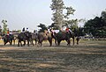 Elephant polo World cup 2012 in Meghauli, Nepal
 -
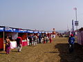 Chitwan Mahotsav 2063 (Chitwan Mahotsav 2007 A.D.) in Narayangarh, Chitwan
 -
 Narayani River


Geography
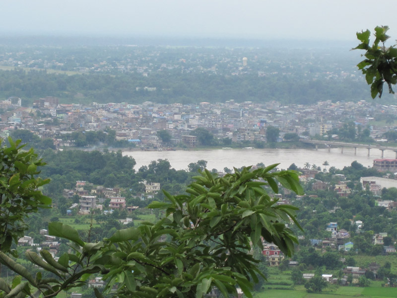
[edit]The Rapti River flows east to the southwest in the south of Bharatpur and forms the northern border of the Chitwan National Park. The Narayani River flows north to south to the west of Bharatpur. It is the deepest and one of the biggest rivers in Nepal. The Narayani Bridge over the river connects Chitwan District with Nawalparasi District of Nepal.
Chitwan is particularly rich in flora and fauna. Nepal's first national park, the Chitwan National Park together with the adjacent Parsa National Park support a diversity of species that is much higher than elsewhere on the Indian subcontinent. Rare species include Bengal tiger, gharial, rhino, leopards, mugger crocodile, Indian rock python and several species of deer. The protected areas are guarded by a battalion of the Nepal Army and patrolled by anti-poaching units.[8] Bishazari Tal ("20 Thousand") Lake is near Chitwan National Park, about 5 km (3.1 mi) south of Bharatpur. The lake is an important bird-watching center.
Krishna Mandir is One of the nice temples of the Hindu religion of Nepal. This is the temple of the god Krishna. There is no statue of the god in this temple. Its interior is made of mirrors all over the wall. The historical event of the god Krishna is shown on the wall. There is one place inside where there is a statue of the god Krishna and his wife.
Transportation and communication
[edit]_2.jpg)
Bharatpur Airport is the only airport in the region and has flights to and from Kathmandu. Mahendra Highway, the main east–west highway in Nepal, runs through the region and, Prithvi Highway a north–south highway from the border with India to Kathmandu runs through the district. Narayangarh is the main transit point for vehicles travelling via the east–west Mahendra Highway and also for people travelling from Kathmandu, Gorkha, and Pokhara through Mugling.
There are numerous local FM radio stations broadcasting from Bharatpur: Synergy FM,[9] Hamro FM, Radio Triveni, Radio Madi, Radio Chitwan,[10] Radio Kotagiri, Chitwan Online FM, Kalika Music FM, Kalika FM.[11] and Narayani FM. Television channels include Beso Channel, Aviyan Channel, Unique Television and Avass Television. There are multiple private Internet service providers. Fibre connectivity and 4G internet is available in the larger cities.
Landmark buildings
[edit]- Upardanghari fort, in the old headquarters of Chitwan district, is believed to have been built by Satrubhanjan Shah, the son of Prince Bahadur Shah to defend the newly founded Kingdom [which?] in the 17th century.
- Kasara Durbar is an old palace built by the Rana Regime inside Chitwan National Park. Currently, it serves as the park office and museum.
- Diyalo Bangala Palace (Aptari Bharatpur) was the spring season palace used by the Shah Dynasty of Nepal. This palace was built by late king Mahendra Bir Bikram Shahdev to rest in during winter season. It is located on the banks of Narayani River in Bharatpur Municipality ward no. 2.
- DAO Building Bharatpur: This old building was built in the period of shifting the headquarters from Upardangghari. Now is used as an office of the chief district officer.
- Bharatpur Covered hall: Hall in guesthouse of Bharatpur for indoor games.
- Umbrella Street. This street has about 480 colourful hanging umbrellas that provide a serene atmosphere for guests.[1]
Geography and climate
[edit]| Climate Zone[12] | Elevation Range | % of Area |
|---|---|---|
| Lower tropical | below 300 m (980 ft) | 58.2% |
| Upper tropical | 301 to 1,000 m (988 to 3,281 ft) | 32.6% |
| Subtropical | 1,001 to 2,000 m (3,284 to 6,562 ft) | 6.7% |
Major places
[edit]- Gondrang
- Ayodhyapuri
- Dibyanagar
- Bharatpur
- Narayangarh Bazaar
- Tandi bazaar
- Parsa Bazaar
- Parsadhap Bazaar
- Birendranagar Bazaar
- Muglin Bazaar
- Rampur Bazaar
- Gitanagar bazaar
- Bhandara Bazaar
- Chanauli Bazaar
- Mangalpur Bazaar
- Manakamana
- Shivanagar bazaar
- Basantapur Bazaar, Madi
- Patihani bazaar
- Parbatipur Bazaar
- Saradanagar bazaar
- Jagatpur Bazaar
- Meghauli-Telauli Bazaar
- Lothar Bazaar
- Sauraha
- Kasara
- Dasdhunga
- Krishna Mandir
- Jhuwani
- Bairiya
Demographics
[edit]| Census year | Pop. | ±% p.a. |
|---|---|---|
| 1981 | 259,571 | — |
| 1991 | 354,488 | +3.17% |
| 2001 | 472,048 | +2.91% |
| 2011 | 579,984 | +2.08% |
| 2021 | 722,168 | +2.22% |
| Source: Citypopulation[13] | ||
At the time of the 2021 Nepal census, Chitawan District had a population of 719,859. 7.01% of the population is under 5 years of age. It has a literacy rate of 83.68% and a sex ratio of 1046 females per 1000 males. 683,634 (94.97%) lived in municipalities.[14]
Ethnicity wise: Khas were the largest group, making up 40% of the population. Hill Janjatis are the second-largest group, making up 31% of the population. Tamangs were the largest Hill Janjatis, with Magars being 11% of the population. Chhetri and Bahun made up 20% of the population.[15]
As their first language, 67.79% of the population spoke Nepali, 9.52% Tharu, 4.94% Tamang, 3.32% Chepang, 3.24% Gurung, 3.22% Magar, 2.48% Bhojpuri, 2.03% Nepal Bhasha and 1.02% Darai as their first language.[16] In 2011, 70.1% of the population spoke Nepali as their first language.[17]
Religion: 81.43% of the population is Hindu, 12.48% Buddhist, 4.19% Christian and 1.33% Islam.[18]
Administration
[edit]
The district consists of seven municipalities, out of which one is a metropolitan city, five are urban municipalities and one is a rural municipality.[19]
- Bharatpur Metropolitan City
- Kalika Municipality
- Khairahani Municipality
- Madi Municipality
- Ratnanagar municipality
- Rapti Municipality
- Ichchhakamana Rural Municipality
Former municipalities and gaunpalikas
[edit]
Prior to the restructuring of the district[when?], Chitwan had following gaunpalikas and municipalities.[20]
Health care
[edit]Chitwan district is known for its hospitals and has many top rated medical institutions, mostly in and around Bharatpur Municipality.Bharatpur is colloquially known as medical city of Nepal. The district is especially known for the B. P. Koirala Memorial Cancer Hospital at Krishnapur and two of the reputed medical colleges of the nation;College of Medical Sciences, Bharatpur and Chitwan Medical College. Chitwan ranks only behind the capitalKathmandu, in terms of hospital facilities in Nepal. Medical facilities in the district also include Bharatpur Hospital, a part of the Bharatpur medical college; Chitwan Eye Hospital; Sairam Dental Hospital and Research Center; Maula Kalika Hospital; and Narayani Community Hospital.
Educational institutions
[edit]
Most of the educational institutions in this region provide quality education to the students from Chitwan and neighboring districts too. These schools and colleges focus on the development of skills and knowledge of their students. Among them:
- Aroma English Secondary School, Bharatpur 10
- Balkumari College is located near the Narayangadh Bharatpur Height and affiliated to Tribhuvan University.
- Balikumari College, Narayangarh, Chitwan
- Birendra Multiple Campus is the oldest campus of the city, located in Bharatpur heights.
- Buddha Shanti Higher Secondary School, Rapti Municipality 03
- Chitwan Higher Secondary School, Bharatpur-10 * shree arunodaya higher secondary school,bharatpur 6 geetanager
- Institute of Agriculture and Animal Science, also known as the Rampur Agriculture Campus, is the agriculture institution under Tribhuvan University, and is the main institution in the fields of agriculture and veterinary science in Nepal. Occupying a huge area, this campus has been declared a university, the Agriculture and Forestry University.
- Secondary School Gawai, Gawai, Khairahani 13
- Aadikabi Bhanubhakta Secondary School, Narayangarh, bharatpur - 1
- Apex Educational Academy, a higher secondary school in Bharapur
- Apex academy in Kshetrapur
- Birendra higher secondary school
- Boston International College, Hakim chowk, Bharatpur-10 (affiliated to Pokhara University)[21]
- Central English Boarding School
- Chitwan Health Foundation and Research Center was established in Bharatpur as the nursing School of Chitwan Hospital and Health Foundation
- Chitwan Hotel Training Center in Bharatpur
- Chitwan Medical College and Research Centre, Dipendranagar, Bharatpur
- Chitwan Science College and Orchid Science College
- College of Medical Sciences: a 700-bed teaching hospital in Dipendranagar, Bharatpur.
- Crystal College, Ratnanagar
- Daisy English Higher Secondary Boarding School, Khairahani - 4, Parsa
- Divya Jyoti Basic School, Harnari, Khairahani 13
- Gawai Secondary School, Khairahani 13, Gawai
- Grandee English Boarding School, Bharatpur-19
- Himalayan Secondary English Boarding School, Ratnanagar-1, Bakulahar
- Holy Vision Public School, Yagyapuri, Bharatpur-4
- Indreni ICT college, affiliated to Tribhuvan University, located at Muktinagar, Bharatpur
- International college is a college of higher education and runs the HSEB and TU affiliated BBS and MBS programs in management streams.
- Jan Aadrash multiple campus Birendranagar is the public campus in Birendranagar ward no. 2.
- Jana Jagriti Higher Secondary School, Pithuwa – 3, Pithuwa
- Kalika English Boarding School
- Kamal Devi English School
- Kankali Secondary School, Khairahani - 1
- Lead Academy for Science and Management Technology
- Little Flower English school, Belchowk
- Little Stars Secondary English Boarding School. Bharatpur 7, Krishnapur
- Madi secondary school, Madi-3 Basantapur
- Maiya Devi Girls College, Dipendranagar, Bharatpur
- Nepal Police School Bharatpur-14
- New Capital College
- Paragon Secondary School, Ratnanagar-10, Chitwan
- Polar Star Secondary English School, Bharatpur-8, Chitwan
- Pragati Shiksha Sadan, East Rampur, Chitwan
- Prembasti Secondary School, Bharatpur 7 Prembasti
- Prerana Higher Secondary School
- Presidency college in Dipendranagar
- SOS Hermann Gmeiner Higher Secondary School
- Sagarmatha Secondary Boarding School, Ratnanagar
- Saheed Smriti Multiple campus, Shantichowk is the biggest campus of eastern Chitwan.
- Sainik Awashiya Mahavidhyalaya Chitwan, operated by Nepal army welfare fund, provided education in high school level.
- Saptagandaki Multiple Campus is the largest public campus in the city, located in Dipendranagar ward no. 10, Bharatpur.
- School of Health Science
- Shanti Academy college in Bharatpur
- Shanti Vidya Mandir English School, Bharatpur-11, Chitwan
- Shree Medical and Technical College located in Bharatpur is affiliated to the Purbanchal University and CTEVT.[clarification needed]
- Shree Prembasti Higher Secondary School, Bharatpur-7, Chitwan
- Shree Sharadpur Higher School
- Sirjana English Secondary School, Located behind Central Bus Terminal (Paras Buspark)
- Skyrider boarding school, ra.na.pa-13, ameliya
- Small heaven School
- Someshwor higher secondary school Madi-01 Baruwa
- Sun Rise English school, Bharatpur 10
- Valmiki Shiksha Sadan Higher Secondary School provides higher secondary education
- Xavier college in Bel chowk
- SOS Hermann Gmeiner School Bharatpur, Bharatpur-8, Chitwan
- shree arunodaya higher secondary school,bharatpur 6 geetanagar chitwan.
Notable people
[edit]- Pushpa Kamal Dahal (Prachanda): Prime Minister of Nepal 2008–09 and 2016–17; chairman of UCPN[22]
- Nilkantha Upreti: Former Chief Election Commissioner of Nepal
- Surendra Pandey: Former Finance Minister of Nepal[23]
- Ram Bahadur Thapa (Badal): Former Home Minister of Nepal[24]
- Bikram Pandey Former minister of Nepal and current house of representative from Chitwan 3
- Shristi Shrestha: Miss Nepal 2012[25]
- Shiva Regmi: Nepalese Film director[26]
- Bodhraj Acharya: Nepalese scientist
- Kamal Bahadur Adhikari: Nepalese weightlifter
- Dr. Santosh Kalwar: Nepalese poet, writer, and computer researcher (first English language novelist of Chitwan)[27][28][29]
- Swopnil Sharma: Lead singer of The Shadows Nepal Band[30]
- Sandeep Lamichhane: Cricketer
- Sushant Subedi: Analyst/Economist [31]
- Asmi Shrestha: Miss Nepal 2016
- Nirmal Purja: Nepalese Mountaineer[32]
- Lalmani Chaudhary : 2008 House of representatives from Chitwan 1 (constituency)[33]
See also
[edit]References
[edit]- ^ Merlen, S. (ed.) (2011). An Overview of the Central Development Region. United Nations Resident & Humanitarian Coordinator's Office, Nepal
- ^ "History". Retrieved 16 May 2010.
- ^ a b "National Population and Housing Census 2011(National Report)" (PDF). Central Bureau of Statistics. Government of Nepal. November 2012. Archived from the original (PDF) on 18 April 2013. Retrieved 1 November 2012.
- ^ "Department of Archeology team reaches Ayodhyapuri in Chitwan to conduct study on birthplace of lord Ram". Rising Nepal Daily. 16 July 2020. Retrieved 30 July 2020.
- ^ Sanskrit-English Dictionary spokensanskrit.de: Sanskrit word चित्त
- ^ Sanskrit-English Dictionary spokensanskrit.de: Sanskrit word वन
- ^ Paudel, P. and A. Matsuoka (2008). Factors Influencing Adoption of Improved Maize Varieties in Nepal: A Case Study of Chitwan District Archived 31 October 2012 at the Wayback Machine. Australian Journal of Basic and Applied Sciences 2(4): 823–834.
- ^ Gurung, K. K. (1983). Heart of the Jungle: The Wildlife of Chitwan, Nepal. André Deutsch, London.
- ^ "Synergy FM 91.6 MHz".
- ^ "Radio Chitwan 94.6 MHz".
- ^ "Kalika FM 95.2 & 91 MHz".
- ^ The Map of Potential Vegetation of Nepal – a forestry/agroecological/biodiversity classification system (PDF), Forest & Landscape Development and Environment Series 2-2005 and CFC-TIS Document Series No. 110, 2005, ISBN 87-7903-210-9, retrieved 22 November 2013
- ^ "NEPAL: Administrative Division". www.citypopulation.de.
- ^ "Provincial/District/Local reports: Bagmati Province" (PDF). Census Nepal 2021. Central Bureau of Statistics.
- ^ a b "Table 1: Caste/Ethnicity and sex". Census Nepal 2021. Central Bureau of Statistics. Retrieved 16 March 2024.
- ^ a b "Table 5: Mother tongue and sex". Census Nepal 2021. Central Bureau of Statistics.
- ^ "Social characteristics tables" (PDF). Central Bureau of Statistics.
- ^ a b "Table 5: Religion and sex". Census Nepal 2021. Central Bureau of Statistics. Retrieved 16 March 2024.
- ^ "स्थानिय तह" (in Nepali). Ministry of Federal Affairs and General Administration. Archived from the original on 31 August 2018. Retrieved 1 September 2018.
- ^ "Nepal Census 2001". Nepal's village development committees. Digital Himalaya. Archived from the original on 12 October 2008. Retrieved 19 November 2008.
- ^ "Boston International College - Best Management College". bostoncollege.edu.np.
- ^ Nepali PM Prachanda Sworn In. English.cri.cn. Retrieved 3 September 2011.
- ^ "Surendra PandeyCommunist Party of Nepal (Unified-Marxist- Leninist) Election Area: Chitwan-1 (Elected)". Archived from the original on 7 July 2014. Retrieved 8 August 2014.
- ^ CPN-Maoist Gen Secy Thapa bereaved of father. thehimalayantimes.com. Retrieved 1 June 2014.
- ^ About Shristi Shrestha – Miss Nepal Archived 4 June 2014 at the Wayback Machine. shristishrestha.org. Retrieved 1 June 2014.
- ^ Regmi no more. ekantipur.com. Retrieved 10 December 2013.
- ^ Book launch program. Archived 8 August 2014 at the Wayback Machine. Retrieved 11 June 2014.
- ^ 'That's My Love Story' Bimochan.. Retrieved 11 June 2014.
- ^ Santosh Kalwar – The Kathmandu Post.. Retrieved 17 April 2017.
- ^ The Shadows, Nepal First Hard Rock Band. Retrieved 6 August 2014.
- ^ https://www.ucl.ac.uk/bartlett/public-purpose/people/masters-students/mpa-class-2022-23/sushant-subedi
- ^ Nirmal Purja – eKantipur Retrieved 25 November 2021
- ^ Paudel, Ramesh Kumar. "CPN-UML recommends nominees for mayoral posts in Chitwan". My Republica. Retrieved 30 September 2022.
External links
[edit]- "Districts of Nepal". Statoids.
Headquarters: Bharatpur | ||
| Metropolitan city |  | |
| Municipalities | ||
| Rural municipality | ||
| Former VDCs | ||
| International | |
|---|---|
| National | |
| Other | |
Chitwan District
View on GrokipediaHistory
Ancient and Medieval Periods
The Chitwan Valley, situated in Nepal's Terai lowlands, exhibits traces of early human activity consistent with broader prehistoric patterns in the region, where settlements emerged around three to five thousand years ago amid fertile alluvial plains suitable for rudimentary agriculture.[11] Archaeological evidence specific to Chitwan remains limited, with no major stratified sites documented, suggesting sparse, mobile populations rather than dense villages; polished stone celts and pottery fragments found in nearby Terai areas indicate Neolithic influences, but these lack direct stratigraphic ties to Chitwan itself.[12] Indigenous Tharu communities, recognized as among Nepal's oldest ethnic groups in the Terai, have maintained an agrarian lifestyle in Chitwan from antiquity, relying on slash-and-burn cultivation, rice farming in monsoon-flooded fields, and forest resource extraction for subsistence.[13] Their traditional practices, including mud-and-thatch longhouses and communal land use, reflect adaptation to malarial swamps and wildlife-rich jungles, with oral histories tracing continuous habitation predating Indo-Aryan migrations.[14] This pre-modern economy emphasized self-sufficiency, avoiding overexploitation to sustain biodiversity, though without evidence of metallurgy or monumental architecture. Hindu mythological traditions link Chitwan to ancient events in the Ramayana epic, particularly the Valmiki Ashram near the Triveni confluence, purportedly the hermitage where sage Valmiki composed the text and sheltered Sita during her exile, where she bore sons Lava and Kush around the Treta Yuga.[15] While unverified archaeologically, the site's enduring cultural significance underscores early sacralization of the valley's riverine landscapes. During the medieval period, from roughly the 15th to 18th centuries, Chitwan fell within the domain of the Makwanpur kingdom, governed by the Sen dynasty from their hill fortress, integrating the valley's resources into regional networks without imposing urban centers.[16] Makwanpur's control facilitated trade routes linking Himalayan passes to Indian plains via the Rapti and Narayani rivers, channeling goods like timber, herbs, and hides from Chitwan's forests southward, though the area itself hosted only scattered Tharu villages rather than fortified towns.[17] This era saw no large-scale urbanization, preserving a decentralized, kin-based settlement pattern until the Gorkha conquest of Makwanpur in 1762 incorporated Chitwan into the expanding Nepali state.[16]Modern Development and Malaria Eradication
The eradication of malaria in Chitwan District during the 1950s marked a pivotal shift, transforming the malarial-infested Rapti Valley from a sparsely inhabited frontier into a viable area for human settlement and economic activity. Prior to these efforts, the region's endemic malaria, exacerbated by dense forests and stagnant waters, had confined permanent residency largely to malaria-resistant indigenous groups like the Tharu, limiting broader population influx. A collaborative program between the Nepalese government and the United States Agency for International Development (USAID), initiated in 1954, employed DDT spraying and other vector control measures, achieving near-complete elimination of the disease by the early 1960s.[18][19][20] This health intervention directly facilitated organized settlement programs under King Mahendra (r. 1955–1972), who promoted migration from the hills to the Tarai plains as part of broader modernization initiatives, including land distribution and infrastructure like the Mahendra Highway. Hill migrants, previously deterred by disease risks, cleared vast swathes of sal forests for paddy fields, triggering a boom in rice cultivation and other cash crops. The Rapti Valley Development Project integrated malaria control with agricultural modernization, introducing mechanized farming and irrigation, which causal analysis attributes to the subsequent deforestation and arable land expansion observed in the valley.[16][21][22] Population dynamics reflected these causal linkages: Chitwan's inhabitants, numbering fewer than 100,000 in the early 1950s due to malaria's toll, surged through incentivized resettlement, reaching over 300,000 by the late [20th century](/page/20th century) amid unchecked hill-to-Tarai migration. This growth, empirically tied to post-eradication habitability, supported initial economic exploitation via subsistence and commercial agriculture but strained resources, with agricultural land in sub-watersheds expanding from around 10% to nearly 30% coverage between the 1970s and 1990s. Government policies under Mahendra prioritized such demographic shifts for food security, though they overlooked long-term ecological pressures from forest conversion.[23][24][25]Establishment of Chitwan National Park
Chitwan National Park was gazetted on December 19, 1973, by King Birendra as Nepal's first national park, encompassing 544 square kilometers of former royal hunting grounds in the Chitwan Valley to address the severe decline in wildlife populations driven by rampant poaching and habitat loss in the preceding decades.[3][18] The initiative followed earlier protections, including the 1959 designation of Mahendra Mriga Kunj by King Mahendra and a 1963 strict nature reserve south of the Rapti River, but intensified after poaching reduced the greater one-horned rhinoceros (Rhinoceros unicornis) population to approximately 100 individuals by the early 1970s from higher numbers in the mid-1960s.[3][26] This establishment aligned with emerging global conservation efforts, including influences from international organizations like the World Wildlife Fund, amid post-colonial pressures to preserve biodiversity hotspots in South Asia.[27] The park's creation necessitated the relocation of around 22,000 people, predominantly Tharu indigenous communities who had inhabited the malarial lowlands for generations after malaria eradication in the 1950s enabled settlement, from core protected zones to peripheral areas.[20] Early government reports and subsequent analyses documented inadequate compensation, with resettled families receiving minimal land allocations or financial aid that failed to match lost agricultural productivity or cultural ties to the forest, leading to documented hardships including poverty and resentment among displaced groups.[28][29] These displacements were justified by authorities as essential for habitat restoration and anti-poaching enforcement, enforced through military patrols starting in 1975, though critics noted the prioritization of wildlife over human rights without sufficient consultation.[30] Initial conservation measures yielded measurable successes in species recovery by restricting human access and implementing patrols, with the rhinoceros population rebounding to over 200 by the early 1980s and Bengal tiger (Panthera tigris tigris) numbers stabilizing from critically low levels through habitat protection and prey base restoration.[26][30] The park received UNESCO World Heritage Site designation in 1984, recognizing its role in safeguarding endangered species amid international acclaim for these early gains, though recoveries were causally linked to exclusionary policies that limited traditional resource use.[4]Political and Administrative Changes Post-1990
Following the Jana Andolan of 1990, Nepal transitioned from the partyless Panchayat system to a multi-party constitutional monarchy, enabling the first local elections in Chitwan District under democratic norms and fostering initial decentralization of administrative functions to district and village levels.[31] This shift allowed greater local political engagement, though centralized control persisted, limiting substantive autonomy in resource allocation and development planning.[32] The Maoist insurgency (1996–2006) disrupted governance in Chitwan, with rebels targeting rural infrastructure and state outposts, exacerbating migration from affected Village Development Committees (VDCs) amid agricultural decline and violence that claimed over 17,000 lives nationwide.[33] Chitwan's proximity to urban hubs like Bharatpur mitigated total control by insurgents compared to remote districts, but parallel Maoist administrations in some VDCs undermined official service delivery. The Comprehensive Peace Accord signed on November 21, 2006, between the government and CPN (Maoist) halted hostilities, reintegrated combatants, and catalyzed abolition of the monarchy in May 2008, transitioning Nepal toward republican federalism and restoring stability for local recovery in Chitwan.[34] The Constitution of Nepal promulgated on September 20, 2015, enshrined federalism with seven provinces, placing Chitwan in Bagmati Province (initially Province No. 3) and devolving legislative, executive, and fiscal powers to subnational tiers to address historical centralization and ethnic grievances through localized decision-making.[35] Administrative reforms merged Chitwan's pre-2015 structure of one municipality and 42 VDCs into seven units: Bharatpur Metropolitan City (formed March 2017 via amalgamation of Narayangadh, Chitrawan, and Kabilas municipalities), five urban municipalities (Ratnanagar, Khairahani, Rapti, Madi, Kalika), and one rural municipality (Ichchhakamana).[36][37] This consolidation under the Local Government Operation Act, 2074 (2017), streamlined administration by reducing fragmentation, enabling unified budgeting and planning that causal analysis attributes to enhanced infrastructure responsiveness, such as road networks and health services, despite ongoing federal-provincial coordination hurdles.[38][39] Local revenues rose post-restructuring due to property taxes and fees, supporting devolved priorities over central directives.[40]Etymology
Origins and Linguistic Roots
The name Chitwan derives from the Sanskrit words citta (चित्त), signifying "heart" or "mind," and vana (वन), denoting "forest" or "jungle," yielding the interpretation "heart of the jungle." This linguistic construction aptly captures the district's pre-modern ecological profile as an extensive, malaria-infested lowland forest dominated by Shorea robusta (sal) trees and supporting prolific wildlife populations, including Asian elephants, Bengal tigers, and greater one-horned rhinoceroses, before mid-20th-century clearing initiatives reduced canopy cover from near-total dominance to fragmented remnants.[41][42] Local Tharu oral traditions offer an supplementary etymology, associating the name with Chitrasen Baba, a deified king or god-figure in Tharu mythology who purportedly governed the undivided jungle realm and conducted rituals in its depths, symbolizing the forest's centrality to indigenous cosmology and sustenance. This narrative aligns with the region's documented faunal abundance in pre-colonial accounts, where the terrain's biodiversity—encompassing over 700 bird species and diverse ungulate herds—fostered a perception of the wilderness as a vital, untamed core.[43][37] The appellation has exhibited unbroken continuity in Nepalese administrative documentation since at least the Rana era (1846–1951), during which the area was valued for royal hunting preserves amid its ecological density, without subsequent impositions of ideologically driven renamings that affected other locales.[16]Geography
Location and Topography
Chitwan District is situated in the southwestern part of Bagmati Province, central Nepal, within the Terai region of the southern plains. It borders India to the south, specifically adjoining Bihar state across the international boundary near Valmiki Tiger Reserve, while domestically it adjoins Makwanpur District to the north, Parsa District to the east, and Nawalparasi District to the west.[44] [5] [45] The district encompasses 2,238 square kilometers of terrain, lying approximately 150 kilometers southwest of Kathmandu by road, facilitating its role as a geographic bridge between Nepal's hill regions and the broader Indo-Gangetic lowlands.[46] [47] Topographically, Chitwan consists primarily of flat alluvial floodplains in the Terai at elevations of 150 to 500 meters above sea level, transitioning northward to the dissected foothills of the Churia Hills, which rise to 815-850 meters. This varied relief is shaped by the southward-flowing Rapti and Narayani (Gandak) river systems, whose seasonal flooding deposits nutrient-rich sediments, forming expansive, gently sloping plains with occasional oxbow lakes and riverine features. The underlying geology features quaternary alluvium in the lowlands and older siwalik sediments in the hills, contributing to the district's proneness to erosion and deposition cycles.[48] [49]Climate and Natural Features
Chitwan District experiences a tropical monsoon climate, characterized by high humidity and distinct wet and dry seasons. Annual precipitation averages approximately 2,400 mm, with the majority falling between June and September due to the southwest monsoon.[50] Temperatures typically range from 10°C in winter lows to 40°C during summer highs, with mean annual temperatures around 23°C in lowland areas like Bharatpur.[51] [50] The district is susceptible to seasonal flooding, particularly along major rivers such as the Narayani and Rapti, exacerbated by intense monsoon rains, high sediment loads raising riverbeds, and overflow from upstream Himalayan catchments.[52] Flood events, often occurring in July and August, inundate low-lying floodplains, leading to erosion and deposition of new sediments.[53] Topographically, Chitwan comprises flat Terai alluvial plains in the south, rising to the dissected Churia (Siwalik) hills in the north, with elevations from about 150 m to 1,000 m. Soils are predominantly fertile alluvial deposits from river sedimentation, enabling nutrient-rich conditions for vegetation growth, though hilly areas face erosion risks from steep slopes, sparse cover, and runoff.[54] [55] Ecological zones transition from open grasslands and wetlands near rivers to dense subtropical sal (Shorea robusta) forests on better-drained uplands, forming a mosaic that supports diverse flora adapted to monsoon cycles.[54]Demographics
Population Statistics
As of the 2021 Nepal census, Chitwan District had a total population of 719,859 residents.[1] The district spans 2,218 square kilometers, yielding a population density of approximately 325 persons per square kilometer.[1] Between the 2011 census, which recorded 579,984 inhabitants, and 2021, the population grew at an average annual rate of about 2.1 percent, outpacing the national average of 0.92 percent during the same period and reflecting influxes from migration and natural increase.[1] [56] Urbanization in Chitwan has accelerated markedly, with the Bharatpur Metropolitan City absorbing much of the growth through expansion of services, commerce, and remittance-fueled construction; by 2021, a substantial portion of the district's residents—over 95 percent—resided in designated municipalities, contributing to semi-urban shifts from predominantly rural baselines in prior decades.[2] This trend aligns with broader provincial patterns in Bagmati Province, where urban centers like Bharatpur have drawn internal migrants seeking economic opportunities beyond agriculture.[57] The district's sex ratio stood at roughly 95 males per 100 females in 2021, with 351,789 males and 368,070 females, indicating near parity influenced by migration patterns favoring female-headed households in some areas due to male labor outflows.[1] Literacy rates for those aged five and above exceeded 80 percent, with 560,119 individuals reported as literate, supported by expanded access to schooling in urbanizing zones though gaps persist in remote rural pockets.[1]| Census Year | Population | Annual Growth Rate (from prior census) |
|---|---|---|
| 2011 | 579,984 | - |
| 2021 | 719,859 | 2.1% |
Ethnic Composition and Languages
Chitwan District's ethnic composition is shaped by the indigenous Tharu population, who historically dominated the area before large-scale migrations from Nepal's hill regions following the eradication of malaria in the mid-1950s, which opened the Terai lowlands to settlement by groups such as Hill Brahmans and Chhetris. Prior to 1954, the district's inhabitants were predominantly indigenous, with Tharu comprising about 90% and smaller groups like Bote, Musahar, Darai, and Majhi making up the rest.[58] These post-1950s influxes, driven by land availability and government resettlement policies, shifted the demographic balance toward hill-origin castes and ethnicities, now forming the majority.[59] According to Nepal's 2021 National Population and Housing Census, Chitwan's total population stands at approximately 720,000, with Hill Brahmans and Chhetris together comprising over 39% of residents, reflecting their migrant dominance. Tharu remain the largest indigenous group at 10.1%, while other Janajati groups like Tamang, Magar, Gurung, and Chepang/Praja constitute significant minorities. Dalit communities, including Bishwokarma and Pariyar, account for around 7-8% combined. Madhesi ethnicities form smaller shares, often below 5% individually.| Ethnic Group | Percentage (2021 Census) |
|---|---|
| Brahman - Hill | 27.6% |
| Kshetri | 11.6% |
| Tharu | 10.1% |
| Tamang | 7.5% |
| Magar | 6.9% |
| Gurung | 5.7% |
| Bishwokarma | 5.1% |
| Chepang/Praja | 5.0% |
| Newa (Newar) | 4.9% |
| Pariyar | 2.2% |
Administration
Governmental Structure
Chitwan District operates within Nepal's federal structure, where the District Coordination Committee (DCC) serves as the coordinating body between local governments and the provincial administration of Bagmati Province, under the oversight of the federal Ministry of Federal Affairs and General Administration. The DCC, elected from district assembly representatives, facilitates policy alignment, resource distribution, and dispute resolution among local units without direct executive powers over them.[60][61] The district encompasses eight local governments: one metropolitan city (Bharatpur), five municipalities (Kalika, Khairahani, Madi, Rapti, and Ratnanagar), and two rural municipalities (Ichchhakamana and Ayodhyapuri). These units exercise devolved powers in areas such as local planning, taxation, and service delivery, as defined by the Local Government Operation Act of 2017. Local elections held in 2017 and 2022 established mayors, deputy mayors, and ward chairs through first-past-the-post and proportional representation systems, yielding councils that prioritize infrastructure and revenue generation.[62][63] Fiscal autonomy for these entities derives from own-source revenues like property taxes, business fees, and vehicle taxes, supplemented by conditional and unconditional grants from federal and provincial levels totaling approximately NPR 5-10 billion annually across the district's units. For instance, Bharatpur Metropolitan City allocated NPR 5.197 billion for fiscal year 2025/26, focusing on urban development. However, inefficiencies persist, with capital expenditure lagging at 44.8% of the district's NPR 8.78 billion development allocation by mid-2025, attributable to bureaucratic delays and procurement hurdles.[64][65] Local governance faces empirical challenges from corruption and fiscal mismanagement, as national Auditor General reports from the 2020s identify local bodies as primary hotspots for irregularities, including unaccounted expenditures and procurement violations totaling billions in discrepancies across Nepal. In Chitwan, declining local revenues and audit findings underscore limited accountability, hindering effective service delivery despite electoral mandates.[66][67]Urban and Rural Divisions
Chitwan District comprises seven local government units established under Nepal's 2017 federal restructuring, which dissolved former Village Development Committees (VDCs) and integrated them into municipalities and rural municipalities to streamline administration.[68] This reform reduced the number of local bodies nationwide from thousands of VDCs to 753 units, with Chitwan's pre-restructuring VDCs—numbering in the dozens—merged into the current framework.[69] The district features one metropolitan city and five municipalities designated as urban areas, alongside one rural municipality. Bharatpur Metropolitan City functions as the district's central urban hub, encompassing key commercial and administrative functions within its boundaries formed by merging multiple prior VDCs including Gunjanagar and Saradanagar in earlier phases. Ratnanagar Municipality borders Chitwan National Park, integrating former VDCs oriented toward park-adjacent development. Kalika Municipality, Rapti Municipality, Khairahani Municipality, and Madi Municipality complete the urban classifications, each consolidating rural-origin VDCs like Siddhi into Kalika and Korak into Rapti.[70] Ichchhakamana Rural Municipality represents the district's sole gaunpalika, covering extensive terrain focused on traditional rural administration and absorbing former VDCs in hilly and peripheral zones. Urban units like Bharatpur prioritize consolidated governance for denser populations, while rural Ichchhakamana emphasizes decentralized management over larger, less populated lands. Infrastructure access varies, with urban municipalities benefiting from prioritized road networks compared to rural counterparts, though specific metrics such as road density remain higher in core urban zones per national connectivity assessments.[71]| Local Government Unit | Type | Key Focus Areas |
|---|---|---|
| Bharatpur | Metropolitan City | Central administration, commerce |
| Ratnanagar | Municipality | Park proximity, mixed development |
| Rapti | Municipality | Consolidated rural-urban mix |
| Kalika | Municipality | Rural-transition governance |
| Khairahani | Municipality | Agricultural-urban interface |
| Madi | Municipality | Peripheral rural integration |
| Ichchhakamana | Rural Municipality | Hilly rural administration |