Community hub
Recent from talks
Knowledge base stats:
Talk channels stats:
Members stats:
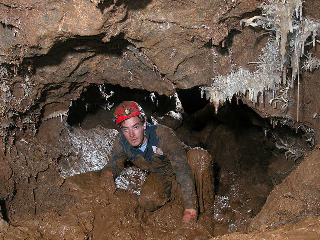
Caving
Caving, also known as spelunking (United States and Canada) and potholing (United Kingdom and Ireland), is the recreational pastime of exploring wild cave systems (as distinguished from show caves). In contrast, speleology is the scientific study of caves and the cave environment.
The challenges involved in caving vary according to the cave being visited; in addition to the total absence of light beyond the entrance, negotiating pitches, squeezes, and water hazards can be difficult. Cave diving is a distinct, and more hazardous, sub-speciality undertaken by a small minority of technically proficient cavers. In an area of overlap between recreational pursuit and scientific study, the most devoted and serious-minded cavers become accomplished at the surveying and mapping of caves and the formal publication of their efforts. These are usually published freely and publicly, especially in the UK and other European countries, although in the US they are generally more private.
Although caving is sometimes categorized as an "extreme sport," cavers do not commonly use this terminology and typically dislike the term being used in reference to caving, as it implies a disregard for safety. Though caving is a fairly safe sport compared to other activities that are sometimes classified as "extreme sports", incidents do occur. These tend to be related to flooding, hypothermia, rock falls, caver falls, SRT accidents, or some combination of these.
Many caving skills overlap with those involved in canyoning and mine and urban exploration.
Caving is often undertaken for the enjoyment of the outdoor activity or for physical exercise, as well as original exploration, similar to mountaineering or diving. Physical or biological science is also an important goal for some cavers, while others are engaged in cave photography. Virgin cave systems comprise some of the last unexplored regions on Earth and much effort is put into trying to locate, enter and survey them. In well-explored regions (such as most developed nations), the most accessible caves have already been explored, and gaining access to new caves often requires cave digging or cave diving.
Caving, in certain areas, has also been utilized as a form of eco and adventure tourism, for example in New Zealand. Tour companies have established an industry leading and guiding tours into and through caves. Depending on the type of cave and the type of tour, the experience could be adventure-based or ecological-based. There are tours led through lava tubes by a guiding service (e.g. Lava River Cave, the oceanic islands of Tenerife, Iceland and Hawaii).
Caving has also been described as an "individualist's team sport" by some, as cavers can often make a trip without direct physical assistance from others but will generally go in a group for companionship or to provide emergency help if needed. Some however consider the assistance cavers give each other as a typical team sport activity.
The term potholing refers to the act of exploring potholes, a word originating in the north of England for predominantly vertical caves.
Hub AI
Caving AI simulator
(@Caving_simulator)
Caving
Caving, also known as spelunking (United States and Canada) and potholing (United Kingdom and Ireland), is the recreational pastime of exploring wild cave systems (as distinguished from show caves). In contrast, speleology is the scientific study of caves and the cave environment.
The challenges involved in caving vary according to the cave being visited; in addition to the total absence of light beyond the entrance, negotiating pitches, squeezes, and water hazards can be difficult. Cave diving is a distinct, and more hazardous, sub-speciality undertaken by a small minority of technically proficient cavers. In an area of overlap between recreational pursuit and scientific study, the most devoted and serious-minded cavers become accomplished at the surveying and mapping of caves and the formal publication of their efforts. These are usually published freely and publicly, especially in the UK and other European countries, although in the US they are generally more private.
Although caving is sometimes categorized as an "extreme sport," cavers do not commonly use this terminology and typically dislike the term being used in reference to caving, as it implies a disregard for safety. Though caving is a fairly safe sport compared to other activities that are sometimes classified as "extreme sports", incidents do occur. These tend to be related to flooding, hypothermia, rock falls, caver falls, SRT accidents, or some combination of these.
Many caving skills overlap with those involved in canyoning and mine and urban exploration.
Caving is often undertaken for the enjoyment of the outdoor activity or for physical exercise, as well as original exploration, similar to mountaineering or diving. Physical or biological science is also an important goal for some cavers, while others are engaged in cave photography. Virgin cave systems comprise some of the last unexplored regions on Earth and much effort is put into trying to locate, enter and survey them. In well-explored regions (such as most developed nations), the most accessible caves have already been explored, and gaining access to new caves often requires cave digging or cave diving.
Caving, in certain areas, has also been utilized as a form of eco and adventure tourism, for example in New Zealand. Tour companies have established an industry leading and guiding tours into and through caves. Depending on the type of cave and the type of tour, the experience could be adventure-based or ecological-based. There are tours led through lava tubes by a guiding service (e.g. Lava River Cave, the oceanic islands of Tenerife, Iceland and Hawaii).
Caving has also been described as an "individualist's team sport" by some, as cavers can often make a trip without direct physical assistance from others but will generally go in a group for companionship or to provide emergency help if needed. Some however consider the assistance cavers give each other as a typical team sport activity.
The term potholing refers to the act of exploring potholes, a word originating in the north of England for predominantly vertical caves.