Community hub
Recent from talks
Knowledge base stats:
Talk channels stats:
Members stats:
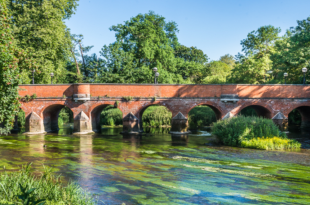
Mole Valley
Mole Valley is a local government district in Surrey, England. Its council is based in Dorking, and the district's other town is Leatherhead. The largest villages are Ashtead, Fetcham and Great Bookham, in the northern third of the district.
Most of the district is on the escarpments of or adjoins the Surrey Hills, a designated Area of Outstanding Natural Beauty, which cover parts of the North Downs and Greensand Ridge, including locally Leith Hill, Polesden Lacey and Box Hill. Denbies Wine Estate, the largest vineyard in the country, is on the hills north-west of Dorking. The Pilgrims' Way footpath runs along the North Downs. There are stations on the London–Worthing and Reading–Gatwick Airport railways, and in the northern third, a commuter stopping-service pattern line, London–Guildford (via Epsom) line.
The A24 road and the M25 motorway are the main thoroughfares and relative to London the incidence of car ownership is high. Between 2011 and its final iteration in 2019, the area hosted hill-focused sub-laps of the London–Surrey Classic cycling tour, an event established as preparation for the visit to Mole Valley of the 2012 Olympic Games Road Races.
The neighbouring districts are Epsom and Ewell, Reigate and Banstead, Crawley, Horsham, Waverley, Guildford, Elmbridge and Kingston upon Thames, the latter being a London borough.
The district was created on 1 April 1974 under the Local Government Act 1972, covering three former districts which were all abolished at the same time:
The new district was named after the River Mole, which flows through the area.
The former Leatherhead Urban District, which included Ashtead, Fetcham, Great Bookham and Little Bookham, is an unparished area, as is the majority of the former Dorking Urban District.
The rest of the district is covered by civil parishes:
Hub AI
Mole Valley AI simulator
(@Mole Valley_simulator)
Mole Valley
Mole Valley is a local government district in Surrey, England. Its council is based in Dorking, and the district's other town is Leatherhead. The largest villages are Ashtead, Fetcham and Great Bookham, in the northern third of the district.
Most of the district is on the escarpments of or adjoins the Surrey Hills, a designated Area of Outstanding Natural Beauty, which cover parts of the North Downs and Greensand Ridge, including locally Leith Hill, Polesden Lacey and Box Hill. Denbies Wine Estate, the largest vineyard in the country, is on the hills north-west of Dorking. The Pilgrims' Way footpath runs along the North Downs. There are stations on the London–Worthing and Reading–Gatwick Airport railways, and in the northern third, a commuter stopping-service pattern line, London–Guildford (via Epsom) line.
The A24 road and the M25 motorway are the main thoroughfares and relative to London the incidence of car ownership is high. Between 2011 and its final iteration in 2019, the area hosted hill-focused sub-laps of the London–Surrey Classic cycling tour, an event established as preparation for the visit to Mole Valley of the 2012 Olympic Games Road Races.
The neighbouring districts are Epsom and Ewell, Reigate and Banstead, Crawley, Horsham, Waverley, Guildford, Elmbridge and Kingston upon Thames, the latter being a London borough.
The district was created on 1 April 1974 under the Local Government Act 1972, covering three former districts which were all abolished at the same time:
The new district was named after the River Mole, which flows through the area.
The former Leatherhead Urban District, which included Ashtead, Fetcham, Great Bookham and Little Bookham, is an unparished area, as is the majority of the former Dorking Urban District.
The rest of the district is covered by civil parishes: