

Community hub
Recent from talks
Contribute something
Nothing was collected or created yet.
North Sumatra
View on WikipediaThis article has multiple issues. Please help improve it or discuss these issues on the talk page. (Learn how and when to remove these messages)
|
North Sumatra (Indonesian: Sumatera Utara;[7] Batak: ᯘᯮᯔᯖᯩᯒ ᯥᯖᯒ) is a province of Indonesia located in the northern part of the island of Sumatra. Its capital and largest city is Medan on the east coast of the island. It borders Aceh to the northwest, Riau to the southeast, West Sumatra to the south, the Indian Ocean to the west, and the Strait of Malacca (with a maritime border with Malaysia) to the east.
Key Information


With a 2020 population around 14.8 million[8] and a mid-2024 estimate around 15.6 million,[1] North Sumatra is Indonesia's fourth most populous province and the most populous province outside of Java Island. At 72,460.74 square kilometres (27,977.25 sq mi), North Sumatra is the third-largest province in area on the island of Sumatra behind South Sumatra and Riau. Major ethnic groups include the Malay, native to the east coast; several Batak groups, indigenous to the west coast and central highlands; the Nias people of Nias Island and its surrounding islets; and Chinese, Javanese, and Indian peoples, who first migrated to Sumatra during Dutch rule.
North Sumatra is home to the Toba supervolcano, located in what is now Lake Toba, which erupted 74,000–75,000 years ago, wiping out nearly all of mankind. The supereruption resulted in the creation of Lake Toba and was rated a VEI-8 eruption.
During Dutch rule, North Sumatra was administered under the Gouvernement van Sumatra, which governed the entire island of Sumatra out of Medan. In 1948, after Indonesian independence was proclaimed, Sumatra Province was divided into three sub-provinces, each of which had the right to regulate and manage its own affairs. The 15th April was later designated as the anniversary of the founding of the province of North Sumatra.
History
[edit]Prehistoric era
[edit]
Archaeological understanding of early North Sumatran peoples is limited compared to that of other nearby regions.[10] Prehistoric relics in North Sumatra show that the oldest population may have been Austronesian or Melanesian. Archaeological evidence indicates that their dispersal took place in the Mesolithic era (Middle Stone Age). They spread to the eastern part of Indonesia, to the island of Papua, and to the west, to North Sumatra and the Malay Peninsula.[citation needed] Early peoples in North Sumatra consumed mostly snails and clams, leaving large shell deposits sometimes referred to as kjokkenmoddinger (kitchen waste), some of which are still found as hills in Saentis, Hinai, Tanjung Beringin, along the Deli-Langkat shore, and on riverbanks.[10]
In the second wave of migration from mainland Southeast Asia c. 1000 BC, the Young Malays or Deutero Malays settled on the coast. They mainly lived by fishing and by cultivating the marshy land for agriculture. Their villages were scattered along the big rivers that flow to the east coast of North Sumatra such as Besitang, Wampu, Asahan, and Barumun. Larger villages grew at the mouths of rivers and became centres of government. Relics of the Mesolithic era have been found in North Sumatra, including finely honed stone axes, bone tools, and painting materials.[11]

Linguistic and archaeological evidence indicates that Austronesian speakers reached Sumatra from Taiwan and the Philippines through Borneo or Java about 2,500 years ago, and the Batak probably descended from these settlers.[12]
New genetic research has found that the Nias people also came from the Austronesian peoples, though their initial ancestors may have arrived earlier: ancestors of the Nias people are thought to have come from Taiwan through the Philippines 4,000 to 5,000 years ago.[13] Ten years of research involving blood samples of 440 Nias people in 11 villages on Nias island show similarities between their Y-chromosome and mitochondrial DNA and that of Taiwanese and Filipino peoples.[14]
Early historic era
[edit]This section needs additional citations for verification. (July 2024) |

The eastern coast of North Sumatra, bordering the Strait of Malacca, has been widely visited by Hindus and by Chinese traders for centuries since the founding of early Situs Kota Cina or Chinatown sites in Hamparan Perak c. 11th–14th centuries AD. Barus, a trading port on the western coast of Tapanuli, attracted Middle Age era traders in search of camphor, which was popular in Ancient Egypt. In 1030, Rajendra Chola recorded the names of North Sumatran states he defeated in one expedition to conquer Srivijaya. States that he mentioned included Sriwijaya, Malayur, Kendara, and the Panai Kingdom. Furthermore, the Negarakertagama epic by Mpu Prapanca from the 14th century list states found in North Sumatra, Pane, Haru, Mandailing, Tamiang, Lawas, and Barus, which were mainly defeated by the Majapahit.

The earliest kingdom that was present on the eastern coast of North Sumatra was the Aru Kingdom, which existed from the 13th to the 16th century AD. In its height, the kingdom was a maritime power and controlled the northern part of the Malacca strait.[16] The kingdom was initially established as a Karo polity.[17] The indigenous population practiced native animism and Hinduism. Starting in 13th century, some also practised Islam.[18] Aru's capital was located close to present-day Medan and Deli Serdang. Its people are believed to have been descendants of the Karo people from the hinterland of North Sumatra.[16]
An area near Lake Toba called Batakland (or the Batak Lands) housed kingdoms of Batak people. It was first mentioned in Zhao Rugua's 13th-century Description of the Barbarous Peoples, which refers to a 'Ba-ta' dependency of Srivijaya. The Suma Oriental, written in the 15th century, also refers to the "Kingdom of Bata" between Pasai and the Aru kingdom. The Batak mainly practiced animism and cannibalism and remained isolated from foreign culture and kingdoms like Srivijaya and Majapahit.[clarification needed] The Toba people divided the Batak Lands into several independent kingdoms, which often entered into defensive alliances. Of the many kingdoms, Bakkara and their king or Sisingamangaraja held the most sway due to customs and traditions which consider Bakkara the place of origin of the Batak people.[citation needed]
The Nias people on Nias Island remained isolated during its early era. Its people practised agriculture and cultivation, made art carvings, and adhered to shamanist and pagan practices.[citation needed]
Kingdom, sultanate, and colonial era
[edit]
By c. 1500, there were several kingdoms on the east coast of Sumatra, namely the larger Nagur and Aru kingdoms and the smaller Panai and Batangiou kingdoms. To the west, in the hinterland of Tapanuli, another kingdom emerged: a Batak kingdom founded by descendants of Sisingamangaraja. This kingdom gradually expanded its influenced throughout Tapanuli to Angkola, Mandailing, and Dairi. The three largest kingdoms in North Sumatra in the sixteenth century were Nagur, the Batak kingdom under the rule of King Sisingamangaraja, and Aru.
Wars between these three kingdoms made the region vulnerable to outside influences from Aceh, Melaka, Portugal, Siak, and Minangkabau. The Sultanate of Aceh worked to spread Islam across the eastern coast, and in the Padri War, succeeded in spreading Islam into the southern Tapanuli kingdom. As a result of this warfare and cultural shifts, the three big kingdoms split into several small kingdoms and sultanates, including Deli, Serdang, Asahan, Langkat Sultanate, Maropat, Lingga.

Malacca fell to the Dutch East India Company (the VOC) in 1641. Coastal areas of North Sumatra felt economic impacts as the VOC subsequently reduced the presence of trade in Malacca and shifted resources towards Batavia. Still, North Sumatra also saw an increase in Arab, Chinese and Indian traders.
After Britain gained a position on the nearby island of Penang by establishing a trading post for the British East India Company (Britain's first such post in the Far East) in 1786, the British traded heavily with the east coast of Sumatra.[19] Prior to the nineteenth century, Dutch power was concentrated on the island of Java and parts of the Moluccas, the Dutch East India Company competed with the British East India Company for trade in the area, especially for pepper, with the two nations trying to obstruct the other's trade efforts.[20] In the nineteenth century, the Dutch began to focus more on to areas outside Java, including North Sumatra, driving out British influence. Dutch control was formalized with the handover of most of Indonesia in the 1814 Treaty of London, which was renewed in the 1824 Treaty of London. However, the UK maintained a presence in several places that were considered important for trade, including parts of Sumatra and Kalimantan.

During the Padri War, in the years prior to 1860, Dutch forces arrived in South Tapanuki at the request of a local leader to provide protection. The Siak sultan subsequently signed a treaty with the Dutch East Indies government recognizing Dutch authority over it and the sultanates of Asahan, Serdang, Deli and Langkat. The Dutch proceeded further into Batakland and North Sumatra, invading Toba, Karo Highland, Nias and Silindung with the help of Christian missionaries, such as Ludwig Ingwer Nommensen, who worked to evangelise the area. The Dutch invasion into Batakland met resistance by Sisingamangaraja XII, causing a guerilla war lasting 30 years until and Sisingmangaraja XII's death in battle and a subsequent Dutch victory. Meanwhile, particularly after 1869, Dutch tobacco plantation activities expanded on the east coast, including the estab;ishment of Deli Maatschappij and London Sumatra, using land leased from the Malay sultans. As there was a worker shortage, the Dutch began importing labourers from Java, Southern China and Southern India. This first big wave of migration established substantial Javanese, Chinese, and Indian populations in North Sumatra that remain to this day. By 1874, the sultanates had been formally included within the Dutch East Indies, and in Deli, the sultan of Deli granted the Dutch sole rights over taxation and leases, in exchange for an annual pension. That year, the East Coast Residency was established.[21][22]
On March 12, 1942, Japanese forces landed in Palubuhan Ruku on the east coast, and advanced on Medan. The advance force reported it had captured the town the next day. The main force followed on bicycles. There was some resistance from the Dutch forces, particularly around Pematangsiantar, but the last major town, Sibolga, fell on 15 March. During the Japanese occupation of North Sumatra, the leader of the Japanese Armed Forces was centred in Bukittinggi, moving the de facto capital out of the Dutch centre of Medan. The occupation lasted 3 years. In 1945 the Japanese occupation officially ended with Japan's surrender in the Pacific and two days later Sukarno declared Indonesian Independence, beginning the four-year Indonesian War of Independence against the Dutch.[23][24][25]
Independence and contemporary era
[edit]
Beginning on 3 March 1946, there was a social revolution in East Sumatra. Across 25 "native states", many sultanates were overthrown. Armed pergerakan groups (Indonesian nationalists) conducted mass killings of the members of aristocratic families.[26] To opportunistic pergerakan militants (including Communist Party of Indonesia members Xarim MS and Luat Siregar), the revolutionary movement was seen as a means for East Sumatra to be freed from colonial rule and to join the larger Indonesian National Revolution.[27] Participants of the revolution were believed to be provoked by leaders to kill aristocrats and create violence with three prime objectives: to eliminate the sultans and aristocrats (who were seen as Dutch allies), to seize their wealth (to fund the Indonesian independence campaign), and to eliminate the region's feudal social structure.[28]
The Dutch authorities, working with the East Sumatra Union (Persatuan Sumatra Timur), which had been formed in 1938 by westernized Malay elites to reassert Malay and Simalungun ethnic interests, established the State of East Sumatra (Indonesian: Negara Sumatra Timur (NST)) as part of the planned United States of Indonesia. The state lasted from December 1947 to August 1950.[29] In addition to the Dutch, the NST state was supported by Malay aristocrats, most of the Simalungun rajas, some Karo chieftains, and Chinese groups who felt that the revolution threatened their interests. Dr Tengku Mansu, a member of the Asahan royal family, was selected as head of state for the NST. While the Dutch wanted the NST to be seen as an orderly and progressive alternative to the republic, western-educated aristocrats saw it as a bastion for their own ethnic interests.[30] Following the Dutch-Indonesian Round Table Conference in late 1949, the Dutch withdrew military support for the State of East Sumatra and its local authority began to collapse. The short-lived state was viewed with suspicion, and Dr Tengku Mansur entered into negotiations with Mohammad Hatta to reunify East Sumatra with the Republic of Indonesia in May 1950. Mansur surrendered authority to the republic and East Sumatra merged with Tapanuli to become the province of North Sumatra on August 15, 1950.[31][32]
After Indonesian independence, at the first session of the National Committee of Regions (KND), Sumatra was divided into three sub-provinces: North Sumatra, Central Sumatra and South Sumatra. North Sumatra was an amalgamation of three administrative regions called Residencies: the Residency of Aceh, the East Sumatra Residency, and the Residency of Tapanuli. The publication of the Law of the Republic of Indonesia (R.I.) No. 10, Year 1948 on April 15, 1948, formalized the division of these three provinces. The date of 15 April 1948 has been subsequently celebrated as the anniversary of North Sumatra Province.
Act R.I. No. 24 of 1956, promulgated on 7 December 1956, established a separate Aceh Province, independent of the province of North Sumatra.[33]
Geography
[edit]
The province of North Sumatra stretches across the island of Sumatra, between the Indian Ocean and the Strait of Malacca, with an area of 72,460.74 km2. It borders the province of Aceh to the northwest and Riau and West Sumatra to the southeast. The province contains a broad, low plain along the Strait of Malacca on which the provincial capital, Medan, is located. In the south and west, the land rises to the Bukit Barisan mountain range that runs the length of Sumatra; the mountains here surround Lake Toba, which was formed from the caldera of an ancient volcano. Several large islands in the Indian Ocean off the west coast of Sumatra are currently part of North Sumatra, most notably Nias Island and the Batu Islands.[citation needed]

There are 419 islands in North Sumatra. The outer islands include the island of Simuk (the most westerly of the Batu Islands) and the island of Berhala in the Strait of Malacca. The Nias archipelago, located off the coast of western Sumatra in the Indian Ocean, consists of Nias Island and other much smaller islands in its vicinity. Its administrative centre is located at the city of Gunungsitoli on the northeast coast of Nias. The Batu Islands, just southeast of Nias, consist of 51 islands including three major islands: Pini, Tanahbala and Tanahmasa. Pulau Telo is their administrative centre on the small island of Situasi. Other islands in North Sumatra include Imanna, Pasu, Bawa, Hamutaia, Batu Makelele, Masa, Bau, Simaleh, Makole, Jake, and Wunga.[citation needed]
Half of the province is located on a high plateau that runs along the Bukit Barisan mountains, from central North Sumatra to the western coast. The tallest mountain in the province is Mount Sinabung in Karo Regency, at elevation around 2,460 metres (8,070 ft), the most active volcano in the region. Volcanic activities (cracks where steam, gas, and lava are emitted) were observed at the summit in 1912; recent documented events include an eruption in the early hours of 29 August 2010 and eruptions in September and November 2013, January, February and October 2014.[34] Another volcano nearby is Mount Sibayak, also located in the Karo highland, sitting at an elevation of 2,181 metres (7,156 ft). Crystalline sulfur deposits on Mount Sibayak have historically been mined on a small scale, and seepage of sulfurous gases has caused acidic discolouration of its small crater lake.

Lake Toba is the site of a supervolcanic eruption that occurred 69,000 to 77,000 years ago, estimated at VEI 8, that formed a climate-changing event.[35] Recent advances in dating methods suggest more precise dating at 74,000 years ago.[36] It is the largest-known explosive eruption on Earth in the last 25 million years. It has been accepted that the eruption of the Toba Caldera led to a volcanic winter with a worldwide decrease in temperatures between 3 and 5 °C (5.4 and 9.0 °F), and up to 15 °C (27 °F) in higher latitudes. Additional studies in Lake Malawi in East Africa show significant amounts of ash deposited by the Toba Caldera eruptions, despite a great distance from the area, but these studies offer little indication of a significant climatic effect in East Africa.[37] According to the Toba catastrophe theory, the eruption killed most humans living at that time and is believed to have created a population bottleneck in central East Africa and India, affecting the human genome to the present day.[38] More recent studies have cast doubt on this theory and found no evidence of substantial changes in population.[39]

In North Sumatra, there are currently two national parks: the Gunung Leuser National Park and Batang Gadis National Park. According to the Ministerial Decree No. 44 of 2005,[citation needed] forest area in North Sumatra today covers 3,742,120 hectares (9,247,000 acres), consisting of a 477,070-hectare (ha) Natural Reserve Area/Natural Conservation Area, 1,297,330 ha of protected forest, 879,270 ha of limited production forest, 1,035,690 ha of permanent production forest, and 52,7600 ha of production forest that can be converted to another status.
However, the figure above is only de jure. In reality, the forests are not as large as the figures suggest. A lot of the forests are damaged, due to encroachment and illegal logging. So far, over 206,000 ha of forests in Sumatra have experienced changes in function. As many as 163,000 ha were converted to plantations and 42,900 ha were transmigration areas.[citation needed]
Governance
[edit]
The administrative centre of North Sumatra is located in the city of Medan, governed by a governor. Earlier governments ruled all of Sumatra (1945–1950); and a North Sumatra Province that included Aceh (1950–1956). In 1956, Aceh split off to form a separate Aceh Province.
Administrative divisions
[edit]North Sumatra is currently subdivided into 25 regencies (kabupaten) and 8 autonomous cities (formerly municipalities). When originally created as a province with its current boundaries, it was composed of 10 regencies and 6 cities, but an 11th regency (Dairi Regency) was created on 23 September 1964. Fourteen more new regencies and two new cities were created between 1998 and 2008. All these are listed below with their areas and their populations at the 2010 census[40] and the 2020 census,[41] together with their official estimates for mid-2024.[1] Regencies and cities are sub-divided into 455 districts, which in turn are further sub-divided into 6,110 villages (as of early 2024). Proposals have been under consideration since 2013 by the People's Representative Council (Dewan Perwakilan Rakyat or DPR) to create three new provinces from parts of the present North Sumatra: Nias Islands, Tapanuli, and East Sumatra; however since 2013 the Indonesian Government have maintained a moratorium on the intended creation of new provinces, regencies and cities. The present regencies and cities are grouped for convenience below according to the projected new provinces within which they are situated:

Nias Islands Region
[edit]
.
This region contains the substantial island of Nias and various small offshore islands, including the Batu Islands to the south. Originally it comprised a single Nias Regency (created on 7 November 1956), but on 25 February 2003 the southern part of the island (including the Batu Islands) was split off to form a separate South Nias Regency. On 29 October 2008 two new regencies - North Nias and West Nias - together with the city of Gunungsitoli, were split off from the remainder of Nias Regency.
| Kode Wilayah |
English name of city or regency |
Local name of city or regency |
Established by statute (a) |
Area in km2 |
Pop'n census 2010[40] |
Pop'n census 2020[41] |
Pop'n [1] estimate mid-2024 |
Capital | HDI[42] 2022 |
|---|---|---|---|---|---|---|---|---|---|
| 12.78 | Gunungsitoli City | Kota Gunungsutoli | UU 47/2008 | 208.684 | 126,202 | 136,017 | 145,233 | Gunungsitoli | 0.702 (High) |
| 12.04 | Nias Regency | Kabupaten Nias | UU 7/1956 | 902.395 | 131,377 | 146,672 | 155,629 | Gidö | 0.639 (Medium) |
| 12.14 | South Nias Regency (b) | Kabupaten Nias Selatan | UU 9/2003 | 2,531.703 | 289,708 | 360,531 | 389,957 | Teluk Dalam | 0.631 (Medium) |
| 12.24 | North Nias Regency | Kabupaten Nias Utara | UU 45/2008 | 1,238.055 | 127,244 | 147,274 | 158,676 | Lotu | 0.637 (Medium) |
| 12.25 | West Nias Regency | Kabupaten Nias Barat | UU 46/2008 | 464.219 | 81,807 | 89,994 | 97,251 | Lahomi | 0.629 (Medium) |
| Totals | 5,345.056 | 756,338 | 880,550 | 946,746 |
Notes: (a) UU is an abbreviation from Undang-Undang (the Indonesia statute of law).
(b) South Nias Regency includes the Batu Islands.
The region include 124 smaller offshore islands - 87 in South Nias Regency (primarily the Batu Islands), 11 in West Nias Regency, 19 in North Nias Regency and 7 in Nias Regency.
Tapanuli Region
[edit]_(04).jpg)

This region comprises the southwestern part of the province on the island of Sumatra, and equates to the former Tapanoeli Residency which existed at the time of independence (except for Nias Island). When the province was created, the region comprised three regencies (North Tapanuli, Central Tapanuli and South Tapanuli) and the city of Sibolga. A fourth regency - Dairi - was created on 23 September 1964 from part of North Tapanuli Regency. Two more new regencies were formed on 23 November 1998 - Mandailing Natal from part of South Tapanuli Regency, and Toba Samosir from another part of North Tapanuli Regency. The city of Padang Sidempuan was split off from South Tapanuli Regency on 21 June 2001. Two further regencies were formed on 25 February 2003 - Humbang Hasundutan from part of North Tapanuli Regency, and Pakpak Bharat from part of Dairi Regency. A new Samosir Regency was created from part of Toba Samosir Regency on 18 December 2003 (more recently, the remaining part of this regency was renamed Toba Regency). Another two regencies were created on 17 July 2007 - Padang Lawas and North Padang Lawas, both from parts of South Tapanuli Regency.
| Kode Wilayah |
English name of city or regency |
Local name of city or regency |
Established by statute |
Area in km2 |
Pop'n census 2010[40] |
Pop'n census 2020[41] |
Pop'n [1] estimate mid-2024 |
Capital | HDI[42] 2022 |
|---|---|---|---|---|---|---|---|---|---|
| 12.11 | Dairi Regency | Kabupaten Dairi | UU 4/1964 | 2,083.604 | 270,053 | 308,764 | 330,586 | Sidikalang | 0.725 (High) |
| 12.15 | Pakpak Bharat Regency | Kabupaten Pakpak Bharat | UU 9/2003 | 1,365.607 | 40,481 | 52,351 | 56,212 | Salak | 0.688 (Medium) |
| 12.17 | Samosir Regency | Kabupaten Samosir | UU 36/2003 | 1,850.035 | 119,653 | 136,441 | 143,071 | Pangururan | 0.716 (High) |
| 12.12 | Toba Regency | Kabupaten Toba | UU 12/1998 | 2,291.616 | 173,129 | 206,199 | 213,850 | Balige | 0.759 (High) |
| 12.02 | North Tapanuli Regency | Kabupaten Tapanuli Utara | UU 7/1956 | 3,895.604 | 279,257 | 312,758 | 326,993 | Tarutung | 0.741 (High) |
| 12.16 | Humbang Hasundutan Regency | Kabupaten Humbang Hasundutan | UU 9/2003 | 2,351.514 | 171,650 | 197,751 | 207,076 | Dolok Sanggul | 0.703 (High) |
| 12.01 | Central Tapanuli Regency | Kabupaten Tapanuli Tengah | UU 7/1956 | 2,307.677 | 311,232 | 365,177 | 394,910 | Pandan | 0.703 (High) |
| 12.73 | Sibolga City | Kota Sibolga | UU 7/1956 | 11.471 | 84,481 | 89,584 | 91,747 | Sibolga | 0.747 (High) |
| 12.03 | South Tapanuli Regency | Kabupaten Tapanuli Selatan | UU 7/1956 | 4,201.035 | 263,815 | 300,911 | 316,486 | Sipirok | 0.709 (High) |
| 12.77 | Padang Sidempuan City | Kota Padang Sidempuan | UU 32/1982 | 159.298 | 191,531 | 225,105 | 240,067 | Padang Sidempuan | 0.760 (High) |
| 12.20 | North Padang Lawas Regency | Kabupaten Padang Lawas Utara | UU 37/2007 | 3,945.557 | 223,531 | 260,720 | 280,595 | Gunung Tua | 0.709 (High) |
| 12.21 | Padang Lawas Regency | Kabupaten Padang Lawas | UU 38/2007 | 3,914.413 | 225,259 | 261,011 | 280,764 | Sibuhuan | 0.695 (Medium) |
| 12.13 | Mandailing Natal Regency | Kabupaten Mandailing Natal | UU 12/1998 | 6,547.257 | 404,945 | 472,886 | 505,360 | Panyabungan | 0.680 (Medium) |
| Totals | 34,924.688 | 2,759,017 | 3,189,658 | 3,351,717 |
The region includes 60 small offshore islands - 24 in Mandailing Natal, 31 in Central Tapanuli (the largest being Mursala Island off Sibolga) and 5 in Sibolga City, plus 7 islands in the landlocked Lake Toba comprising 1 in North Tapanuli Regency (Pulau Sibandang), 5 in Samosir Regency and 1 in Humbang Hasundutan Regency.
East Sumatra Region
[edit]

_(01).jpg)
The region comprises the northeastern part of the province on the island of Sumatra, and equates to the former State of East Sumatra which existed at the time of independence. It now covers ten regencies and five cities, but originally there were just six regencies and the five cities. The new regency of Serdang Bedagai was formed on 18 December 2003 from part of Deli Serdang Regency, and the new regency of Batubara was formed on 2 January 2007 from part of Asahan Regency. Two further regencies were formed on 24 June 2008 - North Labuhanbatu and South Labuhanbatu - both from parts of Labuhanbatu Regency.
| Kode Wilayah |
English name of city or regency |
Local name of city or regency |
Established by statute |
Area in km2 |
Pop'n census 2010[40] |
Pop'n census 2020[41] |
Pop'n estimate mid-2024[1] |
Capital | HDI[42] 2022 |
|---|---|---|---|---|---|---|---|---|---|
| 12.05 | Langkat Regency | Kabupaten Langkat | UU 7/1956 | 6,140.035 | 967,535 | 1,030,202 | 1,078,676 | Stabat | 0.718 (High) |
| 12.75 | Binjai City | Kota Binjai | UU 9/1956 | 93.770 | 246,154 | 291,842 | 307,170 | Binjai | 0.769 (High) |
| 12.07 | Deli Serdang Regency | Kabupaten Deli Serdang | UU 7/1956 | 2,581.232 | 1,790,431 | 1,931,441 | 2,048,480 | Lubukpakam | 0.761 (High) |
| 12.71 | Medan City | Kota Medan | UU 24/1956 | 279.290 | 2,097,610 | 2,435,252 | 2,486,283 | Medan | 0.817 (Very High) |
| 12.06 | Karo Regency | Kabupaten Karo | UU 7/1956 | 2,206.876 | 350,960 | 404,998 | 426,471 | Kabanjahe | 0.753 (High) |
| 12.08 | Simalungun Regency | Kabupaten Simalungun | UU 7/1956 | 4,601.477 | 817,720 | 990,246 | 1,051,845 | Raya | 0.737 (High) |
| 12.72 | Pematangsiantar City | Kota Pematangsiantar | UU 7/1956 | 75.919 | 234,698 | 268,254 | 277,054 | Pematang- siantar |
0.797 (High) |
| 12.18 | Serdang Bedagai Regency | Kabupaten Serdang Bedagai | UU 36/2003 | 1,949.180 | 594,383 | 657,490 | 691,638 | Sei Rampah | 0.712 (High) |
| 12.76 | Tebing Tinggi City | Kota Tebing Tinggi | UU 7/1956 | 39.170 | 145,248 | 172,838 | 180,977 | Tebing Tinggi | 0.761 (High) |
| 12.19 | Batubara Regency | Kabupaten Batubara | UU 5/2007 | 888.142 | 375,885 | 410,678 | 437,360 | Limapuluh | 0.695 (Medium) |
| 12.09 | Asahan Regency | Kabupaten Asahan | UU 7/1956 | 3,737.830 | 668,272 | 769,960 | 813,720 | Kisaran | 0.711 (High) |
| 12.74 | Tanjungbalai City | Kota Tanjungbalai | UU 7/1956 | 60.072 | 154,445 | 176,027 | 185,647 | Tanjungbalai | 0.698 (Medium) |
| 12.23 | North Labuhan Batu Regency | Kabupaten Labuhan Batu Utara | UU 23/2008 | 3,686.013 | 330,701 | 381,994 | 408,749 | Aek Kanopan | 0.727 (High) |
| 12.10 | Labuhan Batu Regency | Kabupaten Labuhan Batu | UU 7/1956 | 2,772.384 | 415,248 | 493,899 | 520,545 | Rantau Prapat | 0.729 (High) |
| 12.22 | South Labuhan Batu Regency | Kabupaten Labuhan Batu Selatan | UU 22/2008 | 3,079.610 | 277,673 | 314,094 | 336,577 | Kota Pinang | 0.721 (High) |
| Totals | 32,191.000 | 9,466,963 | 10,729,215 | 11,251,192 |
The region includes 38 offshore islands - 11 in Langkat Regency, 1 in Deli Serdang, 1 in Medan City, 2 in Serdang Bedagai, 1 in Simalungun, 2 in Batubara, 4 in Asahan, 8 (riverine islands) in Tanjungbalai City, 2 in North Labuhanbatu and 6 in Labuhanbatu Regency.
National Electoral Districts
[edit]The province comprises three of Indonesia's 84 national electoral districts to elect members to the People's Representative Council. Each of the three districts elects 10 members to the People's Representative Council (for a total of 30 members from the province).[43]
- The North Sumatra I Electoral District consists of 2 of the regencies in the province (Deli Serdang and Serdang Bedagai), together with the cities of Medan and Tebingtinggi.
- The North Sumatra II Electoral District consists of 16 regencies (Nias, South Nias, North Nias and West Nias; Samosir, Toba, North Tapanuli, Humbang Hasundutan, Central Tapanuli, South Tapanuli, North Padang Lawas, Padang Lawas and Mandailing Natal; Labuhan Batu, South Labuhan Batu and North Labuhan Batu), together with the cities of Sibolga, Padangsidempuan and Gunungsitoli.
- The North Sumatra III Electoral District consists of the remaining 7 regencies (Asahan, Simalungun, Dairi, Karo, Langkat, Pakpak Bharat and Batubara), together with the cities of Tanjungbalai, Pematangsiantar and Binjai.
Demographics
[edit]Population
[edit]North Sumatra recorded a population of 12,985,075 in the 2010 national census,[40] making it the 4th most populous province in Indonesia, with a sex ratio of 99.59 men per 100 women.[44] The 2015 Intermediate census gave a total of 13,923,262, while the 2020 census gave a total of 14,799,361,[41] and the official estimate for mid-2024 was 15,588,525[1] The mid-2024 total comprised 7,823,399 males and 7,765,126 females, giving a sex ratio of 100.75 men per 100 women.
Migration
[edit]It was reported in January 2024 that a group of 140 Rohingya people, consisting mostly of women and children had landed in Indonesia and been directed by the military to the North Sumatra region. This has been one of several groups that have arrived in the area over the preceding months.[45]
| Year | Pop. | ±% |
|---|---|---|
| 1971 | 6,621,831 | — |
| 1980 | 8,360,894 | +26.3% |
| 1990 | 10,256,027 | +22.7% |
| 1995 | 11,114,667 | +8.4% |
| 2000 | 11,649,655 | +4.8% |
| 2010 | 12,982,204 | +11.4% |
| 2015 | 13,923,262 | +7.2% |
| 2020 | 14,799,361 | +6.3% |
| 2024 | 15,588,525 | +5.3% |
| Source: Badan Pusat Statistik 2025 and earlier | ||
Ethnic groups
[edit]North Sumatra is a multi-ethnic province. The Malay people are regarded as the majority people of the east coast of the province, while the west coast of the province is mainly inhabited by the Batak (Pakpak, Angkola and Mandailing groups). The central region around Lake Toba to the northern Karo highland is predominantly inhabited by other Batak groups (Toba, Simalungun and Karo). The Nias people are indigenous to Nias Island and its surrounding islets. With the opening of tobacco plantations in East Sumatra during the colonial era, the colonial government employed many contract labourers for plantations, they were mainly Chinese, Javanese and Indian migrants, who were majority does not returned after end contract and decided to stay in North Sumatra. The rapid urbanisation in the province also attract neighbouring people from Aceh, Riau and West Sumatra, which is the Aceh and Minangkabau people presents.[citation needed]
Bataks make up 44.95% of the population, including the Batak Karo and Mandailing. The Javanese come second with 30.62%, the Malays add up to 5.92% and the ethnic Chinese comprise 5.75%. The Nias people make up around 4.10% and the rest are Minangkabau (2.66%), Acehnese (1.07%), ethnic Indian (1.00%) and other ethnic groups (1.15%)[citation needed]

The distribution of the tribes, clans, and ethnic groups in North Sumatra is as follows:[citation needed]
- Batak Toba: throughout North Sumatra, forming the majority in the Toba, Samosir, Humbang Hasundutan, and North Tapanuli Regencies.
- Batak Karo: mostly in the Karo Regency, Deli Serdang and Langkat Regencies, including Berastagi and Kabanjahe.
- Batak Mandailing: majority along the western coast: (South Tapanuli, Padang Lawas, Mandailing Natal, Central Tapanuli), and the rest in Medan, Padangsidempuan, Sibolga and Rantauprapat.
- Batak Pakpak: majority in Dairi Regency and Sidikalang.
- Batak Simalungun: majority in Simalungun and Pematangsiantar
- Batak Angkola: majority in North Tapanuli, Gunung Tua, North Padang Lawas, and South Tapanuli
- Malay: mostly in the east coast rurals, especially Langkat and Asahan.
- Nias: mostly in Nias Island (including Gunungsitoli), with a small population around the west coast.
- Javanese: mostly reside in east coast rural areas, and in west coast areas like Deli Serdang, Serdang Bedagai, Asahan and Labuhan Batu Regencies, and in urban communities like Medan and Tebingtinggi.
- Minangkabau people: mostly in Medan, Sibolga and Mandailing Natal.
- Indian: major east coast cities such as; Medan, Binjai, Tebing Tinggi, Pematangsiantar, Kisaran, Tanjungbalai and Deli Serdang.
- Acehnese people: Medan, Binjai up to northern parts such as Langkat.
- Chinese: major cities such as; Medan metropolitan area: (Medan, Binjai, Deli Serdang), Tanjungpura, Stabat, Tebing Tinggi, Tanjungbalai, Kisaran, Limapuluh, Rantauprapat, Pematangsiantar, Balige, Sibolga, Padangsidempuan, and Gunungsitoli.
-
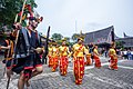 Moyo dance in Nias Island
 -
 Bataknese Tor-tor dance in Samosir Island
 -
 Cap Go Meh festival in Gunungsitoli, Nias Island
 -
 Malay-Deli bride in Maimoon Palace, Medan
 -
 The Indian community celebrated Thaipusam festival in Medan
 -
 The Javanese Bujang Ganong masked dancer, part of Reog, in North Sumatra


Languages
[edit]As well as Indonesian, languages spoken in the province include various dialects of Batak languages (particularly around Lake Toba), Javanese (various regions in the east of the province, especially around Medan), Malay, Minangkabau and the Nias language (parts of Nias).[46]
Religion
[edit]- Islam (62.0%)
- Protestantism (26.9%)
- Roman Catholic (7.44%)
- Buddhism (2.58%)
- Confucianism (0.18%)
- Hinduism (0.65%)
More than 95% of residents are either Muslim or Christian; the remainder are Buddhists, Hindus, or follow folk religions such as Confucianism, and Parmalim. These are the recognized religions of North Sumatra:
- Islam: especially embraced by the Malays, Minangkabau, Javanese, Aceh, Mandailing, Angkola, partly Nias, and partly Chinese, Batak Toba, Karo, Simalungun and Pakpak
- Christianity (Protestantism and Catholicism): especially embraced by Batak Toba, Karo, Simalungun, Nias, Pakpak and partly Batak Angkola, partly Javanese, Chinese and Indian
- Buddhism: mainly embraced by Chinese in urban areas
- Confucianism, Taoism and Chinese folk religion: predominantly embraced by Chinese in urban areas
- Hinduism and Sikhism: especially embraced by Indian in urban areas, there are also small Batak Karo people that practising Hinduism in rural areas
- Traditional religion such as Parmalim/Pemena: embraced by most of the Batak tribe centred in Huta Tinggi, Laguboti district, Toba Samosir Regency
-

-

-
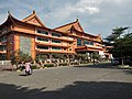 Maha Vihara Maitreya, one of the largest Buddhist temples in Indonesia, located in Percut, Deli Serdang
 -
 St Fransiskus Asisi Catholic church, Gunungsitoli, Nias
 -
 Sri Mariamman Temple, Medan, the oldest Hindu temple in Medan
 -


,_Medan.jpg)

Culture
[edit]North Sumatra hosts various ethnicities, religions and traditions, influenced by the Batak, Malay and Nias peoples, and other cultures such as Chinese, Indian and Javanese.
Music
[edit]The music that is usually played depends on the traditional ceremonies held, but is more dominant with the drums. As in the Coastal Ethnic (Indonesian: Orang Pesisir), there are musical instruments called Sikambang.

The Batak Toba, Pakpak and Simalungun tribes have a musical instrument called Gondang which is usually played during traditional ceremonies in marriage, death, and so on. Meanwhile, the Mandailing and Angkola Batak tribes have musical instruments similar to the gondang, namely Gordang Sambilan. The Malays in the East Coast have the same musical instruments as the Malays in general, such as the accordion, the Malay drum (kompang) and the violin. Meanwhile, in Tanah Karo, there are Kulcapi and Gendang musical instruments which are commonly used to accompany the Landek or Guro Guro Aron dance.
Architecture
[edit]In the field of fine arts that stands out is the traditional house architecture which is a combination of the results of sculpture and carving as well as the results of handicrafts. Traditional house architecture is found in various forms of ornament. In general, the shape of the traditional house building in the Batak traditional group symbolizes "buffalo standing upright" (Indonesian: Kerbau berdiri tegak). This is even clearer by decorating the top of the roof with buffalo heads.
The traditional house of the Batak Toba ethnic, Ruma Batak, stands strong and majestic and is still commonly found in Samosir and Lake Toba area. The Batak Karo traditional house looks big and taller than other traditional houses. The roof is made of palm fiber and is usually supplemented with smaller triangular roofs called ayo-ayo rumah, Jambur and tersek. With soaring multi-layered roofs, Karo's house has a distinctive shape compared to other traditional houses that only have one roof in North Sumatra, there are still several villages in Karo highland that still reserve traditional house and buildings, like in Lingga. The shape of the traditional house in the Batak Simalungun area is quite attractive. The traditional house complex in Pematang Purba village consists of several buildings, namely the Rumah Bolon, Balai Bolon, drying rack, taboo hall of need, and mortar. The prominent Mandailing buildings are called Bagas Gadang (house of Namora Natoras) and Sopo Godang (customary consultation hall).
Malay traditional houses in North Sumatra are not much different from Malay houses in other provinces, only the green and yellow colour is more dominant.
Dances
[edit]
The traditional dance repertoire includes various types. Some are in the form of sacred dances and some are solely for entertainment. In addition to traditional dances which are part of traditional ceremonies, sacred dances are usually danced by dayu-datu. Included in this type of dance are teacher dances and stick dances. Datu danced while swinging a magic stick called Tunggal Panaluan.
Profane dance is usually a young social dance that is danced at a happy party. Tortor is danced at the wedding ceremony. Usually danced by the audience including the bride and young people. These youth dances, for example morah-morah, parakut, sipaj ok, patam-patam and kebangkiung. Magical dances, such as the Nasiraan Tortor Dance, Tunggal Panaluan Tor Tor Dance. This magical dance is usually performed with great solemnity.
Besides Batak dances, there are also Malay dances such as Serampang XII, Gundala-Gundala and Landek dance from Karo Highlands, Moyo and Maena dance from Nias.
Handicraft
[edit]
In addition to architecture, weaving is an interesting craft art from the Batak tribe. Examples of this weave are ulos cloth and songket cloth. Ulos is a traditional Batak cloth used in wedding ceremonies, death, building houses, arts, etc. Ulos cloth is made of cotton or hemp yarn. Ulos colors are usually black, white, and red which have certain meanings. While other colors are symbols of the variety of life. In the Pakpak tribe there is a weave known as oles. Usually the base color of the ointment is black-brown or white. In the Karo tribe there is a weave known as uis. Usually uis base colors are dark blue and reddish. In the west coast community there is a woven fabric known as Songket Barus. Usually the basic color of this craft is Dark Red or Yellow Gold.
Batubara Malay Songket is one of the typical crafts of the East Coast that has been worldwide. Songket Batubara has its own characteristics, this can be seen from: The process of making songket still uses wooden looms in the traditional way, but still has good quality, thus this songket is not inferior to songket produced with today's sophisticated machines. The Batubara songket also has a variety of unique motifs such as bamboo shoots, mangosteen flowers, cempaka flowers, Caul buds, Tolak Betikam, and Fighting Dragons. The Batubara songket woven has an attractive design and a high cultural artistic value.
Culinary
[edit]
There is a wide variety of food in North Sumatra, depending on the region. This includes Saksang and Babi panggang karo, and in the Pakpak Dairi area, Pelleng is a very spicy popular typical food. The characteristic of Batak cuisine is its preference for andaliman (Zanthoxylum acanthopodium) as the main spice. That is why andaliman in Indonesia is sometimes dubbed as Batak pepper.[47] In the Batak land itself there is dengke nani arsik which is fish that is fried without using coconut. For taste, Batak land is heaven for lovers of coconut milk and spicy food. Pasiyak Natonggi or money to buy sweet palm wine is a very familiar term there, describing how close palm wine or nira is to their lives. Batak people are majority Christian — unlike neighboring Muslim-majority ethnic groups such as Aceh and Minang — Christian Batak people are not restricted to Islamic halal dietary law.[48]

Many of the Batak popular meals contain pork as well as dishes made from unusual ingredients, such as dog meat or blood, however there are also halal batak dishes, mostly chicken, beef, lamb, mutton, and freshwater fishes. With a large population of Batak being Muslim, especially among Mandailing people, they have their own dishes such as Sayur daun ubi tumbuk or mashed-cassava leaf soup, Pora-pora, Salai ikan, Pakkat and others. Batak culinary centres are located in towns of Batak highlands, such as the town of Kabanjahe and Berastagi in Tanah Karo area. Some towns around the Lake Toba offer freshwater fish dishes such as carp arsik. The Northern Sumatra capital of Medan is also a Batak cuisine hotspot where numerous of Lapo (Batak restaurants) can be found anywhere across the province, it even expanded into neighbouring provinces such as Riau, Riau Islands, even capital Jakarta and neighbouring countries like in Malaysia and Singapore.
The North Sumatran Malay cuisine is similar to another Malays region, meals such as Nasi lemak (called as Nasi Gurih), Bubur pedas, Lemang and dodol are the most known dishes from Medan and the east coast. The Chinese have influenced the province's cuisine, examples are Cha Sio,Tau Kua He Ci, Popia, Bakpao, Teng-Teng, Chai Pao, Roti Kacang and Bika ambon which are dishes also popular elsewhere in Indonesia. Indian influences can also be seen in dishes such as Martabak, Roti canai, Putu bambu and Mie rebus. The Minangkabau and Acehnese peoples brought Nasi padang and Mie Aceh dishes.
Economy
[edit]- Agriculture (20.9%)
- Manufacturing (20.0%)
- Other industrial (15.4%)
- Service (43.7%)
Energy
[edit]North Sumatra is rich in natural resources such as natural gas in the area of Tandem, Binjai and petroleum in Pangkalan Brandan, Langkat which has been explored since the days of the Dutch East Indies. Besides that, in Kuala Tanjung, Asahan, there is the company named PT Inalum (abbreviated from Indonesia Aluminium) that is engaged in ore mining and smelting of aluminium which is the only one in Southeast Asia.
The rivers that disgorge from the mountains around Lake Toba are also a natural resource that has potential enough to be an exploited resource for hydroelectric power plants. Asahan hydropower, which is the largest hydroelectric power plant on Sumatra Island, is located at Porsea in Toba Samosir Regency.
Moreover, in the mountains there are many geothermal hot spots were very likely to be developed as a source of thermal energy or steam that can then be transformed into electrical energy.
Agriculture and farming
[edit]
The province is famous for its plantations. The plantations are managed by private companies and the state. SOE Plantation area is located in North Sumatra, among others PT Perkebunan Nusantara II (PTPN II), PTPN IV and PTPN III.
North Sumatra produces rubber, cocoa, tea, palm oil, coffee, cloves, coconut, cinnamon, and tobacco. These commodities have been exported to many countries and contributing huge foreign exchange for Indonesia. In addition to commodities, North Sumatra is also known as a producer of horticultural commodities (vegetables and fruits); e.g. Medanese Orange, Deli Guava, Cabbage Vegetable, Tomato, Potato and Carrot generated by Karo, Simalungun and North Tapanuli. The horticultural products have been exported to Malaysia and Singapore.
The plantation is spread in East coast area such as Deli Serdang, Serdang Bedagai Langkat, Simalungun, Asahan, Labuhan Batu, and also around west coast: Central and South Tapanuli. Plantations, especially palm oil, are important for sourcing reticulated and blood pythons, the skins of which are a major export product.[50]
The size of technical irrigation entirely in North Sumatra is 132 ha that covers an area of 174 irrigation site.
Sumatra Mandheling and Sumatra Lintong coffee beans are grown in North Sumatra and largely exported to the United States. Mandheling is named after the similarly spelt Mandailing people located in North Sumatra, Indonesia. The name is the result of a misunderstanding by the first foreign purchaser of the variety, and no coffee is actually produced in the "Mandailing region". Lintong on the other hand, is named after the Lintong district, also located in North Sumatra.

Banking
[edit]In addition to national banks, state banks and international banks, currently there are 61 units of Credited Peoples Banks (BPR) and 7 Credited Sharia Bank (BPRS). Data from Bank Indonesia showed, in January 2006, the Third Party Funds (TPF), which absorbed BPR reached Rp253,366,627,000 (around US$19 million) and loans reached Rp260.152.445.000 (around US$19.5 million). While assets reached Rp340,880,837,000 (US$25.5 million).
Mining
[edit]There are three leading mining companies in North Sumatra:
- Sorikmas Mining (SMM), main base around South Tapanuli with gold as main commodity
- Newmont Horas Nauli (PTNN)
- Dairi Prima Mineral
Industry
[edit]North Sumatra has several industrial sites, mainly around Deli Serdang. Medan Industrial Area (Indonesian: Kawasan Industri Medan) stands for KIM is the main industrial complex in Medan.
Sei Mangkei Industrial Area
[edit]Sei Mangkei Industrial Area, also known as Sei Mangkei – Integrated Sustainable Palm Oil Cluster (SM-ISPOIC), is located in Simalungun Regency and was formally opened on 12 June 2010. Four companies have joined in this area, with investment costs totaling up to Rp1.5 trillion ($176 million).[51][52] In April 2011, three other companies also joined in the Sei Mangkei area. They are Procter & Gamble Co for making CPO derivatives of cosmetic raw materials, Ferrostaal AG and Fratelli Gianazza SpA.
Exports and imports
[edit]The increasingly higher economic performance of Sumatra and Java means that North Sumatran exports will be experiencing rapid growth. In 2004, the size of the foreign exchange sector had reached $4.24 billion, up 57.7% from 2003.
Coffee exports from North Sumatra reached a record high of 46,290 tonnes with Japan as the main export destination countries during the last five years. Sumatran coffee exports are also listed as the top 10 highest export products with a value of US$3.25 million or 47200.8 tons from January to October 2005.
Of the garment sector, garment exports tend to fall in January 2006. The results of special apparel industry down 42.59% from US$1,066,124 in 2005, to US$2,053 in 2006 in the same month.
Import export performance of some industrial products showed a decline. Namely furniture fell 22.83% from US$558,363 (2005) to US$202,630 (2006), plywood down 24.07 percent from US$19,771 to US$8,237, misteric acid down 27.89% from US$115,362 into US$291,201, stearic acid dropped 27.04% from US$792,910 to US$308,020, and soap noodles down 26% from US$689,025 to US$248,053.
Export performance of agricultural imports also decreased the essential oil dropped 18 percent from US$162,234 to US$773,023, seafood / shrimp, coconut oil and robusta coffee also dropped quite dramatically to 97 per cent. Some commodities were increased (a value of over US $ Million) is cocoa, horticulture, arabica coffee, palm oil, natural rubber, seafood (non shrimp). For the results of the molding industry, vehicle tires and rubber gloves.
Tourism
[edit]North Sumatra has lots of travel destinations. According to Ministry of Tourism, North Sumatra is ranked on the top 10 most visited province in Indonesia. There are various kinds of tourist destinations that could be found throughout the province, Berastagi is best known as a hilly place with a cooler temperature as the whole province is in tropical region. Lake Toba is also a popular travel destination. Toba is a large volcanic lake which has an island inside of it, Samosir Island. Nias Island and other several islands nearby named Batu Islands is a popular spot for surfing. The capital itself, Medan, has many places of interest, mainly for its historical sites. The city is also known for its variety of cuisine. The list below is the most known places of interest in North Sumatra:


- Medan is the capital of North Sumatra province with a diverse crowd population of tribes and religions in unity. There are many historical tourist objects to spot and various great cuisine to taste in Medan.
- Lake Toba is the largest volcanic lake in the world. Located in the centre of North Sumatra, the lake can be reached via Parapat (Simalungun regency), Tongging (Karo regency), and Balige (Toba Samosir regency).
- Samosir Island is a volcanic island in middle of Lake Toba, It is a popular tourist destination due to its exotic Batak history and the vistas it offers. The tourist resorts are concentrated in the Tuktuk, Tomok, Simanindo, and Pangururan areas.
- Bukit Lawang known for the largest animal sanctuary of Sumatran orangutan (around 5,000 orangutans occupy the area), and also the main access point to the Gunung Leuser National Park from the east side.
- Nias Island is an island off the western coast of Sumatra. Nias is an internationally popular surfing destination where many international surfing competitions are held. The best known surfing area is Sorake Bay, close to the town of Teluk Dalam, on the southern tip. This is enclosed by the beaches of Lagundri and Sorake. Tourists can visit the island by plane from Medan, or by ferry from Sibolga.
- Bawomataluo village is a settlement in Teluk Dalam of the South Nias Regency of Indonesia. The village was built on a flat-topped hill, the name Bawomataluo meaning "Sun Hill", and is one of the best-preserved villages built in traditional style.[53]
- Berastagi is a small highland town located 63 kilometres to the south of Medan, and is a popular weekend destination for city dwellers due to its chilled and fresh mountain air.
- Dolok Tinggi Raja has a unique soil colour is white because it is located in a limestone hill that resembles snow, and also in the middle of this area there are lakes with hot blue-green coloured water, located in Tinggi Raja, Simalungun.
- Lumbini Natural Park is a Buddhist Theravada-style temple that is similar to Shwedagon Pagoda in Myanmar located in Berastagi.
- Kolam Abadi Pelaruga, a blue crystal river located in Rumah Galuh, Langkat Regency, 50 km from Medan
- Poncan Island is a resort including a beach, located on west offshore of Sibolga city.
- Berhala Island is a 2.5 hectares island located in the Malaka Strait near the boundary of Indonesia and Malaysia. It is a popular place for snorkeling and watching turtle nesting. Visitors can reach the island via boat from Sergei in the Serdang Bedagai regency.
- Sipisopiso, one of the highest waterfalls in Indonesia, is located near Tongging in Karo regency, about 1 hour drive from Berastagi.
- Simalem Resort, is a 5 star resort located around 8 km from Munthe village, Karo Regency. This place is the good place for sightseeing the whole Lake Toba from top of the hill.
- Taman Iman, Indonesian name for The Garden of Faith located in Sitinjo village, Dairi around 10 km away from Sidikalang, it is a religious garden with dioramas from 5 religion of Indonesia (Islam, Christian, Buddhist, Hindu, and Confucian).

- Bahal temple, an ancient Buddhist monastery located in Padang Bolak, Padang Lawas Regency, around 3 hours journey with car from Padang Sidempuan. The temple is believed to be constructed between the 11th and 13th centuries AD.
- Sigura-Gura Waterfall located in Porsea, Toba Samosir Regency, this is a waterfall that has a height that reaches 250 metres.
- Rahmat International Wildlife Museum and Gallery, is a natural history museum in Medan. The museum displays various taxidermy collections of wildlife from the smallest to the largest according to the habitat.

- Tangkahan is a tourist site situated at the edge of the Gunung Leuser national park, around 20 km due north from Bukit Lawang, The main tourist draw at Tangkahan is the presence of Sumatran elephant.[54]
- Salib Kasih, Indonesian name for Love Cross, located in Tarutung. The development objective of this cross-shaped monument is to commemorate the service and dedication of Ludwig Ingwer Nommensen which is a missionary from northern Germany. This Parks built on Dolok (Hill) Siatas Barita.[55]
- Lingga is one of the village in the Karo Regency. Located at an altitude of about 1200 m above sea level, approximately 15 km from Brastagi and 5 km from the Kabanjahe. Linga is unique Karo traditional house and village that has been built an estimated of 250 years ago, but still sturdy.
- Tanjungbalai is an old city situated approximately 180 km from Medan, the capital city of North Sumatra. In fact, it holds the last train station from the capital city. There is some sections of this town that still bears historical building established in the Dutch colonial.[56][better source needed]
Transportation
[edit]Airports
[edit]
The modern Kualanamu International Airport was opened on July 25, 2013, and is located almost 40 kilometres from Medan. The airport replaces the old Polonia International Airport.[57] It serves flights to several Indonesian and Malaysian cities, along with flights to Singapore, Thailand, Hong Kong, and Saudi Arabia. In passenger numbers, Kualanamu is the fifth largest airport in Indonesia.
Other airports in North Sumatra are:
- Lasondre Airport in Batu Islands
- Binaka Airport in Gunung Sitoli, Nias Island
- Aek Godang Airport in Padang Sidempuan, South Tapanuli Regency
- Sibisa Airport in Ajibata, Toba Samosir Regency
- Ferdinand Lumban Tobing Airport or Pinangsori Airport in Sibolga, Centra Tapanuli Regency
- Silangit Airport, in Siborong-Borong
Seaports
[edit]North Sumatra has an international seaport at Belawan, near Medan and is now preparing to have a new seaport at Kuala Tanjung, in Batubara Regency, for about Rp1 trillion ($114 million) budget.[58]
Road
[edit]
In North Sumatra, there is 2098.05 kilometres down a state-road, which pertained only steady 1095.70 kilometres or 52.22 percent and 418.60 kilometres or 19.95 percent in a state of being, remaining in a state of disrepair. While of 2752.41 kilometres of provincial roads, which is in a state of steady length 1237.60 kilometres or 44.96 per cent, while in a state of being 558.46 kilometres, or 20.29 percent. As damaged roads length 410.40 kilometres, or 14.91 percent, and the damaged length 545.95 kilometres, or 19.84 percent.
There are 28 km toll road (expressway) in named as Belmera Toll Road, the first toll road in Medan, connecting from Belawan to Tanjung Morawa, passing east side of the city, the government also on has built a 62 km Medan–Kualanamu–Tebing Tinggi Toll Road and 17 km Medan–Binjai Toll Road. A project to build toll road from Tebing Tinggi to Parapat and also from Tebing Tinggi to Kisaran and Kisaran to Rantauprapat down south to Bagan Batu, Riau also in proportion, meanwhile in the north, a toll project connecting Binjai to Aceh's eastern city, Langsa and up to Banda Aceh are also on going. There are under discussion to build Medan inner ring-road toll road, including an elevated tollway above Deli River to accelerate city traffic.
Rail
[edit]Regional Division I North Sumatra and Aceh or Divre I is regional railway from Aceh to North Sumatra operated by Kereta Api Indonesia, but only in-operation railway are from Binjai to Medan (Sri Lelawangsa), Medan to Pematangsiantar (Siantar Express), Medan to Tanjung Balai (Putri Deli) and Medan to Rantau Prapat (Sribilah), there are an under construction rail way to Banda Aceh in Aceh province also to Pekanbaru, Riau province. Medan also has it first airport rail link in Indonesia, called Kualanamu Airport Rail Link. It connects the city to Kualanamu Airport.
See also
[edit]References
[edit]- ^ a b c d e f g Badan Pusat Statistik, Jakarta, 28 February 2025, Provinsi Sumatera Utara Dalam Angka 2025 (Katalog-BPS 1102001.12)
- ^ a b Aris Ananta; Evi Nurvidya Arifin; M. Sairi Hasbullah; Nur Budi Handayani; Agus Pramono (2015). Demography of Indonesia's Ethnicity. Institute of Southeast Asian Studies dan BPS – Statistics Indonesia.
- ^ a b "Jumlah Umat Agama Menurut Kabupaten/Kota di Provinsi Sumatera Utara, 2022". www.sumut.bps.go.id. Retrieved 29 December 2023.
- ^ Badan Pusat Statistik (2023). "Produk Domestik Regional Bruto (Milyar Rupiah), 2020–2022" (in Indonesian). Jakarta: Badan Pusat Statistik.
- ^ Badan Pembangunan Nasional (2023). "Capaian Indikator Utama Pembangunan" (in Indonesian). Jakarta: Badan Pembangunan Nasional.
- ^ "Indeks Pembangunan Manusia 2024" (in Indonesian). Statistics Indonesia. 2024. Retrieved 15 November 2024.
- ^ "Law No. 8 of 2023 on North Sumatra Province". bpk.go.id (in Indonesian).
- ^ BPS – Statistics Indonesia (9–12 February 2021). "The Indonesian Population Census 2020: Highlights" (PDF). United Nations. Retrieved 4 July 2024.
- ^ "Menjelajah Situs Megalitik di Nias yang Berusia Ribuan Tahun". kompas. 2019.
- ^ a b Louys, Julien (4 April 2024). Albers, Paul C.H.; van der Geer, Alexandra A.E.; Louys, Julien (eds.). "Quaternary Palaeontology and Archaeology of Sumatra" (PDF). Terra Australis. 56 (2024.01). Canberra: ANU Press, The Australian National University: 1–13. doi:10.22459/TA56.2024.01. Retrieved 4 July 2024.
- ^ Bangun, Drs. P P, ed. (1978). Sejarah Daerah Sumatra Utara. Jakarta: Departemen Pendidikan Dan Kebudayaan : Jakarta. ISBN 978-1-4438-0497-4.
{{cite book}}: CS1 maint: publisher location (link) - ^ Bellwood, Peter (1997). Prehistory of the Indo-Malaysian Archipelago (revised ed.). Honolulu: University of Hawai'i Press.
- ^ Media, Kompas Cyber (16 April 2013). "Asal-Usul Orang Nias Ditemukan". KOMPAS.com. Retrieved 12 July 2014.
- ^ "Unexpected island Effects At An Extreme: Reduced Y-Chromosome And Mitochondrial DNA Diversity In Nias". Oxford Journals. Archived from the original on 4 July 2013. Retrieved 12 July 2014.
- ^ Miksic 1996, p. 105.
- ^ a b Bonatz, Dominik; Miksic, John; Neidel, J. David, eds. (2009). From Distant Tales: Archaeology and Ethnohistory in the Highlands of Sumatra. Newcastle upon Tyne: Cambridge Scholars Publishing. ISBN 978-1-4438-0497-4.
- ^ Slamet Muljana (2005). Runtuhnya kerajaan Hindu-Jawa dan timbulnya negara-negara Islam di Nusantara (in Indonesian). PT LKiS Pelangi Aksara. p. 15. ISBN 9789798451164.
- ^ "Kerajaan Aru (Haru), Penguasa Maritim yang Terlupakan". Wacana (in Indonesian). 25 September 2010. Archived from the original on 11 October 2018. Retrieved 11 May 2017.
- ^ "History of Penang Port". Penang Port Commission. Government of Malaysia. Retrieved 19 January 2025.
- ^ Anne Lindsey Reber (1 April 1977). "The private trade of the British in West Sumatra 1735-1770". University of Hull Research Repository. The University of Hull Department of History. Retrieved 19 January 2025.
- ^ Van Langenberg, Michael John (1976). National revolution in north Sumatra: Sumatera Timur and Topanuli, 1942-1950 (PDF) (Doctor of Philosophy thesis). The University of Sydney. pp. 15–23. Retrieved 12 August 2024.
- ^ Dootjes, F.J.J. (November 1938). "Deli, the Land of Agricultural Enterprises". In Koninklijk Instituut voor de Tropen (ed.). Bulletin of the Colonial Institute of Amsterdam. Vol. 2. Kominklijk Instituut voor de Troopen. pp. 45–55.
- ^ War History Office of the National Defense College of Japan (2021). Remmelink, Willem (ed.). The Invasion of the South: Army Air Force Operations, and the Invasion of Northern and Central Sumatra. Leiden University Press. pp. 427–428. ISBN 9789400604100.
- ^ Kahin, Audrey (1974). "Some Preliminary Observations on West Sumatra during the Revolution". Indonesia (18): 77.
- ^ Ricklefs, M.C. (2008) [1981]. A History of Modern Indonesia Since c. 1200 (4th ed.). Palgrave MacMillan. p. 322. ISBN 978-0-230-54686-8.
- ^ Said 1973.
- ^ Kahin 1970, p. 180.
- ^ Reid, Anthony (2005). An Indonesian Frontier: Acehnese and Other Histories of Sumatra. Brill. p. 328. ISBN 978-90-04-48655-3.
- ^ Langenberg 1982, pp. 1–30.
- ^ Reid 2014.
- ^ Reid, Anthony (1971). "The Birth of the Republic in Sumatra" (PDF). Indonesia. 12 (Oct): 21–46. doi:10.2307/3350656. JSTOR 3350656.
- ^ Reid, Anthony (2014). The Blood of the People: Revolution & the End of Traditional Rule in Northern Sumatra. Singapore: NUS Press. p. 262. ISBN 978-9971-69-637-5.
- ^ "Sejarah Pemerintah Provinsi Sumatra Utara". Archived from the original on 4 November 2016. Retrieved 6 January 2017.
- ^ "Mount Sinabung in Sumatra erupts". The Jakarta Post. Archived from the original on 31 August 2010. Retrieved 29 August 2010.
- ^ Ninkovich, D.; N.J. Shackleton; A.A. Abdel-Monem; J.D. Obradovich; G. Izett (7 December 1978). "K−Ar age of the late Pleistocene eruption of Toba, north Sumatra". Nature. 276 (5688). Nature Publishing Group: 574–577. Bibcode:1978Natur.276..574N. doi:10.1038/276574a0. S2CID 4364788.
- ^ Vogel, Gretchen (12 March 2018). "How ancient humans survived global 'volcanic winter' from massive eruption". Science. Retrieved 17 July 2024.
- ^ Lane, Christine S.; Ben T. Chorn; Thomas C. Johnson (29 April 2013). "Ash from the Toba supereruption in Lake Malawi shows no volcanic winter in East Africa at 75 ka". Proceedings of the National Academy of Sciences. 110 (20): 8025–8029. Bibcode:2013PNAS..110.8025L. doi:10.1073/pnas.1301474110. PMC 3657767. PMID 23630269.
- ^ "When humans faced extinction". BBC. 9 June 2003. Retrieved 5 January 2007.
- ^ Yost, Chad L.; Jackson, Lily J.; Stone, Jeffery R.; Cohen, Andrew S. (March 2018). "Subdecadal phytolith and charcoal records from Lake Malawi, East Africa imply minimal effects on human evolution from the ~74 ka Toba supereruption". Journal of Human Evolution. 116: 75–94. Bibcode:2018JHumE.116...75Y. doi:10.1016/j.jhevol.2017.11.005. PMID 29477183.
- ^ a b c d e Biro Pusat Statistik, Jakarta, 2011.
- ^ a b c d e Badan Pusat Statistik, Jakarta, 2021.
- ^ a b c "Metode Baru Indeks Pembangunan Manusia". www.bps.go.id. Badan Pusat Statistik. Retrieved 18 July 2023.
- ^ Law No. 7/2017 (UU No. 7 Tahun 2017) as amended by Government Regulation in Lieu of Law No. 1/2022 and Regulation of General Elections Commission No. 6/2023.
- ^ Account Suspended
- ^ "Global Enterprise Latest News & Headlines - THE BUSINESS TIMES". www.businesstimes.com.sg. Retrieved 1 January 2024.
- ^ Indonesian Ministry of Education Culture Research and Technology. "Bahasa di Provinsi Sumatra Utara" [Languages of North Sumatra Province]. petabahasa.kemdikbud.go.id (in Indonesian). Retrieved 5 May 2024.
- ^ ROW/WSI (20 April 2013). "Andaliman, Batas Bumbu Batak dan Aceh". kompas.com (in Indonesian). Retrieved 10 November 2013.
- ^ Roslin, Tash (30 June 2009). "Batak Karo, Extremes In Cuisine". www.thejakartaglobe.com. The Jakarta Globe. Archived from the original on 10 November 2013. Retrieved 10 November 2013.
- ^ "Provinsi Sumatra Utara Dalam Angka 2023". Statistics Indonesia. Retrieved 22 September 2023.
- ^ Nijman, Vincent (5 November 2022). "Harvest quotas, free markets and the sustainable trade in pythons". Nature Conservation. 48: 99–121. doi:10.3897/natureconservation.48.80988. ISSN 1314-3301. S2CID 248733239.
- ^ "Four Firms to Invest Rp1.5 Trln in Sei Mangkei Industrial Area, Sumatra". Archived from the original on 18 December 2014. Retrieved 5 May 2011.
- ^ "Jurnas.com". Archived from the original on 23 April 2012. Retrieved 5 May 2011.
- ^ "Introducing Bawomataluo". Lonely Planet. Retrieved 21 November 2015.
- ^ Bukitlawang: Tangkahan
- ^ "Tempat wisata di Sumatra Utara". Archived from the original on 2 February 2017. Retrieved 29 January 2017.
- ^ Tanjungbalai (city)
- ^ "Roda Empat Disediakan Menuju Bandara Kualanamu". 23 July 2013.
- ^ North Sumatra to have new seaport
External links
[edit]Places adjacent to North Sumatra | |
|---|---|
| Sumatra |  | |
|---|---|---|
| Java | ||
| Lesser Sunda Islands | ||
| Kalimantan | ||
| Sulawesi | ||
| Maluku Islands | ||
| Western New Guinea | ||
| Former provinces |
| |
| International | |
|---|---|
| National | |
| Geographic | |
| Other | |
North Sumatra
View on GrokipediaNorth Sumatra is a province of Indonesia occupying the northern third of Sumatra island, bordered by Aceh to the northwest, the Strait of Malacca to the northeast, Riau and West Sumatra to the south, and the Indian Ocean to the west.[1] Its capital and largest city is Medan, a major economic hub serving as the primary gateway to the island.[2] Covering an area of 72,981 square kilometers, the province encompasses diverse terrain including coastal lowlands, the Barisan volcanic mountain range, highland plateaus, and extensive rainforests.[3] The population of North Sumatra stands at approximately 14.56 million as of recent estimates, making it one of Indonesia's most populous provinces, with a multi-ethnic composition dominated by Batak groups alongside Malays, Javanese, and Chinese communities.[4] Notable geographical features include Lake Toba, the largest volcanic lake in the world formed by a supervolcano eruption, and the Gunung Leuser National Park, a UNESCO-recognized biosphere reserve critical for biodiversity conservation.[5] The Batak peoples, particularly the Toba subgroup around Lake Toba, maintain distinct cultural traditions, including unique architecture, megalithic sites, and animist-influenced customs that predate widespread Islamization.[6] Economically, North Sumatra relies heavily on agriculture, with palm oil, rubber, coffee, and tobacco as leading exports, supported by processing industries and trade through Medan.[7] The province also features significant mining operations for gold, tin, and coal, alongside growing tourism centered on natural attractions like Lake Toba and active volcanoes such as Mount Sinabung.[8] Challenges include environmental pressures from deforestation and plantation expansion in ecologically sensitive areas like the Leuser ecosystem, which have sparked debates over sustainable development versus economic growth.[1]
History
Prehistoric and Early Historic Periods
Archaeological evidence indicates early modern human presence on Sumatra dating to between 73,000 and 63,000 years ago, based on teeth and cave sediments from Lida Ajer in the Padang Highlands, suggesting coastal migration routes along the island's western edge that likely extended northward.[9] While direct evidence from North Sumatra remains sparse, the island's interconnected geography implies similar dispersals into northern regions, predating the Toba supervolcano eruption around 74,000 years ago, which may have influenced subsequent repopulation patterns.[10] Austronesian-speaking populations arrived in Sumatra around 4,000 to 2,000 years ago, introducing maritime technologies, domesticated plants like rice and bananas, and linguistic precursors to Batak languages in the northern highlands.[11] In North Sumatra, this Neolithic expansion is linked to the ancestors of the Batak peoples, who developed isolated highland societies around Lake Toba, evidenced by polished stone tools and early settlements. Megalithic traditions emerged during this late prehistoric phase, featuring dolmens, stone seats, and chamber tombs on Samosir Island, used for ancestor veneration and secondary burials, with practices persisting into historic times among Toba Batak groups.[12] Early historic periods in coastal North Sumatra involved trade networks from the 4th century CE, as seen at the Bongal site near Barus, where ceramics, beads, and metal artifacts indicate participation in Indian Ocean commerce, exporting camphor resin to South Asia and the Middle East.[13] Barus itself served as a key entrepôt by the 7th century, documented in Arab and Tamil texts for its role in spice and aromatic trades, though archaeological layers suggest pre-Islamic activity linking highland Batak territories to external influences without deep cultural penetration into interior regions.[14] Highland Batak societies remained largely autonomous, maintaining megalithic rituals amid emerging coastal polities.Medieval Kingdoms, Sultanates, and Trade Networks
The medieval period in North Sumatra featured coastal polities centered on maritime trade, contrasting with inland highland societies organized into chiefdoms rather than expansive kingdoms. On the western coast, Barus emerged as a prominent port from at least the 7th century, serving as a hub for exporting camphor—a resin prized for medicinal and preservative uses—along with gold and forest products to Indian, Arab, and Chinese merchants.[14] Archaeological evidence from sites like Lobu Tua reveals Indian Ocean trade artifacts, including ceramics and beads, underscoring Barus's integration into broader networks predating Islamic expansion.[13] Inland, Batak groups around Lake Toba maintained megalithic traditions and animist practices, engaging in limited exchange with coastal traders but without forming unified kingdoms until later dynasties like the Sisingamangaraja in the 16th century.[15] On the eastern coast, the Aru (or Haru) Kingdom flourished from the 13th to 16th centuries, establishing control over northern Strait of Malacca routes near modern Deli Serdang. This polity transitioned to Islam, fostering diplomatic ties and competing with neighbors like Samudera Pasai for dominance in pepper and spice commerce.[16] Chinese records from the Ming era describe Aru as a prosperous entrepôt opposite the Malay Peninsula, reachable in days by sail, highlighting its role in relaying goods between Sumatra's interior and Asian markets.[17] Sultanates proper, such as precursors to Deli and Serdang, began consolidating in the late medieval phase amid Islamic propagation, though full sultanate structures solidified post-1500 under Acehnese influence.[15] Trade networks linked North Sumatra to the Indian Ocean system, facilitating the flow of camphor from Barus, pepper from eastern plantations, and resins to Middle Eastern perfumers and Chinese elites in exchange for textiles, porcelain, and metals.[14] By the 13th century, these routes intersected with Srivijaya's declining maritime sphere and emerging Islamic circuits, evidenced by Tamil inscriptions and Arab texts referencing Sumatran ports.[13] Highland Batak polities contributed forest goods via overland paths to coastal hubs, though animist resistance limited deep integration until European arrivals disrupted patterns.[15] This era's commerce underpinned economic vitality but also invited external pressures, culminating in Aru's subsumption by expanding powers like Aceh by the early 16th century.[16]Colonial Domination and Exploitation
Dutch colonial expansion in North Sumatra accelerated after the Padri Wars (1803–1838), which weakened local Muslim sultanates and enabled the Netherlands to secure protectorates over coastal polities including Deli, Langkat, and Serdang through unequal treaties starting in the 1850s. These agreements allowed Dutch firms to obtain vast land concessions for export-oriented agriculture, transforming the east coast into a plantation belt dominated by tobacco, rubber, and other cash crops. In 1863, Sultan Mahmud Perkasa Alam of Deli granted Dutch planter Jacob Nienhuys a 20-year concession along the Deli River, initiating large-scale tobacco cultivation that yielded high profits due to the region's fertile volcanic soils and favorable climate.[18][19] The plantation system hinged on coerced labor regimes, importing over 20,000 Chinese coolies to Deli by 1890 under debt contracts that often devolved into de facto slavery, characterized by physical punishments, inadequate food, and mortality rates exceeding 30% annually in the early years. Javanese and Indian workers supplemented this workforce, managed through a penal code-like disciplinary system enforced by European overseers, generating immense wealth for companies like the Deli Company while extracting surplus value from indigenous land and labor without equitable returns to locals. In Tapanuli Residency, Dutch policy imposed forced coffee deliveries from 1849 to 1928, compelling Batak and Mandailing farmers to cultivate export quotas under threat of corvée labor and taxation, further entrenching economic dependency.[20][21][22] Military domination extended inland against Batak kingdoms, where Dutch forces launched expeditions from 1878 onward to subdue highland polities resisting missionary incursions and resource claims. Sisingamangaraja XII, the Batak king of the Batak lands around Lake Toba, organized resistance rallies as early as February 1878, framing the conflict as defense against colonial encroachment and Christian proselytization, leading to prolonged guerrilla warfare that claimed thousands of lives on both sides. Dutch troops, bolstered by local auxiliaries, decisively defeated Batak forces by 1907, killing Sisingamangaraja XII in battle near Tarutung on February 17, after which the interior was pacified through direct administration, headhunting suppression, and integration into the colonial tax and labor extraction framework.[23][24][25]Independence, Regional Autonomy, and Contemporary Challenges
Following Indonesia's declaration of independence on August 17, 1945, local revolutionary committees rapidly formed across Sumatra, including in North Sumatra, establishing provisional Republican administrations amid ongoing resistance against residual Dutch forces during the 1945–1949 national revolution.[26] These efforts involved armed skirmishes and political mobilization by ethnic Batak leaders and others, integrating the region into the broader struggle for sovereignty, though fighting persisted until Dutch recognition of Indonesian independence in December 1949.[26] The province of North Sumatra was formally established on April 15, 1948, as part of the subdivision of Sumatra into three administrative provinces to streamline governance under the nascent republic.[27] Post-independence centralization under President Sukarno exacerbated regional grievances in Sumatra, where non-Javanese elites perceived economic neglect and political marginalization, culminating in the PRRI (Revolutionary Government of the Republic of Indonesia) rebellion launched on February 15, 1958, from Padang but encompassing North Sumatra through military units under Colonel Maludin Simbolon.[28] The uprising demanded federalism, reduced central fiscal control, and greater provincial autonomy to address Sumatra's underdevelopment relative to Java, receiving covert U.S. support amid Cold War tensions but lacking broad popular backing.[29] Government forces suppressed the rebellion by mid-1961, reinforcing unitary state structures under Sukarno's Guided Democracy, though it highlighted enduring demands for decentralization that persisted into the New Order era (1966–1998), where centralized planning prioritized national stability over regional input.[30] The fall of Suharto in 1998 triggered democratic reforms, including Laws No. 22/1999 on Regional Governance and No. 25/1999 on Fiscal Decentralization, which devolved authority over education, health, infrastructure, and natural resources primarily to district-level governments (kabupaten and kota), with provinces like North Sumatra assuming oversight roles.[31] Implementation in North Sumatra spurred district proliferation—from 24 in 1999 to 33 by 2023—enabling localized policy-making but straining administrative capacity, as local revenues depend heavily on central transfers (DAU and DAK grants), comprising over 80% of budgets and fostering dependency.[32] While autonomy improved service delivery in urban centers like Medan, it amplified corruption risks and uneven development, with rural districts lagging due to weak governance and elite capture.[33] Contemporary challenges in North Sumatra encompass economic disparities, environmental degradation, and vulnerability to natural hazards. The province's economy relies on agriculture, with palm oil production driving exports but contributing to deforestation—Sumatra experienced a 3.7-fold rise in industrial palm oil-linked forest loss from 2020 to 2022—threatening biodiversity in areas like Leuser Ecosystem and food security through land conversion.[34] Rural-urban inequality persists, with Human Development Index gaps between Medan (high) and remote regencies (medium-low), exacerbated by ease-of-doing-business hurdles like land tenure insecurity and government inefficiencies.[35] Mount Sinabung's reactivation since 2010 has caused recurrent eruptions, including deadly pyroclastic flows in 2016 that killed seven and displaced over 10,000 residents in Karo Regency, disrupting horticulture and infrastructure while ashfall reduces crop yields.[36] [37] Politically, 2024 gubernatorial elections underscored demands for job creation and anti-drug measures amid poor SDG progress on climate action and justice, with weak local enforcement hindering sustainable development.[38] [39]Geography
Physical Landscape and Topography
North Sumatra's topography is dominated by the Bukit Barisan Mountains, a volcanic range extending along the western margin of Sumatra, featuring rugged highlands with elevations typically ranging from 1,000 to over 2,500 meters in the province's northern segments.[1] This backbone influences the drainage patterns, with steep western escarpments descending to narrow coastal plains along the Indian Ocean and gentler eastern slopes forming broader alluvial lowlands toward the Strait of Malacca.[40] The interior highlands host several active volcanoes, including Gunung Sinabung, a stratovolcano rising to 2,460 meters in the Karo Regency, which resumed eruptive activity in 2010 after centuries of dormancy and has produced ongoing lava flows, pyroclastic surges, and ash emissions since 2013.[37] Other notable volcanic features contribute to the province's seismic and geothermal dynamism, part of Indonesia's position on the Pacific Ring of Fire. Prominent among these is the Lake Toba caldera in the central highlands, a remnant of a supervolcanic eruption around 74,000 years ago that formed a vast collapse structure. The lake spans approximately 1,100 square kilometers at an elevation of 906 meters, with a maximum depth of 529 meters and a volume of 1,258 cubic kilometers, ranking it as Indonesia's largest and deepest lake.[41] Surrounding the lake are resurgent dome complexes and the island of Samosir, which rises over 1,000 meters above the water surface due to post-caldera uplift. Major rivers such as the Asahan originate from the caldera rim and flow eastward, carving valleys through the eastern foothills.[42]Climate Patterns and Natural Hazards
North Sumatra features a tropical climate with average annual temperatures between 23°C and 28°C and relative humidity of 70-90%.[43] Precipitation varies significantly by topography, averaging 2273 mm on the eastern coast and up to 3664 mm on western slopes, with east-of-Barisan areas receiving about 2134 mm yearly.[44] The province follows a semi-monsoonal rainfall pattern, peaking during the wet season from December to February, while June to August marks the drier period; rain occurs year-round in northern areas with less pronounced seasonal contrasts.[45][46] Elevations in highland regions, such as the Karo Plateau, moderate temperatures downward by 0.6°C per 100 m rise.[47] Positioned along the Sunda Trench in the Ring of Fire, North Sumatra experiences frequent seismic activity, with over 1,000 earthquakes of magnitude 4.0 or greater recorded within 300 km in the past decade.[48] Notable events include a magnitude 6.0 quake in northern Sumatra in recent years and a 5.5 magnitude tremor in North Sumatra province.[49][50] Volcanic hazards dominate due to active stratovolcanoes like Mount Sinabung, dormant until its 2010 phreatic eruption after ~1,200 years of quiescence, followed by ongoing dome-building, pyroclastic flows, and ash emissions through 2014-2020, displacing thousands and causing at least 16 deaths from surges in 2014.[37][51] Heavy monsoon rains trigger recurrent floods and landslides, intensified by steep terrain, deforestation, and urbanization; in November 2024, such disasters killed 31 people province-wide, with flash floods and slides affecting multiple regencies including Karo and Tapanuli.[52][53] Sinabung's ashfall has further degraded agriculture, destroying crops and prompting economic shifts in affected communities like those in Karo Regency.[54] These hazards collectively strain infrastructure, displace populations, and necessitate ongoing monitoring by agencies like BMKG and BNPB.[55]Biodiversity, Ecosystems, and Resource Pressures
North Sumatra encompasses diverse ecosystems, including tropical rainforests, montane forests, volcanic highlands, and freshwater bodies such as Lake Toba, contributing to Sumatra's status as a global biodiversity hotspot. The province hosts parts of the Leuser Ecosystem, a 2.6 million hectare expanse of lowland and highland rainforests that supports high species richness, with estimates of 10,000 plant species across Sumatran rainforests, including 17 endemic genera, alongside 201 mammal species and 580 bird species. Key fauna includes critically endangered species like the Sumatran tiger (Panthera tigris sumatrae), Sumatran orangutan (Pongo abelii), Sumatran elephant (Elephas maximus sumatranus), and Sumatran rhinoceros (Dicerorhinus sumatrensis), which coexist uniquely in the Leuser area spanning North Sumatra and Aceh. Batang Gadis National Park in North Sumatra further preserves endemic Sumatran wildlife, many of which are globally endangered.[56][57][58][59] Aquatic ecosystems around Lake Toba feature endemic fish species and support surrounding forest biodiversity, though native biota like Batak fish (ihan Batak) face decline. The region's rainforests exhibit varied strata from lowland evergreen dipterocarp forests to upper montane mossy forests, fostering specialized habitats for amphibians, reptiles, and insects with higher richness in primary forests compared to degraded areas. Volcanic activity, as seen in Mount Sinabung, influences soil fertility and ecosystem dynamics but also poses restoration challenges post-eruptions.[60][61][62] Resource pressures threaten these systems, primarily through deforestation driven by palm oil expansion, which reached record highs in 2022 within protected reserves near orangutan habitats in northern Sumatra. Sumatra experienced a 3.7-fold increase in palm oil-related deforestation from 2020 to 2022, fragmenting habitats and reducing prey availability for large carnivores. Illegal logging and small-scale clearing outside concessions persist, exacerbating biodiversity loss, while poaching via snares targets ungulates and incidentally affects tigers, with patrols revealing hotspots tied to prey concentrations. Mining activities contribute to habitat destruction, and invasive species like the red devil fish (Amphilophus labiatus) in Lake Toba have led to native fish extinctions and reduced diversity. These pressures, compounded by human-wildlife conflict and inadequate enforcement, have heightened extinction risks for endemics, though conservation efforts like ranger patrols have curbed some poaching incidents.[63][64][65][66][67][68][59]Demographics
Population Trends and Urbanization
North Sumatra's population stood at 14.80 million according to the 2020 national census conducted by Statistics Indonesia (BPS).[69] This marked an increase from approximately 12.98 million in the 2010 census, reflecting an average annual growth rate of about 1.3 percent over the decade, driven primarily by natural increase (births exceeding deaths) supplemented by net in-migration. By mid-2023, the population had risen to 15.39 million, with projections estimating 15.59 million by 2025 amid a continued growth rate of around 1.4 percent annually in recent years.[70] [71] These trends align with broader Indonesian patterns but are moderated by declining fertility rates, which fell province-wide to around 2.1 children per woman by 2020, nearing replacement level.[72] Urbanization has accelerated in North Sumatra, with approximately 55.5 percent of the population living in urban areas as of 2023, up from lower shares in prior decades due to rural-to-urban migration for economic opportunities in commerce, manufacturing, and services.[73] Medan, the capital and largest city, dominates this shift, housing about 2.47 million residents or 16 percent of the provincial total by late 2023, forming a metropolitan area that includes adjacent Binjai and Deli Serdang with over 3 million combined.[74] Other emerging urban centers like Pematangsiantar (around 250,000) and Tanjungbalai (190,000) have grown via industrial expansion and port-related activities, though they remain secondary to Medan's gravitational pull.[72] This urbanization pattern exerts pressure on infrastructure, with urban density in Medan exceeding 10,000 persons per square kilometer, contributing to challenges like housing shortages and informal settlements, while rural areas depopulate amid agricultural mechanization and plantation labor shifts.[75] Provincial policies aim to balance growth through decentralized development in secondary cities, but migration inflows—predominantly from rural Batak and Malay communities—sustain Medan's expansion at rates surpassing the provincial average.[76] Overall, these dynamics position North Sumatra as one of Indonesia's more urbanized outer-island provinces, with urban shares projected to approach 60 percent by 2030 if current trajectories persist.[77]Ethnic Diversity and Migration Patterns
North Sumatra's population, totaling 14.80 million as of the 2020 census, features a predominant Batak ethnic cluster, encompassing subgroups such as Toba, Karo, Simalungun, Mandailing, and Pakpak, who accounted for 44.75% of residents in the 2010 census—the most recent with detailed provincial ethnic breakdowns.[69][78] These groups historically inhabited the interior highlands around Lake Toba and surrounding volcanic terrains, with cultural practices rooted in patrilineal clans and animist-Christian traditions predating widespread conversion by German missionaries in the late 19th century. Coastal lowlands host Malay communities, concentrated in areas like Deli and Langkat, who trace origins to ancient trade networks and intermarriages with Arab and Indian merchants, fostering Islamic sultanates by the 16th century.[79] Nias people, numbering around 7% regionally, originate from the offshore Nias Islands and maintain distinct megalithic traditions, with migrations to the mainland accelerating post-1900s due to economic pressures and colonial labor demands. Javanese form a substantial migrant-descended population in plantation belts, introduced via Dutch colonial coolie systems from the late 19th century onward, where over 100,000 were contracted annually to tobacco and rubber estates in East Sumatra by the 1920s, often under coercive conditions that led to high mortality rates exceeding 20% in early waves.[80] Post-independence transmigrasi programs under the New Order regime (1966–1998) relocated tens of thousands more from Java's overpopulated central regions to North Sumatra's rural frontiers, particularly Langkat and Asahan, aiming to alleviate Java's density of over 1,000 people per km² while developing underutilized lands; by the 1970s, these settlements preserved Javanese linguistic enclaves amid local assimilation.[81][82] Migration patterns reflect both endogenous expansions and exogenous inflows. Batak highlanders, especially Toba subgroups, migrated en masse to eastern coastal residencies from the early 20th century, driven by plantation job opportunities and missionary education, transforming agrarian clans into urban merchant networks in Medan and Pematangsiantar; this "downhill" movement, peaking post-1920s, diluted interior isolation but sparked ethnic tensions with Malay incumbents over land.[83][84] Smaller inflows include Minangkabau and Acehnese traders settling in urban hubs since the 1950s, alongside Chinese communities in commerce, though latter-day restrictions post-1965 limited growth. Contemporary internal migration favors urbanization, with net flows from rural Batak interiors and transmigrant villages to Medan (population 2.4 million in 2020), fueled by service sector jobs and education, contributing to a 1.2% annual provincial growth rate amid declining rural fertility.[85] These dynamics underscore causal links between resource extraction histories and demographic pluralism, with ethnic enclaves persisting despite national integration policies.[86]Linguistic Variety and Religious Composition
North Sumatra features a diverse array of languages, predominantly from the Austronesian family, aligned with its ethnic makeup. The Batak languages form a key cluster within the Northwest Sumatra-Barrier Islands subgroup of Malayo-Polynesian, spoken by the Batak ethnic groups—who comprise the province's largest indigenous population—and including variants such as Toba Batak (with over 3 million speakers), Karo, Simalungun, Mandailing (often Islamic-influenced), Pakpak (Dairi), and Angkola. These languages exhibit mutual intelligibility to varying degrees but maintain distinct phonological, lexical, and cultural features tied to clan-based societies around Lake Toba and highlands.[87] The Nias language, also Austronesian but from a separate branch, is spoken by approximately 700,000 Nias people on Nias Island and the Batu Islands, characterized by its unique syllabic structure and megalithic cultural associations. Coastal lowlands host Malay dialects, used by the Malay ethnic group for trade and daily communication, while Javanese—brought by transmigration settlers since the 1970s—prevails in rural enclaves and urban pockets, with speakers numbering in the millions due to ongoing migration. Minangkabau influences appear in border areas from West Sumatran migrants, adding matrilineal linguistic elements. Indonesian, a standardized Malay variant, functions as the official language, unifying administration, media, and inter-ethnic interaction amid this variety of roughly five major regional tongues.[87][79] Religiously, North Sumatra displays pluralism shaped by historical trade, colonization, and missions, with Islam dominant but Christianity prominent in upland ethnic enclaves. The 2020 Population Census by Statistics Indonesia (BPS) records Islam as the faith of the majority, adhered to by coastal Malays, Mandailing Bataks, and many urban migrants, comprising about 63% of the 13.9 million residents. Protestantism follows at roughly 30%, largely among Toba, Karo, Simalungun, and Pakpak Bataks due to 19th-century German Rhenish Missionary Society efforts, while Catholicism accounts for around 5%, concentrated in Nias and some Batak subgroups via Dutch and later influences.[88][89] Buddhism (about 1.5%) and Confucianism (under 0.2%) are mainly followed by Chinese Indonesian communities in trade hubs like Medan, Hinduism (around 0.2%) by Balinese transmigrants, and trace adherents to folk beliefs or other recognized faiths fill the rest. This distribution reflects causal factors like geographic isolation preserving Christian majorities in highlands against Islamic coastal spread, though urban growth and internal migration have slightly boosted Muslim proportions since 2010. Interfaith tensions occasionally arise, as in 2010s disputes over church permits, but official policy mandates recognition of six religions under Pancasila.[88][90]Governance
Administrative Framework and Local Divisions
North Sumatra functions within Indonesia's framework of regional autonomy, as defined by Law No. 23/2014 on Regional Government, which delineates provincial responsibilities including coordination of local development, fiscal management, and service delivery in sectors like health and education. The provincial executive is led by a directly elected governor serving a five-year term, supported by a deputy governor, a secretariat, and 29 technical agencies (dinas) handling specialized functions such as transportation, agriculture, and public housing. Legislative authority resides with the Provincial People's Representative Council (DPRD Provinsi Sumatera Utara), comprising 82 members elected proportionally every five years to approve budgets, ordinances, and oversee executive performance. The province is divided into 33 second-level administrative units: 25 regencies (kabupaten), which are predominantly rural and governed by bupatis (regents), and 8 autonomous cities (kota), which are urban-oriented and led by walikota (mayors). These units possess equivalent administrative status, deriving authority from the same national law, with independent budgets funded by central allocations, local taxes, and resource-sharing mechanisms; regencies emphasize agricultural and infrastructural development, while cities focus on urban services and commerce. The cities are Medan (provincial capital), Binjai, Pematangsiantar, Tanjungbalai, Tebing Tinggi, Padang Sidempuan, Sibolga, and Gunungsitoli.[91] Key regencies include Asahan, Deli Serdang, Simalungun, Tapanuli Utara, and Labuhan Batu, reflecting historical divisions from colonial-era residencies that have undergone splits, such as the creation of new regencies like North Nias in 2007 and East Tapanuli in 2007, to enhance local governance efficiency.[92] Regencies and cities are further subdivided into 455 districts (kecamatan) as of 2024, each administered by a camat (district head) appointed by the regent or mayor, serving as intermediaries for policy implementation and data collection. Districts encompass thousands of villages (desa) in rural regencies and urban neighborhoods (kelurahan) in cities, enabling grassroots administration of public services, land use, and community programs; for instance, Medan City alone has 21 districts and 151 kelurahan. This tiered structure promotes decentralized decision-making while maintaining national oversight through ministerial supervision and performance audits.[93][94]Political Dynamics and Electoral Processes
North Sumatra's electoral processes follow Indonesia's national framework for regional head elections (Pilkada), conducted every five years through direct popular vote for governor and vice governor, managed by the provincial General Elections Commission (KPU). Voters aged 17 or older with identity cards participate in a first-past-the-post system, where candidates require nomination from political parties or coalitions securing at least 20% of legislative seats or votes in the prior election. Independent candidacies demand verified supporter signatures equivalent to 6.5-15% of voters, though rarely successful due to logistical barriers.[95] The 2024 gubernatorial election on November 27 exemplified these processes, featuring two main pairs: Bobby Nasution (son-in-law of former President Joko Widodo) paired with Muhammad Suryadi, backed by President Prabowo Subianto's coalition including Gerindra and Golkar, against incumbent Edy Rahmayadi and Hasan Basri Sagala. Nasution secured victory with 62.7% of votes, totaling approximately 7.6 million, leading to his inauguration on February 20, 2025, after KPU confirmation amid disputes alleging organizer bias and civil servant favoritism toward the incumbent, which courts ultimately rejected.[96][97][98] Political dynamics in North Sumatra are shaped by ethnic diversity—dominated by Batak Christians and Muslims, Malays, and Niasans—and religious cleavages, historically polarizing votes between Islamist-leaning coalitions and secular-nationalist ones, as seen in the 2018 race mirroring national Islamist vs. pluralist divides. However, the 2024 presidential and gubernatorial contests showed pragmatic shifts, with voters prioritizing competence and national alignments over strict religious binarism, influenced by Prabowo's broad coalition absorbing former opponents. Golkar maintains strong influence, consistently ranking top in seats and votes, leveraging patronage networks from Suharto-era legacies, while PDI-P and Gerindra compete via family ties and development promises.[99][100][101] Coalition-building dominates, with parties forming opportunistic alliances to meet nomination thresholds, often sidelining ideological consistency for power-sharing, as evidenced by Prabowo allies' sweep in 2024 regionals outside Jakarta. Money politics persists, with reports of vote-buying via social aid distribution, though enforcement by Bawaslu (Election Supervisory Agency) remains inconsistent, undermining reformasi goals of transparent competition. Ethnic Chinese communities engage politically post-reformasi, advocating economic interests amid diversity's complexities.[102][103][104]Corruption, Conflicts, and Institutional Realities
North Sumatra has faced persistent corruption challenges, exemplified by high-profile graft cases investigated by Indonesia's Corruption Eradication Commission (KPK). In June 2025, the KPK named the province's Public Works Agency chief, along with four private company representatives, as suspects in a bribery scheme tied to road construction projects, involving losses estimated at Rp 231.8 billion.[105] [106] The investigation highlighted systemic bribery in project approvals, with authorities probing potential involvement of provincial governor Bobby Nasution, though he has not been formally charged.[107] Separately, in October 2025, prosecutors seized Rp 150 billion in assets linked to land sales corruption involving state land agency (BPN) officials who allegedly misused authority to sell PTPN I assets to developer PT Nusa Dua Parsanaam, underscoring vulnerabilities in land administration.[108] [109] These incidents reflect broader national trends, with Indonesia's 2024 Corruption Perceptions Index score of 37 out of 100 indicating entrenched issues, though provincial data shows North Sumatra's cases contributing to slowed anti-corruption enforcement nationwide.[110] [111] Conflicts in the province often stem from resource extraction and land disputes, particularly affecting indigenous communities. In September 2025, escalating violence was reported in areas linked to APRIL Group's pulp operations, where indigenous groups faced attacks amid claims of land encroachment for plantations, leading to injuries and displacement.[112] A separate incident involved bloody clashes following a land grab by PT TPL, where around 150 workers and security personnel confronted locals, resulting in violence documented by Indonesia's National Human Rights Commission.[113] Indigenous defenders have faced criminalization for resisting such encroachments, despite constitutional protections for ancestral lands, with prosecutions highlighting tensions between formal property rights and customary claims.[114] Broader unrest, including 2025 protests at the North Sumatra parliament over economic grievances and alleged police misconduct, has amplified these frictions, contributing to reported political violence and civilian targeting in U.S. State Department assessments.[115] Institutionally, North Sumatra grapples with incomplete decentralization reforms, where formal governance structures coexist uneasily with customary institutions, leading to accountability gaps. Village-level administration varies widely due to ethnic diversity, often prioritizing informal adat norms over bureaucratic processes, which can enable elite capture in resource allocation.[116] [117] Performance in UN Sustainable Development Goals lags, particularly in peace, justice, and strong institutions, with provincial authorities criticized for weak enforcement against environmental permit corruption and land zoning violations.[39] [118] Bureaucratic inefficiencies, compounded by nepotism in political dynasties, perpetuate these realities, as seen in graft probes implicating high-level officials and slowing policy implementation.[119] [120]Economy
Agricultural Production and Plantation Economies
North Sumatra's agricultural economy centers on plantation crops, which have historically and currently drive exports and employment. The province hosts 1,517,141 agricultural business units as per the 2023 Census of Agriculture, with a substantial portion dedicated to estate crops like oil palm, rubber, and coffee.[121] These plantations, often managed by both large estates and smallholders, leverage the region's fertile volcanic soils and tropical climate for high-yield production.[122] Oil palm dominates contemporary plantation output, with North Sumatra ranking fourth nationally in crude palm oil (CPO) production at 5.3 million tons in 2021.[123] This sector supports widespread smallholder involvement and has spurred rural development, though rapid expansion influences local migration patterns and land allocation.[124] Rubber plantations, another staple, faced supply constraints in 2023, yielding 184,084 tons of processed rubber from January to June, prompting nine factory closures due to raw material shortages.[125] Provincial rubber exports rebounded to 20,737 tons in February 2025, reflecting ongoing global demand.[126] Coffee cultivation thrives in highland areas, producing both robusta and arabica varieties, with North Sumatra achieving among the highest yields per hectare in Indonesia at approximately 817 kg/ha nationally in recent years.[127] The province contributes significantly to Indonesia's total coffee output, projected at 11.3 million 60-kg bags for 2025/26.[128] Tobacco, epitomized by the Deli variety, fueled early colonial plantations from the 1860s, yielding over 5,000 tons annually by 1880 and establishing Medan as a key hub.[129] Its role has since waned amid shifts to higher-value crops like palm oil.[130] Food crop production, including rice and corn, underpins domestic food security, with corn output supporting local feed demands estimated at 1.4-1.5 million tons yearly.[131] However, land carrying capacity remains low due to population pressures and conversion to plantations, constraining expansion.[132] Overall, these sectors generate farmer exchange rates above 129 (2018=100) in late 2023, indicating favorable terms of trade.[133]
Extractive Industries: Mining and Energy
North Sumatra's extractive industries center on gold mining and geothermal energy, with lesser contributions from oil, natural gas, and minor non-metallic mineral extraction. Gold mining predominates the metallic sector, driven by the Martabe mine in South Tapanuli Regency, operated by PT Agincourt Resources under United Tractors. Commencing full production on July 24, 2012, the open-pit operation spans 646 hectares and yielded an estimated 314,620 ounces of gold in 2023, alongside substantial silver output from reserves totaling 6.2 million ounces of gold and 59 million ounces of silver as of September 2023.[134][135][136] The mine emphasizes sustainable practices, with closure planned by 2033 and environmental rehabilitation budgeted at Rp457 billion.[137] Coal mining occurs on a limited scale in North Sumatra, primarily supporting local energy needs rather than large-scale exports, unlike dominant producers in South Sumatra or Kalimantan; specific production volumes remain modest and are not among Indonesia's top contributors.[138] Other mining activities include quarrying of andesite and limestone for construction, but these do not rival gold in economic impact. In energy, geothermal power leads renewable extractives, exemplified by the Sarulla Geothermal Power Plant in Tapanuli Utara Regency, with a total capacity of 330 MW across three 110 MW units utilizing steam and brine from Silangkitang and Namora-I-Langit reservoirs. Fully operational since May 2018 under a single EPC contract, it generates electricity for approximately 210,000 households and integrates into North Sumatra's grid via PT PLN.[139][140][141] Oil and gas extraction from the North Sumatra Basin, including legacy fields like Arun, sustains regional output exceeding 1,200 MMSCFD historically, though national trends show declining crude production amid maturing reservoirs.[142] These sectors collectively bolster provincial GDP, aligning with Sumatra's broader resource-driven economy where hydrocarbons and mining account for roughly 10% of regional value added.[143]Industrial Development and Manufacturing Hubs
North Sumatra's industrial sector has expanded significantly since the early 2010s, driven by government incentives for special economic zones and downstream processing of agricultural commodities, particularly palm oil, which constitutes a major export driver. In 2022, the province's economy grew by 6.07%, with manufacturing contributing through resource-based industries rather than high-tech assembly.[144] The focus remains on agro-industry, including food processing from plantations, livestock, and fisheries, alongside iron and steel production, reflecting the province's integration of raw material extraction with value-added manufacturing.[144] This development aligns with national policies promoting industrial estates to boost exports and employment, though challenges like infrastructure gaps persist.[145] The Sei Mangkei Special Economic Zone (SEZ), established as a flagship project, exemplifies concentrated manufacturing efforts, spanning agro-industry clusters for palm oil derivatives such as fertilizers and final products, alongside processed foods and basic metals. Located strategically near international shipping routes, the SEZ aims to enhance global competitiveness through integrated infrastructure, attracting investments in sustainable processing to minimize raw export dependency.[146] By 2023, it had positioned North Sumatra as a hub for palm oil downstream activities, which generate economy-wide impacts via multiplier effects in related sectors.[147] Palm oil processing alone underscores the province's long-standing role as Indonesia's pioneer in large-scale plantations, evolving into manufacturing for higher-value outputs.[123] Medan, the provincial capital, hosts the Medan Industrial Estate, a mature hub with over 500 tenants engaged in processing industries, including light manufacturing of bricks, tiles, machinery, textiles, and electronics alongside food and beverage subsectors. This estate supports the city's role as North Sumatra's economic core, where manufacturing integrates with trade, contributing to a metropolitan growth rate of 6.4% as of recent assessments, outpacing national averages through diversified output.[145][148] The area's proximity to ports facilitates export-oriented production, though sectoral transformation analyses indicate leading subsectors like waste management and recycling alongside traditional processing, highlighting uneven advancement beyond agro-linkages.[149] Overall, manufacturing growth in North Sumatra shows potential but lags in labor-intensive or high-value segments compared to Java, with 2025 projections emphasizing resource-tied estates amid rising investments in Sumatra's mining-linked processing.[150][151] Policy impacts, including land allocations for zoned development, have spurred estate expansions, yet empirical data reveal reliance on commodities vulnerable to global price fluctuations.[152]Trade, Services, and Tourism Contributions
North Sumatra's trade sector is anchored by exports of agricultural commodities, particularly crude palm oil (CPO), coffee, and rubber derivatives, which drive significant foreign exchange earnings. In October 2024, the province's exports totaled approximately US$1.5 billion cumulatively through major ports, with key destinations including China (US$162.50 million), the United States (US$107.33 million), and India (US$84.94 million).[153] Exports grew by 4.13 percent month-to-month in October 2024, reflecting resilience amid global commodity price fluctuations, though imports reached US$500.61 million in May 2024, up 15.65 percent year-over-year, primarily machinery and raw materials for processing industries.[154] The trade balance remains positive, supporting provincial GRDP through plantation-linked value chains, though vulnerability to international demand shifts, such as U.S. tariffs on CPO and coffee, poses risks.[155] The services sector, encompassing wholesale and retail trade, finance, and transportation, has emerged as a growth engine, with the broader services component expanding by 12.62 percent quarter-on-quarter in Q4 2024.[156] Wholesale and retail trade, in particular, bolstered overall economic expansion alongside construction, driven by urban consumption in Medan and surrounding hubs.[157] Financial services lag in contribution at around 2 percent of GRDP, limited by underdeveloped leasing and corporate segments, but digital integration and investment inflows are fostering gradual diversification.[158] This sector absorbs urban labor and facilitates commodity distribution, though informal activities dominate, constraining formal productivity gains. Tourism contributes modestly but increasingly to GRDP via accommodations, food services, and cultural sites, with the accommodation and food provision subsector growing 11.98 percent in 2024.[156] Foreign visitor arrivals rose 26.32 percent year-over-year to December 2024, fueled by attractions like Lake Toba and ecotourism in Gunung Leuser National Park, while domestic tourism sustains steady inflows.[159] Lake Toba alone projected 1 million visitors in 2024, up from 850,000 in 2023, generating revenue through homestays and handicrafts, though infrastructure gaps and seasonal volcanic activity limit full potential.[160] Visitor expenditures positively correlate with GRDP, amplifying local multipliers in hospitality and transport, yet the sector's share remains below 5 percent amid competition from Bali and reliance on post-pandemic recovery.[161]Growth Metrics, Challenges, and Policy Impacts
North Sumatra's Gross Regional Domestic Product (GRDP) growth recovered from the COVID-19 downturn, recording 2.61% year-on-year expansion in 2021 at constant 2010 prices, accelerating to 4.73% in 2022 and 5.01% in 2023.[8][162][163] These rates, driven primarily by agriculture, manufacturing, and trade sectors, aligned closely with Indonesia's national GDP growth of around 5% in 2023, with per capita GRDP reaching IDR 63.19 million (approximately USD 4,100) in 2022.| Year | GRDP Growth (y-o-y, constant prices) |
|---|---|
| 2021 | 2.61% |
| 2022 | 4.73% |
| 2023 | 5.01% |