
Community hub
Recent from talks
Contribute something
Nothing was collected or created yet.
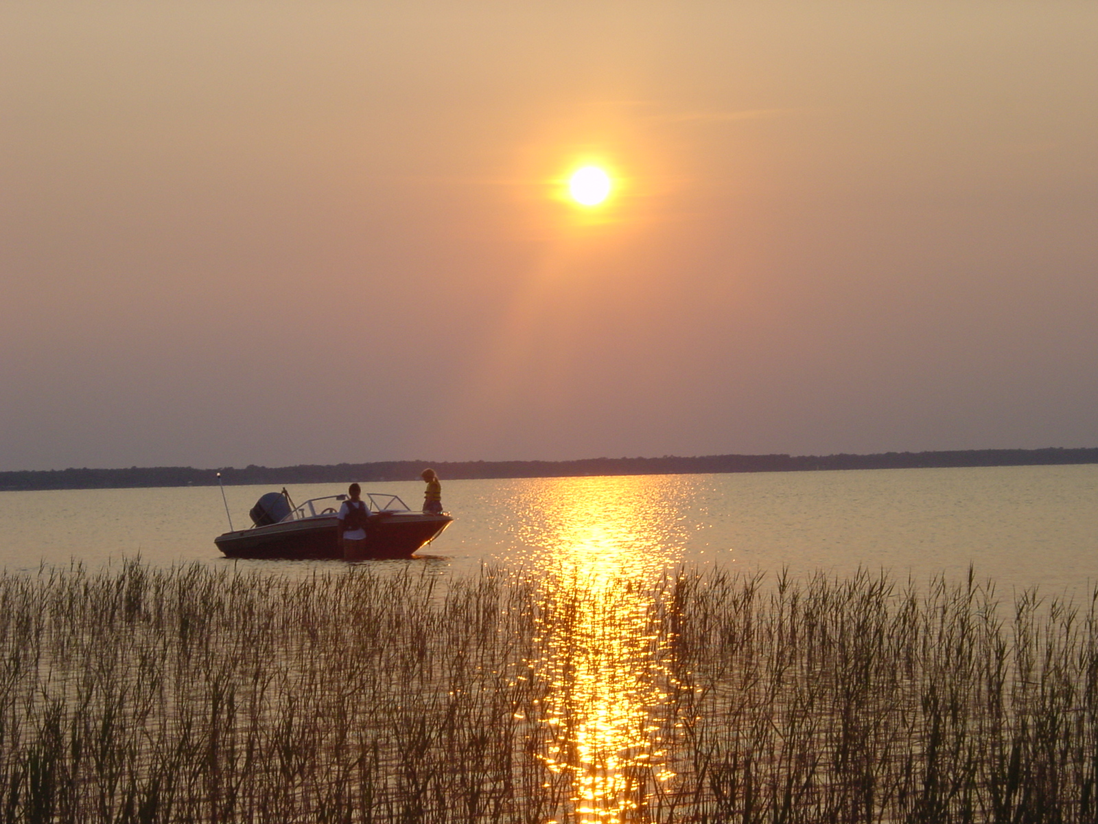
Lake Waccamaw
View on Wikipedia
This article needs additional citations for verification. (June 2019) |
Lake Waccamaw is a fresh water lake located in Columbus County in North Carolina. It is the largest of the natural Carolina Bay lakes.[2] Although bay trees (Magnolia virginiana L., Gordonia lasianthus Ellis, and Persea) are present within many Carolina Bays,[3] the term "bay" does not refer to the trees but comes instead from an early science publication by Glenn (1895), who used the word "bay" (which he described as "lake-like expanses") to refer to these features near the town of Darlington, South Carolina.[4] Lake Waccamaw is fed by four creeks: First, Second, Third, and Big creeks. The outlet forms the Waccamaw River which flows south-southwest to empty into the Atlantic Ocean near Georgetown, South Carolina
Key Information


Geography
[edit]Lake Waccamaw has a broad, flat bottom of gyttja (mud) and peat, encircled by sandy shallows and submerged sandy terraces that extend up to 1,650 ft (500 m) offshore. The lake is oval in shape, measuring roughly 5.2 miles (8.4 km) by 3.5 miles (5.6 km), covering 8,938 acres (3,617 ha) surface area with an average depth of 7.5 feet (2.3 m) and a shoreline of about 14 miles (23 km). The marginal 70% of the lake bottom is composed of clear sand, whereas the central 30% is overlaid with a deposit of fibrous and pulpy peat.[5] The lake is fed mainly by Big Creek and the surrounding swamp lands. The organic matter from the decaying vegetation of the swamps makes the water tea-colored. The lake is full of life. Unlike most of the other Carolina Bay lakes, Lake Waccamaw gets the majority of its water from the surrounding swamp, instead of direct rain water. A limestone bluff along the north shore filters the water and reduces the acidity levels, making the lake ideal for a wide range of aquatic life.[3] Lake Waccamaw has several feeders, called First Little, Second Little and Third Little Creeks and then Big Creek as well as water from the Friar swamp. Underground springs feed the creeks.
Geology
[edit]Lake Waccamaw is one of the larger Carolina Bays. Recent work by the U.S. Geological Survey has interpreted the Carolina Bays formed several thousands of years ago when the climate was colder, drier, and windier.[6] Thermokarst lakes develop by thawing of frozen ground (permafrost) and by subsequent modification by wind and water. Thus, this interpretation suggests that permafrost once extended as far south as the Carolina Bays during the last ice age and (or) previous ice ages.
The lake has been estimated to be between 15,000 and 30,000 years old. It is underlain by strata containing fossils of various ages, including the lower Pliocene Goose Creek Limestone[7] and the lower Pleistocene Waccamaw Formation. In 2008, a whale fossil was found in the lake.[8] Scientists have removed the bones of a whale that they say may date back 1 - 3 million years. The skull of the whale has been restored and is currently on display at Lake Waccamaw State Park through longstanding loan from the North Carolina Museum of Natural Sciences.
.jpg)
Ecology
[edit]Several endemic species are found only in or around the lake, including the Waccamaw darter, silverside and killifish. The lake even contains some species of fish, such as the Waccamaw silverside, that are native only to Lake Waccamaw.[9] The water also contains a diversity of unusual mollusks. Genetic analysis shows that the mussel species reported as endemic are not distinct from populations outside the lake, but many of the freshwater mollusks and fish found in the lake are imperiled, especially with declining water quality.[10] Fifteen species of mussels and clams are reported from the lake. And, of the 11 snail species, the Waccamaw amnicola and siltsnail are also one-of-a-kind species. Alligators are also found at Lake Waccamaw.
| Species | Family | Habitat | Trophic level | Status |
|---|---|---|---|---|
| Acantharchus pomotis | Centrarchidae | demersal | 3.0 | native |
| Ameiurus catus | Ictaluridae | demersal | 3.8 | native |
| Ameiurus natalis | Ictaluridae | demersal | 3.3 | native |
| Ameiurus platycephalus | Ictaluridae | demersal | 3.4 | native |
| Amia calva | Amiidae | demersal | 3.8 | native |
| Anguilla rostrata | Anguillidae | demersal | 3.7 | native |
| Aphredoderus sayanus | Aphredoderidae | demersal | 3.4 | native |
| Centrarchus macropterus | Centrarchidae | demersal | 3.7 | native |
| Cyprinus carpio carpio | Cyprinidae | benthopelagic | 3.0 | native |
| Dorosoma cepedianum | Clupeidae | pelagic | 2.0 | native |
| Elassoma zonatum | Elassomatidae | demersal | 3.0 | native |
| Enneacanthus gloriosus | Centrarchidae | demersal | 3.0 | native |
| Enneacanthus obesus | Centrarchidae | demersal | 3.0 | native |
| Erimyzon oblongus | Catostomidae | demersal | 2.8 | native |
| Erimyzon sucetta | Catostomidae | demersal | 2.8 | native |
| Esox americanus americanus | Esocidae | demersal | 3.4 | native |
| Esox niger | Esocidae | demersal | 4.0 | native |
| Etheostoma fusiforme | Percidae | benthopelagic | 3.2 | native |
| Etheostoma perlongum | Percidae | benthopelagic | 3.4 | endemic |
| Fundulus waccamensis | Fundulidae | benthopelagic | 3.0 | endemic |
| Gambusia affinis | Poeciliidae | benthopelagic | 3.2 | native |
| Lepisosteus osseus | Lepisosteidae | demersal | 4.2 | native |
| Lepomis auritus | Centrarchidae | demersal | 3.1 | native |
| Lepomis gibbosus | Centrarchidae | benthopelagic | 3.1 | native |
| Lepomis gulosus | Centrarchidae | demersal | 3.7 | native |
| Lepomis macrochirus | Centrarchidae | benthopelagic | 3.3 | native |
| Lepomis punctatus | Centrarchidae | demersal | 3.0 | native |
| Menidia extensa | Atherinidae | pelagic | 3.2 | endemic |
| Micropterus salmoides | Centrarchidae | benthopelagic | 3.8 | native |
| Morone americana | Moronidae | demersal | 3.0 | native |
| Notemigonus crysoleucas | Cyprinidae | demersal | 3.0 | native |
| Notropis chalybaeus | Cyprinidae | benthopelagic | 3.0 | native |
| Notropis petersoni | Cyprinidae | benthopelagic | 3.0 | native |
| Noturus gyrinus | Ictaluridae | demersal | 3.2 | native |
| Perca flavescens | Percidae | benthopelagic | 3.7 | native |
| Pomoxis nigromaculatus | Centrarchidae | benthopelagic | 4.2 | native |
| Umbra pygmaea | Umbridae | demersal | 3.6 | native |

The lack of rain in the eastern portion of North Carolina during 2007 affected the water level in Lake Waccamaw. Water levels dropped greater than 15 inches (380 mm) below normal as of late 2007. The record low is 19.5 inches (500 mm) recorded in 1993. The record high was 37 inches (940 mm) above normal in 1999. In 2008, some additional rain and swamp drainage had increased the water levels.
In October 2012 there was a hydrilla outbreak. Efforts to free the lake of the invasive weed were estimated to take between 5 and 7 years.[12]
The lake was established as a North Carolina State Lake in 1929, and it is managed by the adjacent Lake Waccamaw State Park.
A dam at the outlet, built in 1926, regulates lake levels.[13]
References
[edit]- ^ "Lake Waccamaw". Geographic Names Information System. United States Geological Survey, United States Department of the Interior. June 17, 1980.
- ^ "Size of the North Carolina State Parks System" (PDF). North Carolina Division of Parks and Recreation. January 1, 2011. pp. 1–4. Archived from the original (PDF) on February 16, 2008. Retrieved October 4, 2011.
- ^ a b "History of lake Waccamaw, North Carolina".
- ^ Glenn, L.C., 1895, Some notes on Darlington (S.C.), 'Bays': Science, v. 2, no. 41, p. 472-475
- ^ "Search FishBase". www.fishbase.de. Retrieved March 5, 2019.
- ^ Swezey, C.S. (2020) "Quaternary eolian dunes and sand sheets in inland locations of the Atlantic Coastal Plain Province", in Inland Dunes of North America (N. Lancaster and P. Hesp, eds.), Springer Publishing, Switzerland, pp. 11-63. doi:10.1007/978-3-030-40498-7_2 ISBN 978-3-030-40498-7
- ^ Campbell, Matthew R.; Campbell, Lyle D. (1995). "Preliminary Biostratigraphy and Molluscan Fauna of the Goose Creek Limestone of Eastern South Carolina". Tulane Studies in Geology and Paleontology. 27 (1–4). Retrieved April 22, 2021.
- ^ "Search FishBase". www.fishbase.de. Retrieved March 5, 2019.
- ^ McGrath, Gareth. "Whale of a find in Lake Waccamaw". Wilmington Star News. Retrieved March 5, 2019.
- ^ McCartney, Michael A.; Bogan, Arthur E.; Sommer, Kristine M.; Wilbur, Ami E. (December 2016). "Phylogenetic Analysis of Lake Waccamaw Endemic Freshwater Mussel Species". American Malacological Bulletin. 34 (2): 109–120. doi:10.4003/006.034.0207. S2CID 90395424.
- ^ "Species in Waccamaw". FishBase. July 4, 2013. Retrieved July 4, 2013.
- ^ Wyche, Ray (October 20, 2012). "Mysterious weed in lake is hydrilla". The News Reporter. Archived from the original on February 9, 2013. Retrieved April 21, 2021.
- ^ Parker, Bobby Powell; Little, Susan Prescott. "History". Town of Lake Waccamaw. Retrieved April 22, 2021.
External links
[edit] Geographic data related to Lake Waccamaw at OpenStreetMap
- Lake Waccamaw informational website
- Photos Of Lake Waccamaw
- Columbus County Information
- Official Lake Photo Site