.jpg/1538px-Northern_Philippines_(Luzon).jpg)

Luzon
View on Wikipedia
Key Information


Luzon (/luːˈzɒn/ loo-ZON, Tagalog: [luˈson]) is the largest and most populous island in the Philippines. Located in the northern portion of the Philippine archipelago, it is the economic and political center of the nation, being home to the country's capital city, Manila, as well as Quezon City, the country's most populous city. With a population of 64.3 million as of 2024[update],[2] it contains 55% of the country's total population and is the 4th most populous island in the world.[3] It is the 15th largest island in the world by land area.
Luzon may also refer to one of the three primary island groups in the country. In this usage, it includes the Luzon Mainland, the Batanes and Babuyan groups of islands to the north, Polillo Islands to the east, and the outlying islands of Catanduanes, Marinduque and Mindoro, among others, to the south.[4] The islands and provinces of Masbate, Palawan and Romblon are also included, although these three are sometimes grouped with another of the island groups, the Visayas.
Etymology
[edit]The name Luzon is thought to derive from ᜎᜓᜐᜓᜅ᜔ lusong, a Tagalog word referring to a particular kind of large wooden mortar used in dehusking rice.[5][6] A 2008 research paper by Eulito Bautista and Evelyn Javier provides an image of a lusong, explaining:
Traditional milling was accomplished in the 1900s by pounding the palay with a wooden pestle in a stone or wooden mortar called lusong. The first pounding takes off the hull and further pounding removes the bran but also breaks most grains. Further winnowing with a bamboo tray (bilao) separates the hull from the rice grains. This traditional hand-pounding chore, although very laborious and resulted in a lot of broken rice, required two to three skilled men and women to work harmoniously and was actually a form of socializing among young folks in the villages.[7]
In old Latin, Italian, and Portuguese maps, the island is often called Luçonia or Luconia.[8][9][10][11][12][13][14][15][excessive citations]
Luções, [luˈsõjʃ] (also Luzones in Spanish) was a demonym[16] used by Portuguese sailors in Malaysia[17] during the early 1500s, referring to the Kapampangan and Tagalog people who lived in Manila Bay, which was then called Lusong (Kapampangan: Lusung, Portuguese: Luçon), from which Luzon was also derived.[18][19][20][17] The term was also used for Tagalog settlers in Southern Tagalog region, where they created intensive contact with the Kapampangans.[21] Eventually, the term "Luzones" would refer to the settlers of Luzon island, and later on, would be exclusive to the peoples of Central Luzon.
History
[edit]Before European colonization
[edit]Before 1000 CE, the Tagalog, Kapampangan, and Pangasinan peoples of south and central Luzon had established several major coastal polities, notably Maynila, Tondo and Namayan. The oldest known Philippine document, written in 900, is the Laguna Copperplate Inscription, which names places in and around Manila Bay and also mentions Medan, a place in Indonesia.[22] These coastal Philippine kingdoms were thalassocracies, based on trade with neighboring Asian political entities and structured by leases between chiefs or lords (Datu) and paramount lords (Lakan) or Rajahs, by whom tributes were extracted and taxes were levied. These kingdoms were under the competing influence of Hinduism, Animism, or Islam. Before that, from 2500 - 2000 BCE, Kapampangans along with Sambal people and Hatang Kayi settled south Luzon; subsequently, from 1200 - 1000 BCE, the migrating Tagalog settlers from eastern Visayas or northeast Mindanao stayed in south Luzon and they made contact with the Kapampangans, Sambal people and the Hatang Kayi, of which contact with the Kapampangans was most intensive;[21] after this, the original settlers moved northward: Kapampangans moved to modern Tondo, Navotas, and Central Luzon (modern Bulacan, Nueva Ecija, Aurora, Pampanga, south Tarlac, and east Bataan),[23][24][25][26] and Sambals to the modern province of Zambales,[27] in turn, displacing the Aetas.
There was also a Buddhist polity known as Ma-i or Maidh, described in Chinese and Bruneian records in the 10th century, although its location is still unknown and scholars are divided on whether it is in modern-day Bay, Laguna or Bulalacao, Mindoro.[28][29]
According to sources at the time, the trade in large native Ruson-tsukuri (literally Luzon-made, Japanese:呂宋製) clay jars used for storing green tea and rice wine with Japan flourished in the 12th century, and local Tagalog, Kapampangan and Pangasinan potters had marked each jar with Baybayin letters denoting the particular urn used and the kiln the jars were manufactured in. Certain kilns were renowned over others; prices depended on the reputation of the kiln.[30][31] Of this flourishing trade, the Burnay jars of Ilocos are the only large clay jar manufactured in Luzon today with origins from this time.
In the early 1300s the Chinese annals, Nanhai zhi, reported that Hindu Brunei invaded or administered Sarawak and Sabah as well as the Philippine kingdoms of Butuan, Sulu, and in Luzon: Ma-i (Mindoro) and Malilu 麻裏蘆 (present-day Manila); Shahuchong 沙胡重 (present-day Siocon or Zamboanga), Yachen 啞陳 Oton (Part of the Madja-as Kedatuan), and 文杜陵 Wenduling (present-day Mindanao),[32] which would regain their independence at a later date.[33]
In 1405, the Yongle Emperor appointed a Chinese governor of Luzon, Ko Ch'a-lao, during Zheng He's voyages.[34][35] China also had vassals among the leaders in the archipelago.[36] China attained ascendancy in trade with the area in Yongle's reign.[37]

Afterwards, some parts of Luzon were Islamized when the former Majapahit province of Poni broke free, converted to Islam, and imported Sharif Ali, a prince from Mecca who became the Sultan of Brunei, a nation that then expanded its realms from Borneo to the Philippines and set up the Kingdom of Maynila as its puppet-state.[38] The invasion of Brunei spread Chinese royal descent like Ong Sum Ping's kin and Arab dynasties too into the Philippines like the clan of Sultan Sharif Ali. However, other Luzon kingdoms resisted Islam, like Pangasinan. It had remained a tributary state of China and was a largely Sinified kingdom, which maintained trade with Japan.[39] The Polity of Cainta also existed as a fortified city-state, armed with walls and cannons. As written in the book of Dong-Xiyang kao 東西洋考, the Chinese Ming dynasty recorded that there was a "Kingdom of Luzon" that existed over the current island of Luzon.[40]
Interactions with the Portuguese
[edit]The Portuguese were the first European explorers who recorded it in their charts as Luçonia or Luçon, calling the inhabitants Luções.[41] Edmund Roberts, who visited Luzon in the early 19th century, wrote that Luzon was "discovered" in 1521.[6]
Portuguese and Spanish accounts from the early[42] to mid 1500s state that the Kingdom of Maynila was the same as the Kingdom of Luzon[43] that was mentioned in Ming Dynasty Records[40] (from the Tagalog or Malay name Lusong and Kapampangan name Lusung), and whose citizens had been called "Luções".[42]
Many people from Luzon were employed within Portuguese Malacca. For example, the spice magnate Regimo de Raja, based in Malacca, was highly influential and was appointed as Temenggong (Sea Lord)—a governor and chief general responsible for overseeing of maritime trade—by the Portuguese. As Temenggong, de Raja was also the head of an armada which traded and protected commerce in the Indian Ocean, the Strait of Malacca, the South China Sea,[44] and the medieval maritime principalities of the Philippines.[45][46] His father and wife carried on his maritime trading business after his death. Another important Malacca trader was Curia de Raja who also hailed from Luzon. The "surname" of "de Raja" or "diraja" could indicate that Regimo and Curia, and their families, were of noble or royal descent as the term is an abbreviation of Sanskrit adiraja.[47]
Fernão Mendes Pinto noted that a number of Luções in the Islamic fleets went to battle with the Portuguese in the Philippines during the 16th century. The Sultan of Aceh gave one of them (Sapetu Diraja) the task of holding Aru (northeast Sumatra) in 1540. Pinto also says one was named leader of the Malays remaining in the Moluccas Islands after the Portuguese conquest in 1511.[48] Antonio Pigafetta notes that one of them was in command of the Brunei fleet in 1521.[49] However, the Luções did not only fight on the side of the Muslims. Pinto says they were also apparently among the natives of the Philippines who fought the Muslims in 1538.[48]
On Mainland Southeast Asia, Lusung/Luções warriors aided the Burmese king in his invasion of Siam in 1547. At the same time, Lusong warriors fought alongside the Siamese king and faced the same elephant army of the Burmese king in the defence of the Siamese capital at Ayutthaya.[50] The Luções were so successful in Siam that the Thai king rewarded them by having them ennobled and granted them land.[51] Luções military and trade activity reached as far as Sri Lanka in South Asia where Lungshanoid pottery made in Luzon were discovered in burials.[52] Meanwhile in the nearby Sultanate of Aceh the Luções fighting men so impressed the Sultan, that they were assigned to become the Sultan's royal guard [53] and to be assigned as the Sultan's royal guard, is proof of Luçoes men's physical strength, martial prowess, and masculine attractiveness; as during that time period, among medieval kingdoms, that office was delegated only to the most strong, handsome, virile, aristocratic, and combat-worthy, of soldiers.[54]
Scholars have thus suggested that they could be mercenaries valued by all sides.[18][19][20]
Spanish Colonial Era
[edit]
_delegates_in_Peking_in_1761.jpg)
In 1569, a Spanish expedition dispatched by Miguel Lopez de Legazpi led by Luis Enriquez de Guzman and Augustinian friar Alonso Jimenez first set foot in Albay. They arrived on the coastal settlement called Ibalon in present-day Magallanes, Sorsogon after exploring the islands of Masbate, Ticao and Burias and proceeded inland as far as present-day Camalig, Albay.[55][56] The Spanish arrival in the 16th century saw the incorporation of the Luções people and the breaking up of their kingdoms and the establishment of the Las Islas Filipinas with its capital Cebu, which was moved to Manila following the defeat of the local Rajah Sulayman in 1570. Martín de Goiti, having been dispatched by Legazpi to Luzon, conquered Maynila. Legazpi followed with a larger fleet comprising both Spanish and a majority Visayan force,[57]: 79-80 taking a month to bring these forces to bear due to slow speed of local ships.[58] This large force caused the surrender of neighboring Tondo. An attempt by some local leaders, known as the Tondo Conspiracy, to defeat the Spanish was repelled.

Legazpi renamed Maynila Nueva Castilla, and declared it the capital of the Philippines,[57]: 80 and thus of the rest of the Spanish East Indies,[59] which also encompassed Spanish territories in Asia and the Pacific.[60][61] Legazpi became the country's first governor-general. Under Spain, Luzon also came to be known as the Nueva Castilla or the New Castile. The population of Luzon at the time of the first Spanish missions is estimated as between 1 and 1.5 million, overall density being low.[62] Moros from western Mindanao and the Sulu Archipelago also raided the coastal Christian areas of Luzon and the Visayas. Settlers had to fight off the Chinese pirates (who lay siege to Manila, the most famous of which was Limahong in 1573).

After the successful expedition and the exploration of the North, Juan de Salcedo founded "Villa Fernandina de Vigan" in honor of King Philip II's son, Prince Ferdinand, who died at the age of four. From Vigan, Salcedo rounded the tip of Luzón and proceeded to pacify Camarines, Albay, and Catanduanes. As a reward for his services to the King of Spain, Salcedo was awarded the old province of Ilocos, which consisted of the modern provinces of Ilocos Norte, Ilocos Sur, Abra, La Union and part of Mountain Province as his hacienda (estate), and was accorded the title of Justicia Mayor de esta Provincia de Ylocos (Province Mayor of Ilocos).[63][64]
In Spanish times, Luzon became the focal point for trade between the Americas and Asia. The Manila Galleons constructed in the Bicol region brought silver mined from Peru and Mexico to Manila. The silver was used to purchase Asian commercial goods like Chinese silk, Indian gems and Indonesian spices, which were then exported back to the Americas. The Chinese valued Luzon so much, in that when talking about Spain and the Spanish-Americas, they preferred to call it as "Dao Lusong" (Greater Luzon) while the original Luzon was referred to as "Xiao (Small) Lusong" to refer to not only Luzon but the whole Philippines.[65]

Luzon also became a focal point for global migration. The walled city of Intramuros was initially founded by 1200 Spanish families.[66] The nearby district of Binondo became the center of business and transformed into the world's oldest Chinatown.[67] There was also a smaller district reserved for Japanese migrants in Dilao. Cavite City also served as the main port for Luzon and many Mexican soldiers and sailors were stationed in the naval garrisons there.[68][69] When the Spanish evacuated from Ternate, Indonesia; they settled the Papuan refugees in Ternate, Cavite which was named after their evacuated homeland. After the short British Occupation of Manila, the Indian Sepoy soldiers that mutinied against their British commanders and joined the Spanish, then settled in Cainta, Rizal.
Newcomers who were impoverished Mexicans and peninsulares were accused of undermining the submission of the natives. In 1774, authorities from Bulacan, Tondo, Laguna Bay, and other areas surrounding Manila reported with consternation that discharged soldiers and deserters (from Mexico, Spain and Peru) were providing Indios military training for the weapons that had been disseminated all over the territory during the British war.[70] There was also continuous immigration of Tamils and Bengalis into the rural areas of Luzon: Spanish administrators, native nobles, and Chinese businessmen imported them as slave labor during this period.[71]
In the 1600s, Fr. Joaqin Martinez de Zuñiga, conducted a census of the Archdiocese of Manila which held most of Luzon under its spiritual care, and it had the following number of tributes, with each tribute representing a family of 6–7, and he reported 90,243 native Filipino tributes;[72]: 539 10,512 Chinese (Sangley) and mixed Chinese Filipino mestizo tributes;[72]: 537 and 10,517 mixed Spanish Filipino mestizo tributes.[72]: 539 Pure Spaniards are not counted as they are exempt from tribute. Out of these, Fr. Joaqin Martinez de Zuñiga estimated a total population count exceeding half a million souls.[72]: 537
People from the Philippines, primarily from Luzon, were recruited by France (then in alliance with Spain), first to defend Indo-Chinese converts to Christianity being persecuted by their native governments. Eventually, Filipino mercenaries helped the French conquer Vietnam and Laos and to re-establish Cambodia as a French Protectorate. This process culminated in the establishment of French Cochinchina, centered in Saigon.[73]
A great number of infrastructure projects were undertaken during the 19th century that put the Philippine economy and standard of living ahead of most of its Asian neighbors and even many European countries at that time. Among them were a railway system for Luzon, a tramcar network for Manila, and Asia's first steel suspension bridge Puente Claveria, later called Puente Colgante.[74] In the meantime, Luzonians and Filipinos living abroad; were active in the Mexican War of Independence, Argentine War of Independence, and the War of 1812 between the United States and the British Empire, at the Americas, while at the same time had fought in the Taiping Rebellion in China.
After Spanish colonization
[edit]After many years of Spanish occupation and resistance to reform, the Andres Novales uprising occurred and it was inspired by the Latin American Wars of Independence. Novales' uprising was primarily supported by Mexicans living in the Philippines[75] as well as immigrant Latinos from the now independent nations of Colombia, Venezuela, Peru, Chile, Argentina and Costa Rica.[76] Although the uprising failed it inspired the Cavite Mutiny, the suppression of which, lead to the martyrdoms of Priests, Gomburza and the subsequent execution of the reformist and hero, Jose Rizal. Reeling against this, the Philippine Revolution against Spain erupted in Cavite and spread all throughout Luzon and the Philippines. Consequently, the First Philippine Republic was established in Malolos, Bulacan. In the meantime, Spain sold the Philippines to the United States and the First Philippine Republic resisted the United States in the Philippine–American War which the Republic's forces lost due to its diplomatic isolation (no foreign nation recognized the First Republic) as well as due to the numerical superiority of the American military.[77] The Americans then set up the cool mountain city of Baguio as a summer retreat for its officials. The Americans also rebuilt the capital, Manila, and established American military bases in Olongapo and Angeles cities mainly Clark Airbase and Subic Naval Base.[78]
During the Pacific War, the Philippines were considered to be of great strategic importance because their capture by Japan would pose a significant threat to the U.S. General McArthur made a successful surprise attack at Lingayen Gulf on 9 January 1945 and captured the island.[79] As a result, 135,000 troops and 227 aircraft were stationed in the Philippines by October 1941. Luzon was captured by Imperial Japanese forces in 1942 during their campaign to capture the Philippines. General Douglas MacArthur—who was in charge of the defense of the Philippines at the time—was ordered to Australia, and the remaining U.S. forces retreated to the Bataan Peninsula.[80]
A few months after this, MacArthur expressed his belief that an attempt to recapture the Philippines was necessary. The U.S. Pacific Commander Admiral Chester Nimitz and Chief of Naval Operations Admiral Ernest King both opposed this idea, arguing that it must wait until victory was certain. MacArthur had to wait two years for his wish; it was 1944 before a campaign to recapture the Philippines was launched. The island of Leyte was the first objective of the campaign, which was captured by the end of December 1944. This was followed by the attack on Mindoro and later, Luzon.[80]

The end of the World War necessitated decolonization due to rising nationalist movements across the world's many colonies. Subsequently, the Philippines gained independence from the United States. Luzon then arose to become the most developed island in the Philippines. However, the lingering poverty and inequality caused by the long dictatorship of US-supported dictator, Ferdinand Marcos, gave rise to the Philippine diaspora and many people from Luzon have migrated elsewhere and had established large overseas communities; mainly in the United States, Hong Kong, Singapore and Saudi Arabia. Eventually, the People Power Revolution led by Corazon Aquino and Cardinal Jaime Sin, removed Marcos and his cronies from power and they fled to Hawaii where the US granted them asylum. The following administrations are subsequently managing the political and economic recovery of the Philippines with the particular aim of spreading development outside of Luzon and into the more isolated provinces of the Visayas and Mindanao. During the administration of Ferdinand Marcos' son, Bongbong Marcos, Luzon became a destination of American and Japanese investments, it being the location of the Luzon Economic Corridor.[81]
Geography
[edit].jpg)
Luzon island alone has an area of 109,964.9 square kilometres (42,457.7 sq mi),[1] making it the world's 15th largest island. It is bordered on the west by the South China Sea (Luzon Sea in Philippine territorial waters), on the east by the Philippine Sea, and on the north by the Luzon Strait containing the Babuyan Channel and Balintang Channel. The mainland is roughly rectangular in shape and has the long Bicol Peninsula protruding to the southeast.
Luzon is roughly divided into four sections; Northern Luzon, Central Luzon, Southern Luzon, and Southeastern Luzon.
| Regions | Six divisions | Four divisions | Three divisions | Two divisions |
|---|---|---|---|---|
| Ilocos Region | Ilocandia | Northern Luzon[82] | North and Central Luzon/North Central Luzon[82] | North and Central Luzon/North Central Luzon[82] |
| Cagayan Valley | ||||
| Cordillera Administrative Region | Cordilleras | |||
| Central Luzon | Central Luzon[82] | |||
| National Capital Region | Metro Manila | Southern Luzon | ||
| Calabarzon | Southern Tagalog | Southern Luzon | Southern Luzon | |
| Mimaropa | ||||
| Bicol Region | Bicolandia | |||
Physical
[edit]Northern Luzon
[edit]
Northern Luzon consists of 3 clusters in three regions, the Ilocos Region, the Cordillera Administrative Region and the Cagayan Valley.
The northwestern portion of the island, which encompasses most of the Ilocos Region, is characterized by a flat terrain extending east from the coastline toward the Cordillera Central mountains.
The Cordillera mountain range, which feature the island's north-central section, is covered in a mixture of tropical pine forests and montane rainforests, and is the site of the island's highest mountain, Mount Pulag, rising at 2,922 metres. The range provides the upland headwaters of the Agno River, which stretches from the slopes of Mount Data, and meanders along the southern Cordillera mountains before reaching the plains of Pangasinan.
The northeastern section of Luzon is generally mountainous, with the Sierra Madre, the longest mountain range in the country, abruptly rising a few miles from the coastline. Located in between the Sierra Madre and the Cordillera Central mountain ranges is the large Cagayan Valley. This region, which is known for being the second largest producer of rice and the country's top corn-producer, serves as the basin for the Cagayan River, the longest in the Philippines.
Along the southern limits of the Cordillera Central lies the lesser-known Caraballo Mountains. These mountains form a link between the Cordillera Central and the Sierra Madre mountain ranges, separating the Cagayan Valley from the Central Luzon plains.[83]
Image gallery
[edit]-
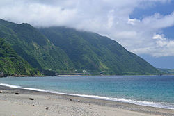 North coast of Luzon along the Cagayan-Ilocos Norte boundary
 -
 Summit of Mount Pulag, Luzon's highest mountain
 -
 West coast of Luzon at San Juan overlooking the South China Sea
 -
 The Cagayan Valley at Cabagan with the Sierra Madre mountains in the background
 -
 Canoes along upstream Cagayan River at Quirino province

.jpg)


Central Luzon
[edit]
The central section of Luzon is characterized by a flat terrain, known as the Central Luzon plain, the largest in the island in terms of land area. The plain, approximately 11,000 square kilometres (4,200 sq mi) in size, is the country's largest producer of rice, and is irrigated by two major rivers; the Cagayan to the north, and the Pampanga to the south. In the middle of the plain rises the solitary Mount Arayat.
The western coasts of Central Luzon are typically flat extending east from the coastline to the Zambales Mountains, the site of Mount Pinatubo, made famous because of its enormous 1991 eruption. These mountains extend to the sea in the north, forming Lingayen Gulf, and to the south, forming the Bataan Peninsula. The peninsula encloses Manila Bay, a natural harbor considered to be one of the best natural ports in East Asia, due to its size and strategic geographical location.
The Sierra Madre mountain range continues to stretch across the western section of Central Luzon, snaking southwards into the Bicol Peninsula.
Central Luzon is located between the regions of Northern Luzon, Southern Luzon and Metro Manila. These are the provinces of: Aurora, Bataan, Bulacan, Nueva Ecija, Pampanga, Tarlac and Zambales. The province of Aurora in the middle of the year 2002 was included in the Southern Tagalog Region. The regional center of Central Luzon is San Fernando, Pampanga.
4 Divisions
[edit]| Region | Regional Center | Division |
|---|---|---|
| Ilocos Region, 1 | San Fernando, La Union | Northwestern Luzon |
| Cordillera Administrative Region (CAR) | Baguio | Northcentral Luzon |
| Cagayan Valley, 2 | Tuguegarao | Northeastern Luzon |
| Central Luzon, 3 | San Fernando, Pampanga | Central Luzon |
Southern Luzon
[edit] 1 2 3 4 5 6 7 8 9 | ||||||||||||||||||||
| ||||||||||||||||||||
Southern Luzon is dominated by Laguna de Bay (Old Spanish, "Lake of Bay town"), the largest lake in the country. The 949-square-kilometre (366 sq mi) lake is drained into Manila Bay by the Pasig River, one of the most important rivers in the country due to its historical significance and because it runs through the center of Metro Manila.
Located 20 kilometres (12 mi) southwest of Laguna de Bay is Taal Lake, a crater lake containing the Taal Volcano, the smallest in the country. The environs of the lake form the upland Tagaytay Ridge, which was once part of a massive prehistoric volcano that covered the southern portion of the province of Cavite and the whole of Batangas province.
South of Laguna Lake are two solitary mountains, Mount Makiling in Laguna and Batangas provinces, and Mount Banahaw, the highest in the region of Calabarzon.
Mainland Southern Tagalog is the current region of Calabarzon which consists of Cavite, Laguna, Batangas, Rizal and Quezon, and Mimaropa is Region IV-B which is considered the Southwestern Tagalog Region is in the outland.
Metro Manila is the urban center or capital of the Philippines. It consists of 16 cities and 1 town. Its regional center is Manila, the capital of the Philippines. Metro Manila was formerly a province or province that included the name Tondo. In 1898, it included the districts and barangays of each city area as well as some towns in the province of Rizal.
Southeastern Luzon
[edit]The southeastern portion of Luzon is dominated by the Bicol Peninsula, a mountainous and narrow region extending approximately 150 kilometres (93 mi) southeast from the Tayabas Isthmus in Quezon province to the San Bernardino Strait along the coasts of Sorsogon. The area is home to several volcanoes, the most famous of which is the 2,460-metre (8,070 ft) high symmetrically shaped Mayon Volcano in Albay province. The Sierra Madre range has its southern limits at Quezon province. Ultra-prominent mountains dot the landscape, which include Mount Isarog and Mount Iriga in Camarines Sur, and Mount Bulusan in Sorsogon.
The peninsula's coastline features several smaller peninsulas, gulfs and bays, which include Lamon Bay, San Miguel Bay, Lagonoy Gulf, Ragay Gulf, and Sorsogon Bay.

It consists of Bicolandia or Region 5 which is the last region on the island of Luzon.
4 Divisions
[edit]| Region | Regional Center | Division |
|---|---|---|
| Metro Manila, NCR | Manila | Metro Manila |
| Calabarzon, 4-A | Calamba | Southern Luzon |
| Mimaropa, 4-B | Calapan | Southwestern Luzon |
| Bicol Region, 5 | Legazpi | Southeastern Luzon |
Outlying islands
[edit]Several outlying islands near mainland Luzon are considered part of the Luzon island group. The largest include Palawan, Mindoro, Masbate, Catanduanes, Marinduque, Romblon and Polillo.
Administrative divisions
[edit]The island is covered by 8 administrative regions, 30 provinces and, as of 2014[update], 68 cities (8 regions, 38 provinces and 71 cities if associated islands are included).
| Region (designation) |
Location | Population (2020)[2] |
Area[i][84][85] | Density | Regional center |
|---|---|---|---|---|---|
| Ilocos Region (Region I) |

|
5,301,139 (4.9%) |
13,012.60 km2 (5,024.19 sq mi) |
410/km2 (1,100/sq mi) |
San Fernando (La Union) |
| Cagayan Valley[ii] (Region II) |

|
3,685,744 (3.4%) |
28,228.83 km2 (10,899.21 sq mi) |
130/km2 (340/sq mi) |
Tuguegarao |
| Central Luzon (Region III) |

|
12,422,172 (11.4%) |
22,014.63 km2 (8,499.90 sq mi) |
560/km2 (1,500/sq mi) |
San Fernando (Pampanga) |
| Calabarzon (Region IV-A) |

|
16,195,042 (14.9%) |
16,873.31 km2 (6,514.82 sq mi) |
960/km2 (2,500/sq mi) |
Calamba |
| Southwestern Tagalog Region[ii] (Mimaropa) |

|
3,228,558 (3.0%) |
29,620.90 km2 (11,436.69 sq mi) |
110/km2 (280/sq mi) |
Calapan |
| Bicol Region[ii] (Region V) |

|
6,082,165 (5.6%) |
18,155.82 km2 (7,010.00 sq mi) |
330/km2 (850/sq mi) |
Legazpi |
| Cordillera Administrative Region (CAR) |

|
1,797,660 (1.6%) |
19,422.03 km2 (7,498.89 sq mi) |
93/km2 (240/sq mi) |
Baguio |
| National Capital Region (NCR) |

|
13,484,462 (12.4%) |
611.39 km2 (236.06 sq mi) |
22,000/km2 (57,000/sq mi) |
Manila |
Table note(s):
- ^ Land area figures are the sum of each region's component provinces (and/or independent cities), derived from the National Statistical Coordination Board (Philippine Statistics Authority) official website.
- ^ a b c The list includes the associated islands of Luzon (provinces of Marinduque, Occidental Mindoro, Oriental Mindoro, Palawan, Romblon, Batanes, Catanduanes and Masbate).
Tectonics
[edit]
Luzon is part of the Philippine Mobile Belt, a fast deforming plate boundary zone (Gervasio, 1967) hemmed in between two opposing subduction zones, the west-dipping Philippine Trench-East Luzon Trench subduction zone, and the east-dipping north–south trending Manila Trench-Negros Trench-Cotabato Trench.[86] The Philippine Sea Plate subducts under eastern Luzon along the East Luzon Trench and the Philippine Trench, while the South China Sea basin, part of the Eurasian Plate, subducts under western Luzon along the Manila Trench.
The North-Southeastern trending braided left-lateral strike-slip Philippine Fault System traverses Luzon, from Quezon province and Bicol to the northwestern part of the island. This fault system takes up part of the motion due to the subducting plates and produces large earthquakes. Southwest of Luzon is a collision zone where the Palawan micro-block collides with SW Luzon, producing a highly seismic zone near Mindoro island. Southwest Luzon is characterized by a highly volcanic zone, called the Macolod Corridor, a region of crustal thinning and spreading.
Using geologic and structural data, seven principal blocks were identified in Luzon in 1989: the Sierra Madre Oriental, Angat, Zambales, Central Cordillera of Luzon, Bicol, and Catanduanes Island blocks.[87] Using seismic and geodetic data, Luzon was modeled by Galgana et al. (2007) as a series of six micro blocks or micro plates (separated by subduction zones and intra-arc faults), all translating and rotating in different directions, with maximum velocities ~100 mm/yr NW with respect to Sundaland/Eurasia.
Demographics
[edit]| Year | Pop. | ±% p.a. |
|---|---|---|
| 1903 | 4,101,516 | — |
| 1918 | 5,397,401 | +1.85% |
| 1939 | 8,165,778 | +1.99% |
| 1948 | 9,876,263 | +2.14% |
| 1960 | 14,061,448 | +2.99% |
| 1970 | 19,688,100 | +3.42% |
| 1975 | 22,790,274 | +2.98% |
| 1980 | 26,080,694 | +2.73% |
| 1990 | 33,357,887 | +2.49% |
| 1995 | 38,249,776 | +2.60% |
| 2000 | 42,822,686 | +2.45% |
| 2007 | 49,799,956 | +2.10% |
| 2010 | 52,362,999 | +1.84% |
| 2015 | 57,470,097 | +1.79% |
| 2020 | 62,196,942 | +1.68% |
| 2024 | 64,301,558 | +0.80% |
| Source: National Statistics Office[88][89][a] | ||
As of the 2024 census, the population of Luzon Island itself is 59,865,193 people,[88][a] making it the 4th most populated island in the world.
Cities
[edit]_(Diliman,_Quezon_City)(2017-09-07)_cropped.jpg)
Metro Manila is the most populous of the 3 defined metropolitan areas in the Philippines and the 11th most populous in the world. as of 2007[update], census data showed it had a population of 11,553,427, comprising 13% of the national population.[90] Including suburbs in the adjacent provinces (Bulacan, Cavite, Laguna, and Rizal) of Greater Manila, the population is around 21 million.[90][91]
| Rank | Name | Region | Pop. | Rank | Name | Region | Pop. | ||
|---|---|---|---|---|---|---|---|---|---|
| 1 | Quezon City | National Capital Region | 3,084,270 | 11 | Bacoor | Calabarzon | 661,381 | ||
| 2 | Manila | National Capital Region | 1,902,590 | 12 | Las Piñas | National Capital Region | 615,549 | ||
| 3 | Caloocan | National Capital Region | 1,712,945 | 13 | Biñan | Calabarzon | 584,479 | ||
| 4 | Taguig | National Capital Region | 1,308,085 | 14 | Calamba | Calabarzon | 575,046 | ||
| 5 | Antipolo | Calabarzon | 913,712 | 15 | Muntinlupa | National Capital Region | 552,225 | ||
| 6 | Pasig | National Capital Region | 853,050 | 16 | Angeles | Central Luzon | 483,452 | ||
| 7 | Valenzuela | National Capital Region | 725,173 | 17 | General Trias | Calabarzon | 482,453 | ||
| 8 | Dasmariñas | Calabarzon | 744,511 | 18 | Imus | Calabarzon | 481,949 | ||
| 9 | Parañaque | National Capital Region | 703,245 | 19 | Marikina | National Capital Region | 471,323 | ||
| 10 | San Jose del Monte | Central Luzon | 685,688 | 20 | Mandaluyong | National Capital Region | 465,902 | ||
.svg)

(2015 Census, 100,000+ inhabitants)[92]
Ethnic groups
[edit]
Seven major Philippine ethnolinguistic groups predominate Luzon. Ilocanos and Pangasinenses dominate northern Luzon, particularly in the Ilocos Region to parts of the Cagayan Valley, while Kapampangans, Tagalogs, Ilocanos, Pangasinans and Sambals populate Central Luzon. Tagalogs dominate the National Capital Region, Calabarzon and the island provinces of Marinduque, Mindoro and extending to parts of Palawan and northern Bicol Peninsula, while Bicolanos populate the Bicol peninsula. Visayans, such as Masbateños, Romblomanons, Waray Sorsogonons, Cuyunons, mainly populate in the southern Bicol peninsula and island provinces of Masbate, Romblon, and Palawan.
Other ethnic groups lesser in population include the Aetas of Zambales and Bataan, the Ibanags of Cagayan and Isabela, the Gaddang of Nueva Vizcaya, the Igorot of the Cordilleras, the Bugkalots of Nueva Vizcaya, Quirino, Nueva Ecija and Aurora, Umiray and Tagabulós of Aurora and Quezon, Remontado of Quezon, and the Mangyans of Mindoro.
Due to historical centuries-old migrations, populations of ethnic Chinese Filipinos, Spanish Filipinos, Japanese Filipinos, Indian Filipinos, and Muslim Moros from Mindanao have also been present in urban areas. Historical mixed mestizo populations, particularly Chinese mestizos (mestizo de Sangley) and Spanish mestizos, and more recent mixed mestizos of Americans, Japanese, Koreans, Indians (mostly Punjabis),[93] and Arabs are also occasionally present. The historical Sangley Chinese and their pure and mixed-mestizo descendants are spread all across Luzon of several generations across the centuries. According to old Spanish censuses, around 1/3rd of the population of Luzon are mestizo admixed with either or both Southern Han Chinese (mostly from Manila to Pampanga) and/or Hispanic (Spanish or Latino) descent (Mostly in Cavite and Manila).[94] Most Americans have settled in Central Luzon's highly urbanized cities of Angeles and Olongapo due to the former presence of the U.S. air and naval bases (Clark & Subic) there, while a majority of the Koreans and Japanese have mainly settled in the major cities and towns like Koreatown in Angeles City and Baguio and Subic.
Languages
[edit]

Almost all of the languages of Luzon belong to the Philippine group of the Malayo-Polynesian branch of the Austronesian language family. Major regional languages include: Tagalog, Ilocano, Central Bikol, Kapampangan, and Pangasinan.
English is spoken by many inhabitants. The use of Spanish as an official language declined following the American occupation of the Philippines. Almost inexistent among the general populace, Spanish is still used by the elderly of some families of great tradition (Rizal, Liboro...) and by upper and middle-class residents of Spanish blood.

Religion
[edit]Like most of the Philippines, the major religion in Luzon is Christianity, with Roman Catholicism being the major denomination. Other major sects includes Jehovah's Witnesses, Protestantism, the Philippine Independent Church (Aglipayans), the Church of Jesus Christ of Latter-day Saints (Mormons), and the Iglesia ni Cristo.[95] Indigenous traditions and rituals, though rare, are also present.
There are also sizable communities of Sikhs, Hindus, Buddhists and Muslims in Metro Manila and in other, especially, urban areas due to the immigration of Indians, Japanese, Koreans, Chinese, Moros and Muslims from other countries to the island.

Economy
[edit]The economy of the island is centered in Metro Manila with Makati serving as the main economic and financial hub. Major companies such as Ayala, Jollibee Foods Corporation, SM Group, and Metrobank are based in the business hubs of Makati Central Business District, Ortigas Center, and Bonifacio Global City. Industry is concentrated in and around the urban areas of Metro Manila while agriculture predominates in the other regions of the island producing crops such as rice, bananas, mangoes, coconuts, pineapple, and coffee.[96] Other sectors include livestock raising, tourism, mining, and fishing.
See also
[edit]


Notes
[edit]References
[edit]- ^ a b c "Islands of Philippines". Island Directory Tables. United Nations Environment Programme. Archived from the original on April 28, 2019. Retrieved April 18, 2016.
- ^ a b c Census of Population (2020). Table B - Population and Annual Growth Rates by Province, City, and Municipality - By Region. Philippine Statistics Authority. Retrieved July 8, 2021.
- ^ Boquet, Yves (2017). The Philippine Archipelago. Springer. p. 16. ISBN 9783319519265. Archived from the original on March 26, 2023. Retrieved December 22, 2018.
- ^ Zaide, Sonia M. The Philippines, a Unique Nation. p. 50.
- ^ Ooi, Keat Gin (2004). Southeast Asia: A Historical Encyclopedia, from Angkor Wat to East Timor. ABC-CLIO. p. 798. ISBN 978-1-57607-770-2. Archived from the original on March 26, 2023. Retrieved September 15, 2020.
- ^ a b Roberts, Edmund (1837). Embassy to the Eastern Courts of Cochin-China, Siam, and Muscat. New York: Harper & Brothers. p. 59. Archived from the original on October 15, 2013. Retrieved October 15, 2013.
- ^ Bautista, Eulito U.; Javier, Evelyn F. (2008). "Rice Production Practices: PIDS Research Paper Series 2008-02" (PDF). Philippine Institute of Development Studies Research Papers Series. Philippine Institute of Development Studies: 44. Archived from the original (PDF) on August 15, 2017. Retrieved May 29, 2019.
- ^ Van Linschoten, Jan Huygen (1596). "Exacta & Accurata Delineatio cum Orarum Maritimarum tum etjam locorum terrestrium quae in Regionibus China, Cauchinchina, Camboja sive Champa, Syao, Malacca, Arracan & Pegu". Barry Lawrence Ruderman Antique Maps Inc. Archived from the original on September 1, 2019. Retrieved June 16, 2021.
- ^ Quad, Matthias; Bussemachaer, Johann (1598). "Asia Partiu Orbis Maxima MDXCVIII". Barry Lawrence Ruderman Antique Maps Inc. Archived from the original on September 1, 2019. Retrieved June 16, 2021.
- ^ Hondius, Jodocus (1606). "India Orientalis". Barry Lawrence Ruderman Antique Maps Inc. Archived from the original on June 24, 2021. Retrieved June 16, 2021.
- ^ Jansson, Jan (1630). "Indiae Orientalis Nova Descriptio". Barry Lawrence Ruderman Antique Maps Inc. Archived from the original on June 24, 2021. Retrieved June 16, 2021.
- ^ Blaeu, Willem Janszoon (1642). "India quae Orientalis dicitur et Insulae Adiacentes". Barry Lawrence Ruderman Antique Maps Inc. Archived from the original on June 24, 2021. Retrieved June 16, 2021.
- ^ Blaeu, Willem Janszoon (1635). "Asia Noviter Delineata". Barry Lawrence Ruderman Antique Maps Inc. Archived from the original on June 24, 2021. Retrieved June 16, 2021.
- ^ Hondius, Henricus (1636). "India quae Orientalis dicitur et Insulae Adiacentes". Barry Lawrence Ruderman Antique Maps Inc. Archived from the original on June 24, 2021. Retrieved June 16, 2021.
- ^ Mariette, Pierre (1650). "Carte Generale Des Indes Orientales et des Isles Adiacentes". Barry Lawrence Ruderman Antique Maps Inc. Archived from the original on June 24, 2021. Retrieved June 16, 2021.
- ^ Alfonso, Ian Christopher B. (2016). The Nameless Hero: Revisiting the Sources on the First Filipino Leader to Die for Freedom. Angeles: Holy Angel University Press. ISBN 9789710546527.
- ^ a b Scott, William Henry (1994). Barangay: Sixteenth Century Philippine Culture and Society. Quezon City: Ateneo de Manila University Press. ISBN 971-550-135-4.
- ^ a b Pires, Tomé (1944). A suma oriental de Tomé Pires e o livro de Francisco Rodriguez: Leitura e notas de Armando Cortesão [1512 – 1515] [The Summa Oriental of Tomé Pires and the book by Francisco Rodriguez: Reading and notes by Armando Cortesão [1512 – 1515]] (in Portuguese). Translated by Cortesão, Armando. Cambridge: Hakluyt Society.
- ^ a b Lach, Donald Frederick (1994). "Chapter 8: The Philippine Islands". Asia in the Making of Europe. Chicago: University of Chicago Press. ISBN 0-226-46732-5.
- ^ a b Reid, Anthony (1995). "Continuity and Change in the Austronesian Transition to Islam and Christianity". In Peter Bellwood; James J. Fox; Darrell Tryon (eds.). The Austronesians: Historical and comparative perspectives. Canberra: Department of Anthropology, The Australian National University. doi:10.22459/A.09.2006. ISBN 978-0-7315-2132-6. Archived from the original on September 2, 2007. Retrieved August 30, 2015.
- ^ a b Zorc, David (1993). "The Prehistory and Origin of the Tagalog People". In Øyvind Dahl (ed.). Language - a doorway between human cultures : tributes to Dr. Otto Chr. Dahl on his ninetieth birthday (PDF). Oslo: Novus. pp. 201–211.
- ^ Morrow, Paul. "Laguna Copperplate Inscription". Mts.net. Archived from the original on February 5, 2008. Retrieved December 19, 2010.
- ^ "Tantingco: The Kapampangan in Us". SunStar. Archived from the original on January 23, 2024. Retrieved January 23, 2024.
- ^ What is the Kapampangan Region?
- ^ The Language Shift from the Middle and Upper Middle-Class Families in the Kapampangan Speaking Region
- ^ Pampanga used to be a coast-to-coast mega-province: What happened? on Facebook
- ^ "Sambal". National Commission for Culture and the Arts. Archived from the original on January 21, 2008.
- ^ Go, Bon Juan (2005). "Ma'I in Chinese Records – Mindoro or Bai? An Examination of a Historical Puzzle". Philippine Studies. 53 (1): 119–138. Archived from the original on October 21, 2013.
- ^ Scott, William Henry (1989). "Societies in Prehispanic Philippines". Prehispanic Source Materials for the Study of Philippine History. Quezon City: New Day Publishers. ISBN 978-9711002268.
- ^ Manansala, Paul Kekai (September 5, 2006). "Quests of the Dragon and Bird Clan: Luzon Jars (Glossary)". Quests of the Dragon and Bird Clan. Archived from the original on September 4, 2007. Retrieved December 19, 2010.
- ^ South East Asia Pottery – Philippines. Seapots.com. Retrieved on 2010-12-19. Archived October 19, 2014, at the Wayback Machine
- ^ Reading Song-Ming Records on the Pre-colonial History of the Philippines Archived February 13, 2023, at the Wayback Machine By Wang Zhenping Page 256.
- ^ Ptak, Roderich (1998). "From Quanzhou to the Sulu Zone and beyond: Questions Related to the Early Fourteenth Century". Journal of Southeast Asian Studies. 29 (2): 280. doi:10.1017/S002246340000744X. JSTOR 20072046. S2CID 162707729.
- ^ Ho 2009, p. 33.
- ^ Karnow 2010, p. 84.
- ^ Encyclopædia Britannica, Volume 9. Contributor: Walter Yust. EncyclopÆdia Britannica. 1954. p. 75. Archived from the original on March 26, 2023. Retrieved June 21, 2019.
{{cite book}}: CS1 maint: others (link) - ^ "Philippine Almanac & Handbook of Facts" 1977, p. 59.
- ^ Frans Welman (August 1, 2013). Borneo Trilogy Brunei: Vol 1. Booksmango. pp. 8–. ISBN 978-616-222-235-1.
- ^ Scott, William Henry (1989). "Filipinos in China in 1500" (PDF). Asian Studies. 21: 8. Archived from the original (PDF) on July 24, 2015. Retrieved June 10, 2015.
- ^ a b The Taiwan Strait between the Twelfth and Sixteenth Centuries and the Maritime Route to Luzon by Liu Yingsheng, 刘迎胜, (Vol. 46, No. 2 (2012), pp. 179 )
- ^ Pires, Tomé, A suma oriental de Tomé Pires e o livro de Francisco Rodriguez: Leitura e notas de Armando Cortesão [1512–1515], translated and edited by Armando Cortesao, Cambridge: Hakluyt Society, 1944.
- ^ a b Pigafetta, Antonio (1524). Relazione del primo viaggio intorno al mondo.
- ^ p. 12: https://ec.europa.eu/translation/portuguese/magazine/documents/folha61_pt.pdf
- ^ Antony, Robert J. Elusive Pirates, Pervasive Smugglers: Violence and Clandestine Trade in the Greater China Seas. Hong Kong: Hong Kong University Press, 2010. Print, 76.
- ^ Junker, Laura L. Raiding, Trading, and Feasting: The Political Economy of Philippine Chiefdoms. Honolulu: University of Hawaiì Press, 1999.
- ^ Wilkinson, R J. An Abridged Malay-English Dictionary (romanised). London: Macmillan and Co, 1948. Print, 291.
- ^ Junker, 400. http://sambali.blogspot.com/2014/12/the-borneo-route.html Archived August 3, 2015, at the Wayback Machine
- ^ a b Pinto, Fernão Mendes (1989) [1578]. The Travels of Mendes Pinto. Translated by Catz, Rebecca D. Chicago: University of Chicago Press. ISBN 9780226669519.
- ^ Pigafetta, Antonio (1969) [1524]. First voyage round the world. Primo viaggio intorno al globo terraqueo.English. Translated by J.A. Robertson. Manila: Filipiniana Book Guild. Archived from the original on June 22, 2019. Retrieved June 22, 2019.
- ^ Pigafetta 1969, p. 195.
- ^ Diogo do Couto, Décadas da Ásia (Lisbon, 1778) Vol. 5, pp. 95–100 (Década VIII, Livro II, cap. V) Siam (1547)
- ^ "Quest of the Dragon and Bird Clan; The Golden Age (Volume III)" -Lungshanoid (Glossary)- By Paul Kekai Manansala
- ^ Fernão Mendes Pinto, Peregrinação (C. R. Boxer, ed., The Travels of Mendes Pinto, vol. 1, Hakluyt Society, 1956) pp. 256–261 (Book II, ch. XLIX) Aceh (1539)
- ^ Skaff, Jonathan Karam, Sui-Tang China and Its Turko-Mongol Neighbors: Culture, Power, and Connections, 580-800
- ^ Newson, Linda A. (January 1, 2009). Conquest and Pestilence in the Early Spanish Philippines. University of Hawai'i Press. ISBN 9780824832728.
- ^ "History". Province of Albay. Archived from the original on November 25, 2015. Retrieved October 18, 2015.
- ^ a b Halili, Maria Christine N. (2004). Philippine History. Manila: Rex Bookstore, Inc. ISBN 978-971-23-3934-9.
- ^ Newson 2009, p. 20.
- ^ Fernando A. Santiago Jr. (2006). "Isang Maikling Kasaysayan ng Pandacan, Maynila 1589–1898". Malay. 19 (2): 70–87. Retrieved July 18, 2008.
- ^ Manuel L. Quezon III (June 12, 2017). "The Philippines Isn't What It Used to Be". SPOT.PH. Retrieved October 24, 2020.
- ^ Andrade, Tonio (2005). "La Isla Hermosa: The Rise of the Spanish Colony in Northern Taiwan". How Taiwan Became Chinese: Dutch, Spanish and Han colonialization in the Seventeenth Century. Columbia University Press.
- ^ Newson 2009, p. 4.
- ^ LEAGUE Magazine, September-October 2017 Issue: The Local Government Unit Magazine. The League Publishing Company, Inc. September 1, 2017.
- ^ Centennial Commemorative Lectures, 1998. The Committee. 1998.
- ^ Chinese in Mexico by Chao Romero, pages 203 to 205
- ^ Barrows, David P. (1905). A History of the Philippines. New York: American Book Company. p. 179. Archived from the original on February 8, 2019. Retrieved October 12, 2018 – via Guttenburg.
Within the walls, there were some six hundred houses of a private nature, most of them built of stone and tile, and an equal number outside in the suburbs, or "arrabales," all occupied by Spaniards ("todos son vivienda y poblacion de los Españoles"). This gives some twelve hundred Spanish families or establishments, exclusive of the religious, who in Manila numbered at least one hundred and fifty, the garrison, at certain times, about four hundred trained Spanish soldiers who had seen service in Holland and the Low Countries, and the official classes.
- ^ See, Stanley Baldwin O. (November 17, 2014). "Binondo: New Discoveries in the World's Oldest Chinatown". GMA News Online. Archived from the original on August 18, 2020. Retrieved October 12, 2018.
- ^ Galaup "Travel Accounts" page 375.
- ^ Mehl, Eva Maria (2016). Forced Migration in the Spanish Pacific World: From Mexico to the Philippines, 1765–1811. Cambridge: Cambridge University Press. p. 235. doi:10.1017/cbo9781316480120. ISBN 978-1-316-48012-0.
- ^ "Eva Maria Mehl: Forced migration in the Spanish pacific world: From Mexico to the Philippines, 1765–1811" Page 100. Archived May 16, 2022, at the Wayback Machine From the original Spanish language source in the archives of Mexico: "CSIC ser. Consultas riel 208 leg.14 (1774)"
- ^ Peasants, Servants, and Sojourners: Itinerant Asians in Colonial New Spain, 1571–1720 By Furlong, Matthew J. Archived April 29, 2022, at the Wayback Machine "Slaves purchased by the indigenous elites, Spanish and Hokkiens of the colony seemed drawn most often from South Asia, particularly Bengal and South India, and less so, from other sources, such as East Africa, Brunei, Makassar, and Java..." Chapter 2 "Rural Ethnic Diversity" Page 164 Translated from: "Inmaculada Alva Rodríguez, Vida municipal en Manila (siglos xvi–xvii) (Córdoba: Universidad de Córdoba, 1997), 31, 35–36."
- ^ a b c d "ESTADISMO DE LAS ISLAS FILIPINAS TOMO PRIMERO By Joaquín Martínez de Zúñiga (Original Spanish)" (PDF). Archived (PDF) from the original on March 9, 2016. Retrieved February 3, 2024.
- ^ Nigel Gooding, Filipino Involvement in the French-Spanish Campaign in Indochina, archived from the original on August 3, 2020, retrieved July 4, 2008
- ^ De Borja, Marciano R. (2005). Basques in the Philippines. Reno: University of Nevada Press. p. 132. ISBN 9780874175905.
- ^ Garcia de los Arcos has noted that the Regiment of the King, which had absorbed a large percentage of Mexican recruits and deportees between the 1770s and 1811, became the bastion of discontent supporting the Novales mutiny. ~Garcia de los Arcos, "Criollismo y conflictividad en Filipinas a principios del siglo XIX," in El lejano Oriente espanol: Filipinas ( ˜ Siglo XIX). Actas, ed. Paulino Castaneda ˜ Delgado and Antonio Garcia-Abasolo Gonzalez (Seville: Catedra General Casta ´ nos, ˜ 1997), 586.
- ^ "Filipino-Mexican-South American Connection". filipinokastila.tripod.com. Archived from the original on February 25, 2021. Retrieved February 17, 2021.
- ^ Vidal, Gore; Nielsen, David. "Death in the Philippines | David Nielsen". The New York Review of Books. Archived from the original on October 23, 2022. Retrieved October 23, 2022.
- ^ "Clark Air Base History". Clarkab.org. Archived from the original on January 3, 2019. Retrieved July 14, 2009.
- ^ The War Illustrated (periodical) 2 February 1945
- ^ a b "The Philippines". Archived from the original on February 22, 2009. Retrieved December 6, 2008.
- ^ Luzon Economic Corridor project draws foreign investments – Marcos By Filane Mikee Cervantes
- ^ a b c d The provinces of the north areas of Central Luzon are sometimes considered part of North Luzon, most particularly Aurora, Nueva Ecija, Tarlac, and Zambales; sometimes Pampanga is included. Since Central Luzon is usually grouped with North Luzon, North Central Luzon is mostly simplified as North Luzon.
- ^ Smith, Robert Ross (1993). Triumph in the Philippines (Transcribed and formatted by Jerry Holden for the HyperWar Foundation). Honolulu, HI: University Press of the Pacific. p. 450. ISBN 1410224953. Archived from the original on January 25, 2015. Retrieved December 25, 2014.
- ^ "PSGC Interactive; List of Provinces". Philippine Statistics Authority. Archived from the original on January 11, 2013. Retrieved April 3, 2016.
- ^ "PSGC Interactive; List of Cities". Philippine Statistics Authority. Archived from the original on April 29, 2011. Retrieved April 7, 2016.
- ^ Hashimoto, M, ed., Accretion Tectonics in the Circum-Pacific Regions, ISBN 90-277-1561-0 p299
- ^ Rangin and Pubellier in Tectonics of Circum-Pacific Continental Margins ISBN 90-6764-132-4 p148 fig 4
- ^ a b Census of Population (2015). Highlights of the Philippine Population 2015 Census of Population. Philippine Statistics Authority. Retrieved June 20, 2016.
- ^ Census of Population and Housing (2010). Population and Annual Growth Rates for The Philippines and Its Regions, Provinces, and Highly Urbanized Cities (PDF). National Statistics Office. Retrieved June 29, 2016.
- ^ a b Philippine Statistics Authority (April 2008). "Total Population and Annual Population Growth Rates by Region: Population Censuses 1995, 2000, and 2007". Archived from the original on July 16, 2012. Retrieved April 4, 2010.
- ^ Demographia. (July 2010). Demographia World Urban Areas (World Agglomerations) Population & Projections Archived May 3, 2018, at the Wayback Machine (Edition 6.1). Retrieved March 29, 2011.
- ^ Census of Population (2015). Highlights of the Philippine Population 2015 Census of Population. Philippine Statistics Authority. Retrieved June 20, 2016.
- ^ "Indian Express (2016)". May 18, 2016. Archived from the original on March 3, 2020. Retrieved February 4, 2023.
- ^ Jagor, Fëdor, et al. (1870). The Former Philippines thru Foreign Eyes Archived January 9, 2021, at the Wayback Machine
- ^ PHILIPPINES: ADDITIONAL THREE PERSONS PER MINUTE Archived 2016-03-05 at the Wayback Machine, National Statistics Office Archived 2013-10-04 at the Wayback Machine. Last revised: July 18, 2003. Retrieved November 27, 2006.
- ^ "Index of Agriculture and Fishery Statistics". National Statistics Office. Archived from the original on February 21, 2012. Retrieved December 19, 2010.
Further reading
[edit]- Agoncillo, Teodoro A.; Guerrero, Milagros (1975). History of the Filipino People (4 ed.). R. P. Garcia. ISBN 9712345386. Retrieved April 24, 2014.
- Agoncillo, Teodoro A. (1962). Philippine History. Inang Wika Publishing Company. ISBN 9712345386. Retrieved April 24, 2014.
{{cite book}}: ISBN / Date incompatibility (help) - Alip, Eufronio Melo (1954). Political and Cultural History of the Philippines, Volumes 1-2 (revised ed.). Alip & Sons. Retrieved April 24, 2014.
- Antonio, Eleanor D.; Dallo, Evangeline M.; Imperial, Consuelo M.; Samson, Maria Carmelita B.; Soriano, Celia D. (2007). Turning Points I' 2007 Ed (unabridged ed.). Rex Bookstore, Inc. ISBN 978-9712345388. Retrieved April 24, 2014.
- Bishop, Carl Whiting (1942). War Background Studies, Issues 1-7. Contributor: Smithsonian Institution. Smithsonian Institution. Retrieved April 24, 2014.
- Bishop, Carl Whiting (1942). Origin of Far Eastern Civilizations: A Brief Handbook, Issues 1–7. Contributor: Smithsonian Institution. Smithsonian Institution. Retrieved April 24, 2014.
- Corpuz, Onofre D. (1957). The bureaucracy in the Philippines. Institute of Public Administration, University of the Philippines. Retrieved April 24, 2014.
- Demetrio, Francisco R. (1981). Myths and Symbols: Philippines (2 ed.). National Book Store. Retrieved April 24, 2014.
- Del Castillo y Tuazon, Antonio (1988). Princess Urduja, Queen of the Orient Seas: Before and After Her Time in the Political Orbit of the Shri-vi-ja-ya and Madjapahit Maritime Empire : a Pre-Hispanic History of the Philippines. A. del. Castillo y Tuazon. Retrieved April 24, 2014.
- Farwell, George (1967). Mask of Asia: The Philippines Today. Praeger. Retrieved April 24, 2014.
- Fitzgerald, Charles Patrick (1966). A concise history of East Asia. Praeger. Retrieved April 24, 2014.
- Ho, Khai Leong, ed. (2009). Connecting and Distancing: Southeast Asia and China (illustrated ed.). Institute of Southeast Asian Studies. ISBN 978-9812308566. Retrieved April 24, 2014.
- Karnow, Stanley (2010). In Our Image: America's Empire in the Philippines (unabridged ed.). Random House LLC. ISBN 978-0307775436. Retrieved April 24, 2014.
- Krieger, Herbert William (1942). Peoples of the Philippines, Issue 4. Vol. 3694 of Publication (Smithsonian Institution). Smithsonian Institution. ISBN 9780598408662. Retrieved April 24, 2014.
{{cite book}}: ISBN / Date incompatibility (help) - Lucman, Norodin Alonto (2000). Moro Archives: A History of Armed Conflicts in Mindanao and East Asia. FLC Press. Retrieved April 24, 2014.
- Liao, Shubert S. C., ed. (1964). Chinese participation in Philippine culture and economy. Bookman. Archived from the original on November 9, 2006. Retrieved April 24, 2014.
- Manuel, Esperidion Arsenio (1948). Chinese Elements in the Tagalog Language: With Some Indication of Chinese Influence on Other Philippine Languages and Cultures, and an Excursion Into Austronesian Linguistics. Contributor: Henry Otley Beyer. Filipiniana Publications. Retrieved April 24, 2014.
- Ostelius, Hans Arvid (1963). Islands of Pleasure: A Guide to the Philippines. G. Allen & Unwin. Retrieved April 24, 2014.
- Panganiban, José Villa; Panganiban, Consuelo Torres (1965). The literature of the Pilipinos: a survey (5 ed.). Limbagang Pilipino. Retrieved April 24, 2014.
- Panganiban, José Villa; Panganiban, Consuelo Torres- (1962). A Survey of the Literature of the Filipinos (4 ed.). Limbagang Pilipino. Retrieved April 24, 2014.
- Quirino, Carlos (1963). Philippine Cartography, 1320–1899 (2 ed.). N. Israel. Retrieved April 24, 2014.
- Ravenholt, Albert (1962). The Philippines: A Young Republic on the Move. Van Nostrand. Retrieved April 24, 2014.
- Sevilla, Fred; Balagtas, Francisco (1997). Francisco Balagtas and the roots of Filipino nationalism: life and times of the great Filipino poet and his legacy of literary excellence and political activism. Trademark Pub. Corp. ISBN 9789719185802. Retrieved April 24, 2014.
- Spencer, Cornelia (1951). Seven Thousand Islands: The Story of the Philippines. Aladdin Books. Retrieved April 24, 2014.
- Tan, Antonio S. (1972). The Chinese in the Philippines, 1898–1935: A Study of Their National Awakening. R. P. Garcia Publishing Company. Retrieved April 24, 2014.
- Zaide, Gregorio F. (1957). The Philippines since pre-Spanish times.-v. 2. The Philippines since the British invasion. Vol. 1 of Philippine Political and Cultural History (revised ed.). Philippine Education Company. Retrieved April 24, 2014.
- Zaide, Gregorio F. (1979). The Pageant of Philippine History: Political, Economic, and Socio-cultural, Volume 1. Philippine Education Company. Retrieved April 24, 2014.
- Philippines (Republic). Office of Cultural Affairs (1965). The Philippines: a Handbook of Information. Contributor: National Economic Council (Philippines) (revised ed.). Republic of the Philippines, Department of Foreign Affairs. Retrieved April 24, 2014.
- Philippine Chinese Historical Association (1975). The Annals of Philippine Chinese Historical Association, Volumes 5–8 (revised ed.). Retrieved April 24, 2014.
- IAHA Conference (1962). Biennial Conference Proceedings, Issue 1. Philippine Historical Association. Retrieved April 24, 2014.
- The Philippines: A Handbook of Information. Philippine Information Agency. 1955. Retrieved April 24, 2014.
- University of Manila Journal of East Asiatic Studies, Volume 7. Contributors: Manila (Philippines) University, University of Manila (revised ed.). University of Manila. 1959. Retrieved April 24, 2014.
{{cite book}}: CS1 maint: others (link) - Unitas, Volume 30, Issues 1–2. Contributor: University of Santo Tomás. University of Santo Tomás. 1957. Retrieved April 24, 2014.
{{cite book}}: CS1 maint: others (link) - The Researcher, Volume 2, Issue 2. Contributors: University of Pangasinan, Dagupan Colleges. Dagupan Colleges. 1970. Retrieved April 24, 2014.
{{cite book}}: CS1 maint: others (link) - Philippine Social Sciences and Humanities Review, Volumes 24–25. Contributor: University of the Philippines. College of Liberal Arts. 1959. Retrieved April 24, 2014.
{{cite book}}: CS1 maint: others (link) - Philippine Social Sciences and Humanities Reviews, Volume 24, Issues 1–2. Contributors: Philippine Academy of Social Sciences, Manila, University of the Philippines. College of Liberal Arts. College of Liberal Arts, University of the Philippines. 1959. Retrieved April 24, 2014.
{{cite book}}: CS1 maint: others (link) - Studies in Public Administration, Issue 4. Contributor: University of the Philippines. Institute of Public Administration. Institute of Public Administration, University of the Philippines. 1957. Retrieved April 24, 2014.
{{cite book}}: CS1 maint: others (link) - Proceedings [of The] Second Biennial Conference, Held at Taiwan Provincial Museum, Taipei, Taiwan. Republic of China, October 6–9, 1962. Tʻai-pei. 1963. Retrieved April 24, 2014.
- Yearbook. 1965. Retrieved April 24, 2014.
- Philippine Almanac & Handbook of Facts. 1977. Retrieved April 24, 2014.
External links
[edit]


 Geographic data related to Luzon at OpenStreetMap
- . The American Cyclopædia. 1879.

| 100,000 km2 (38,610 sq mi) and greater | ||
|---|---|---|
| 20,000–99,999 km2 (7,722–38,610 sq mi) |
| |


| International | |
|---|---|
| National | |
| Other | |

Luzon
View on GrokipediaGeographically, Luzon features diverse terrain including the Central Luzon Plain, the Sierra Madre and Cordillera mountain ranges, active volcanoes such as Mount Pinatubo and Taal, and extensive coastlines along the South China Sea and Philippine Sea.[3] The island's tropical rainforests and ecosystems harbor significant biodiversity, with high levels of endemism among flora and fauna, contributing to the Philippines' status as a global biodiversity hotspot.[4] Economically, Luzon drives national growth through agriculture in its fertile plains, mining of minerals like copper and gold, manufacturing hubs, and the service-oriented economy of Manila, which includes major ports and financial districts.[3] Historically, the island has been inhabited by indigenous groups such as the Aeta and various Cordilleran peoples prior to Austronesian migrations and subsequent Spanish colonization, playing a pivotal role in the archipelago's path to independence and modern development.[5]
Etymology
Name Origin and Historical Usage
The name Luzon derives from the Tagalog word lusong, denoting a large wooden mortar employed in dehusking rice, a practice central to pre-colonial agriculture in the region.[6][7] This etymology reflects the island's indigenous linguistic roots, with the term adapted by foreign traders to refer to the land and its people.[8] Historical records indicate early usage of variants like Lüsong (呂宋) in Chinese Ming dynasty documents from the 14th to 17th centuries, describing a polity centered in what is now Manila, engaged in tribute trade with imperial China.[9] Portuguese accounts from the early 1500s, during interactions with Luzon traders in the Malacca Sultanate, employed ilhas Luções for the island group, marking one of the first European references.[10] Upon Spanish arrival in 1521, explorers like Ferdinand Magellan and subsequent expeditions adopted and popularized Luzón to designate the northern Philippine archipelago, distinguishing it from the Visayan and Mindanaoan islands.[11] This nomenclature persisted through colonial administration, encompassing the island's diverse polities under unified geographic terminology.[12]History
Pre-Colonial Period
The earliest evidence of human presence on Luzon dates to approximately 709,000 years ago, based on stone tools unearthed at the Kalinga site in the Cagayan River Valley, indicating early hominin occupation during the Pleistocene.[13] Later, fossils attributed to Homo luzonensis, including teeth, hand, foot bones, and a partial femur dated between 50,000 and 67,000 years ago, were recovered from Callao Cave in northern Luzon, suggesting a distinct archaic human population adapted to island environments.[14] These early inhabitants, likely hunter-gatherers, coexisted with later waves of modern humans, including Negrito groups such as the Aeta, who maintained foraging lifestyles into historical times. Austronesian-speaking peoples arrived in the Philippines around 4,000 to 3,000 years ago, migrating from Taiwan via the Batanes Islands to northern Luzon, introducing Neolithic technologies like red-slipped pottery, domesticated plants (including rice and taro), and maritime voyaging capabilities.[15] Archaeological sites in Penablanca Caves document this transition, with evidence of interactions between incoming farmers and pre-existing foragers, including exchanges of earthenware, shell beads, and forest products.[16] By the late Neolithic and into the Metal Age (circa 500 BCE onward), communities in Luzon developed wet-rice agriculture, metalworking (evidenced by bronze tools and gold ornaments), and settled villages, particularly along rivers and coasts conducive to trade and defense. Pre-colonial Luzon societies were organized into independent barangays—kinship-based polities typically comprising 50 to 100 families, governed by a hereditary datu (chief) who held authority through consensus, wealth, and martial prowess.[17] Larger confederations emerged in fertile lowlands, such as the polity of Tondo (centered near modern Manila), which by the 10th century functioned as a major entrepôt, as corroborated by the Laguna Copperplate Inscription of 900 CE naming local rulers and referencing debts in a mix of Old Malay, Sanskrit, and local scripts.[18] These entities emphasized animist beliefs, with datus mediating alliances via marriage and tribute, while social stratification included maharlika (nobles), timawa (freemen), and alipin (dependents bound by debt or capture). Maritime trade networks linked Luzon polities to China from the Tang Dynasty (9th century CE), with exports of gold, beeswax, and pearls exchanged for ceramics, silk, and iron; Indian Ocean influences introduced via intermediaries brought spices, textiles, and Buddhist-Hindu motifs evident in artifacts.[19] Northwestern Luzon sites reveal gold trade routes connecting highland mines to coastal ports, fostering economic interdependence without centralized imperial control.[20] Warfare occurred sporadically over resources, but alliances and raids shaped fluid territorial boundaries until European contact.Spanish Colonial Period
The Spanish expedition under Miguel López de Legazpi reached Manila Bay on May 19, 1571, where forces defeated the Muslim ruler Rajah Sulayman, enabling the formal founding of Manila as the colonial capital on June 24, 1571.[21] [22] This establishment positioned Luzon as the administrative and economic core of the Spanish East Indies, governed initially as a dependency of New Spain (Mexico) until Mexican independence in 1821.[23] [24] By the late 16th century, Spanish control extended over most coastal and lowland regions of Luzon through military campaigns and alliances with local datus, though highland areas like the Cordilleras remained largely autonomous.[23] Manila's strategic port anchored the Manila-Acapulco galleon trade, launched in the 1570s and peaking in the 1620s–1630s, which annually transported Asian commodities—primarily Chinese silk, porcelain, and spices—across the Pacific in exchange for Mexican silver, generating immense revenue for the Spanish crown but fostering dependency on trade monopolies.[25] [26] This system enriched Manila's elite, including Spanish officials, Chinese merchants, and emerging mestizo classes, while rural Luzon endured exploitative policies such as the encomienda (early land grants with tribute obligations, phased out by the 17th century) and later state-imposed forced labor (polo y servicios), requiring able-bodied men to work 40 days annually on infrastructure or galleon construction without compensation.[23] [25] Economic stagnation in agriculture followed, as resources prioritized trade over local development, exacerbating inequalities between urban ports and agrarian interiors.[25] Catholic evangelization, directed by royal patronage (Patronato Real), drove the conversion of lowland populations through regular orders like Augustinians (arriving 1565) and Franciscans (1578), who established missions, doctrinas, and reducciones—compact settlements relocating natives for baptism and surveillance.[27] [28] By 1600, over 250,000 baptisms had occurred in Luzon alone, integrating Christian doctrine with indigenous practices, though friars often wielded secular power as local judges, collecting tithes equivalent to 10% of produce.[27] Highland groups, such as Igorots, resisted through uprisings like the 1601 revolt against forced pacification and tribute, highlighting limits to Spanish hegemony in rugged terrains.[11] Grievances over tribute burdens (initially one fanega of rice per adult), labor drafts, and friar abuses fueled sporadic revolts in Luzon, including the 1660 Maniago uprising in Pampanga, where indigenous leaders protested excessive demands amid famine, leading to temporary concessions before suppression.[23] Similar disturbances, such as the 1649–1650 Sumuroy revolt's extensions into Luzon fringes, underscored causal links between extractive policies and resistance, though outright independence movements emerged only in the late 19th century.[11] Spanish governance evolved with audiencias (high courts) in Manila by 1583 for judicial oversight, yet corruption and remoteness perpetuated inefficiencies until the period's close in 1898.[23]American Colonial Period and World War II
The American colonial period in Luzon began following the U.S. victory over Spanish forces in Manila Bay on May 1, 1898, during the Spanish-American War, which facilitated the subsequent cession of the Philippines to the United States via the Treaty of Paris signed on December 10, 1898.[29] [30] Resistance from Filipino revolutionaries, who had declared independence on June 12, 1898, escalated into the Philippine-American War starting February 4, 1899, with intense fighting concentrated in Luzon, including the Battle of Manila and subsequent guerrilla campaigns.[29] The war, lasting until 1902, resulted in approximately 4,200 U.S. military deaths and up to 200,000 Filipino civilian deaths from violence, famine, and disease, with notable engagements like the clash near Catubig on April 15-19, 1900, where 150 Filipino rebels and 21 U.S. soldiers perished.[29] [31] Under U.S. administration from 1900 onward, Luzon saw significant infrastructure and educational reforms aimed at pacification and modernization, including the construction of roads, railroads, schools, hospitals, ports, and airfields, with Manila serving as the administrative hub.[30] [32] The U.S. established a public education system emphasizing English-language instruction and vocational training, rapidly expanding school enrollment from rudimentary levels to over 500,000 students by 1910, primarily in Luzon's urban centers like Manila and surrounding provinces.[32] These developments fostered economic growth in agriculture and trade but also entrenched U.S. influence, with limited Filipino autonomy until the Tydings-McDuffie Act of 1934 paving the way for independence scheduled in 1946.[30] World War II disrupted this period when Japanese forces invaded Luzon on December 8, 1941, shortly after the attack on Pearl Harbor, rapidly advancing despite U.S.-Filipino defenses.[33] Key battles included the fall of Manila on January 2, 1942, and the prolonged defense of Bataan from January 7 to April 9, 1942, where U.S. and Filipino troops, outnumbered and undersupplied, inflicted heavy Japanese losses before surrendering, leading to the Bataan Death March.[34] Japanese occupation from 1942 to 1945 involved brutal control, resource extraction, and atrocities, with guerrilla resistance persisting in Luzon's mountainous interiors.[35] U.S. forces under General Douglas MacArthur launched the liberation of Luzon on January 9, 1945, with landings at Lingayen Gulf involving over 60,000 troops facing initial light opposition but fierce defenses in caves and urban areas.[36] [37] The campaign, lasting until August 15, 1945, culminated in the Battle of Manila from February 3 to March 3, 1945, where house-to-house fighting destroyed much of the city, resulting in 1,010 U.S. deaths, 5,565 wounded, 16,000 Japanese killed, and approximately 100,000 Filipino civilian deaths from combat, massacres, and bombardment.[35] [38] Overall, the Luzon campaign saw 10,380 U.S. and Allied troops killed, 36,550 wounded, and over 230,000 Japanese fatalities, marking one of the Pacific War's costliest engagements before Japan's surrender.[37]Post-Independence Era
Following independence from the United States on July 4, 1946, Luzon faced extensive reconstruction amid widespread devastation from [World War II](/page/World War II), particularly in Manila, which had been razed during the 1945 Battle of Manila, resulting in over 100,000 civilian deaths and the destruction of 80% of its buildings.[39] The Philippine Rehabilitation Act of 1946 facilitated U.S. aid for rebuilding infrastructure, including universities and government structures like the University of the Philippines' Palma Hall, though full restoration proved incomplete, with many areas evolving into informal settlements due to rapid urbanization and limited resources.[40] [41] Economic recovery emphasized agriculture and light industry in Central Luzon, but persistent land tenure inequalities exacerbated rural discontent. The Hukbalahap (Huk) rebellion, a communist-led peasant insurgency in Central Luzon from 1946 to 1954, stemmed from agrarian grievances and wartime resistance against Japanese occupation, evolving into armed opposition against the Philippine government over unmet land reform promises.[42] Operating primarily in provinces like Tarlac, Pampanga, and Nueva Ecija, the Huks controlled rural areas through guerrilla tactics, peaking with an estimated 15,000 fighters by 1950, but faced counterinsurgency efforts bolstered by U.S. military aid.[43] The rebellion ended with the surrender of leader Luis Taruc in 1954 under President Ramon Magsaysay's administration, which implemented targeted land redistribution and amnesty programs, reducing Huk influence to scattered remnants.[44] From the 1950s to the early 1970s, Luzon drove national economic expansion, with Manila emerging as the hub of import-substitution industrialization, achieving average annual GDP growth of around 6% through the 1960s, fueled by manufacturing, exports, and infrastructure like highways and ports.[45] The island's provinces, particularly Central Luzon and Calabarzon, benefited from agricultural modernization and foreign investment, positioning the Philippines as Asia's second-highest GDP per capita in the early 1950s behind Japan.[46] However, by the 1970s, debt-financed growth masked inefficiencies, with Luzon's urban centers experiencing inequality and overcrowding. President Ferdinand Marcos declared martial law on September 23, 1972, centralizing power in Manila and suspending civil liberties across Luzon to combat insurgencies and crime, leading to the arrest of over 70,000 individuals, torture of 34,000, and 3,200 deaths in the ensuing decade.[47] While initial measures reduced urban violence and facilitated infrastructure projects like the Cultural Center complex in Manila, the regime's authoritarianism stifled dissent, particularly among Luzon's student and media groups, and contributed to economic stagnation by the mid-1980s amid corruption and cronyism.[48] The 1986 EDSA Revolution, a four-day nonviolent uprising along Epifanio de los Santos Avenue in Metro Manila from February 22-25, mobilized millions against electoral fraud, prompting military defection and Marcos's flight, restoring democratic rule under Corazon Aquino.[49]Recent Developments
The Luzon Economic Corridor (LEC), launched as part of trilateral cooperation between the Philippines, United States, and Japan, has driven significant infrastructure investments in northern and central Luzon since 2023, focusing on railways, ports, and clean energy to enhance regional connectivity and economic growth.[50] On October 21, 2025, the corridor received additional funding commitments, including Swedfund's support for feasibility studies on signaling systems for the Subic-Clark-Manila-Batangas Railway, a key project linking major ports and economic zones. Sweden granted $1.3 million on October 25, 2025, specifically for the railway's operational models, underscoring international backing for Luzon's logistics enhancements.[51] Private sector investments have accelerated, with U.S.-based I Squared Capital advancing its $2 billion commitment by breaking ground on October 23, 2025, for a 1.5-hectare expansion of a cold storage facility in Bulacan, increasing national cold-chain capacity and supporting agro-logistics in Central Luzon.[52] [53] Central Luzon has drawn further property and industrial developments as of May 2025, fueled by ongoing infrastructure like airport expansions and a skilled workforce.[54] In northern Luzon, townships and the Laoag International Airport expansion—targeted for completion beyond 2028—signal rising viability for non-Metro Manila real estate as of October 2025.[55] [56] Security developments include the Philippine Armed Forces' activation of a new naval base in the Luzon Strait on August 29, 2025, positioned near Taiwan to bolster maritime domain awareness and support external defense amid tensions in the South China Sea.[57] Committed power projects as of March 31, 2025, encompass coal, natural gas, and hydroelectric initiatives across Luzon, ensuring energy reliability for industrial growth.[58] Luzon has faced ongoing natural hazards, with over 2,000 annual seismic events and frequent typhoons exacerbating vulnerabilities; in 2025, events like Typhoon Bualoi in September and earthquakes in October have prompted enhanced disaster preparedness measures, including science and technology interventions showcased at the Handa Pilipinas 2025 forum in August.[59] [60]Geography
Physical Geography
Luzon constitutes the largest island in the Philippine archipelago, encompassing a land area of approximately 107,720 square kilometers and extending 922 kilometers from north to south.[61] Its physical landscape features a diverse array of landforms, including extensive mountain ranges, fertile valleys, rolling plains, and indented coastlines along the South China Sea to the west and the Philippine Sea to the east. The island's interior is predominantly mountainous, while coastal lowlands and alluvial plains support dense population centers and agriculture. The northern region is dominated by the Cordillera Central, a massive range spanning over 300 kilometers north-south and up to 118 kilometers east-west, characterized by steep peaks and deep valleys formed through tectonic uplift and erosion.[62] Mount Pulag, the highest point on Luzon at 2,922 meters above sea level, rises within this range and represents a key feature of the island's alpine terrain.[63] To the east, the Sierra Madre range parallels the Pacific coast for more than 540 kilometers, acting as a typhoon barrier with elevations reaching up to 1,920 meters and fostering unique biodiversity hotspots.[64] Connecting these are the Caraballo Mountains, while the Zambales Mountains extend along the northwestern flank, contributing to the island's fragmented topography. Major river systems shape Luzon's hydrology, with the Cagayan River—the longest in the Philippines at 505 kilometers—draining a basin of 27,753 square kilometers through the northeastern Cagayan Valley, the largest valley on the island.[65] This river originates in the Caraballo Mountains and flows northward to the Babuyan Channel, supporting irrigation and sediment deposition in downstream plains. Central Luzon features the expansive Pampanga Plain, formed by volcanic ash and river alluvium, interspersed with lakes like Laguna de Bay. The island's position along the Pacific Ring of Fire results in active volcanism, with notable features including the caldera of Taal Volcano in Batangas and the post-eruption landscape of Mount Pinatubo in Zambales, influencing soil fertility and seismic activity across the region.[61]Climate and Natural Disasters
Luzon possesses a tropical monsoon climate, marked by high year-round temperatures, elevated humidity, and pronounced seasonal rainfall patterns. Average annual temperatures hover between 26°C and 28°C across most lowland areas, with maxima reaching 30–32°C during the hottest months of April and May, and minima dipping to 23–25°C from December to February. Higher elevations, such as in the Cordillera Administrative Region, experience cooler conditions, with Baguio averaging below 20°C annually.[66][67] The island's wet season, spanning June to November, results from the southwest monsoon (habagat) interacting with trade winds, yielding annual rainfall totals of 2,000–4,000 mm, particularly heavy in eastern provinces due to orographic enhancement by the Sierra Madre mountains. Conversely, the dry season from December to May is dominated by the northeast monsoon (amihan), delivering lighter precipitation of under 100 mm monthly in sheltered western regions like Ilocos. Regional disparities are evident: western Luzon receives less rain overall, while Bicol and eastern areas endure more frequent downpours.[66][68] Luzon's location along the Pacific typhoon belt and within the Ring of Fire renders it susceptible to recurrent natural hazards, including typhoons, earthquakes, and volcanic eruptions. Approximately 20 tropical cyclones enter the Philippine Area of Responsibility each year, with 8–10 typically making landfall on Luzon, triggering floods, storm surges, and landslides that have historically caused thousands of casualties and billions in damages.[69] Seismic activity stems from tectonic interactions, including the subduction of the Philippine Sea Plate beneath the Sunda Plate and intra-plate faulting along the Philippine Fault system. The July 16, 1990, magnitude 7.7 earthquake, epicentered near Baguio, resulted in 1,621 deaths, over 3,000 injuries, and extensive infrastructure collapse across northern and central Luzon, exacerbated by soil liquefaction and building failures.[70] Volcanic threats arise from active stratovolcanoes like Mount Pinatubo and Taal. Pinatubo's cataclysmic June 15, 1991, eruption (Volcanic Explosivity Index 6) expelled 10 cubic kilometers of ejecta, directly causing around 800 deaths while lahars and ashfall affected 3 million people in central Luzon, burying communities and prompting the evacuation of over 200,000 Aeta indigenous residents. Taal Volcano, situated within a caldera lake south of Manila, has recorded 33 historical eruptions since 1572, including a 1965 phreatomagmatic event that killed 200 and the January 2020 phreatic explosion that displaced more than 100,000 and blanketed nearby areas in ash.[71][72]Geology and Tectonics
Luzon occupies a position within the Philippine Mobile Belt, a zone of complex deformation resulting from the convergence of the Eurasian, Philippine Sea, and Sunda plates. The island's tectonic framework is dominated by opposing subduction systems: the east-dipping Manila Trench along the western margin, where South China Sea lithosphere subducts beneath the Philippine Sea Plate at rates of approximately 7-8 cm/year, and the west-dipping East Luzon Trough to the east, accommodating subduction of the Philippine Sea Plate.[73][74] This configuration drives the formation of the 1,200 km-long Luzon volcanic arc, extending from Mindoro northward into Taiwan, characterized by Pliocene to Pleistocene stratovolcanoes, necks, and plugs primarily along the western flank of northern Luzon.[75] Major geological features include ophiolite complexes indicative of ancient oceanic lithosphere. The Zambales Ophiolite in western Luzon exposes a sequence of Late Cretaceous to Eocene basalt flows, diabasic dikes, layered gabbro, and tectonized harzburgite, obducted during Eocene collision and subsequently uplifted in the Miocene through Pliocene block faulting.[76] Eastern Luzon features the Sierra Madre Mountains, a fold-thrust belt composed of Cretaceous to Tertiary volcanic, clastic sedimentary, and ophiolitic rocks deformed by east-vergent thrusting linked to Philippine Sea Plate subduction.[77] The Central Cordillera, traversing northern Luzon, consists of Paleozoic to Mesozoic metamorphic and igneous rocks intruded by Tertiary granites, shaped by transpressional tectonics along the Philippine Fault system.[78] Southeastern Luzon divides into three structural units: a western block of ophiolitic basement overlain by Tertiary volcanics, a central metamorphic terrain, and an eastern accreted arc terrane, reflecting progressive tectonic assembly from Mesozoic subduction initiation.[77] Active faulting, including segments of the left-lateral Philippine Fault, contributes to ongoing seismicity, with historical events like the 1990 Luzon earthquake (Mw 7.7) highlighting the island's vulnerability to tectonic deformation.[73] Volcanism persists in calderas such as Taal and stratovolcanoes linked to slab-derived fluids, underscoring Luzon's position in the Pacific Ring of Fire.[75]Administrative Divisions
Luzon comprises eight administrative regions established by the Philippine government to manage local governance, development planning, and service delivery.[79] These regions encompass the main island of Luzon along with nearby island provinces, totaling 38 provinces, 74 cities, and 697 municipalities as delineated under the Philippine Standard Geographic Code.[79] The National Capital Region (NCR) functions without provinces, instead divided into cities and municipalities forming Metro Manila, while the other regions each include multiple provinces subdivided into cities and municipalities.[80] The regions vary in size, population, and economic focus, with NCR and CALABARZON being the most densely populated and urbanized.[81] MIMAROPA, though included administratively, consists primarily of offshore islands rather than the Luzon landmass proper.[82] Regional centers serve as hubs for government operations and coordination.[81]| Region | Code | Regional Center | Provinces |
|---|---|---|---|
| Ilocos Region | I | San Fernando, La Union | Ilocos Norte, Ilocos Sur, La Union, Pangasinan (4 provinces)[83] |
| Cagayan Valley | II | Tuguegarao City | Batanes, Cagayan, Isabela, Nueva Vizcaya, Quirino (5 provinces)[84] |
| Central Luzon | III | San Fernando, Pampanga | Aurora, Bataan, Bulacan, Nueva Ecija, Pampanga, Tarlac, Zambales (7 provinces)[85] |
| CALABARZON | IV-A | Calamba City | Batangas, Cavite, Laguna, Quezon, Rizal (5 provinces)[86] |
| MIMAROPA | IV-B | Calapan City | Marinduque, Occidental Mindoro, Oriental Mindoro, Palawan, Romblon (5 provinces)[82] |
| Bicol Region | V | Legazpi City | Albay, Camarines Norte, Camarines Sur, Catanduanes, Masbate, Sorsogon (6 provinces)[87] |
| Cordillera Administrative Region | CAR | Baguio City | Abra, Apayao, Benguet, Ifugao, Kalinga, Mountain Province (6 provinces)[88] |
| National Capital Region | NCR | Manila | None (0 provinces; 16 cities and 1 municipality)[80] |