

Community hub
Recent from talks
Contribute something
Nothing was collected or created yet.
Adamawa Region
View on WikipediaThis article needs additional citations for verification. (July 2024) |

Key Information
The Adamawa Region (French: Région de l'Adamaoua) is a constituent region of the Republic of Cameroon. It borders the Centre and East regions to the south, the Northwest and West regions to the southwest, Nigeria to the west, the Central African Republic (CAR) to the east, and the North Region to the north.
This mountainous area forms the barrier between Cameroon's forested south and savanna north. At almost 64,000 km2 in land area, the Adamawa is the third largest of Cameroon's ten regions. The land is rugged and sparsely populated, however, as most is devoted to the rearing of cattle. The Muslim Fulbe (Fulani) form the major ethnic group, though Tikar, Gbaya, and other peoples are present in lesser numbers.
History
[edit]Early population movements
[edit]The Adamawa's oldest populations were various Paleo-Sudanese peoples. These were mostly displaced or absorbed by invading Sudanese groups in the 8th or 9th century. These included the Mbum (Mboum), Ndoro (Dourou), Kutin, (Koutine), Laka-Mbere, Chamba, Doayo, Fali, Mundang (Moundang), and Tupuri (Toupouri).
Its southwestern flank lies within the northern fringes of the region of the earliest (Proto-) Bantu homeland from where the Bantu expansion began about 2000 BC (Blench, 1993). This stretch is believed to contain some of "the Bantu who stated home" after the Bantu split and expansion to central, eastern and southern Africa Zeitlyn - Connell, 2003:136). Since the split, the southwestern section witnessed series of invasions and dispersals analogous to Armageddon. Many of the populations of the Western Grassfields can be traced to these dispersals.
The Kanem-Bornu Empire of Lake Chad had relations with these tribes. They called the area Fumbina or Mabina (a name which denoted the present province as well as territories in present-day Nigeria and the Central African Republic). The Kanem-Bornu also introduced Islam to the region between 1349 and 1385 by way of the Islamic centre at Kano in present-day Nigeria. However, no more than a few rulers, nobles or merchants ever converted.
Many more tribes entered the territory from the region of Chad between the 14th and 17th centuries. These included the Semi-Bantu tribes, such as the Bamileke, Bamun, Kom, Nso, Tikar, Widikum, and Wimbam. The Bantu came as well, examples being the Beti-Pahuin and Maka and Njem. Other groups who came were the Gbaya, from the present CAR, and the Vute, from the Lake Chad region. The Vute were region's first iron workers, and they founded the towns of Mbamnyang (present Banyo) and Tibaré (present Tibati). The Semi-Bantu peoples gradually moved south before settling near the headwaters of the Mbam River sometime between the 17th and 19th centuries. The Bantu settled east of them, south of the Adamawa Plateau. One or all of these populations founded Banyo, Tibati, and Ngaoundéré.
Meanwhile, the Bantu and Semi-Bantu invasions drove the longer-established Sudanese peoples north. The Mbum, Ndoro, Kutin, and Laka-Mbere moved to the present-day province's northern reaches, while the other Sudanese migrated even farther. This period marked the highest population for the Adamawa territory until modern times. However, one event had drastic consequences for the region: the arrival of the Fulbe.
Fulbe jihads
[edit]Early Fulbe settlers entered the Adamawa from present-day Nigeria or northern Cameroon as early as the 13th century. These settlers and nomads were never numerous, however, and they often held subservient status to other tribes. Over time, however, the steady stream of Fulbe immigrants allowed Fulbe communities to spring up in many areas. These early Fulbe converted to Islam sometime in the 17th century, beginning with the settled, or town, Fulbe.
In 1804, Fulbe in the territory and beyond were growing disenchanted with submission to pagan tribes. They were also hungry for larger territories that they could use for cattle grazing. The Fulbe leader Usman dan Fodio responded to this sentiment and called a jihad. Usman named his lieutenant Modima Adam Al-Hasan, or Modibo Adama, lamido of Fumbina, and Adama quickly raised an army in the territory.
Adama's forces proved all but unstoppable. He conquered major Vute centres at Mbamnyang and Tibaré in 1835, which he renamed Banyo and Tibati. At Adama's death in 1847, Fulbe horsemen controlled territory from the Niger River to the west and the Logone to the east and from the Sahara to the north and the Sanaga River to the south to form the Sokoto Caliphate. Adama's emirate (known as the Adamawa Emirate) was divided into districts under governors; the Adamawa Plateau fell into the Ngaoundéré subdivision.
Fighting against native peoples continued for many years. Around 1830, the Fulbe conquered the Mbum village of Delbé, which they renamed Ngaoundéré, after a nearby hill. Many Mbum converted to Islam and remained, though many others migrated north. The town became the seat of the lamidat of Ardo Ndjobdi.
Beginning around 1835, Fulbe immigrants streamed into the newly conquered territories in large numbers. By 1850, the Fulbe were firmly entrenched in northern Cameroon. Native populations were subjugated and placed under the rule of the local lamidos. Native populations were forced to convert to Islam, face enslavement, or flee. Fulbe merchants accepted salt and horses from North Africa in exchange for slaves for sale in the Muslim empires to the north. A smaller number of slaves went south for the trans-Atlantic market.
Those groups who resisted had no choice but to flee to the unforgiving mountains or else to the jungle south. Those groups who were immediate neighbours to the warring Fulbe, such as the Vute and Gbaya, dislodged others who lay in their path, such as Cameroon's Bantu peoples. The Fulbe jihads thus served as the single most important event in the peopling of southern Cameroon. The jihad only served to depopulate Cameroon's north, however. The Fulbe invaders did not set up new settlements. Rather, they used their conquered lands as pasture for their cattle. Many of these groups were still migrating when they came into contact with Cameroon's new colonisers: The Germans.
European contacts
[edit]British explorers were the first Europeans to enter Adamawa territory when they came in 1822. The German Dr. Gustav Nachtigal was the first Westerner to explore the region extensively, which he did between 1869 and 1873. Nachtigal kept a keen eye out to notice what groups lived in the region, what their relations were like with their neighbours, and what resources could possibly be exploited from the area. The British Eduard E. Flegel followed Nachtigal in 1882. He explored the Adamawa emirate, setting up trade and reaching as far south as Banyo. He died in 1883, however, still on expedition, and peaceful contact between the West and the Fulbe empire came to an end. Instead, Germany annexed part of Adama's empire in 1884, and the other part became part of British Nigeria. As far as Europe was concerned, the Adama emirate no longer existed.
German administration
[edit]The Fulbe fiercely opposed German hegemony. The German governor Jesko von Puttkamer sent soldiers under Captain Von Kamptz to suppress the uprisings, and on 7 May 1899, Banyo became the first major town to surrender. Tibati fell a month later, and Ngaoundéré followed on 20 September 1901. The Adamawa Plateau was now largely pacified, and the Germans pushed north toward the important trade town of Garoua.
Germany eventually prevailed against the Fulbe, and the present Adamawa fell into the Ngaoundéré administrative area, or "residency". From 1902 to 1903, Germany allowed most lamidos to stay in power, albeit under German supervision; rulers who refused to cooperate were replaced. The colonials also encouraged the Islamisation of the area's non-Muslim inhabitants, as this would place them under the rule of the lamidos, who were already submissive to the German governor.
French administration
[edit]Germany's 1916 defeat in Africa in World War I eventually gave control of the territory to the French, the region's third occupying force in less than a century. The new governors placed the region in the Mora-Garoua administrative area with its capital at Garoua.
French colonial policies varied little from their German predecessors. Lamidos were left in nominal power, though they were expected to carry out French policies. France also did away with recalcitrant rulers, and by 1936, the region had 39 lamidos and one sultan. France's main contribution to the region was its improvements to infrastructure. Road construction, in particular, accelerated during French rule, and the colonials had a road built from Foumban to Garoua via Banyo, Tibati, and Ngaoundéré.
In 1956, France made all of its West African colonies self-governing. André-Marie Mbida became the first premier of Cameroon. Mbida quickly alienated the Muslim north, however, when he introduced his Abong-Mbang Resolutions. One of these called for the "democratisation" of northern Cameroon, which the Muslim rulers feared was code for bringing an end to their influence. Muslim leaders thus threatened to secede from Cameroon and join French Chad unless the resolutions were recalled. The events eventually led to Mbida's expulsion from the prime ministry and his replacement by Ahmadou Ahidjo, a Muslim from the country's north.
Post-independence
[edit]Ahidjo became Cameroon's first president after the country's independence on 1 January 1960. He devoted substantial resources to developing his northern homeland, such as the extension of a road north from Yaoundé to better link Cameroon's north and south. The railroad followed soon thereafter, construction beginning in 1961 and reaching Ngaoundéré ten years later.
The northern Muslims largely viewed the arrival of Cameroon's second president, Paul Biya, suspiciously. This was largely due to an Ahidjo partisan named Moussa Yaya, whom Biya and the press accused of trying to turn the lamidos against the new leader. Biya enjoys some support in the province today, but his popularity is nowhere near as strong as in Cameroon's south. Part of this is because Biya's main activities in the north have been minimal. He split the North Province into three parts in 1983, thus creating the Far North Region (Cameroon), North, and Adamawa Provinces as they exist today. He also absorbed the University of Ngaoundéré into the national system.
In the first months of 2014, thousands of refugees fleeing the violence in the Central African Republic arrived in Cameroon via the border towns of the Adamawa Region, East Region, and North Region.[4]
2008 presidential decree abolishes provinces
[edit]In 2008, the President of the Republic of Cameroon, President Paul Biya signed decrees abolishing "Provinces" and replacing them with "Regions". Hence, all of the country's ten provinces are now known as Regions.
Geography
[edit]Land
[edit]
The Adamawa is one of Cameroon's more geologically diverse areas. The Gotel and Mambila Mountains at the border with Nigeria are largely composed of granite, which gives way to crystalline and metamorphic rock such as mica, schists, and gneiss. These are often covered in volcanic basalt, a combination that dominates until the Faro River. East of this, granites once again prevail, though sedimentary rock forms the valley of the Mbéré River, and a zone of metamorphic rock surrounds this. The Lom River also rises in a region of metamorphic rock. Volcanic rock occurs in the northwest just east of the Gotel Mountains and northeast of Ngaoundéré, the provincial capital, along the border with the North Province.
Soils are mostly made up of brown or brownish-red laterites, the result of the annual shift between dry and wet conditions and soil wash on the mountains. Iron and aluminium content is high, which causes hardpans, duracrust, or cuirasses to form near the surface due to oxidation. The soil of the Lom valley is a lightly evolved composition of raw materials, as is that directly northwest of the Mbakaou Reservoir and directly west of the Faro River. The extreme northwest of the province has ferruginous soil instead, and many of the province's mountains, including the Gotes and Mambilas, contain mixtures of several soil types.
Drainage
[edit]The Adamawa is sometimes dubbed the "water tower" of Cameroon, since a large number of the country's rivers rise in the area. All of these fall into a tropical regime, with a period of high water from May to September during the rainy season, and a period of low water – or even complete dryness – from October to April. Some of these are subject to seasonal flooding as well, such as the Djérem in the area of the Mbakaou Reservoir. The province's rivers fall into three different basins: those that ultimately flow into the Niger River, to Lake Chad, and to the Atlantic Ocean.
The Mayo Deo River rises in the Gotel Mountains and then flows into the North Province. The Faro River begins a short distance east of the Mayo Deo but follows a wide, arcing course east and north between the Vina division and the Faro and Deo division before entering the North Province (the two rivers eventually join).
Two major rivers lie in the Chad Basin. The Mbéré rises north of the town of Meiganga and then flows northeast toward the border with the North Province and the Central Africa Republic. The headwaters of the Vina River flow just north of Ngaoundéré before the river enters the North Province. These two rivers eventually merge to form the Logone River.
The Mbam, Kim, and Djérem are the major rivers of the Atlantic basin. The Mbam and Kim both rise in the southwest before flowing into the Centre Province. The Djérem forms in eastern and western branches, which converge at the Mbakaou Reservoir. The river then flows south into the East Province. Due to the reservoir (which holds two million cubic metres of water), the Djérem forms an important source of hydroelectric power for Cameroon. Finally, the Lom rises about 60 km east of Meiganga before flowing south into the East Province. The Djérem eventually becomes the Sanaga River, and these other rivers ultimately empty into it.
A long history of volcanism has also created a number of crater lakes in the province, the results of collapsed volcanoes filling with water. Among the most well known are Lakes Tison (Tyson, Tisson) and Mbalang near Ngaoundéré.
-
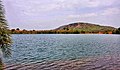 Lake Mbalang near to Ngaoundere
 -
 Lake Tizon at Ngaoundere
 -
 Vina River located in Ngaoundéré
 -
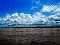 Logone River located between Cameroon and Chad
 -
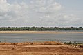 Sanaga River
 -
 Mbam River


Relief
[edit]

Powerful geothermal forces have shaped the Adamawa. The province begins to the south as part of the South Cameroon Plateau. The land rises gently but unevenly until about 6 degrees latitude. Here begins the Adamawa Plateau, a band of terrain that ranges from 1,000 to 2,000 m in altitude (averaging about 1,100 m) and stretches from Nigeria to the CAR. Altitude dips to as low of 500 m in the Djérem and Mbéré valleys and at the border north of Ngaoundéré. The plateau continues to about 8 degrees north before descending to the Benué Depression in abrupt cliffs and active volcanoes (though this transitional zone is mostly in the North Province).
Faults also cut across the area, the major one being the Cameroon Fault, dating from the Cretaceous Period. The Mbang Mountains follow this fault in a rough cut toward the east. Other mountains dot the province, as well. The Mambilas stretch into the extreme southwest from Nigeria and the Northwest and West Provinces. The Gotels are north of these along the border with Nigeria. All of these mountains form part of the Cameroon Ridge. Tchabal Mbabo, in the Gotels, is the highest peak at 2,460 m.
Plant and animal life
[edit]The Adamawa's vegetation has been shaped greatly by man. It was once highly forested, but repeated brush burning and cattle trampling have changed the terrain. In the south, this is Guinean savanna, a transitional zone between Cameroon's forested south and desert north. On the plateau itself, the savanna continues, though it is less wooded. Grass cover is consistent and thick, and the original vegetation still survives in the river valleys.
What few trees dot the landscape are evergreen and deciduous until about 1800 m altitude, when ferns and bamboos become prevalent. Grasses are the dominant form of plant life throughout except in the few forested areas and in some regions of scrubby bush. In addition, the southwestern half of the Mayo-Banyo division is a more heavily forested woodland savanna.
The Adamawa has two national reserves. The first of these is the Parc National du Mbam et Djérem, which protects 4165 km2 in both the Adamawa and East Provinces. The park is notable for containing both large tracts of savanna and forest. In addition, a small portion of the Parc National de Boumba Ndjida extends into the territory from the North Province.
Demographics
[edit]| Year | Pop. | ±% p.a. |
|---|---|---|
| 1976 | 359,334 | — |
| 1987 | 495,185 | +2.96% |
| 2005 | 884,289 | +3.27% |
| 2015 | 1,200,095 | +3.10% |
| source:[5] | ||
Settlement patterns
[edit]
The Adamawa is sparsely populated. Large swathes of land are devoted almost entirely to the use of Fulbe cattle herders, this pasture punctuated only by occasional settlements. The Cameroonian government has made efforts to persuade Fulbe herdsmen to adopt sedentary ways, but the nomadic traditions show little signs of change. Because the savanna has been pushing south, however, there is now a substantial amount of immigration to the Centre and East Provinces.
Ngaoundéré is one of Cameroon's fastest growing cities due to its location at the terminus of Cameroon's north–south railroad. The modern city is thus a sprawling mass of winding streets surrounding the traditional town. It is also a microcosm of the province's ethnic diversity, as representatives of most of the Adamawa's peoples can be found there.
The Mayo-Banyo division in the southwest has a slightly higher population density than the rest of the province, largely due to the highly concentrated Mambila and Konja of the Mambila Mountains and the Vute and Pere of the Gotel Mountains. The Pere are also known as the Kutin or Koutine, though this is in fact a highly derogatory term meaning "dogs" that was given to them by the Fulbe. The northern border also has a slightly higher population density than the Fulbe interior.
People
[edit]
Language provides the most convenient means of categorising the Adamawa's ethnic groups. The greatest number of peoples speak various Southern Bantoid languages. These Bantoid peoples primarily occupy the province's western third, in the Faro and Deo and the Mayo-Banyo divisions. The Ndoro are the northernmost, living on the Nigerian border on the upper Mayo Deo. To their south lie the Nyem-Nyem, called Suga by the Mbum, in the northern third of Mayo-Banyo division and along the west bank of the Meng River. The Vute live south of them on the Nigerian border and in a second population centre on the southwestern bank of the Mbarkaou Reservoir. The Mambila inhabit the southwestern border, and the Konja lie inland from them along the Banyo-Bankim road. The Tikar are at the province's southwestern corner, with territories extending into the neighbouring provinces.
Those peoples who speak Adamawa languages constitute the next major grouping. The Pere are farthest west of these, living in three main concentrations. The first is at the province's northwest, north of Mayo-Baleo town. They have another centre at the village of Paro south of Tignère, and their third grouping on the Meng River. The Kali at the province's northeast, along the North Province border centred at Bélél. The Mbum (Mboum) are the last group, occupying the town of Ngaoundal and its environs. East of Ngaoundéré are the Dii, who have larger territories in the North Province.
As speakers of an Ubangi language, the Gbaya make up another important grouping. Their territory spans the whole of the Mbéré division as well as a small area at the southwest of the Vina division. They continue south into the East Province.
The Fulbe make up an estimated 60% of the Adamawa's population. They are further subdivided into two subgroups: the sedentary, or town, Fulbe and the pastoral Fulbe, or Bororo. The sedentary Fulbe are more numerous and inhabit most of the province's major towns, including Banyo, Tibati, Tignère, and Ngaoundéré, the capital. Over years of intermixing with native populations, they have come to physically resemble their Sudanese neighbours. The pastoral Fulbe create only temporary settlements, preferring instead to range across the province and beyond with large herds of cattle. These Fulbe are lighter skinned than their town brethren, tall and thin, with aquiline features.
The Fulbe speak a Cameroonian dialect of the Senegambian language Fulfulde. Due to their historical hegemony of the territory, it also serves as a lingua franca. Other major languages include Bitare, Dii, Gbaya, Mambila, and Tikar. Most educated inhabitants also speak French.
Religion
[edit]Islam is followed by many in Adamawa, especially among the Fulbe majority. Even among them, however, there is a noted difference between the sedentary Fulbe, who are more religious, and the nomadic Bororo, who are often only nominally Muslim. Christianity has made many inroads, though Christians are in a distinct minority. Many of the tribes retain animist, or "pagan", beliefs, particularly in the mountains near the Nigerian border.
Climate
[edit]The province's high elevation lends it a relatively cool climate average between 22 and 25 degrees Celsius. However, specific conditions vary between the South Cameroon and Adamawa Plateaus. The former experiences an equatorial climate of the Guinea type with four seasons: a long, dry period from December to May, a short, wet period from May to June, a short, dry season from July to October, and finally a long, wet season from October to November.
The climate of the Adamawa Plateau is classified as tropical of the Sudan type. It has only two seasons; November begins the dry period, and April the wet. Rainfall here averages 900 to 1,500 mm per year and decreases further north. May and June are the wettest, with occasional tornadoes; August is another rainfall peak. In addition, temperatures dip from November to January, as conditions similar to those that cause winter in temperate climes take at least a tentative hold. Temperatures rise due to the Harmattan beginning in January, reaching a high in April. Torrential rains in May and June bring temperatures down once again.
A third climate type characterises the Adamawa's southwest corner (most of the Mayo-Banyo division). This region experiences an equatorial climate of the Cameroon type. Rainfall is within 1,500 to 2,000 mm with a long dry period followed by a long wet period.
Economy
[edit]Livestock
[edit]The Adamawa's economy is based almost entirely on one single thing: cattle, a Fulbe monopoly. The region's low population, high humidity, and vast fields of grass make it ideal for grazing. Herdsmen rotate pastures, and they often construct watering holes or wells for themselves and their animals.
The close relationship between the Bororo and their herds lends a great cultural importance to a Fulbe's number of cattle, and the more heads of cattle a man has, the wealthier he is. This often leads herders to never kill their animals, however, and to keep sick animals alive for fear of losing a portion of one's net worth. Nevertheless, many Fulbe herders transport their cattle to the big markets of Yaoundé and Douala for sale (some make it as far as Gabon and Congo). The major transhumance paths are in the western third of the province and at the border with Chad.
Most of these animals are of the humpbacked zebu breed. Near Ngaoundéré and Banyo, these are called Fulani zebu, large and meaty animals with dark-brown hides and white spots. The nomadic Fulbe, on the other hand, herd Bororo zebu. These are leaner, lighter-coloured beasts that are better able to travel long distances.
The government-run Institut de Récherche Zootechniques (IZR) and SODEPA have established a handful of modern cattle ranches, as well. The major ones are near the villages of Laro, Wakwo and Ndokayo. Here, ranchers have bred new breeds of cattle by mixing native Fulbe animals with the American Brahmin. Government initiatives have also been instrumental in the eradication of the tsetse fly in the region.
Many ranchers and Bororo also raise horses and donkeys. In addition, the Adamawa has more goats and sheep than any other province, as these can live even in the larger towns. Pigs, however, are much less common due to the prevalence of Islam in the region.
Agriculture
[edit]Nearly all farming in the province is done at the sustenance level. Millet is the mainstay, though maize, and manioc are also important. Other crops, grown in smaller quantities, include cocoyams, yams, and groundnuts.
The Gbaya, Mbum, and Dourou are the region's most prolific farmers, though even the herdsmen farm in the rainy season. Farms are typically small plots that are cleared or burned out of the brush and then planted during the dry season. Crops grow during the rainy season, when they are harvested. Because the dry season is so long, crops must be preserved, so most are transformed into grain, which is pounded by hand with mortar and pestle.
Cash crops play a small role in the region's economy. SODEBLE grows wheat on 100 km2 at Wassandé, near Ngaoundéré. The southwestern Mayo-Banyo division also has some coffee plots. Other interests have established groundnut, millet, and wheat plantations in recent years.
Industry
[edit]The Adamawa has a bit of industry, most located in the capital. Much of this is tied to the region's cattle-based economy. For example, leatherworking is an important industry in Ngaoundéré, as evidenced by the Société des Tanneries et Peausseries du Cameroun (STPC) factory. Rubber, perfume, and dairy products are also processed in the capital. Handicrafts, including woodworking and mat weaving, form another sector. Tin is mined near Mayo Darlé and the Nigerian border and southwest of Banyo, and bauxite is mined near Ngaoundal and Minim-Martap. Mineral water is obtained at Doungué.
The Mbakaou Power Station is an operational mini hydroelectric power station located approx. 34 kilometres (21 mi) southeast of Tibati, the nearest large town.[6]
Transport
[edit]Ngaoundéré is the gateway to the province, and it is most easily accessible from southern Cameroon via the "Transcam II" rail line. The trip takes between 12 and 30 hours, but the presence of couchettes makes the journey bearable for those who can afford them. Other passengers are crammed into all available seats, however, including those in the dining car. Due to the overcrowded conditions, thieves are another hazard.
Road travel from the south is also possible, but this is limited to poor roads from the Centre Province or else a long detour through the East Province, where the roads are not much better. Roads within the Adamawa itself are mostly unpaved and are often in poor condition (particularly south of Ngaoundéré) due to little maintenance. The road north from Ngaoundéré into the North Province is paved, however, meaning that those traveling via train can continue to the North and Far North without too much discomfort. National Road 6 enters the province from Foumban in the West Province and continues on to Banyo, Tibati, and Meïganga. National Road 15 comes from Sangbé in the Centre Province to Tibati and on to Ngaoundéré.
A regional airport services Ngaoundéré with flights to Yaoundé, Douala, Garoua, and Maroua. Tignère, Banyo, Ngaoundal, Tibati, and the Mbakaou Reservoir all have airstrips.
Tourism
[edit]
Most travellers see the Adamawa only briefly as they transition at Ngaoundéré from the train to a bus further north. The province does see some visitors who are interested in the region's rich cultural history. A number of lamidos allow tourists to visit their palaces, for example, such as the ruler of Ngo, who receives nobles every Friday and Sunday. The province also has numerous scenic destinations ranging from crater lakes to caves and waterfalls.
Administration and social conditions
[edit]What social inequalities exist in the Adamawa largely stem from the region's high level of cultural homogeneity. Most people in the province are Muslim Fulbe, and those who are not often fall prey to racism and discrimination, especially in more rural areas. The Cameroonian government has made efforts to encourage the region's nomads to settle, but so far has made little progress.
With its low population, the Adamawa holds little import to Cameroonian politicians. However, the Fulbe tribe is spread throughout the country, especially in the three northern provinces, and together they form a significant bloc that Cameroonian politicians cannot easily ignore. This is one way that Cameroon's greater north is able to oppose policies more favourable to the south.
Government
[edit]
Adamawa is composed of five departments (departements):
- Djérem, with its capital at Tibati
- Faro-et-Déo, with its headquarters in Tignère
- Mayo-Banyo, with its capital in Banyo
- Mbéré, headed from Meiganga
- Vina, governed from Ngaoundéré
A presidentially appointed prefect (prefet), or senior divisional officer, governs each of these. The president also appoints the governor, whose offices are in Ngaoundéré.
Traditional political organisation
[edit]Lamidos, traditional Muslim rulers, still hold great sway over their Fulbe subjects. Most large towns in the province have a lamido, and many smaller villages do as well. The various lamidos elect councilors to serve them; these may come from both Fulbe and other tribal groups. The Cameroonian government permits these rulers to hold their own courts and to keep their own jails, something human rights groups have pointed to as problematic.
Most other tribes in the region are nominally under the rule of a chief. However, these men are mostly just figureheads today. Among the Tikar, however, these individuals still hold a substantial amount of power. A group of advisers, or "Council of Notables", serves each Tikar chief. Below them are various ward heads (sous-chefs) who govern a specific portion of a village or town. The quarter chiefs (chefs de quartier) hold sway over a particular neighbourhood.
Education
[edit]The Adamawa's education level is generally very low. The nomadic Bororo rarely send their children to school. Meanwhile, town Fulbe often marry their daughters off early into puberty, and married girls do not go to school. The province has an estimated 80% illiteracy rate.
Another obstacle is lack of schools and teachers. Most schools are located in larger towns or in the capital, meaning that students often must travel long distances or live away from home, particularly at the secondary level. In addition, Cameroonian teachers who are assigned to the province often refuse to go on account of its remoteness.
Health
[edit]
Most of the Adamawa's towns have some form of health provider, if only a small clinic. The capital also has a hospital. The region's major health concern is lack of sanitation. This is especially pronounced in the increasingly urbanised Ngaoundéré. Another concern is HIV and AIDS. Official government figures give the province an HIV-infection rate of 17%, the highest in the country. These numbers come from samples in Ngaoundéré only, however, and infection rates in more rural areas are probably lower.
Cultural life
[edit]The Adamawa maintains a lively traditional culture. One notable example is the Menang, a Tikar dance. Performers may dance for any number of reasons, from aiding warriors to celebrating women's sensuality. Births, funerals, and weddings are often occasion for grand celebration among the region's non-Muslim populations, as well.
References
[edit]- ^ "Cameroun • Fiche pays • PopulationData.net". Archived from the original on 2020-08-23. Retrieved 2018-12-23.
- ^ "- CRTV". Archived from the original on 2017-11-13. Retrieved 2017-11-13.
- ^ "Sub-national HDI - Area Database - Global Data Lab". hdi.globaldatalab.org. Retrieved 2018-09-13.
- ^ "Cameroon: Location of Refugees and Main Entry Points (as of 02 May 2014) - Cameroon". ReliefWeb. 6 May 2014. Retrieved 2014-06-08.
- ^ Cameroon: Administrative Division population statistics
- ^ "Mbakaou to Tibati". Mbakaou to Tibati. Retrieved 2025-06-24.
- Fanso, V.G. (1989) Cameroon History for Secondary Schools and Colleges, Vol. 1: From Prehistoric Times to the Nineteenth Century. Hong Kong: Macmillan Education Ltd, 1989.
- Neba, Aaron, Ph.D. (1999) Modern Geography of the Republic of Cameroon, 3rd ed. Bamenda: Neba Publishers.
- Ngoh, Victor Julius (1996) History of Cameroon Since 1800. Limbé: Presbook, 1996.
External links
[edit]| Djérem |  | |
|---|---|---|
| Faro-et-Déo | ||
| Mayo-Banyo | ||
| Mbéré | ||
| Vina |
| |
Adamawa Region
View on GrokipediaHistory
Pre-colonial societies and migrations
The Adamawa plateau hosted diverse indigenous societies prior to the early 19th-century Fulani conquests, dominated by ethnic groups speaking Adamawa-Ubangi languages within the Niger-Congo family, alongside Chadic and other Sudanic-speaking peoples.[6] The Mbum, considered among the region's earliest settlers, established chiefdoms across the plateau, featuring hierarchical structures with divine kingship embodied in rulers called bellaka, who wielded political, religious, and ritual authority supported by kinship ties, land tenure, and communal security mechanisms.[6] Related groups such as the Tikar, Tchamba, and Jukun-influenced polities migrated into the area from northern Nigerian savannas, forming similar centralized chiefdoms with sacred leadership traditions.[6] Lineage-based societies predominated among other autochthonous groups, including the Vere (Pere), Marghi, Mbula, and Kilba, which lacked formalized kingdoms but organized around extended family units, age-sets, and ritual specialists for governance and dispute resolution.[6] The Bwatiye (also Batta), concentrated along the Benue River valley, developed influential polities emphasizing riverine trade and defensive alliances, naming local waterways in their languages.[6] Economies centered on subsistence farming of yams, sorghum, and millet, supplemented by cattle herding among pastoral subgroups and limited inter-regional exchange of ivory, cloth, and iron tools with northern polities like Bornu.[6] Archaeological evidence from megalithic alignments and iron-smelting sites in the eastern plateau documents the emergence of metallurgical technologies by the late Iron Age, likely tied to these societies' territorial expansions and ritual practices around 500–1500 CE.[8] Migrations were incremental, driven by ecological pressures, conflicts, and resource quests; for instance, Mbum oral traditions trace origins to eastern savanna pools or symbolic animal mediators, reflecting southward movements from Chadic frontiers before 1500 CE.[9] These pre-Fulani patterns fostered heterogeneous clusters bound by shared environmental adaptations rather than unified states, setting the stage for later interactions.[6]Establishment of the Adamawa Emirate through Fulani jihads
The Fulani jihads, extending the broader Sokoto Caliphate's expansion initiated by Usman dan Fodio's 1804 uprising against Hausa rulers, reached the southern Benue frontier through Modibbo Adama's campaigns. Adama, a Fulani cleric born circa 1786 in what is now Gombe State, Nigeria, aligned with Usman dan Fodio and received a flag of jihad authority in 1806, tasking him with conquering the non-Muslim "Fombina" (southern lands) to impose Islamic governance.[10][11] He launched initial offensives in 1809 from bases near Gurin, targeting animist and decentralized societies lacking centralized resistance, such as the Bata and Vere groups along the Benue River.[12][11] Adama's forces, comprising Fulani pastoralist warriors, cleric-led talakawa (commoners), and allied converts, employed cavalry tactics suited to the savanna terrain, overwhelming local defenses through superior mobility and religious zeal. By 1812, he had subdued northern Benue districts, establishing ribats (frontier forts) and extracting tribute from subjugated communities, while enslaving resistors to bolster the economy via raids southward into the highlands. Campaigns intensified post-1815, penetrating the Adamawa Plateau against Chamba, Mbum, and Gbaya polities; Adama's strategy involved delegating flags to lieutenants like Hamman of Muri, fragmenting opposition and integrating conquered elites under Fulani overseers.[13] These conquests spanned approximately 40,000 square miles by the 1830s, creating a stratified society with Fulani aristocracy dominating Hausa merchants, pagan tributaries, and slave labor, all subordinated to Sokoto's caliphal oversight.[14] The emirate's consolidation hinged on Adama's relocation of the capital multiple times for strategic defense— from Ribago to Jobbi, then Yola in 1841—amid intermittent revolts and environmental pressures like tsetse fly belts limiting expansion.[15] Adama ruled until his death in 1847, bequeathing a polity that enforced Sharia courts, zakat taxation, and annual slave-hunting expeditions, sustaining Fulani hegemony through ideological purity claims against pre-jihad "corruption" while pragmatically tolerating non-Muslim labor in peripheral zones.[14][16] This jihadist foundation embedded enduring ethnic hierarchies, with Fulani lamidos (emirs) extracting resources via forced migrations and tribute, shaping the region's pre-colonial political economy until European incursions.Colonial conquests and administration
The southern reaches of the Adamawa Emirate, encompassing the territory of the modern Adamawa Region, were incorporated into the German protectorate of Kamerun through a series of military expeditions beginning in the mid-1890s. Initial exploratory missions, such as the 1893–1894 expedition organized by the Deutsches Kamerun-Komitee, mapped the Adamawa Plateau and established initial contacts, but sustained conquest required armed campaigns to overcome resistance from Fulani lamidos and local ethnic groups.[17] German forces launched a major invasion of southern Adamawa in January 1898, targeting centers like Tibati and advancing northward amid sporadic battles that involved up to several hundred troops and local auxiliaries.[11] By 1901, an Anglo-German agreement partitioned the emirate, assigning its southern portion—approximately the area south of Yola—to German administration, while the north went to British Nigeria; this facilitated further German incursions, including the occupation of Ngaoundéré in 1902 under Lieutenant Hans Dominik's campaign, which deployed around 200 soldiers and subdued key resistance at Maroua earlier that year with minimal German casualties but significant local losses.[18] German rule imposed direct oversight via military stations and appointed akidas, extracting tribute and labor while prohibiting cross-border ties to Yola, though enforcement was uneven due to vast terrain and ongoing skirmishes until circa 1903.[19] Allied forces overran German positions in Kamerun during World War I, with French troops securing eastern areas including Adamawa by late 1916 through joint Anglo-French operations that captured Yaoundé and advanced northward.[20] Under the 1922 League of Nations Class B mandate, French Cameroun administered the region via a system of indirect rule, preserving Fulani lamidates as intermediaries for tax collection, corvée labor, and dispute resolution under resident commandants de cercle stationed in Ngaoundéré and Tibati; this approach, influenced by budgetary constraints and the need to co-opt Islamic hierarchies, collected annual taxes averaging 10–20 francs per adult male by the 1930s while building rudimentary roads linking to the south.[21][22] Colonial policies tolerated residual slavery until formal abolition in 1946, with enforcement lagging amid lamido complicity, as French priorities focused on stability over social reform.[23]Path to independence and integration into Cameroon
The portion of the Adamawa Emirate within German Kamerun, encompassing much of the modern Adamawa Region, was subdued through the Adamawa Wars (1899–1907), after which it fell under direct German colonial control until World War I.[24] Following the 1916 Allied conquest of Kamerun, the territory was partitioned under the 1919 Treaty of Versailles, with the eastern Adamawa areas allocated to French administration as part of the French mandate of Cameroun, comprising about four-fifths of former German territory.[25] French authorities implemented a form of indirect rule in the northern Muslim regions, including Adamawa, by recognizing Fulani lamidos (emirs) as local intermediaries while centralizing power in Yaoundé, which preserved some pre-colonial hierarchies amid infrastructure development like roads and missions.[26] Under the League of Nations Class B mandate (1922–1946) and subsequent UN Trusteeship (1946–1960), French Cameroun experienced rising nationalist agitation, particularly from the Union des Populations du Cameroun (UPC), though northern areas like Adamawa, with their Fulani-dominated elites, aligned more closely with moderate figures such as Ahmadou Ahidjo, a northern Muslim politician appointed prime minister in 1958.[25] France suppressed UPC activities through military operations, but granted internal autonomy in 1957 and full independence on January 1, 1960, establishing the Republic of Cameroun with Ahidjo as president; the Adamawa territories were seamlessly incorporated as a northern province within this sovereign state, benefiting from Ahidjo's regional ties that facilitated administrative continuity.[27][26] Petitions to the UN Trusteeship Council in the 1950s sought unification of the partitioned Adamawa Emirate—split since 1901 between British Nigeria (including Yola) and French Cameroun—but these efforts failed amid colonial boundaries and differing administrative paths, leaving the Cameroon segment integrated into the new republic without cross-border merger.[28] On February 11, 1961, a UN-supervised plebiscite in the adjacent British Southern Cameroons resulted in 71% voting for unification with the Republic of Cameroun (versus joining Nigeria), leading to formal federation on October 1, 1961, as the Federal Republic of Cameroon; Adamawa, as part of former French Cameroun (rechristened East Cameroon), was thus integrated into this bilingual federal framework, with its northern pastoral economy and emirate structures retained under central oversight.[29][25] This process marked the end of colonial division for the region's core territories, though lingering UPC insurgency in other areas underscored uneven decolonization.[27]Post-independence governance and reforms
Following Cameroon's independence from France on January 1, 1960, and the subsequent unification with the southern portion of British Cameroon on October 1, 1961, the territory of what would become the Adamawa Region was incorporated into the federal structure as part of the northern administrative zones under central government oversight.[25] Governance remained highly centralized, with President Ahmadou Ahidjo consolidating power through the Union Nationale Camerounaise (later renamed Cameroon National Union in 1966), which enforced single-party rule and appointed prefects to manage provincial affairs, limiting local autonomy.[30] The 1972 constitutional referendum abolished federalism in favor of a unitary state, reorganizing the country into seven provinces, with the Adamawa area subsumed under the larger North Province, where administrative control emphasized national integration over regional self-rule.[25] Under President Paul Biya, who succeeded Ahidjo in 1982, the North Province was subdivided in 1983 to form the Adamawa Province (later redesignated a region in 2008), introducing a dedicated administrative prefect responsible for coordination with Yaoundé on security, development, and resource allocation.[31] Multiparty politics were legalized in 1990 amid pressure for reform, yet the Cameroon People's Democratic Movement retained dominance, with governance in Adamawa characterized by appointed officials and rudimentary local councils handling basic services like roads and markets under tight central supervision.[32] Decentralization reforms gained constitutional footing in the January 18, 1996, amendment, which devolved limited powers to regions, departments, and communes for local development while preserving unitary state control.[31] Implementing laws followed in 2004, aiming to transfer competencies in areas such as education, health, and infrastructure, but progress in Adamawa lagged due to inadequate fiscal transfers, weak institutional capacity, and competing national priorities.[33] The 2019 General Code of Decentralized Territorial Collectivities formalized regional assemblies, with Adamawa's first elections in December 2020 electing councilors to oversee budgets and projects, though central government retained veto powers and funding shortfalls persisted, constraining effective local governance.[34][35] By 2025, reforms emphasized gradual empowerment, including state investments in local infrastructure, yet analyses highlight ongoing weaknesses like elite capture and resource mismanagement in northern regions including Adamawa.[33]Geography
Physical location and borders
The Adamawa Region is positioned in north-central Cameroon, primarily occupying the central extent of the Adamawa Plateau, a volcanic upland that divides the country's southern equatorial forests from its northern savannas. This location places it approximately between 6° and 8° N latitude, serving as a climatic and ecological transition zone.[36] [37] To the north, the region borders Cameroon's North Region; to the south, it adjoins the Centre Region and East Region; to the west, it shares an international boundary with Nigeria; and to the east, it borders the Central African Republic. The western frontier with Nigeria includes segments along natural features such as the Faro River, while the eastern boundary with the Central African Republic follows parts of the Mbéré River valley. These borders encompass an area of approximately 63,701 km², positioning Adamawa as Cameroon's third-largest region by land area.[38][39]Topography and geological features
The Adamawa Region occupies the central portion of the Adamawa Plateau, a broad upland area in Cameroon characterized by an average elevation of approximately 1,100 meters above sea level, with ranges extending from 1,000 to 2,000 meters.[40] The topography features gentle undulations with dissected plateaus, interspersed hills, and occasional steeper escarpments, particularly along the northern boundary where rugged cliffs and uneven slopes drop toward lower plains.[40] Central areas exhibit softer relief with swampy valleys, while eastern sectors display more pronounced mountainous forms and volcanic cones.[40] Geologically, the region is underlain by Precambrian basement rocks, primarily migmatites, gneisses, and granites that underwent granitization during the Pan-African orogeny around 500-600 million years ago.[41] These formations form the core of the Adamawa dome, overlain in places by volcanic rocks including basalts, trachytes, and trachyphonolites associated with the Cameroon Volcanic Line.[40] Structural elements include faults linked to the Central African Shear Zone, which bound features like the Mbéré trough, and evidence of basaltic intrusions and fractures inferred from gravity data.[42] Volcanic activity has produced craters and small lakes, contributing to the plateau's dissected landscape and hydrological prominence as a watershed divide.[41]Rivers, lakes, and water resources
The Adamawa Region functions as a major watershed on the Adamawa Plateau, where rivers originate and drain northward toward the Logone and Chari basins or southward to the Sanaga. The Vina River, a primary waterway, flows through the Vina Division, featuring notable waterfalls and cascades near Ngaoundéré that support local ecosystems and potential hydropower.[43] As a tributary of the Logone River, it contributes to the broader Lake Chad hydrological system, with its valley influencing biodiversity and human settlements in the Sudan-savanna zone.[43] Several crater lakes punctuate the volcanic landscape around Ngaoundéré, including Lakes Tizon, Mbalang, Tabere, Gegouba, and Baledjam, formed by ancient maars and tuff rings associated with the Cameroon Volcanic Line.[44] These shallow, freshwater bodies host diverse ichthyofauna, with studies documenting species like Clarias catfish and tilapias adapted to varying salinities and depths up to 20 meters in some cases.[45] Sediment cores from these lakes reveal Late Holocene environmental shifts driven by climate variability and human impacts, such as fluctuating precipitation and vegetation changes.[46] Water resources in the region sustain rain-fed agriculture, pastoralism, and limited irrigation, though challenges like seasonal variability and degradation affect availability.[47] Initiatives include borehole drilling, with projects targeting thousands in northern Cameroon to bolster household and livestock access amid population pressures.[48] Modeling efforts assess climate change impacts on soil and water, emphasizing sustainable management in the Adamawa's savanna ecosystems.[49]Climate patterns and variations
The Adamawa Region exhibits a tropical highland climate, moderated by its plateau elevation ranging from 800 to 1,500 meters above sea level, resulting in cooler temperatures compared to Cameroon's lowland areas. Average annual temperatures fluctuate between 22°C and 27°C, with the warmest month reaching approximately 25.5°C in April and the coolest around 21°C in January.[50][51] These conditions stem from the region's position along the Cameroon Volcanic Line, where altitude reduces diurnal temperature extremes and fosters relative humidity levels that support vegetation adapted to seasonal shifts.[52] The region experiences two primary seasons: a wet season from April to October, driven by the northward migration of the Intertropical Convergence Zone (ITCZ), and a dry season from November to March, influenced by harmattan winds from the Sahara that lower humidity and introduce dust. Annual precipitation averages 1,000 to 1,500 mm, concentrated in the wet season with peak monthly rainfall exceeding 200 mm in May.[53][46] Dry season months often receive less than 20 mm, contributing to periodic water stress for agriculture and pastoral activities.[50] Spatial variations arise from topographic gradients, with southern areas receiving higher rainfall—up to 1,500 mm annually—due to orographic effects on southerly moist airflows, while northern zones trend drier at around 1,000 mm. Higher elevations maintain cooler microclimates, with temperature drops of 0.6°C per 100 meters ascent, fostering localized fog and dew in valleys that mitigate dry season aridity. Temporal patterns show interannual rainfall variability, with studies indicating no consistent long-term trend in Adamawa but increased frequency of extreme wet events in recent decades, potentially linked to broader West African monsoon shifts.[54][52] These fluctuations underscore the region's vulnerability to drought cycles, historically documented through lake sediment proxies revealing periodic intensification of dry conditions during the mid-Holocene.[52]Biodiversity and ecosystems
The Adamawa Region occupies the Adamawa Plateau, a transitional zone between the Guineo-Congolian rainforests to the south and Sudanian savannas to the north, fostering ecosystems such as wooded savannas, open shrublands, gallery forests, highland grasslands, and volcanic crater lakes.[55] This ecotone supports elevated biodiversity, with the plateau functioning as Cameroon's hydrological "water tower" by feeding major river systems.[56] Dominant vegetation includes open shrub savannas characterized by species like Adansonia digitata, Zizyphus mauritiana, Vitex doniana, Terminalia laxiflora, Daniellia oliveri, and Piliostigma thonningii, adapted to a climate with bimodal rainfall averaging 1228–1676 mm annually and mean temperatures around 22°C.[57] Historical pollen records indicate past forest expansions, including sub-montane elements like Olea and Podocarpus, but savanna has prevailed since approximately 3000 calibrated years before present due to drier conditions and anthropogenic influences.[55] Economically valuable species such as Prunus africana occur, alongside threats from overexploitation for timber and non-timber products.[58] Terrestrial fauna encompasses diverse avifauna, including endangered species across three landscape types on the plateau, as well as large mammals like leopards and African golden cats in higher elevations.[59][58] Aquatic systems host 26 fish species in nine surveyed crater lakes, with endemics such as Clarias camerunensis, Parauchenoglanis similis, and Synodontis rebeli concentrated in Sanaga Basin waters like Lake Assom, which exhibits the highest richness at 13 species.[45] The Mbam Djerem National Park, spanning over 416,000 hectares on the plateau's southern slopes, safeguards Cameroon's most biodiverse protected area, blending savanna, forest, and wetland habitats that shelter forest elephants, Nigeria-Cameroon chimpanzees, buffaloes, bongos, and three pangolin species amid an avifauna of 365 recorded birds.[60][61][62][63] Human activities, including bushmeat hunting, agricultural encroachment, livestock grazing, and resource extraction, exert significant pressure, causing habitat loss and biodiversity declines despite co-management efforts like logging bans.[57][64]Demographics
Population size and settlement patterns
The population of the Adamawa Region in Cameroon is estimated at 1,273,000 residents.[7] This figure reflects projections from national demographic data, accounting for growth since the 2005 census, which reported lower totals amid challenges in enumeration due to the region's vast terrain and mobile pastoral populations. The population density remains low at approximately 19 inhabitants per square kilometer across the region's 63,701 square kilometers, indicative of its expansive savanna plateau and limited arable land suitable for dense habitation.[65] Settlement patterns in Adamawa are predominantly rural, with over 80% of residents living in dispersed villages and hamlets clustered around water sources, river valleys, and transport routes such as the Trans-Saharan highway.[66] These nucleated rural settlements support subsistence farming and transhumant pastoralism, particularly among Fulani groups, where extended family compounds form the basic unit, often numbering 20 or more individuals per settlement.[67] Urbanization is minimal compared to national averages, with the primary concentration in Ngaoundéré, the regional capital, which houses about 231,000 people and serves as a commercial and administrative hub.[68] Secondary towns like Tibati and Ngaoundal exhibit smaller, linear developments along trade paths, but the overall pattern emphasizes sparse, adaptive distributions shaped by environmental constraints and nomadic traditions rather than centralized urban growth.[69]Ethnic groups and social structures
The Adamawa Region of Cameroon hosts a diverse array of ethnic groups, with the Fulani (Fulbe) forming the predominant population, particularly the Muslim pastoralist subgroups such as the Wollarbe and Yillaga'en. These groups established dominance through the 19th-century Adamawa Emirate, founded in 1809 by Modibbo Adama, which expanded via conquests incorporating over 40 semi-autonomous lamidats by 1847. Other significant ethnic communities include the Mbum, with their pre-existing hierarchical chiefdoms led by divine rulers known as bellaka; the Batta (Bwatiye), noted for resistant polities in the Benue Valley; and various Gbaya (Baya) subgroups, who maintain patrilineal descent systems and were historically integrated as subjects or through alliances. Smaller groups such as Tikar, Chamba, Kilba, Vere, Marghi, and Mbula contribute to the region's ethnic mosaic, often retaining lineage-based or chiefdom structures amid Fulani overlordship.[6][5][70] Social structures in the region reflect a blend of Fulani-imposed hierarchies and indigenous systems, characterized by stratified classes including noble Fulani elites, commoners, and descendants of enslaved populations from conquered groups. The emirate's governance integrated local autochthonous chiefs into administrative roles, such as peripheral command or councils like the Kambari in Ngaoundéré, fostering multi-ethnic alliances through marriage and shared military service while suppressing rebellions via fortified ribats. Fulani society emphasizes clan-based pastoral mobility and Islamic scholarship, with lamidos exercising authority over diverse subjects, a legacy persisting in modern traditional leadership recognized by Cameroonian state structures. Among non-Fulani groups, social organization varies: Mbum feature sacred kingship and matrilineal influences in some lineages, while Gbaya emphasize egalitarian village councils and extended family units centered on agriculture and craftsmanship. This layered hierarchy has historically supported economic interdependence, with pastoral Fulani relying on sedentary farmers for grain, though ethnic tensions occasionally arise from land and resource competition.[6][12]Linguistic diversity
The Adamawa Region of Cameroon is marked by substantial linguistic diversity, reflecting its position on the Adamawa Plateau where numerous Niger-Congo languages predominate, including those classified within the Adamawa and Ubangi subgroups of the Atlantic-Congo branch. These languages, often small-scale and tied to specific ethnic communities, number in the dozens regionally, with the broader Adamawa group encompassing around 80 languages across northern Cameroon and adjacent areas, many featuring vestigial noun class systems characteristic of their Niger-Congo origins.[71] [72] Prominent among these are languages from the Samba-Duru cluster, such as Chamba (Samba) and various Duru varieties like Vere and Mbudum, spoken contiguously across the plateau's eastern and central zones by agriculturalist groups. The Mbum language, a key Adamawa tongue with dialects extending into northern Cameroon, is used by over 100,000 speakers in the region and exemplifies the family's tonal and morphological complexity. Other notable clusters include Bena-Mboi and Leko, contributing to the patchwork of micro-languages that resist full genetic classification due to limited documentation.[73] [74] Fulfulde (Adamawa dialect), a Senegambian language of the Niger-Congo family, functions as a lingua franca among pastoralist Fulani communities and traders, with approximately 1 million speakers in Cameroon concentrated in the Adamawa Region due to 19th-century migrations and the historical Fulani emirate centered at Ngaoundéré. French serves as the official administrative language, though its penetration varies in rural areas dominated by indigenous tongues. This multilingualism fosters code-switching but also poses challenges for education and communication, with no single indigenous language achieving dominance akin to Hausa in the far north.[75] [76]Religious composition and practices
The Adamawa Region features a religious composition dominated by Islam, particularly Sunni Islam practiced by the majority Fulani (Peul) population and Mbororo subgroups, who constitute the largest ethnic group in the area.[66][77] Christianity, encompassing Protestant denominations such as Lutheran and Evangelical groups alongside Roman Catholicism, forms a notable minority, with missionary activities dating back to the 1930s among groups like the Dii. Adherents of traditional African religions, often syncretized with Abrahamic faiths, persist among various ethnic communities, including Gbaya and Tikar peoples, though exact regional percentages remain undocumented in recent censuses due to the lack of granular data beyond the national 2005 figures.[78][66] Islamic practices in the region blend orthodox elements with folk traditions, as seen among the Adamawa Fulani, where adherence to core tenets like prayer and fasting during Ramadan coexists with pre-Islamic customs such as ancestor veneration and protective rituals against spirits. Mosques serve as central community hubs, though internal divisions, such as the 2022 dismissal of the Grand Imam in Ngaoundéré, have occasionally disrupted leadership. State interventions, including the 2021 suspension of night prayers during Ramadan in Adamawa to curb COVID-19 spread, highlight tensions between religious observance and public health measures.[5][79][77] Christian practices emphasize evangelism and church-based social services, with groups like the Evangelical Lutheran Church of Cameroon active in peacebuilding and environmental advocacy as of 2025. Traditional practices endure in rural areas, including circumcision rites among some groups, reframed as cultural rather than strictly religious, and animist beliefs in natural spirits influencing pastoral and agricultural life. Syncretism remains common, with many Muslims incorporating indigenous healing and divination, reflecting the region's historical Islamization efforts from the 19th-century Fulani jihad onward.[80][78][5]Economy
Agricultural production and challenges
The Adamawa Region's agricultural sector is dominated by smallholder subsistence farming, with major food crops including cereals such as maize, millet, and sorghum; tubers like cassava, yams, and cocoyams; and legumes including groundnuts and soybeans.[81][82] In the 2019 crop year, production reached 172,486 tons of maize across 86,644 hectares, 547,363 tons of cassava on 55,148 hectares, 37,834 tons of yams, 11,072 tons of cocoyams, and 41,715 tons of groundnuts, reflecting increases in tuber and legume outputs compared to 2018 but a slight decline in maize due to reduced cultivated area.[81] These crops support local food security, generating a regional surplus of 18% in cereal-equivalent terms (402,506 tons total food supply), though deficits persist in divisions like Mayo-Banyo and Mbéré.[81] Efforts to expand cash and staple crops include wheat cultivation on over 200 hectares, alongside maize, rice, and soybean seed multiplication initiatives led by the Institute of Agricultural Research for Development (IRAD).[83] However, yields remain below potential due to yield gaps attributed to suboptimal inputs and practices; for instance, maize yields average far under attainable levels in rain-fed systems across Cameroon, with Adamawa's high-savanna agroecology offering opportunities for improvement through better varieties and management.[84][82] Key challenges include irregular bimodal rainfall patterns, with drought pockets and flooding reducing maize and tuber outputs, as observed in 2019 when erratic precipitation curtailed cultivated areas.[81][85] Soil fertility has declined from continuous cropping without adequate fallowing or rotations, exacerbated by erosion on the region's slopes during heavy rains, leading to nutrient loss and topsoil degradation in the basaltic highlands.[84][86][87] Limited access to fertilizers and phytosanitary products, driven by high costs and scarcity, hampers yields, particularly for nutrient-demanding crops like cocoyams, where near-absent inputs contributed to variability.[81] Pest pressures, including caterpillar infestations, and diseases further erode production, while insecurity and population displacement in areas like Faro and Déo reduced available farmland by up to 46% in affected zones during the assessed period.[81][88] Deforestation from agricultural expansion compounds these issues, diminishing long-term soil quality and water retention.[89]Pastoralism and livestock economy
The Adamawa Region, spanning approximately 64,000 km² of highland terrain, serves as Cameroon's primary center for pastoral livestock production, with cattle herding forming the economic backbone for a significant portion of its population. Predominantly practiced by Fulani (Fulbe) pastoralists through transhumant systems, where herds migrate seasonally for grazing, the sector supports an estimated 1.25 million head of cattle as of recent assessments, making it a net exporter of beef and live animals to urban centers in southern Cameroon and neighboring countries.[90][91][92] Livestock activities, including cattle alongside smaller numbers of sheep, goats, and poultry, generate substantial rural incomes, historically exceeding local meat demand by over 288% in the late 1980s, a surplus pattern that persists due to favorable grazing conditions on the Adamawa Plateau. Economic outputs include meat, milk, hides, and draft power, with trade networks facilitating sales in regional markets like Ngaoundéré and cross-border exchanges, though informal channels dominate and limit formal revenue tracking. Recent initiatives, such as World Bank-supported pastoral resource management, have aided over 38,000 herders by improving veterinary services and reducing calf mortality to around 9% in targeted areas.[4][93][94] Challenges undermine productivity, including recurrent farmer-herder conflicts over grazing lands and water, exacerbated by population pressures and climate variability, leading to livestock losses and economic disruptions. Disease outbreaks, feed shortages during dry seasons, theft, and inadequate infrastructure—such as limited veterinary access and poor market linkages—further constrain growth, with herders citing these as primary barriers alongside financial limitations. Emerging shifts toward semi-sedentary ranching in parts of the region aim to mitigate mobility risks but face resistance from traditional transhumant practices.[95][96][97]Extractive industries and trade
The extractive industries in the Adamawa Region remain underdeveloped relative to Cameroon's agriculture and petroleum sectors, with mining contributing minimally to national GDP at approximately 0.63%. Bauxite extraction represents the most significant industrial-scale activity, centered on the Minim-Martap project, which features revalued reserves of 144 million tons following exploration upgrades from an initial 99 million tons. Operated by Canyon Resources through its subsidiary CAMALCO S.A., the open-pit mine development, launched on September 27, 2025, includes infrastructure such as road extensions from the site to Makor and aims to establish a full bauxite-alumina-aluminum value chain to diversify Cameroon's export-dependent economy away from oil. Additional bauxite deposits, estimated at over 1 billion tons collectively, occur in areas like Ngaoundal, Minim, Martap, and Makan, though exploitation lags due to infrastructural and regulatory hurdles.[98][99][100] Artisanal and small-scale mining (ASM), involving around 200,000 participants nationally, includes semi-mechanized gold extraction in sites like Djouzami, where operations have degraded local water quality through chemical contamination and sedimentation. Illegal gold mining persists in Adamawa and adjacent regions, prompting government inspections since July 2025 to enforce compliance and curb unregulated activities that exacerbate environmental damage without fiscal benefits. Emerging prospects include lithium in pegmatite systems and corundum (sapphire and ruby) deposits near Banyo, alongside exploration in Poli, but these lack commercial development amid limited geological data and investment.[101][102][103][104][105] Regional trade is predominantly informal and oriented toward livestock and agricultural commodities rather than extractives, given the nascent mining output; cattle from Adamawa's herds, comprising part of Cameroon's 83% northern concentration, flow through interconnected markets to southern regions like the West and North-West, as well as cross-border to Nigeria and Chad. These trading systems influence live cattle prices via supply dynamics, seasonal migrations, and transport costs, with Ngaoundéré serving as a key nodal point for pastoralist exchanges. Formal mineral trade is negligible, though the Minim-Martap project anticipates future bauxite exports to support national goals under frameworks like the African Continental Free Trade Area.[106][107][108]Transportation and infrastructure
The Adamawa Region's transportation relies primarily on roads and rail, with limited air connectivity. National Road 15 (N15) forms a key artery, linking the region's capital Ngaoundéré southward to Batchenga in the Centre Region. A 167.22 km segment of N15 from Lena through Tibati to Ngatt, spanning the Central and Adamawa regions, was under construction with partial delivery accepted in March 2022 to improve access to northern areas.[109][110] Rail infrastructure centers on the Camrail-operated line, where Ngaoundéré Central Station serves as the northern terminus for passenger services from Yaoundé, covering approximately 460 km.[111] Camrail, managing Cameroon's rail concessions since 1999, provides amenities like free Wi-Fi at Ngaoundéré station.[111] Ongoing rehabilitation efforts target the Bélabo-Ngaoundéré section, including track upgrades for a design speed of 90 km/h across 329 km.[112] Feasibility studies completed in 2024 support potential extension of this line 700 km northward to N'Djamena in Chad, with 170 km in Cameroon, to bolster cross-border trade.[113] Ngaoundéré Airport (IATA: NGE) facilitates domestic air travel, with scheduled flights to Yaoundé and Douala operated by Camair-Co, covering distances up to 563 km. As a small regional facility, it primarily supports limited passenger and general aviation needs without international service. Infrastructure challenges persist, with national efforts allocating funds for rail upgrades along the Douala-N'Djamena corridor, including CFA500 billion for road and rail improvements by 2025.[114] Reconstruction of sections like the N1 highway linked to Ngaoundéré aims to enhance trade and regional integration.[115]Government and Administration
Regional governance structure
The Adamawa Region's governance operates under Cameroon's decentralized framework, featuring a Governor as the central government's appointed representative responsible for coordinating national policies, maintaining public order, and supervising regional services including security and administrative enforcement. The Governor, appointed by the President, holds executive authority over the region's departments and ensures alignment with federal directives. As of October 2025, Kildadi Taguiéké Boukar serves in this role, focusing on issues such as public service absenteeism and post-electoral stability.[116][117][118] Complementing the Governor's office, the Regional Council functions as the elected deliberative body, tasked with regional development planning, resource allocation, and implementation of decentralization competencies such as infrastructure projects and local economic initiatives derived from the Regional Development Plan (PRD). Chaired by a President elected from council members, the body addresses territorial challenges through triennial projections and partnerships with national ministries. Dr. Mohamadou Dewa has led the council since 2020, emphasizing competence transfer effectiveness amid ongoing decentralization reforms.[116][119][120] This structure reflects Cameroon's 2019 regionalization push, devolving powers to councils while retaining gubernatorial oversight to balance local autonomy with national cohesion, though implementation faces hurdles like limited resource transfers and coordination gaps in Adamawa's vast territory.[121]Departmental and local divisions
The Adamawa Region of Cameroon is divided into five departments: Djérem, Faro-et-Deo, Mayo-Banyo, Mbéré, and Vina.[122] Each department is headed by a prefect and serves as the primary administrative unit below the regional level, responsible for local governance, public services, and implementation of national policies.[116] These departments are further subdivided into 21 arrondissements, each managed by a sub-prefect, which handle more localized administration including civil registration, security, and basic infrastructure maintenance.[123] Additionally, the region comprises 22 communes, which are municipal entities focused on urban and rural local government, including councils elected to manage services like waste collection, markets, and community development. The following table outlines the departments, their capitals, and the number of arrondissements:| Department | Capital | Number of Arrondissements |
|---|---|---|
| Djérem | Tibati | 2 |
| Faro-et-Deo | Tignère | 4 |
| Mayo-Banyo | Banyo | 3 |
| Mbéré | Meiganga | 4 |
| Vina | Ngaoundéré | 8 |