

Community hub
Recent from talks
Contribute something
Nothing was collected or created yet.
Muscatine, Iowa
View on Wikipedia
Muscatine (/ˌmʌskəˈtin/ MUSS-kə-TEEN[4]) is a city in and the county seat of Muscatine County, Iowa, United States. The population was 23,797 at the time of the 2020 census,[5] an increase from 22,697 in 2000.[6][7] It is located along the Mississippi River. The local business association states that the name Muscatine is not used by any other community.[8]
Key Information


.jpg)


Muscatine is the principal city of the Muscatine Micropolitan Statistical Area (2010 census population 54,132) as of 2011[update] the estimate was 54,184, which includes all of Muscatine and Louisa counties, making it the 283rd-largest micropolitan statistical area.[9]
History
[edit]
Muscatine began as a trading post founded by representatives of Colonel George Davenport in 1833. Muscatine was incorporated as Bloomington in 1839; the name was changed to reduce mail delivery confusion, as there were several Bloomingtons in the Midwest. Before that, Muscatine had also been known as "Newburg" and "Casey's Landing".
The origin of the name Muscatine is debated. It may have been derived from the Mascouten Native American tribe.[10] The Mascoutin lived along the Mississippi in the 1700s.[11]: 66 In 1819 Muscatine Island was known as Mascoutin Island.
In the 1838 United States General Land Office map, the town is labelled Musquitine, which may be a variation of Musquakeen, an alternative name for Muscatine Island; Musquakeen may have derived from the Meskwaki indigenous people who lived close by.[12] Major William Williams, who was visiting in 1849 when the town was still called both Bloomington and Muscatine, claimed, "Muscatine in English is Fire Island," in his list of the meanings of Siouan language names.[13]
Williams wrote a brief description of the settlement:
Bloomington is a fine town, one of the most important points in the state. Its situation on one of the great bends of the Mississippi has great commercial advantages; [it] is the seat of justice of Muscatine County. Contains about 2000 inhabitants, is the natural depository for a vast amount of trade from the surrounding country, has many neat residences and several spacious brick mercantile establishments- a large steam mill, one smaller one, two printing establishments, 6 churches, 4 physicians, 8 lawyers, an neat court house and jail, Masonic lodge, etc.... This town is very prettily situated, in part on a level on the river for two streets back, when the ground rises and the remaining street is elevated in benches, the whole standing in a rise enclosed by a range of high bluffs which runs around it in a semicircular form, forming beautiful sites for residences. From the bluff there is a beautiful view of the town below and of the Mississippi for miles up and down. All steam boats land here, passing up and down.[13]
— Major William Williams
.jpg)
From the 1840s to the Civil War, Muscatine had Iowa's largest black community, consisting of fugitive slaves who had traveled the Mississippi from the South and free blacks who had migrated from the eastern states. One of the most prominent community leaders was Alexander G. Clark Sr., born free in Pennsylvania. He was a barber, a respected position at the time, and eventually became a wealthy timber salesman and real estate speculator. In 1848 he was among the founders of the local African Methodist Episcopal Church, which had been established as the first independent black denomination in the US.
In the antebellum period he assisted fugitive slaves, and petitioned the state government to overturn racist laws before the Civil War. In 1863, Clark helped organize Iowa's black regiment, the 60th United States Colored Infantry (originally known as the 1st Iowa Infantry, African Descent), though an injury prevented him from serving.
In 1868, he gained desegregation of Iowa's public schools by suing the Muscatine school board after his daughter Susan was turned away from her neighborhood school. Eleven years later, in 1879 his son Alexander Jr. became the first black graduate of the University of Iowa College of Law and its first black graduate from any department. Clark Sr. went to the college and became its second black law graduate five years later, despite being 58 years old. He said that he wanted to serve “as an example to young men of his own race.” Clark rose to prominence in the Republican Party, serving as a delegate to state and national conventions.
In 1890, Clark was appointed ambassador to Liberia by President Benjamin Harrison. He was one of four Muscatine residents to be appointed as a diplomatic envoy between 1855 and 1900, a remarkable feat for a town of such small size: George Van Horne was consul at Marseille, France during the 1860s; Samuel McNutt served at Maracaibo, Venezuela in 1890; and Frank W. Mahin represented his country in Liberec (Reichenberg), Austria-Hungary in 1900.
Less than a year after arriving in Liberia, Clark died of fever. His body was returned to the US, where he was buried in Muscatine's Greenwood Cemetery. In 1975 the city moved his former house about 200 feet (61 m), to make room for a low-income apartment complex for senior citizens; the latter was named in his honor. The University of Iowa's chapter of the Black Law Students Association (BLSA) is named for the Clarks, as a testament to the accomplishments of father and son, and their places in the history of civil rights in Iowa.
Mark Twain lived in the city briefly during the summer of 1855 while working at the local newspaper, the Muscatine Journal, which was partly owned by his brother, Orion Clemens.
He noted some recollections of Muscatine in his book Life on the Mississippi:
And I remember Muscatine—still more pleasantly—for its summer sunsets. I have never seen any, on either side of the ocean, that equaled them. They used the broad smooth river as a canvas, and painted on it every imaginable dream of color, from the mottled daintinesses and delicacies of the opal, all the way up, through cumulative intensities, to blinding purple and crimson conflagrations which were enchanting to the eye, but sharply tried it at the same time. All the Upper Mississippi region has these extraordinary sunsets as a familiar spectacle. It is the true Sunset Land: I am sure no other country can show so good a right to the name. The sunrises are also said to be exceedingly fine. I do not know.
— Mark Twain

In 1884, J. F. Boepple, a German immigrant, founded a pearl button company. He produced buttons that looked like pearls by machine-punching them from freshwater mussel shells harvested from the Mississippi River. Muscatine's slogan, "Pearl of the Mississippi," refers to the days when pearl button manufacturing by the McKee Button Company was a significant economic contributor. In 1915, Weber & Sons Button Co., Inc. was the world's largest producer of fancy freshwater pearl buttons. From that time forward, Muscatine was known as "The Pearl Button Capital of the World". Weber is still manufacturing today[when?] and celebrated its 100-year anniversary in 2004.[14]
Muscatine is nearly as well known as the "Watermelon Capital of the World",[14] a title that reflects the agricultural rural nature of the county (several other cities, including Cordele, GA and Hope, AR also lay claim to this title.[15])
Muscatine was home to minor league baseball. The Muscatine Muskies was the last moniker of the minor league teams that played in Muscatine from 1910 to 1916. Muscatine was a member of the Northern Association (1910) and Central Association (1911–1916). Baseball Hall of Fame member Sam Rice played for the Muscatine Wallopers in 1912. Muscatine played at League Field, now named "Tom Bruner Field".[16][17]
Muscatine was the home town and operating location of broadcaster Norman G. Baker, inventor of the calliaphone. In 1925–1931, Baker operated the powerful radio station KTNT, published a newspaper, and operated the Baker Institute, a clinic. He also owned numerous businesses in the town.[18]
Muscatine was formerly a stop on the shared Chicago, Rock Island and Pacific Railroad and Milwaukee Road line. Restructuring of the railroads followed declines in passenger traffic and the Rock Island station was eventually demolished. The two railroads split near the railroad crossing on county highway X61. A portion of the Milwaukee Road's line is extant; it serves business and is used for the storage of rolling stock.
Muscatine was hit by an EF3 tornado on June 1, 2007, which destroyed or damaged areas of the city.[19]
On February 15, 2012, Xi Jinping, Vice President of the People's Republic of China, visited Muscatine. He had previously visited in 1985 as part of a Chinese delegation to learn about American agriculture.[a] He returned to Muscatine when he toured the U.S. in 2012 before becoming president. The visit prompted the public appearance of both supporters and protesters. The latter criticized China's human rights record in Tibet.[21]
In 2017, the 33,000-square-foot (3,100 m2) Sino-U.S. Cultural Center was established for $1 million (equivalent to $1.28 million in 2024),[22] by Glad Cheng (born 1971), owner of Muscatine Travel and chairman of the China Windows Group Inc.[23][24][25][26]
The city's main shopping district is Muscatine Mall, opened in 1971.
Geography
[edit]According to the United States Census Bureau, the city has a total area of 18.35 square miles (47.53 km2), of which 17.30 square miles (44.81 km2) is land and 1.05 square miles (2.72 km2) is water.[27]
Muscatine is primarily located on a series of bluffs and hills at a major west-south bend in the Mississippi River. The river-bend gives the city roughly 260 degrees of riverfront. The "highland" area of the town is divided into three ridge-like hills by Papoose Creek and Mad Creek, each of which flow individually into the Mississippi in downtown Muscatine. The city's main roads follow these ridges and valleys in a radial fashion.
Several large working-class neighborhoods and industrial sectors have been built on what is called "Muscatine Island". This flat, sandy expanse was largely underwater before a portion of the Mississippi River rerouted to follow the course of the present-day Muscatine Slough. It is unclear when the river changed course. The hills, river, and island are all integral to the diversity of Muscatine's economy and housing sector. As the city's urbanized area develops, the areas of highest elevation in the "High Prairie" crescent (between the Cedar and Mississippi Rivers) are increasingly taken from agricultural use and developed as suburban housing.
Positioned some 25 miles (40 km) (30 minutes) from the Quad Cities, 38 miles (61 km) (52 minutes) from Iowa City and some 68 miles (109 km) (75 minutes) from Cedar Rapids, Muscatine is the smallest link in a non-contiguous populated area which surpassed 800,000 residents in the decade following the 2000 census. The key feature of this region is that although the populated areas are non-contiguous, a high percentage of residents commute among the cities for work, particularly those in professional fields.
Climate
[edit]| Climate data for Muscatine, Iowa (1991–2020 normals, extremes 1935–present) | |||||||||||||
|---|---|---|---|---|---|---|---|---|---|---|---|---|---|
| Month | Jan | Feb | Mar | Apr | May | Jun | Jul | Aug | Sep | Oct | Nov | Dec | Year |
| Record high °F (°C) | 69 (21) |
74 (23) |
89 (32) |
93 (34) |
96 (36) |
104 (40) |
111 (44) |
107 (42) |
101 (38) |
96 (36) |
81 (27) |
72 (22) |
111 (44) |
| Mean daily maximum °F (°C) | 31.0 (−0.6) |
35.9 (2.2) |
49.5 (9.7) |
63.1 (17.3) |
73.6 (23.1) |
82.3 (27.9) |
85.4 (29.7) |
83.3 (28.5) |
77.6 (25.3) |
64.5 (18.1) |
49.0 (9.4) |
36.1 (2.3) |
60.9 (16.1) |
| Daily mean °F (°C) | 22.1 (−5.5) |
26.7 (−2.9) |
39.0 (3.9) |
51.2 (10.7) |
62.3 (16.8) |
71.6 (22.0) |
74.8 (23.8) |
72.6 (22.6) |
65.7 (18.7) |
53.2 (11.8) |
39.3 (4.1) |
27.8 (−2.3) |
50.5 (10.3) |
| Mean daily minimum °F (°C) | 13.1 (−10.5) |
17.4 (−8.1) |
28.4 (−2.0) |
39.4 (4.1) |
50.9 (10.5) |
60.8 (16.0) |
64.2 (17.9) |
62.0 (16.7) |
53.7 (12.1) |
41.8 (5.4) |
29.6 (−1.3) |
19.5 (−6.9) |
40.1 (4.5) |
| Record low °F (°C) | −31 (−35) |
−34 (−37) |
−18 (−28) |
10 (−12) |
26 (−3) |
33 (1) |
44 (7) |
39 (4) |
23 (−5) |
17 (−8) |
−5 (−21) |
−23 (−31) |
−34 (−37) |
| Average precipitation inches (mm) | 1.51 (38) |
1.78 (45) |
2.55 (65) |
3.82 (97) |
5.11 (130) |
5.46 (139) |
4.25 (108) |
4.26 (108) |
3.91 (99) |
3.04 (77) |
2.28 (58) |
2.00 (51) |
39.97 (1,015) |
| Average snowfall inches (cm) | 7.0 (18) |
5.8 (15) |
2.8 (7.1) |
0.7 (1.8) |
0.0 (0.0) |
0.0 (0.0) |
0.0 (0.0) |
0.0 (0.0) |
0.0 (0.0) |
0.2 (0.51) |
0.8 (2.0) |
6.2 (16) |
23.5 (60) |
| Average precipitation days (≥ 0.01 in) | 7.7 | 7.8 | 9.1 | 11.3 | 13.4 | 12.4 | 9.2 | 10.1 | 8.4 | 9.8 | 8.2 | 8.6 | 116.0 |
| Average snowy days (≥ 0.1 in) | 4.9 | 3.5 | 1.4 | 0.3 | 0.0 | 0.0 | 0.0 | 0.0 | 0.0 | 0.1 | 0.7 | 3.2 | 14.1 |
| Source: NOAA[28][29] | |||||||||||||
Demographics
[edit]| Census | Pop. | Note | %± |
|---|---|---|---|
| 1850 | 2,540 | — | |
| 1860 | 5,324 | 109.6% | |
| 1870 | 6,718 | 26.2% | |
| 1880 | 8,295 | 23.5% | |
| 1890 | 11,454 | 38.1% | |
| 1900 | 14,073 | 22.9% | |
| 1910 | 16,178 | 15.0% | |
| 1920 | 16,068 | −0.7% | |
| 1930 | 16,778 | 4.4% | |
| 1940 | 18,286 | 9.0% | |
| 1950 | 19,041 | 4.1% | |
| 1960 | 20,997 | 10.3% | |
| 1970 | 22,405 | 6.7% | |
| 1980 | 23,467 | 4.7% | |
| 1990 | 22,881 | −2.5% | |
| 2000 | 22,697 | −0.8% | |
| 2010 | 22,886 | 0.8% | |
| 2020 | 23,797 | 4.0% | |
| U.S. Decennial Census[30][5] | |||
2020 census
[edit]As of the census of 2020,[31] there were 23,797 people, 9,623 households, and 5,960 families residing in the city. The population density was 1,308.9 inhabitants per square mile (505.4/km2). There were 10,541 housing units at an average density of 579.8 per square mile (223.9/km2). The racial makeup of the city was 77.6% White, 4.3% Black or African American, 0.6% Native American, 1.0% Asian, 0.0% Pacific Islander, 8.4% from other races and 8.1% from two or more races. Hispanic or Latino persons of any race comprised 19.1% of the population.
Of the 9,623 households, 30.1% of which had children under the age of 18 living with them, 41.6% were married couples living together, 9.5% were cohabitating couples, 28.4% had a female householder with no spouse or partner present and 20.5% had a male householder with no spouse or partner present. 38.1% of all households were non-families. 31.2% of all households were made up of individuals, 13.3% had someone living alone who was 65 years old or older.
The median age in the city was 37.9 years. 26.2% of the residents were under the age of 20; 6.3% were between the ages of 20 and 24; 26.0% were from 25 and 44; 24.1% were from 45 and 64; and 17.4% were 65 years of age or older. The gender makeup of the city was 49.7% male and 50.3% female.
From 2019 to 2023 the median households income (in 2023 dollars) was $59,332, the per capita income in past 12 months (in 2023 dollars) was $31,057 and 16.5% persons were in poverty per American Community Survey poverty estimate.[32]
2010 census
[edit]As of the 2010 United States census,[33] there were 22,886 people, 9,008 households, and 5,923 families residing in the city. The population density was 1,322.9 inhabitants per square mile (510.8/km2). There were 9,830 housing units at an average density of 568.2 per square mile (219.4/km2). The racial makeup of the city was 87.8% White, 2.3% African American, 0.5% Native American, 0.8% Asian, 6.4% from other races, and 2.2% from two or more races. Hispanic or Latino people of any race were 16.6% of the population.
There were 9,008 households, of which 34.3% had children under the age of 18 living with them, 46.8% were married couples living together, 13.4% had a female householder with no husband present, 5.5% had a male householder with no wife present, and 34.2% were non-families. 28.0% of all households were made up of individuals, and 11.4% had someone living alone who was 65 years of age or older. The average household size was 2.50 and the average family size was 3.04.
The median age in the city was 36.1 years. 26.4% of residents were under the age of 18; 8.6% were between the ages of 18 and 24; 25.7% were from 25 to 44; 25.7% were from 45 to 64; and 13.6% were 65 years of age or older. The gender makeup of the city was 49.1% male and 50.9% female.
2000 census
[edit]As of the 2000 United States census,[34] there were 22,697 people, 8,923 households, and 6,040 families residing in the city. The population density was 1,348.1 inhabitants per square mile (520.5/km2). There were 9,375 housing units at an average density of 556.9 per square mile (215.0/km2). The racial makeup of the city was 90.40% White, 1.08% African American, 0.37% Native American, 0.65% Asian, 0.03% Pacific Islander, 6.04% from other races, and 1.44% from two or more races. Hispanic or Latino people of any race were 12.30% of the population.
There were 8,923 households, out of which 33.4% had children under the age of 18 living with them, 52.7% were married couples living together, 11.0% had a female householder with no husband present, and 32.3% were non-families. 27.4% of all households were made up of individuals, and 11.4% had someone living alone who was 65 years of age or older. The average household size was 2.49 and the average family size was 3.04.
Age spread: 26.4% under the age of 18, 9.2% from 18 to 24, 28.6% from 25 to 44, 21.9% from 45 to 64, and 14.0% who were 65 years of age or older. The median age was 36 years. For every 100 females, there were 94.7 males. For every 100 females age 18 and over, there were 90.2 males.
The median income for a household in the city was $38,122, and the median income for a family was $45,366. Males had a median income of $36,440 versus $23,953 for females. The per capita income for the city was $19,483. About 8.0% of families and 10.9% of the population were below the poverty line, including 13.2% of those under age 18 and 9.6% of those age 65 or over.
Economy
[edit]Companies in Muscatine include Bridgestone Bandag, H. J. Heinz Company,[35] The Raymond Corporation Carver Pump, the Kent Corporation with its subsidiaries: Kent Nutrition Group, Grain Processing Corporation and Kent Pet Group, Musco Lighting and Stanley Consultants. As of 2024, Bayers Muscatine plant supplied 70% of North America's Roundup.[36] The Musser Lumber Company was one of Iowa's pioneer lumber concerns.
Headquartered in Muscatine, The HNI Corporation designs and manufactures office furniture including chairs, filing cabinets, workstations, tables, desks and educational furniture under various brand names The HON Company, Allsteel, HBF, Artcobell, Paoli, Gunlocke, Maxon, Lamex, bpergo, and Midwest Folding Products.[37][independent source needed]
Arts and culture
[edit]Points of interest
[edit]
- Riverfront (which includes the Pearl City Station, Riverview Center, Riverside Park, and "Mississippi Harvest" sculpture by Erik Blome)
- Mark Twain Scenic Overlook
- Kent Stein Park (which includes historic Tom Bruner Field)
- Weed Park and Aquatic Center
- Muscatine Community Stadium and the nearby Pearl City Rugby field
- Muscatine History and Industry Center
- Muscatine Art Center, including Musser Mansion and the Stanley Gallery
- Weed Mansion, Alexander G. Clark House, and many other historic homes dating back to the mid-19th century
- Two historic districts (Downtown and West Hill) are listed on the National Register of Historic Places
- Discovery Park and Environmental Learning Center
- W. Joseph Fuller House
- St. Mathias Catholic Church
- Sinnett Octagon House
- Pearl Button Museum
- Former Muscatine North & South Railway Depot on the riverfront (referred to locally as the Red Brick Building)
Education
[edit]
Muscatine Community School District is home to Muscatine High School, which has the athletic teams under the name Muscatine Muskies. The district covers almost all of the city limits.[38] A small portion of the city limits is within the Louisa–Muscatine Community School District.[39]
Muscatine is home to Muscatine Community College and the MCC Cardinals.
Media
[edit]The Muscatine Journal newspaper circulates daily Monday through Saturday throughout the Muscatine area and on muscatinejournal.com.[40] Established in 1840, the Muscatine Journal was once owned by Mark Twain's brother, Orion Clemens, and Twain wrote for the paper during his time in Muscatine.[41] The publication and its weekly shopper Hometown Extra have been owned by Lee Enterprises, based in Davenport, Iowa, which as of January 2025 owned 72 markets in 25 states.[41]
The Voice of Muscatine,[42] a publication of Jam Media Solutions, has been an operation newspaper since October 28, 2015. It is a county-wide publication, servicing Muscatine County.
Radio
[edit]Jam Media Solutions, LLC. has two radio stations in Muscatine; KWPC-AM has been a long part of the city's history,[43] and KMCS-FM has been in the community since 1996.[44]
Townsquare Media's KBEA-FM transmits from a tower near 10 miles (16 km) north of Muscatine, but broadcasts from studios shared with other Townsquare Media stations in the Quad Cities community of Davenport.
Residents also receive radio broadcasts from stations in the Quad Cities, Iowa City, Cedar Rapids, Burlington, Waterloo, and Aledo, Illinois (WRMJ).
Television
[edit]Muscatine and Muscatine County are part of the Quad Cities Television Market. As such, all broadcast stations from this market are available both over-the-air and on pay television providers such as cable television and satellite television. Depending on location, terrain, and type of antenna used, some Muscatine area residents can also receive television signals from Cedar Rapids–Waterloo, and the Iowa side of the Ottumwa–Kirksville market.
Infrastructure
[edit]Transportation
[edit]Muscatine is located along two designated routes of Iowa's "Commercial-Industrial Network", U.S. Highway 61 and Iowa Highway 92. Highway 61 serves as a major agricultural-industry route to the south from Burlington to Muscatine, where it becomes a heavy-industrial and major commuter route to the northeast between Muscatine and Davenport. In conjunction with Iowa 92, which provides access to the Avenue of the Saints (U.S. 218/IA 27) to the west and the lightly populated western Illinois via the Norbert Beckey Bridge to the east, Highway 61 serves as a shortcut for traffic from northeastern Missouri and southeastern Iowa en route to the Quad Cities, Chicago, and points beyond. Several regional highway improvement projects are in the works to further establish and capitalize on this trade-route. Additionally, Muscatine is connected to Interstate 80 to the north by fifteen miles (24 km) of Iowa Highway 38. Iowa Highway 22 also connects with U.S. 218/IA 27 to the west, and Davenport to the east. The port of Muscatine is proposed for construction.
The MuscaBus is the primary provider of mass transportation in Muscatine, with four routes serving the region. As of 2019, the system provided 149,140 rides over 21,796 annual vehicle revenue hours with 4 buses and 5 paratransit vehicles.[45] MuscaBus operates 4 weekday bus routes on a pulse system with three routes leaving City Hall on the hour and half hour. On Saturdays, two routes operate from City Hall.[46] Hours of operation for the system are Monday through Friday from 6:30 A.M. to 5:00 P.M and Saturdays from 8:30 A.M. to 4:15 P.M. There is no service on Sundays.[47]
The city is served by the Muscatine Municipal Airport, whch was once served by Ozark Airlines.
Notable people
[edit]- Lee Allen, medical illustrator
- Norman G. Baker (1882–1958), inventor of the Calliaphone; established (KTNT) radio station[48]
- Jack Barlow, country music singer
- Terry Beatty, artist; penciler and inker in the comic book industry
- Ellis Parker Butler, author
- Roy James Carver, industrialist and philanthropist
- Alexander Clark, diplomat; United States Ambassador to Liberia
- David C. Cloud, Iowa Attorney General and state legislator
- Max Allan Collins, crime novelist
- Stan Freese, American musician best known for his work with The Walt Disney Company.
- Al Gould, Major League Baseball player for the Cleveland Indians
- Oscar Grossheim, photographer[49]
- Scot Halpin, fan who filled in on drums with the Who when Keith Moon collapsed during a performance
- Tom Hearst, NASCAR national racing champion
- Jim Yong Kim (born 1959), co-founder and executive director of Partners In Health
- Sarah Lacina, contestant on reality TV show Survivor: Cagayan
- Hattie Horner Louthan (1865 – 1950), writer
- Ralph P. Lowe, fourth governor of Iowa
- Emmett Lynn, actor
- James Bradley Orman, former governor of Colorado
- Dame Margherita Roberti, opera singer
- W. R. Schoemaker (1863–1937), Baptist pastor
- C. Maxwell Stanley, engineer and delegate to the United Nations
- Phil Vischer, founder of the Christian media company Big Idea Entertainment
- Murray Wier, University of Iowa basketball star, NBA player
- Joe Wieskamp, University of Iowa Basketball player and NBA draft pick
Environmental problems
[edit]Grain Processing Corp. (GPC) has been known to pollute the air by emitting small particles from its coal burning, acetaldehyde as a byproduct from corn ethanol processing, and also lead. "The plant released more lead than any other plant in Iowa, according to Iowa Department of Natural Resources data. It emitted more acetaldehyde – a probable carcinogen chemically similar to formaldehyde – than almost any plant in the country."[50] In 2006 GPC had to pay a $538,000 fine (equivalent to $839,149 in 2024)[22] for violating the hourly operating limit for years.[50] In July 2014, the company agreed to new, more stringent, air emissions permits with the Iowa Department of Natural Resources and federal regulators.[51] The company moved from coal to natural gas as their fuel source and built a new $83 million (equivalent to $110 million in 2024)[22] animal feed dryer to meet the new emissions requirements.[52] The company claimed that, by 2018, these projects would reduce overall pollution by 87%.[53]
Environmental improvements from GPC and other businesses in the area allowed EPA's Muscatine County SO2 Nonattainment Area, which includes all of the City of Muscatine,[54][55] to be re-classified to attainment status for EPA's 1-hour SO2 national ambient air quality standard (NAAQS) on October 4, 2018.[56] The actions required to achieve attainment status resulted in a reduction of over 10,000 lbs of SO2 emissions per year.[57]
The Muscatine Area Resource Recovery for Vehicles and Energy program (MARRVE) is building a food waste collection station for the anaerobic digesters at the municipal wastewater facility. The first phase of MARRVE began operating in December 2019. MARRVE processes between 25 and 30 tons of food waste per day.[58] MARRVE will generate biogas for vehicles and biosolids for fertilizer, while also reducing local methane emissions.[59]
Twin towns – sister cities
[edit]Muscatine's sister cities are:[60]
 Drohobych, Ukraine
 Ichikawamisato, Japan
 Kislovodsk, Russia
 Łomża, Poland
 Ludwigslust, Germany
 Ramallah, Palestine
 Zhengding, China
Notes
[edit]- ^ In 1980 accompanied by Jan Berris of the National Committee on US-China Relations, Xi Jinping's father Xi Zhongxun visited New York City, Washington, D.C., Iowa, Colorado, California and Hawaii. In Muscatine, Sarah Lande sponsored Xi Jinping during his visits and has visited China numerous times, too.[20]
References
[edit]- ^ "Brad Bark voted in as Muscatine mayor over incumbent Diana Broderson". WQAD. November 2, 2021. Archived from the original on November 6, 2021. Retrieved December 17, 2021.
- ^ "2020 U.S. Gazetteer Files". United States Census Bureau. Archived from the original on May 10, 2022. Retrieved March 16, 2022.
- ^ a b U.S. Geological Survey Geographic Names Information System: Muscatine, Iowa
- ^ Rick Aschmann (May 2, 2018). "North American English Dialects, Based on Pronunciation Patterns". Aschmann.net. Archived from the original on November 8, 2019. Retrieved November 25, 2019.
- ^ a b "2020 Census State Redistricting Data". census.gov. United states Census Bureau. Archived from the original on August 12, 2021. Retrieved August 12, 2021.
- ^ "Data from the 2010 Census". State Data Center of Iowa. Archived from the original on July 18, 2011. Retrieved March 26, 2011.
- ^ "Find a County". National Association of Counties. Archived from the original on May 9, 2015. Retrieved June 7, 2011.
- ^ "Our History" Archived September 27, 2016, at the Wayback Machine. Greater Muscatine Chamber of Commerce & Industry. Retrieved September 27, 2016.
- ^ List of micropolitan statistical areas
- ^ "The Prosperous Industrial History of Muscatine" Archived October 4, 2008, at the Wayback Machine, Greater Muscatine Chamber of Commerce & Industry, 2004. Retrieved May 9, 2008.
- ^ Irving Berdine Richman, John Brown Among the Quakers: And Other Sketches Archived February 15, 2016, at the Wayback Machine, Historical Department of Iowa, 1894
- ^ Toole, William (1870). "History of Louisa County". Annals of Iowa. 8: 260.
- ^ a b Williams, William (1920). "Major William Williams' Journal of a Trip to Iowa in 1849". Annals of Iowa. 12 (4): 249–250, with minor spelling and punctuation changes.
- ^ a b "History". Co.muscatine.ia.us. Archived from the original on July 28, 2012. Retrieved March 26, 2013.
- ^ "Which City is the Real Watermelon Capital of the World?". watermelon.org. Retrieved August 9, 2025.
- ^ "Sam Rice Minor Leagues Statistics & History". Baseball-Reference.com. Archived from the original on May 26, 2020. Retrieved April 12, 2020.
- ^ Ferguson, Mike (July 3, 2010). "Muscatine field marks 100th year of baseball". The Quad-City Times. Archived from the original on April 12, 2020. Retrieved April 12, 2020.
- ^ Juhnke, Eric. "Baker, Norman". THE BIOGRAPHICAL DICTIONARY OF IOWA. University of Iowa. Retrieved March 23, 2023.
- ^ "Terrible touchdown in Muscatine" Muscatine Journal, June 1, 2007. Accessed 2007-06-01.
- ^ Lim, Louisa (November 12, 2012). "China's Next Leader Has A Soft Spot For Iowa Town". NPR. Archived from the original on October 31, 2018. Retrieved October 30, 2018.
- ^ Johnson, Kirk (February 15, 2012). "Xi Jinping of China Makes a Return Trip to Iowa". The New York Times. Archived from the original on September 18, 2017. Retrieved February 25, 2017.
- ^ a b c 1634–1699: McCusker, J. J. (1997). How Much Is That in Real Money? A Historical Price Index for Use as a Deflator of Money Values in the Economy of the United States: Addenda et Corrigenda (PDF). American Antiquarian Society. 1700–1799: McCusker, J. J. (1992). How Much Is That in Real Money? A Historical Price Index for Use as a Deflator of Money Values in the Economy of the United States (PDF). American Antiquarian Society. 1800–present: Federal Reserve Bank of Minneapolis. "Consumer Price Index (estimate) 1800–". Retrieved February 29, 2024.
- ^ "Muscatine-China Connection". Visit Muscatine website. Archived from the original on October 31, 2018. Retrieved October 30, 2018.
- ^ Touney, Jan (April 3, 2017). "Chinese cultural center to open in downtown Muscatine". Muscatine Journal. Archived from the original on October 31, 2018. Retrieved October 30, 2018.
- ^ "Chinese cultural center to open in southeast Iowa city". Washington Times. Associated Press. April 4, 2017. Archived from the original on October 31, 2018. Retrieved October 30, 2018.
- ^ Munson, Kyle (April 4, 2017). "It seems easier for Muscatine to make friends with China than its own city government". The Des Moines Register. Retrieved October 30, 2018.
- ^ "US Gazetteer files 2010". United States Census Bureau. Archived from the original on January 25, 2012. Retrieved May 11, 2012.
- ^ "NowData – NOAA Online Weather Data". National Oceanic and Atmospheric Administration. Archived from the original on June 26, 2021. Retrieved June 25, 2021.
- ^ "Station: Muscatine, IA". U.S. Climate Normals 2020: U.S. Monthly Climate Normals (1991-2020). National Oceanic and Atmospheric Administration. Archived from the original on June 26, 2021. Retrieved June 25, 2021.
- ^ "Census of Population and Housing". Census.gov. Archived from the original on July 1, 2021. Retrieved June 4, 2015.
- ^ "2020 Census". United States Census Bureau.
- ^ "QuickFacts Muscatine city, Iowa". US Census. February 7, 2025.
- ^ "U.S. Census website". United States Census Bureau. Retrieved May 11, 2012.
- ^ "U.S. Census website". United States Census Bureau. Archived from the original on December 27, 1996. Retrieved January 31, 2008.
- ^ Charles, Dan (September 2, 2019). "Meet The Man Who Guards America's Ketchup". National Public Radio. Archived from the original on December 1, 2020. Retrieved September 3, 2019.
- ^ Kriss Nelson (September 12, 2024). "Crop Protection Tools Needed To Keep Farmers Profitable". Iowa Soybean Association. Retrieved March 24, 2025.
- ^ "HNI Corporation". www.hnicorp.com. Archived from the original on September 10, 2005.
- ^ "Muscatine Archived 2020-03-29 at the Wayback Machine." Iowa Department of Education. Retrieved on April 2, 2020.
- ^ "Louisa-Muscatine" (PDF). Iowa Department of Education. Archived (PDF) from the original on April 2, 2020. Retrieved April 2, 2020.
- ^ "Iowa Newspaper Association". Inanews.com. Archived from the original on February 7, 2012. Retrieved March 26, 2013.
- ^ a b Enterprises, Lee (n.d.). "About Us". Lee Enterprises. Retrieved February 7, 2025.
- ^ "Muscatine News, Events, Things To Do, & More". Voice Of Muscatine. Archived from the original on April 12, 2020. Retrieved April 12, 2020.
- ^ "KWPC-AM 860 kHz". Radio Locator. Retrieved March 24, 2023.
- ^ "KMCS(FM)". fcc.info.com. Retrieved March 24, 2023.
- ^ "MuscaBus Agency Profile" (PDF). Retrieved July 10, 2023.
- ^ "Route Maps". Retrieved July 10, 2023.
- ^ "Public Transit". Retrieved July 10, 2023.
- ^ MAK (December 29, 2003). "Norman Baker / Tangley". Radiomak.org. Archived from the original on April 26, 2016. Retrieved March 26, 2013.
- ^ "Musser Public Library". Upper Mississippi Valley Digital Image Archive. Retrieved May 14, 2025.
- ^ a b Hamby, Chris (November 30, 2011). "Despite lone inspector's efforts, persistent haze envelops Iowa town". The Center for Public Integrity. Archived from the original on April 19, 2014. Retrieved July 22, 2014.
- ^ Murphy, Erin (May 17, 2016). "Muscatine businesses, DNR develop pollution reduction plan". Muscatine Journal. Archived from the original on June 22, 2016. Retrieved March 27, 2023.
- ^ "GPC'S Conversion to Natural Gas is Complete". Muscatine Journal. July 18, 2015. Archived from the original on May 10, 2017. Retrieved March 27, 2023.
- ^ David, John (May 7, 2015). "Pollution solution starts with dryer house at GPC Muscatine". WQAD. Retrieved March 27, 2023.
- ^ "Air Plan Approval; Iowa" (PDF). epa.gov. EPA. Retrieved April 20, 2023.
- ^ "Iowa's Alternative 1-hour SO2 Nonattainment Boundary Proposal for Muscatine County" (PDF). Iowa DNR. Retrieved April 20, 2023.
- ^ "Air Plan Approval; Iowa; Determination of Attainment by the Attainment Date for the 2010 1-Hour Sulfur Dioxide Standard". Federal Register. National Archives. January 26, 2022. Retrieved April 19, 2023.
- ^ "EPA Approves Iowa's Attainment Plan for Muscatine County". Iowa Department of Natural Resources. IDNR. Retrieved April 19, 2023.
- ^ "Tons of waste being kept out of landfill thanks to MORC". Discover Muscatine. Retrieved May 12, 2023.
- ^ "MARRVE". Muscatine, IA - Official Website. December 6, 2019. Archived from the original on December 24, 2019. Retrieved December 24, 2019.
- ^ "International Connections & Sister Cities". visitmuscatine.com. City of Muscatine. Archived from the original on November 3, 2020. Retrieved October 30, 2020.
External links
[edit]- Official website
- Muscatine Chamber of Commerce
- . Encyclopædia Britannica (11th ed.). 1911.
Municipalities and communities of Muscatine County, Iowa, United States | ||
|---|---|---|
| Cities | 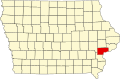 | |
| Townships | ||
| CDPs | ||
| Other communities | ||
| Footnotes | ‡This populated place also has portions in an adjacent county or counties | |
| International | |
|---|---|
| National | |
| Geographic | |
| Other | |
Muscatine, Iowa
View on GrokipediaHistory
Founding and early settlement
The area encompassing modern Muscatine was part of the Sauk and Meskwaki territories until the Black Hawk Purchase of 1832–1833, which ceded lands east of the Mississippi River to the United States, opening Iowa to legal white settlement.[6] Prior to organized settlement, the site served as an informal Indian trading post known as Manatheka.[7] The first recorded white settlement in present-day Muscatine County occurred in spring 1834, when Benjamin Nye established a post at the mouth of Pine Creek, approximately 12 miles northeast of the future city, where he constructed a store and three mills, including a grist mill that endures today in Wildcat Den State Park.[6] Settlement at the precise location of Muscatine began in 1835, with Colonel George Davenport erecting a log cabin trading post managed by an agent, followed by James W. Casey's establishment of Casey's Wood Yard of Newburg downstream.[6] In 1836, Colonel John Vanater, returning from a prior claim, purchased Davenport's post and commissioned the first U.S. government survey, platting the town as Bloomington—named for his Indiana hometown—as a grid of blocks along the Mississippi River bluffs.[6] [8] This platting positioned Bloomington as the county seat via an act of the Wisconsin Territorial Legislature on January 8, 1837, capitalizing on the site's river access for trade and steamboat traffic.[6] Bloomington incorporated as a town of the second class on January 23, 1839, with Joseph Williams elected as its first president on May 6; at incorporation, the settlement comprised 71 residents in 33 buildings, expanding to 84 houses by November amid construction of flour and sawmills to support arriving pioneers.[6] Early economy relied on lumber from adjacent islands, cordwood sales to steamboats, and agriculture, drawing settlers primarily from Ohio, Pennsylvania, and New England.[8] The name changed to Muscatine in 1850 to resolve postal confusion with other Bloomingtons, deriving possibly from the Mascoutin ("fiery nation") or a local island designation.[6]Industrial development in the 19th and 20th centuries
In the mid-19th century, Muscatine's economy relied heavily on lumbering and woodworking, with sawmills, planing mills, and factories producing sash, doors, and other wood products, supported by abundant nearby forests and the Mississippi River for transportation.[6] These industries formed the core of early industrial activity, alongside grist mills such as the Pine Creek Grist Mill established in 1848 by settler Benjamin Nye, which processed local grain.[9] By the 1890s, however, deforestation diminished lumber output, prompting diversification into emerging sectors like button manufacturing.[10] The pearl button industry, derived from Mississippi River mussel shells, began in 1891 when German immigrant John Boepple founded the Boepple Button Company, capitalizing on abundant local shell supplies to produce mother-of-pearl buttons.[11] This venture expanded rapidly; by 1897, Muscatine hosted 53 button-cutting shops harvesting 3,500 tons of shells annually, and by 1898, Iowa produced over 138 million buttons, with Muscatine as a primary hub.[12] The sector's growth was driven by demand for durable, iridescent fasteners in clothing, leveraging the river's natural resources and immigrant labor skilled in shell processing.[13] Entering the 20th century, the industry peaked, earning Muscatine the title "Pearl Button Capital of the World" by the early 1900s, with factories outputting 1.5 billion buttons annually and comprising 37 percent of global production by 1905.[13] Factory numbers surged from 27 in 1901 to 43 by 1911, employing thousands, though labor tensions culminated in a 1911 strike involving 2,300 workers protesting low wages and overproduction, which disrupted operations for months.[14] The sector dominated the local economy until the 1950s, when synthetic plastics and depleted mussel stocks—exacerbated by overharvesting—led to its decline, though some firms adapted to plastic buttons.[15] Diversification included light manufacturing and food processing; river-based transportation and rail links sustained trade, while the 1930s construction of Lock and Dam No. 16 improved navigation and hydropower.[10] Post-World War II, facilities like the former government alcohol plant repurposed by Grain Processing Corporation in the 1940s focused on corn-derived products, marking a shift toward agribusiness.[16] These adaptations reflected causal dependencies on natural resources, infrastructure, and global markets, with the button industry's rise illustrating resource-driven booms vulnerable to technological substitution.[12]Postwar expansion and challenges
Following World War II, Muscatine underwent modest economic and demographic expansion, supported by growth in food processing and manufacturing sectors tied to its agricultural base. The city's population rose from 19,041 in 1950 to 23,467 in 1980, a roughly 23% increase that paralleled Iowa's broader postwar urbanization trends, with residents shifting from rural farms to urban jobs.[17] [18] Residential construction accelerated after the war, particularly in neighborhoods like West Hill, where development in the late 1950s included adoption of modern zoning practices to accommodate suburban-style housing.[19] Key industries driving this growth included soybean processing and canning. Central Soya rapidly expanded its Muscatine facility in the immediate postwar period, establishing it as the company's largest plant with a storage capacity reaching nine million bushels by the mid-20th century, capitalizing on demand for soybean meal and oil.[20] Similarly, H.J. Heinz continued adding to its longstanding canning operations, originally established in 1893, to process tomatoes, pickles, and other products amid national postwar food production booms.[6] Emerging manufacturers like HNI Corporation (founded as HON Industries in 1944) scaled up furniture production, while Bandag, established in 1954, innovated in tire retreading, both contributing to diversified employment and drawing workers to the area.[6] Despite these advances, Muscatine encountered significant challenges, particularly from recurrent Mississippi River flooding and shifts in legacy industries. The pearl button sector, once a staple reliant on local mussel shells, collapsed by the mid-1940s due to competition from synthetic plastics and cheap imports, displacing workers and underscoring vulnerabilities in resource-dependent manufacturing.[21] A major setback occurred in spring 1965, when heavy rains and snowmelt caused the river to crest at 24.81 feet on April 29—the highest recorded level at the time—leading to evacuations, infrastructure damage, and economic losses as part of a regional disaster affecting Iowa and neighboring states with over $125 million in damages and 14,000 evacuees statewide.[22] [23] These events strained local resources and highlighted the limitations of early flood control measures, even as population growth slowed in later decades amid broader Iowa farm consolidations and manufacturing fluctuations.[18]Recent economic and demographic shifts
The population of Muscatine increased from 22,886 in 2000 to 23,967 by 2010, before reaching 23,797 in the 2020 census, marking a modest overall growth of about 4% over two decades amid broader stagnation in rural Iowa communities.[24] Recent estimates show a reversal, with the city's population declining by 2.84% since 2020 to approximately 23,298 in 2024, at an annual rate of -0.58%, consistent with net domestic out-migration exceeding natural increase in non-metropolitan areas.[1] At the county level, Muscatine County's population grew by just 0.98% from 2000 to 2023, averaging 0.04% annually, buoyed by international migration that offset losses from native-born departures, as seen in Iowa's statewide net gain of 23,074 residents from 2023 to 2024 primarily via foreign inflows.[25][26] Demographic composition shifted toward greater ethnic diversity, driven by Hispanic immigration tied to labor demands in manufacturing and agriculture; the Hispanic or Latino share rose to 19.1% of the city's population by 2020, up from under 5% in 1990, while non-Hispanic whites fell to 72%.[27][28] Countywide, the non-Hispanic white proportion declined from 80.8% in 2010 to 75.5% in 2022, with Hispanics comprising the fastest-growing group amid sustained Latino population expansion across Iowa, which increased over 50% since 2010.[29][30] This influx filled workforce gaps in low-wage sectors like food processing, though it coincided with slower overall growth compared to urban Iowa centers. Economically, Muscatine remained anchored in manufacturing, which accounted for the largest employment share in 2023 (employing over 11,400 workers citywide across goods production), supplemented by agriculture, forestry, and related activities vulnerable to commodity price fluctuations.[31] Post-2008 recovery saw county unemployment drop from a peak of 11.8% in February 2010 to 2.1% in April 2022, reflecting rebound in industrial output and ag exports, though rates climbed to 4.4% by mid-2025 amid broader Iowa manufacturing slowdowns.[32][33] Recent shifts include strain from a 2025 agricultural downturn, with low crop prices curbing farmer equipment purchases and exports—down 9.2% year-over-year statewide—triggering layoffs estimated at up to 11,400 jobs across Iowa's ag-linked sectors, including Muscatine's processing plants.[34][35] Manufacturing's disproportionate ties to farming amplified these pressures, limiting innovation and long-term planning despite Iowa's overall economic resilience in diversified goods production.[36]Geography
Location and physical features
Muscatine is situated in eastern Iowa, United States, serving as the county seat of Muscatine County. The city lies along the western bank of the Mississippi River, approximately 32 miles (51 km) southwest of Davenport and 25 miles (40 km) northwest of Burlington. Its geographic coordinates are approximately 41.426° N, 91.048° W.[37][38] The total area of Muscatine is 18.1 square miles (46.9 km²), of which 17.7 square miles (45.9 km²) is land and 0.4 square miles (1.0 km²) is water, primarily from the Mississippi River. The city's position at a major westward bend in the river provides extensive visibility of river traffic for roughly 260 days annually due to the curve's geometry.[38] Physically, Muscatine occupies a landscape of bluffs and rolling hills rising from the Mississippi River floodplain. The Mississippi River and its tributaries have carved steep limestone bluffs and valleys in the region, with the city's terrain featuring elevations from about 520 feet (158 m) at the river level to over 700 feet (213 m) on the upland bluffs. This bluffland topography, characteristic of eastern Iowa's driftless area influences, includes loess-covered hills and provides natural drainage patterns shaped by glacial and fluvial processes.[39]Climate and weather patterns
Muscatine experiences a humid continental climate (Köppen Dfa), marked by hot, humid summers, cold winters with snowfall, and precipitation throughout the year influenced by its proximity to the Mississippi River, which moderates temperatures slightly but contributes to higher humidity and flood risks.[40][41] The growing season typically spans from mid-April to mid-October, averaging 180-190 frost-free days, supporting agriculture in the surrounding region.[42] Average annual temperature is 51.6°F, with extremes ranging from record highs near 111°F to lows below 0°F, though daily lows rarely drop under -3°F in winter.[43][42][44] July features average highs of 86°F and lows of 65°F, while January averages 32°F highs and 17°F lows.[42] Precipitation averages 38.6 inches annually, with June as the wettest month at about 4.2 inches, often from thunderstorms; winter months see less liquid precipitation but equivalent in snow.[43][42] Average snowfall totals around 30 inches per year, concentrated December through February, with occasional blizzards causing drifts and disruptions.[45]| Month | Avg High (°F) | Avg Low (°F) | Precipitation (in) | Snowfall (in) |
|---|---|---|---|---|
| January | 31 | 14 | 1.5 | 7.8 |
| February | 36 | 18 | 1.4 | 5.9 |
| March | 49 | 29 | 2.4 | 3.4 |
| April | 62 | 40 | 3.2 | 0.5 |
| May | 72 | 51 | 4.0 | 0.0 |
| June | 81 | 60 | 4.2 | 0.0 |
| July | 86 | 65 | 3.8 | 0.0 |
| August | 84 | 63 | 3.5 | 0.0 |
| September | 77 | 54 | 3.1 | 0.0 |
| October | 64 | 42 | 2.6 | 0.2 |
| November | 49 | 31 | 2.3 | 2.1 |
| December | 36 | 20 | 1.8 | 5.5 |
Demographics
Population trends and census data
According to the 2020 United States decennial census, Muscatine had a population of 23,797.[46] Historical census data indicate steady long-term growth, with the population increasing from 14,073 in 1900 to 22,697 in 2000, reflecting industrialization and economic expansion along the Mississippi River.[17] Growth slowed in the early 21st century, rising modestly to 22,886 in the 2010 census before the 2020 increase of 4.0%.[47] Decennial census populations for Muscatine are summarized below:| Year | Population |
|---|---|
| 1900 | 14,073 |
| 1910 | 14,792 |
| 1920 | 16,278 |
| 1930 | 15,721 |
| 1940 | 16,177 |
| 1950 | 16,346 |
| 1960 | 17,957 |
| 1970 | 18,706 |
| 1980 | 19,941 |
| 1990 | 20,948 |
| 2000 | 22,697 |
| 2010 | 22,886 |
| 2020 | 23,797 |
Racial, ethnic, and immigrant composition
As of the 2020 United States Census, the racial composition of Muscatine was 72.0% White (non-Hispanic), 4.5% Black or African American, 1.0% Asian, 0.6% American Indian or Alaska Native, and smaller percentages for other races, with 19.3% of the population identifying as Hispanic or Latino of any race.[49] [50] These figures reflect a city population of approximately 23,640, with non-Hispanic Whites comprising the plurality but showing a decline from prior decades amid broader diversification in Iowa's manufacturing and agricultural sectors.[29] The Hispanic or Latino population, which increased to 19.1% in Muscatine County by 2023 estimates, is predominantly of Mexican origin, driven by labor migration to food processing and farming industries since the mid-20th century.[51] [31] Initial waves of Mexican migrant workers arrived in the 1960s, transitioning to more permanent settlement patterns tied to employment stability in meatpacking plants and related facilities.[52] Other ethnic groups remain minimal, with no significant concentrations of Middle Eastern, South Asian, or sub-Saharan African ancestries beyond isolated individuals or small communities. Foreign-born residents accounted for 7.95% of Muscatine's population in 2023 (about 1,870 individuals), below the national average of 13.9%, with the majority originating from Latin America, particularly Mexico as Iowa's top foreign birthplace overall.[31] [53] European-born immigrants represent a smaller share (around 7% of foreign-born in the surrounding micro area), often linked to historical German or Scandinavian heritage rather than recent arrivals, while Asian and African origins are negligible in local data.[53] This composition underscores economic pull factors over voluntary migration for diversity, with census data indicating sustained but modest inflows tied to job opportunities rather than refugee resettlement or family reunification programs.[54]Socioeconomic indicators including income and poverty
The median household income in Muscatine, Iowa, stood at $59,332 in 2023, reflecting a 1.47% increase from $58,474 the prior year.[31] This figure lags behind the state median of $73,147 for the 2019–2023 American Community Survey (ACS) period and the national median of approximately $75,149 for the same timeframe, highlighting localized economic pressures in a manufacturing-dependent community. Per capita income in the city was $42,159 in 2023, about 80% of Iowa's statewide per capita figure of roughly $39,728 adjusted for recent estimates, underscoring disparities driven by workforce composition and industry wages.[1] [55] Poverty affected 16.5% of Muscatine's population in 2023, a decline of 5.07 percentage points from the previous year, yet remaining elevated compared to Iowa's rate of about 11% and the U.S. average of 11.5% over the 2019–2023 ACS period.[31] Among those below the poverty line, the largest group was White residents, followed by Hispanic and multiracial individuals, reflecting the city's demographic majority of non-Hispanic Whites (around 72%) amid a 19% Hispanic population that correlates with higher aggregate poverty exposure in blue-collar sectors.[31] [55] Family poverty rates mirrored this, with broader ACS data indicating structural factors like reliance on seasonal manufacturing and agricultural processing contributing to persistence despite recent improvements.[56]| Indicator | Muscatine (2023) | Iowa (2019–2023 ACS) | United States (2019–2023 ACS) |
|---|---|---|---|
| Median Household Income | $59,332 | $73,147 | $75,149 |
| Poverty Rate | 16.5% | ~11% | 11.5% |
| Per Capita Income | $42,159 | ~$39,728 (adjusted est.) | ~$41,261 |